This post reviews the first part of our Patagonian trip, with its islands, ferries, volcanoes, glaciers and more.
The overall journey through this gorgeous mountain landscape and desert pampas began at Puerto Montt, Chile, and ended at Ushuaia, Argentina. We spent nearly a month driving and ferrying along three thousand kilometers, from north to south.
CHILOE
There are two options heading south: one is a well-used eight hour ferry ride to Parque Pumalin followed by a bumpy ride south to Chaiten. The other is a drive down Chiloe Island to the west, and then a much shorter ferry to Chaiten and Pumalin. The second was our choice.
Relatively unvisited by tourists, Chiloe’s Grand Island is a gentler landscape of farmland, forested rolling hills and coastal bays. We were pleasantly surprised at this charming start to our Patagonia trip as we found it distinctive in several ways…
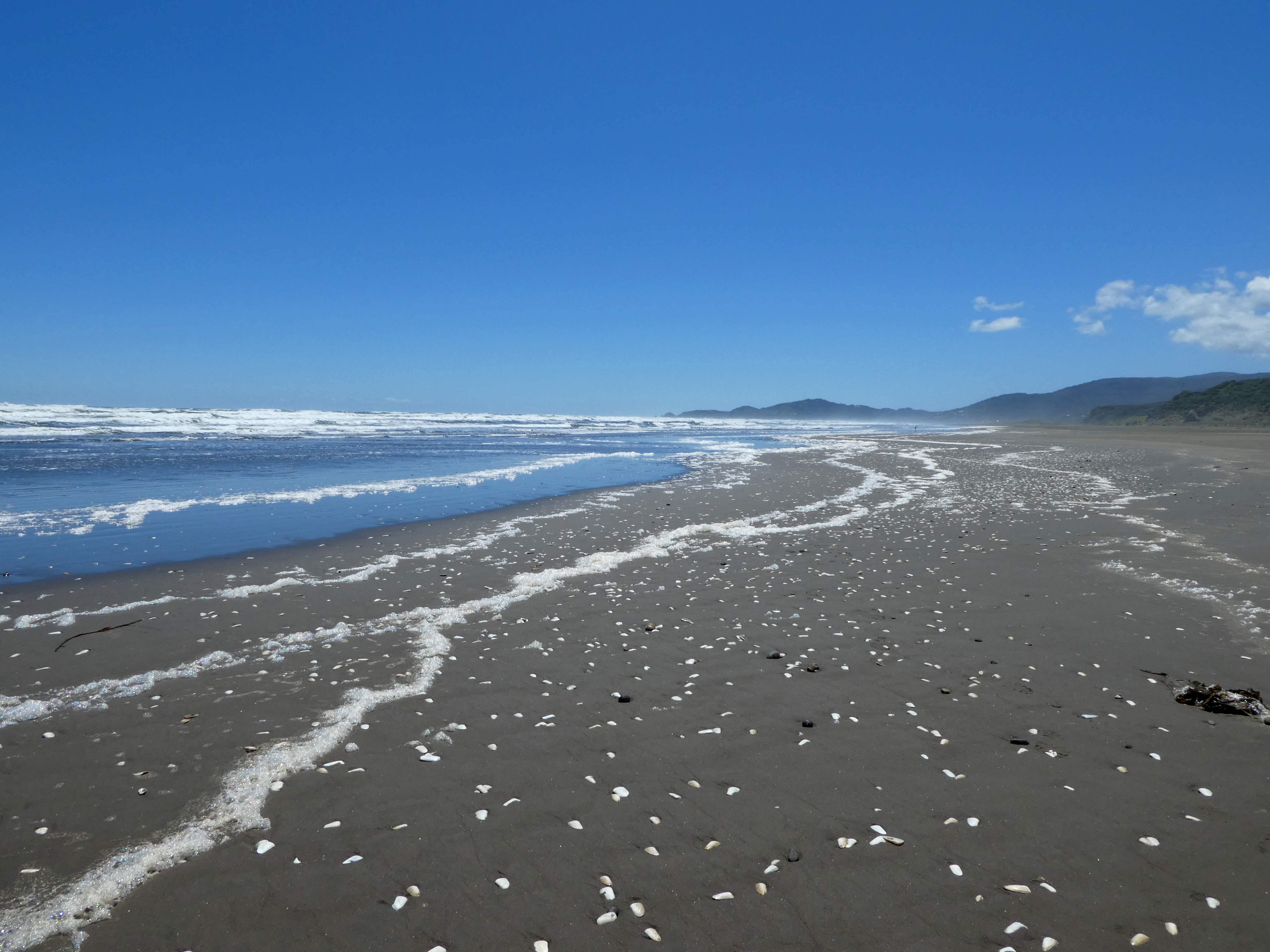
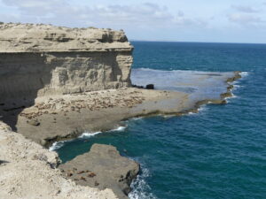
In its wild Pacific coastal beaches, especially the sections on the long coast in the National Park of Chiloe.

There the turbulent waves make the beach unusable for water sports, but the dark sand, the dunes and headlands scalloped into odd shapes, and the marshlands are a delight to explore.
Brisk breezes make the foam deposited by the waves wriggle like white wreaths. And it sends balls of foam skittering along the flat beach, each quickly shrinking to nothing from friction.
And Chiloe is distinctive in the stilt-supported housing along the bays, proudly lifted above the ebb and flow of tides.
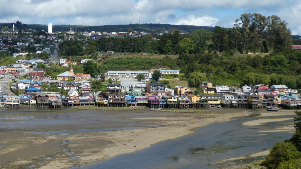
Palofitos, or stilt houses, are perfectly suited to the tidal ebb and flow of the Grand Island’s eastern bays. After a devastating earthquake and tsunami in 1960, most of these collapsed.
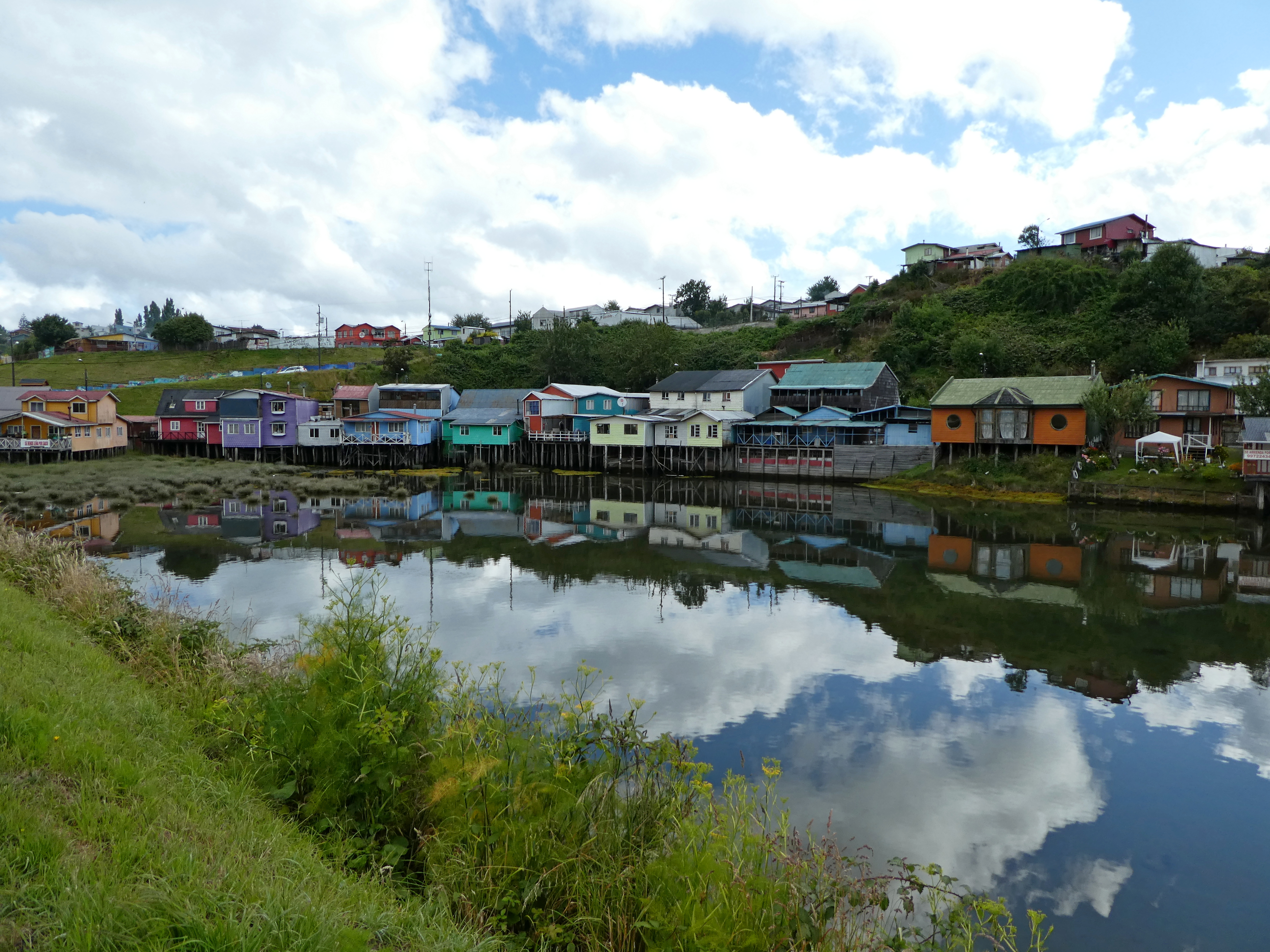
The few groupings that remain, like these in Castro, are visually striking, colorfully reflected in bay waters at high tide, or even stuck in the mud at low tide.
And distinctive in the flamboyant, but pragmatic Chiloe style of wood construction, most notable in the 100 or so UNESCO wooden churches.
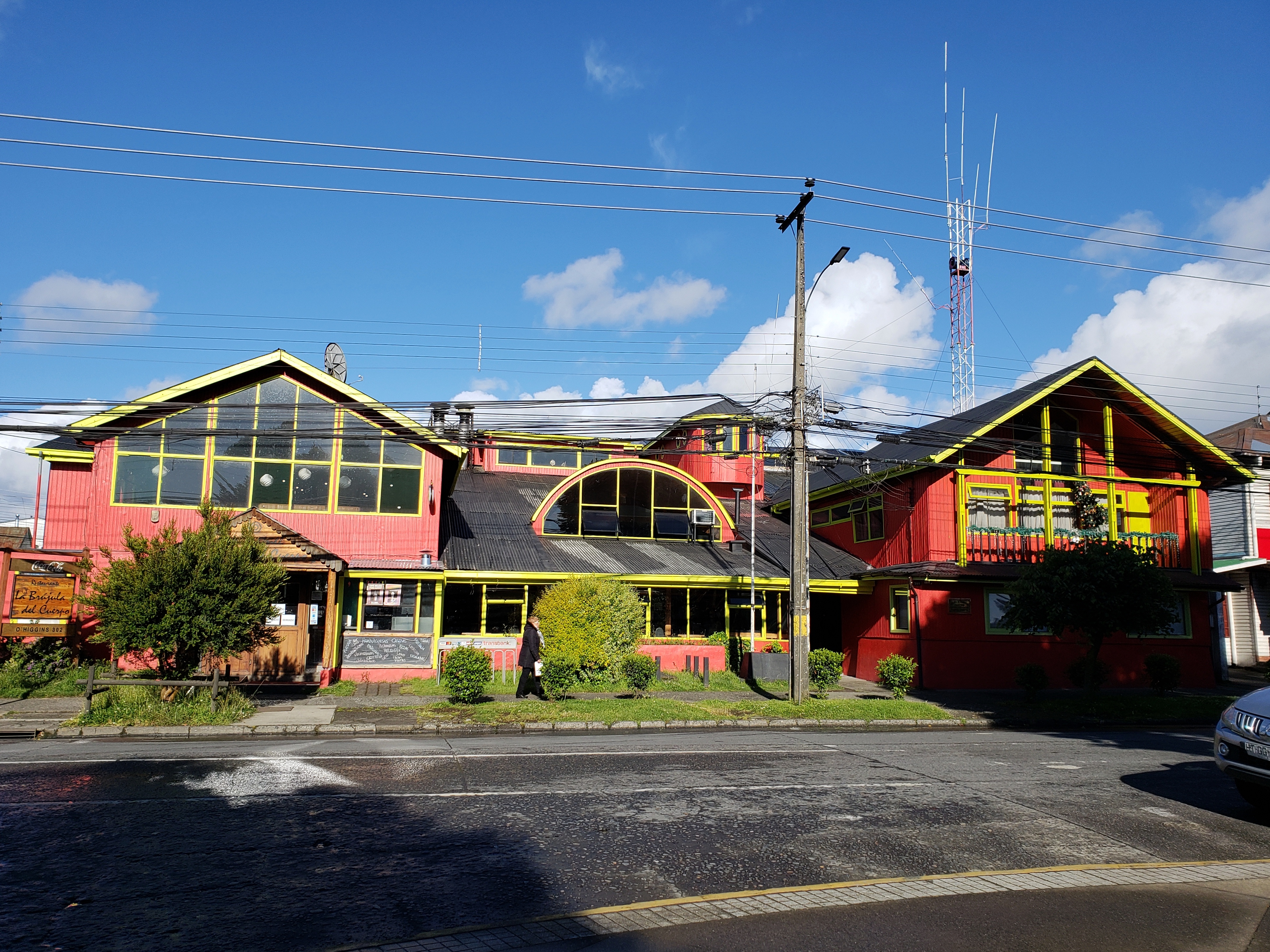
Chiloean style on the main street of Castro
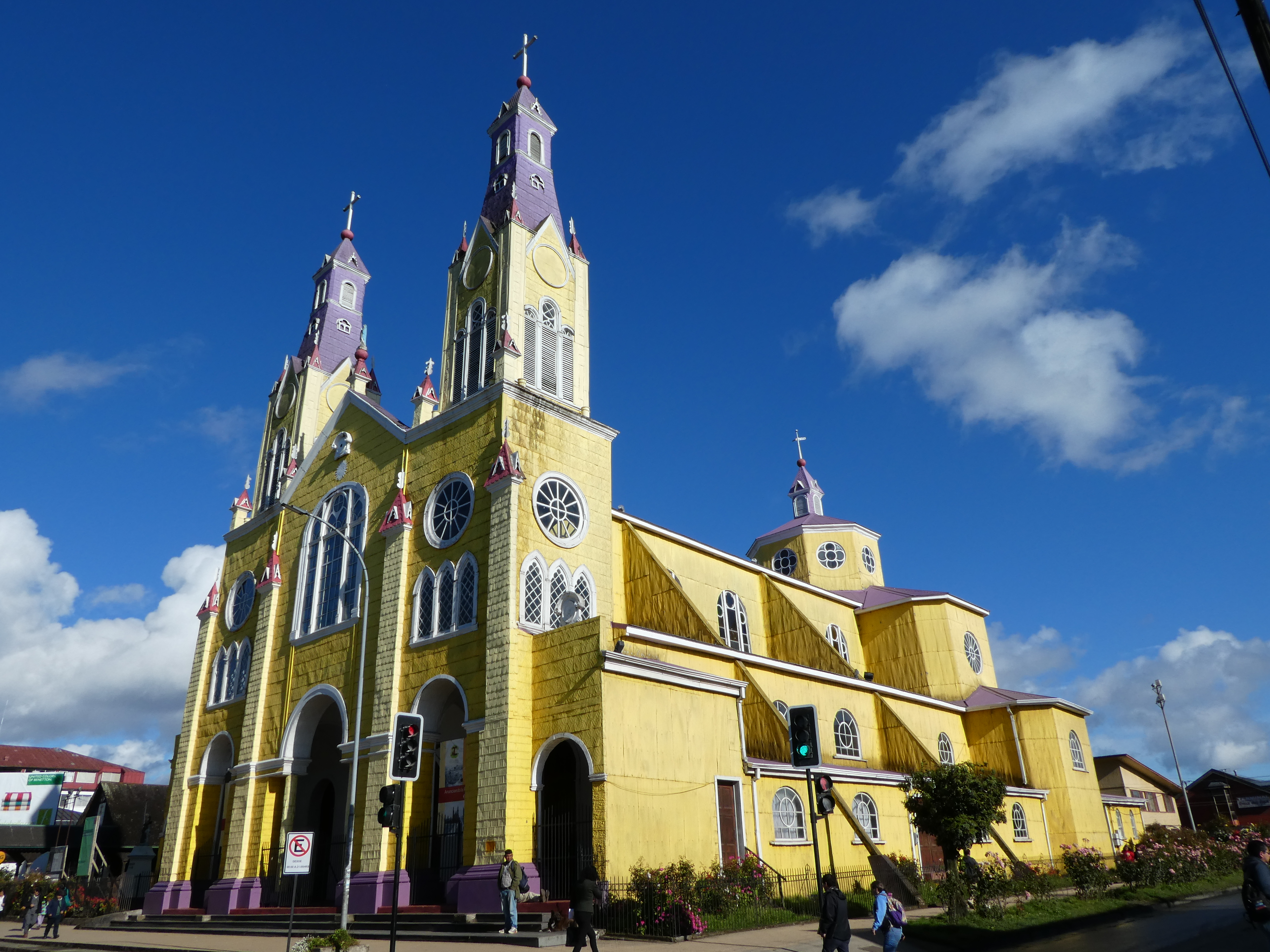
The eclectic and oh so brightly colored San Francisco church in the main plaza of Castro.
One of the prettiest of the 100 or so Jesuit-inspired wooden churches that are UNESCO World Heritage designated.
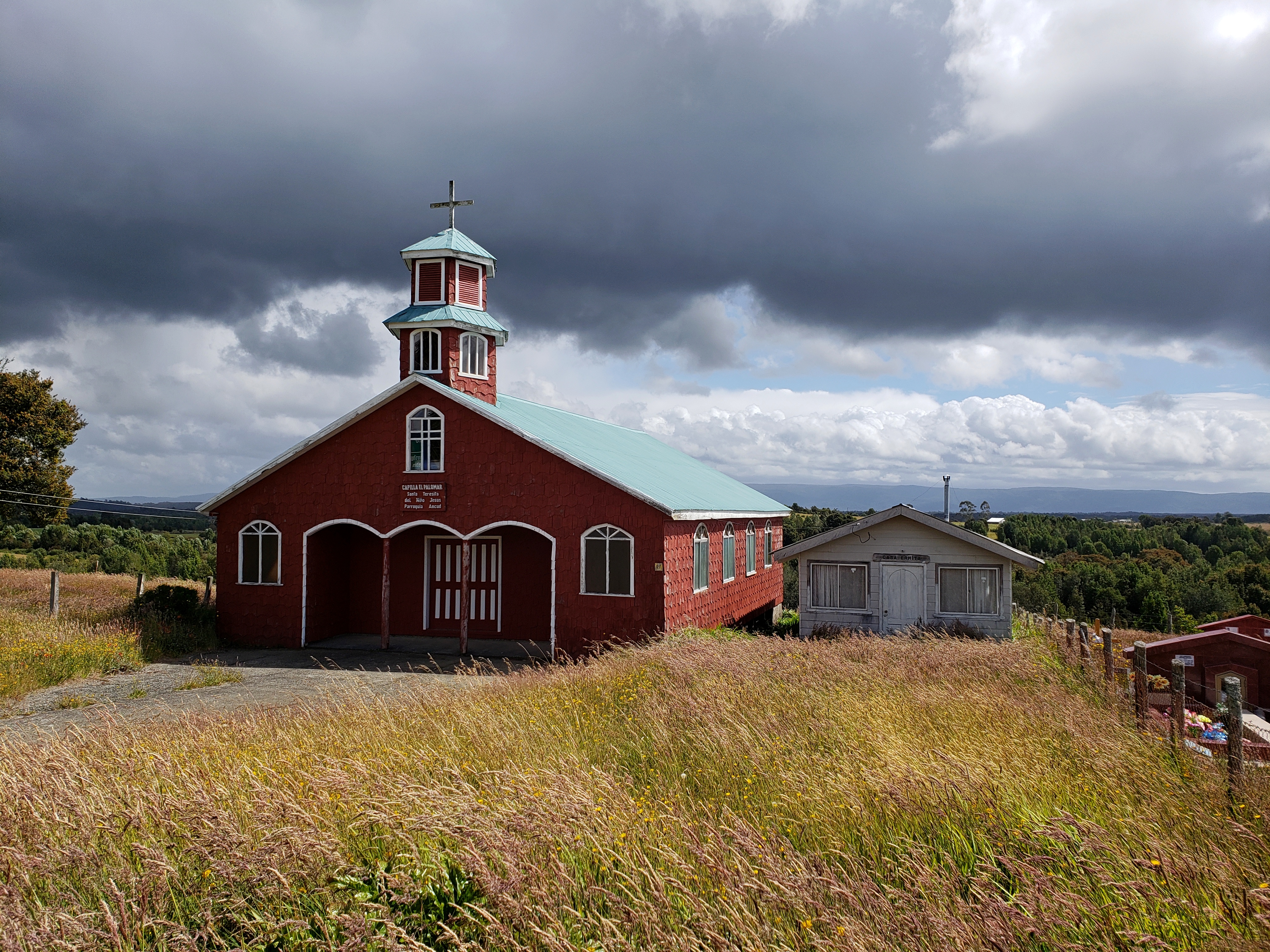
Many have been restored to revive the look and feel of their 18th century origins. Others have been given a more modern look inside.
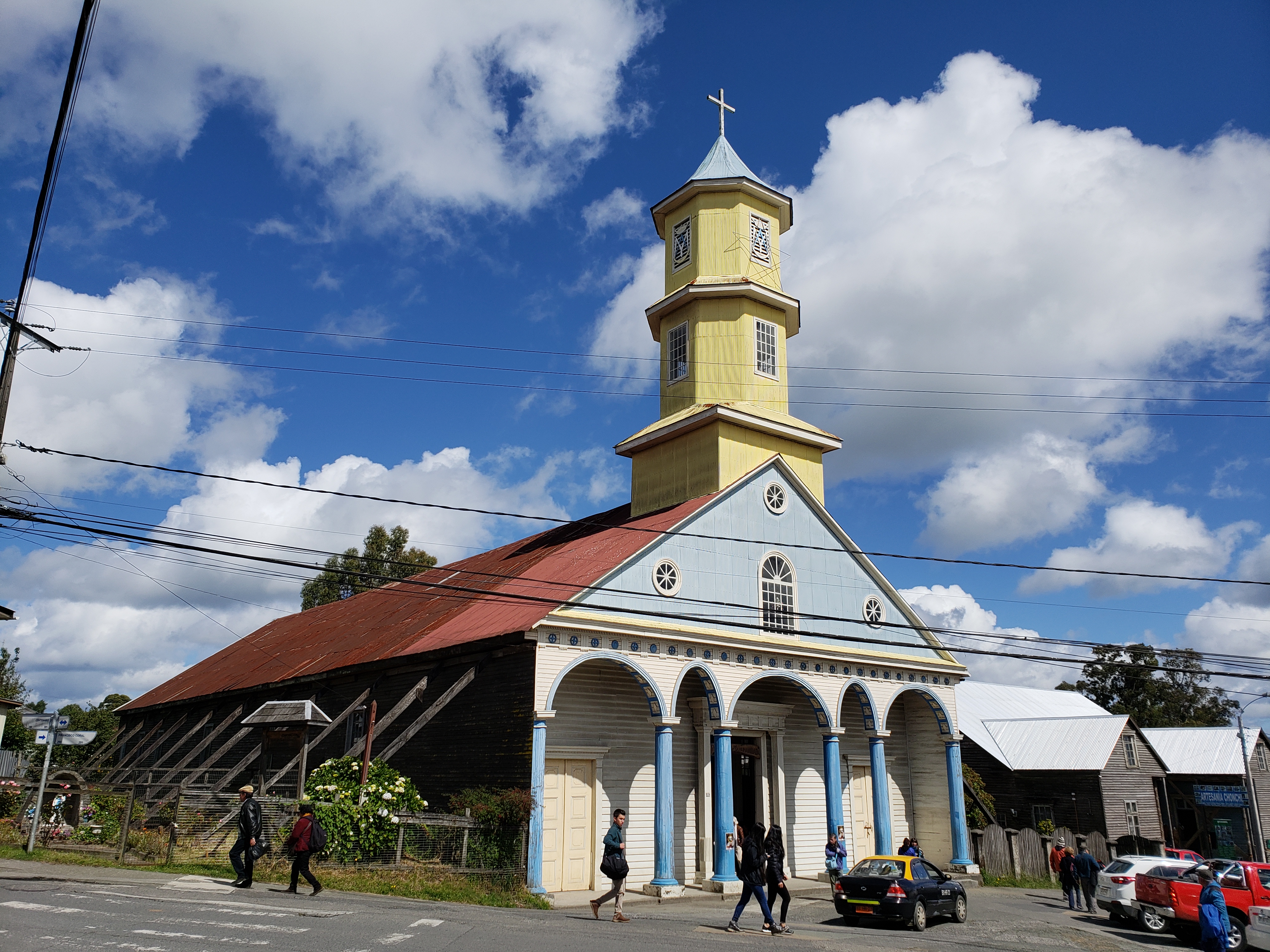
The most spectacular wooden church on the island, San Carlos de Chanchi, exquisitely restored inside and out to its early glories – a fine example of the Chiloe style. The interior features a barrel-shaped blue roof glistening with pointy stars.
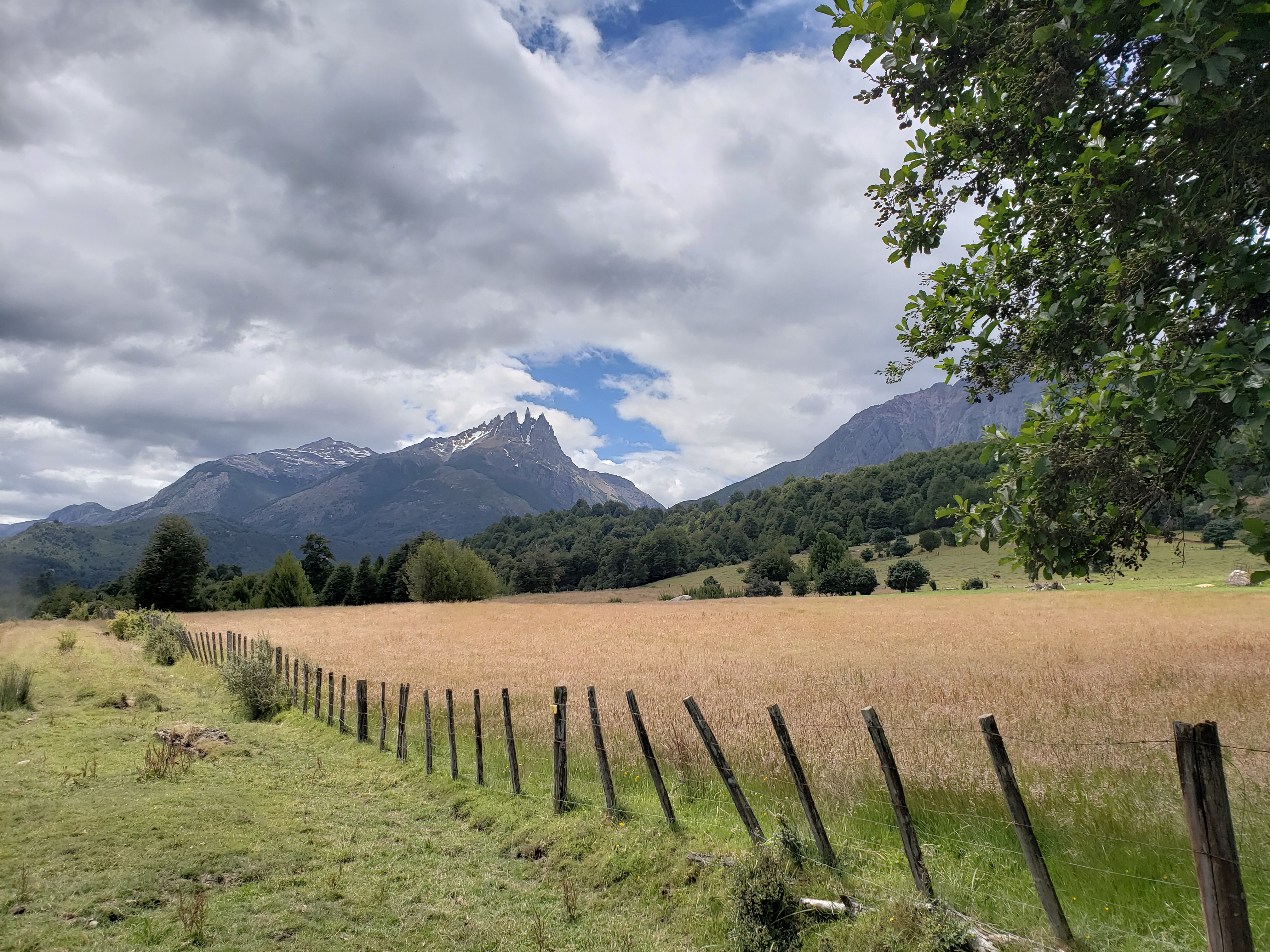
CHAITEN AND PARQUE PUMALIN
Parque Pumalin, to which the northern ferries connect, is one of the country’s great national parks, a star attraction for hikers, campers and idlers.
Kris McDivitt and Douglas Tompkins – who became wealthy from leading the Northface, Esprit and Patagonia clothing lines – bought the land for conservation, rather than development, and convinced the government to turn the property into a national park, with free use for all.
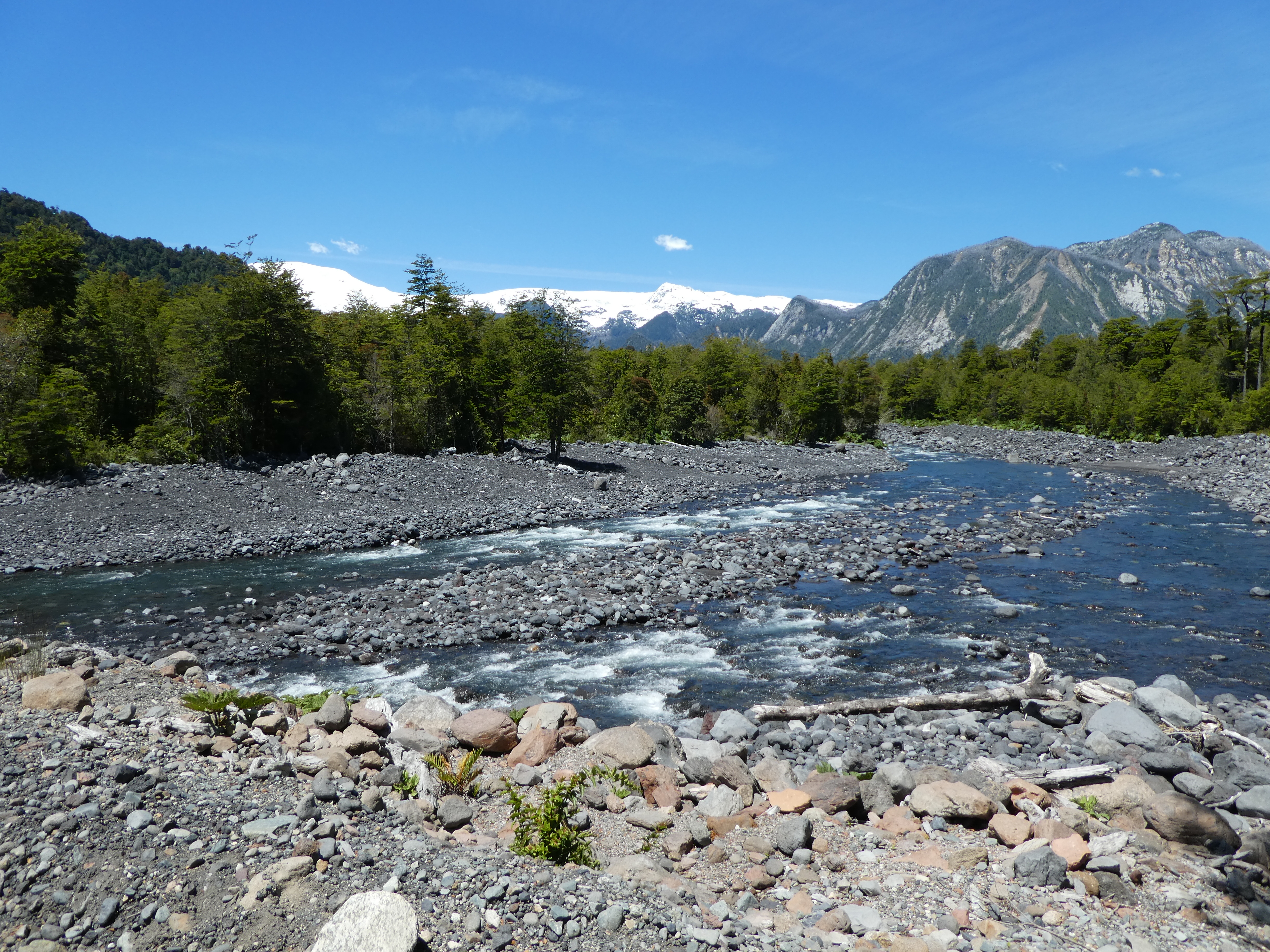
Well-maintained trails rise from the gravel road that snakes through the park, an adjunct to the famous Carretera Austral to its south. Campsites are as well integrated into the landscape and inviting as any we have seen.
We traipsed for days amid Pumalin’s volcanoes and lakes, so grateful to the generous and forward-thinking couple for making it all possible.
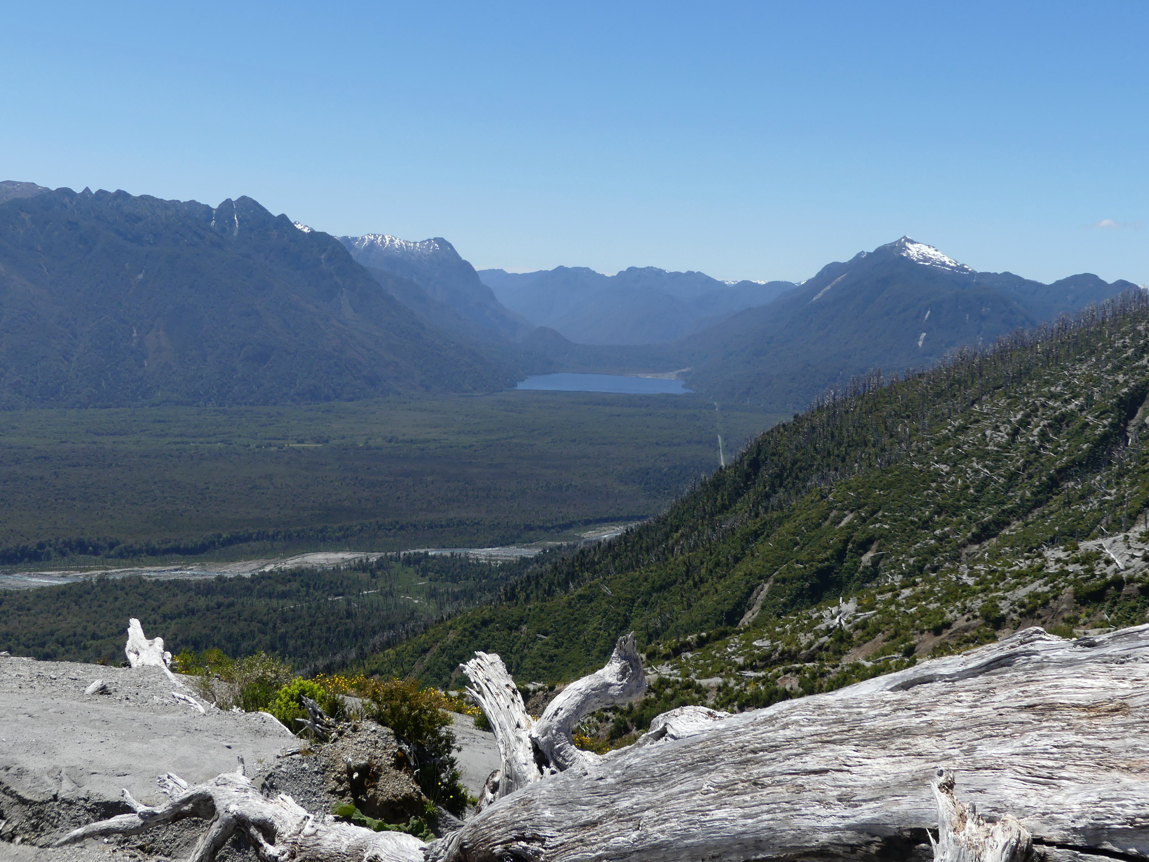
The longest was the hike up Volcan Chaiten – 600 meters (2000 feet) in altitude to climb.
Here we are starting on the Volcan Chaiten hike with the goal in the background
At the steep, slippery finish to the Volcan Chaiten hike with the fjord at the town of Chaiten below us
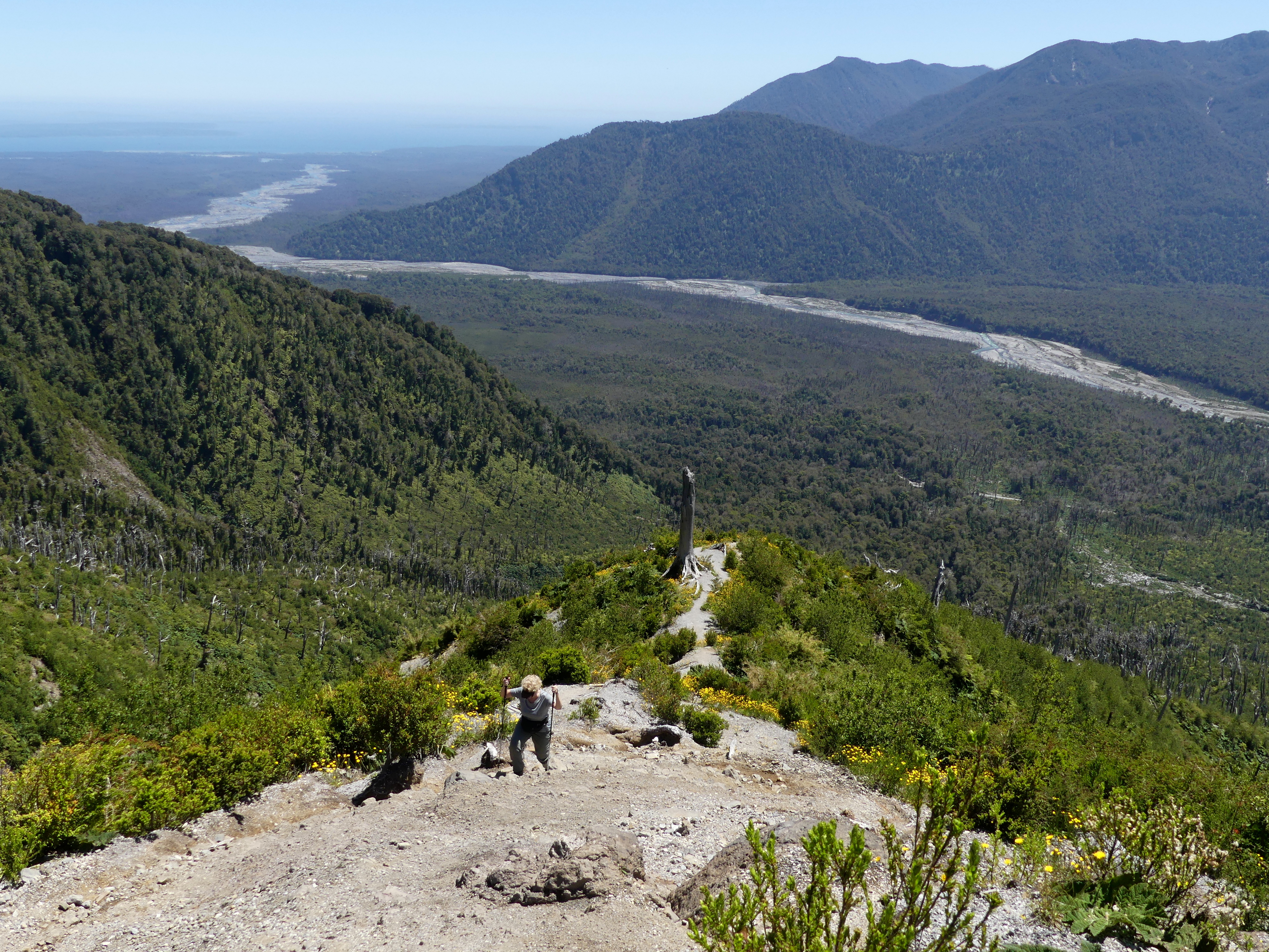
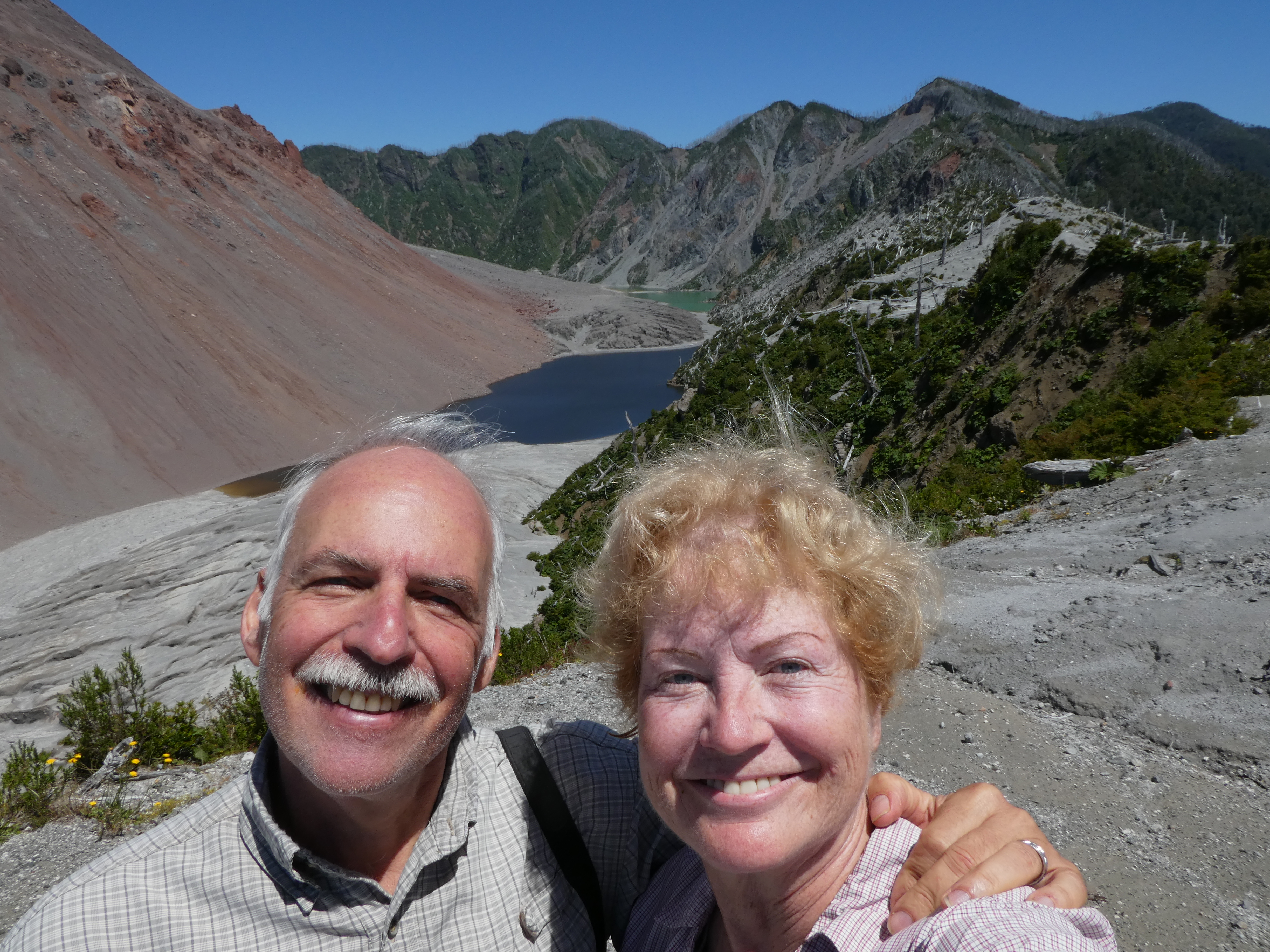
At the finish of the Volcan Chaiten hike, where the outer crater encircles the still percolating cone of the volcano. In 2008, the volcano erupted after thousands of years of quiet, and destroyed the town of Chaiten as well as a huge section of the park.
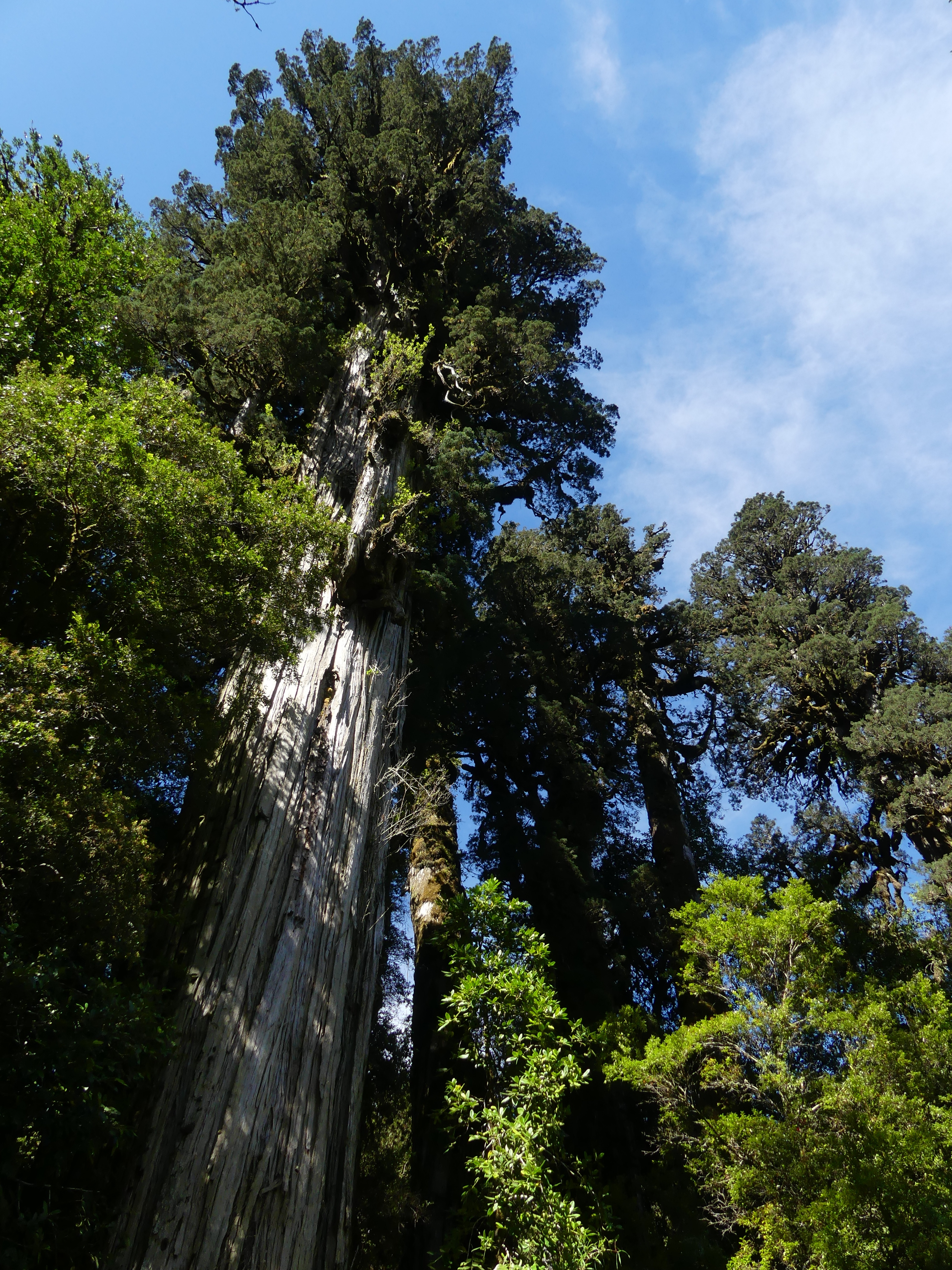
Looking up at tall alerce trees, the largest trees in South America and only native to the Andes.
These started growing 3000 years ago – but nearly died out as a species until preservation efforts in Pumalin and elsewhere in Chile rescued them.
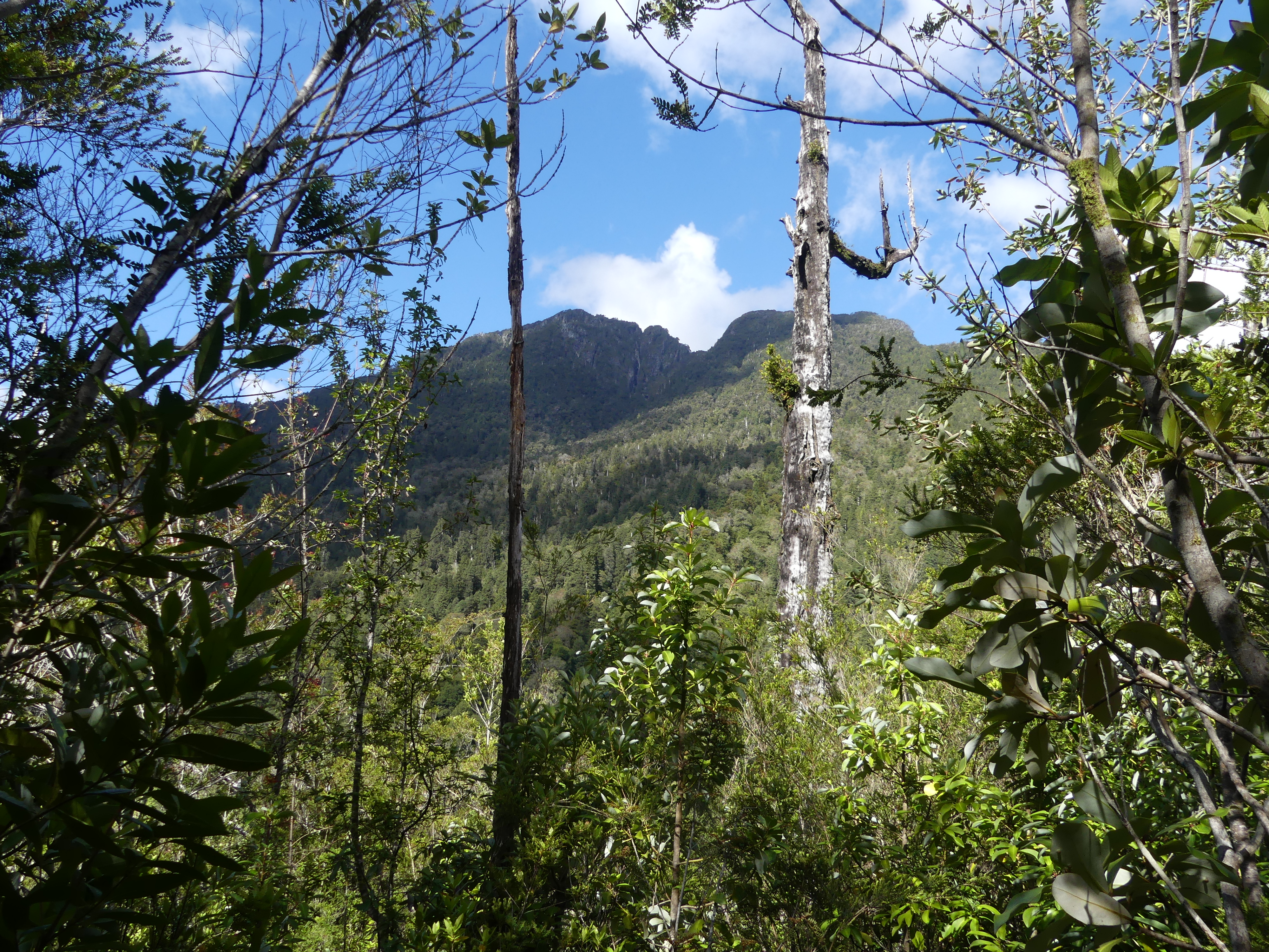
Volcan Michinmahuida, the other huge volcano here, stand out because of its irregular sky-scraping crater
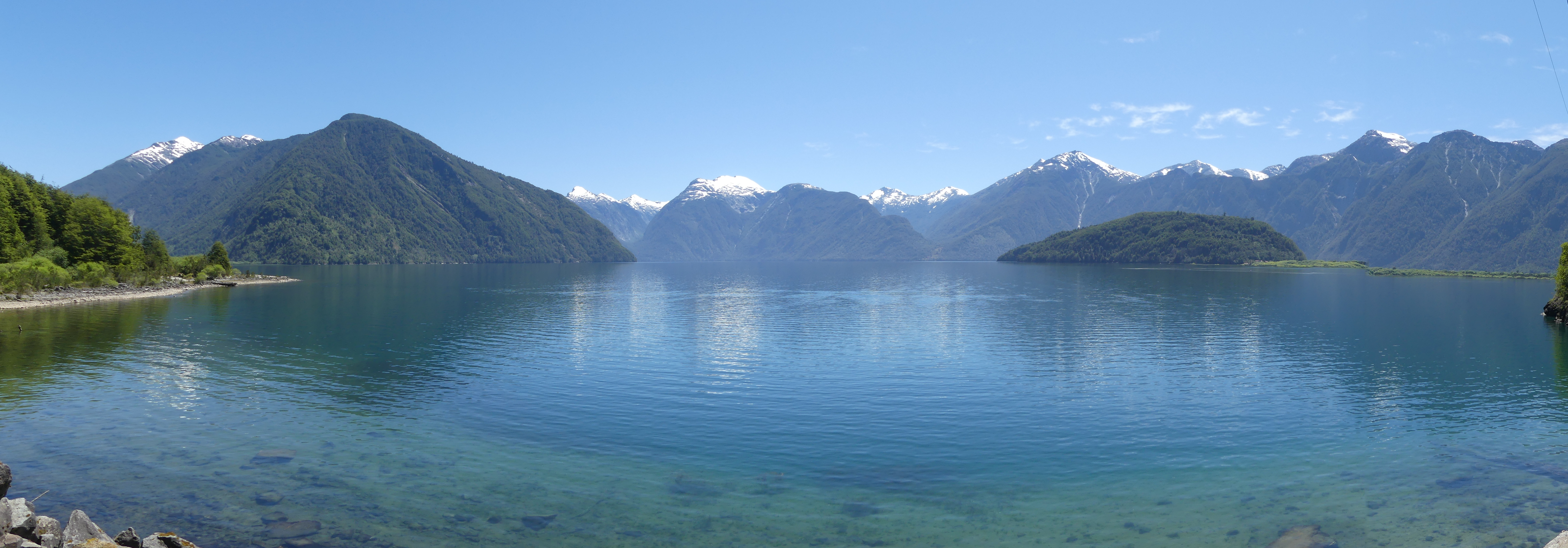
Sadly, the co-founder of the park, Doug Tompkins, died on a Patagonian lake farther south by the town of Rio Tranquilo. The name belies the frequently turbulent and wind-swept waters. His kayak was overturned by the vicious winds common to this spot.
FUTALEUFU
The renowned Carretera Austral through Chilean Patagonia continually offers splendid scenery, but the side roads can be even more amazing.
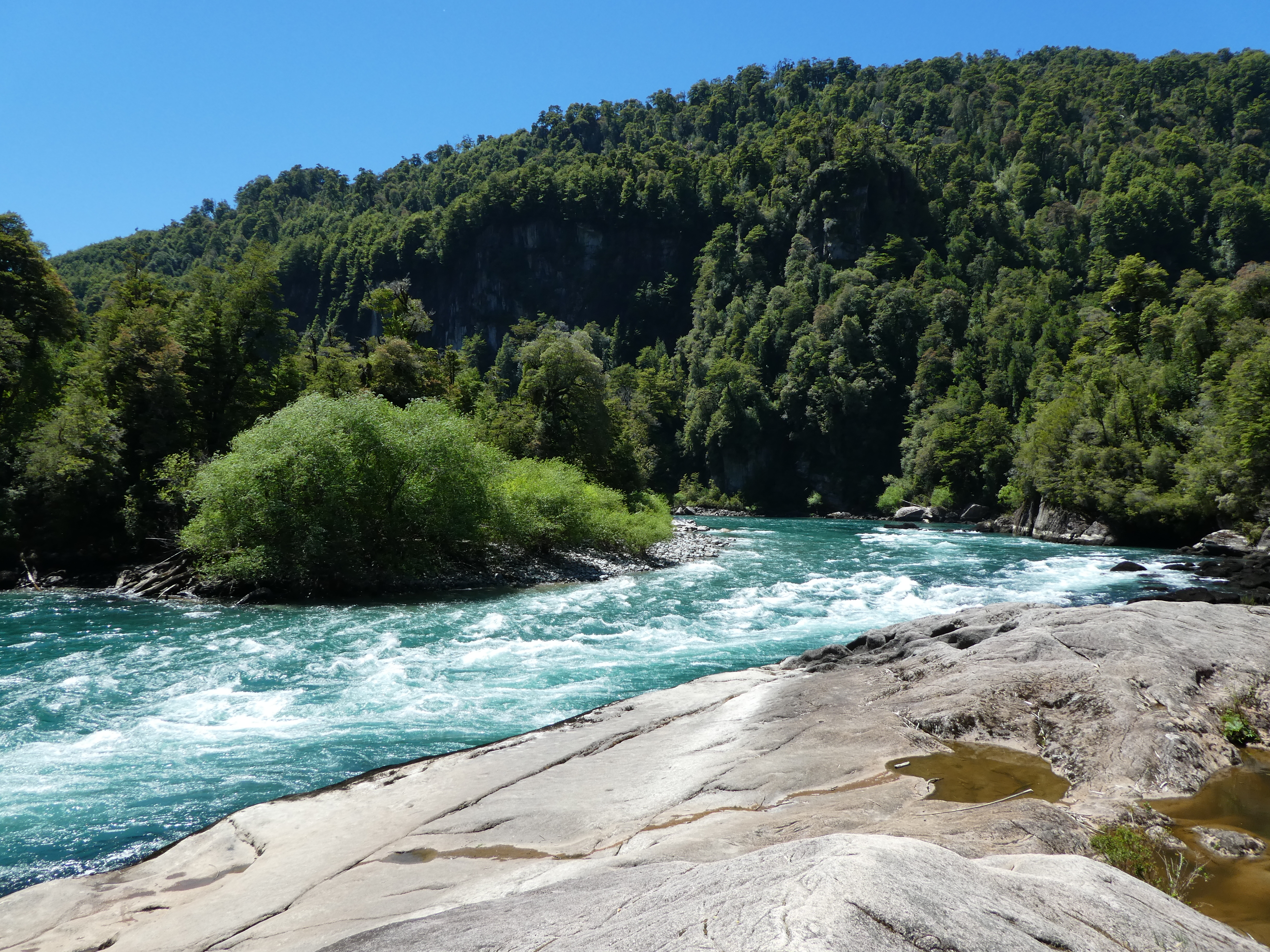
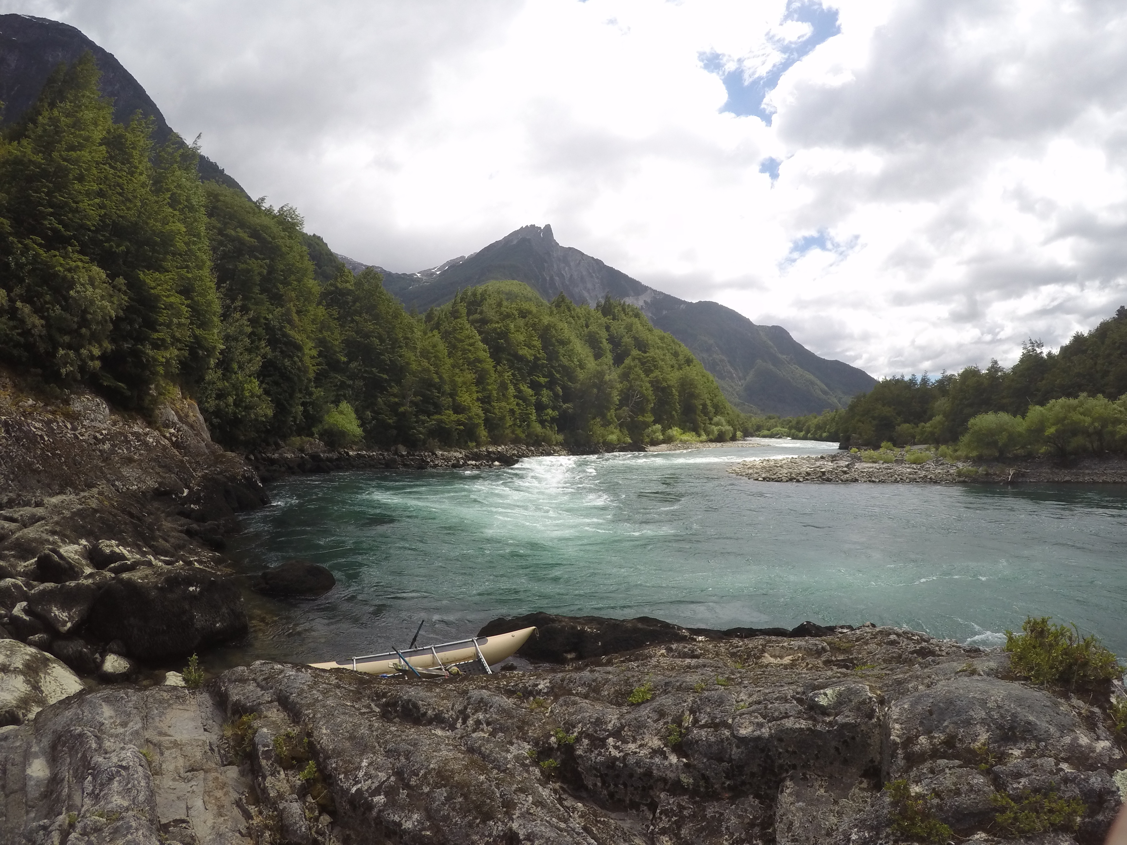
We detoured from the main road to reach the tongue-twisting town of Futaleufu. Many consider this the best place in the world to run rapids via raft or kayak. So did we after doing it!
The rough road to Futaleufu, which we had to drive for several hours each way, tried its best to rival the challenge of the river; yet it presented other grand vistas that made the effort worthwhile.
Halfway along the Futaleufu river, one tranquil spot offers a cliff to jump into the river. The break from the action was a welcome one. Several people on our raft took advantage of the drop…while others admired the scenery.
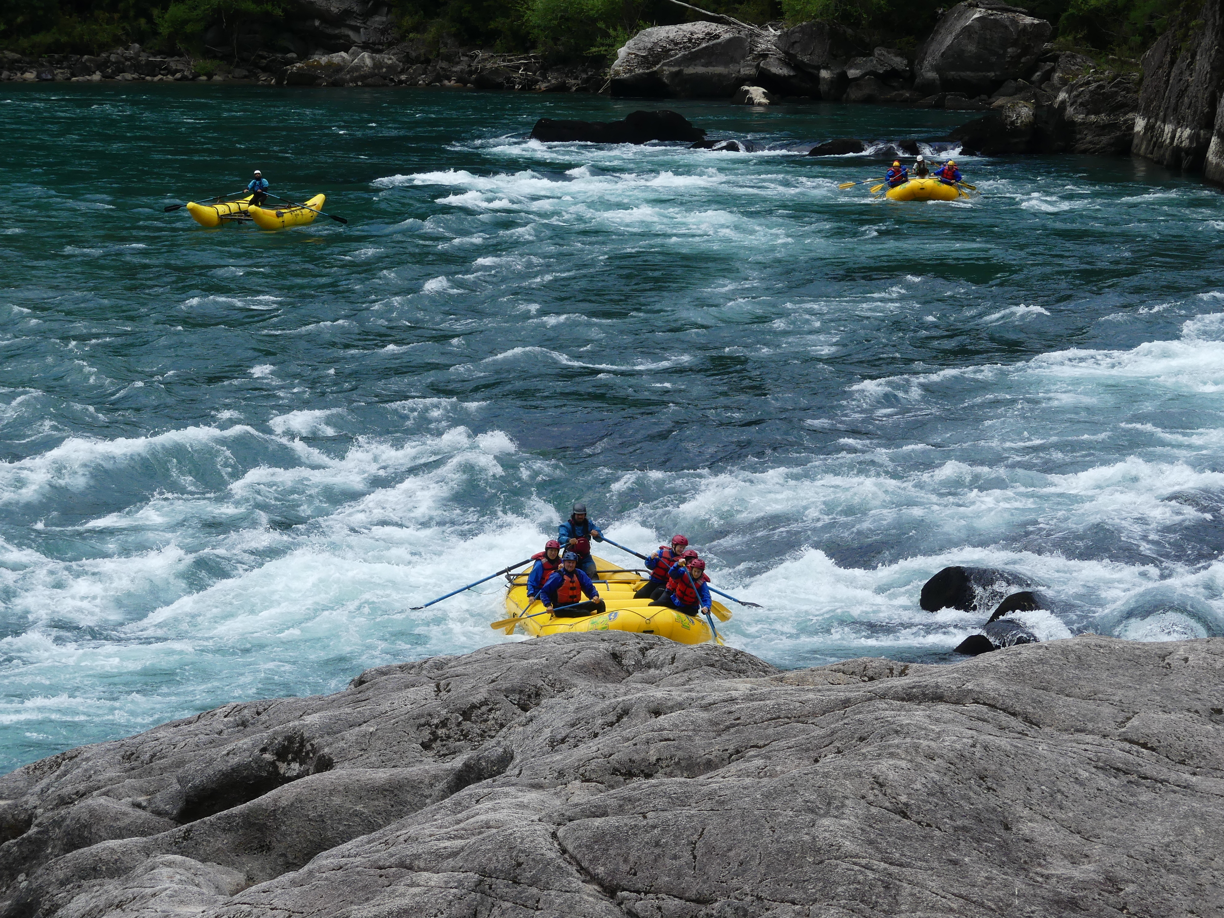
Finishing the Futaleufu rapids – no question, but this is a roller coaster ride of non-stop class 4 and 5 rapids amid a glorious landscape.
Back on the main road, this DC-3 was crash-landed by the Chilean Air Force in 1974. Its fuselage was later hauled near the Carretera by a private citizen who converted it into a three room home.
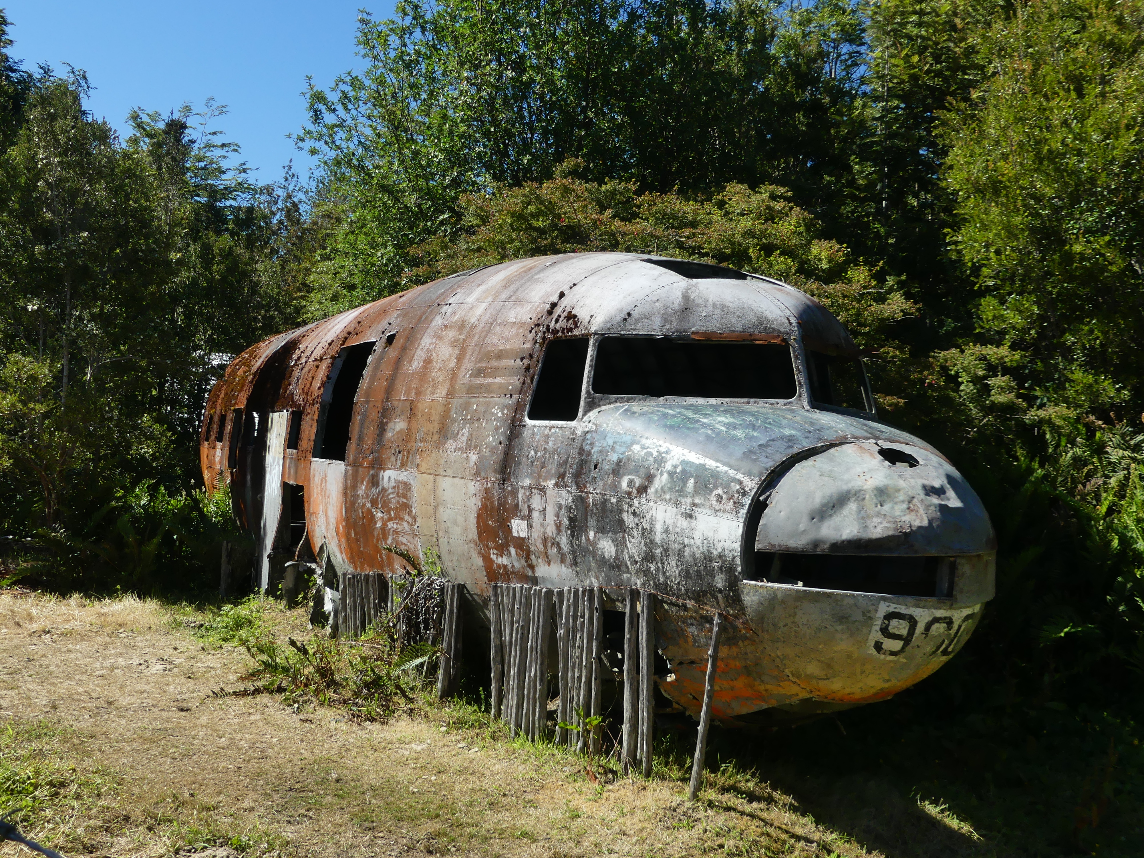
Later the rusting hull of the plane was traded it to a police officer for a 4×4 jeep. On the gate to the property, a for sale sign seeks the next owner…one with vision apparently…or another jeep that they can spare.
PUYUHUAPI
As we drove farther south on Chile’s Patagonian highway, the slow, rutted sections of hard-packed dirt seemed to show up as a kind of obstacle to handle before reaching a destination. Puyuhuapi was one of these. Fortunately, every other building in that small town offers cabanas for weary visitors like us to stay.
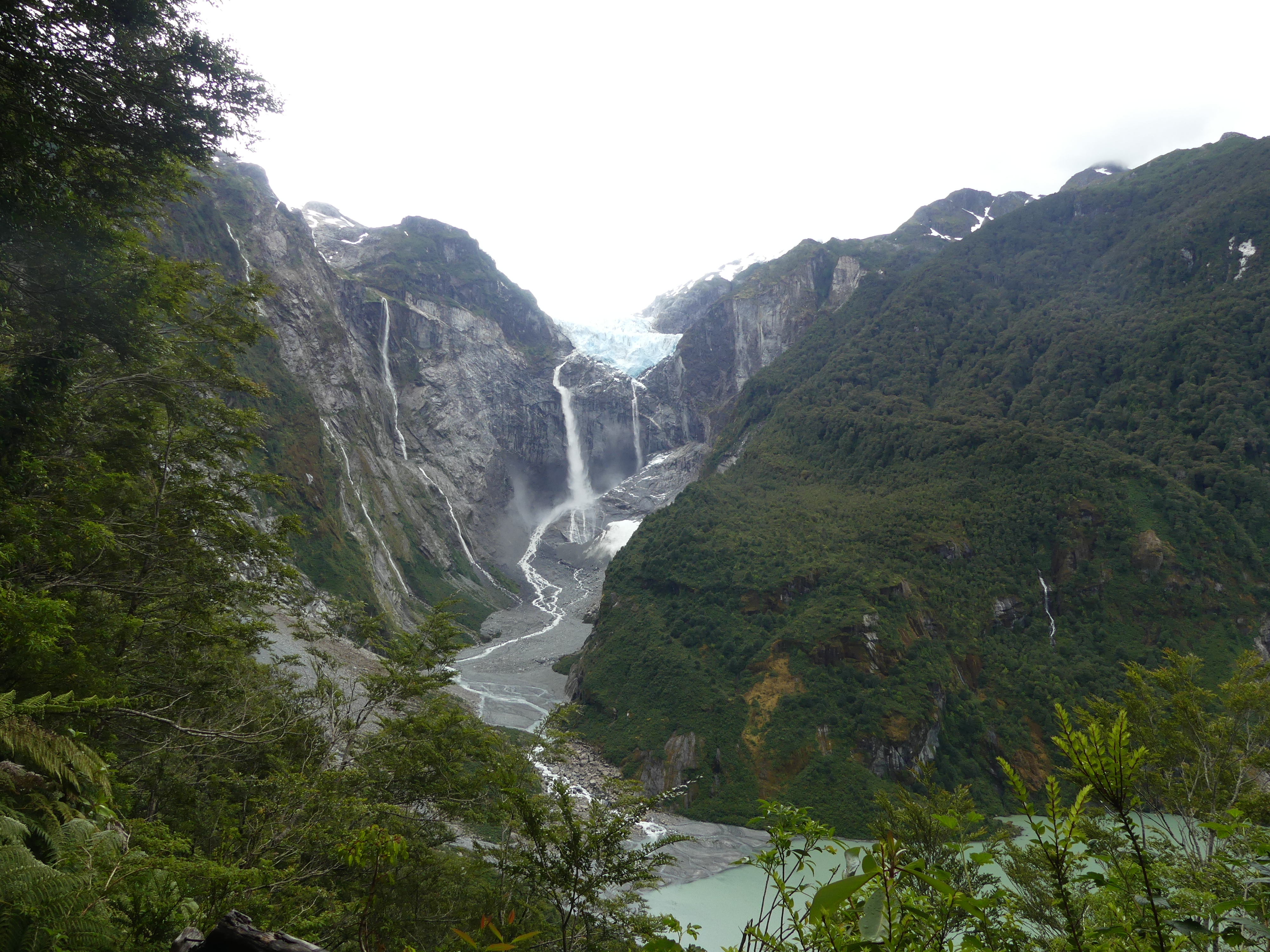
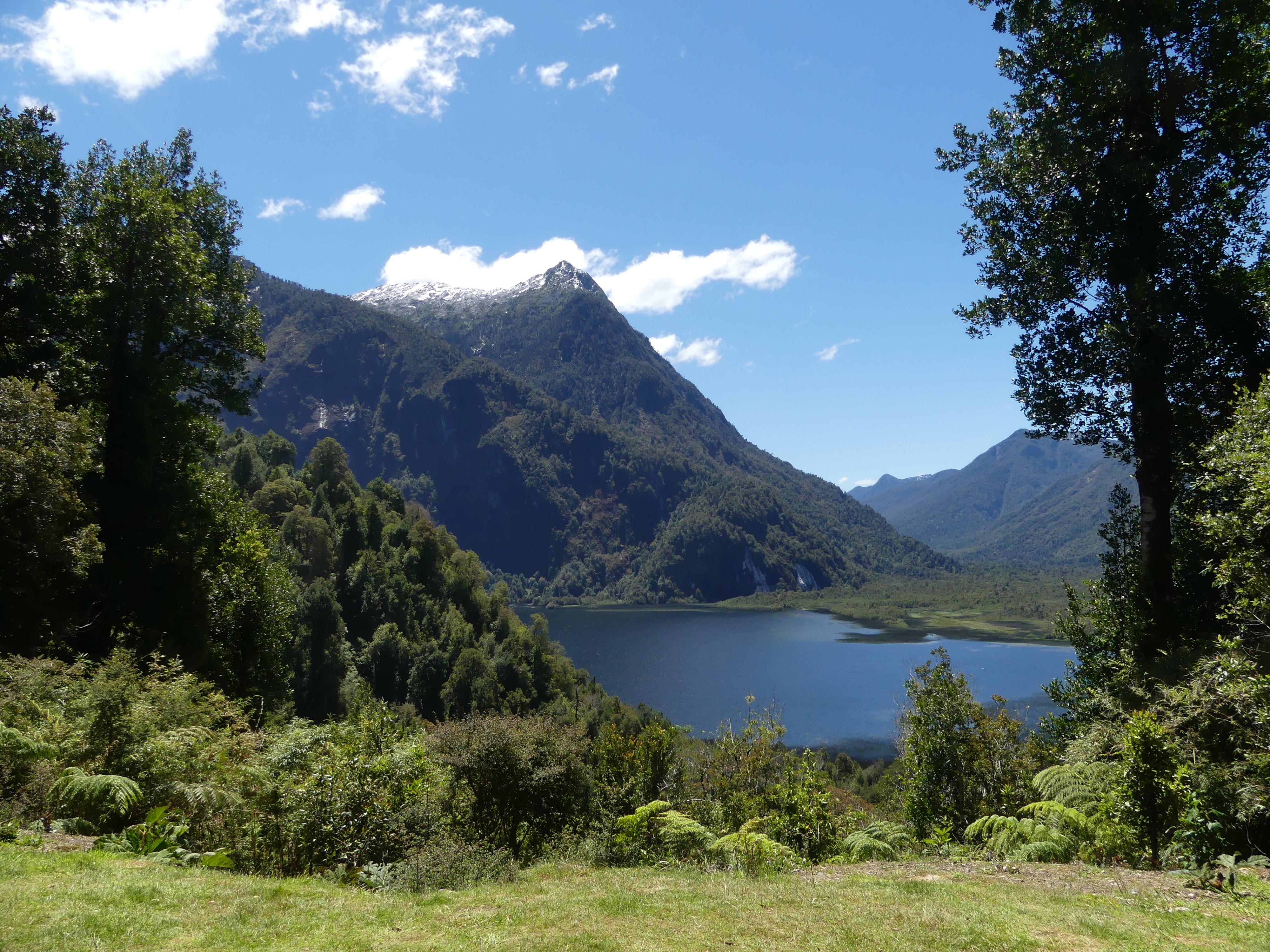
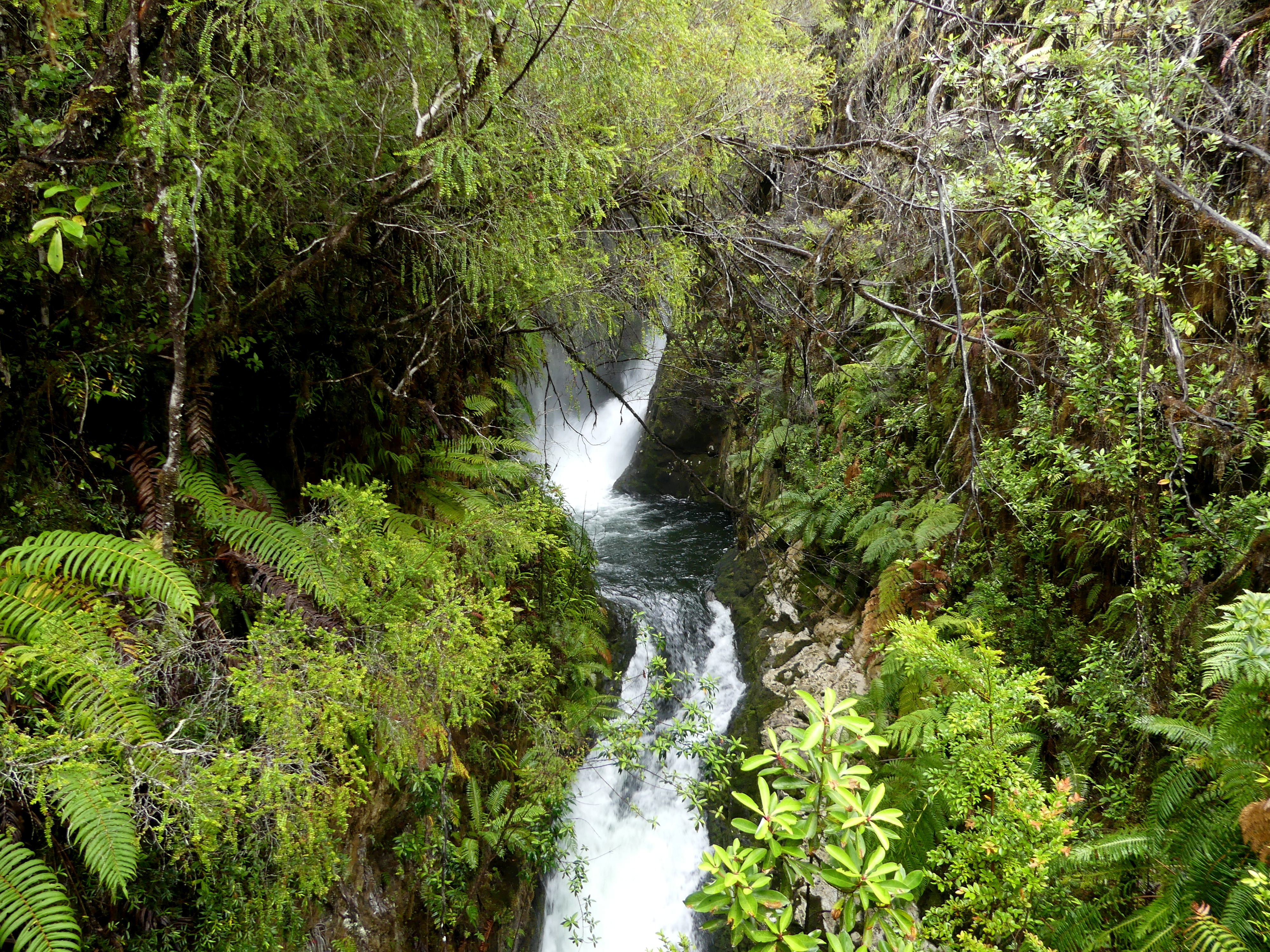
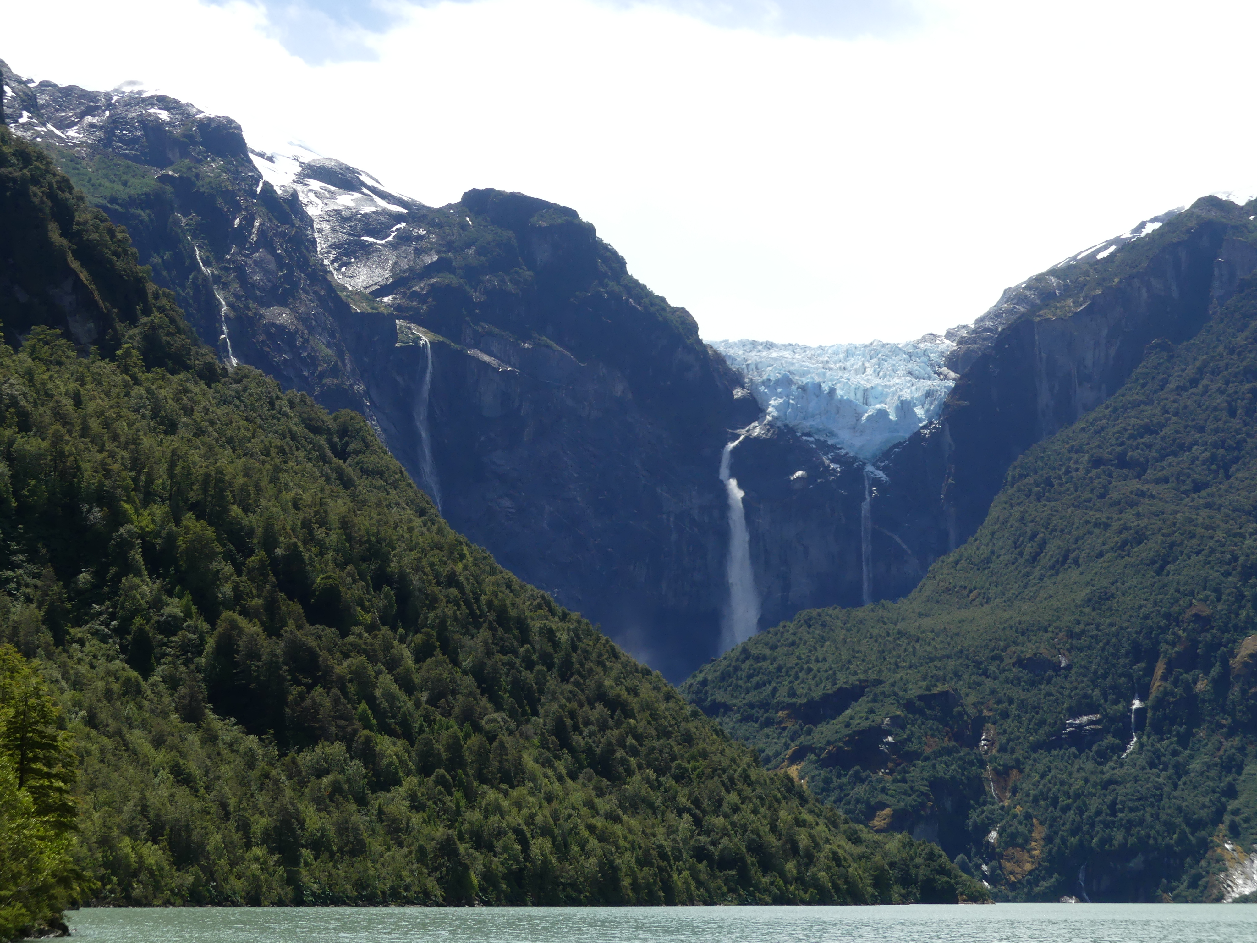
The reason to make the effort is the town’s proximity to hikes within the National Park of Queulat, whose hills are filled with thundering rivers, rich forests – and its biggest spectacle: a hanging glacier.
Most glaciers terminate in a lake, but the glacier in Queulat ends abruptly high up on a cliff-face. Waterfalls spill from it down the cliff and frequently huge ice chunks tumble noisily off it as well.
Visitors to the Hanging Glacier usually just amble over to the lake which the ice melt replenishes after spilling water and ice down its cliff-face.
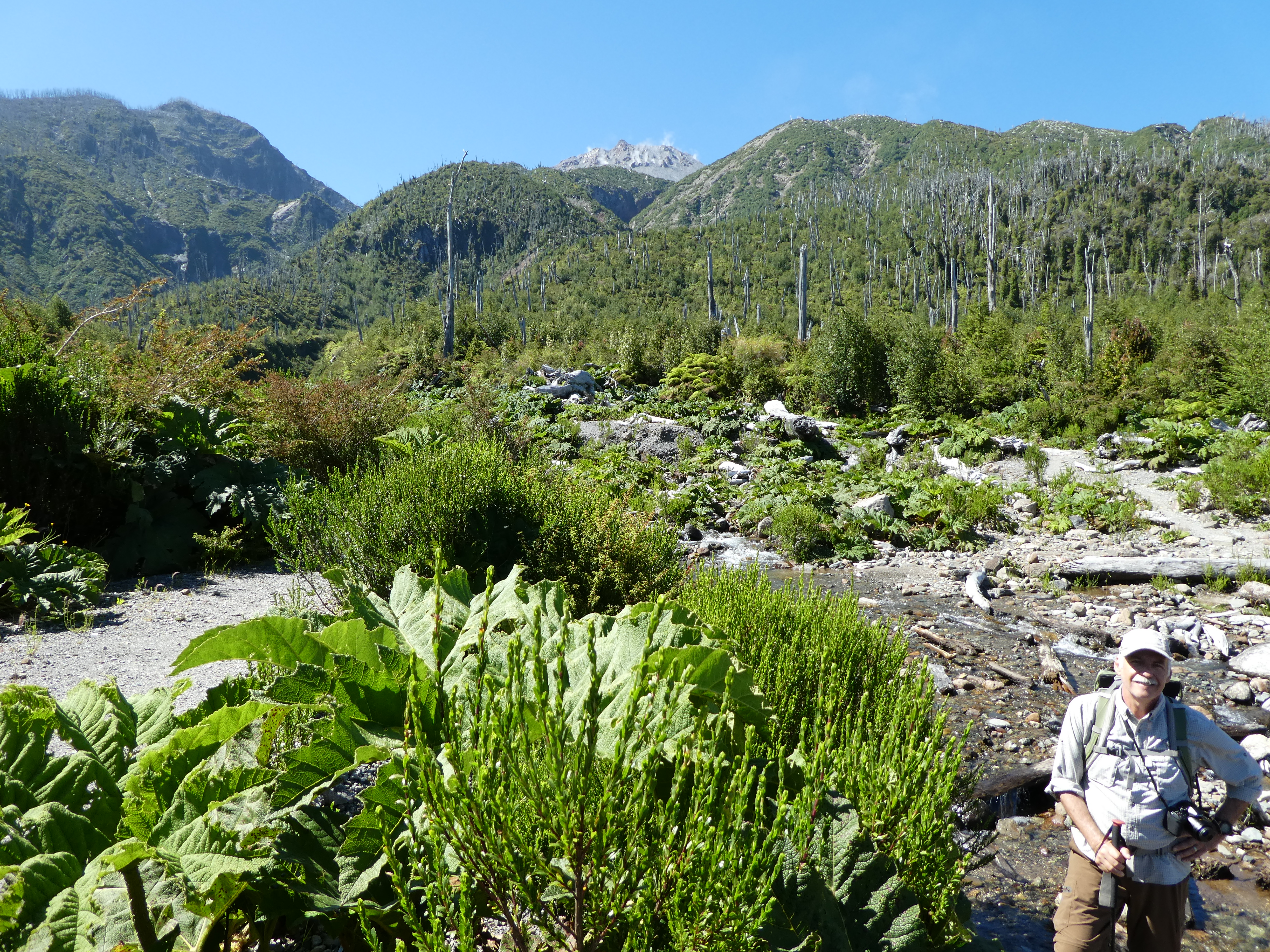
The more strenuous option is to climb to the lookout over the hanging glacier. This demanding trail is steep, muddy, filled with roots and obstacles, but beautiful in its own way when you stop to admire it during the four hours you’re on it.

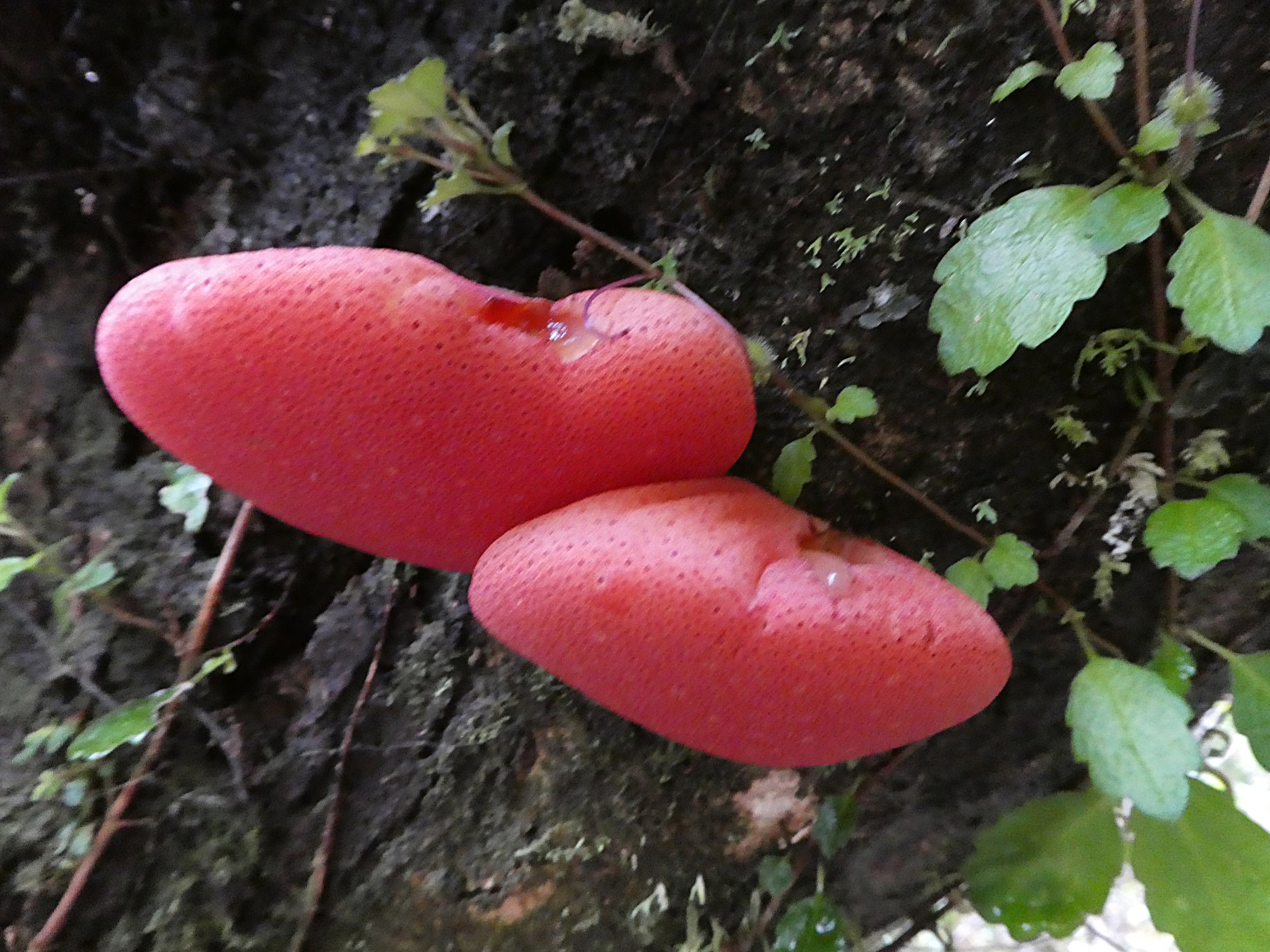
Forget the glacier…even the fungus is interesting here.
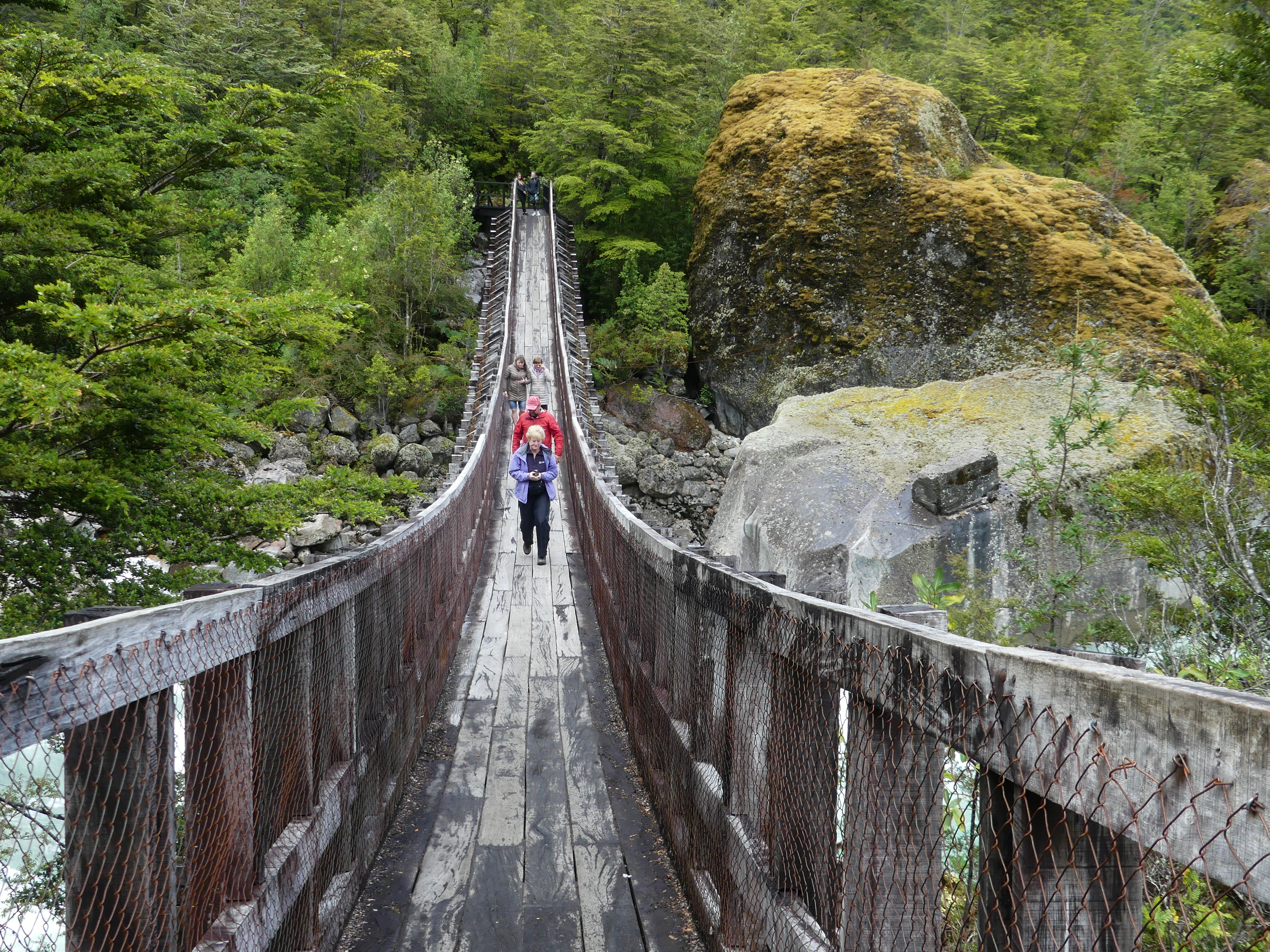
The bridge along the trail up toward the glacier is also a hanging one, traversing some pretty turbulent waters that tumble from the glacial lake.
Whether you view it from the lake it creates far below or from the end of the muddy steep hike that faces it on high – the hanging glacier is an impressive site worth the effort of getting there.
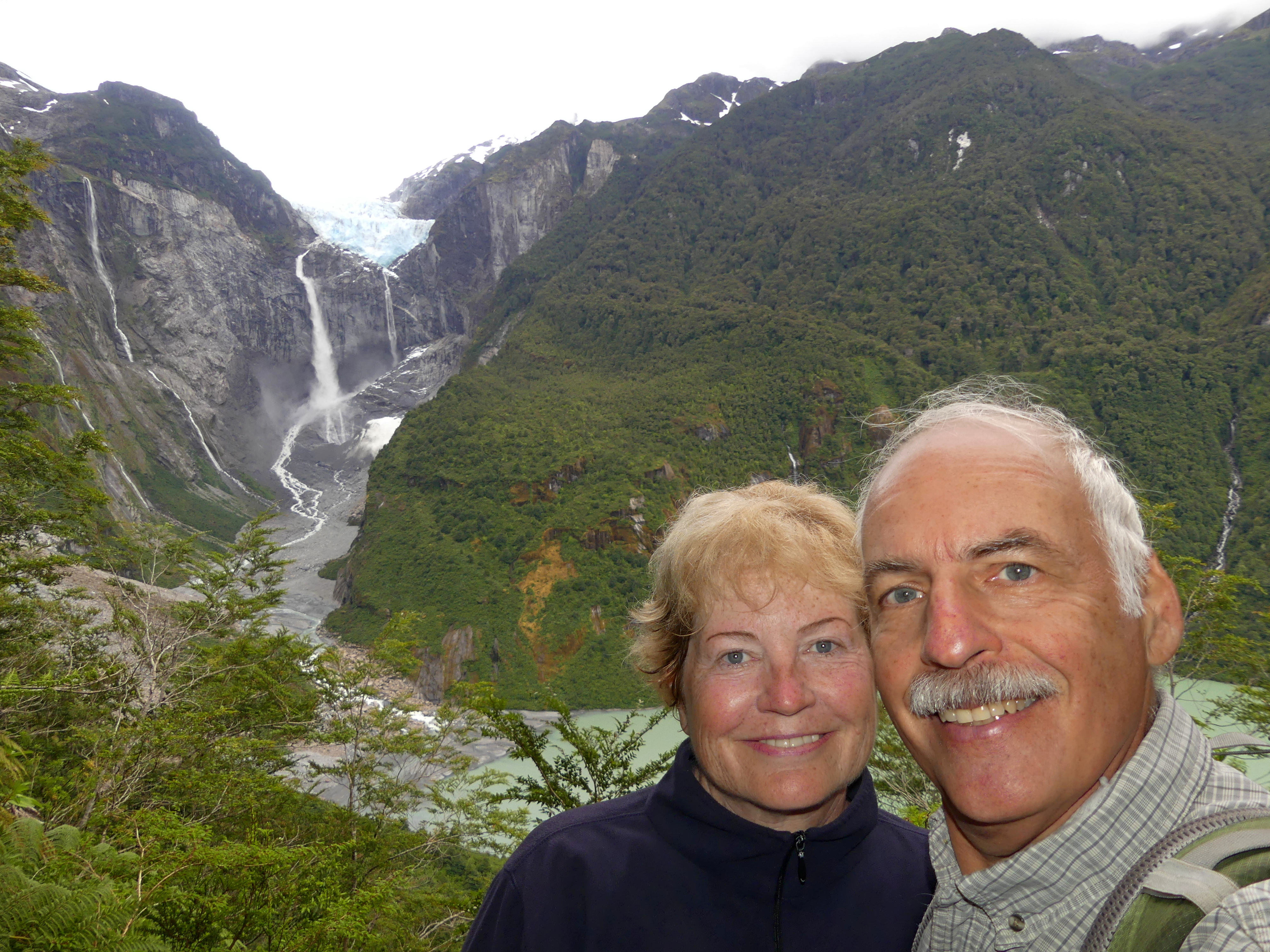
Muddy but unbowed, we reached the viewing platform after hours of hiking along the very slippery and twisting climb. There we joined several groups of younger hikers and some colorful birds.
Though the tough trek back down was calling to us, we celebrated reaching Ventisquero Colgante (hanging glacier) and its incomparable vista.
(To enlarge any picture above, click on it. Also, for more pictures from Chile, CLICK HERE to view the slideshow at the end of the itinerary page.)