This post reviews the second part of our trip, one of colorful canyons, alpine ridgelines, marbled caves, tough roads and endlessly sublime scenery.
The overall journey through this gorgeous mountain landscape and desert pampas began at Puerto Montt, Chile, and ended at Ushuaia, Argentina. We spent nearly a month driving and ferrying along three thousand kilometers, from north to south.
COYHAIQUE
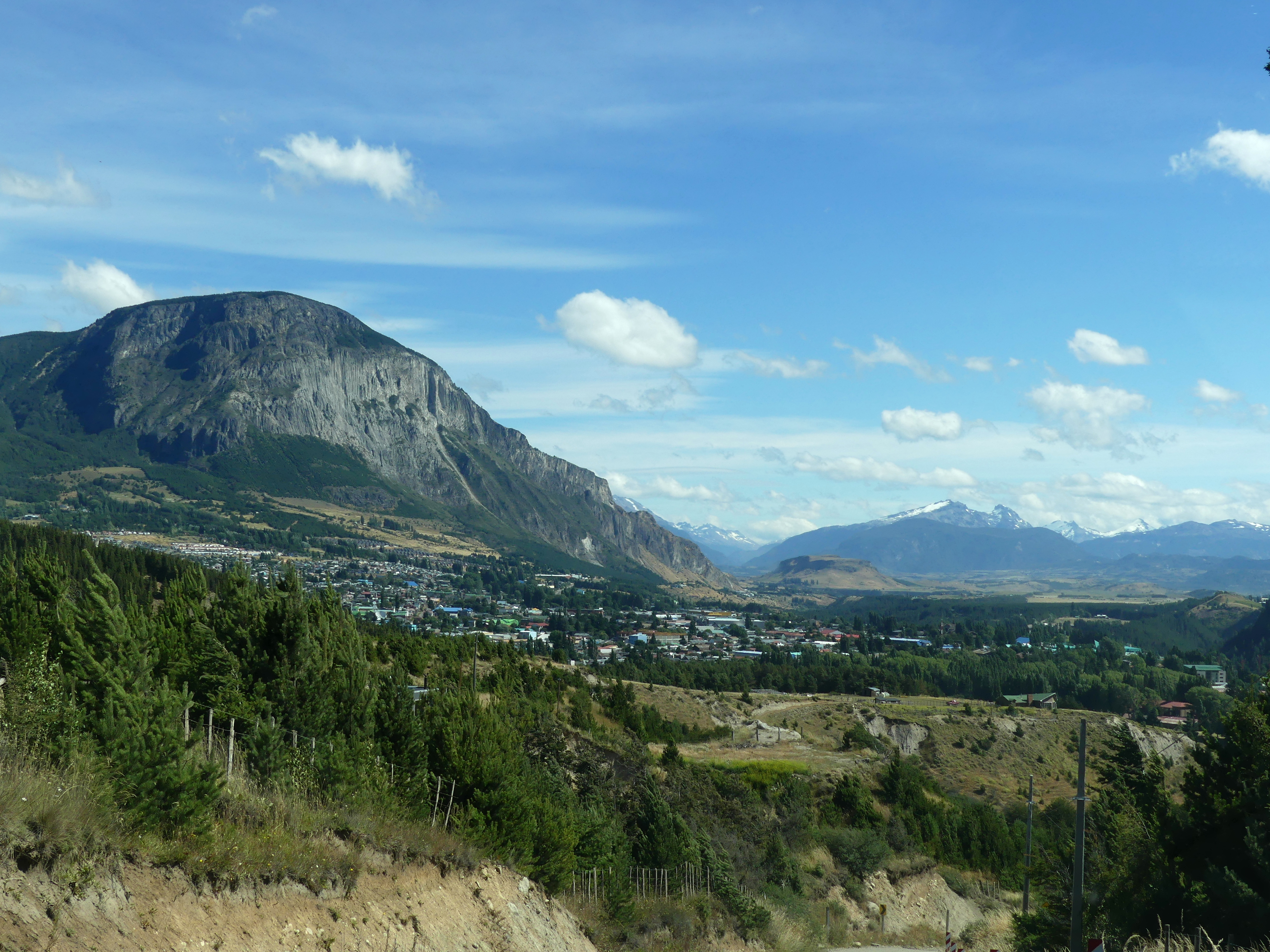
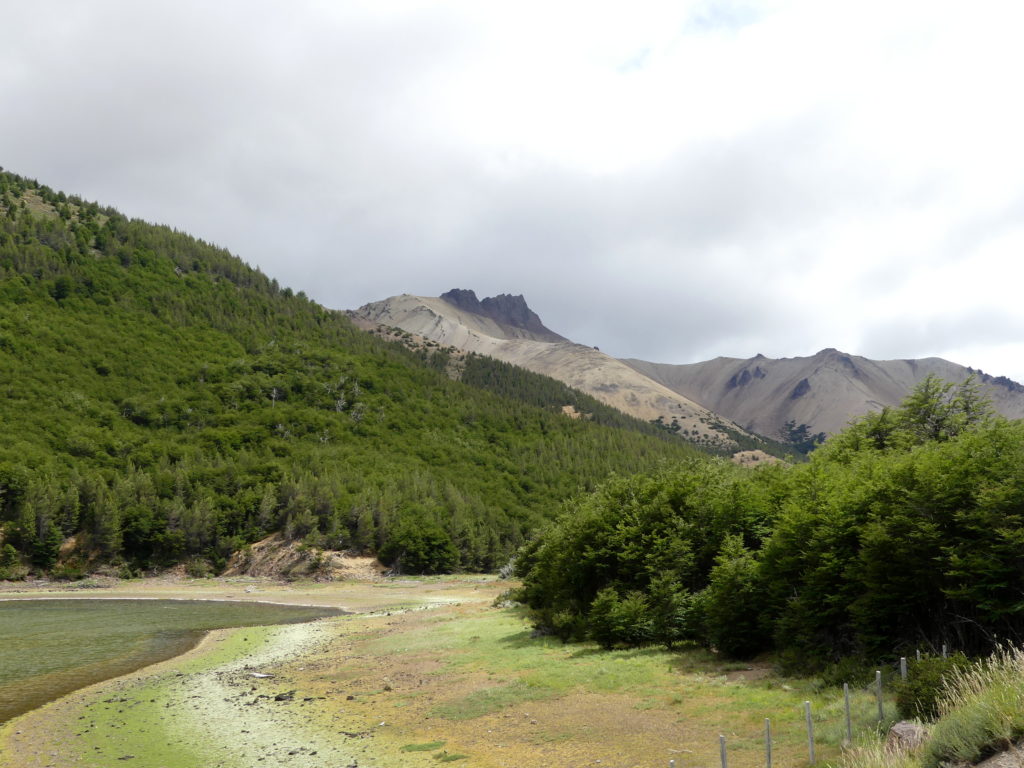
Coyhaique is the largest town in the heart of Chilean Patagonia, a principal stop for most travelers along the Carretera Austral. It’s also a place with several deep canyons cut long ago by the local rivers and with access to the countless fjords nearby.
A scraped and bulbous peak looms over Coyahaique, along its principal river canyon.
The beauty of the area is a good reason to stay a while here, since you must pass through the town anyway. Many Carretera travelers end here also since it is the best place to return your rental car and fly out of Chile, or ferry north up the fjords, after doubling back from the road’s end at tiny O’Higgins to the south.
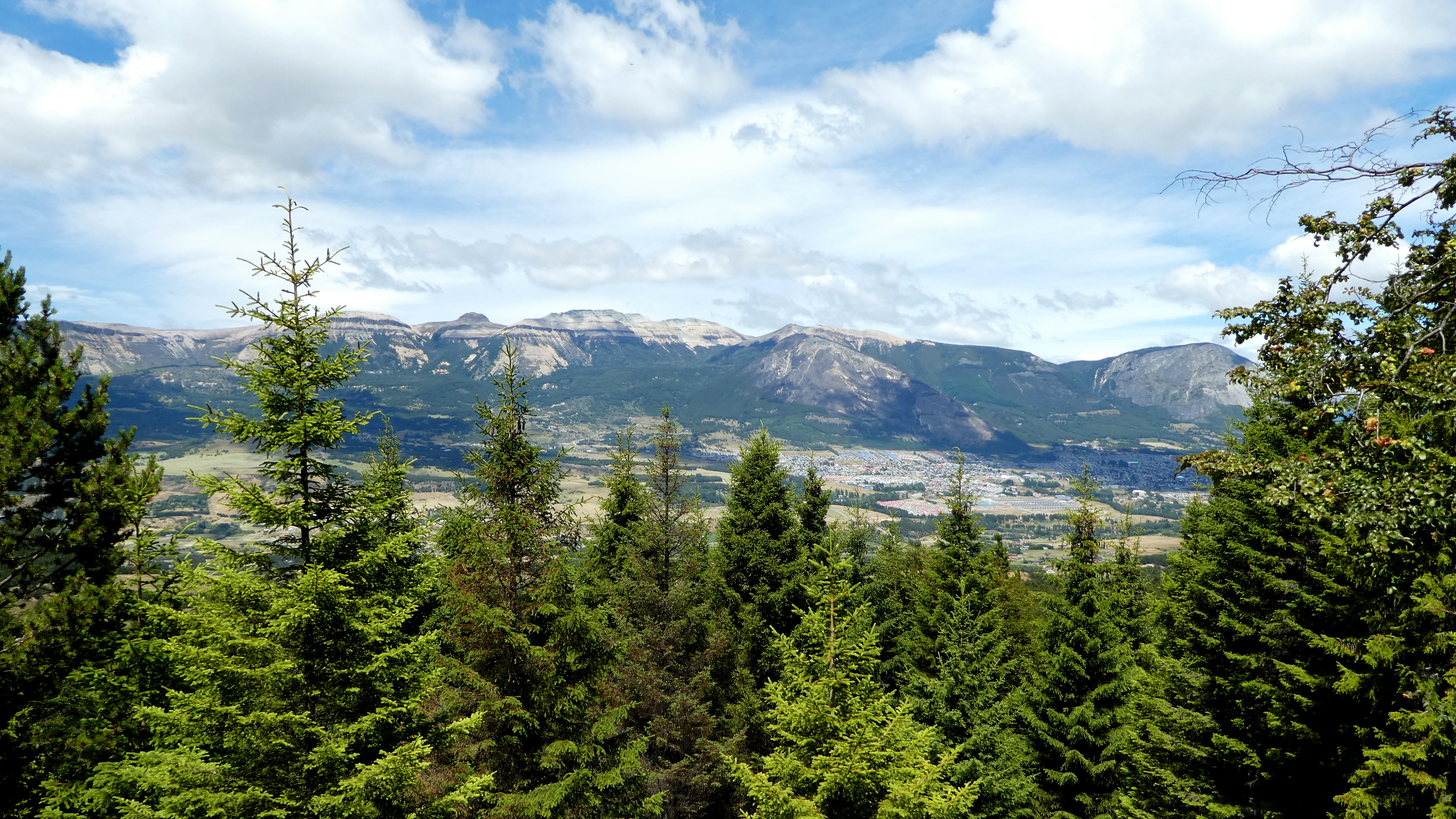
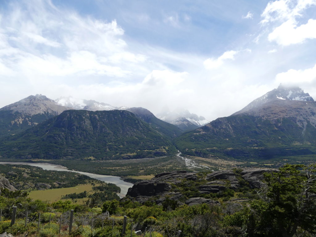
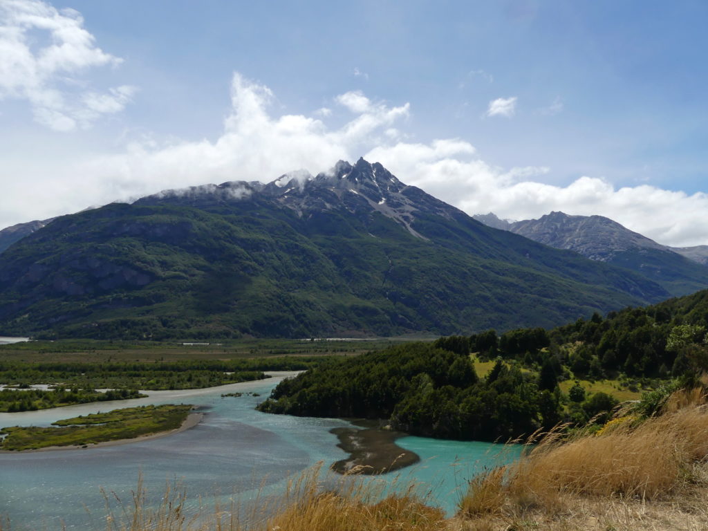
We hiked in the local Reserve along a trail that connected a half dozen lakes through rich forests, with splendid vistas, such as this view of Coyhaique’s mountain range.
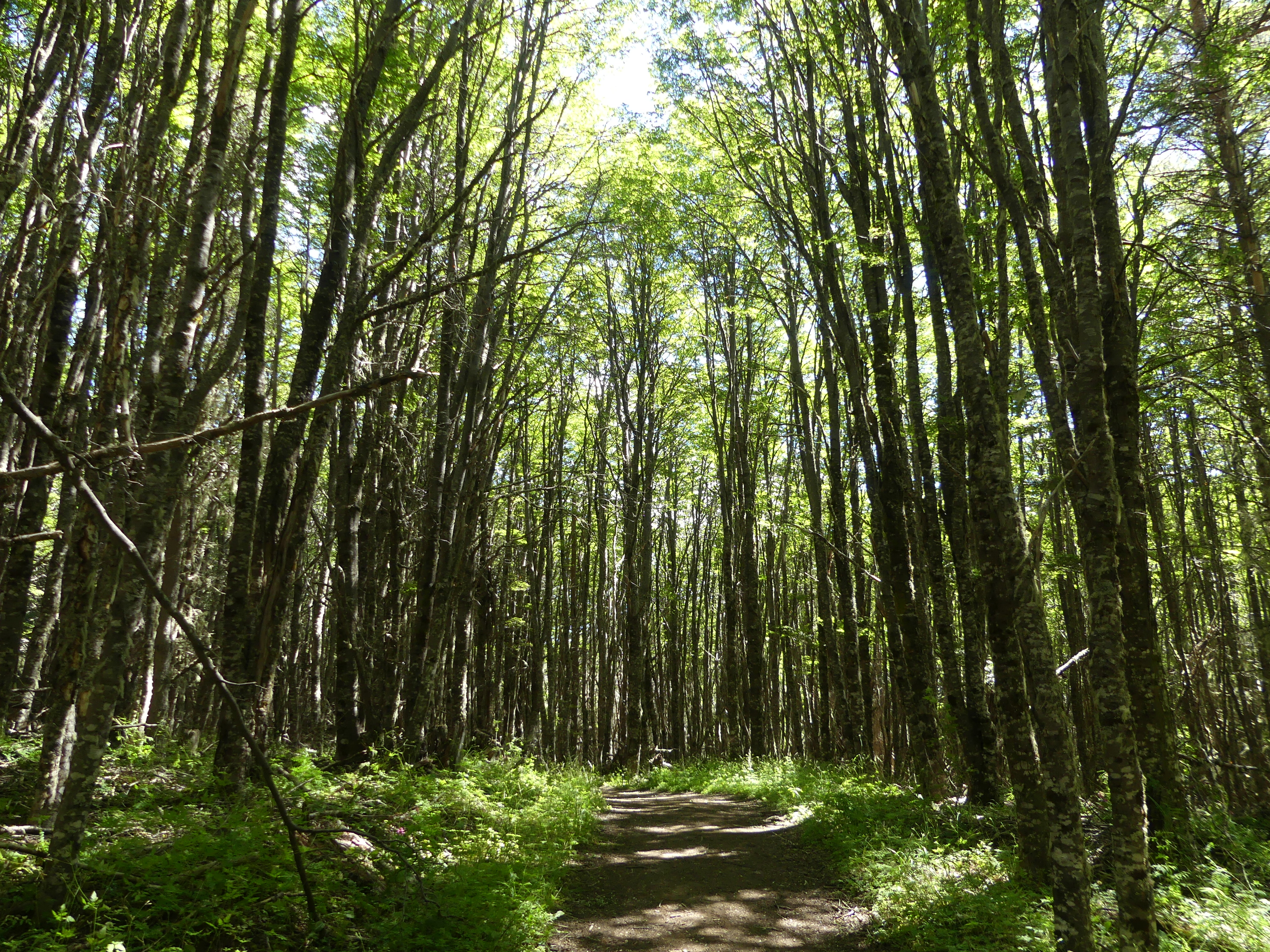
Typical forested section of the Reserve, an incredibly peaceful and relaxed hike away from the snowy mountain peaks of Patagonia
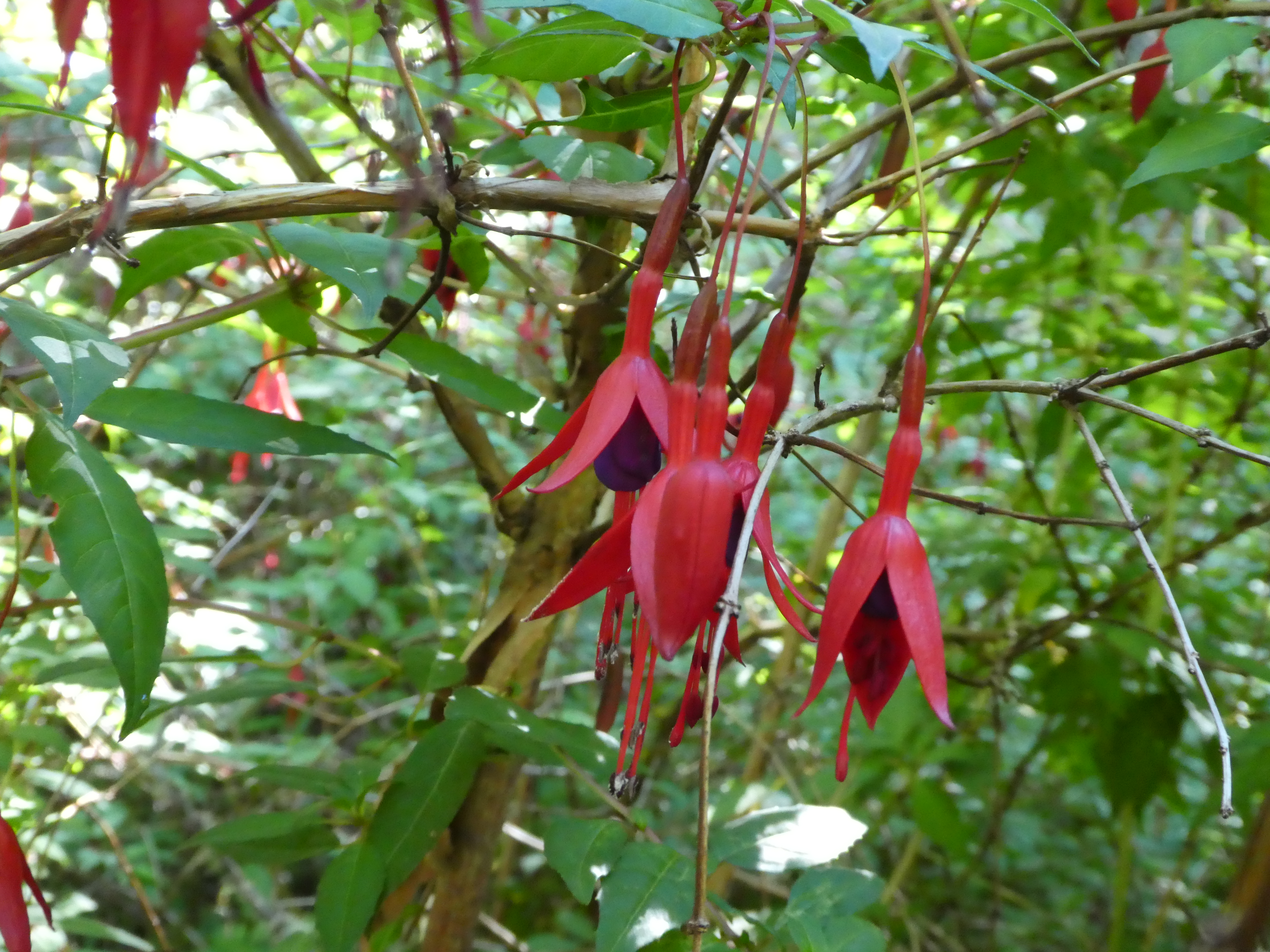
Wild firecracker fuchsia (or chilco) along the Reserve trail, some of the many flowers we passed along our hike.
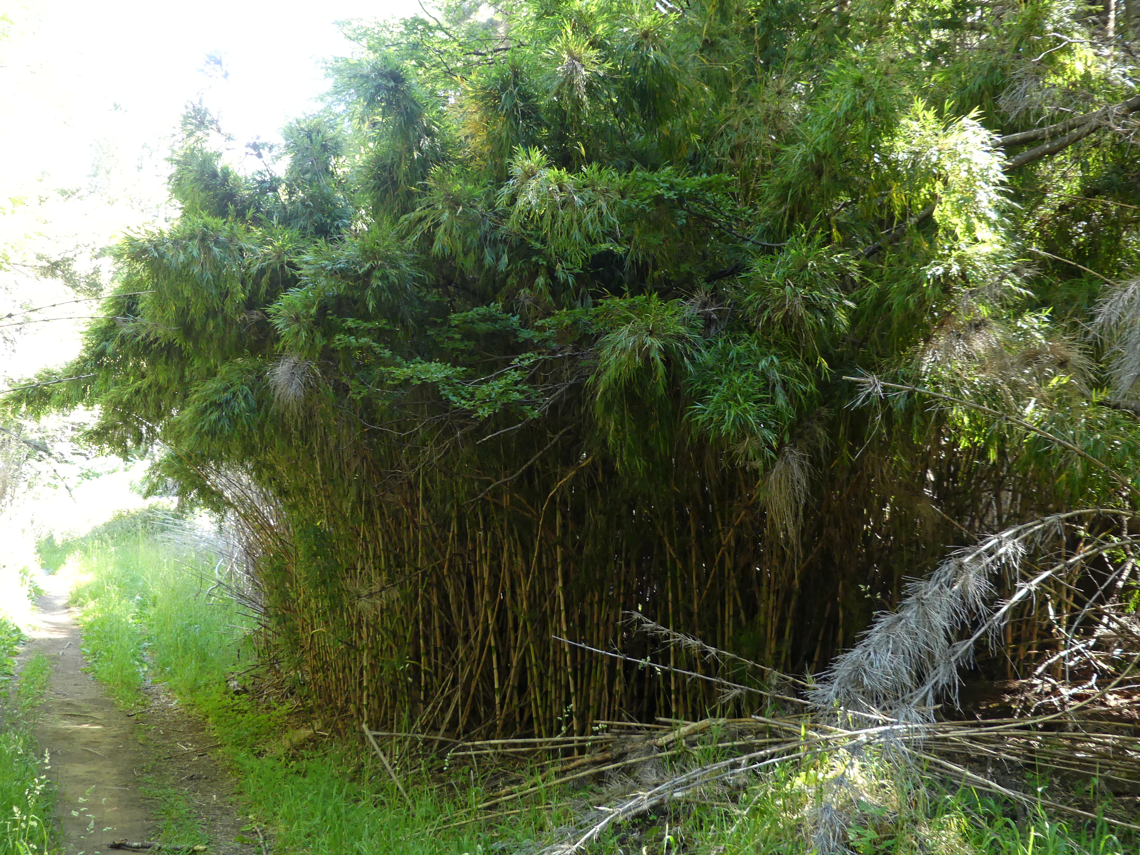
We can appreciate the beauty and diversity of trees in woods like these even if we may not be able to identify them. Unexpectedly, we often came upon several bundles of bamboo crowding the trail, groves that added an extra flair to the hike.
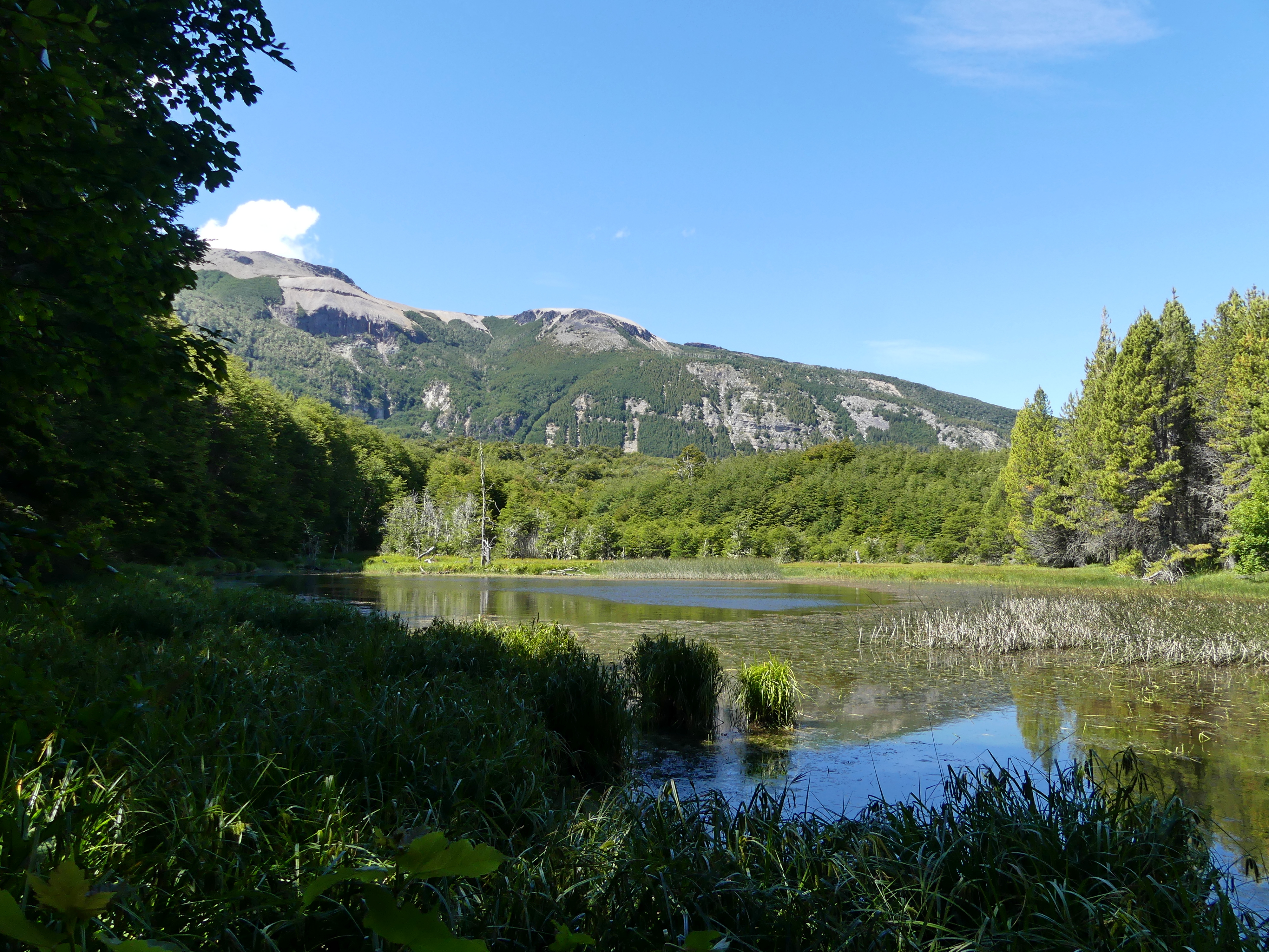
Near the end, we came upon one of the prettiest of the interconnected lakes of the Reserve trails, Laguna Los Sapos, with Coyhaique’s mountain range rising impressively in the backdrop. At another marshy lake, we sat on a small, rickety tower watching ducks and picnicking al fresco.
LOOKING BACK ON THE ROAD
Since you must pass through Coyhaique on the Carretera, you wouldn’t think it would be so difficult to reach the town. For us, though, it was a case of bad timing…we had to drive a challenging country road to bypass a blockade by striking miners about 40 kilometers north. Then we had to wait 2.5 hours for dynamiting on the last 15 kilometers, as non-striking road workers were replacing the old dirt road. We spent 9 hours in the car for a 4.5 hour trip. At least, we shared the wait with half a dozen people we had met before on the long journey south from Puerto Montt.
More generally, Chile’s asphalted roads in this northern section are a pleasure. But, as we saw at Puyuhuapi, the dirt roads can be trying. Often, we found, they entice you to think they are smoothing out just to find that they turn into a squooshy carpet of small stones, or strut-punishing ruts, or teeth-rattling washboards or slippery soft dirt up hill and dale…every variation of dirt one could imagine. You need very good tires to make it through. Ours were not, we had two flats before Coyhaique, one of which the local tire guy could repair and the other requiring a slightly off-size used substitute tire. In Coyhaique, our rental company replaced all four of them!
LAGUNA SAN RAFAEL
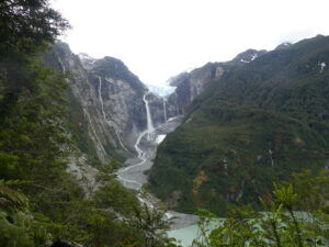
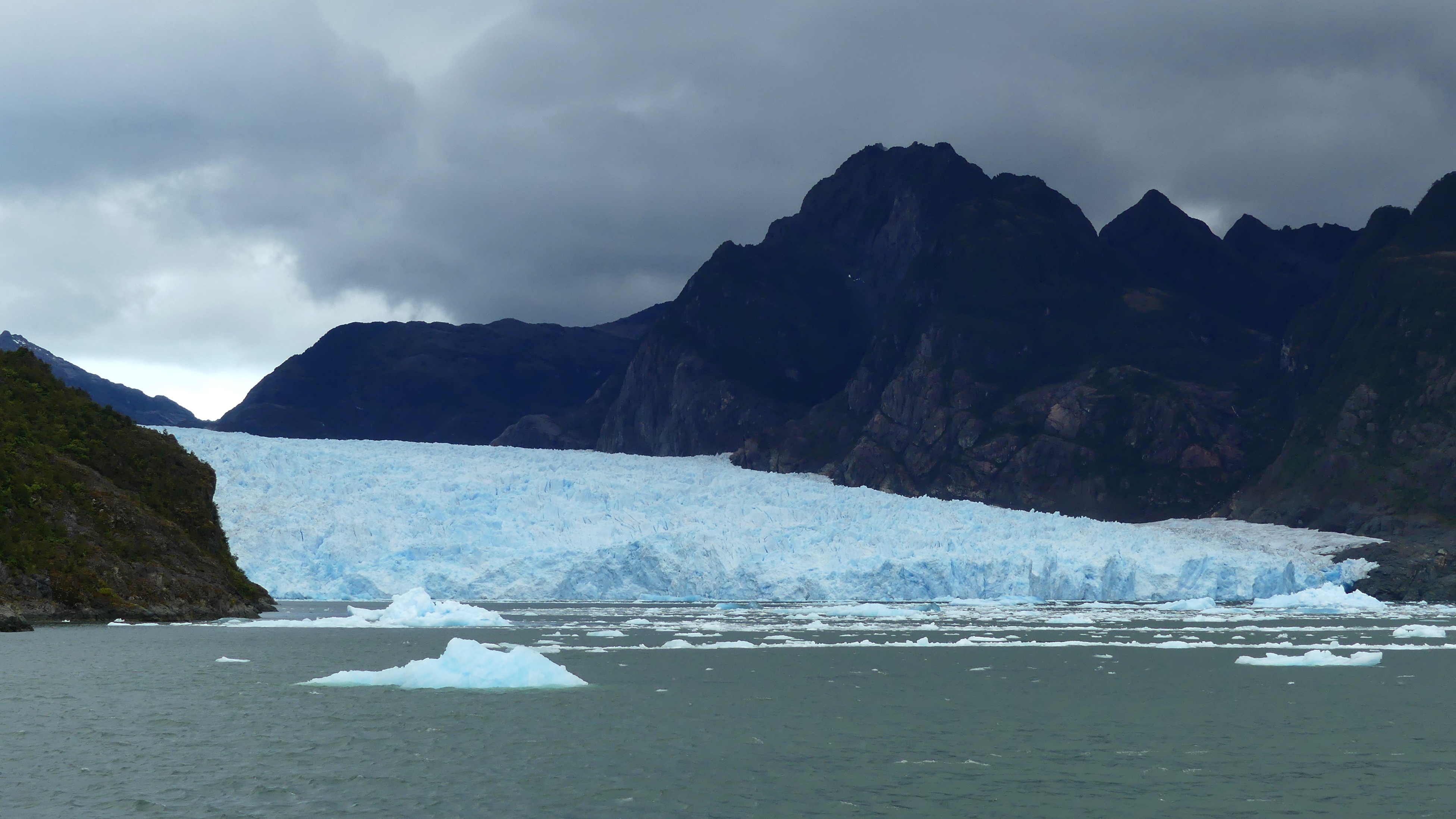
Also, about an hour away from Coyhaique, we boated for a full day on the fjords to the remote Laguna San Rafael with its huge glacier.
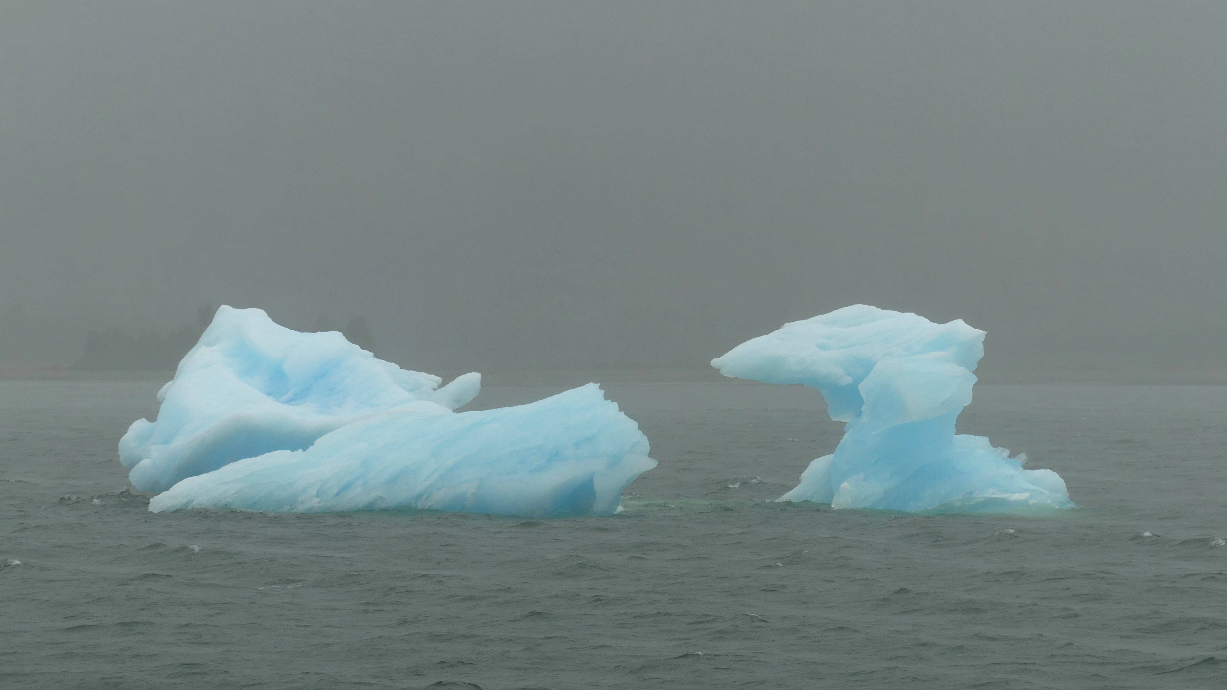
We reached the glacier in Laguna San Rafael at the farthest point in our fjord voyage. The glacier is about a mile wide (1.5 kilometers). When we arrived, it was windy and rainy, but we nonetheless plunked ourselves in a zodiac raft with other passengers to see the glacier and ice floes from the water.
With icy rain whipped into our faces and wind-driven waves that made the boat bounce violently at times, all of us felt this was quite an adventure in glacier watching – even if not the most pleasant weather.
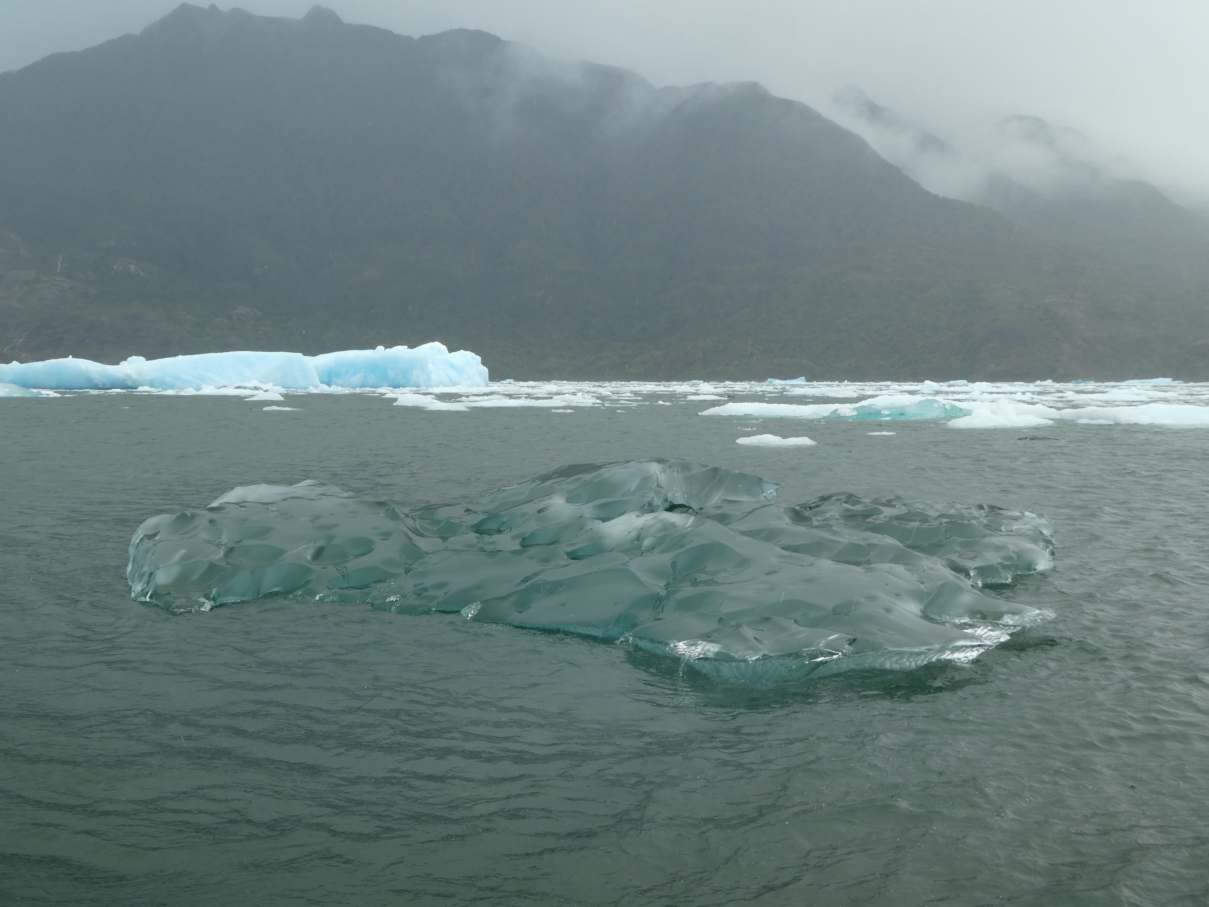
Ice floes in Laguna San Rafael, at the furthest point in our fjord voyage
What’s left of some ice chunks that had calved from the glacier, Laguna San Rafael
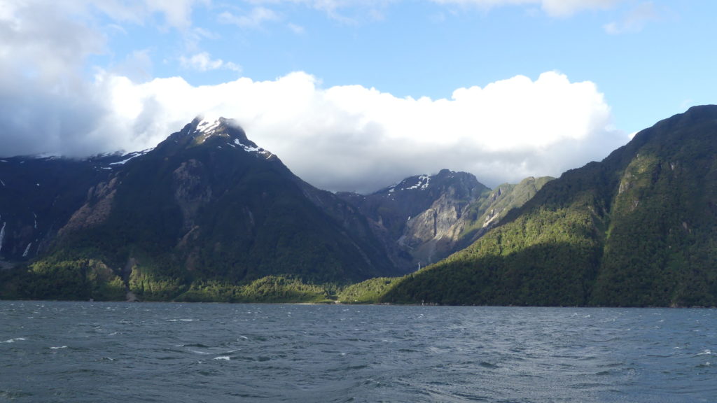
One of the fjords on the return from Laguna San Rafael. Unfortunately, that day, the fjords were mostly shrouded in dense rain clouds throughout the 12 hour trip, so the white-peaked mountains of the Patagonia volcanoes were invisible. That dampened everyone’s spirits until the bar opened for free drinks chilled with glacial ice after the Laguna, and spirited Chilean karaoke began in the lounge. We joined the party, of course singing and dancing to old-time Chilean songs that most knew, though we did not. The day also happened to be Barry’s birthday, so everyone sang the birthday song in English and Spanish (all together now: Cumpleanos feliz, cumpleanos feliz…). Then they made him sing an Elvis Presley tune as our contribution to the karaoke. Despite that, the party continued raucously for hours.
At last, toward the end of the day, the skies cleared to reveal some of what we had missed.
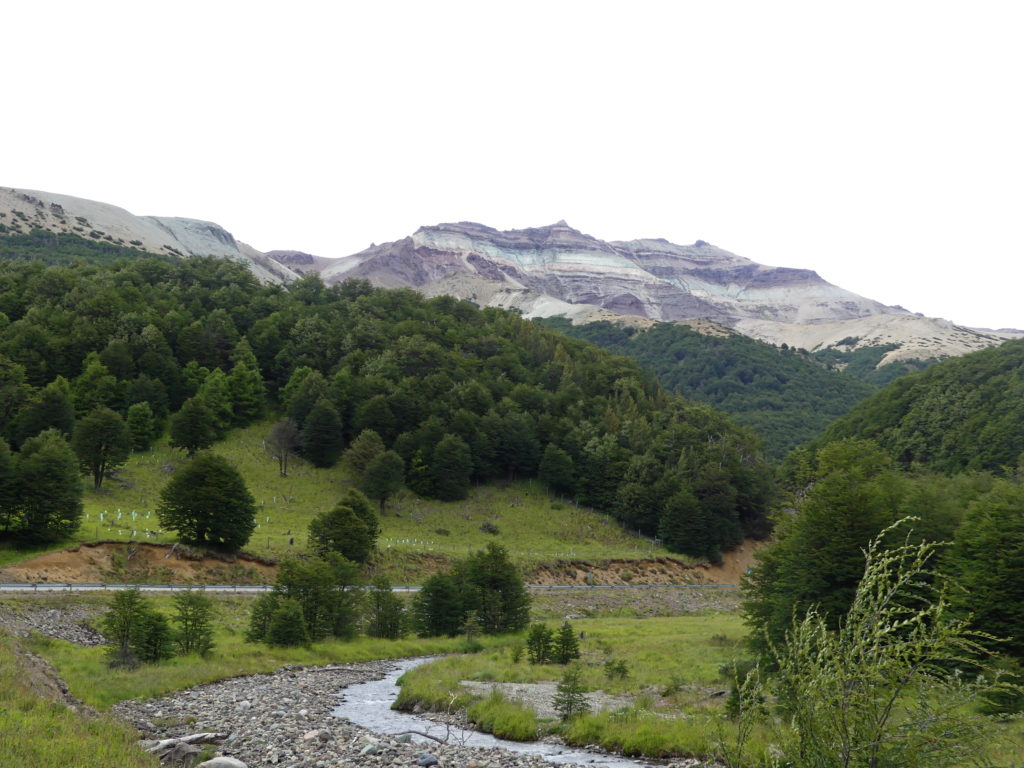
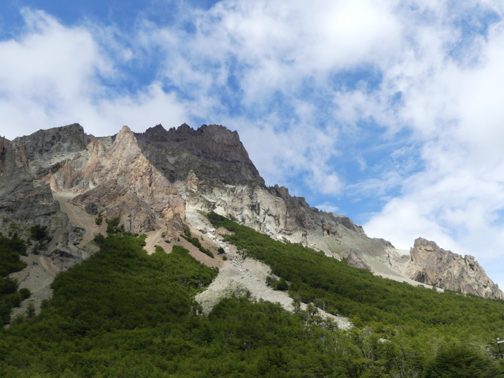
CERRO CASTILLO
We didn’t plan to stop for long in the area of Cerro Castillo, a striking range of mountains south of Coyhaique. Yet we spent nearly a half day slowly traveling first along its dry side, and then turning back to it along its snowy face – marveling throughout at its extraordinary beauty.
Backpacking hitchhikers – who use the term “autostop” or “hacer dedo” (literally “do the finger”) for hitchhiking – are plentiful on the roadsides, but around here we picked up a local man who was trying to reach his village, Villa Cerro Castillo.
Conversation with him was limited as he was nearly deaf and his accent was so different that we only understood a few words he spoke in Spanish. Yet he gleefully pointed out the highlights of his town, it seemed, and its best vistas. Despite some vicious winds, we did halt several times to enjoy his recommendations.
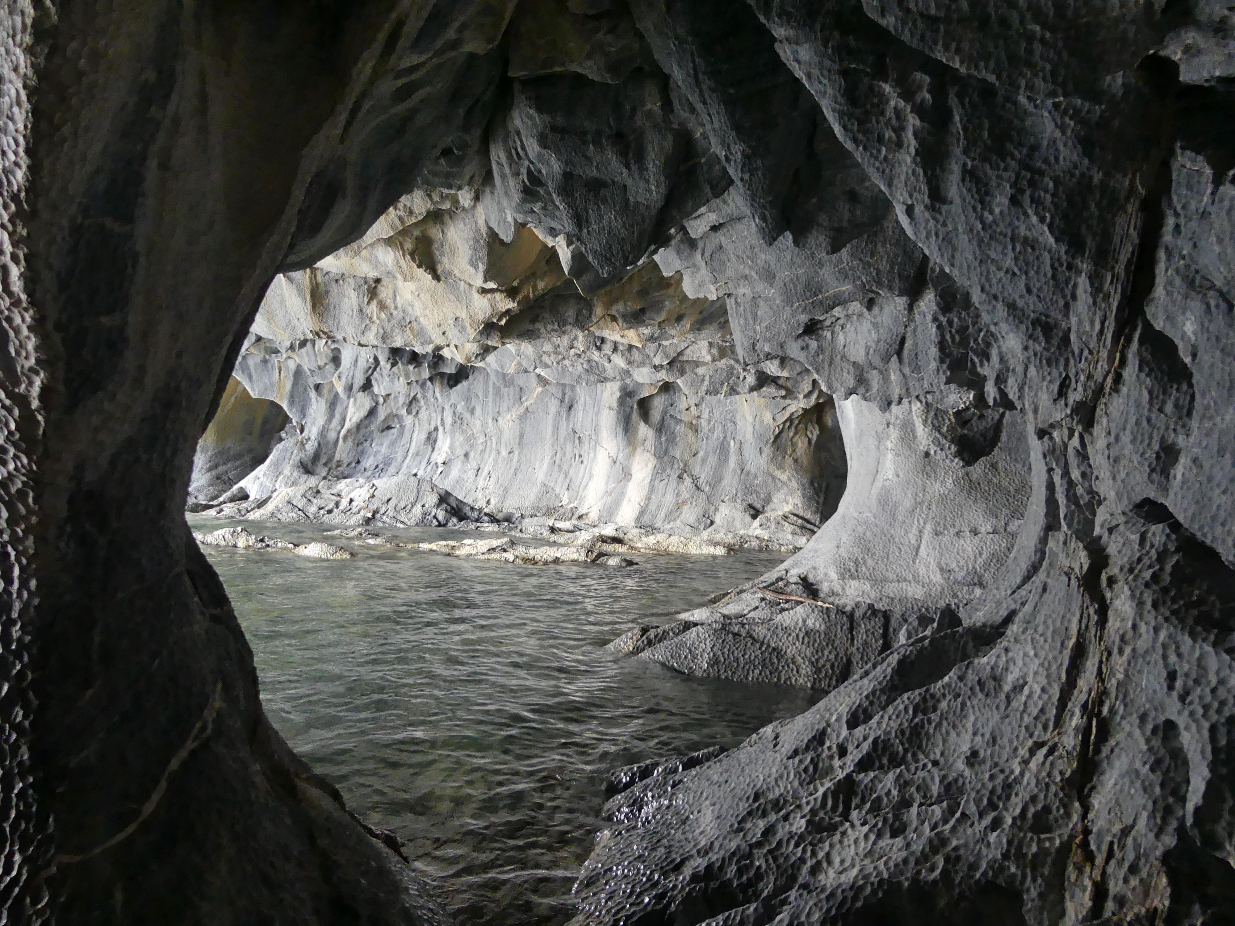
RIO TRANQUILO & MARBLE CAVES
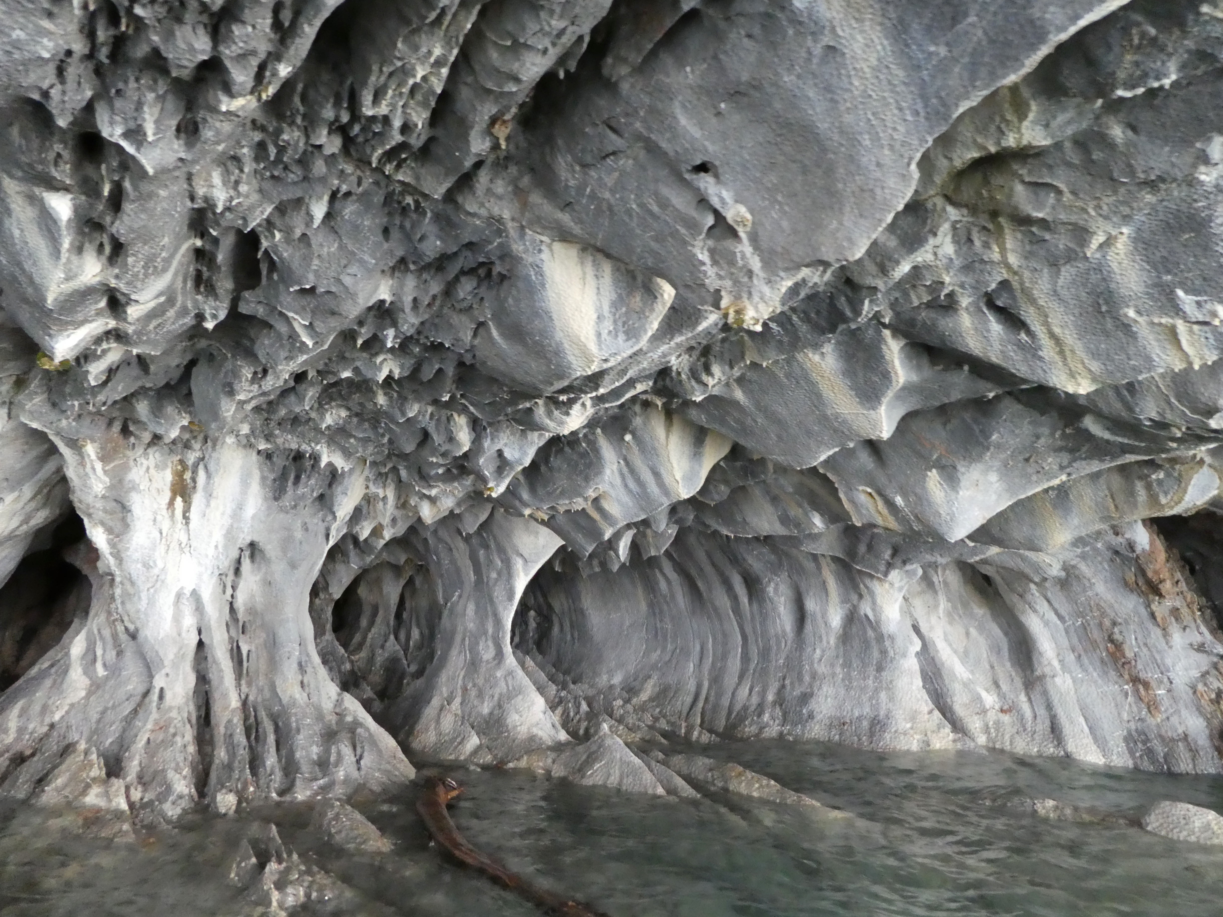
Bumping along the rutted dirt road to Rio Tranquilo, our last stop in Chile before crossing to the pampas of Argentinean Patagonia, the weather turned cloudy and rainy. That was particularly unfortunate since our main reason for stopping here for a night was to make a boat trip to the picturesque marble caves on the edge of the vast General Carrera lake that is fed by that “tranquil” river. Bright morning sunlight, we had been told, was the best time to view the striated caverns.
We were also concerned that the strong winds we had experienced along the way would make a trip to the caves impossible. We knew that Doug Tompkins, the apparel mogul who created Parque Pumalin to the north, had died on this lake when winds overturned his kayak (see the post about Pumalin).
So, arriving tired and grumpy in the rainy evening, we headed to a well known spot along the two block main street for a hand-crafted beer. Along with the beer, we were cheered by conversations there with backpackers and hikers, as well as the manager.

He promised a better forecast for the next morning and helped us locate a reliable company for visiting the marble caves. OK, we figured, why not try the pizza recommended by others at the bar? The pizza proved to be a very tasty, very thin crust dinner – and the forecast was accurate.
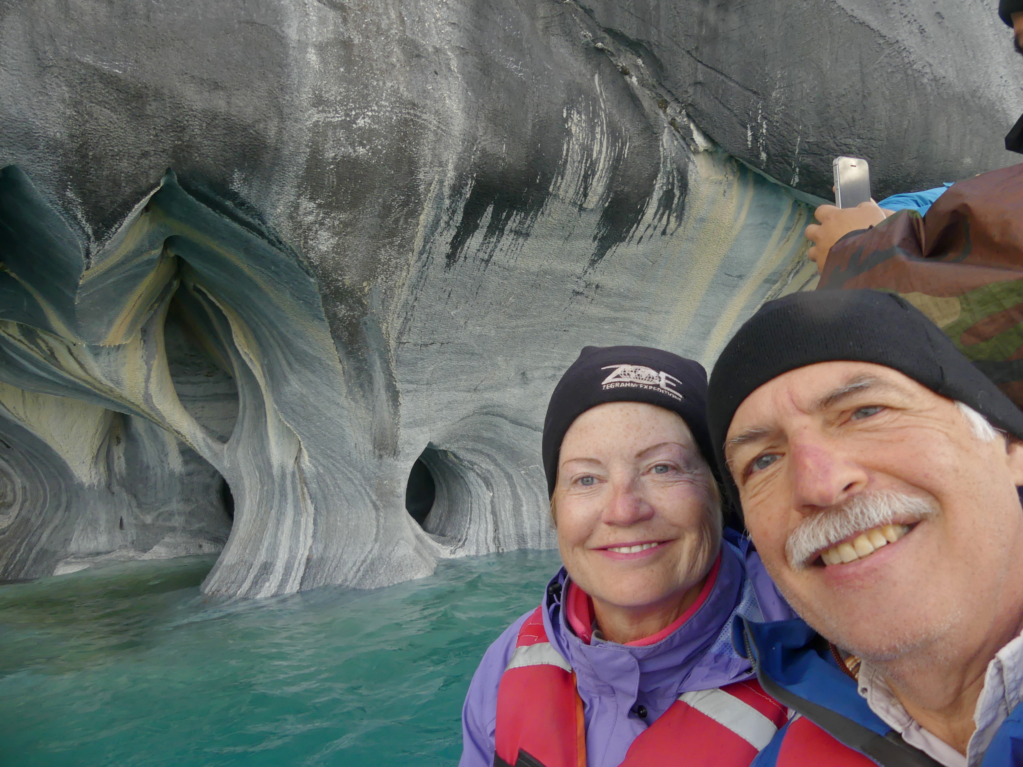
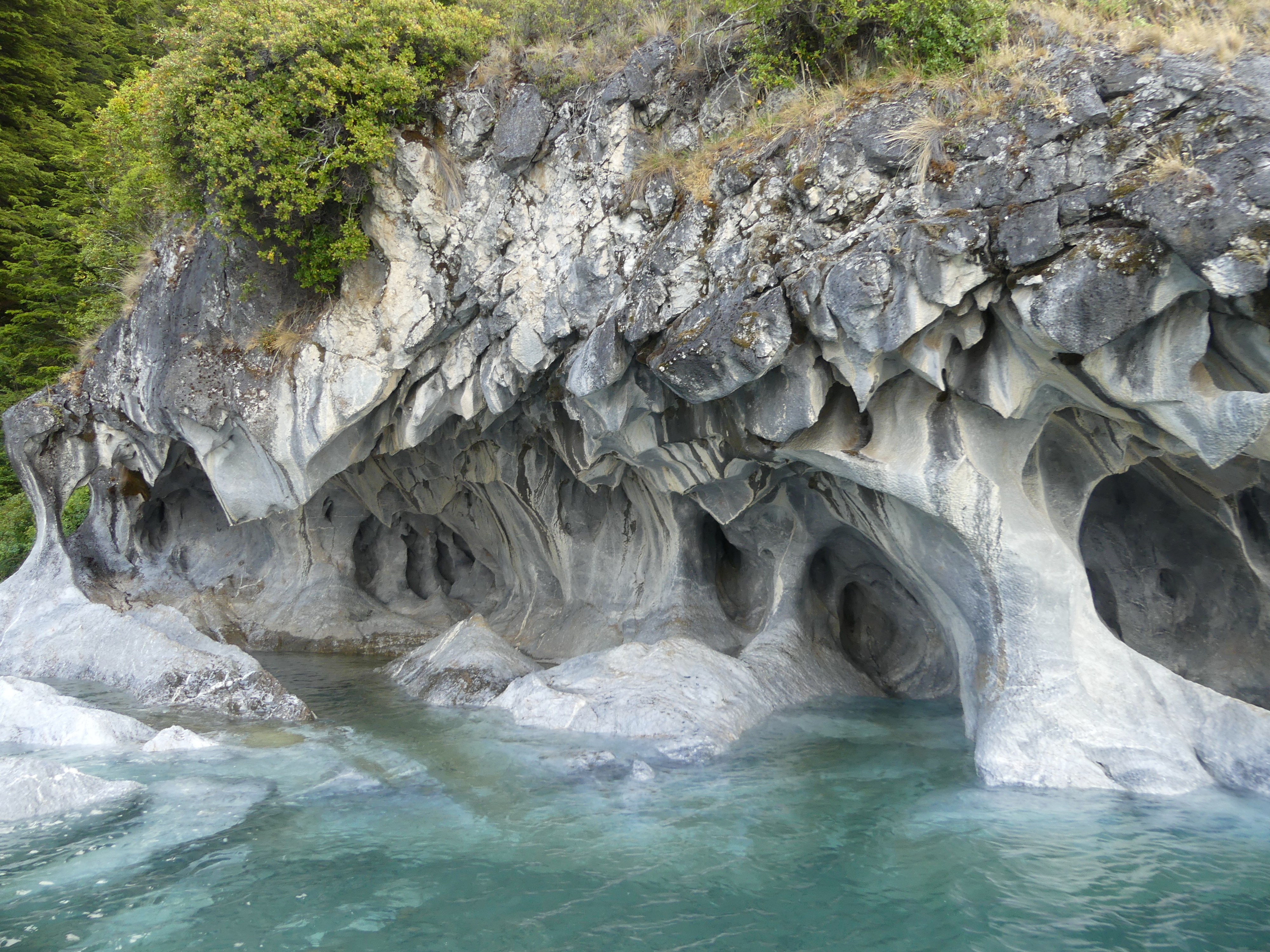
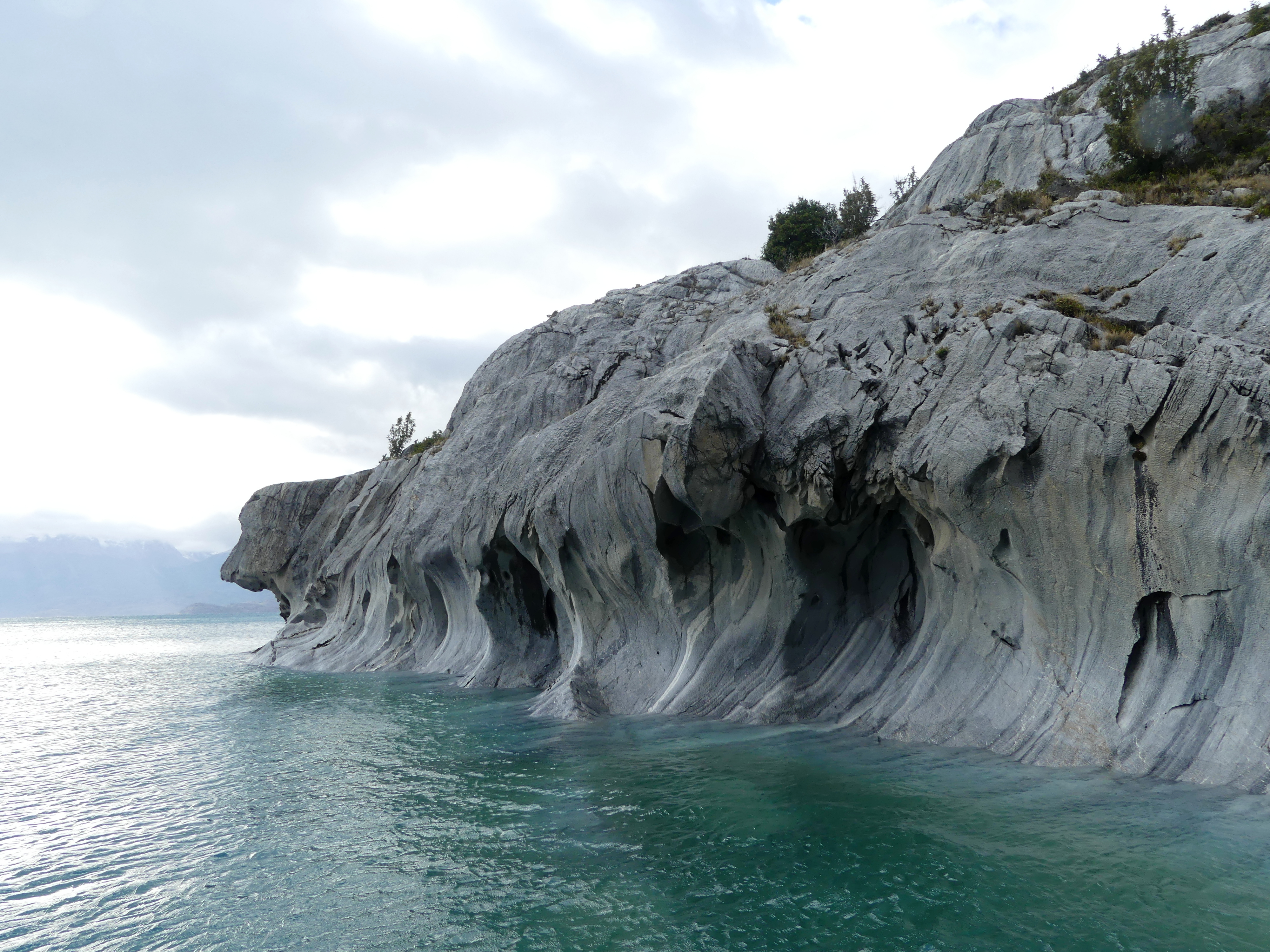
But the morning began with at least a hazy light. Winds moderated enough so that the bays with the marble caves remained as tranquil as the town’s name. We did plow wildly across the open lake’s bumpy waves to reach the bay and return, but what a sight once we stopped!
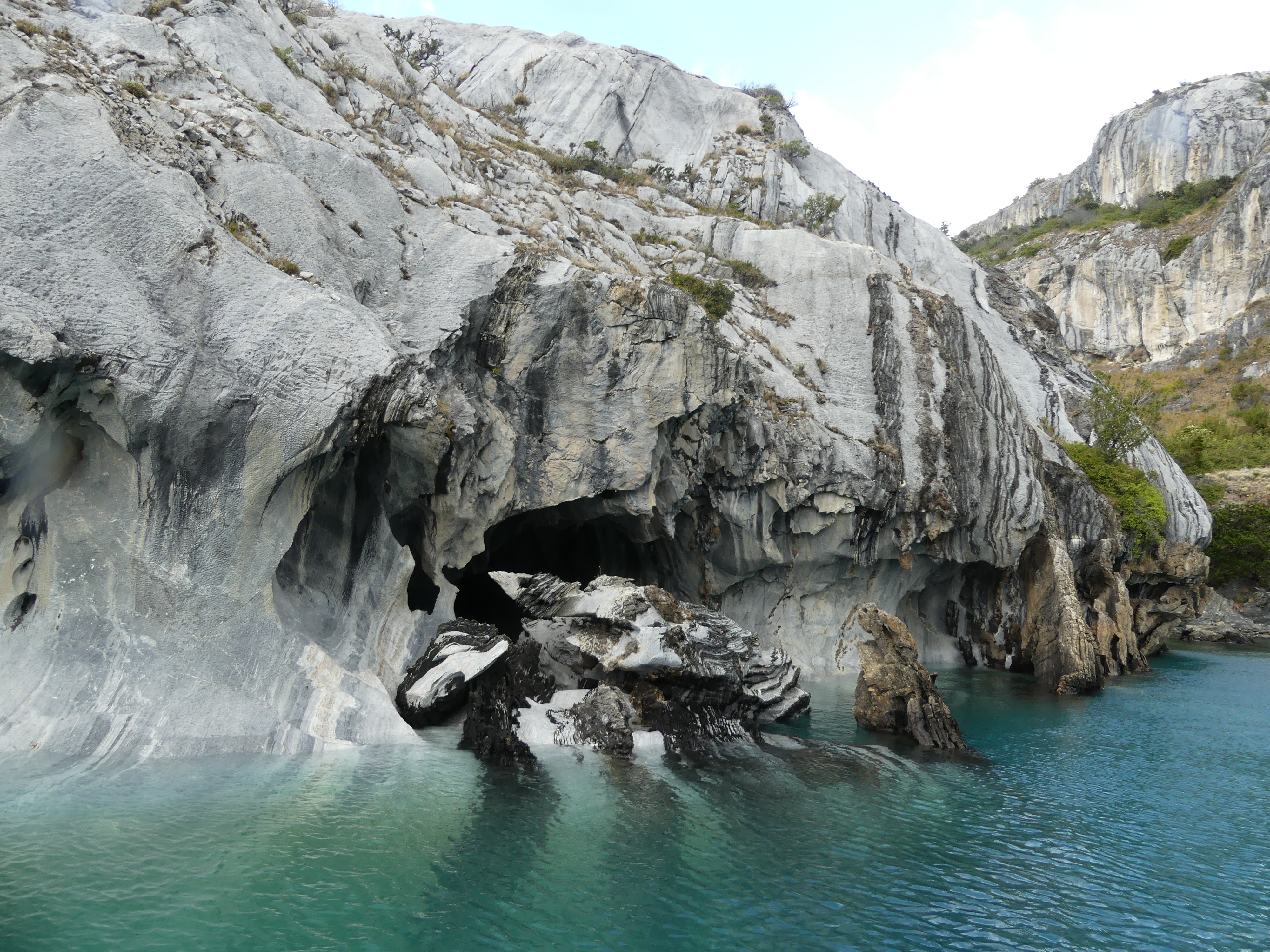
The caves were true, young marble, not just mineral colorations – formed from carbon deposits still ageing toward stuff strong enough for use in buildings or sculptures. Years of wild winds had joined with the water to erode this softer, pliable marble into intricate caverns, vortices, swirls, bizarre formations and sweeps of color – a delight in any weather.
The hardy fishing boats that transport visitors to the caves can fit into many of the caverns, when the water levels are right
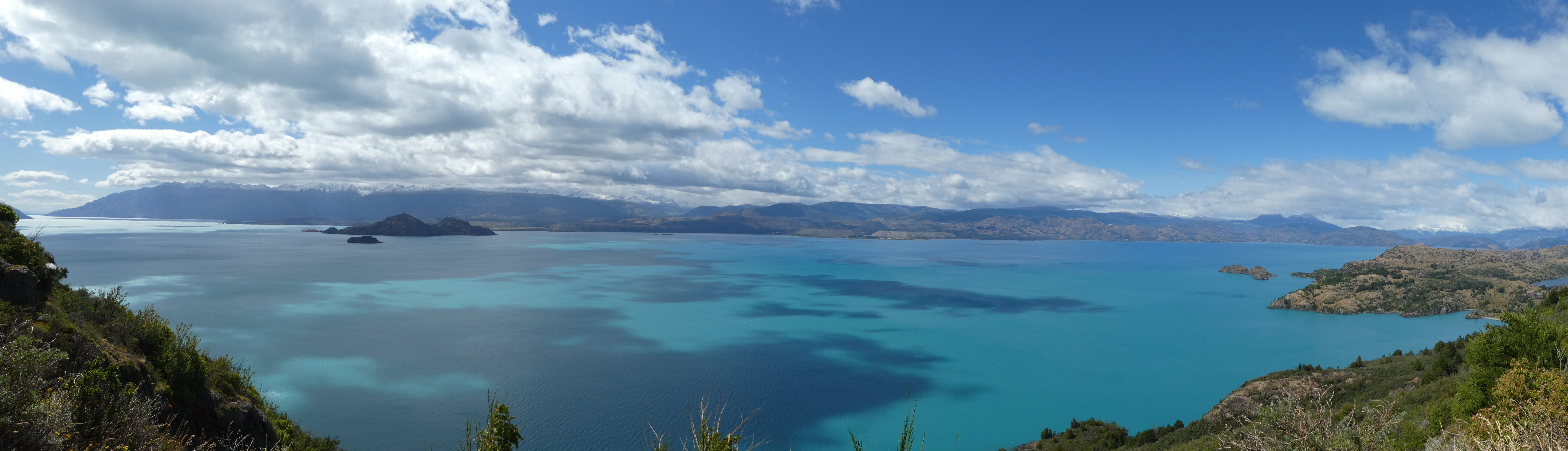
By mid-day, more sunlight lit up the Lake General Carrera. Along with nearly every other vehicle departing Rio Tranquilo, we couldn’t help but stop several times to admire the grandeur of the lake’s mountain setting. We could understand why many hikers linger in the area for days after viewing the marble caves.
And then we crossed over to Argentina to proceed south.
(To enlarge any picture above, click on it. Also, for more pictures from Chile, CLICK HERE to view the slideshow at the end of the itinerary page.)