After the remarkable landscape of Lac Abbe (see post), we figured we could not add much surprising to our Djibouti trip. Not so, due to the country’s remarkable highs (at the Foret du Day) and lows (salty Lac Assal).
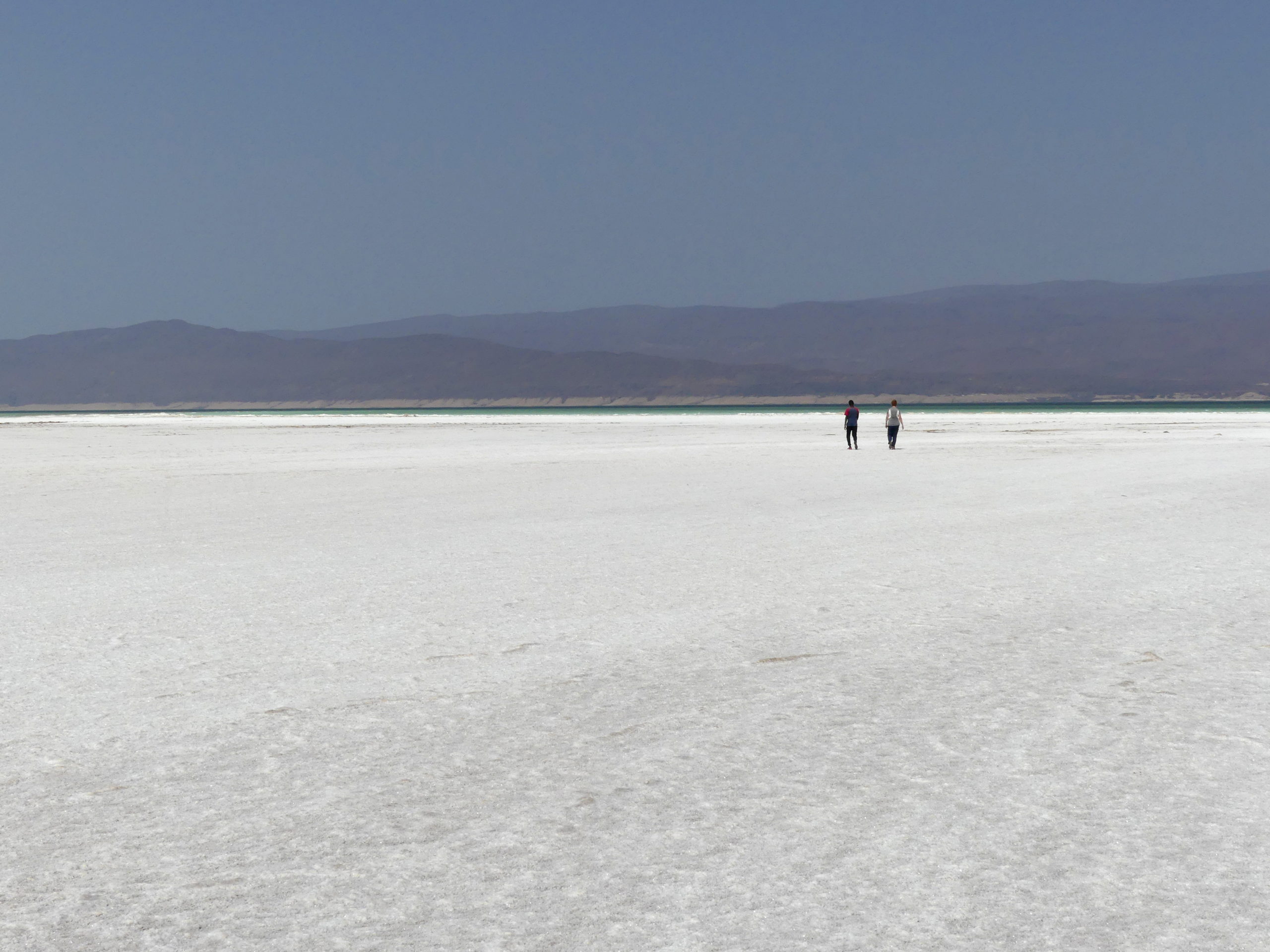
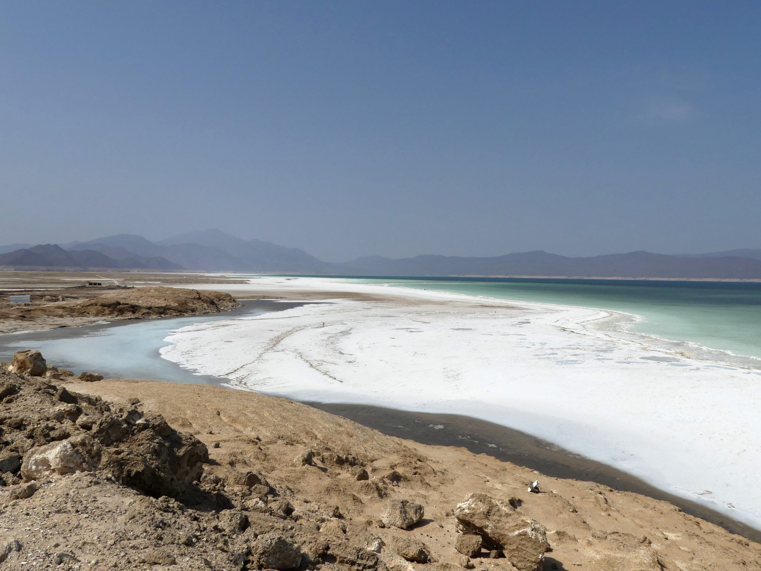
At the steamy edge of Lac Assal, one of the lowest points on earth some 150 meters (500 feet) BELOW sea level, we crossed the kilometer-wide, hard, crunchy salt plain fringing the lake.
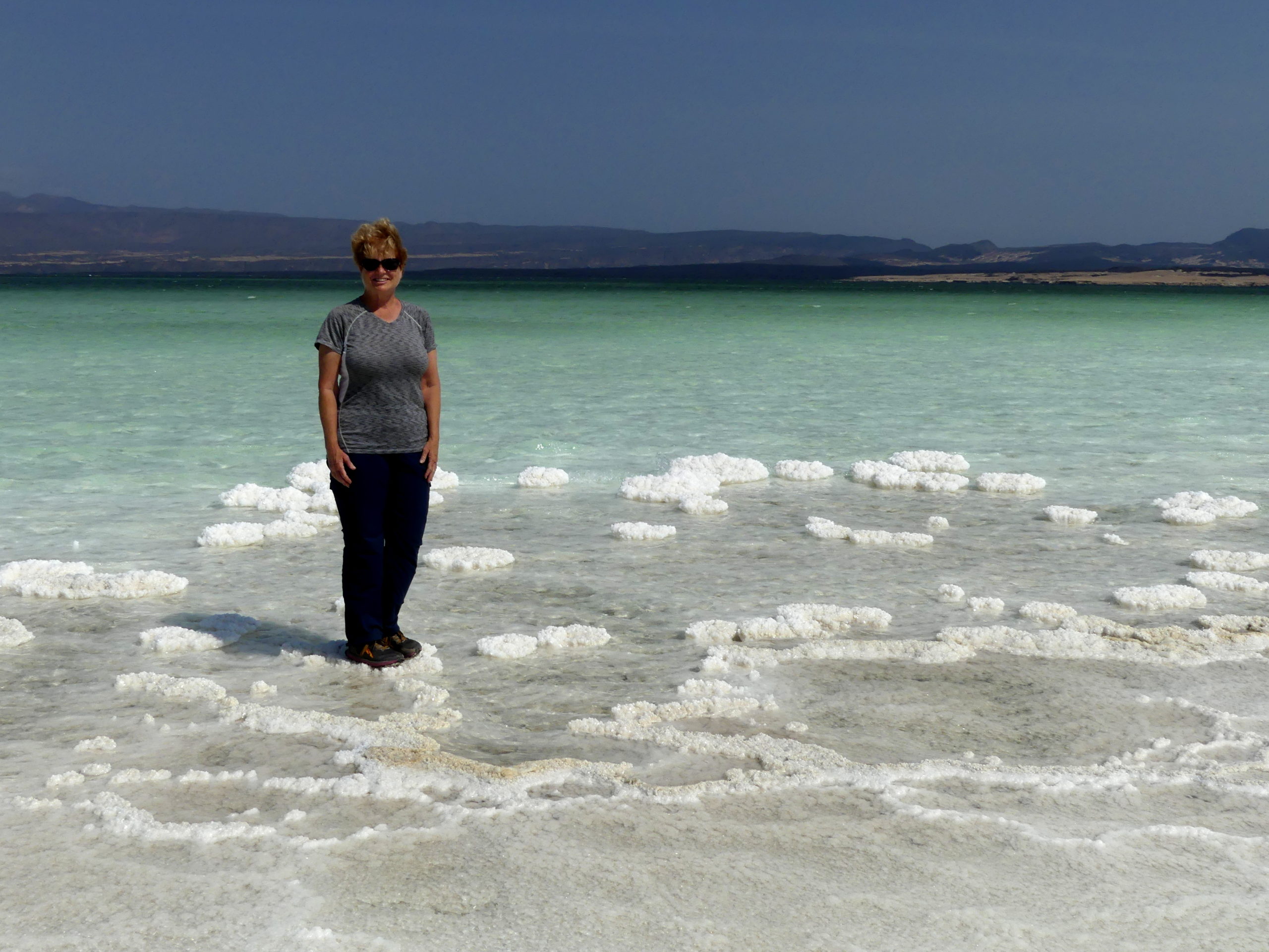
Once at the water, we found we could danced on islets of salt
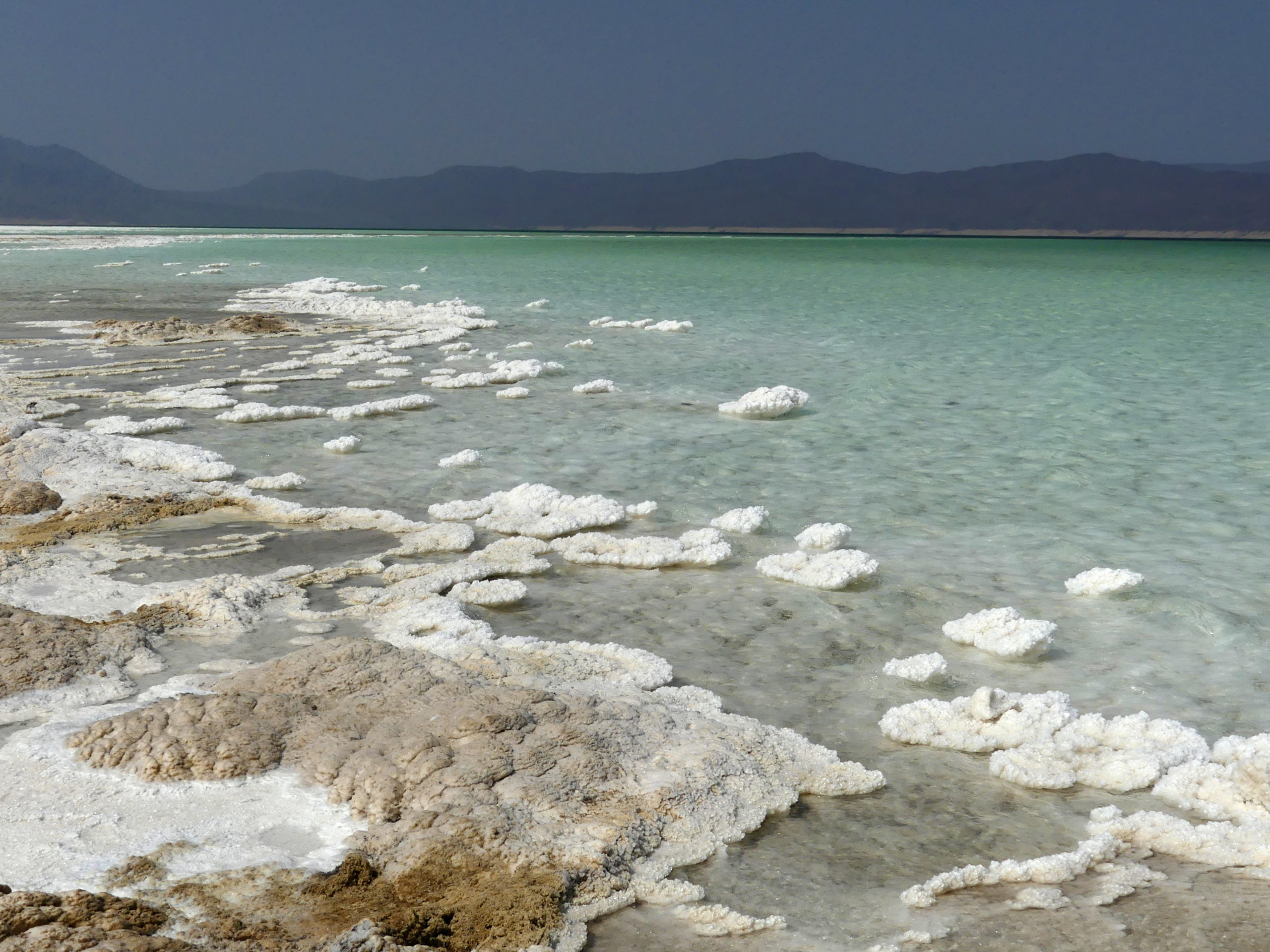
The lake was formed by the slow flow of sea water into a basin from the Gulf of Tadjoura and the Gulf of Aden. Sun and heat evaporate the water in the basin so the lake becomes very, very salty – another Dead Sea.
The salt also collects along the edges, leaving wide margins of salt plains as well as those rock-hard islets of salt we could tiptoe across.

Unsurprisingly, all this natural action has commercial value, as several plants mine the salt of Lac Assal for sale.
Lac Assal is just one feature in a multi-country region known as the Great Rift, a 6000 kilometer (3800 mile) long series of watery bodies and trenches made by the tectonic plates from Africa drifting away from those of Asia. Djibouti also contains the Afar Triple Junction, where three plates actively widen the rift.
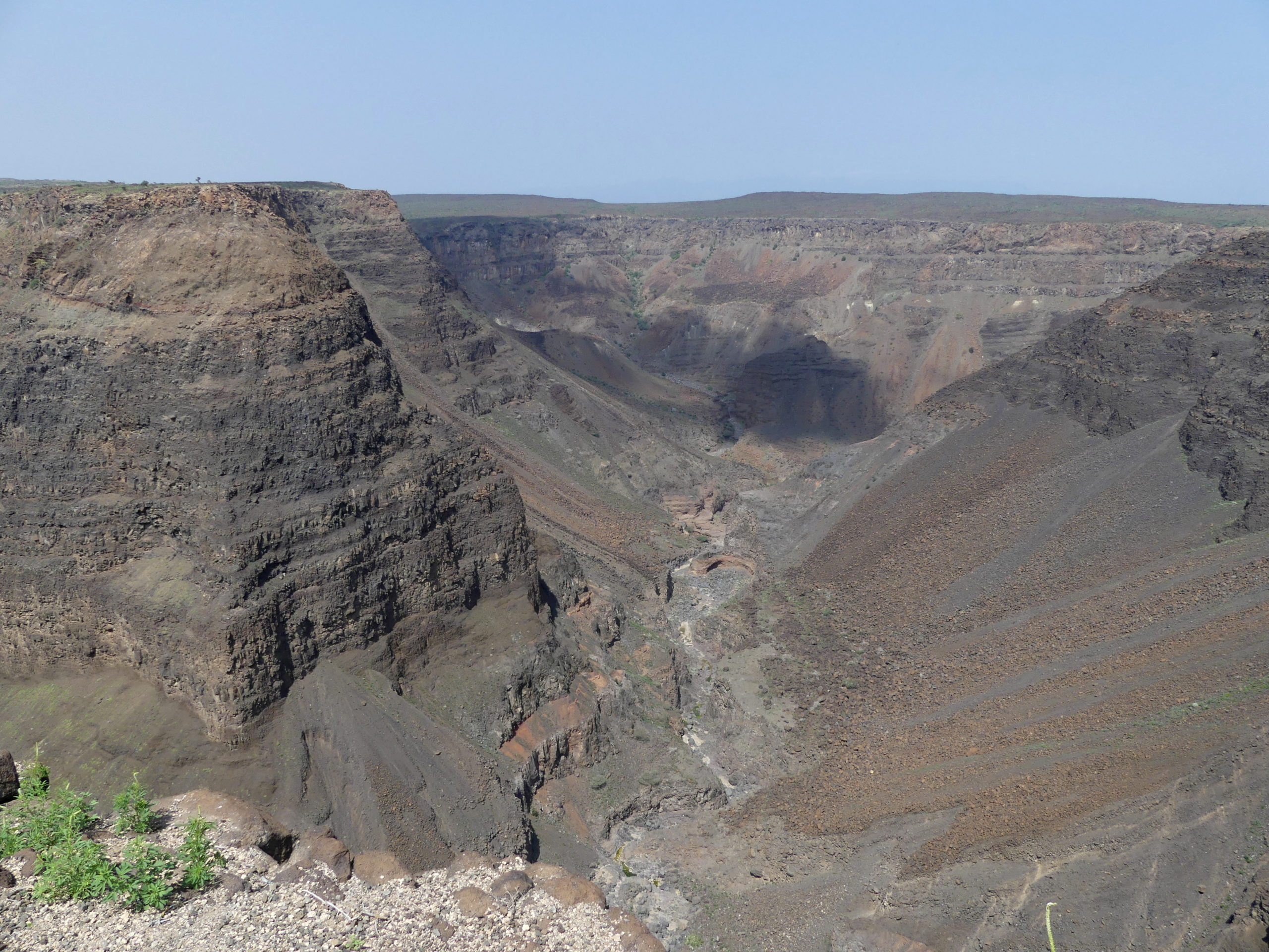
You can – nearly – see this happen here, as the canyon widens about 10 cm per year, pushing Africa west and Arabia/Asia east. The Great Rift runs more than the length of the continent, from Lebanon all the way south to Mozambique. In Ethiopia next door, the salt plain, volcanoes and bubbling sulfur pots of the Danakil depression are also found in the Great Rift.
After venturing below sea-level at Lac Assal, we moved nearby to Djibouti’s highs at Foret du Day (pronounced ‘die’).
The forest – from the top to bottom – is really a kind of island in Djibouti, an extensive, woodsy high mountain grasslands encircled by dry desert lowlands. Sadly, it is less foresty these days, as nearly 90% of the forest’s trees have died out, leaving scattered ones across the reserve.
At Day, we camped atop its lush ridges 1700 meters (over a mile) above sea level. The middle of most days was sunny.
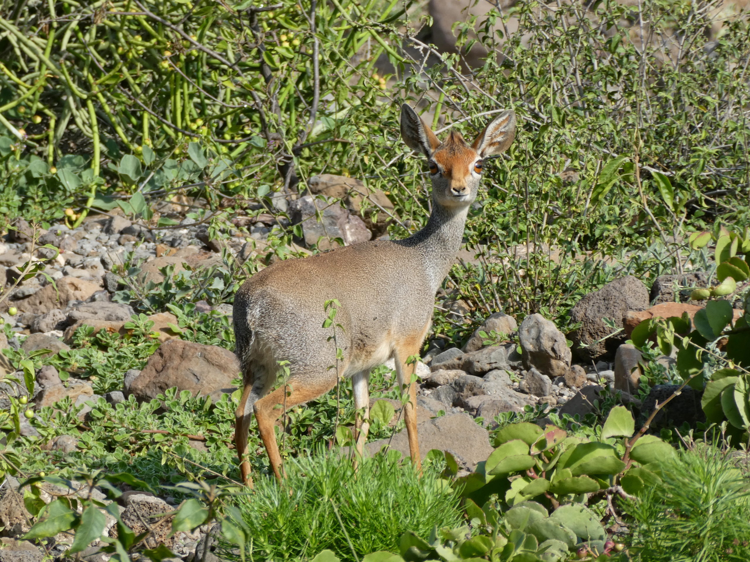
That’s when we saw a group of Salt’s dik dik. Though not the most svelte gazelle, this one looks at you with the a pair of amazing eyes.
By evening and during the morning, however, chilly fog covered the hillsides, risen from the ocean far below. We stayed in huts quite close in construction to the native dwellings, with thatch roofs and wooden stilts for sides.
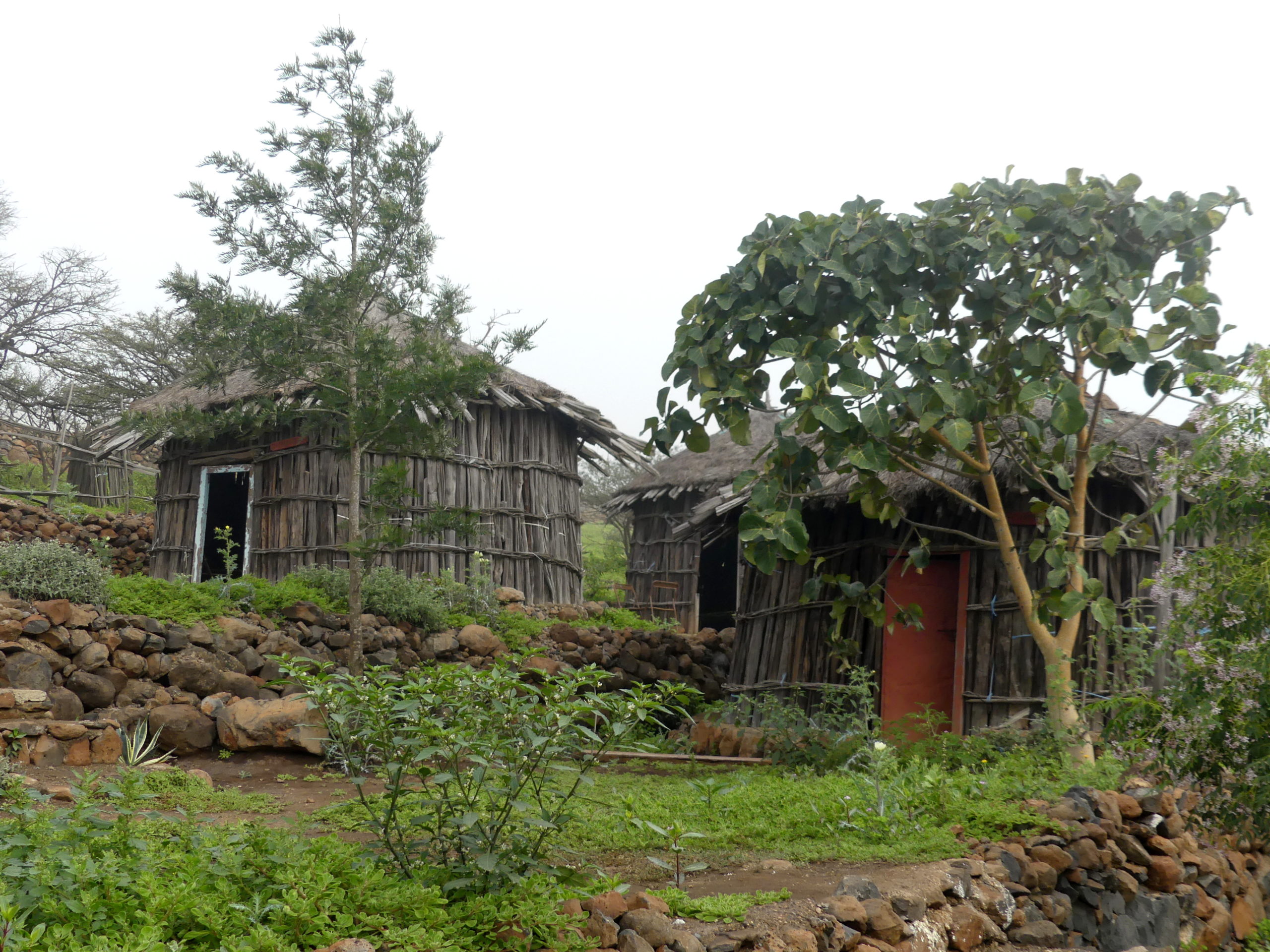
The fog easily infiltrated the wooden stilts of the sides, making things damp inside, even though the rain we experienced one night didn’t come through the roof at all.
A large central hut nearby was our source of recharging power and the place for dinner. The toilet block was about a minute walk away, not so bad in just the fog, though a bit chilly at night. One afternoon we needed to hurry to the showers before the chilly fog blew in from the hillsides below and removed the warming sunlight.
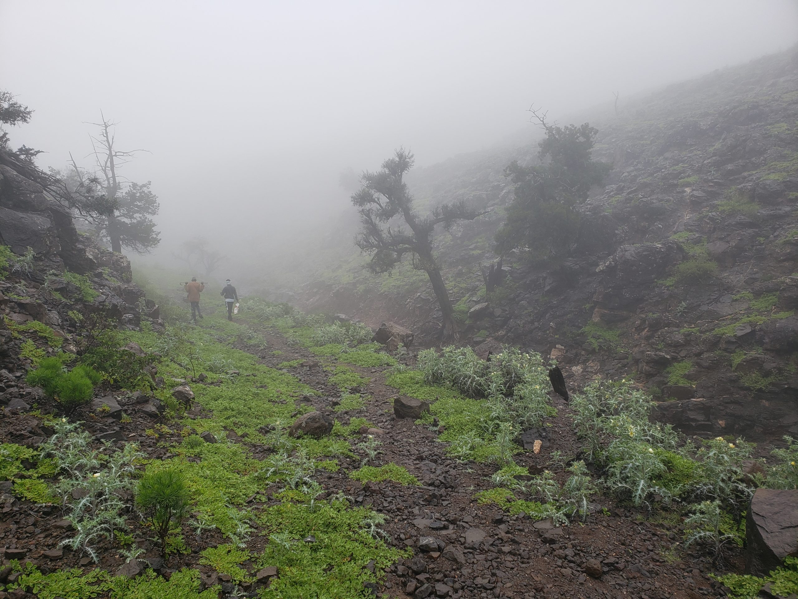
The day we descended 1000 meters in altitude (3300 feet) from Day, however, never cleared.
We started the hike in foggy dark skies at over a mile (1700 meters) in altitude…the rain came shortly after.
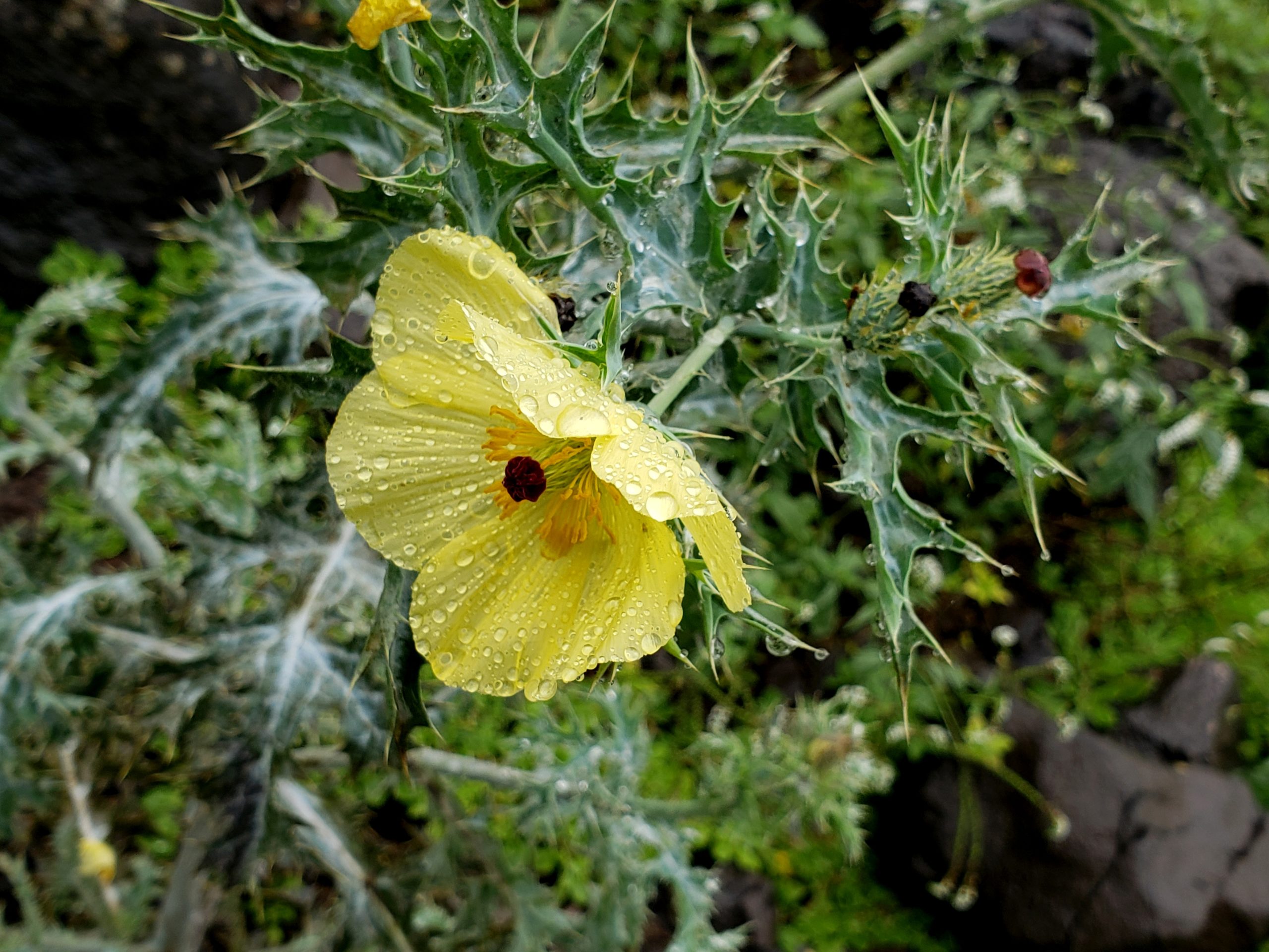
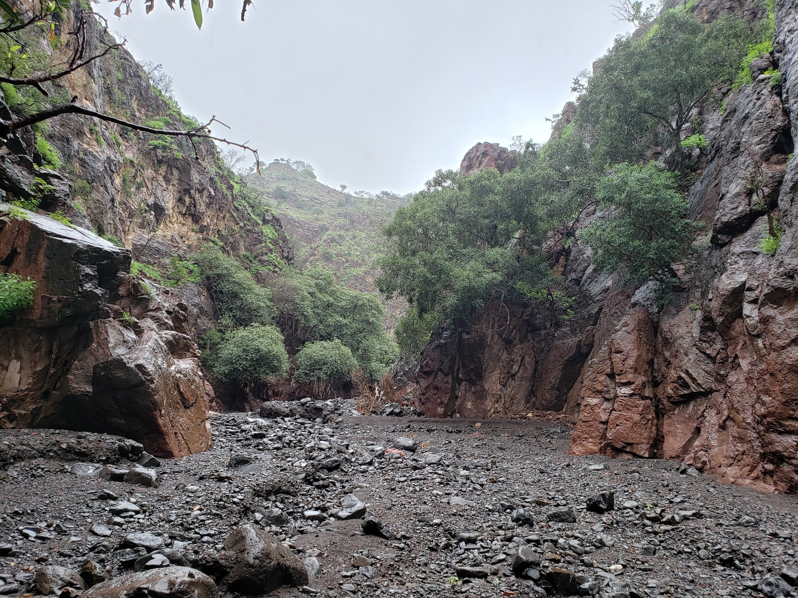
So we slogged soggily for the next five hours through rain and chilly temperatures. You would think we would have hated the experience. The opposite: the conditions might not have allowed us to photo the beauty so much as the ruggedness. At least we handled the weather almost as well as this omnipresent spiky-leaved, mallow-like flower.
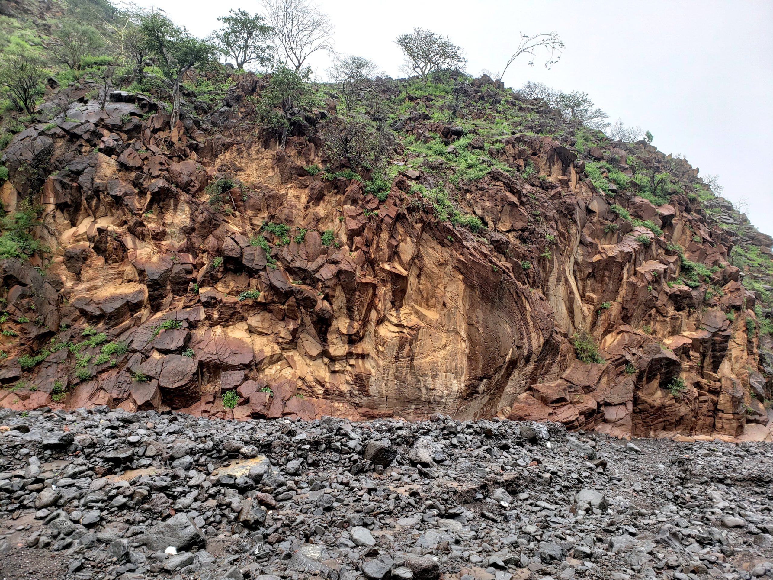
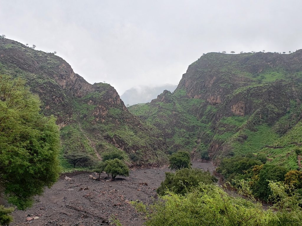
But the walk itself thoroughly impressed us – one of the most gorgeous river canyons we have ever seen. This colorful wall was just one example of the brilliant features of the canyon. Orange-copper rocks like these greeted us as we rounded bends in the river valley, both along the faces and strewn about the canyon floor.
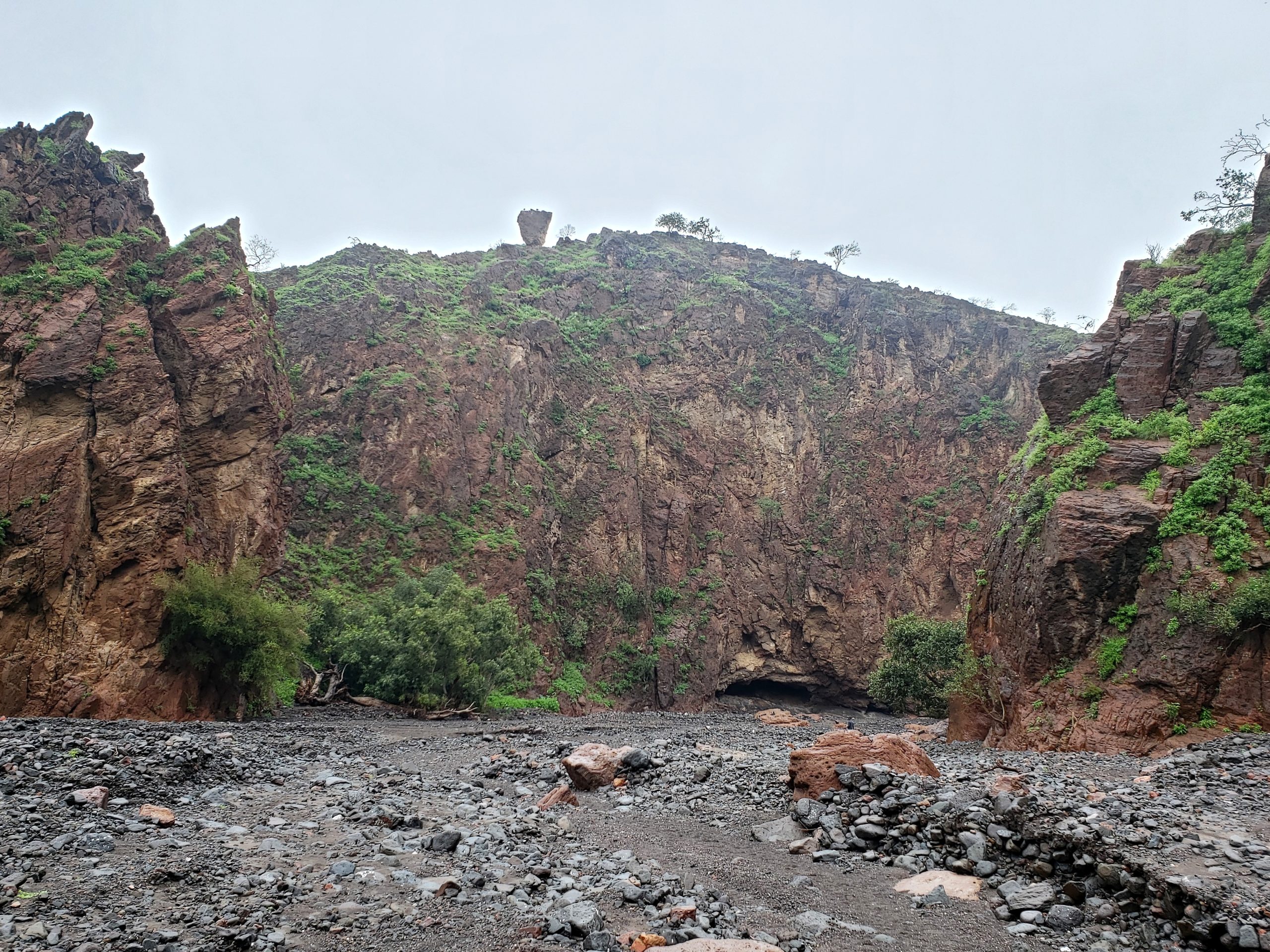
near the hike’s end…plus a precarious rock.
The wetness may even have enhanced the color, like the slippery rocks of the American Southwest.
Sure, we were cold and much too damp by the time we finished the canyon. But a bit of sun finished off the day so we could dry some of our clothing and gear.
And the campsite afforded us one lasting spectacular valley view to enjoy for a few hours before night came on us.
It’s a shame that the difficulty of reaching the Forest by car keeps most visitors away, so they miss the spectacular canyon we hiked – though we did enjoy having the long canyon all to ourselves.
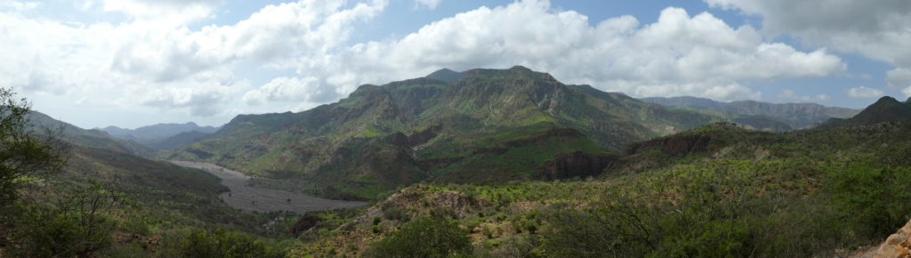
We weren’t even very upset when the next day saw the sun alternating with billowy clouds. This spectacular valley and mountain landscape suggests what our soggy hike might have looked like in better weather.
(To enlarge any picture above, click on it. Also, for more pictures from Djibouti – along with Eritrea and Ethiopia -, CLICK HERE to view the slideshow at the end of the itinerary page.)