


We love to bike. So, in a relatively flat city like Melbourne, we just had to purchase good, low cost bikes and get rolling.
We had been warned about the threat of crazed motorists and even crazier intersections here. And, yes, we have experienced fuming drivers tailgating our bikes, honking as if they were Americans, and the rush of impatient drivers brushing close by.
For the most part, though, we have found Melbourne a very biker friendly town. The city has responded to the community’s interest in biking for recreation and commuting, and tried to encourage more.
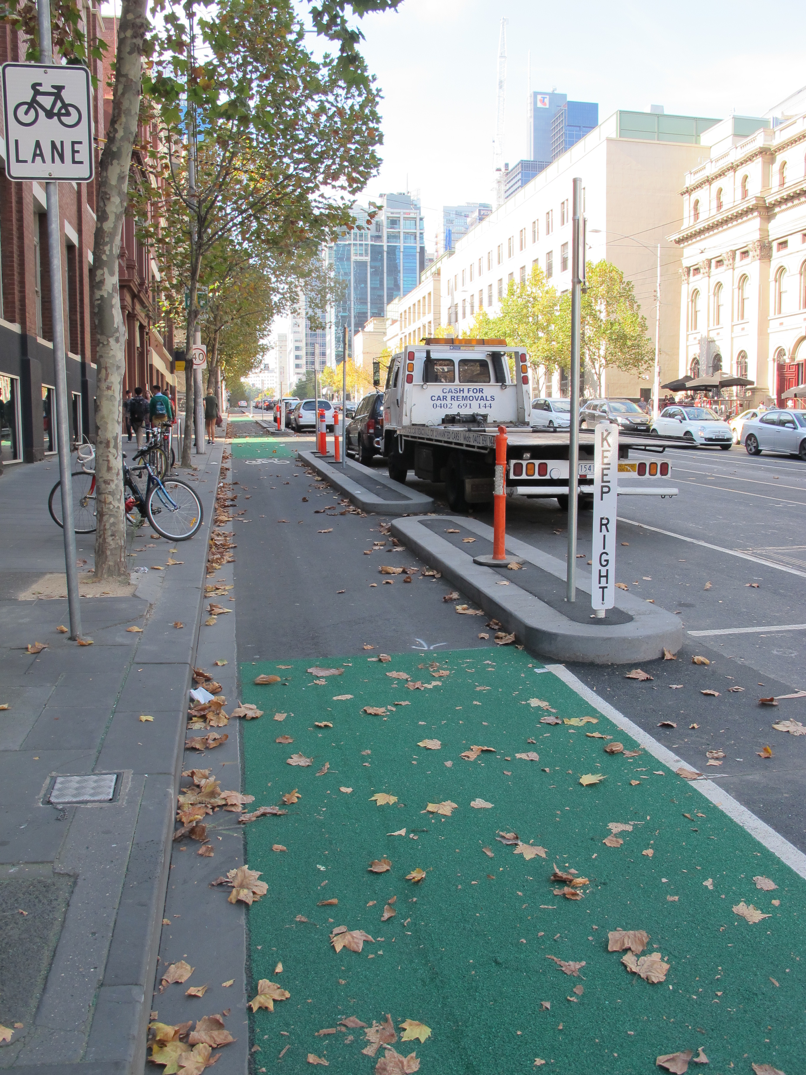
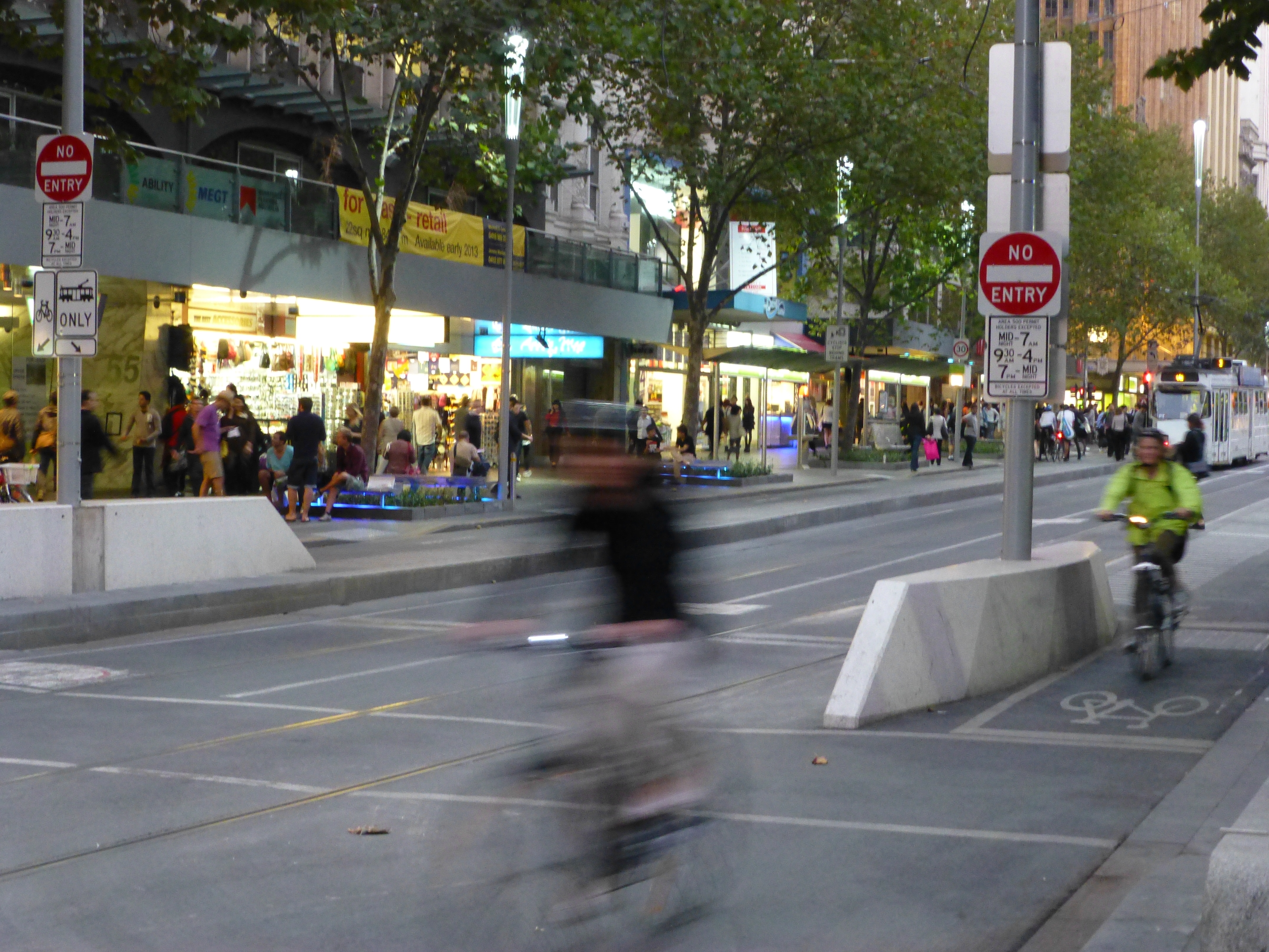
Across town you find dedicated lanes, including many that are not just demarcated by painted borders, but are physically separated from cars by curbs. And you can find dedicated routes that tie the city to its suburbs. Colourful (sic) maps issued by the city alert you to the roads with the protected lanes, quieter side streets and connectors to far flung parts of the city. Within the last month, crews have started remedying a major gap in connectivity, the lack of a good east-west bike route through the city by upgrading the off-and-on lane of wide Latrobe Street (on during morning rush hour; off all other times due to parked cars) that goes west to the Docklands. Latrobe will soon have a curb-protected bike lane to use akin to Albert Street, which can take you a long way east. Farther afield from the CBD, numerous rail trails on former rail lines stretch east and west from the city through the state of Victoria, with even more in development.
When the maps have proved a bit confusing due to piling on of data, we’ve also consulted a number of websites to help with local trips and far-flung options. See these at the end of the post.
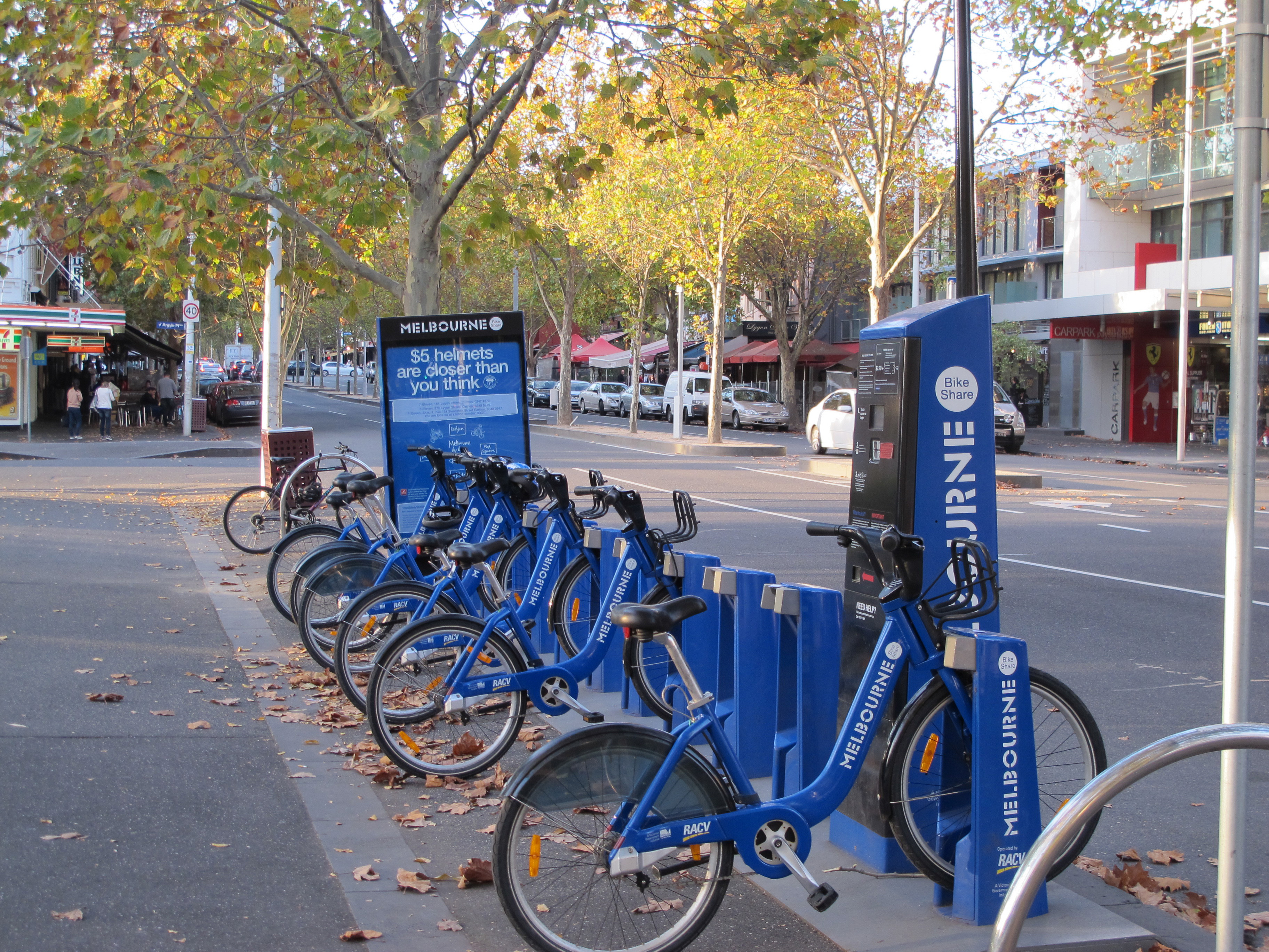
Like Paris, Amsterdam and a few U.S. cities, the city offers bikes at major rail/tram stops and other busy spots (www.melbournebikeshare.com). The system here is that you check out a locked three-speed bike (flat terrain, remember) – plus helmet – with a credit card, then return it to any station in town. You can even buy the helmet for $5. The pricing promotes use of the bikes for short hops: your first 30 minutes are free, so you can zip from one point to another without any cost at all. Or you can have two-hour use of the bike for just $20, with cheaper pricing for longer stays. There’s even an app to find a bike and local stations.
People use them. Locals pedal about with them, and often stations have but a few bikes left in them. We’ve also seen a number of guided tours of the city, with the visitors on Melbourne’s blue bikes, so the tour company doesn’t even have to supply the bikes.
Despite the city’s efforts to foster and protect bikers, as well as the extensive commuting by bike at all hours, we have found you still need to be cautious and alert, as we had been warned.
In addition to those uncaring motorists, there are some built-in perils: the dreaded right hand turn from a left lane within the intersection (click to see post), crossing the frequent tram tracks (Barry once got a front tire jammed into a similar track, promptly laying him out on the asphalt), or bike lanes that turn into parking spots after the morning commute leaving you afloat in traffic lanes.
It does still require a leap of faith, moreover, to use delineated bike lanes on major roads like the St. Kilda artery to the south or the Royal Parade to the north. Somehow the wide bike lane with the fuzzy green paint and solid white lines don’t seem quite protective enough as car and truck traffic buzzes by. Even these have a few crazy intersections where the bike lane disappears into a left turn lane forcing you quickly to become one with the vehicular lanes.
In some of the places where cars and bikes must jam together, at least planners have invited bikers onto the sidewalk to ensure they don’t become part of it (though few regulars seem to use that escape route on the central Princes Bridge). By mistake, we recently found ourselves heading back to town on one of the major arteries that make no provision for bikes; so we heard what motorists really think about two-wheelers.
None of these seem to matter much, though, when you travel along the best of the city bike trails.
Our most recent favorite branches off from the Docklands on the west side, follows some new condo developments along the Yarra River, and then takes Lorimer Street along an industrialized portion of the river as it approaches massive Port Phillip Bay. That may sound unappealing but the road is mostly a pleasant boulevard despite the commercial activity, and you can bike non-stop for hours. (The boulevard will soon have its bike lanes upgraded making it even more appealing.) Along the way, the massive wall painting of the Boeing Dreamliner on a wall of its local plant alone is worth the trip.
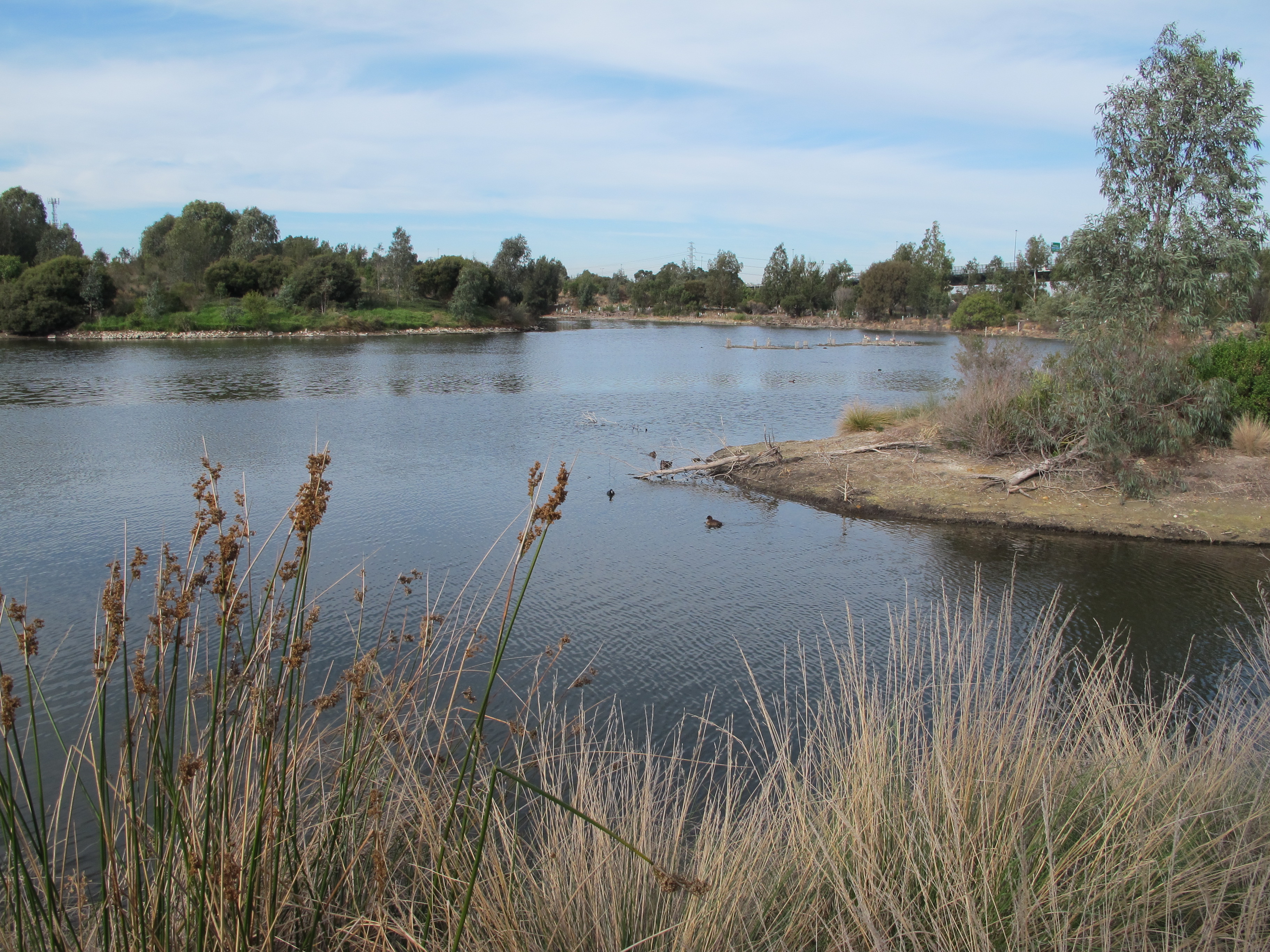
The route continues through sprawling Westgate Park, a delightful wetlands full of birds and forested picnic spots, even though it’s partly tucked far below the M1 Highway overpass. We then follow the beach-lined coast of the bay to St. Kilda, past the Tasmanian ferry and the docked cruise ships, before turning back to the city by way of a lovely strip of newly redeveloped parkland along a tram line. You can also continue down the coast as far as you can handle.
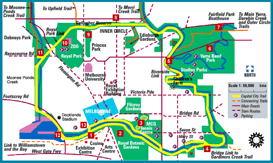
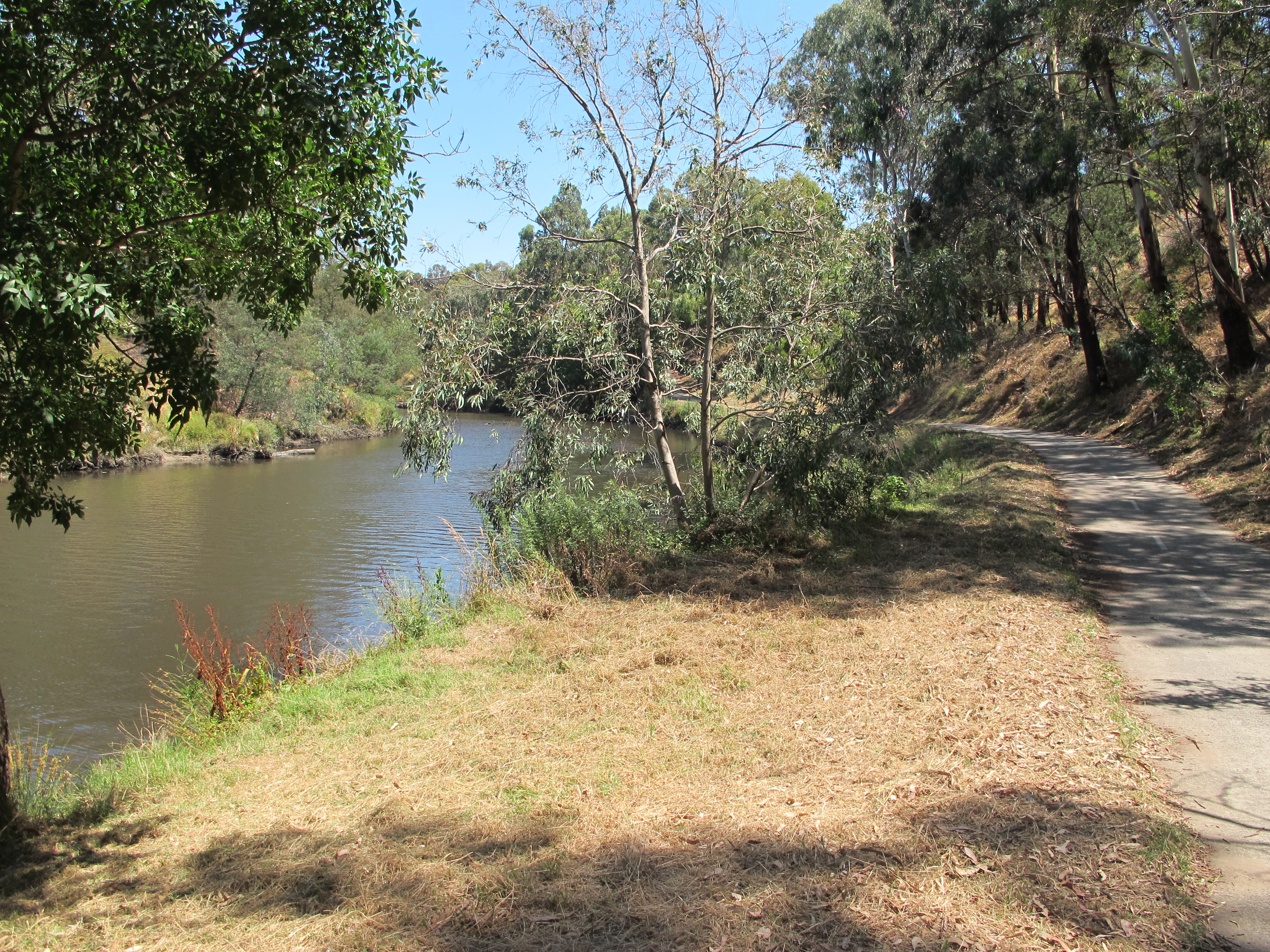
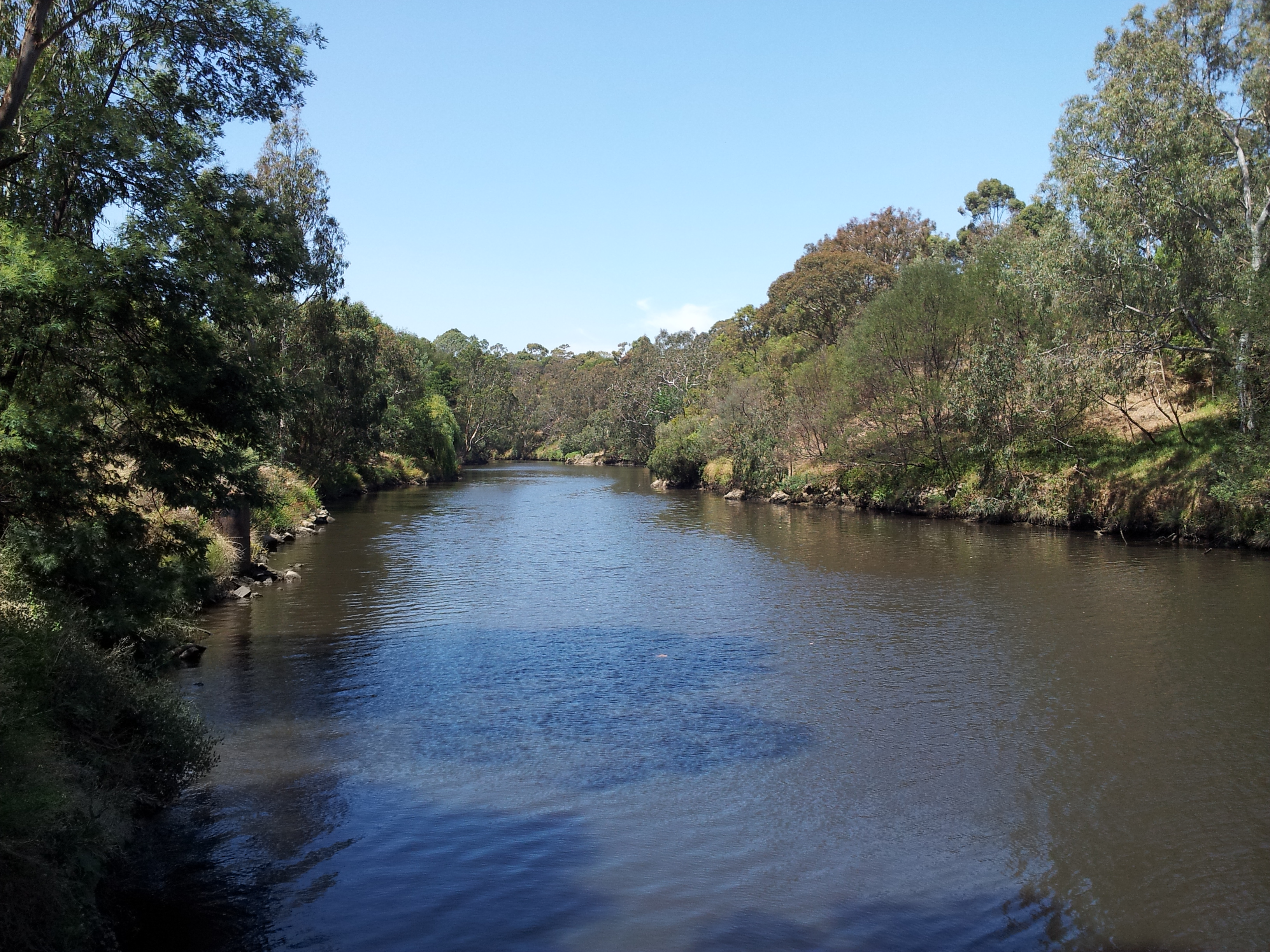
The biking jewel, however, is the Capital City Trail (CCT or MCC), a loop officially 39km long around the major landmarks of the city, as well as a link to many of the suburbs near the city. You may cross some streets, but none of the trail is actually on a street. For about half the loop, and for a while on either bank, you follow the Yarra River.
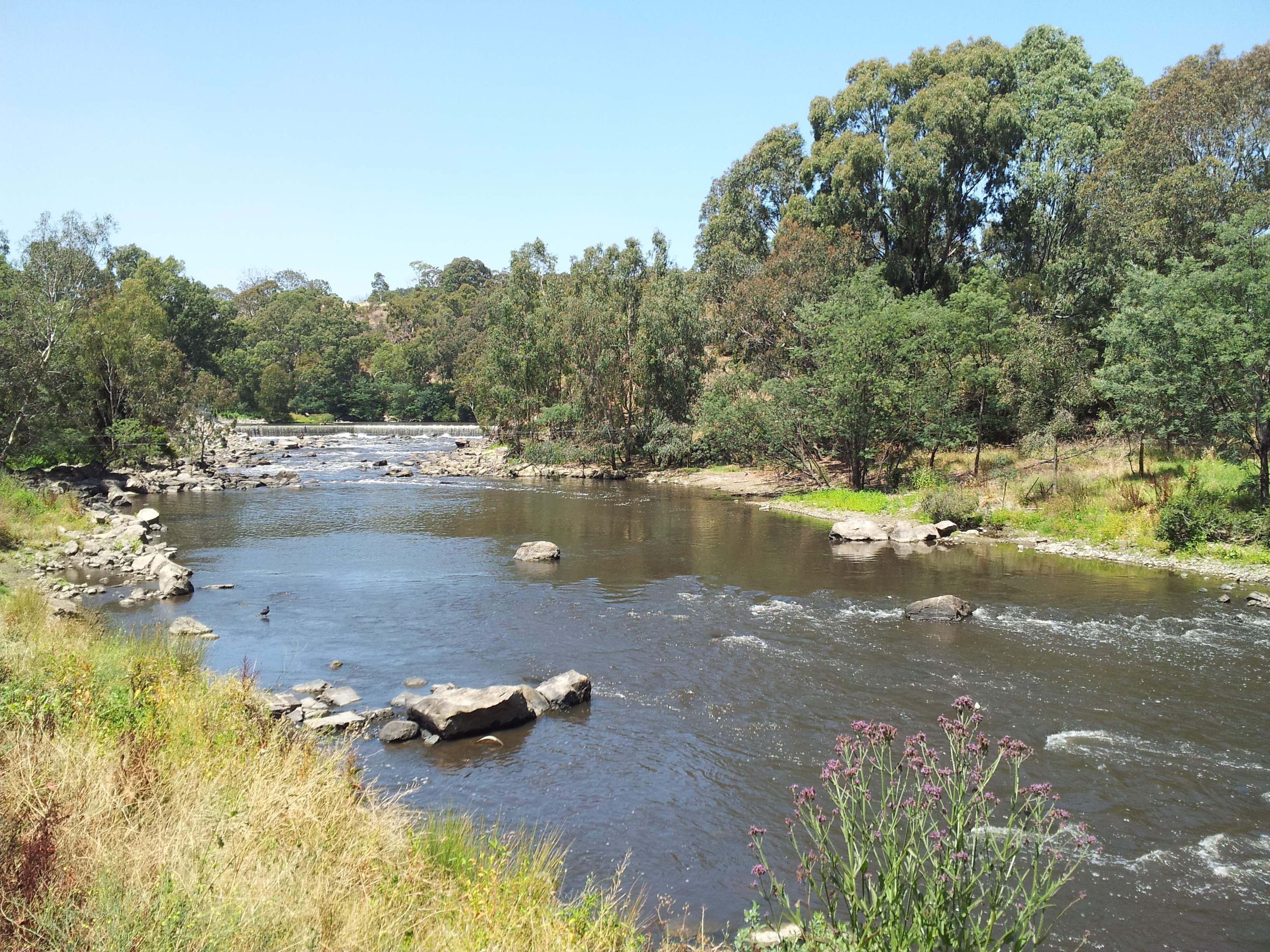
You start east past the Cricket Grounds, tennis arenas and Botanic Gardens. Soon you turn north passing alongside several suburbs and through the forested areas of Yarra Bend all the way to the modest drop-off of Dight’s Falls.
Turning west, you bike within thicker forest before following a grassy strip through a more urbanized section. You then skirt the edge of Princes Park and glide southward through Royal Park past the often noisy Melbourne Zoo.
The remainder passes industrial and commercial centers along a canal – including a giant Costco store – before reaching the virtually new city of the Docklands. Then, past the charming waterfront near the Convention Centre, you at last turn back east through Southbank.
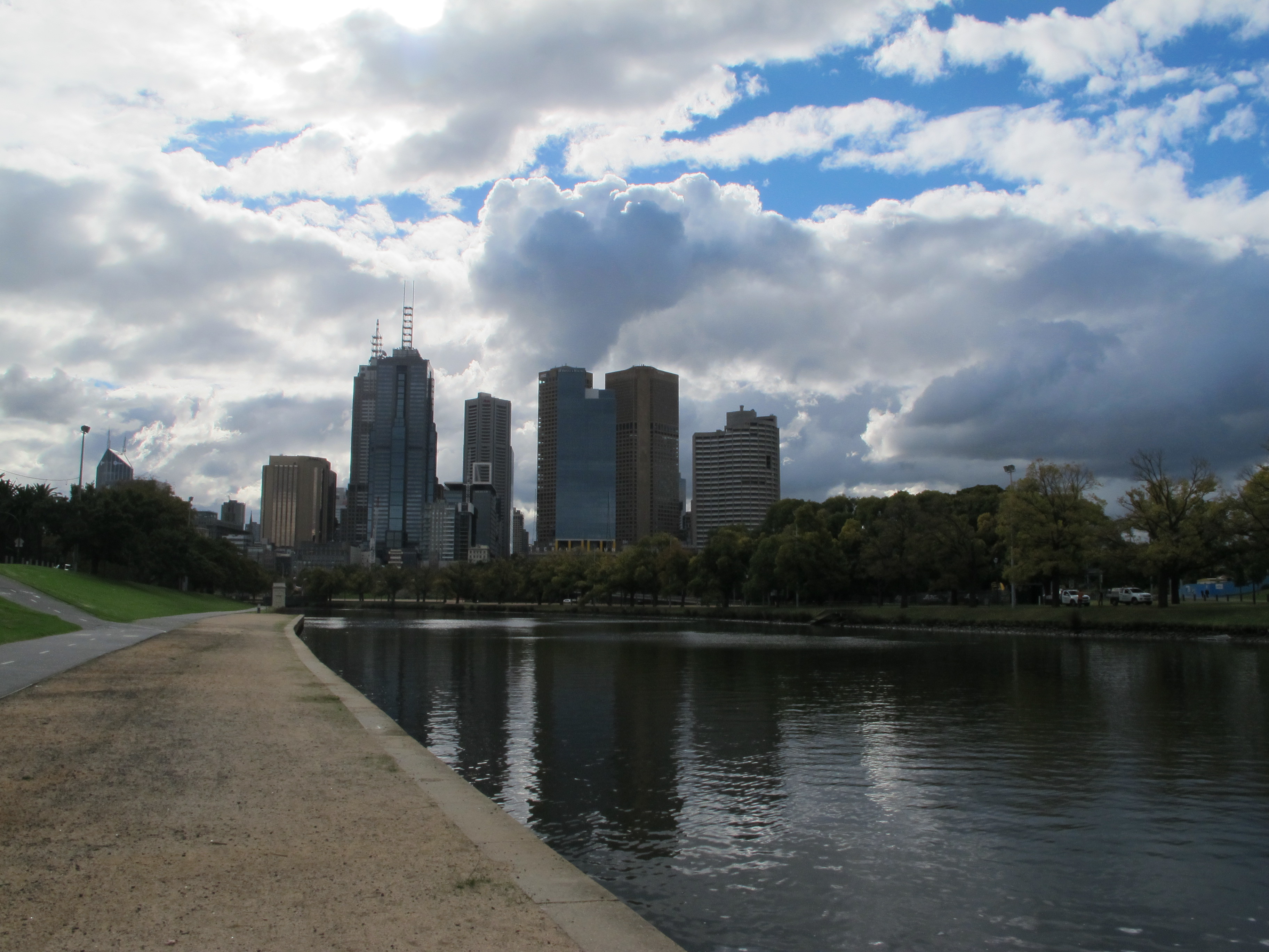
Southbank is a grand river promenade, bordering a mix of decade-old high rises, corporate buildings, and restaurants on the Yarra’s south bank, with stunning views of the CBD. In this last kilometer of the Capital City Trail, we must carefully weave through hosts of slow-moving walkers and dodge oncoming bikers. Imagine cycling on the sidewalk of Fifth Avenue in New York. It makes no sense that you can bike on this strip, but it is part of the trail because there are no nearby passageways safe to bike on either.
Aside from the lovely terrain and landmarks you pass, we have come to appreciate the clever workarounds that allowed planners to fashion such a continuous trail. Just a few kilometres from the CBD, the trail is a metal causeway built over the water where a highway pinched off space along the riverbank. Factories and private lands forced the trail to cross the river along narrow bridges, whose lane and a half just barely accommodates cyclists and pedestrians. Throughout the trail, you share it with pedestrians, who occasionally cluster thickly, most noticeably as you pass through the middle of a popular demonstration farm in Abbotsford. You have to get off the bike a few times: once to port your bike up or down three flights of stairs, another time to negotiate a railroad underpass.
The first time we tried the CCT we made a few rookie mistakes where signage wasn’t so clear. The Main Yarra Trail follows the CCT for quite a while before branching off at Dight’s Falls. We followed that one, missing the sign that actually pointed away from us, and wandered through pleasant forest land farther and farther east, until we realized we should have been bending west. Later, on the same endless trip, we branched north along the Merri Trail since that CCT marker also faced the wrong way. These offshoots do let you bike for hours and hours farther out from the city amid woodlands and parks, but are not the way to close the loop. Later we fumbled at a fork in the trail bisected with a CCT marker pointing directly between the options. With all these miscues, it took us three hours to go just two-thirds around the trail, which normally requires just two hours in total.
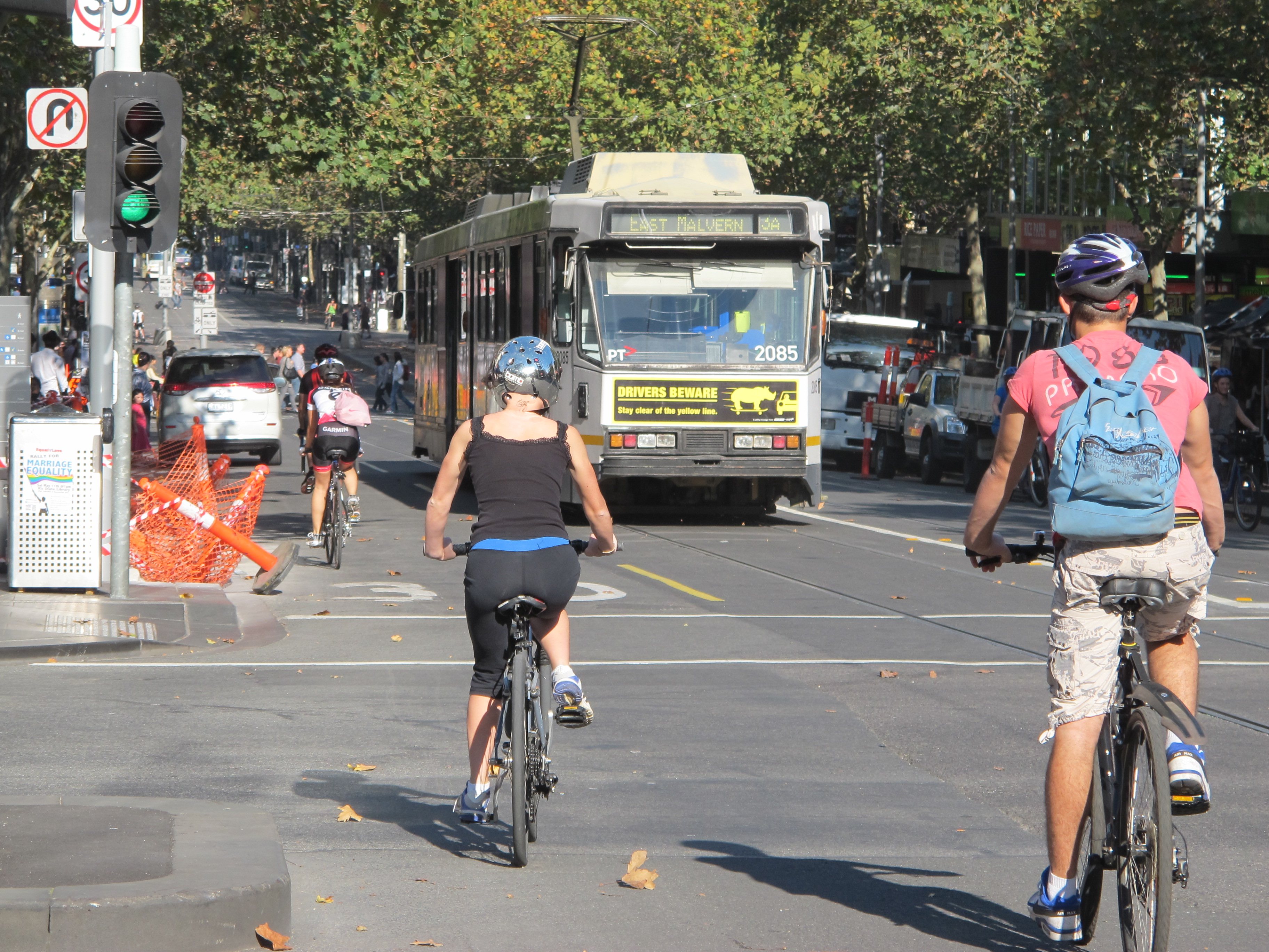
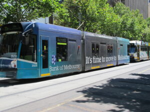
We appreciate the wondrous trails around the city, but we feel best treated by the finish of our ride back home along Swanston Street. This runs north-south through the center of the CBD, the city’s busiest pedestrian and tram street. Most of it is closed to car traffic, yet bicyclists still are favored by a protected passageway along the whole length. As you climb its gentle hill, you cycle past thousands of pedestrians, a flotilla of trams and major landmarks of the city: Flinders St. Station, St. Paul’s Cathedral, Town Hall, tony Bourke Street pedestrian mall, QV Market, the State Library, several universities and the City Baths. Except for yielding to passengers alighting the trams, the dedicated bicycle green lights at intersections give you priority. Ah, here, the two-wheeler is finally king.
(Also, for more pictures from Australia, CLICK HERE to view the slideshow at the end of the Australia itinerary page.)
—
NOTE: Great websites for bikers in Melbourne
- www.bikemap.net/ – bikers document the rides they’ve done and routes they’ve taken, plus you can get help with the best ways to get where you’re going
- www.bicyclenetwork.com.au/ – offers a broad array of resources for the biking community including great ride recommendations
- www.ridethecity.com – our new favorite, this is an international site offering terrific maps of good streets and route planning for major cities in the U.S., Australia, Canada, France and Spain and a smattering more. It is great for Melbourne.
Like site and article. Is there a way to “like” the article so it posts to Facebook?
Thanks! For now, you can share an article to your Facebook timeline with the little “f” for Facebook at the end of an article, but there is no “Like” button yet. We’ll look into it.
The Facebook icon at the top of the page brings you to our Facebook Page, Adventurephiles Travel Blog. You can the follow our posts via Facebook if you like our page with the “Like” button to the right of the title beneath the background picture.
Hi, nice article. I really like it!
Signed up for NYC Bike Share, still waiting for my pass to come….
From a picture we saw, the bikes look like they came from Melbourne…blue all over.