Across Ecuador, a visitor can wander and explore a remarkable, ever-changing terrain. It was crafted over the eons by volcanic action, the continuing movement of the Andean tectonic plates as well as the remaining 90 or so volcanoes in the country (out of 200 in all of SA). Forty of these are still considered active. Eight are still liable to erupt at any time.
The names of the volcanoes are legendary, dating back before the Spanish, and such a strong part of the culture that their names define the different regions of the country. Chimborazo, or the ice of the Chimbo people.
Cotopaxi, or the Neck of the Moon, and so on. In the indigenous religions, as with the Maori in New Zealand, some are considered male and some female. Stories tell of how they interact and consort, somewhat like the old Greek and Nordic gods.
The swath from Quito south to Cotopaxi and beyond is actually called Volcano Alley. Yet, across the country, the volcanoes – and the landscape, altitude, farming, weather shifts and seismic threats they generate – are the norm for people here. To visitors like us, all of this is far from normal.
The landscape
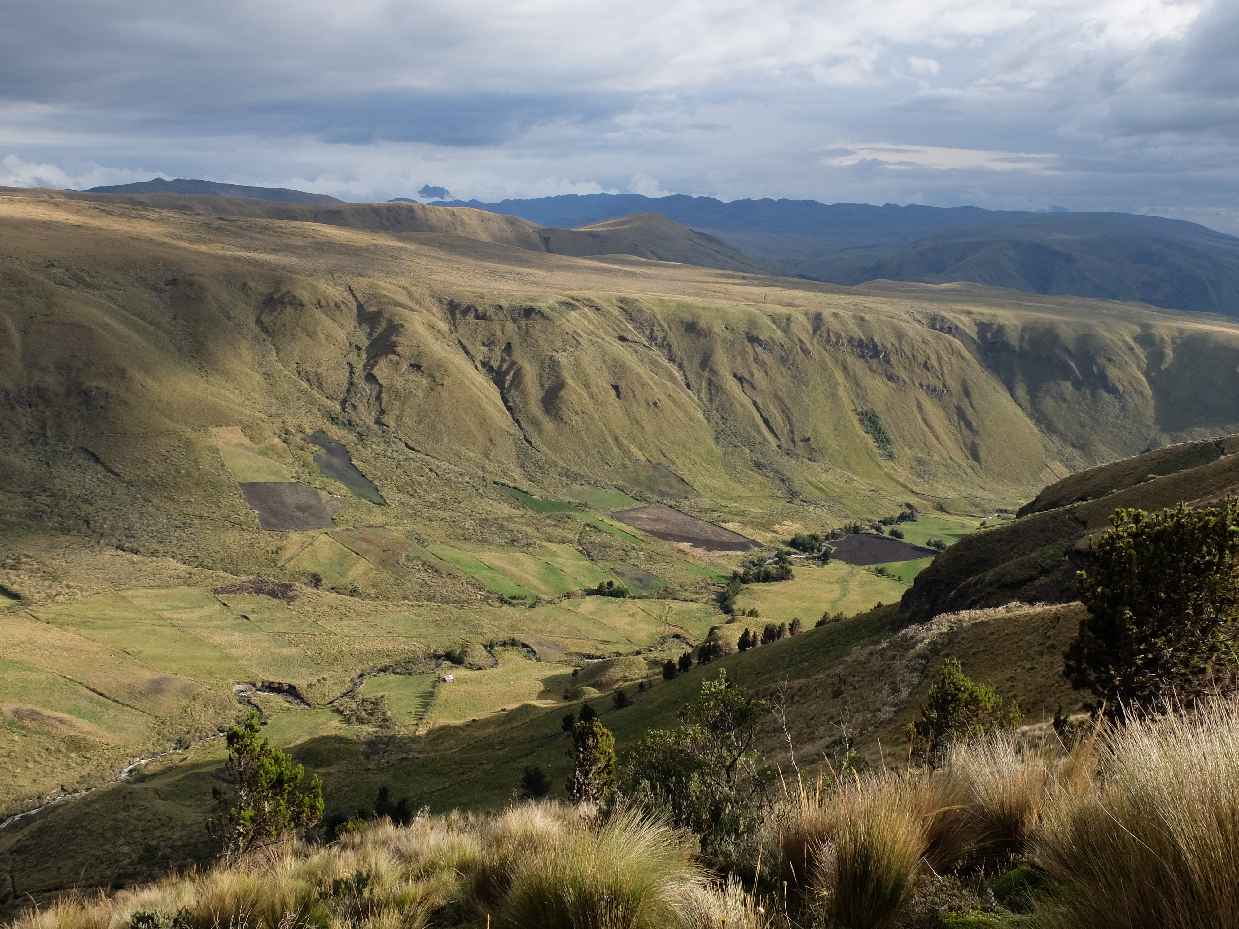
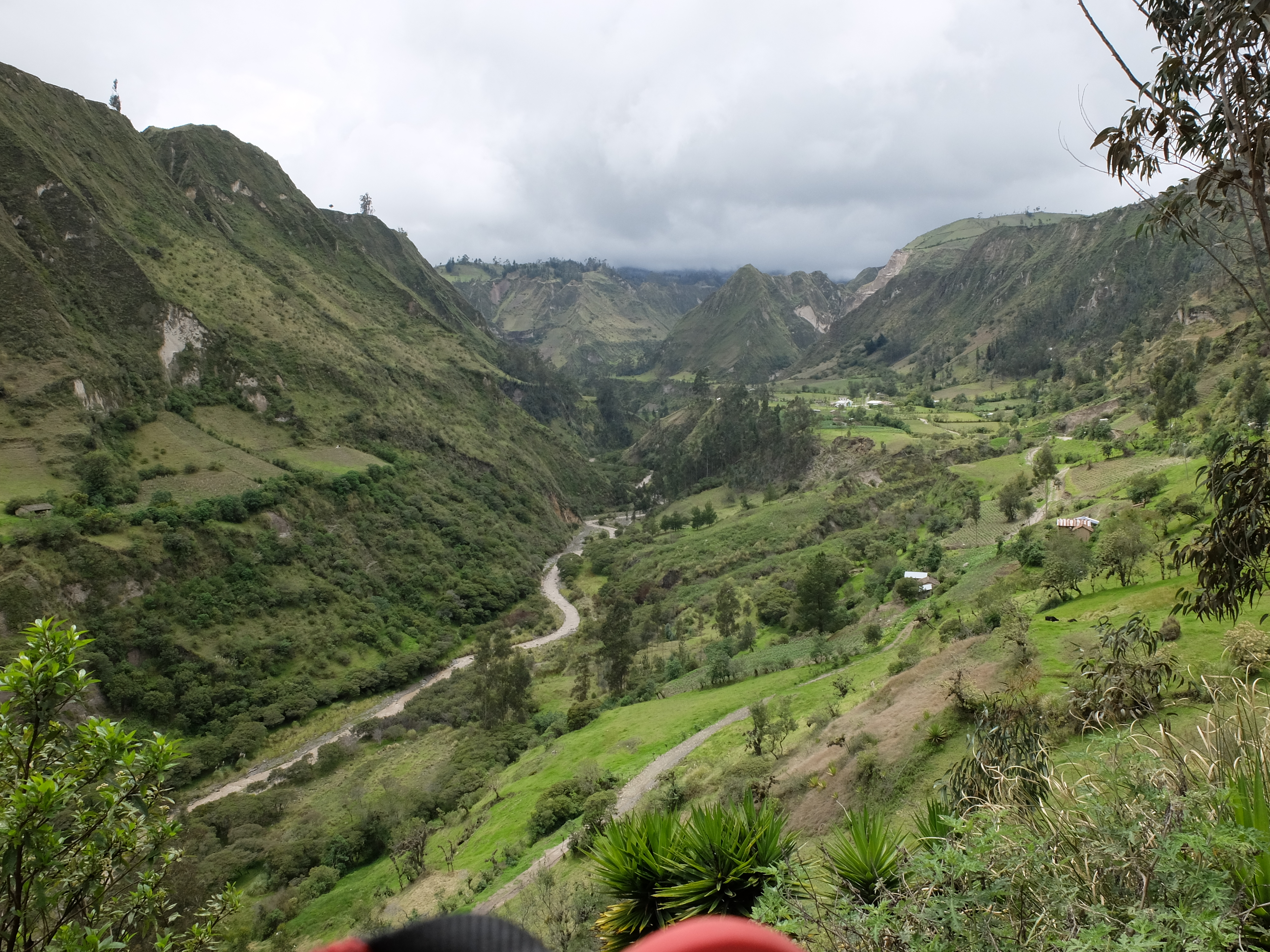
The hills left by the volcanoes only stop rolling when they turn into steep slopes and precipitous valley clefts, or flatten at the Amazon jungle or Pacific coastline. And where the largest peaks have pulled the land around them into the heavens.
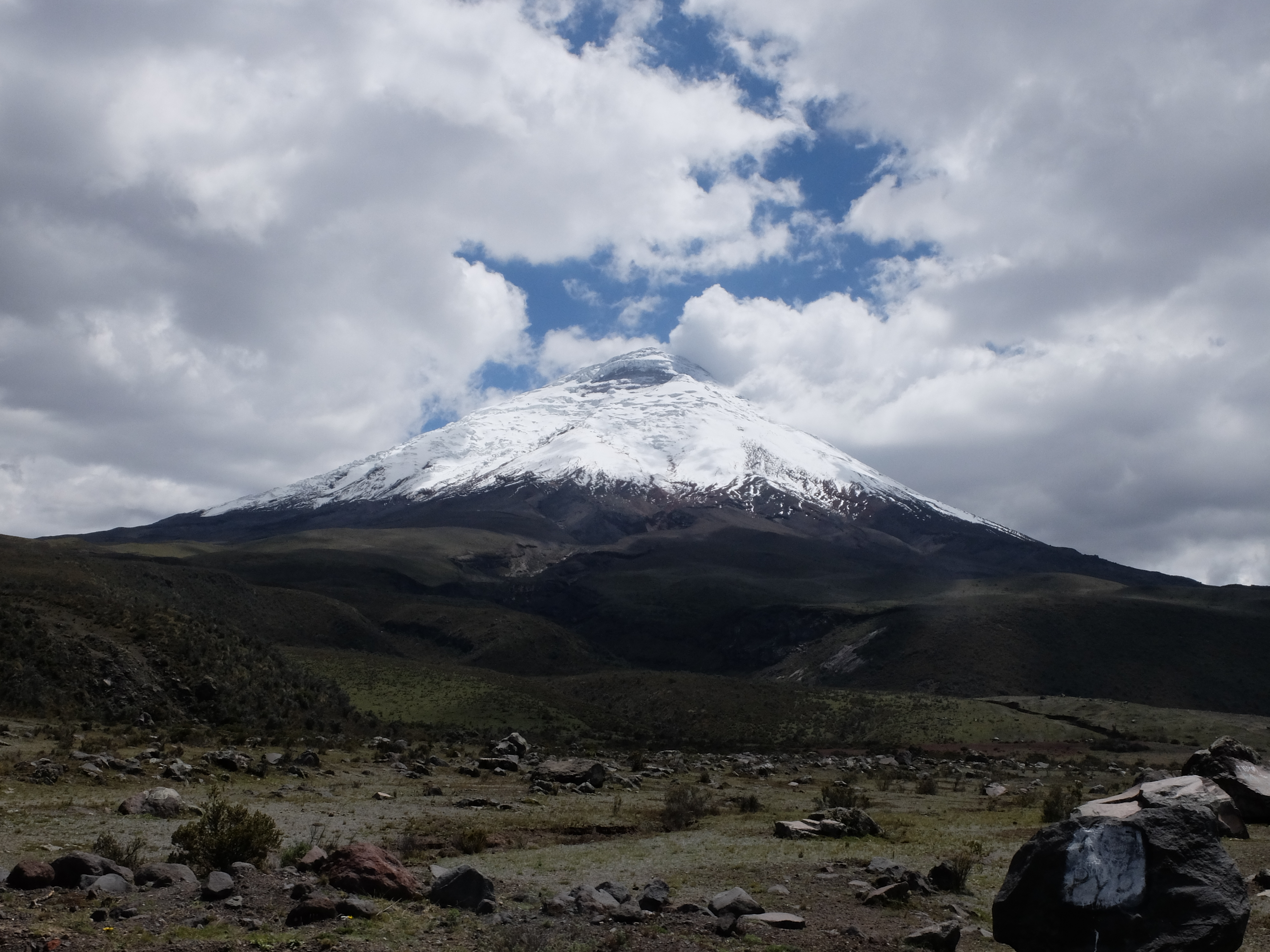
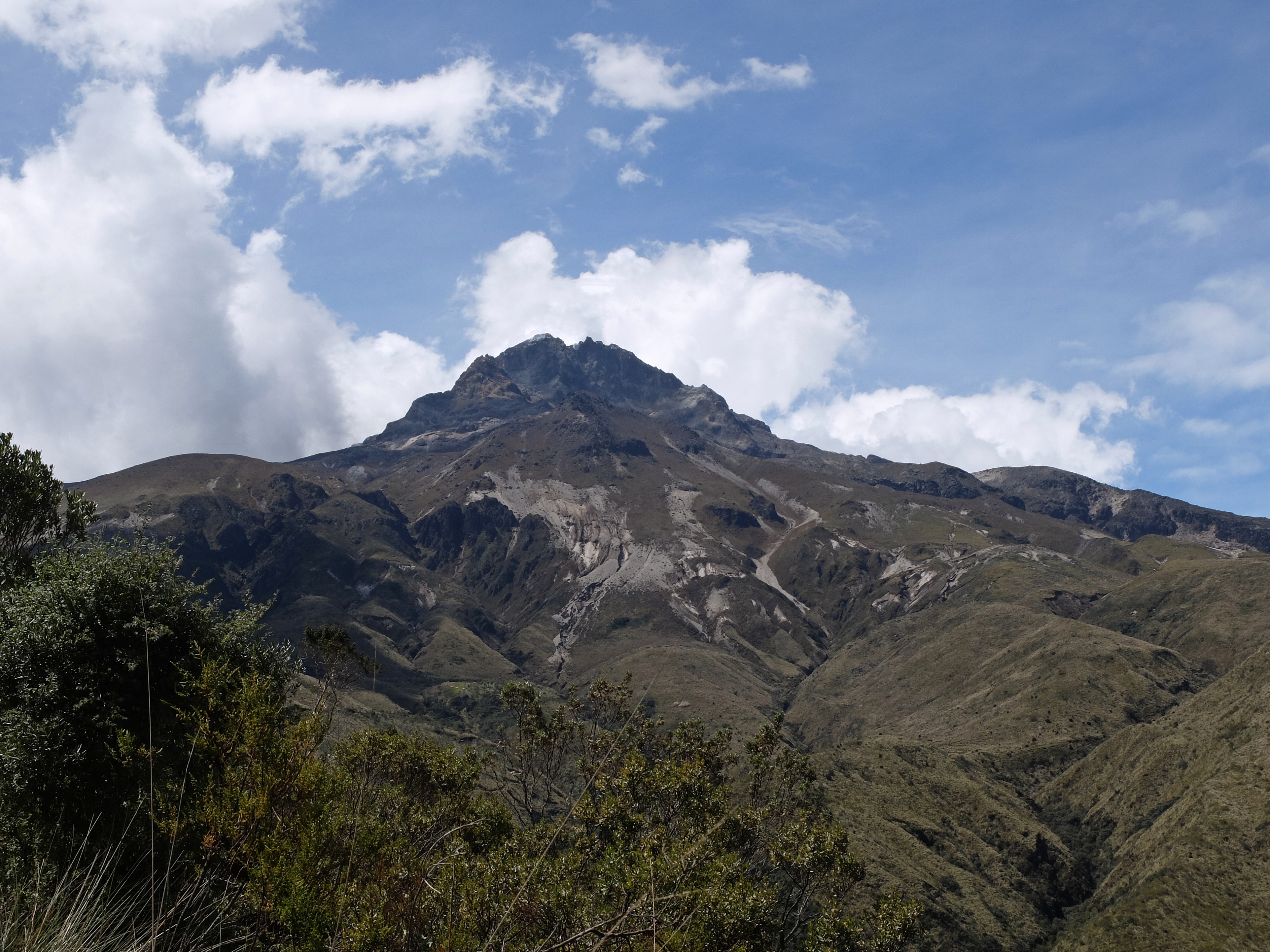
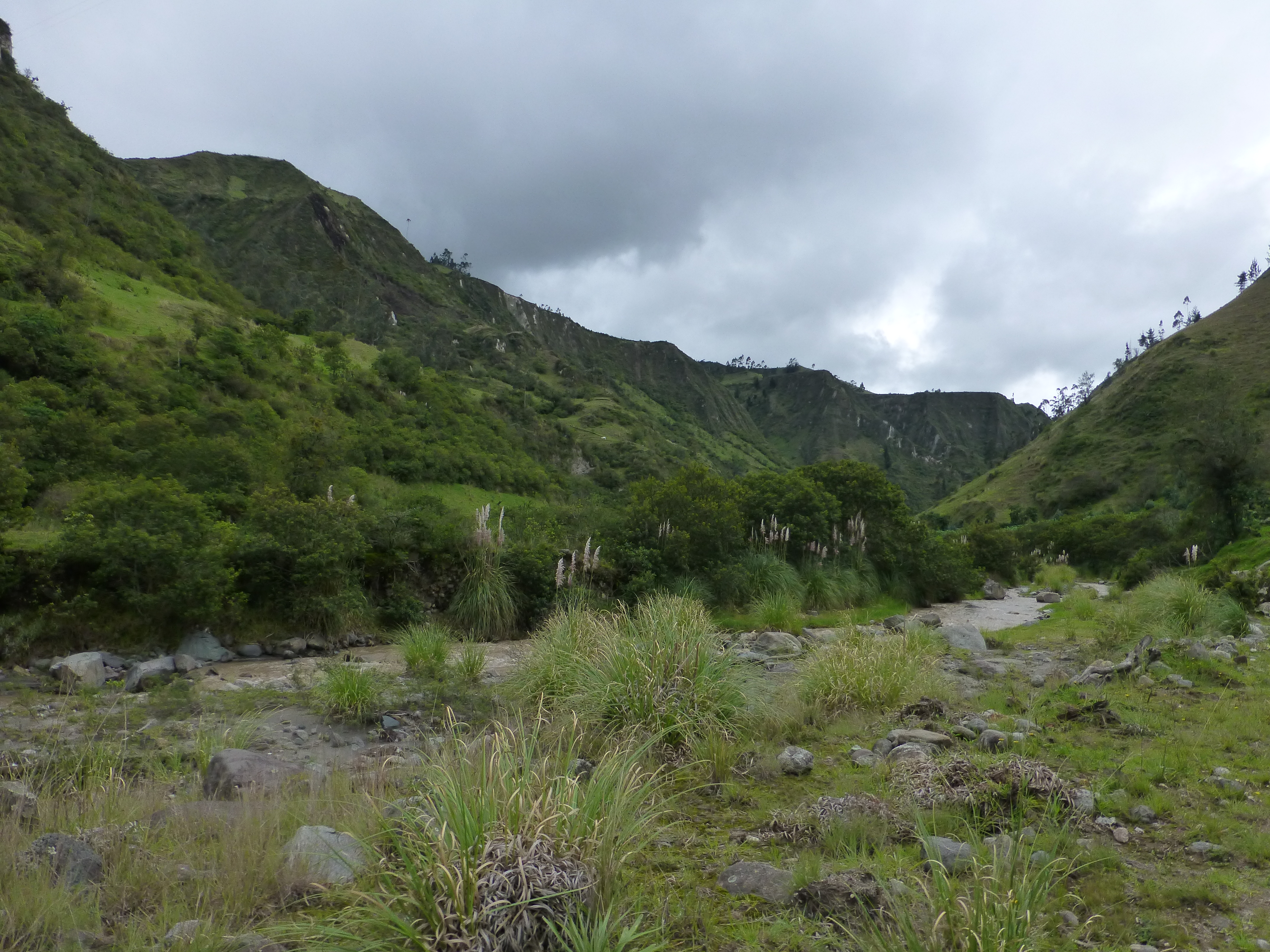
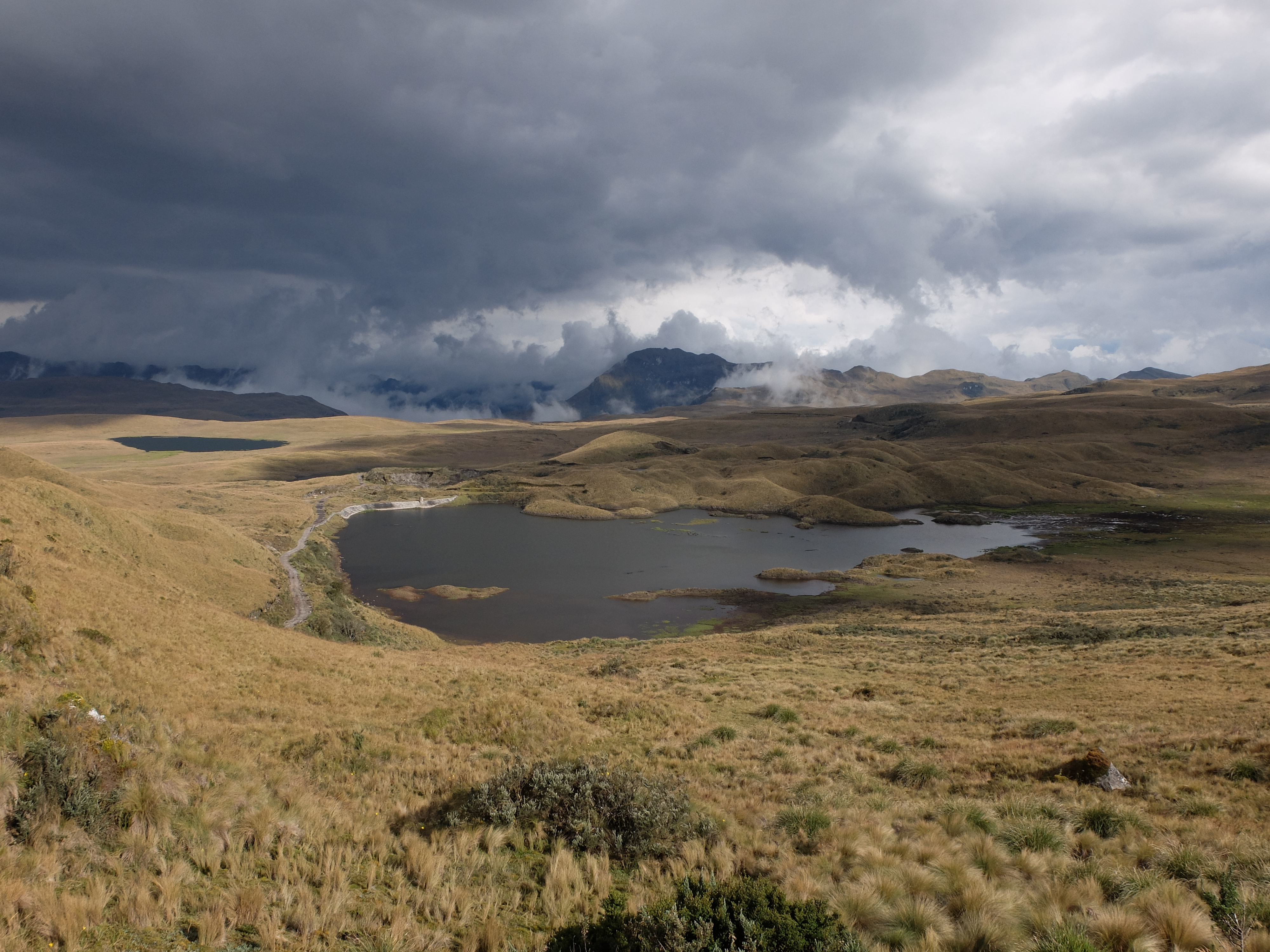
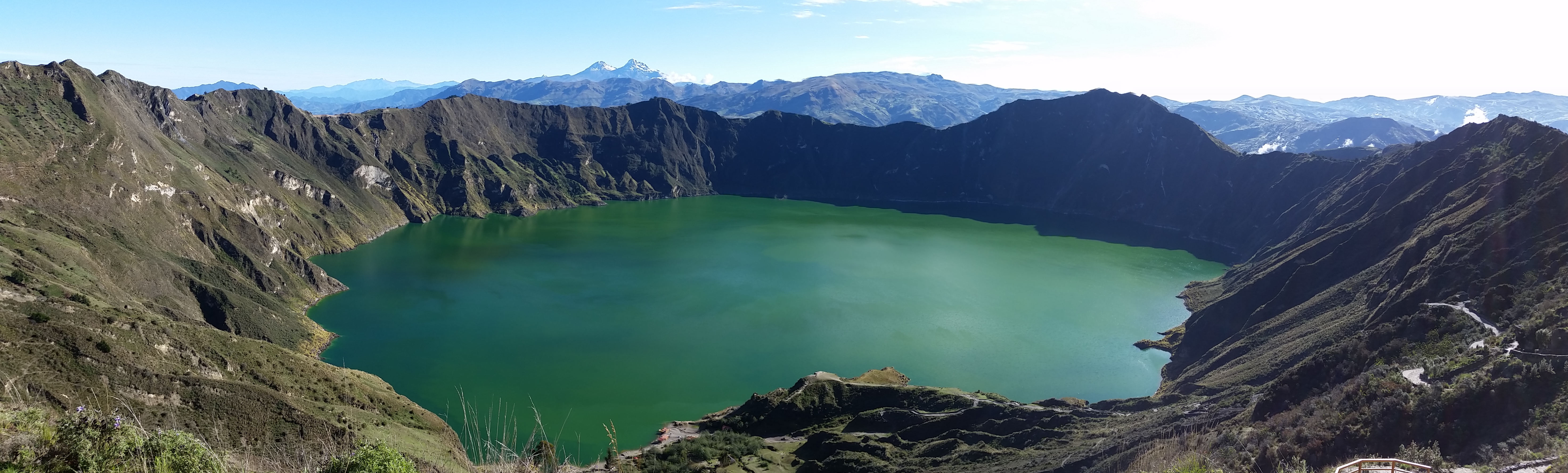
The remarkable terrain and vistas produced by volcanoes never stop in Ecuador. Just when we thought we had seen it in all its diversity, we headed south around Cuenca through another stunning section. And then there was remarkable flow of light and water in the paramo, a high altitude catch basin full of lagoons and spongey under foot.
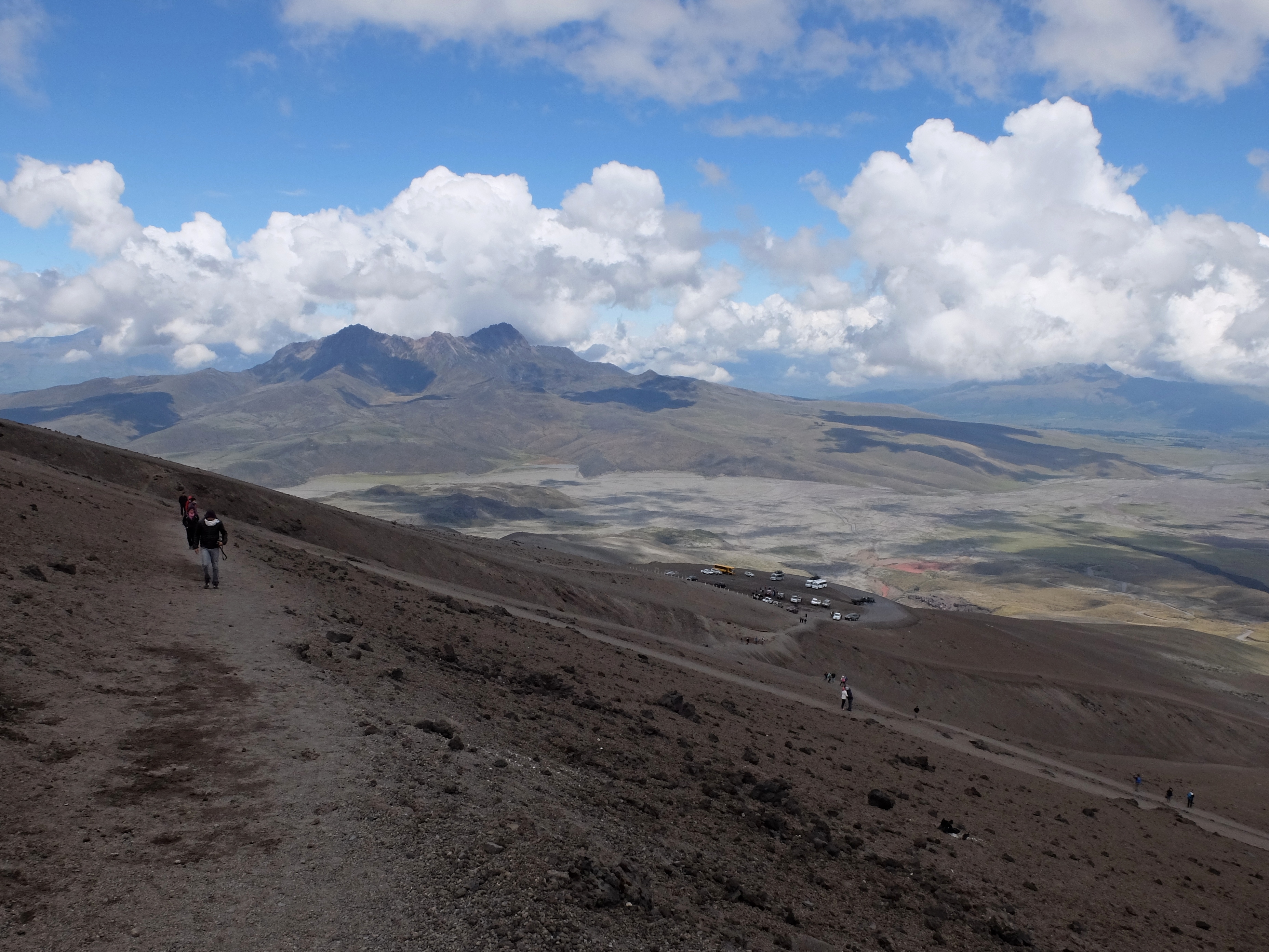
Much of the beauty is approachable by road, so driving is a thrilling experience that tests your ability to stay focused on the road itself. But the best is accessible only by four-legged help or on your own two legs. The hiking, naturally, can be strenuous and demanding, as well as astonishingly beautiful – from volcano climbs high up paths strewn with lava rock or snow, to the meandering of low valleys and the more temperate lower hills.
You need to linger a while or return to Ecuador frequently just to see the volcanoes in all their flavors and in all the variety of weather – snow clad, cloud fringed, clear, smoking. To even sample the varied terrain and its seasonal changes on foot or by horseback could pleasurably take years.
Every season in a day
It seems that everywhere we travel, people talk about how variable the weather is. Here in Ecuador, that’s not just a feeling. As we drove for two hours away from Chimborazo, one day, we passed from pouring rain to thick fog to sun-filled land and back again. Of course, up high at 4000 meters or more it gets very cold; lower down, the day passes through a temperate, narrow range. You can’t reliably forecast in one place how the weather will shift among these variables, especially in the rainy season.
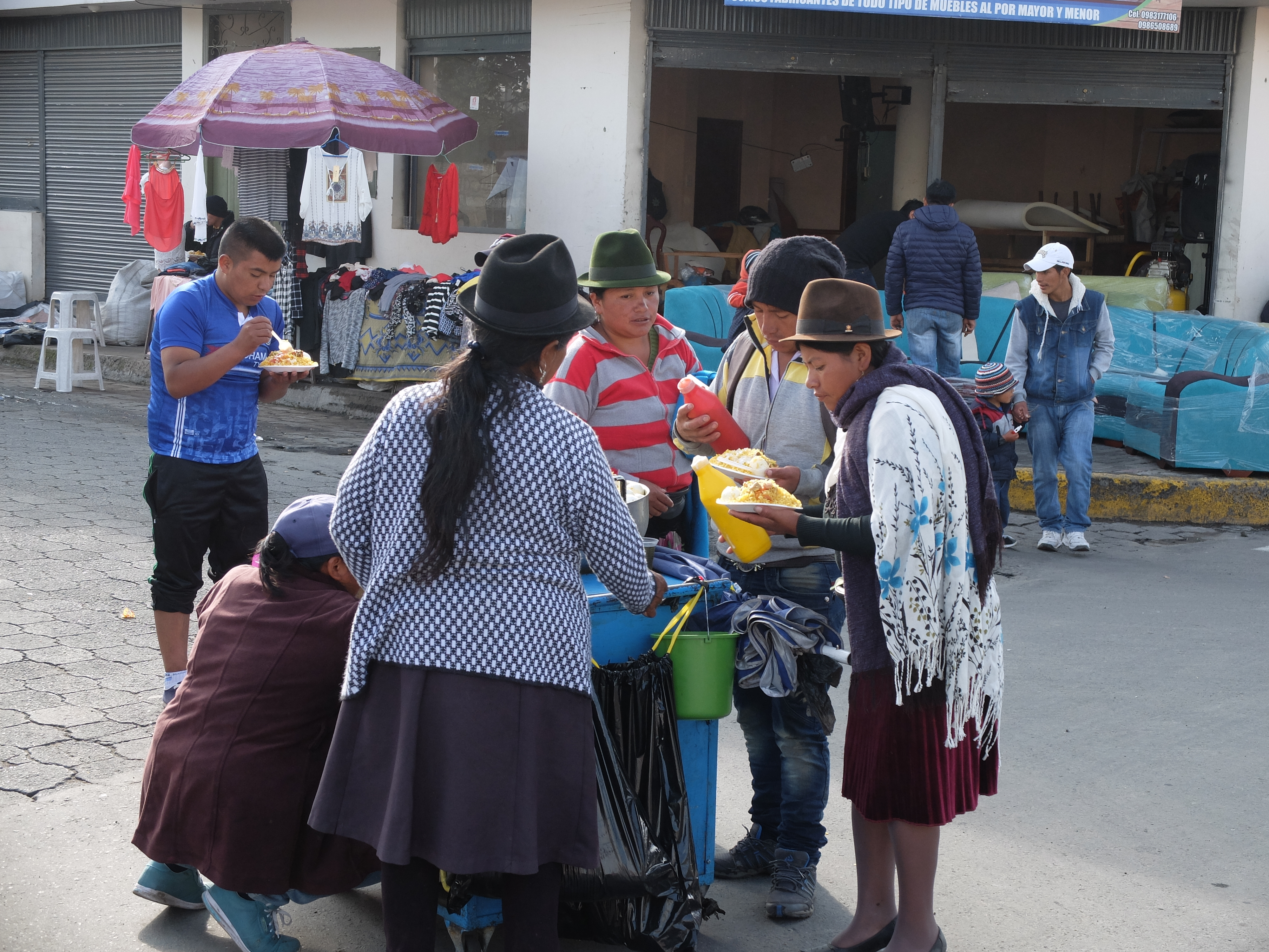
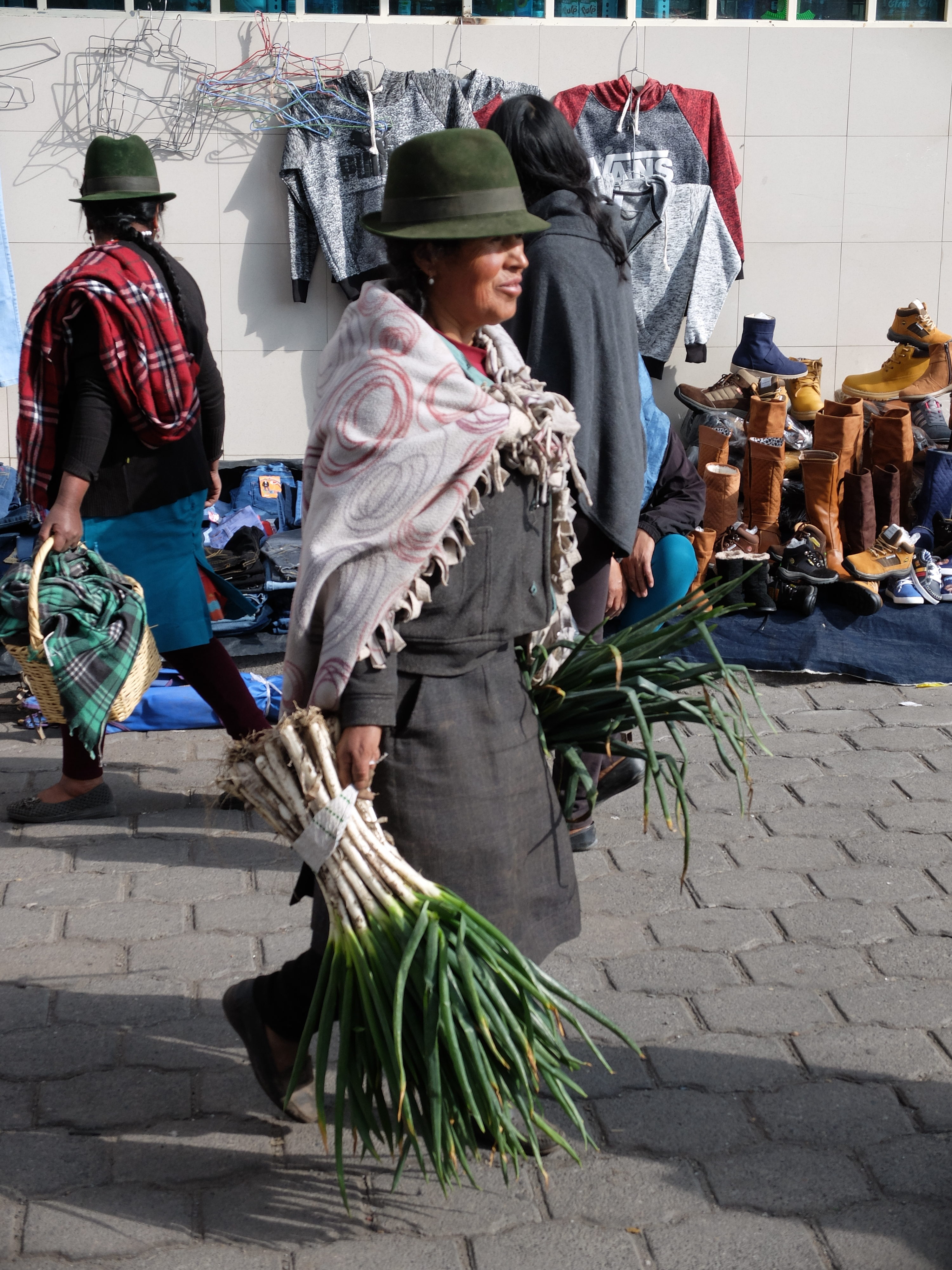
The locals have adapted to all this variability. When the sun shines it is intense, so the women especially keep their ever-present brimmed hats and coverups. The traditional costume of woolen ponchos keep them warm and dry, though supplemented by plastic ponchos in the worst of the rains.
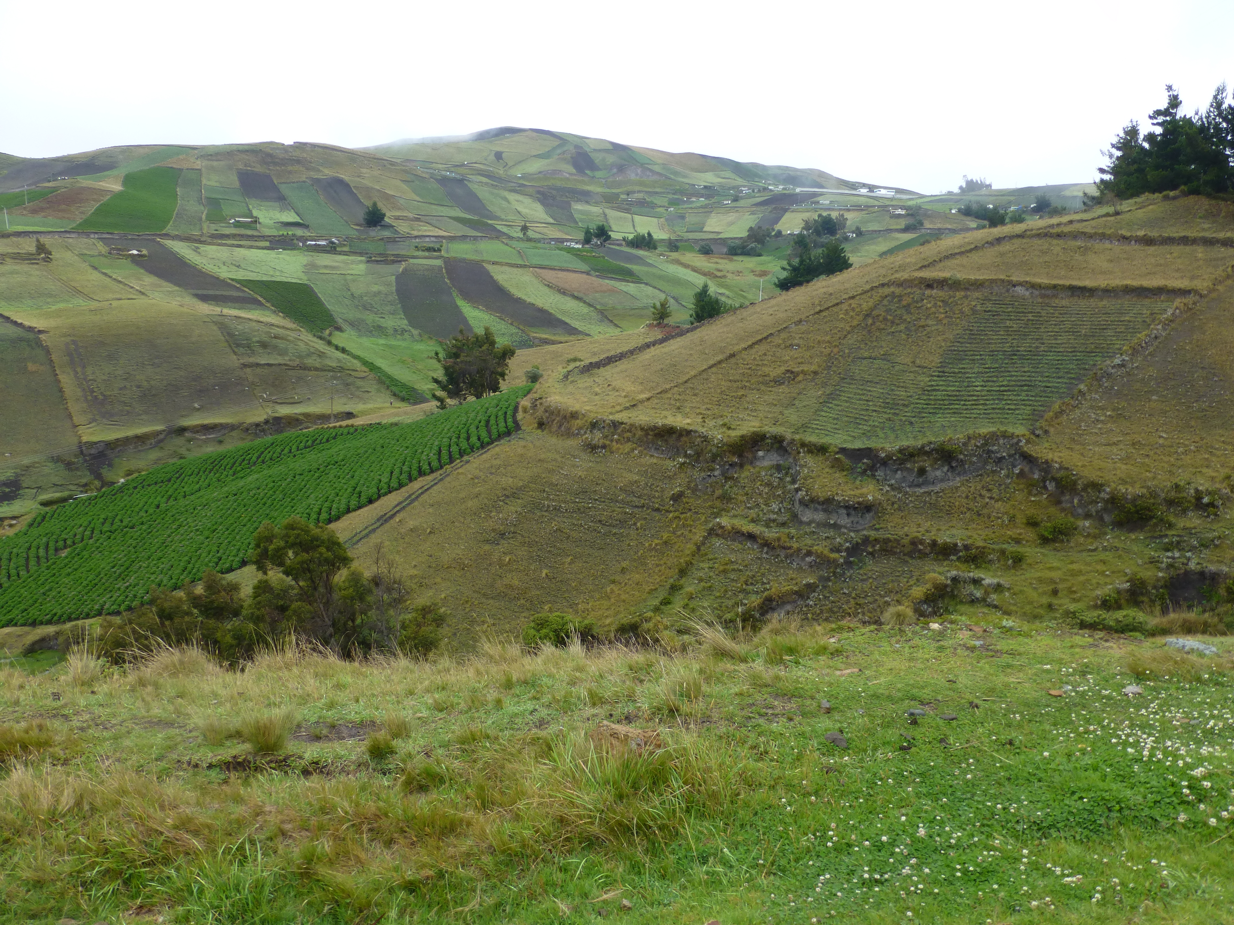
As farmers, primarily, they are beholden to the rains. Rain is the lifeblood, filling the rivers and irrigating the crops. It comes not just as water, but as mist from the common fog layers induced by those same volcanoes and their temperature gradients. The highlands are relentlessly and inevitably green with native forest or terraced farmland.
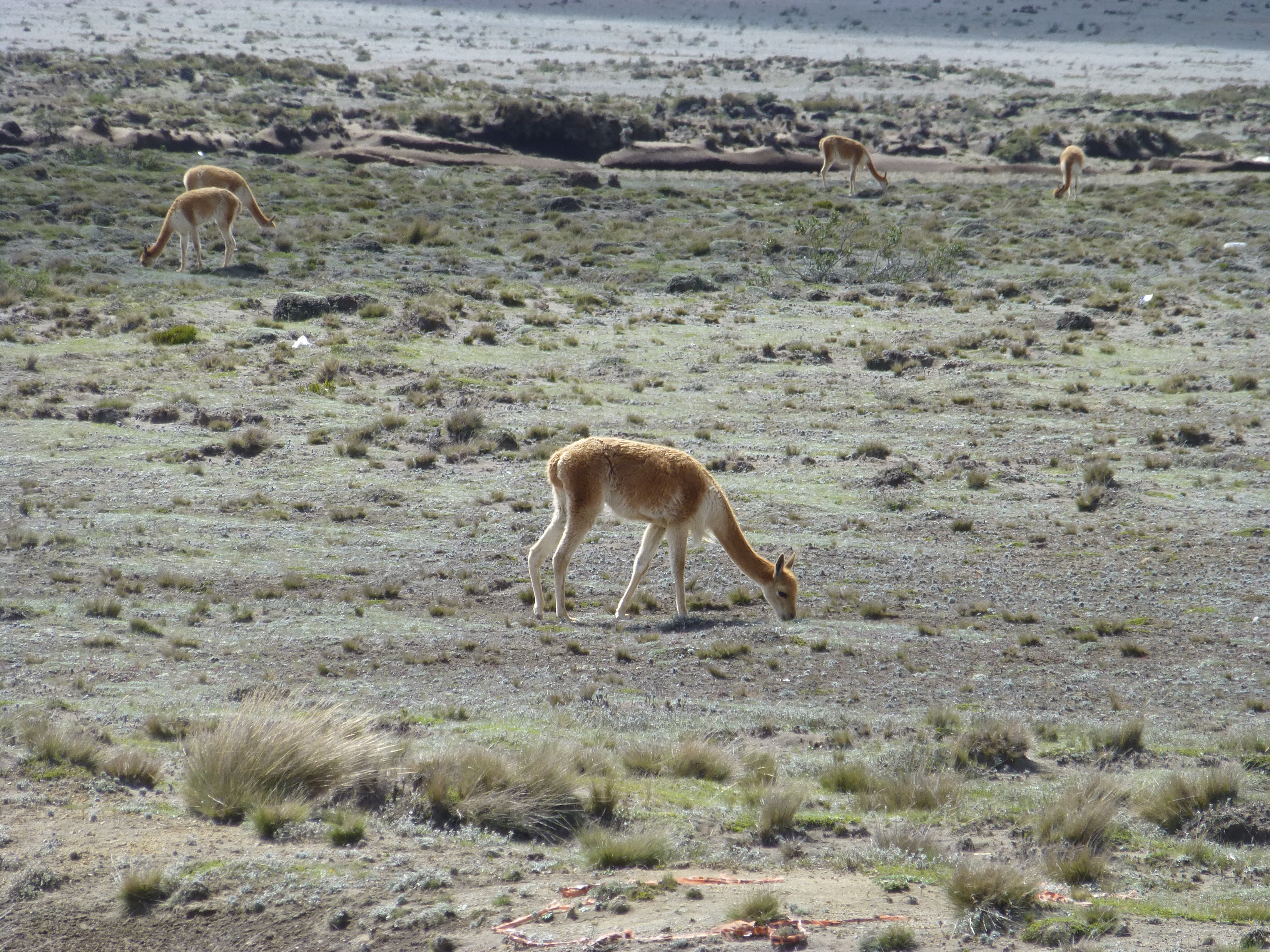
Even in one location, the vagaries of weather induced by the big volcanoes can create wholly different ecologies. Circling around Chimborazo, on one side we went through scrub grasses and plants of a desert, where vicunas grazed, below lava rubble higher up; the other side, where the moisture collected, comprised lush and green farmland.
Edgy place to live
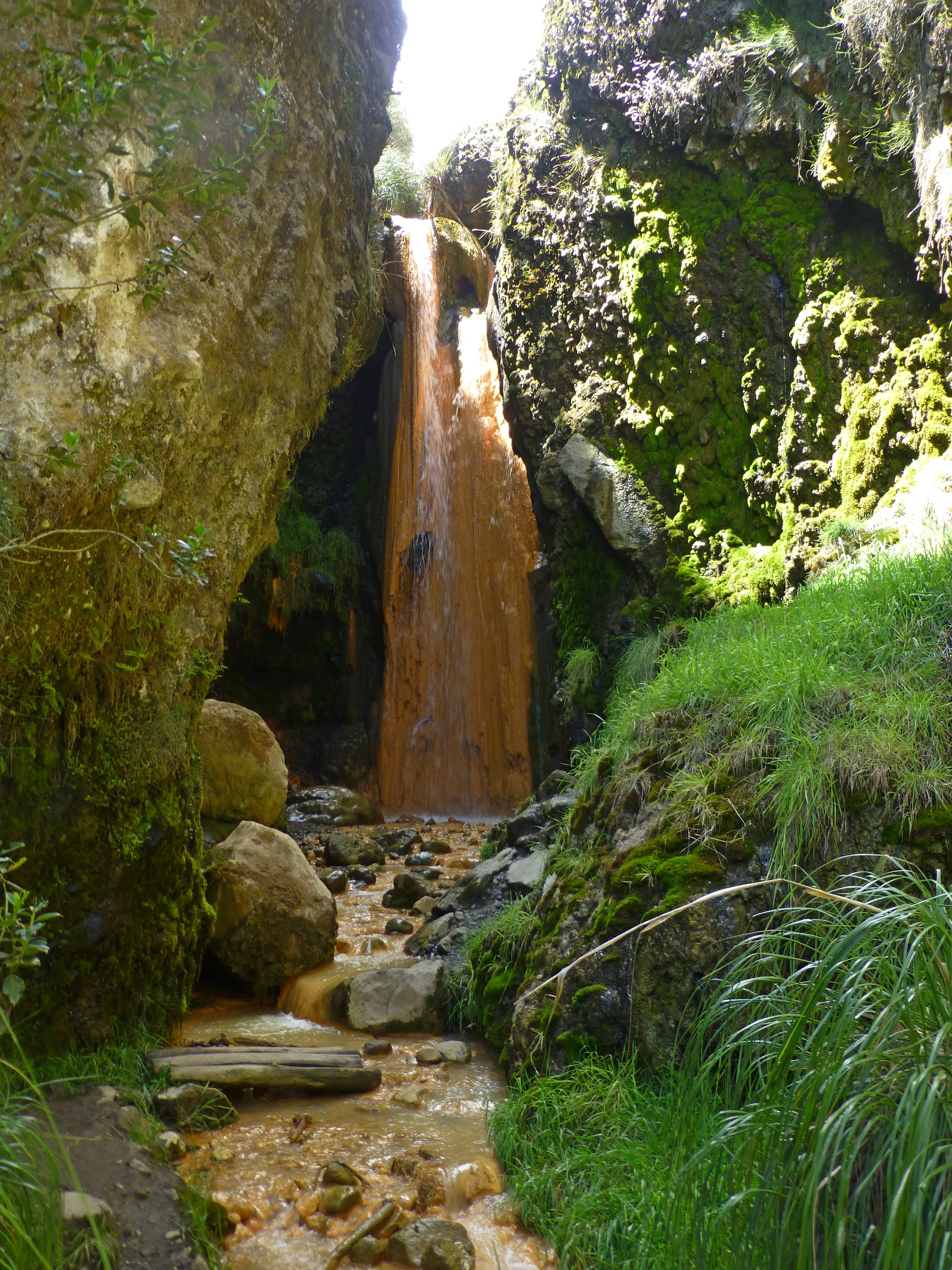
The volcanoes and the tectonic plates create other effects unusual to an outsider. Some are benign like the many thermal springs that emerge from the depths of the volcanoes through underground springs. The town of Banos was developed around its hot pools.
And some are perilous like the earthquakes from the plates that helped push these peaks higher. The last bad quake, in 2015, was very destructive.
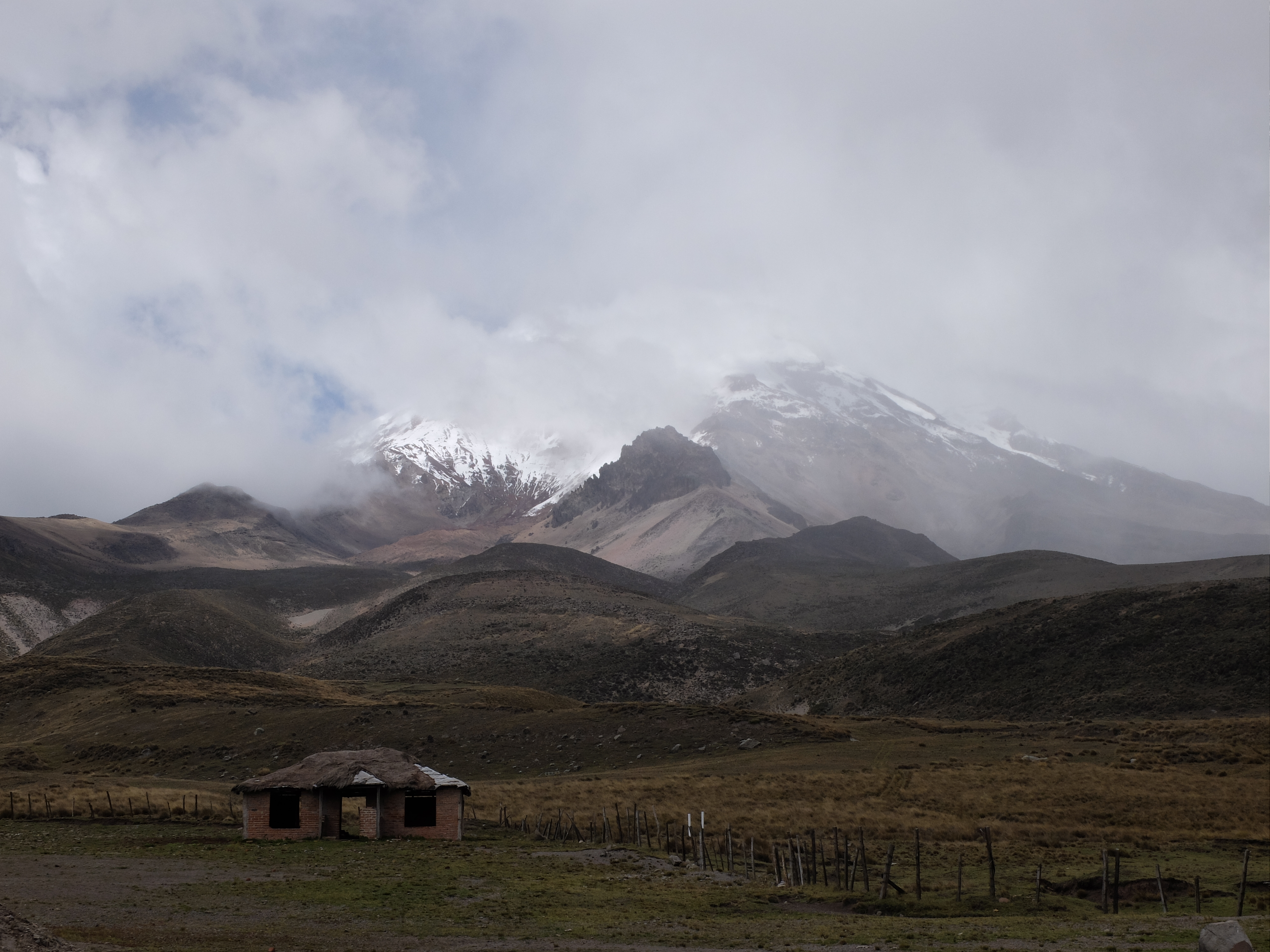
As for volcanic activity, the last devastating volcanic eruption was at Cerro Negro in 1999. But just a few years ago, one blew in the Galapagos. The locals have learned to keep an eye out for those 40 active ones. We saw monitoring stations all over Cotopaxi, over quite a range in altitude. Banos nestles downstream from the Tunguruhua volcano at the end of a visually striking canyon. One day, the town had organized a practice drill to ensure people knew what to do if the thing blew. We figured this was a fairly regular exercise around here.
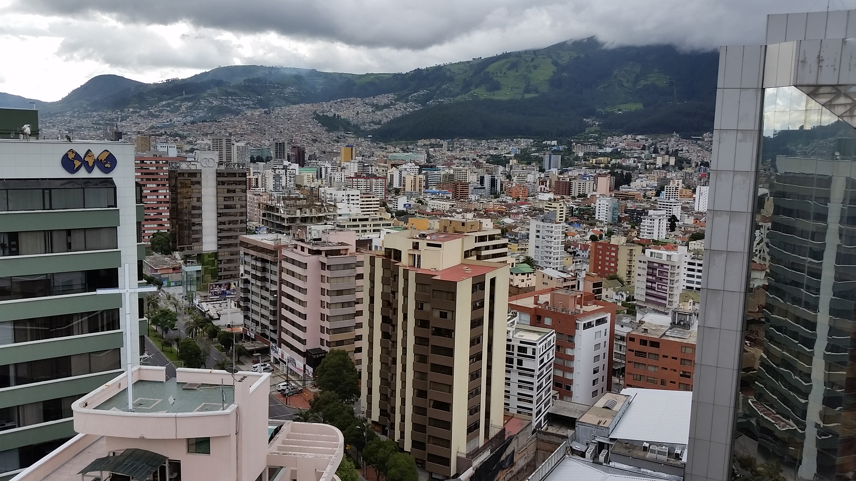
Cities like the capital Quito grew up from the low points in the shadows of volcanoes, then spread along the valleys. Eventually the housing climbed up the sides of their volcanoes to make room for more residents. They stay alert as well.
Altitude: Take a deep breath
It’s challenging enough to adjust to altitude in the relatively low towns of the highlands in the 2000 to 3000 meter level (from over a mile high to 10,000 feet, somewhat akin to the height of Rocky Mountain towns and ski mountains in the U.S. though without snow at the equator). We lowlanders must acclimate, an adjustment increasingly difficult as the numbers go up. What you need is time for the body to accommodate the change in oxygen and pressure, and keep the water coming in to bypass the loss of moisture. At extreme altitudes, this adjustment can take weeks.
The first effect you notice, unsurprisingly, is shortness of breath and tiredness in the muscles, as one struggles to get enough oxygen out of the air and deliver it to the body. Higher up, headaches, insomnia and wild dreams kick in. And it’s not just about fitness or age, for the effects can hit anyone even at relatively low altitudes like Quito (2800 meters). At the high altitudes, you can suffer severely. That’s why we saw treatment centers with oxygen tanks and other equipment at the refuges on volcanoes from around 4000 meters and above.
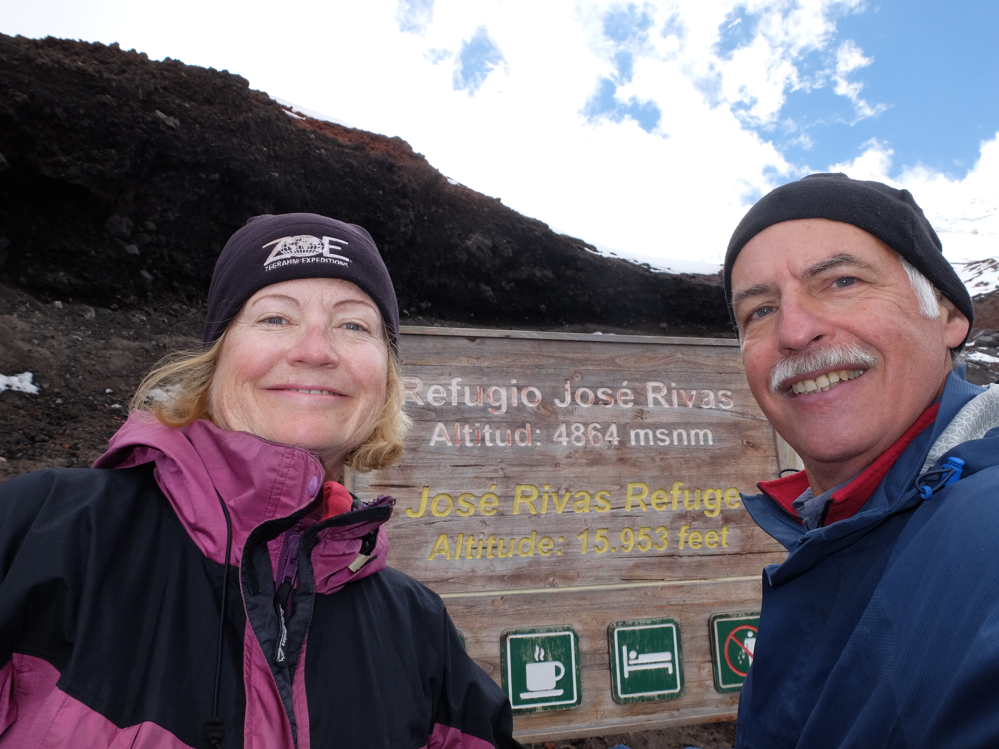
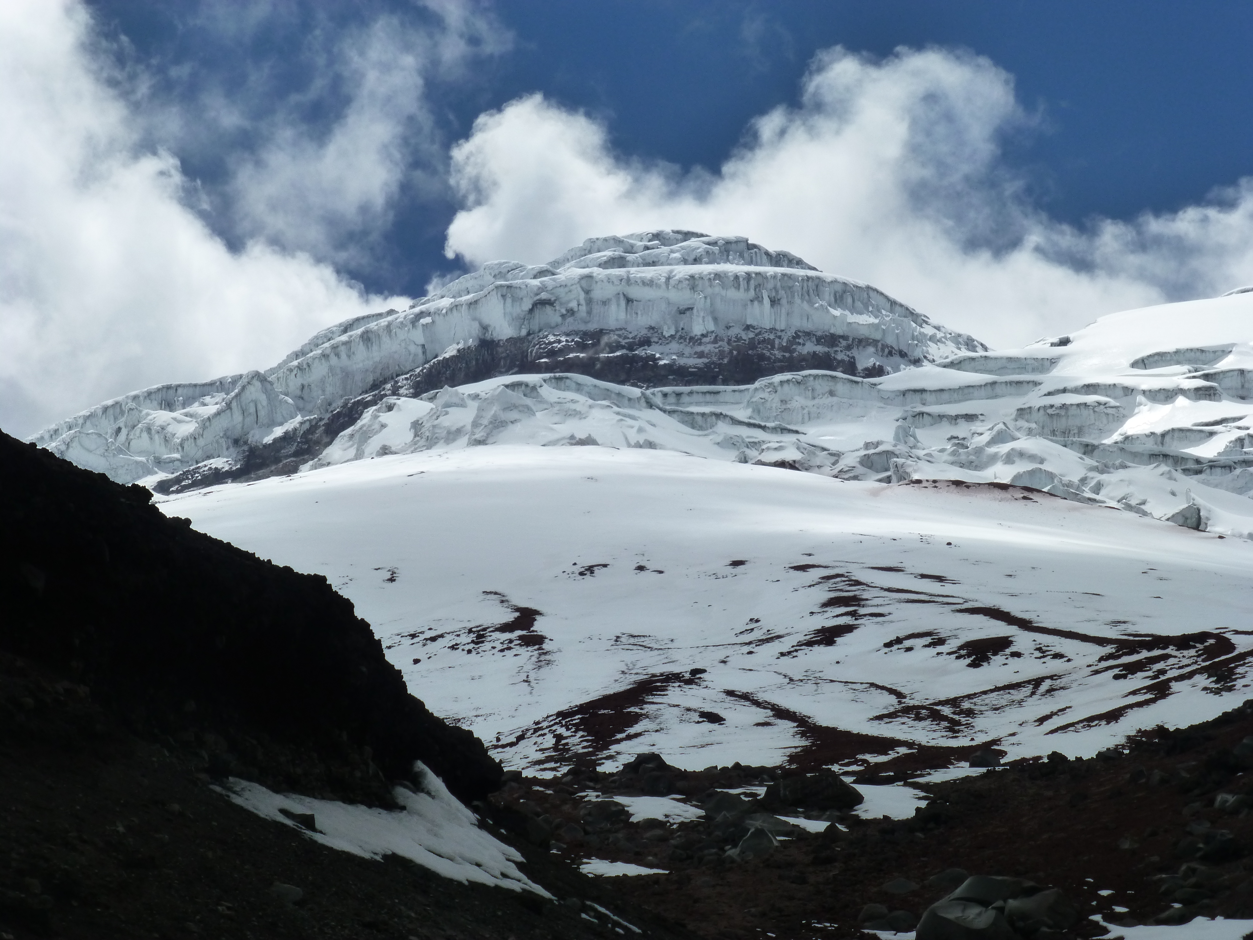
We were a bit concerned about how we could handle hiking at altitude, with a lot of it ahead of us in South America. We first tested ourselves on Cotopaxi Volcano, whose peak is 2 meters higher than Kilimanjaro. We climbed up 300 meters in altitude (1000 feet) to El Refugio, the highest you can go on this active volcano – at 4864 meters above sea level (15953 feet). We were unsurprisingly a little breathless at times, but overall felt great doing it – and relieved.
You can see how people here have adapted already to the highs and lows of the landscape. Life proceeds fairly normally for them at 3500 meters and below, though they have learned to pace themselves. You just need to recognize how well suited to conditions is that elder farmer trundling past you on a steep climb while you struggle along. Physically, their bodies have developed very efficient breathing and oxygen transfer. Another adaptation is that they have remained short and compact despite modern influences and better health conditions.
Farming
To the Ecuadorians and the indigenous tribes, the rich volcanic soil and the rains across the country make farming very productive.
At the lower altitudes, say up to 3000 meters, fruits dominate, with pineapples and bananas toward the coast; higher, it’s the root vegetables like potatoes and lettuces.
Yet precipitous hillsides and valleys don’t stop them – the tilling across the slopes climbs steeply tier by tier upward. Huge swaths of land look like patchwork quilts spread over mounds.
And the farmers, adapted as they are, hike and climb the narrow paths beside them to do the laborious work by hand. They focus on the hard work at hand – oblivious perhaps to the beauty so dazzling to the outsider, the rains that ensure good crops, the heat or the cold and the grumbling of the earth below their tilling.
(Also, for more pictures from Ecuador, CLICK HERE to view the slideshow at the end of the itinerary page.)