Surprises, surprises…or why we love to travel. We planned to visit Cape Verde as an adjunct to our visiting the three countries on the bulge of the western African mainland – Senegal, Gambia, and Guinea-Bissau (click here to read about those countries). Because of Cape Verde’s old colonial ties to Portugal, regular non-stop flights could deliver us in about four hours from Lisbon to Praia, the capital of the country on Santiago Island. We were thinking, nice, let’s relax for a few weeks on some tropical islands and contribute to the economy of a poorer country.
Before arriving, our first surprise was the country’s geographical weirdness, a circle of 10 volcanic islands with a diameter of about 150 miles (250 km). Even with two weeks, we had to make some choices. Once we arrived at the capital on Santiago Island, more surprises. Here tropical Cape Verde (or ‘Green Cape’) was mostly arid, more like sub-Saharan African savannah surrounded by Atlantic Ocean. Lastly, we discovered a flourishing economy despite the colonial legacy and a lack of natural resources. Good leadership in a stable democracy has created growing prosperity for its people.
We looked forward to more surprises during our visit to Cape Verde…and found many.
Praia
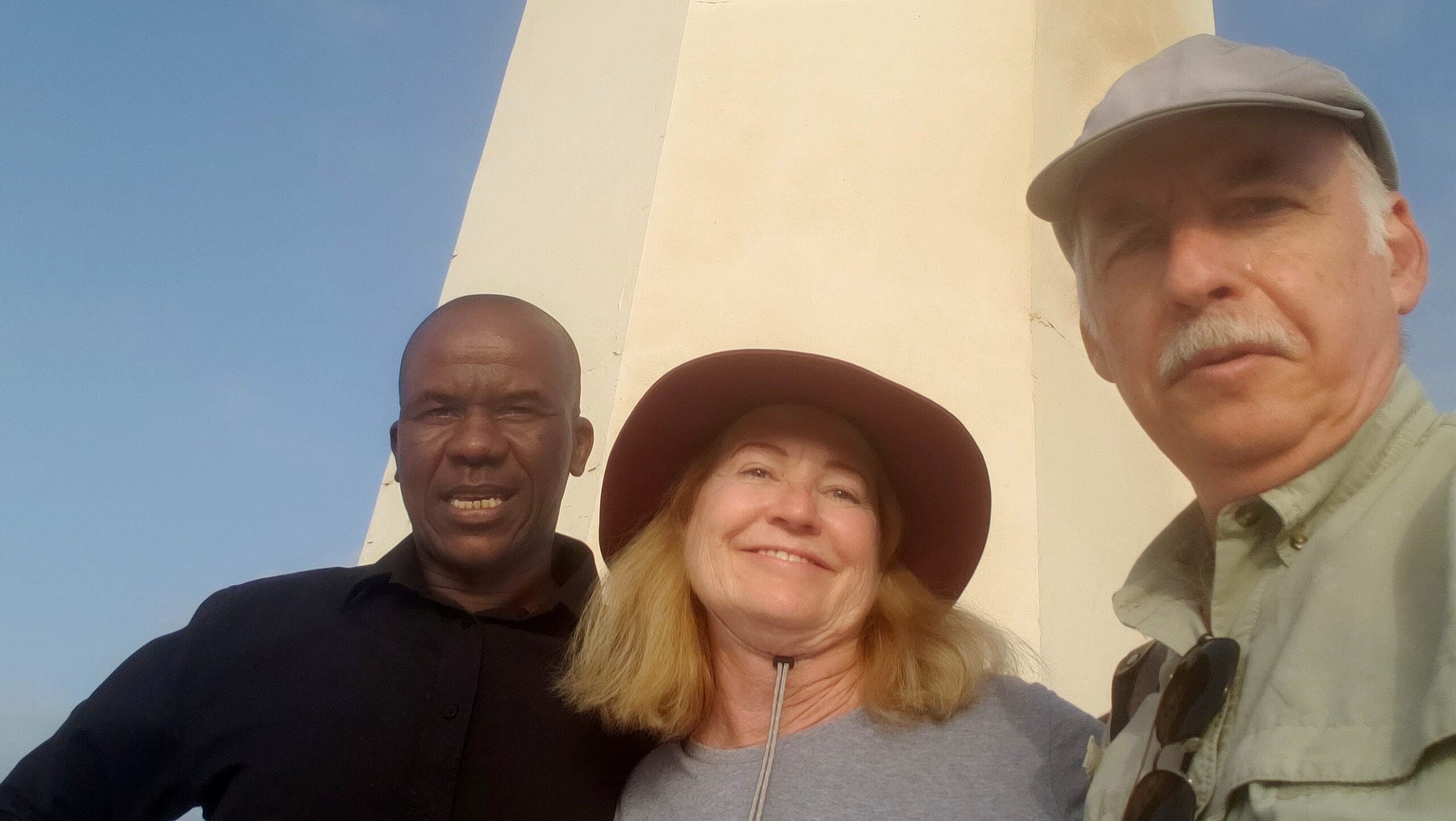
We are accustomed to warm hospitality from the people of African countries. Cape Verdeans are just as welcoming. One of the first locals we met was Jorge, tender of the historic 19th century lighthouse in Praia, the capital of CV on southernmost Santiago Island.
Exuberant and warm-hearted he not only gave us a lighthouse tour, but pointed out highlights of the island from up top, while recounting local history, ethnography, and personal experiences with the Presidents of Portugal and CV. Thanks, Jorge!
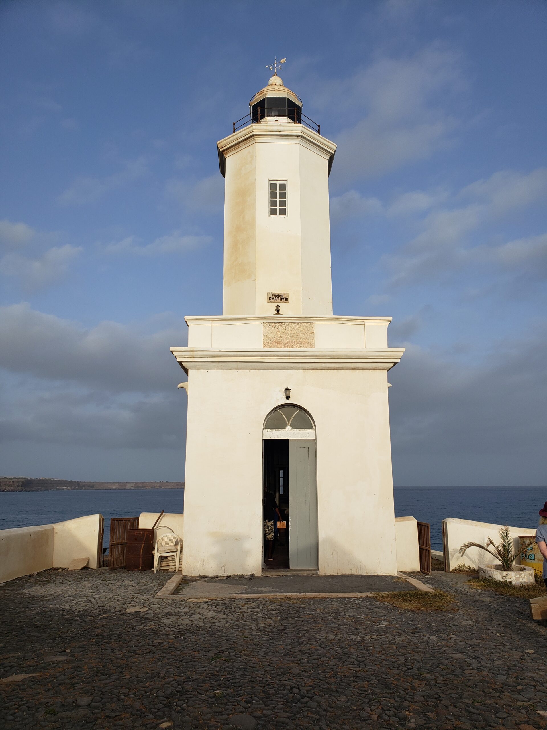
That elegant 19th century lighthouse at the edge of Praia where Jorge gave us his tour. The spiraling staircase has kept its wooden steps, though the (“don’t touch, don’t touch”) electrochemical lamp is modern.
Serving shipping activity and transport has remained a source of wealth on Cape Verde since the 16th century, though the rocky shores often proved treacherous to vessels. Even today with modern equipment, this night light is still a comfort to captains.
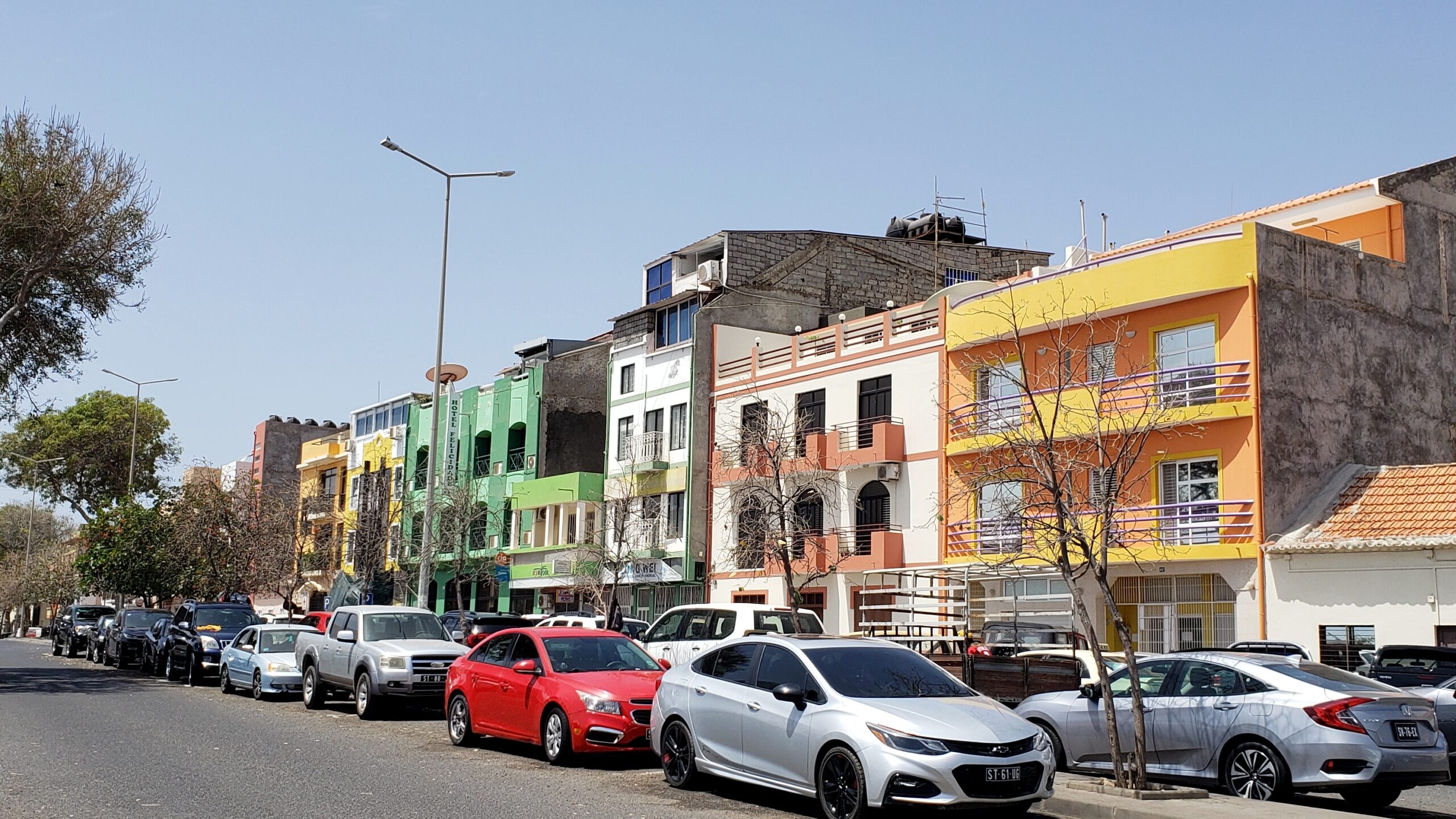
A colorful commercial street in the heart of the Plato (Plateau), the rocky plateau where the central city sits.
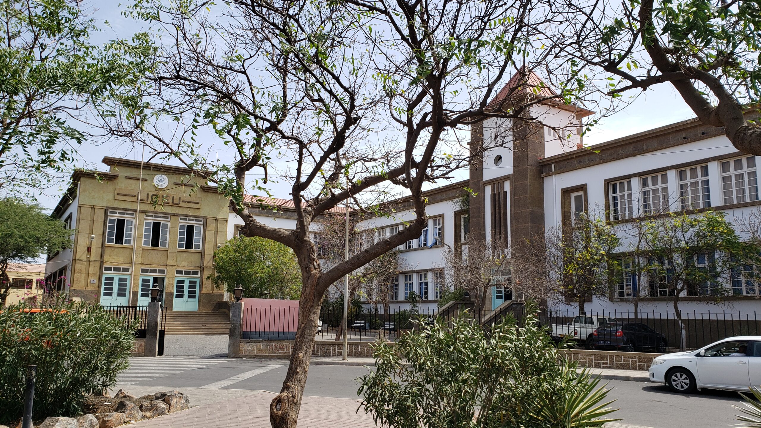
This graceful set of high school buildings clearly dates from Portugal’s colonial days here, but after independence CV governments have kept it in sparkling condition for educating students.
A quiet residential street on the Plato of central Praia shows off charming homes and gardens.
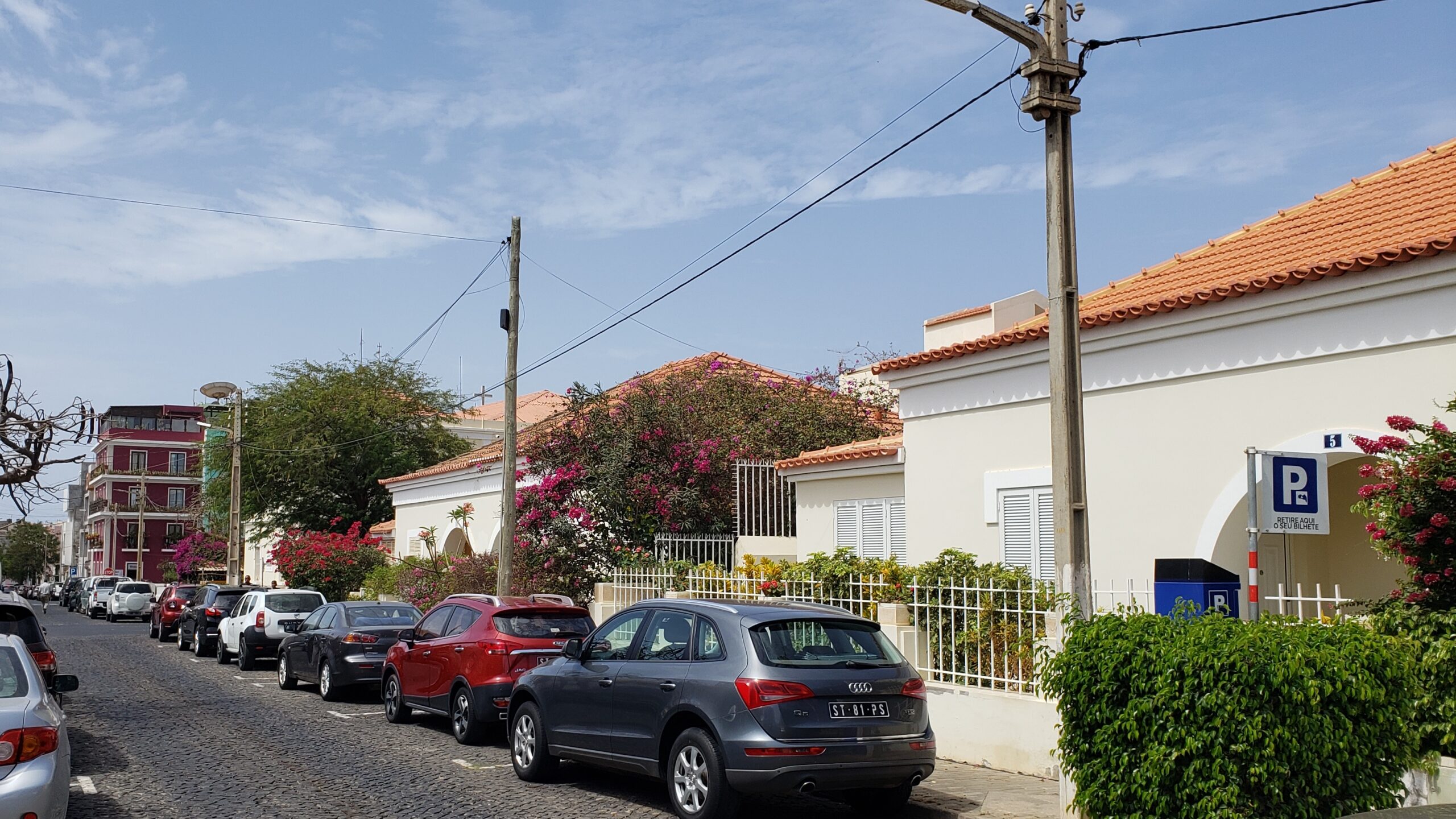
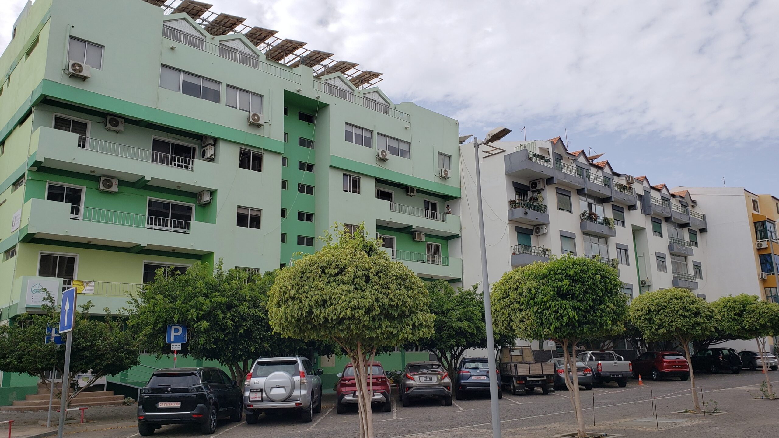
On a nearby bluff, we found an appealing middle-class section of Praia filled with restaurants, mini-markets, a Hot Bread bakery chain, banks and other services – as well as charming new apartment buildings like these.
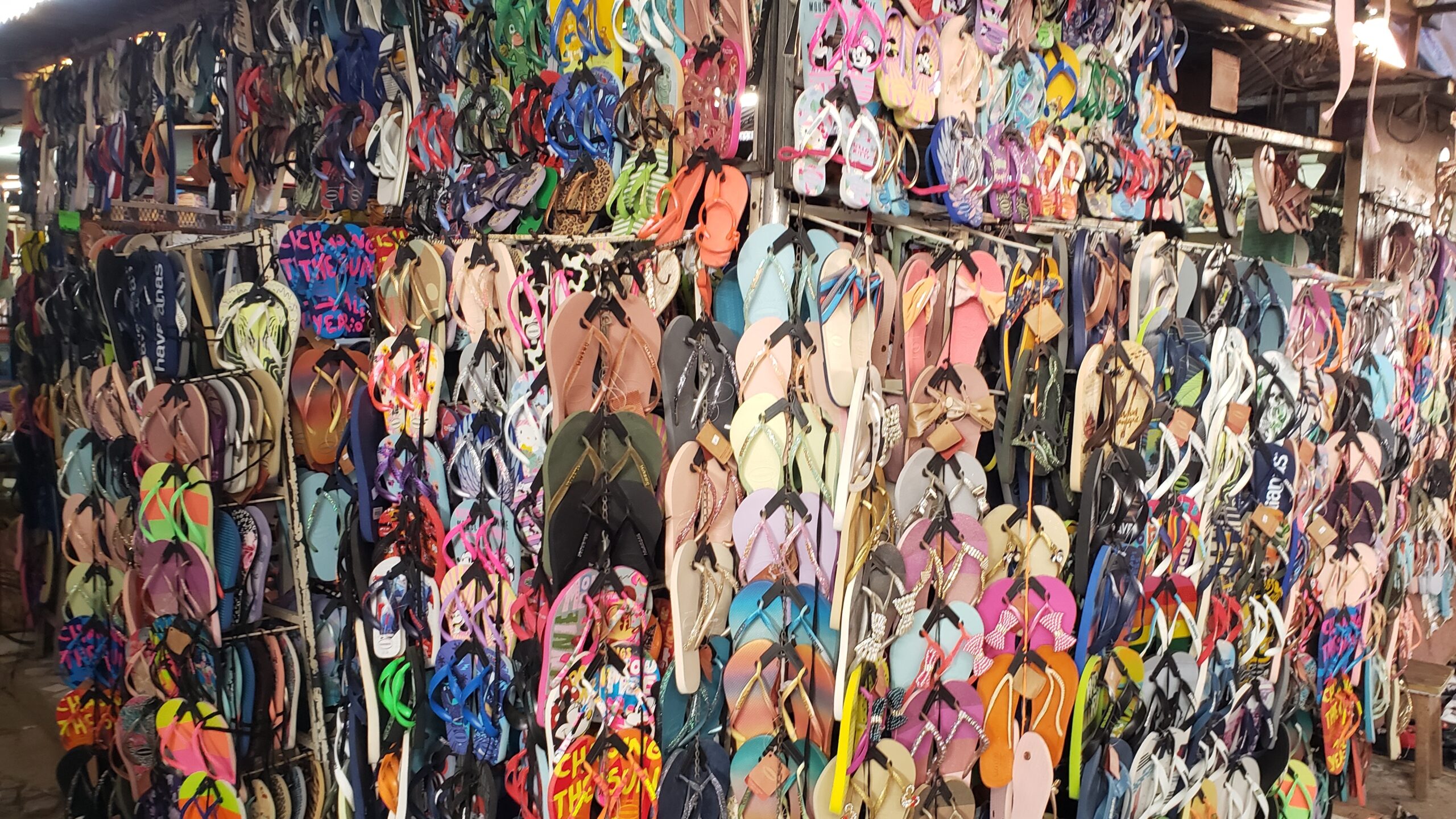
Sucupira is a large open air market to the west of central Praia, whose rocky plateau looms over it. Here we found a medina-style tangle of lanes and shops for residents. We were dazzled by the tropical colors on display from stall to stall, as with this sandal shop. But the quality and pricing of goods demonstrated the relative prosperity here.
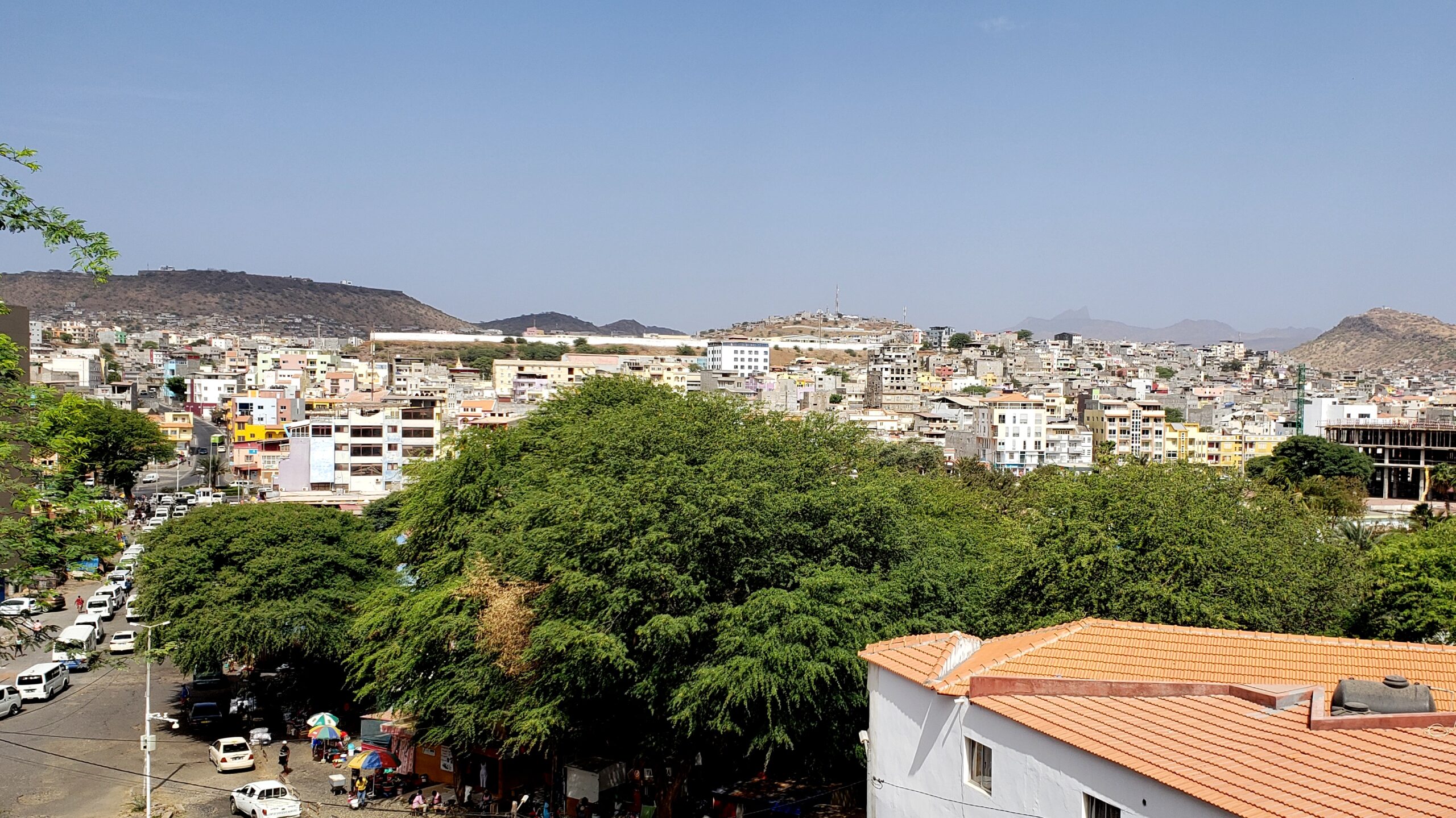
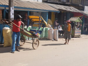
View down from Praia’s plateau over a canopy of trees alongside the Sucupiru goods market. All those white vans on the streets comprise part of the extensive mini-bus transport system serving small communities on Santiago. Praia has sprawled across neighboring hills to accommodate immigrants and villagers moving to the capital.
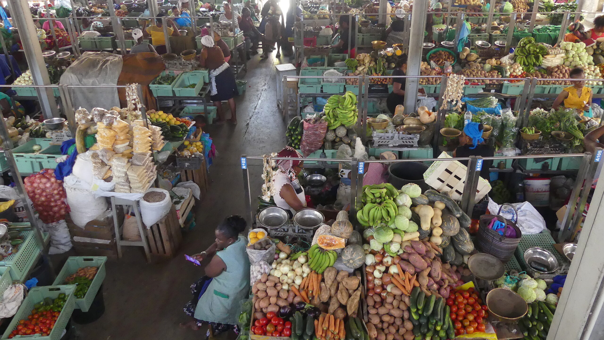
The main food market in Praia occupies a 100 year old open-air structure off a pedestrian mall along the spine of the city center. The tightly packed stalls laden with fruits and vegetables are an age-old style of shopping, as is this cranial method of carrying heavy loads.
From the second level, we had a top-down look at the market during a quiet period of the day. The lull gave the woman below us a chance to check her phone for pricing information or Whatsapp messages. We enjoyed how CV vendors even make their produce stalls so colorful.
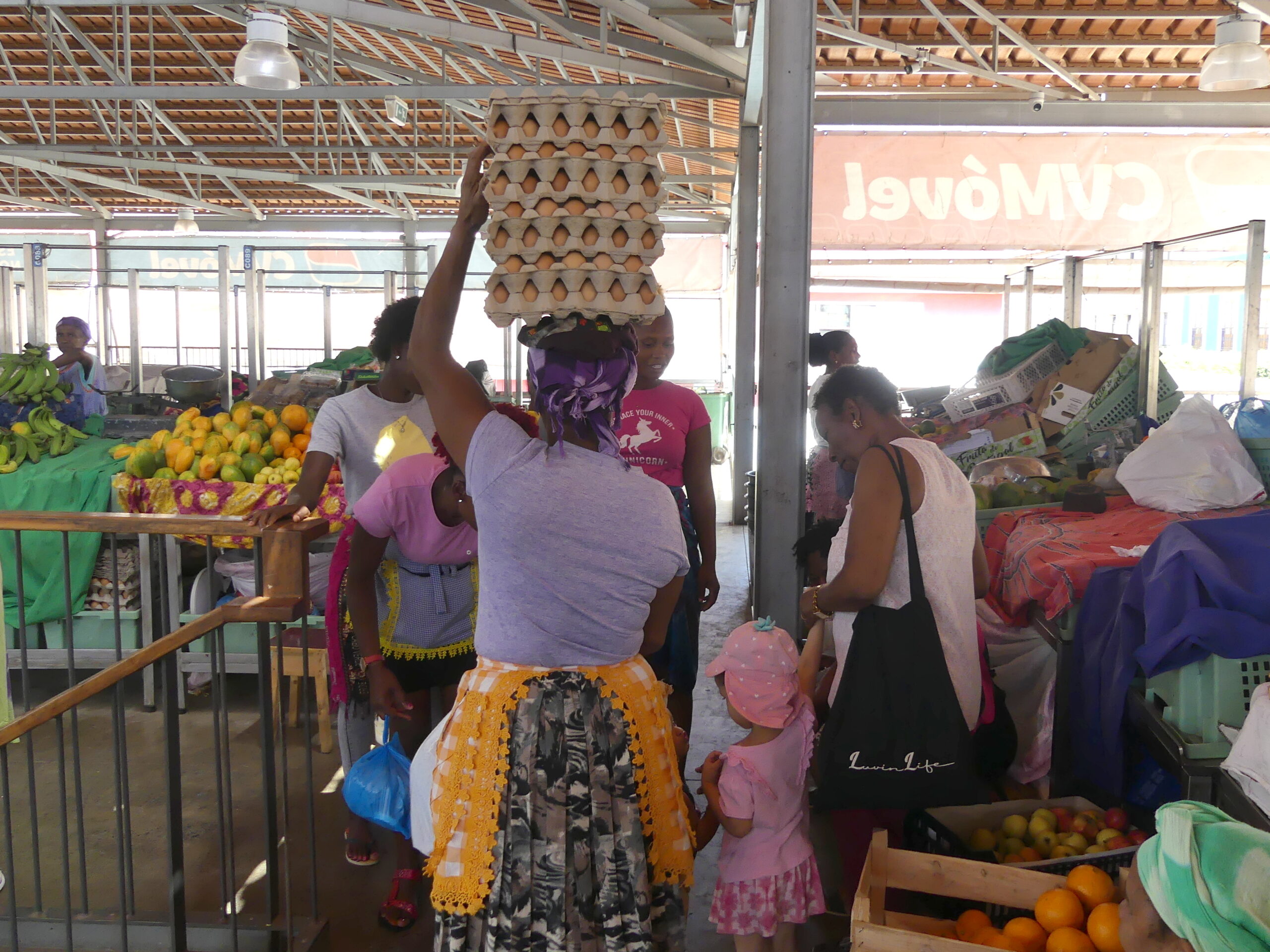
This woman had just climbed the steep staircase with her balanced load. We saw many women about town doing the same thing with products just as fragile as these eggs.
Cidade Velha (Old Town)
In the mid-15th century, Santiago was just an uninhabited island off the western African coast. The Portuguese then turned it into a major trading outpost – 50 years before Columbus went to the Americas. The colony was centered on Ribeira Grande, or the World Heritage site of Cidade Velha (“old town”), along the island’s southern coast.
There they could profit from transport around Africa, as well as with Europe and the emerging American lands. Sadly, they traded not just products, but people captured from the continent, enslaved and hauled across the seas.
In the late 1500s, Captain Francis Drake razed the town, but failed to capture the place for England, as the wily residents fled into the hills. In the early 1700s, French forces finished the job, overwhelming the cliff-top fort and destroying the other buildings, including a just-completed cathedral over a century in the making. The Portuguese moved eastward to the cliff-top town of Praia and held on to the island until 1974.
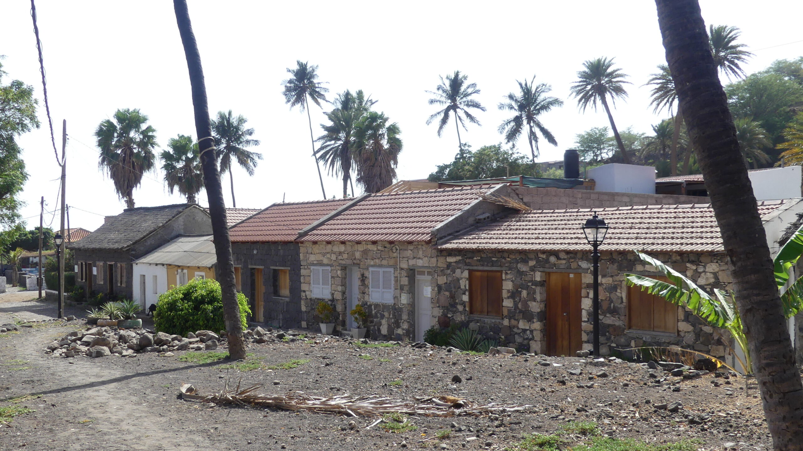
Banana Street was the main street of Ribeira Grande, or Cidade Velha, back to its origins. It features low-lying stone buildings like these and leads to several churches and an old convent. You could guess rightly that it was named for the banana trees lining it in the old days.
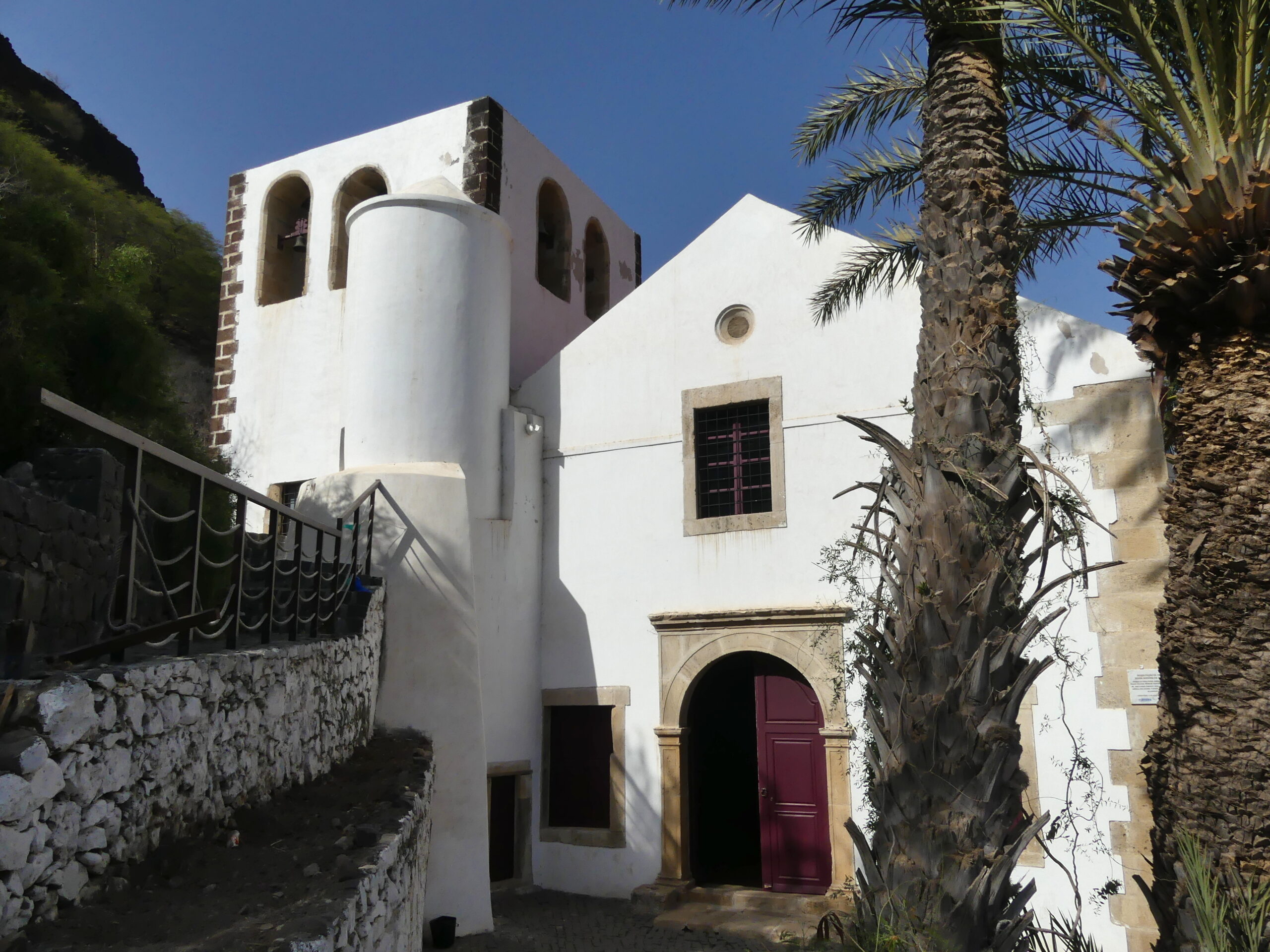
The restored Rosario Church (and original cathedral) from the 16th century is charming on the inside, though little of its older features remain, as well as impressive from the outside.
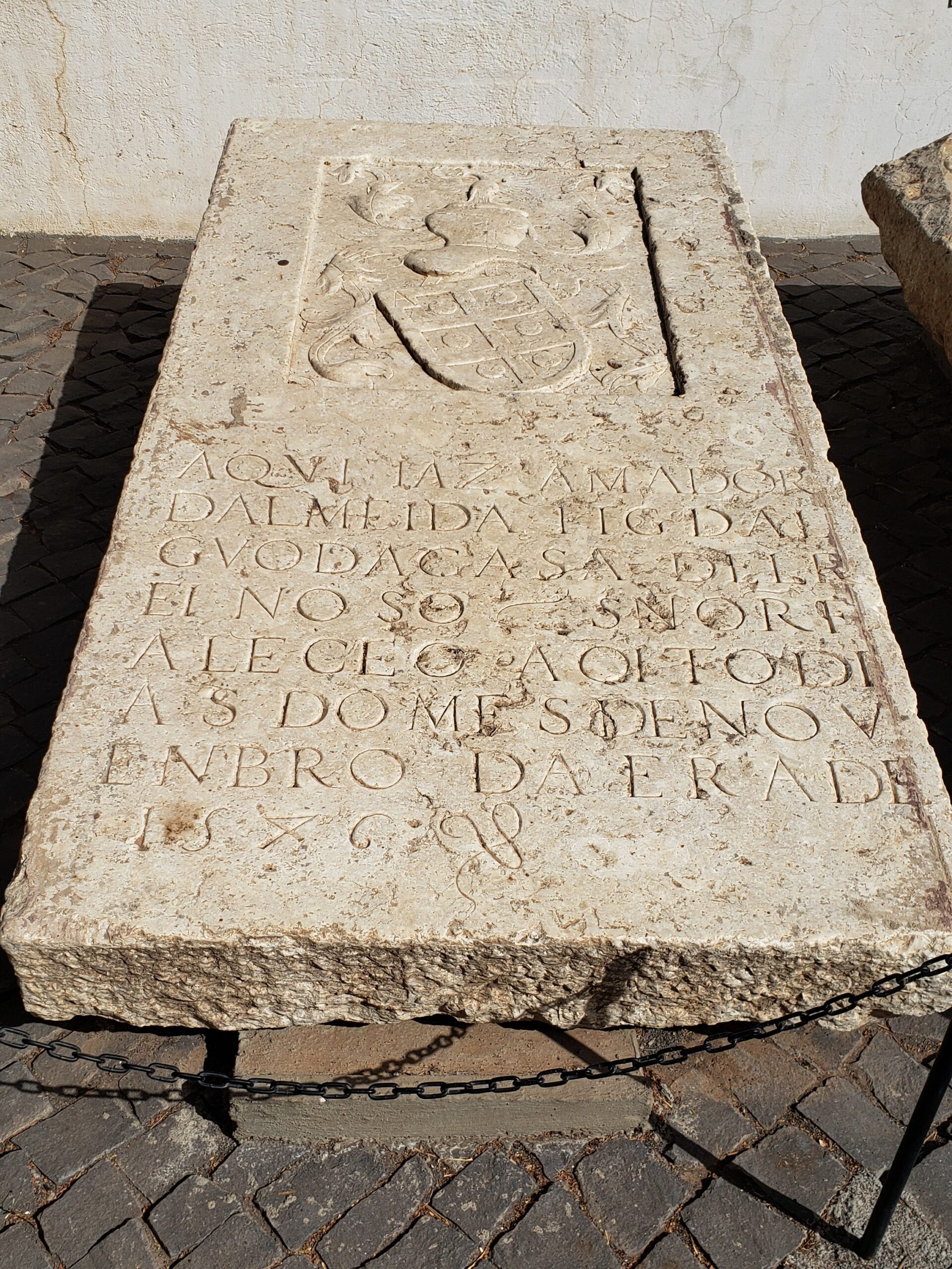
Various tombstones line the floor of the Rosario church and are also displayed along the verandah outside. This one, memorializing Senhor d’Almeida, was the oldest one we found. The year 1546 can be deciphered at the bottom of the inscription.
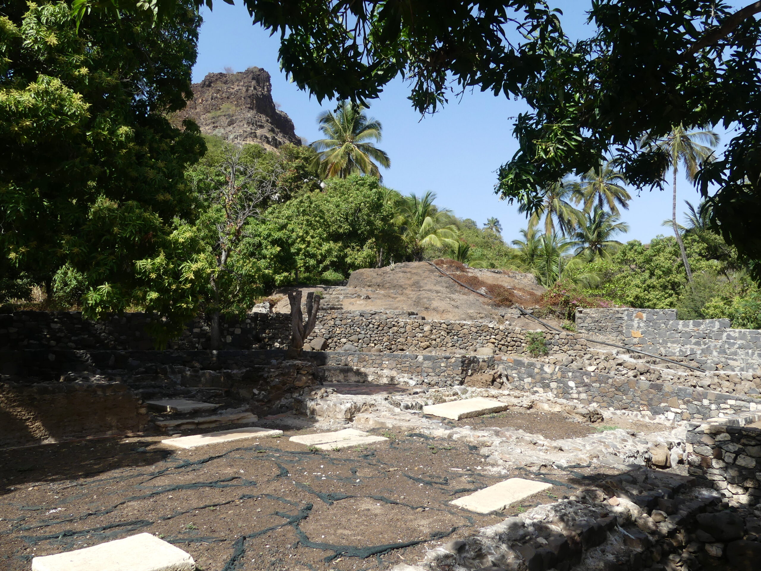
Finished in 1470, some 550 years ago, the Conceiçao church of Cidade Velha has survived only as a ruin far beneath the promontory on which the revived fortress stands. Higher in the same valley is the restored Rosario church from a century later (earlier photo) and even further up are the remains of a Portuguese convent.
São Felipe Fortress above Cidade Velha
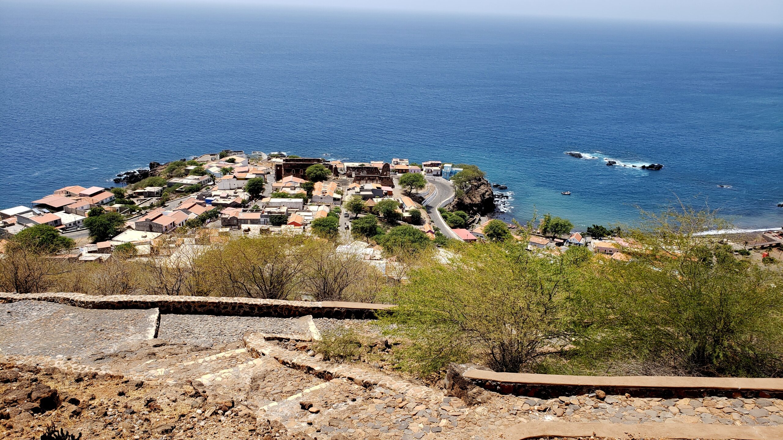
The view over Ribeira Grande from the cobblestone pathway to the fort of São Felipe. The original old town sat at sea level to the right of this newer plateau. The black ruin atop the plateau is what remains of the sizable 17th century cathedral destroyed by the French. Though much visited by tourists from the capital, the town remains a fishing village.
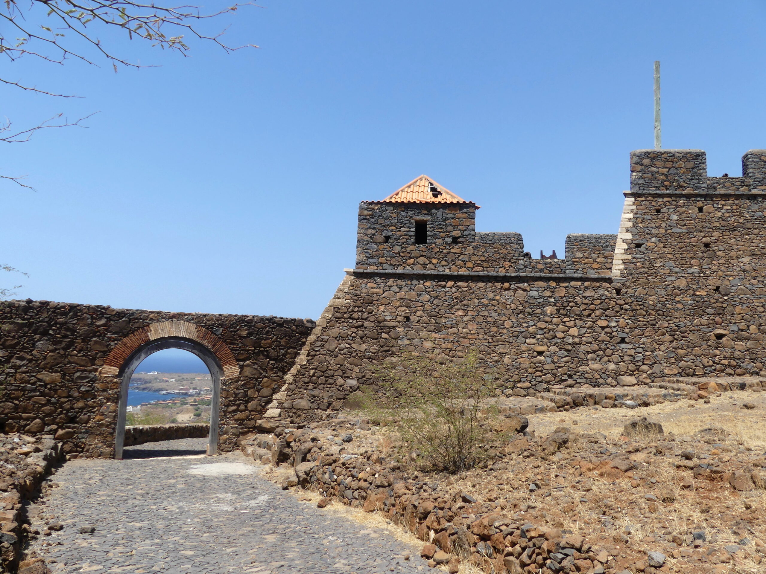
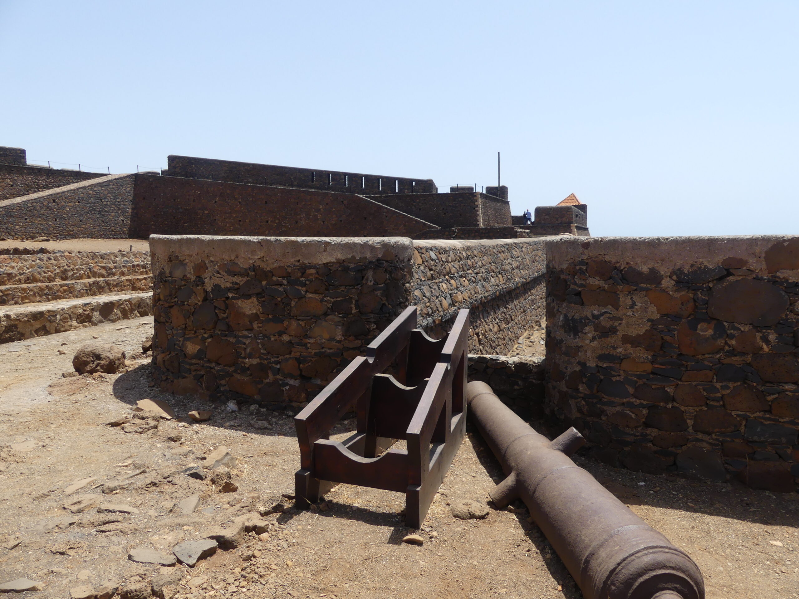
This is the main entrance gate through the stonework walls of the fortress of São Felipe, lovingly restored by Spanish archeological teams. This gate is beloved by the residents of Santiago Island as their access to the structure, and attracts wedding parties even today.
The top of the old fort looks peaceful now after the superb restoration by Spanish experts, but was horrific when the French forces overwhelmed it. The restorers brought a few cannons along to show off the use of the parapets. We wondered if they would return and heft this hardware into place.
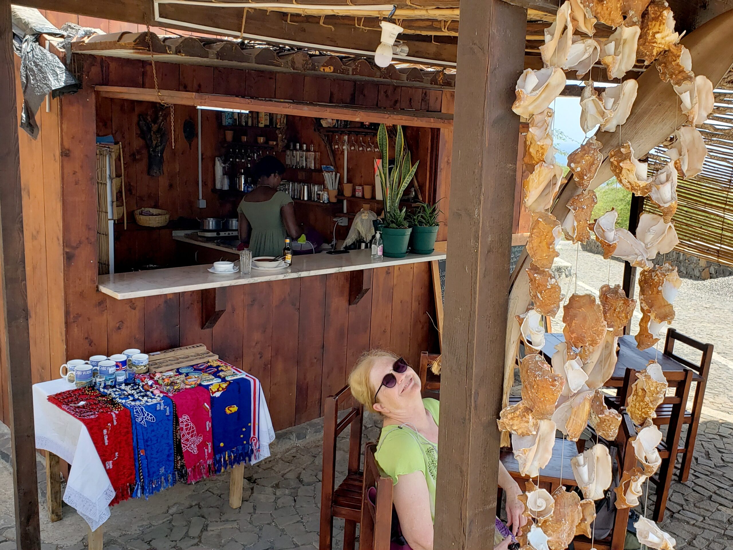
After climbing up to the fort and wandering around it in the hot sun, we descended to this little way-station, a great spot to rest and cool off. The welcoming host made Barry a delicious buzio (fish stew), to go with his cold beer.
We wondered how the owner could make any money, as a broad parking lot for the fort, accessed by a different road, now lets most visitors bypass the stall.
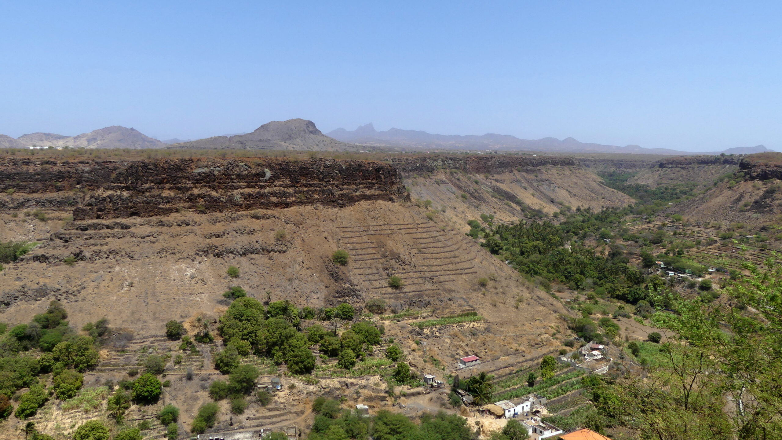
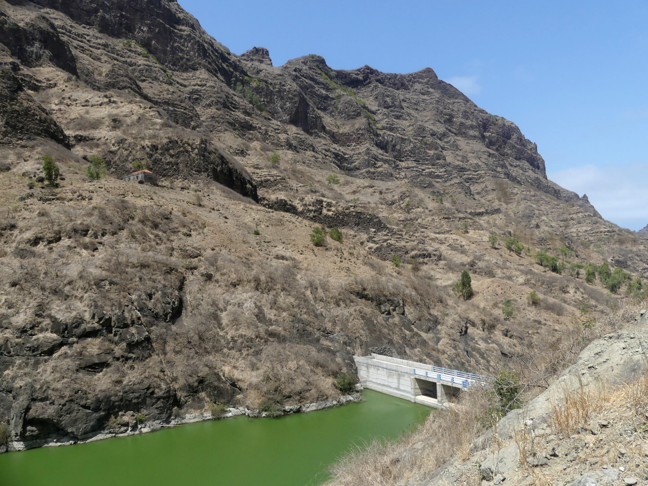
From the fort, you can view the whole of this canyon, which carries water down to the old city and provides for extensive agriculture as well – bananas, cane, cabbages, and fruits like papaya or mango. You cannot see the water because it moves underground for most of the year. We found several dams along similar ribeiras around the island, retaining excess water and controlling the flow to the farms. In the background, rise the mountains of the island’s central spine.
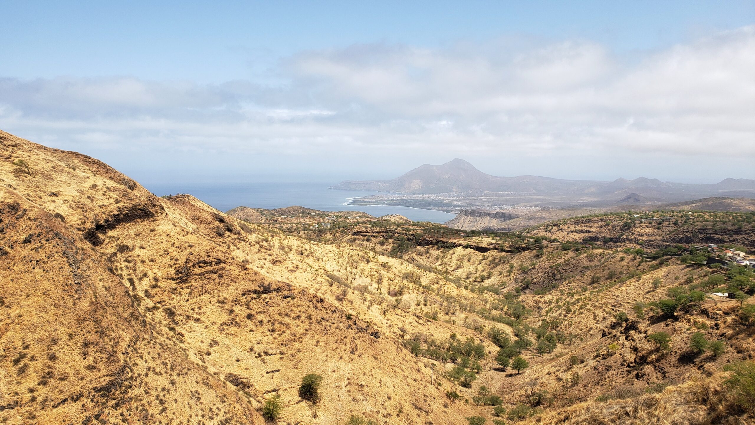
The Island Landscape
The Cape Verde islands offer a magnificent landscape – really two landscapes. At sea level are the long coastlines, with their black or white sand beaches, churning or gentle bays, and lava-rock formations.
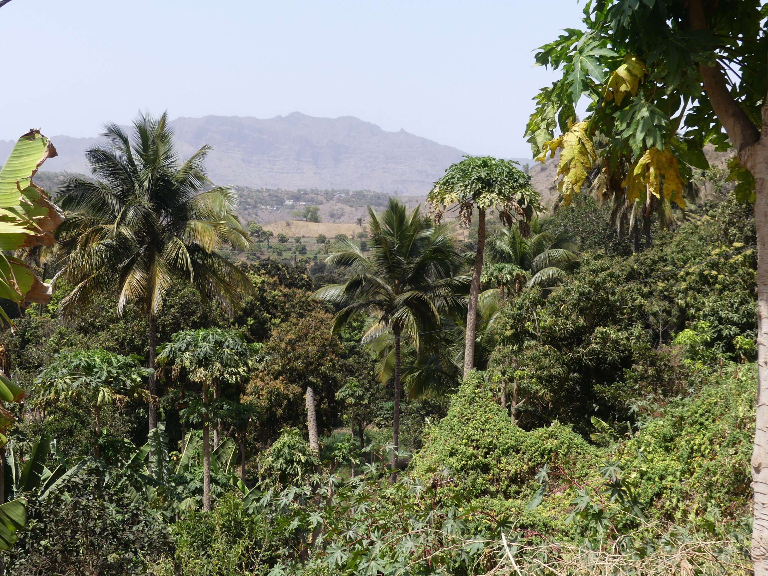
At their heights, islands like Santiago offer an equally enticing experience. The old volcanic peaks push their often unusual shapes into the sky. There, despite the arid climate, the mountains capture moisture risen from the seas and channel it through the surprisingly fertile valleys beneath.
Coast
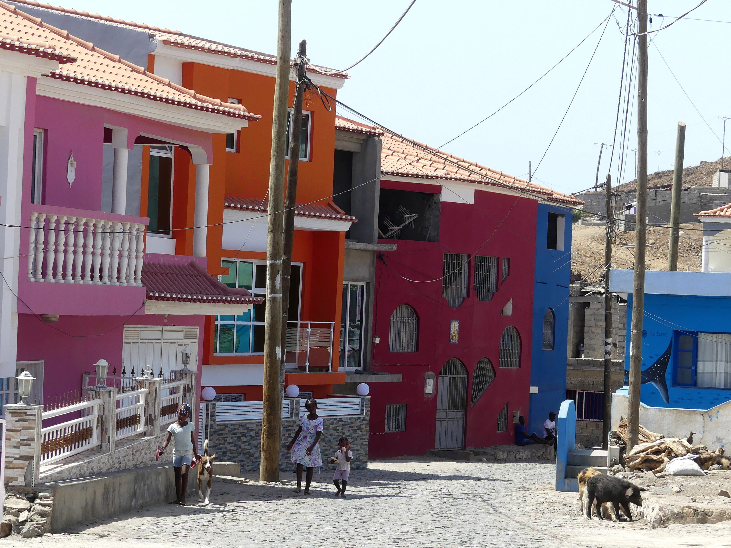
Fishing villages still dot the coasts of Santiago Island, nestled between the foamy water hitting the shore’s volcanic rocks and the ubiquitous cliffs and savannah. We were delighted to encounter this small village of Porto Mosquito with its colorful residences. We thought the smiling little girls in white frocks underscored the well-being of the place, while the wandering pigs showed this was still a local village.
Huge murals of sea-life by the artist Lantuna decorated most walls in the rest of town. When we stopped at its fishing port, villagers at the beach greeted us repeatedly. Another pig body-surfed onto the black sand. And a friendly young man pointed out the famous bird rookeries nearby.
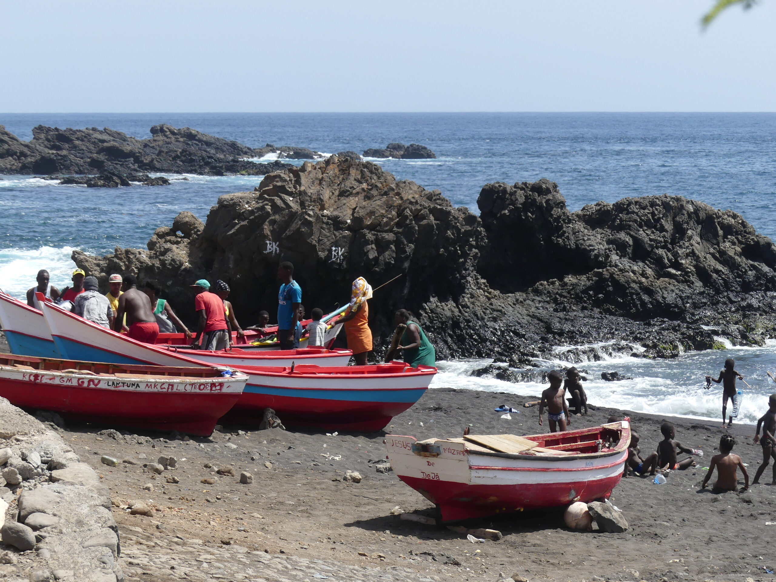
Seemingly ancient are the practices of the fishermen, who still launch their wood boats from beaches like this onto the encircling Atlantic. Here numerous fishermen have hauled their large boat up on shore while young boys look on. Another boat beside it is labelled Jesus de Nazaré. These kids not only played in the tumbling surf with little supervision, but also traipsed barefoot along the volcanic rocks.
The old lava has turned into black sand here, an attraction not just for locals, but for the many tourists visiting the islands. Some slightly older children took a lengthy swim offshore to a bobbing boat so they could play fishermen or pirates or some other adventure.
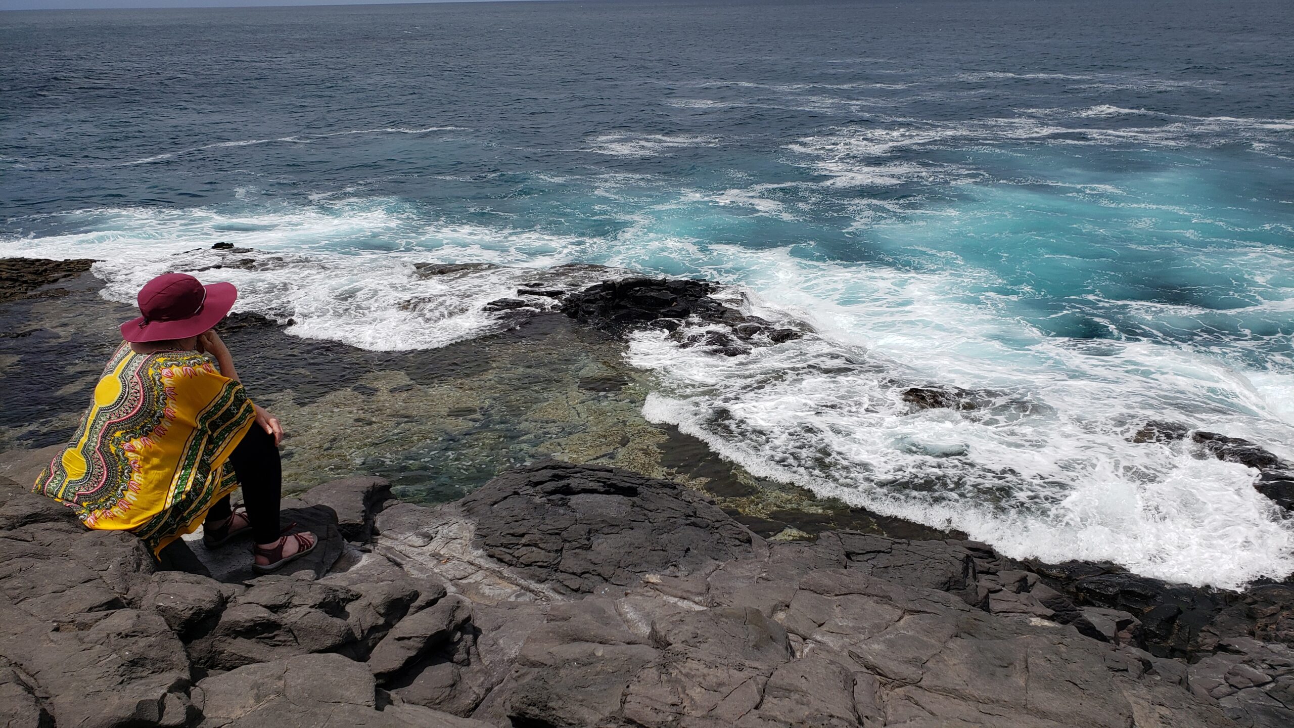
A moment of meditation on the seaside lava rocks at a locals’ spot for swimming in a natural basin. The wave action was a bit too strong for a swim this day.
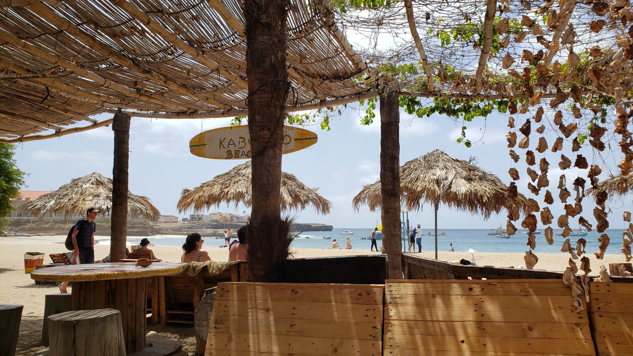
Tarrafal offers one of the best wide beaches on the island, with one section covered with fishing boats and another with bathers. And we couldn’t forego the beach bar with cheap caiparinhas made from the local sugar cane alcohol, grogue.
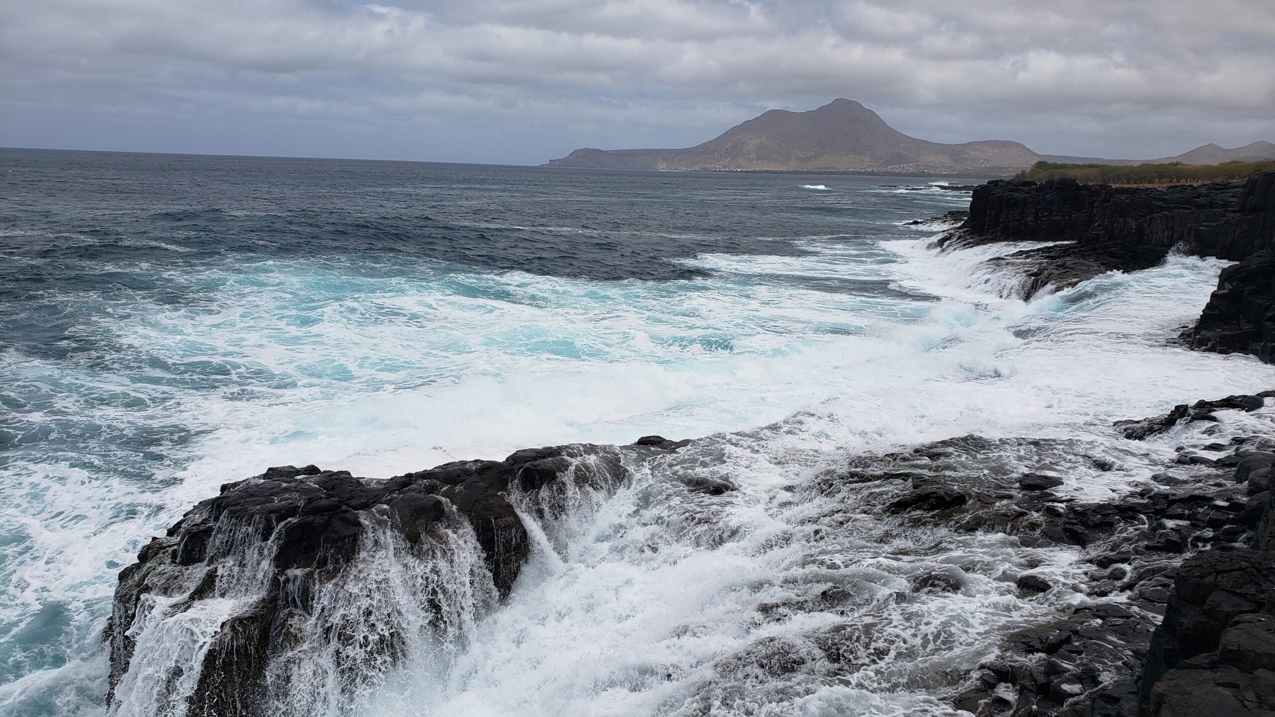
Whipped frothy by winds, the churning sea crashes around these rocks near the Cuba basin of Tarrafal, whose headland floats over its distant bay.
Here we stopped at the descent into the bay of Tarrafal, where we enjoyed the beach and lava pools. That arid set of hills gives no sense of the nearby valleys where water runs underground for agriculture.
Heights
Most days in the spring the moisture from the sea keeps the distant peaks hazy on Santiago Island. These gleamed in the sunlight one day.
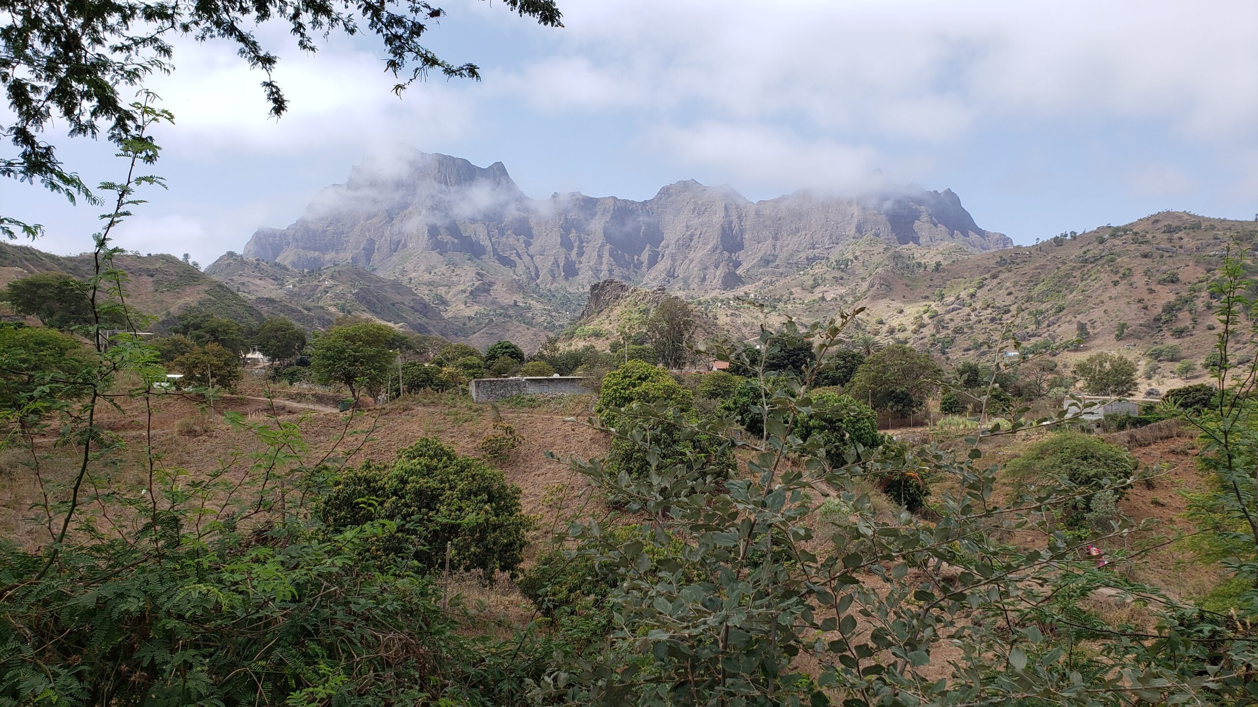
The Serra Malagueta, famous for its hikes and charming peaks.
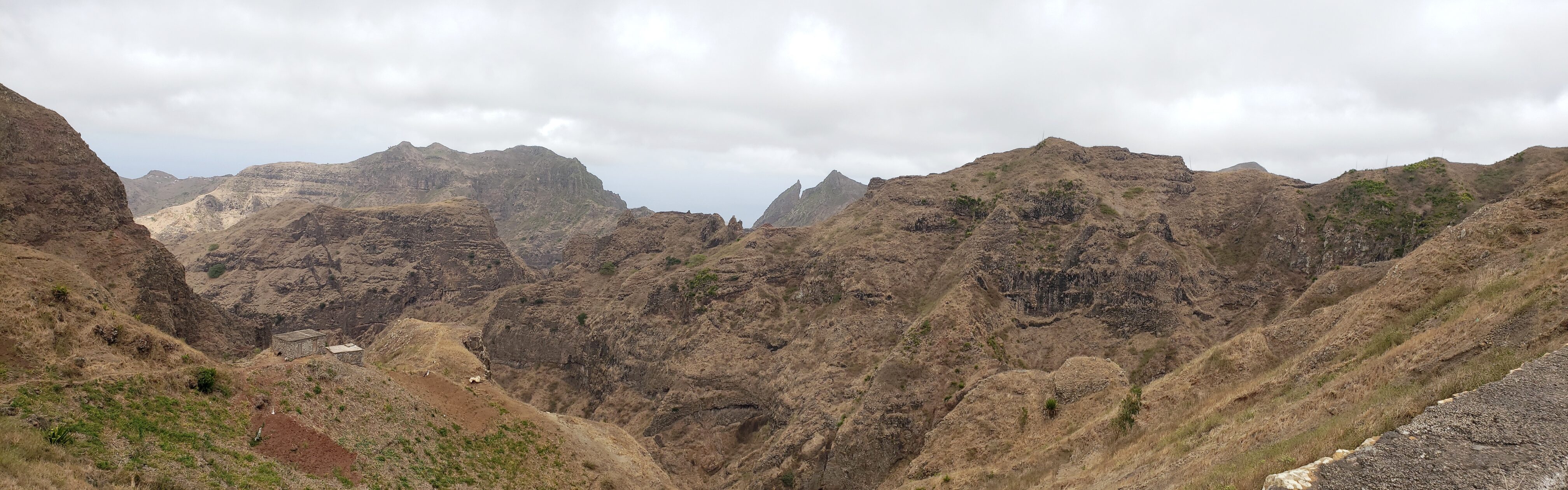
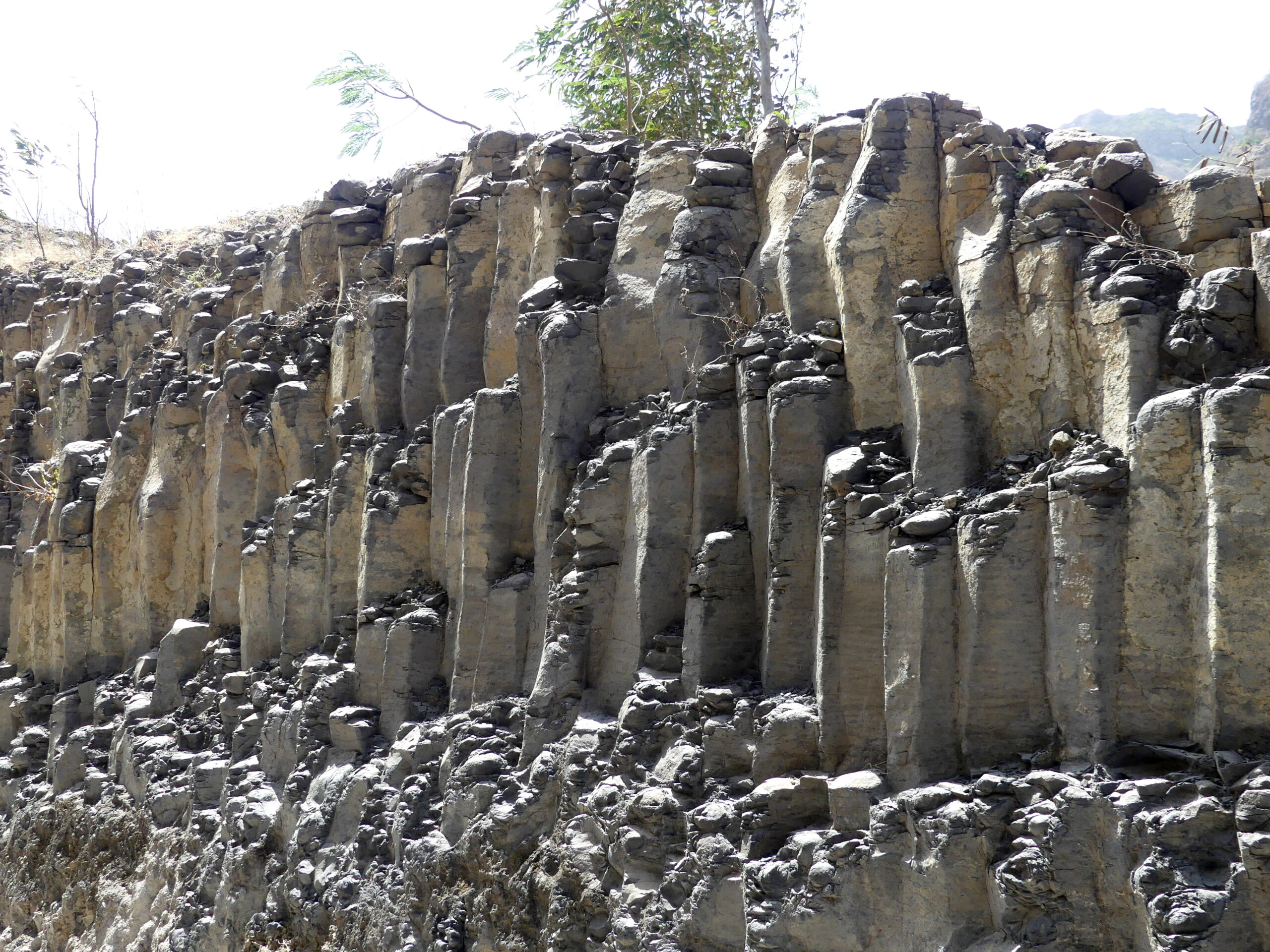
In other places, like Iceland and Ethiopia, we discovered how hot lava somehow hardens into hexagonal “organ pipes.” On Santiago, these are mostly hidden, but a road up to the tallest part of the Serra Malagueta exposed this fascinating feature.
A lower section of crenellated hills and valleys on Santiago.
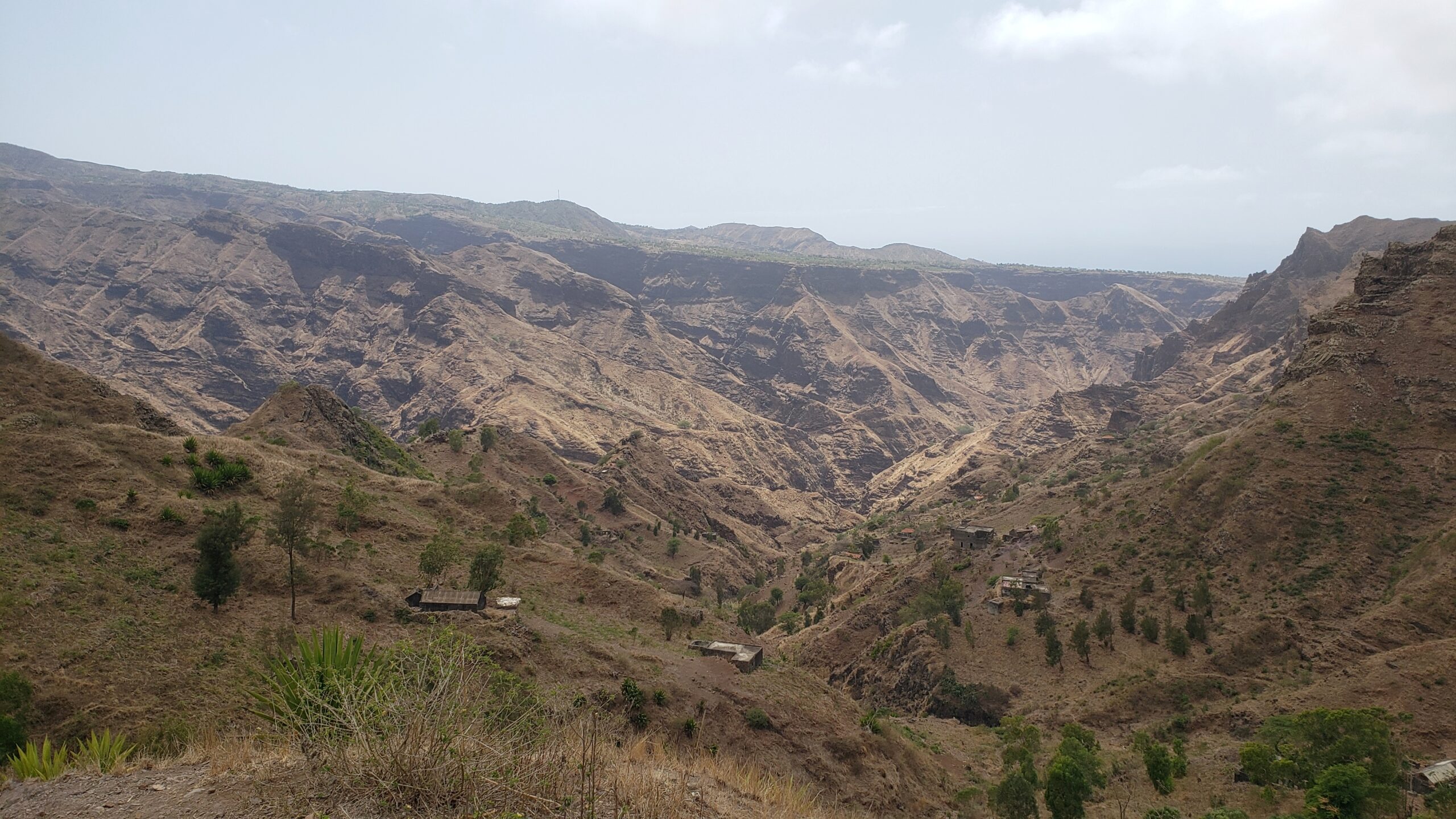
At around 1400 meters (4600 feet) above sea level, Santo António is Santiago Island’s highest peak. Below it is a typical farm along the middle of the island.
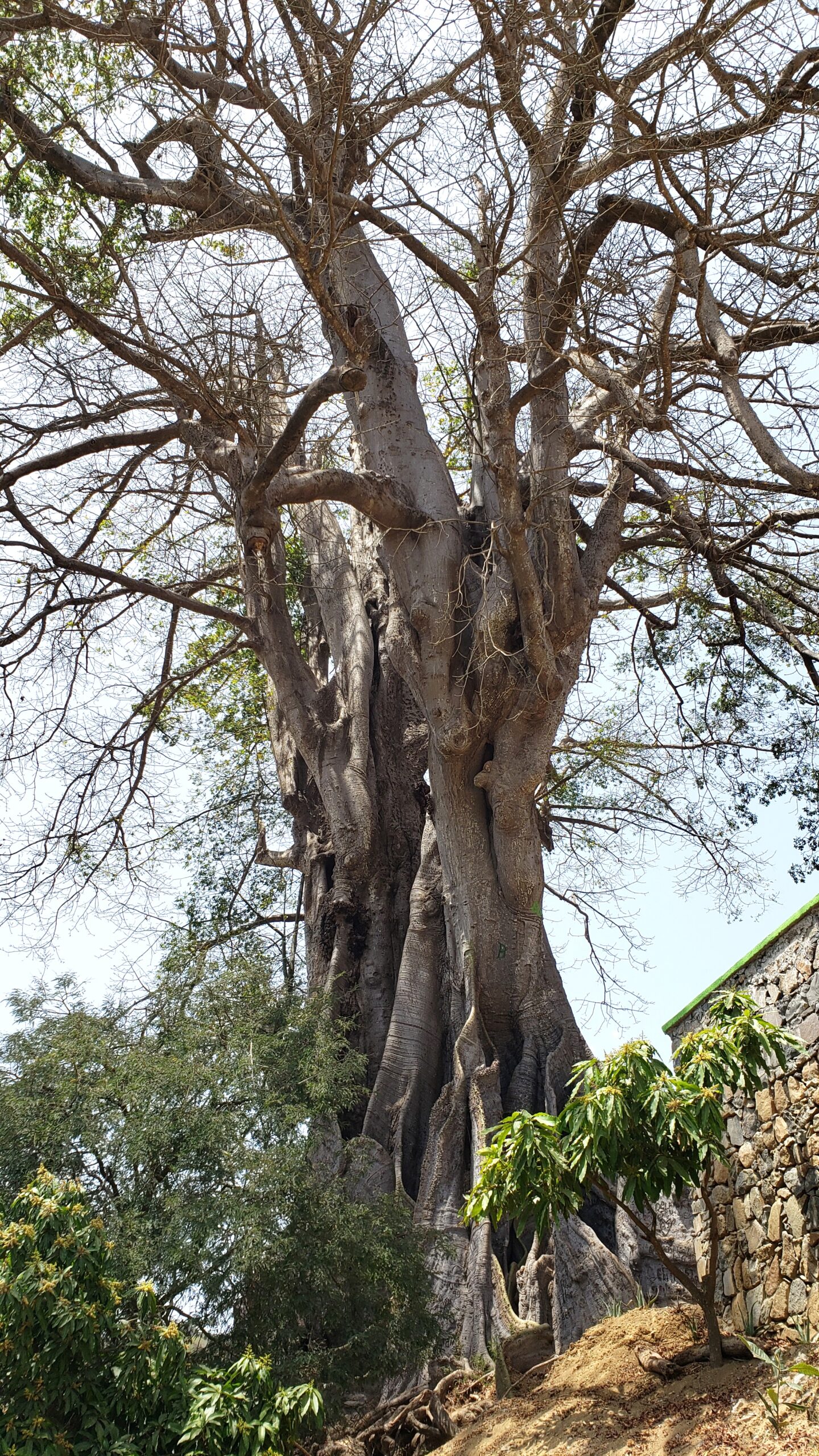
One of the most famous sights on Santiago Island is the massive “baobab” tree, though it’s really a kaopak. The top is about 25 meters (80 feet) high, with a buttressed trunk about 30 meters (100 feet) around. The two hour hike to the tree passes through one of those fertile valleys beneath the arid hills.
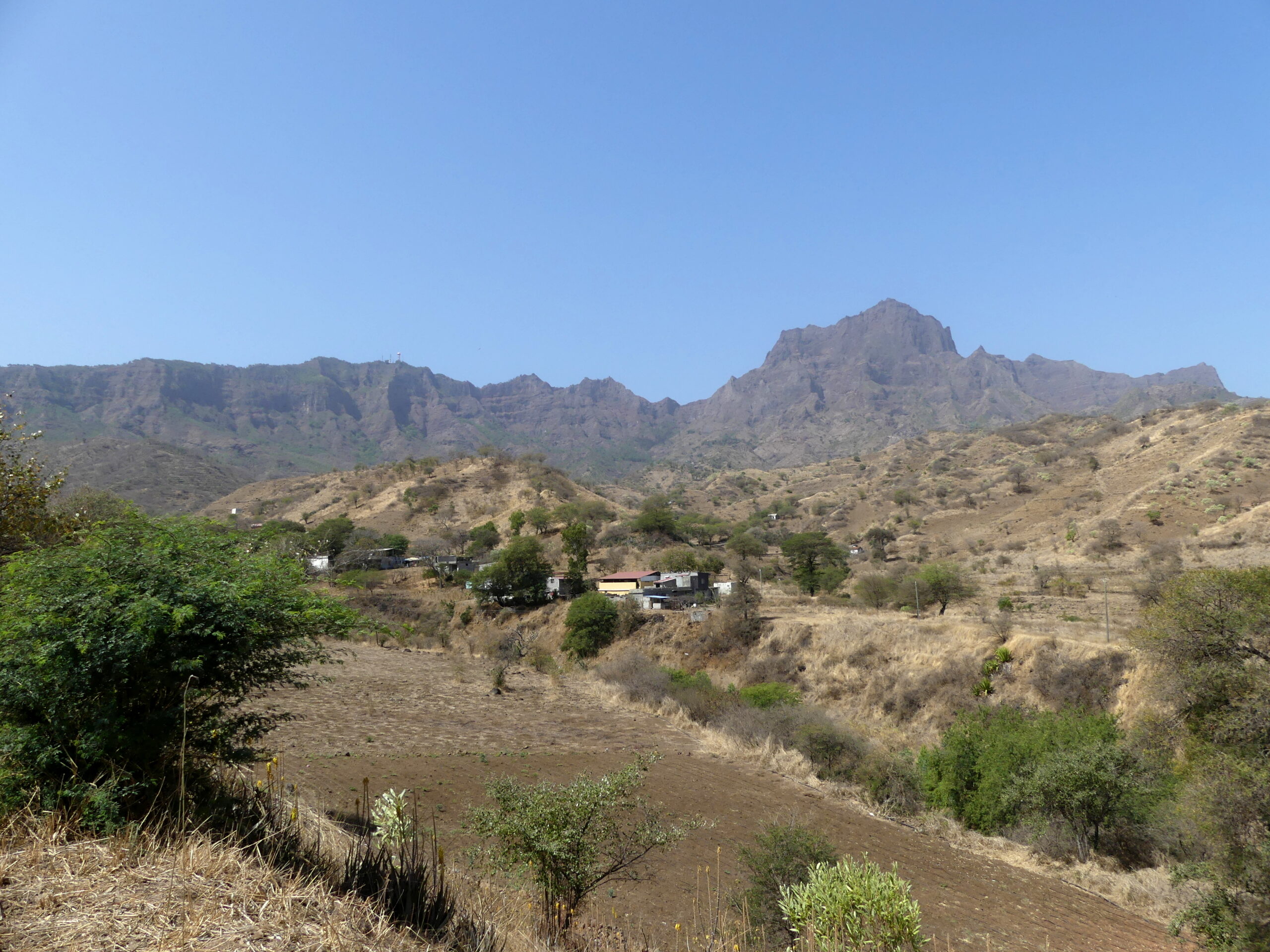
This is the very fertile valley we walked for the Baobab hike – with its farming of cane, bananas, fruit trees, cabbage and carrot patches, and more. It showed us how much water can be captured despite the dry climate.
In the best valleys for water run-off, small dams like this control distribution to the farms below.
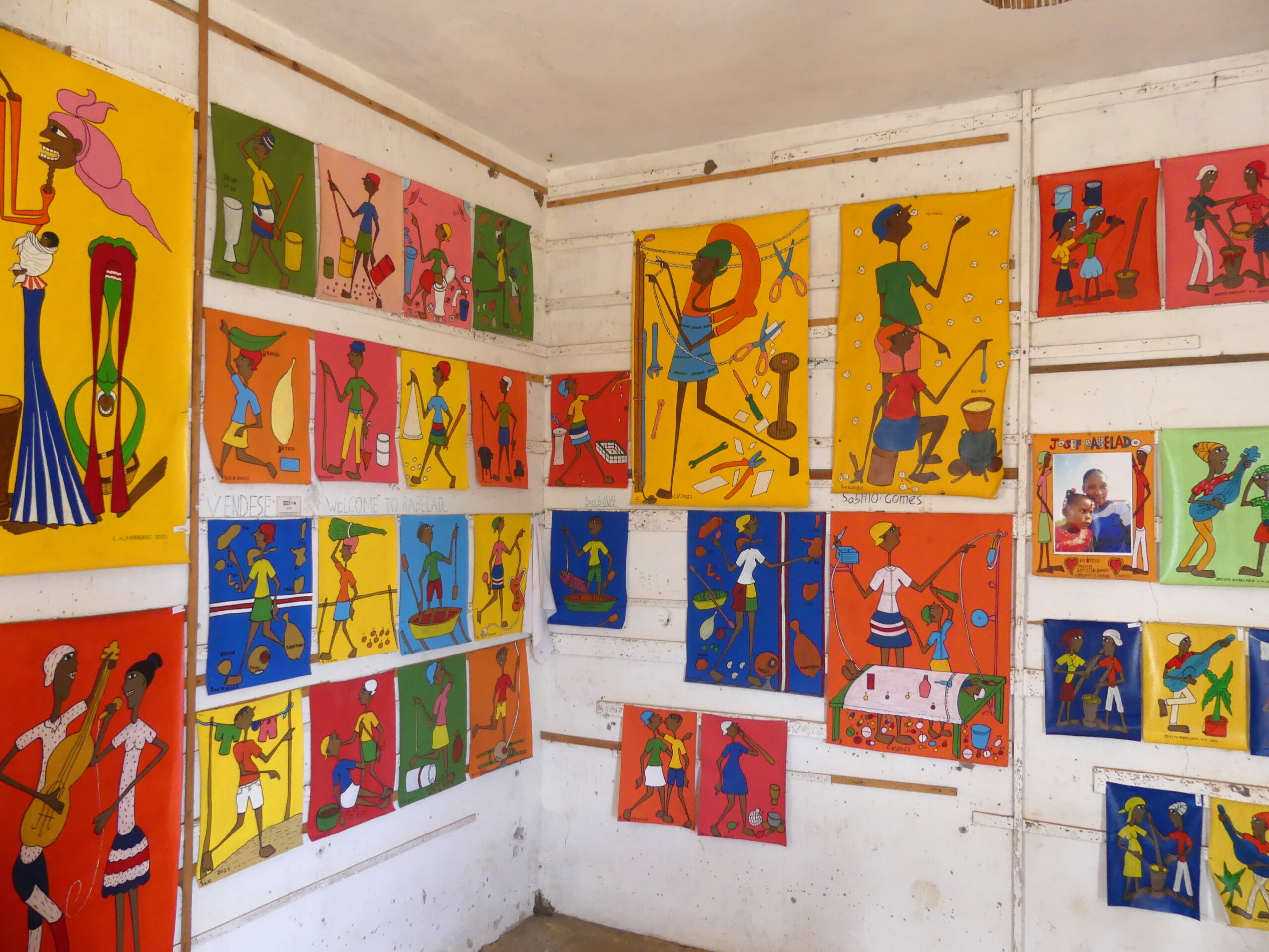
In the mountains, we also visited a small community with two distinctions. One is that they are dedicated to making art like these colorful prints; the other is that they abjure modern distractions like TV. Their houses were made of lava rock or thatched roof and cane plants, with few interior walls.
(To enlarge any picture above, click on it. Also, for more pictures from Cape Verde, CLICK HERE to view the slideshow at the end of the itinerary page.)