It takes some effort to see the most notable of the active volcanoes in the Philippines. Although the islands of the country are all volcanic in origin, only about twenty of these are considered active or remain any kind of threat to erupt again. We visited three of the best known ones, Taal and Pinatubo on the island of Luzon near Manila, and Kanlaon on the island of Negros.
Why take on a volcano? Primarily because we do like to hike, and have thoroughly enjoyed prior scrambles on the rims of Italian, New Zealand, Hawaiian and Costa Rican volcanoes, as well as trekking up the volcanic puys of central France. Sometimes it’s the view across the countryside; sometimes it’s the many colors of the crater lake; sometimes it’s the fissures and steaming that stirs the blood. It’s not because we feel that these mountains are particularly risky. Each of the active Philippine volcanoes is monitored carefully for seismic activity, an issue of much more concern to the villagers living literally under the volcanoes than to us.
Here, moreover, it turned out the visits and climbs were all quite different, though each proved somewhat wild and quite a bit wet in their own ways.
Taal (Luzon)
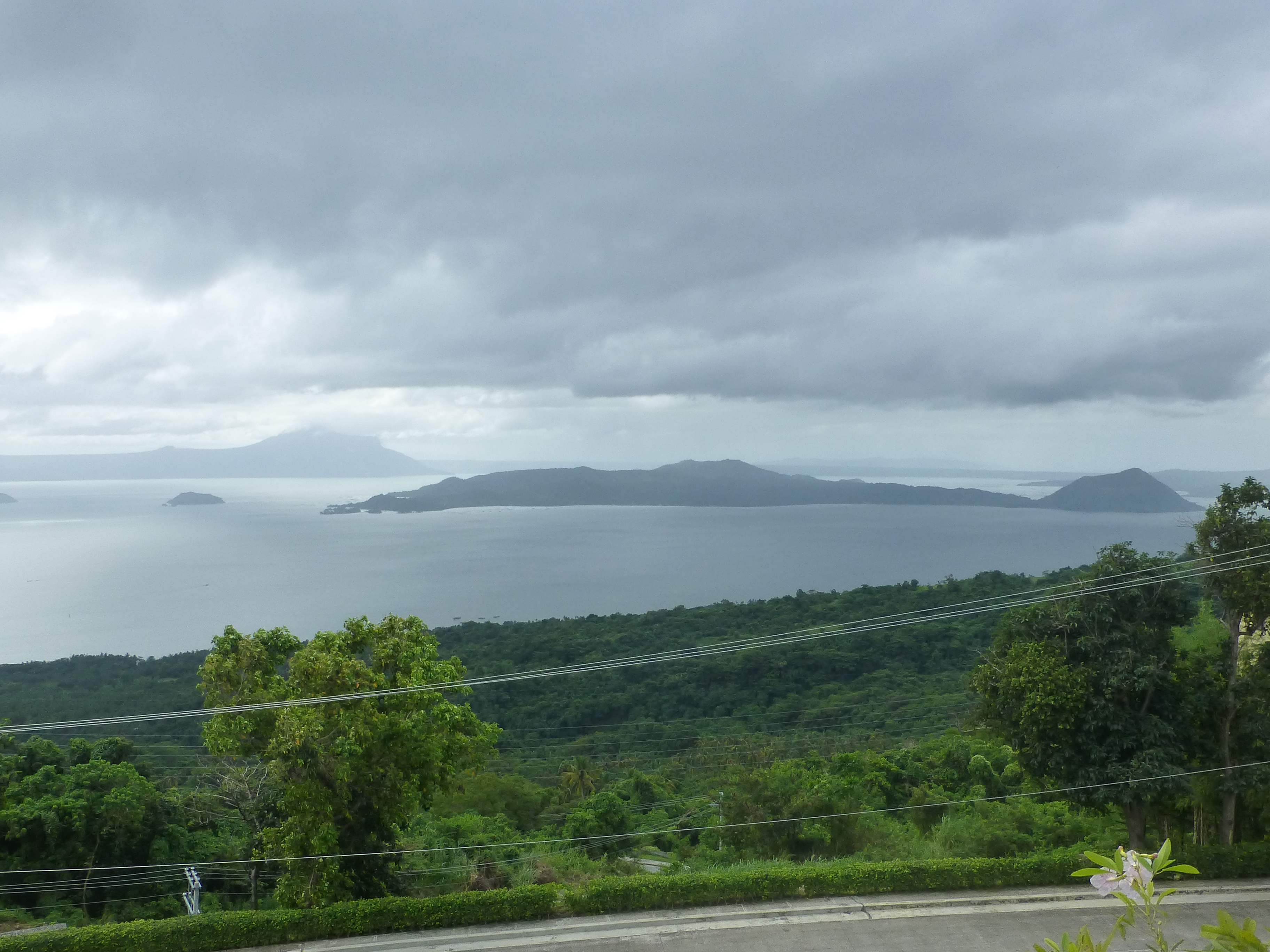
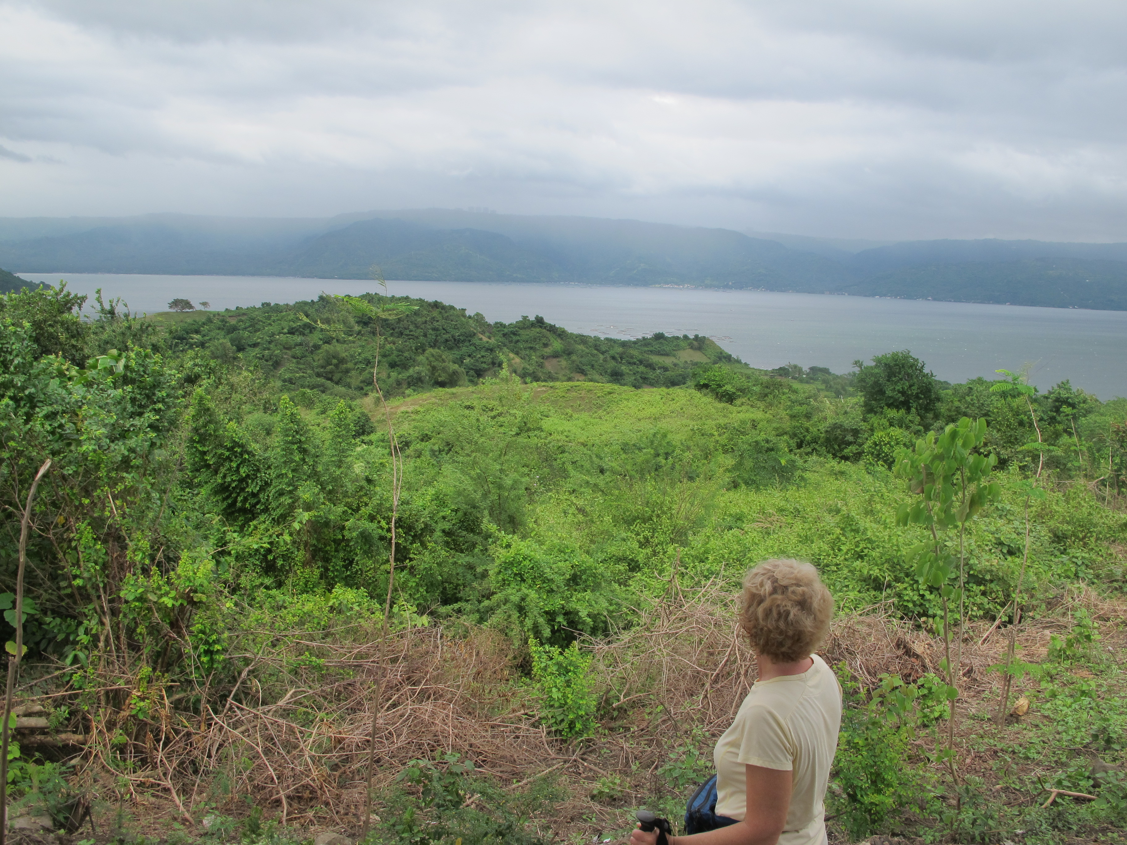
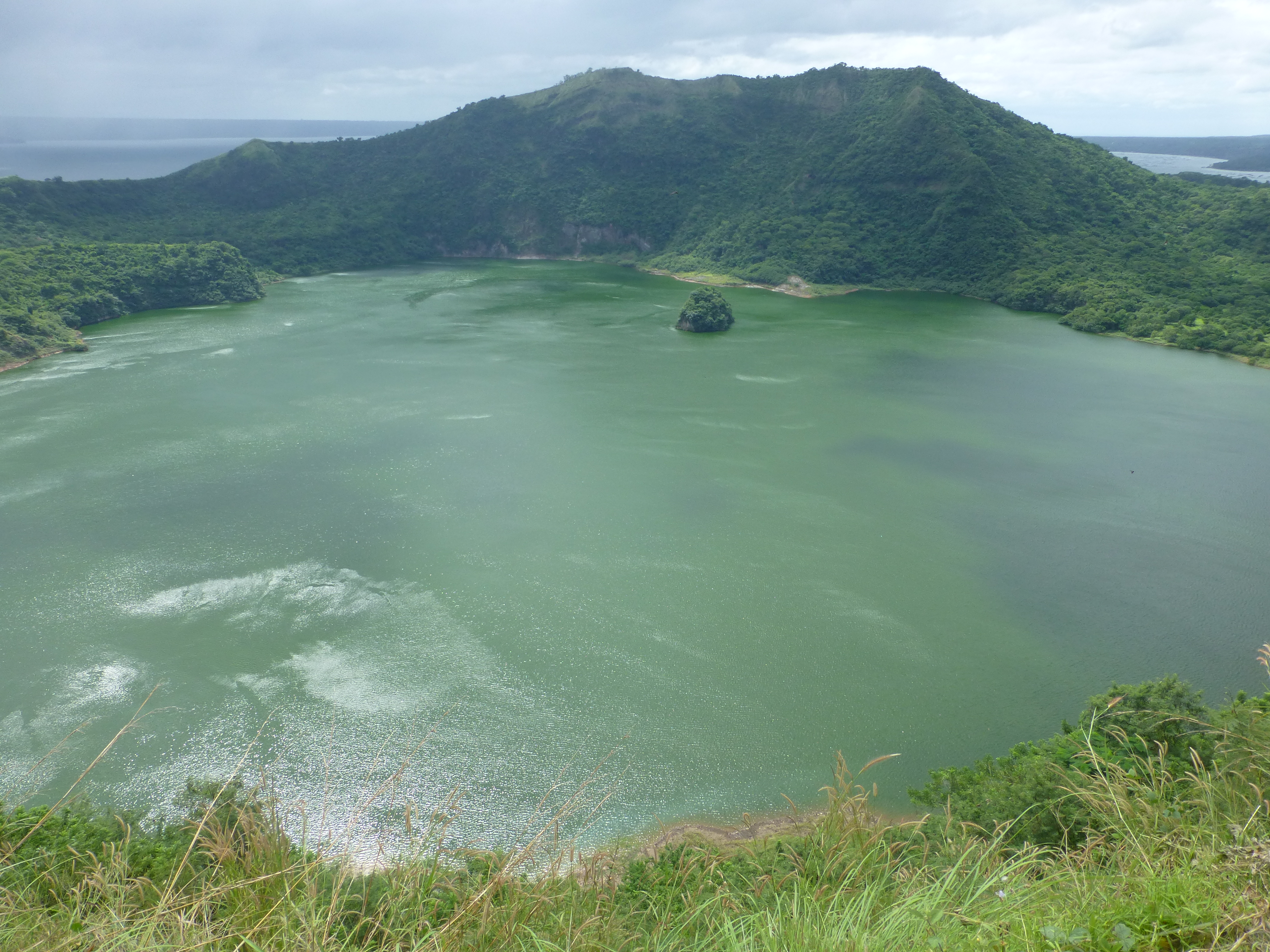
You see Taal first from the main road winding through the nearby hillsides after about an hour’s battle with Manila traffic. After ascending to a ridge, like most people, we stopped for the grand viewpoint. The ridge on which we stood was actually an earlier crater edge formed during the last major eruption in the 18th century. Below us was a huge lake, the water-filled crater from that time. Out in the water, we could see a small, elongated island. That island is now the core, active volcano, which last erupted in a limited way back in 1977. Barely noticeable, tucked along the island’s closest shore, is a small village whose residents escort visitors up to the main crater.
Descending from the viewpoint to the lake is a lot like coming to a busy resort. Boat operators and other vendors crowd the roadway, hoping to ferry you across the lake to the central island and help you in any other ways you might need. Our trip was fully organized in advance so we headed straight to a small restaurant whose tiny dock held the boat for our crossing.
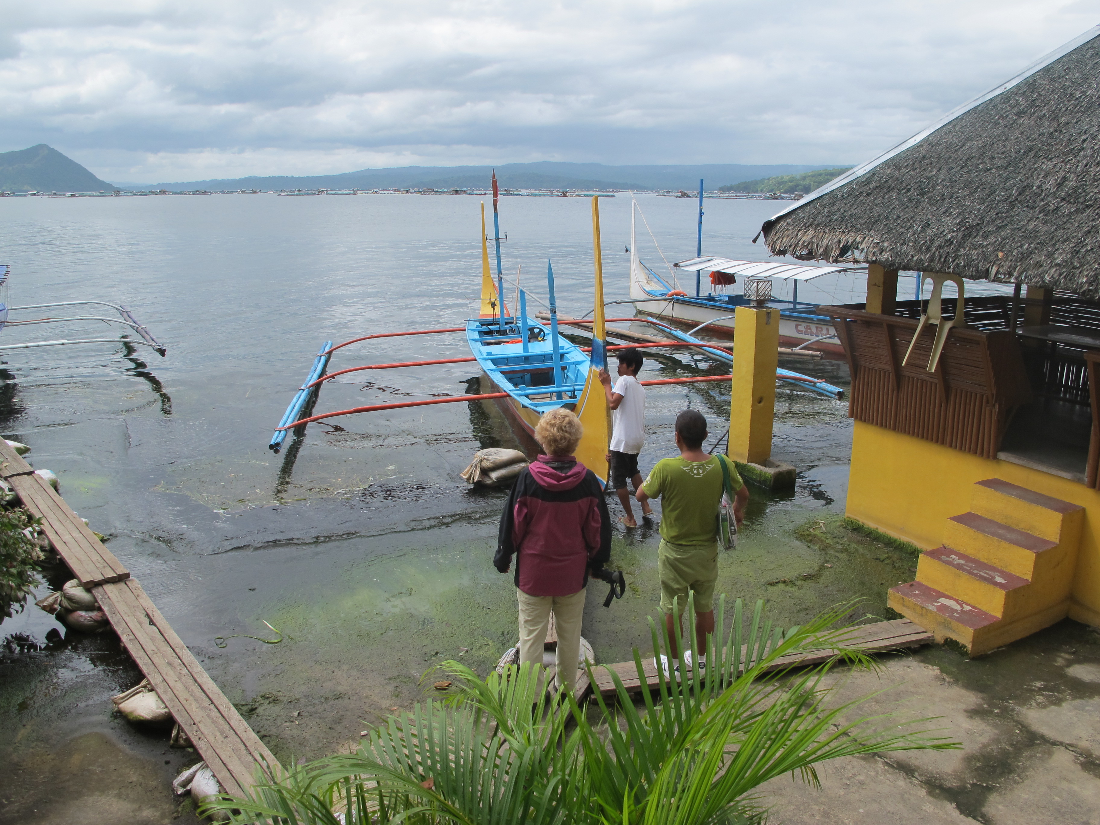
This boat was our first introduction to the ubiquitous local outrigger called a bangka. The simplest of these, like the one we took at Taal, is just a narrow wood craft that can hold a half dozen or so people. Outlying bamboo poles, parallel to the length of the boat and lashed to thwarts across the boat, provide the lateral stability. Power comes from small diesel engines that rattle and wheeze, but seem to just keep chugging along under all conditions. More elaborate or larger bangkas offer reasonable protection from splashing by any significant waves you confront, as the poles slash thru the waves. In the simplest ones, like ours at Taal, there is not much to keep the water off, especially on a somewhat blustery day, with the threat of Typhoon Haiyan in the offing.
So, peering through water-soaked sunglasses, we were well drenched during the twenty-minute long outgoing trip. Still, the day was warm and the sun peeked through the clouds enough during our walk to the crater that we dried nearly as fast.
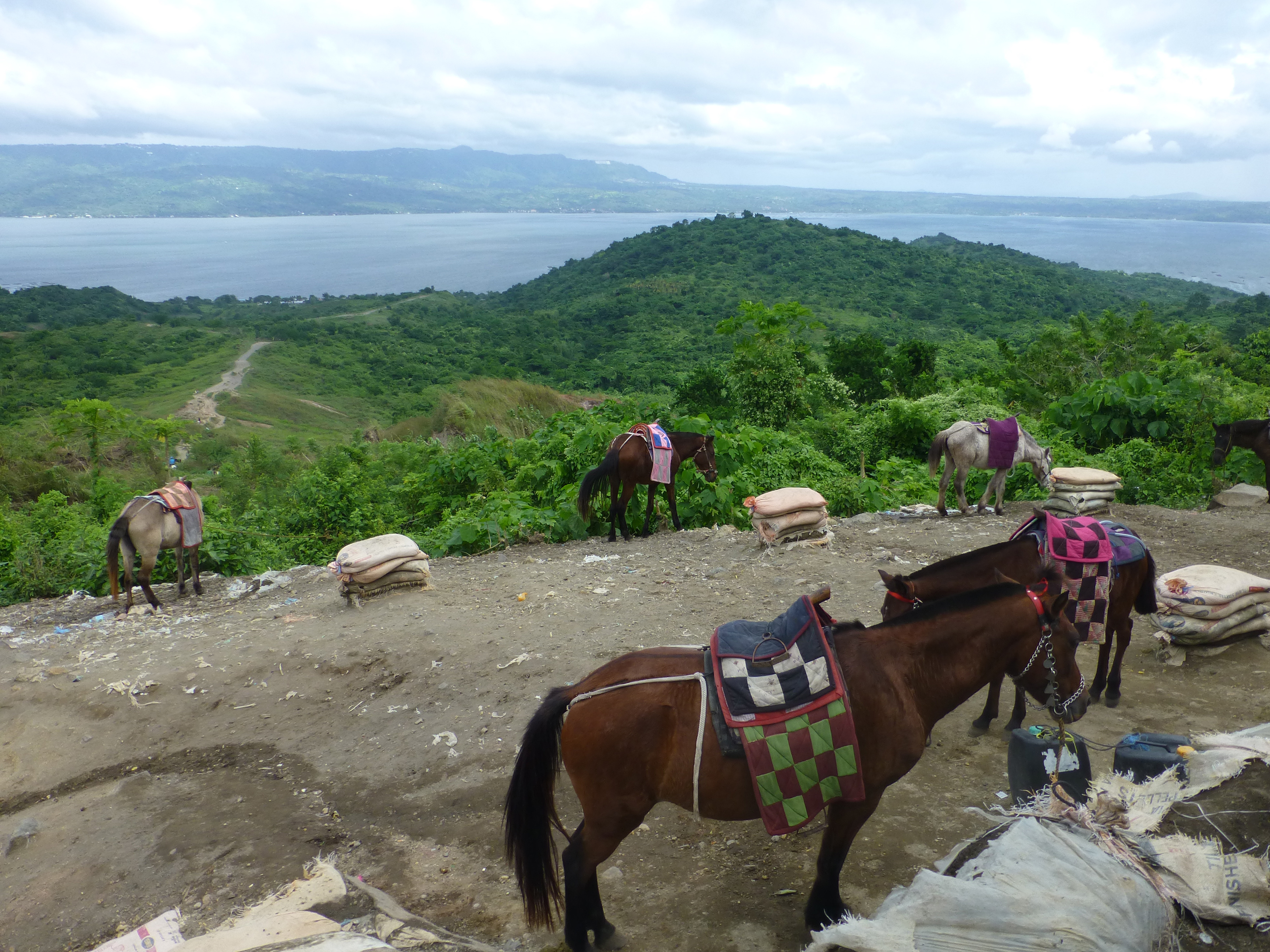
For the ascent, almost all visitors large and small choose to take the tiny horses offered by the villagers at the volcano’s base. The handlers lead the tourists carefully up the wide trail and narrow defiles to the top. We passed many as they bounced down from above, including a large number of Koreans and Chinese in two boisterous groups.
We climbed on foot instead, and were not overly challenged during the hour climb. The trail stayed mostly moderate in pitch, as it passed thru forested areas, with a few steep portions in the sparser section toward the end. Along the way, we passed a small hole out of which steam hissed its affirmation of the still roiling volcano below us. The biggest threat, however, was the oncoming storm. Our local guide kept prodding us to pick up the pace so we could get back across the lake sooner.
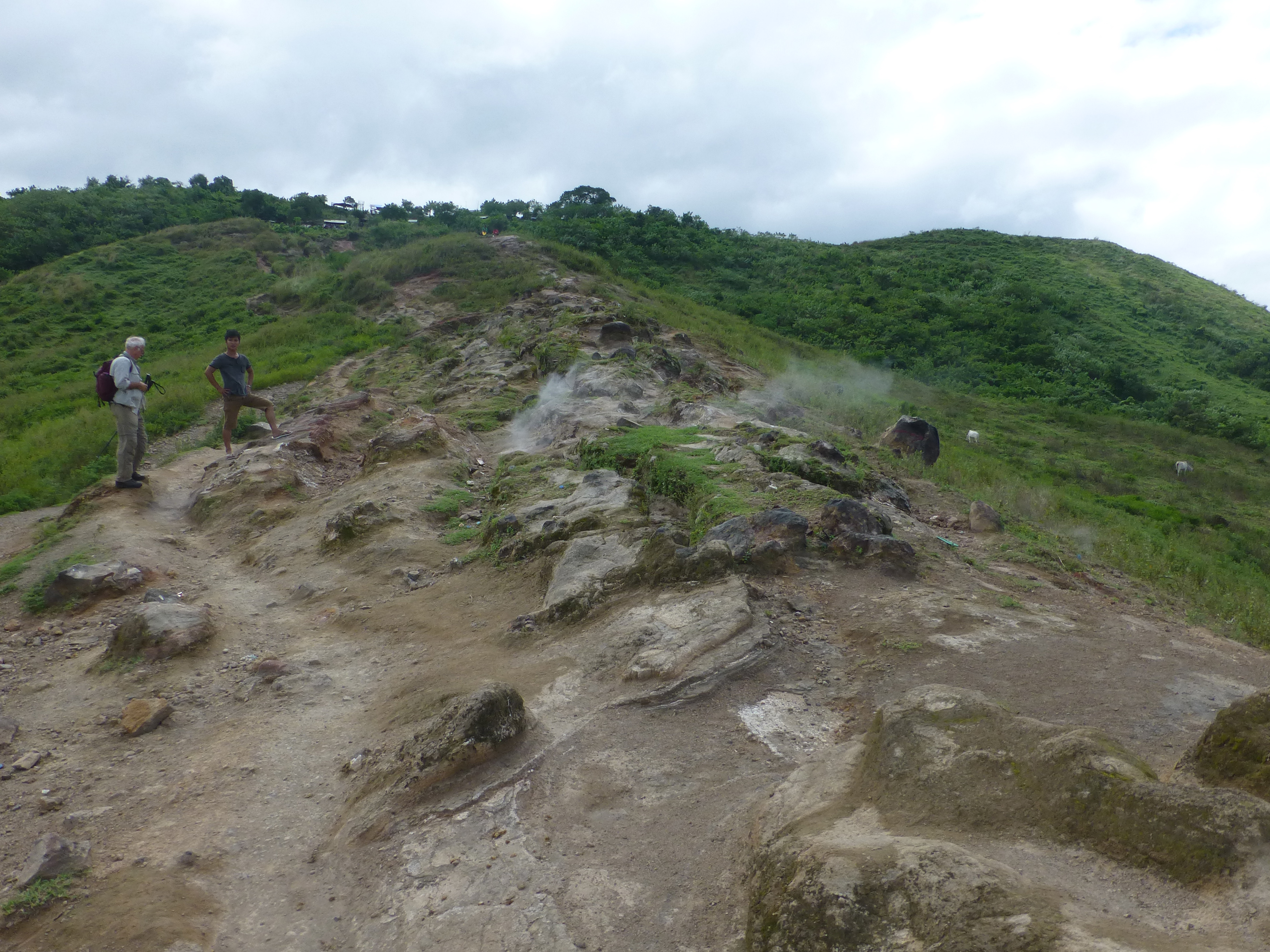
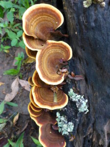
At the end, navigating past the many village vendors and the restless horses tethered just below the crater rim, we happily reached the crater. Looking back over the large outer lake we had crossed , hazy mountains battled with darkening clouds in the distance. Around the wide rim, more vendor stands squeezed out some of the adventurousness of the experience; this is a tourist attraction, we couldn’t help but recall. At least down below within the inner crater, the volcano reminded us of its wildness. Swirled curlicues of turquoise and orange and blue decorated the water, signs of the hot sulphurous gasses filtering into the crater.
After taking a while to enjoy the wide view and the inner colorations, we headed down briskly, though more and more tourists on horses trudged up the dusty trail past us.
Occasionally the now more blustering wind blew a potent blend of lava dust and pony poo into our faces. Our boat driver also must have heard the stables calling, for he upped our speed going back over the churning lake, banging into the waves and kicking up buckets of spray in our faces. Drenched even more thoroughly, we soon arrived at our starting point for a damp lunch.
Pinatubo (Luzon)
Pinatubo was wet in a different way, a lot wilder and much more challenging.
Though it rises to 1500 meters above sea level, it is barely noticeable amid the neighboring mountains. Until you’re very close to the peak, it can stay hidden. Yet, this may be the most famous of all the Philippine volcanoes because of the massive eruption in 1991, the second largest during the entire 20th century. Over 250 meters of the peak blew off. Ash covered villages dozens of kilometers away, over a range of 100,000 square kilometers. Central Luzon island turned dark. Environmental damage spread globally, with effects akin to Krakatoa in the 19th century.
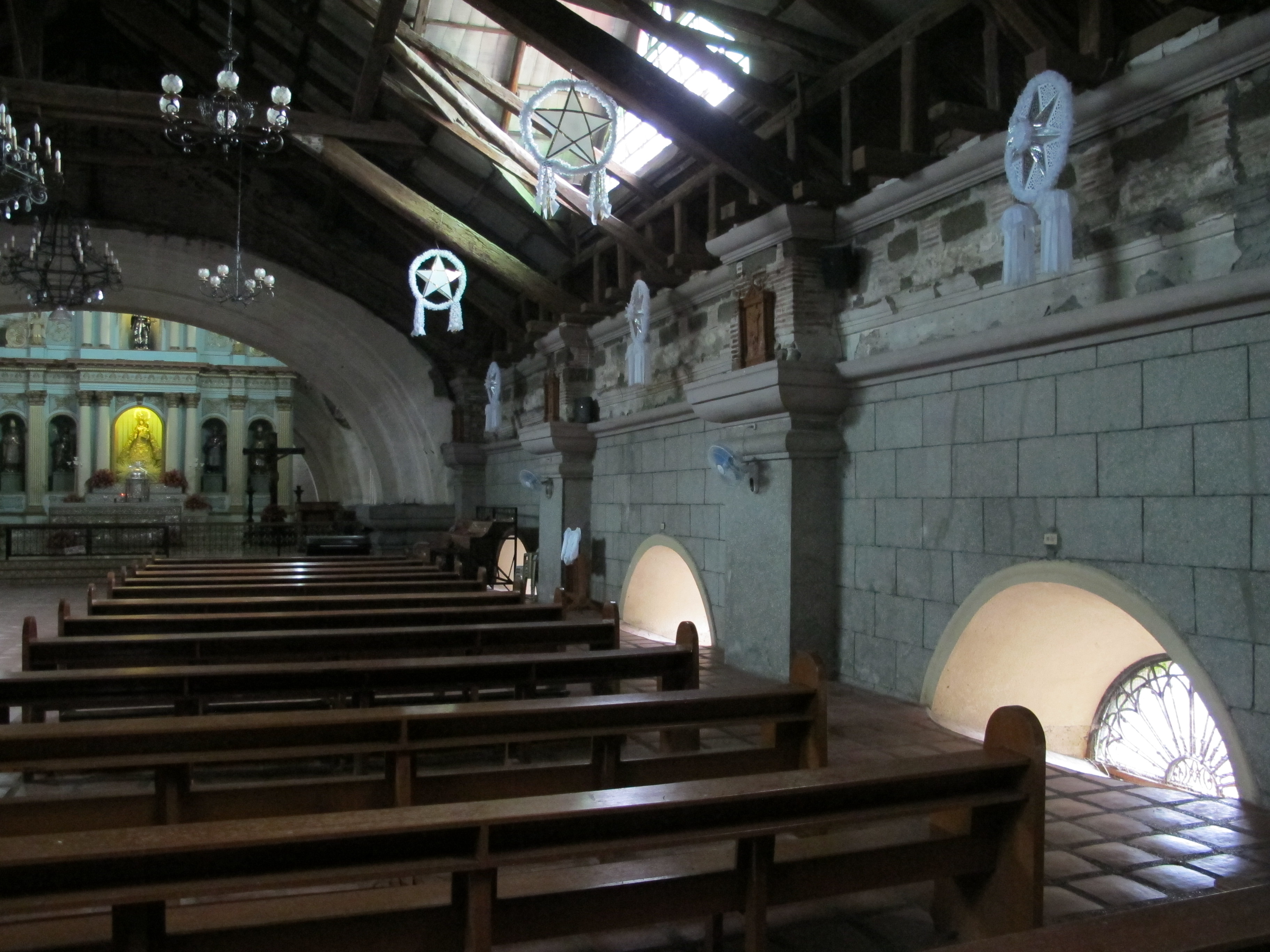
Houses nearby were buried partly or wholly in the ash and lava. The local Spanish-style church, San Guillermo, survived, but half of its 12 meter height disappeared into the ash. What’s left is a hobbit-like space where you walk near the tops of the neo- classical columns and enter through the arches above its old windows.
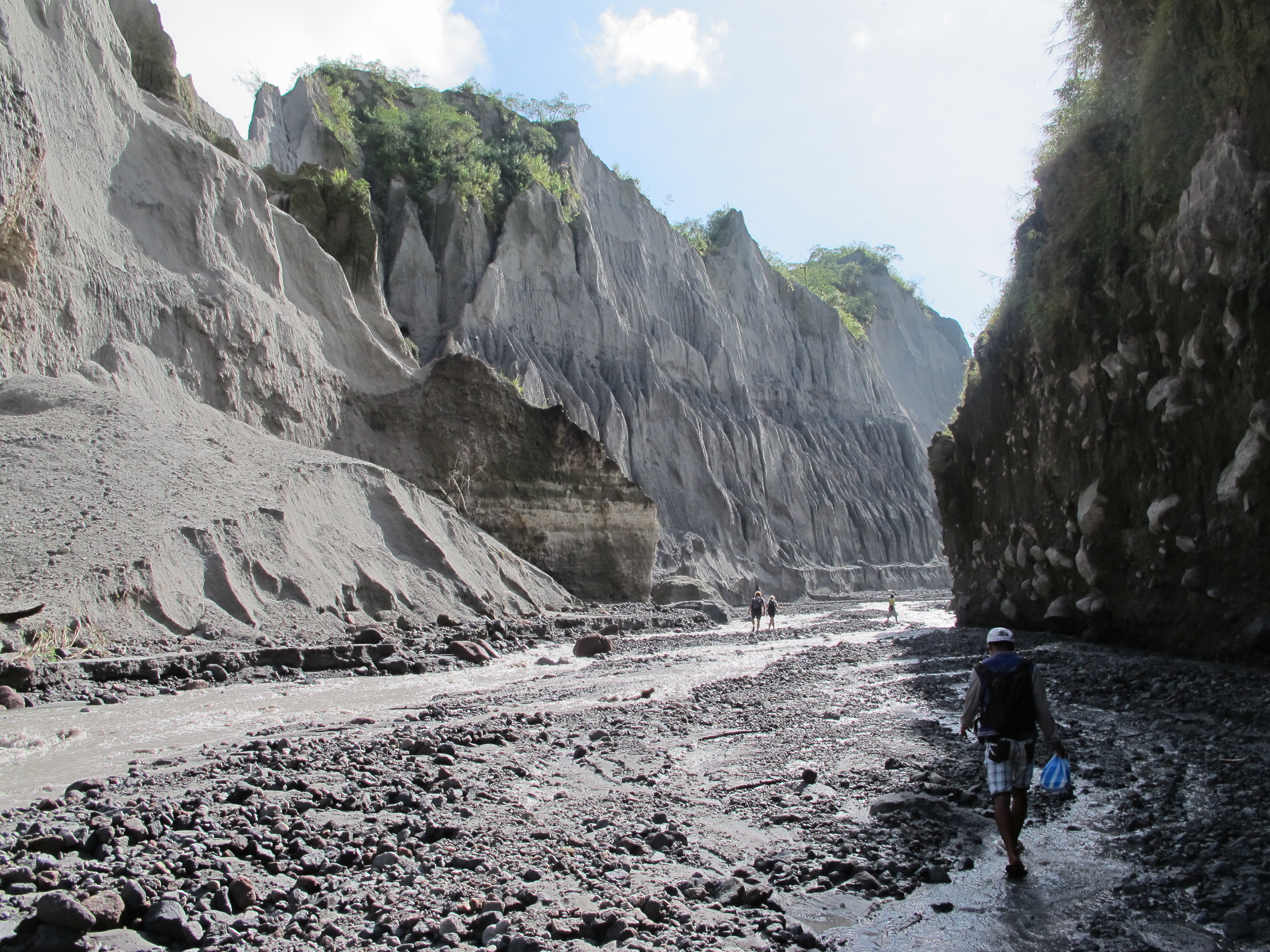
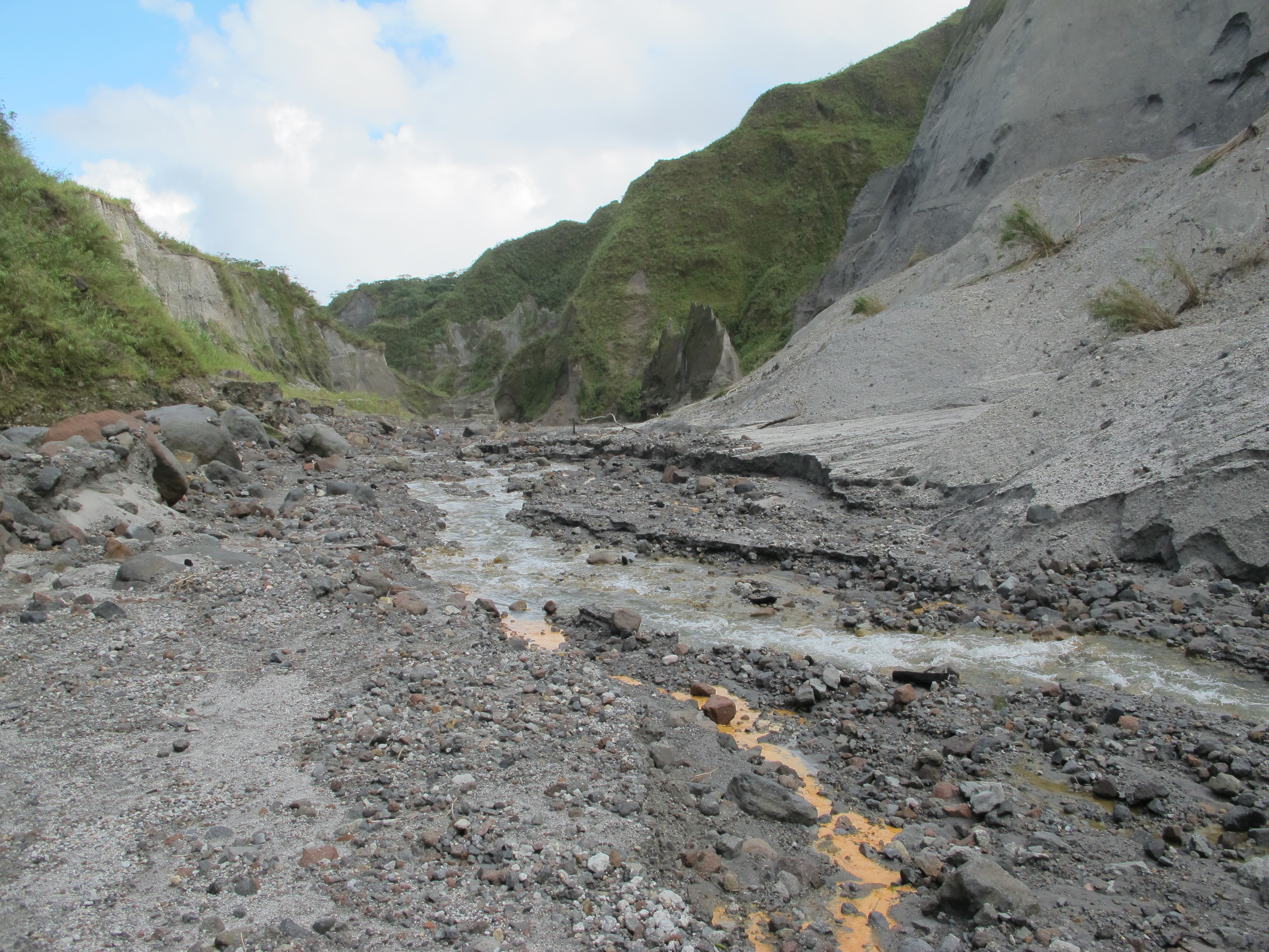
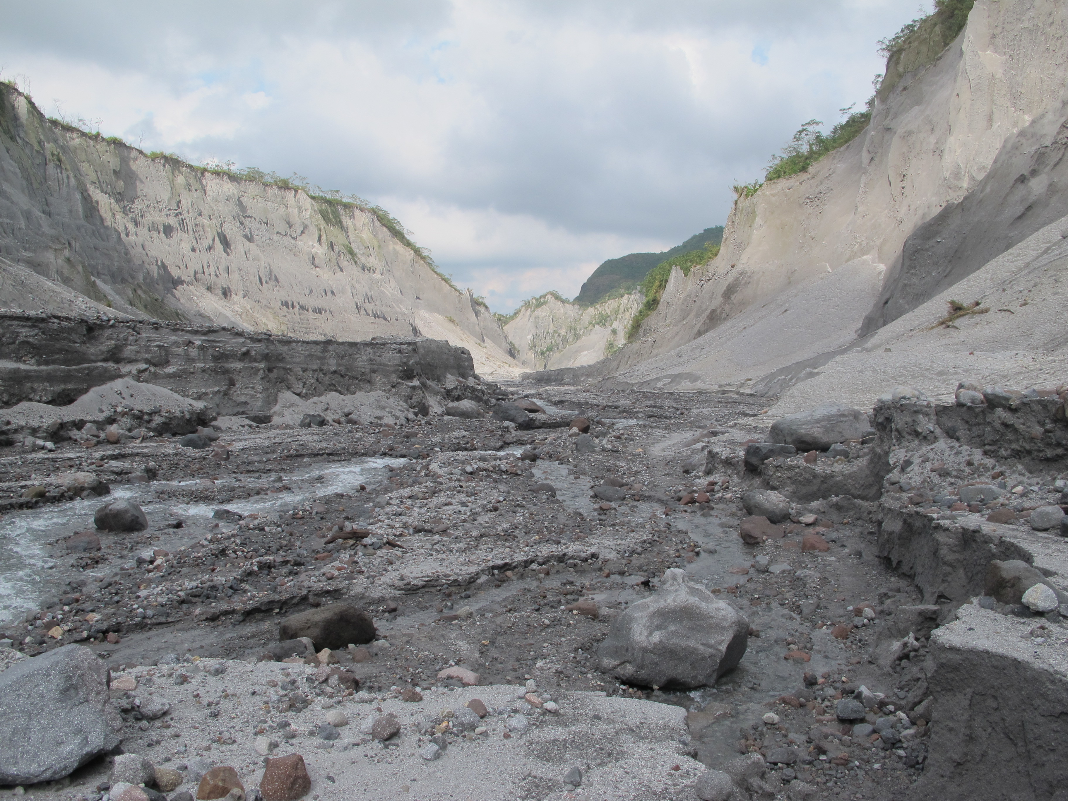
At the volcano, the massive lava river gouged an austere and otherworldly channel down from the peak. Now water run-off pours through this channel, sometimes as a full roiling river and sometimes as just tumbling streams and rivulets or shallow washes. To get to the crater, you must pass through water.
It’s a lot longer trip from Manila also, and one with a time constraint. Because you must cross an area used for some unspecified military operations, reputedly target practice, we had to clear the checkpoint in the closest village of Sta. Juliana by 7am – or, as this is the Philippines, maybe 7:30AM or 7:45AM if you check ahead. That means departing Manila at 5AM because of its traffic and the distance to Pinatubo. It’s a lot easier on you if you stay closer the night before, like in Clark or Tarlac.
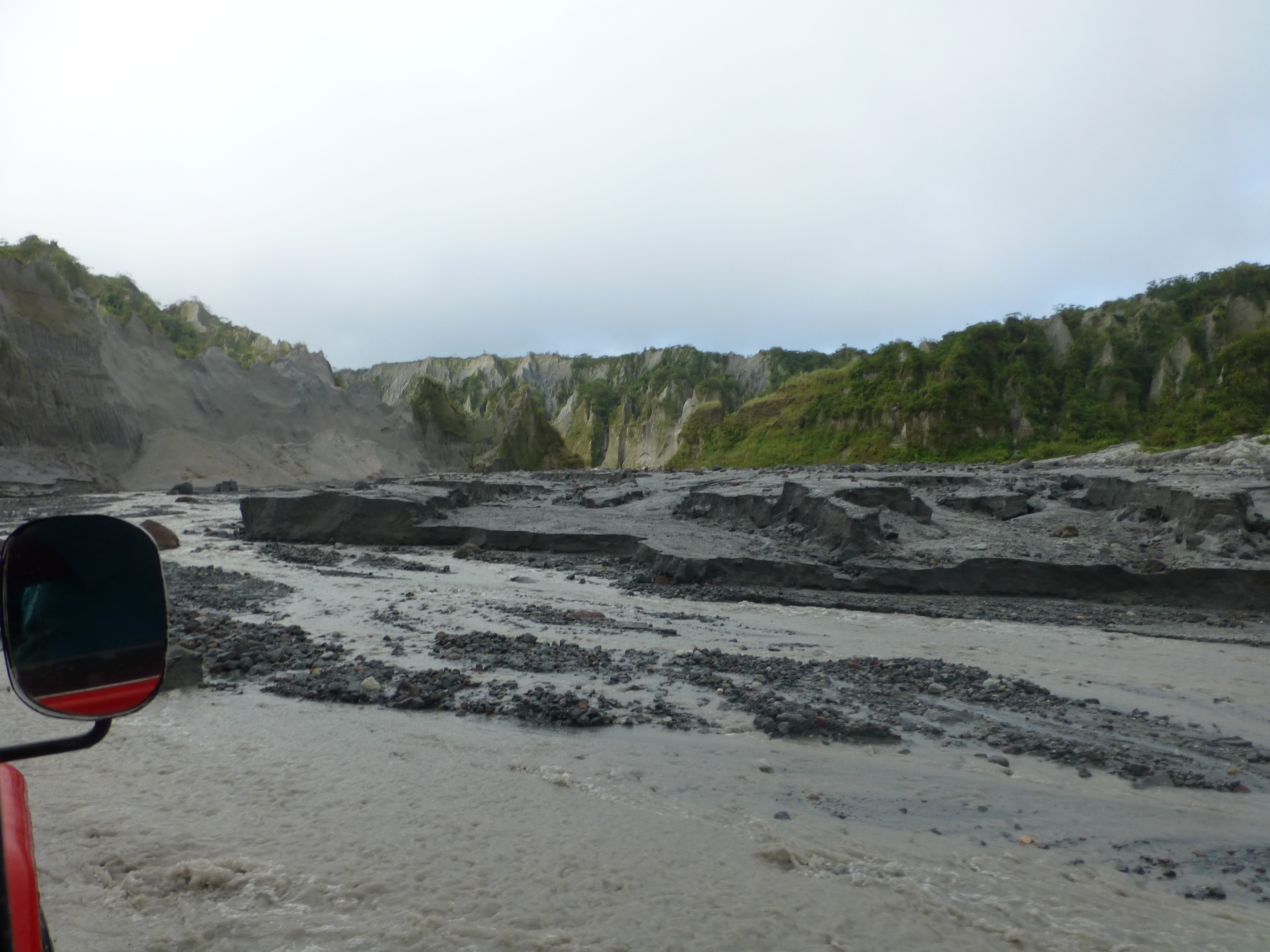
At the village, you clamber into a well-worn 4WD jeep-like Toyota with a local guide and what turns out to be a very skilled driver – for one of the wildest drives we’ve ever had. For the next hour and a quarter, we bounced and splashed through the broad lava channel – over soft sand, up and over hillocks of ground-up lava, across fast-moving streams and through shallow, quick-running water flows. As the Toyota grumbled its way along, the lava channel that constituted our road slowly narrowed, lined with odd shaped cliffs and peculiar ridges formed from the shearing of the hills by the hot lava flow of 1991. With a final heave up an embankment, the jeep dropped us at the trail head for the hike to the top.

For the next few hours, we were the ones fording streams, hopping rocks and stomping upwards through the lava channel – past more fantastically shaped hills and huge walls of composite rock and lava. Our boots and pants quickly were soaked to about knee-high. About half way up, some of the streams in the channel even turned orange from sulphur seeping out of the volcano.
The setting wasn’t completely otherworldly as a large group of Filipinos up from Manila noisily trudged along with us for a while, before they slowed down. But for us the pitch was moderate until the last 15 minutes or so, when the trail narrowed through a forested section. By then we had climbed about 300 to 400 meters (1000 – 1200 feet) over about 7 kilometers.
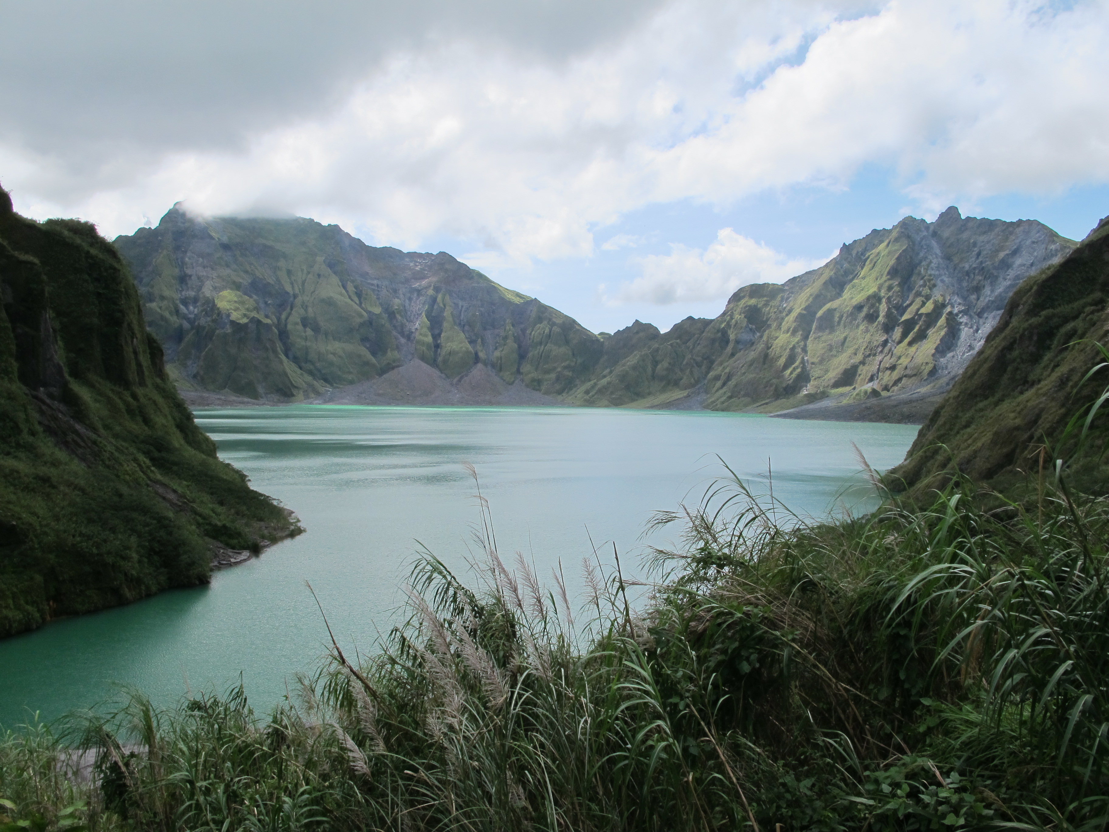
Cresting the crater ridge, looking out over the wide lake below, we again saw the rainbow swirls formed by the heated sulfur bubbling upward. As clouds shifted about, we admired the grandeur of the enclosing crater walls looking like individual mountains – some now forested green and some still the dark grey of bare rock. We sat at a viewpoint to savor the vista, while taking a small lunch. We walked down to the lake, even more impressed by the size and beauty of the crater while standing in the soft sand at its edge. No swimming, our guide, admonished us.
About an hour after we arrived, as the remnants of the Filipino group finally reached the summit, we headed back for the five miles on foot, getting even wetter in the faster-flowing streams of afternoon. Then, back by jeep through deeper waters to the village, past the military checkpoint, and then on to Manila to dry out our boots and pants.
And what’s that on the schedule? Massages at the hotel…we didn’t really need them after such a hike, but oh yes, they felt good.
Kanlaon (Negros Occidental)
Different again: a short tough climb, damp forest and icy pools, with a taste of the wild to end it.
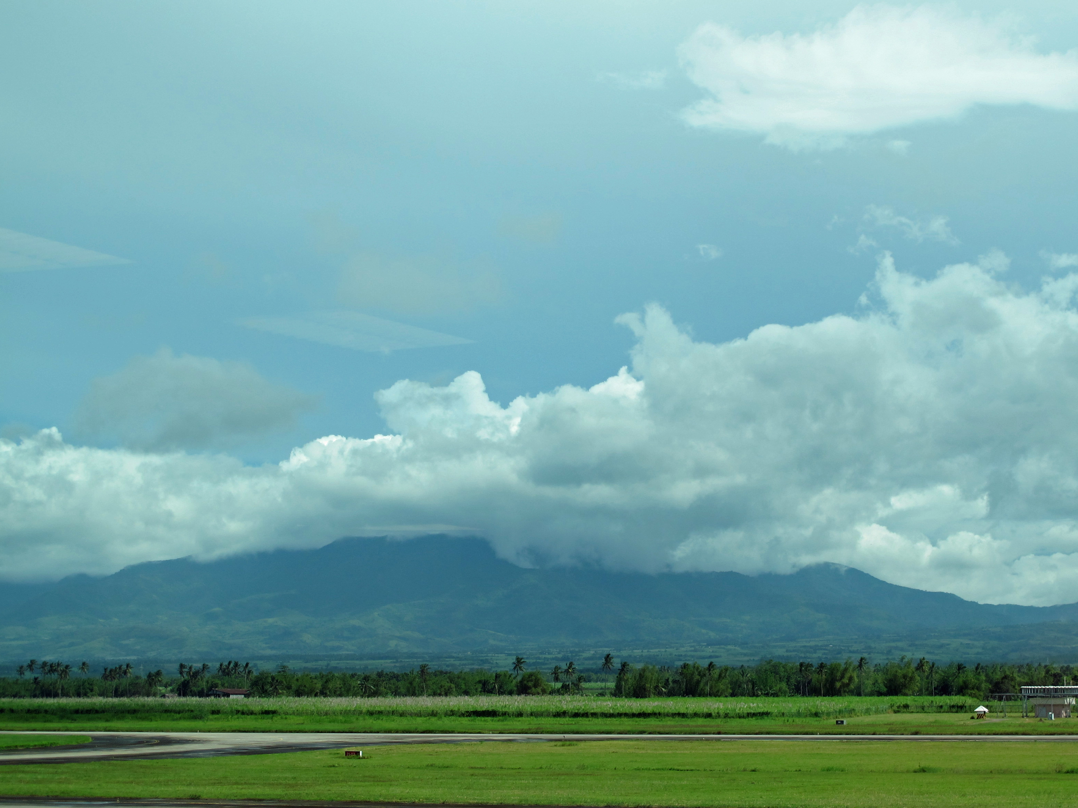
Though Kanlaon is the most active volcano in the country – having erupted over 25 times in the last 100 years – these bursts have been minor, except for the one in 1996 that killed several climbers. Unlike the other two volcanoes, it’s visible from a long way off. About 2500 meters high, it sprawls far and wide over the plains below it, like Mount Fuji without a snowy peak, making it visually iconic here.

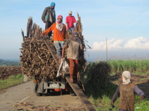
It’s also over an hour’s trip from the largest town nearby, Bacolod, so our local guide picked us up at 7am on the American holiday of Thanksgiving. Along the way, we passed hectares and hectares of sugarcane, the predominant cash crop on Negros, huge fields of which were being harvested by local workers who looked as if the sugar had been caramelized black on their bodies.
About 1000 meters up Kanlaon, like every climber, we started the ascent from the village of Guintubdan, whose 50 families and over 300 residents supply the guides and sherpas that accompany hikers to the top. Our two guides were a father and son team, because the son had deferred higher schooling till the family had more money.
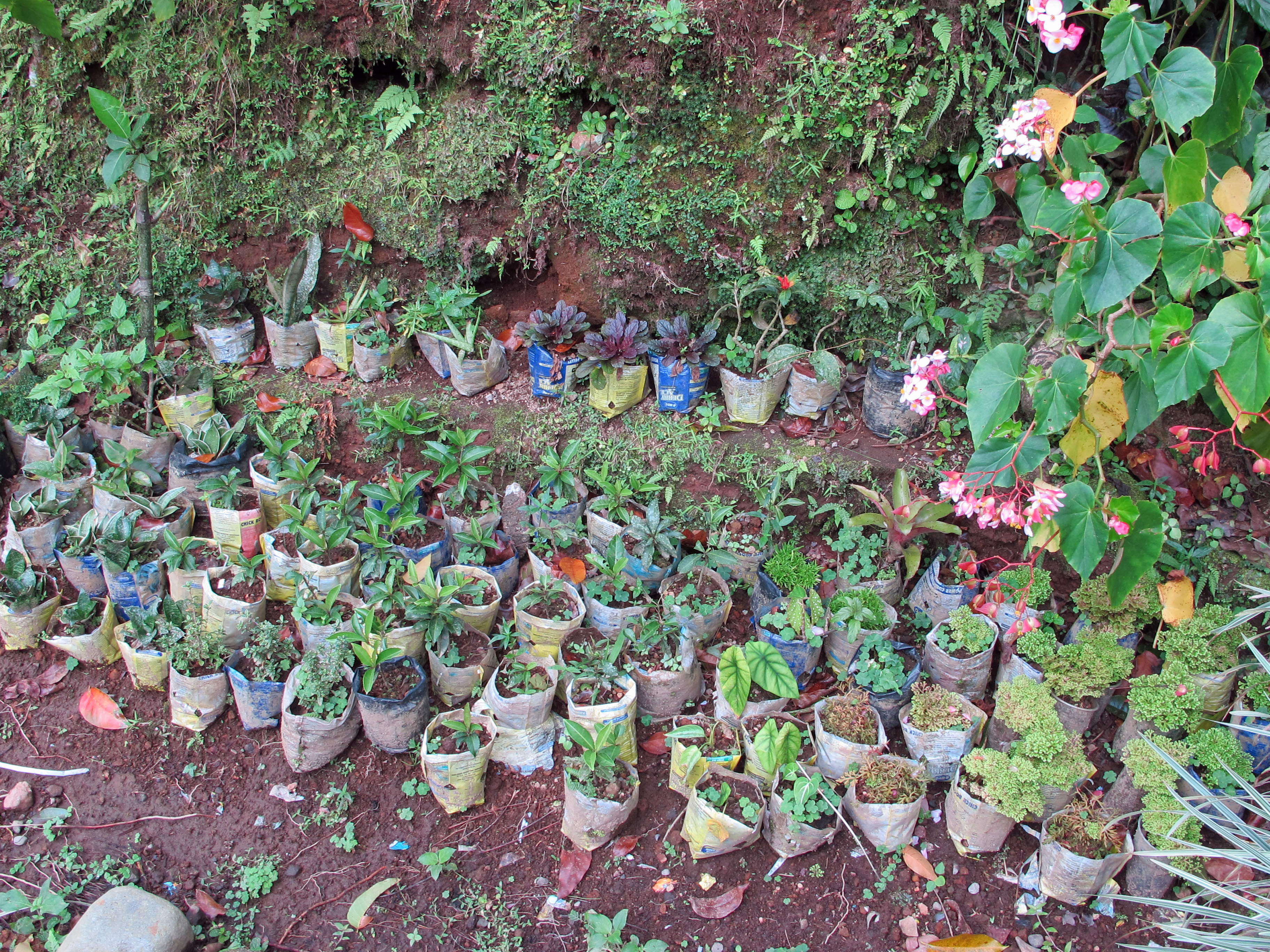
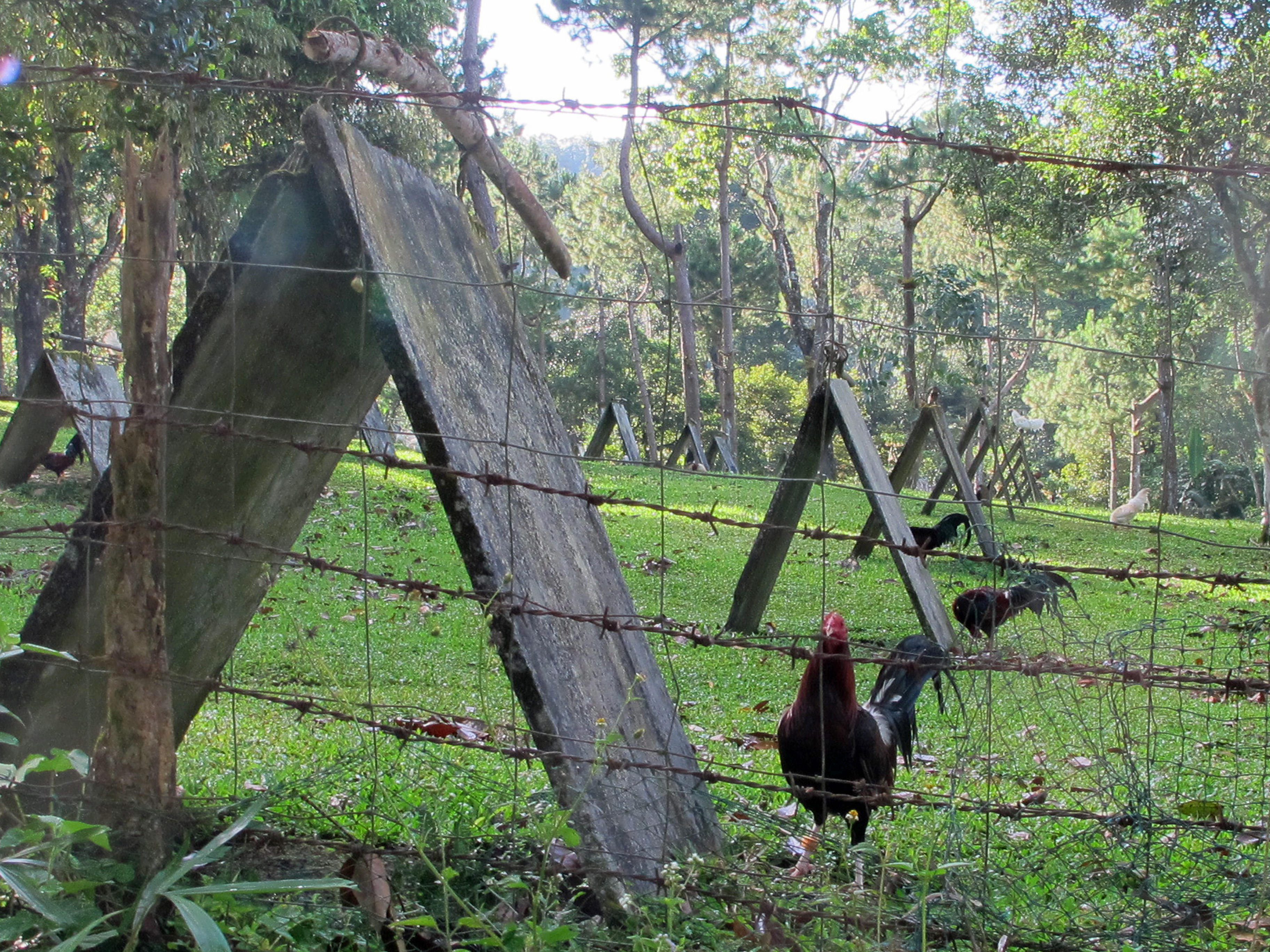
But this is not the only local business in Guintubdan. Amid the bountiful gardens, we saw small pots germinating all manner of tropical flowers and plants for sale in markets. We passed hundreds of triangular coops and perches, a single rooster tethered at each. Naively, we asked where the chickens were. Not with these roosters, we were told, for these are bred for the popular – and legal – sport of cock-fighting.
We might not have needed a guide at the other volcanoes, but here we wouldn’t have gone far without one. The trail is very narrow, at times just a boot width across. It twists steeply upward, often almost invisibly because of the lush plant-life overgrowing the trail. Equally good-looking trails split off from the main one with no way to tell which does what.
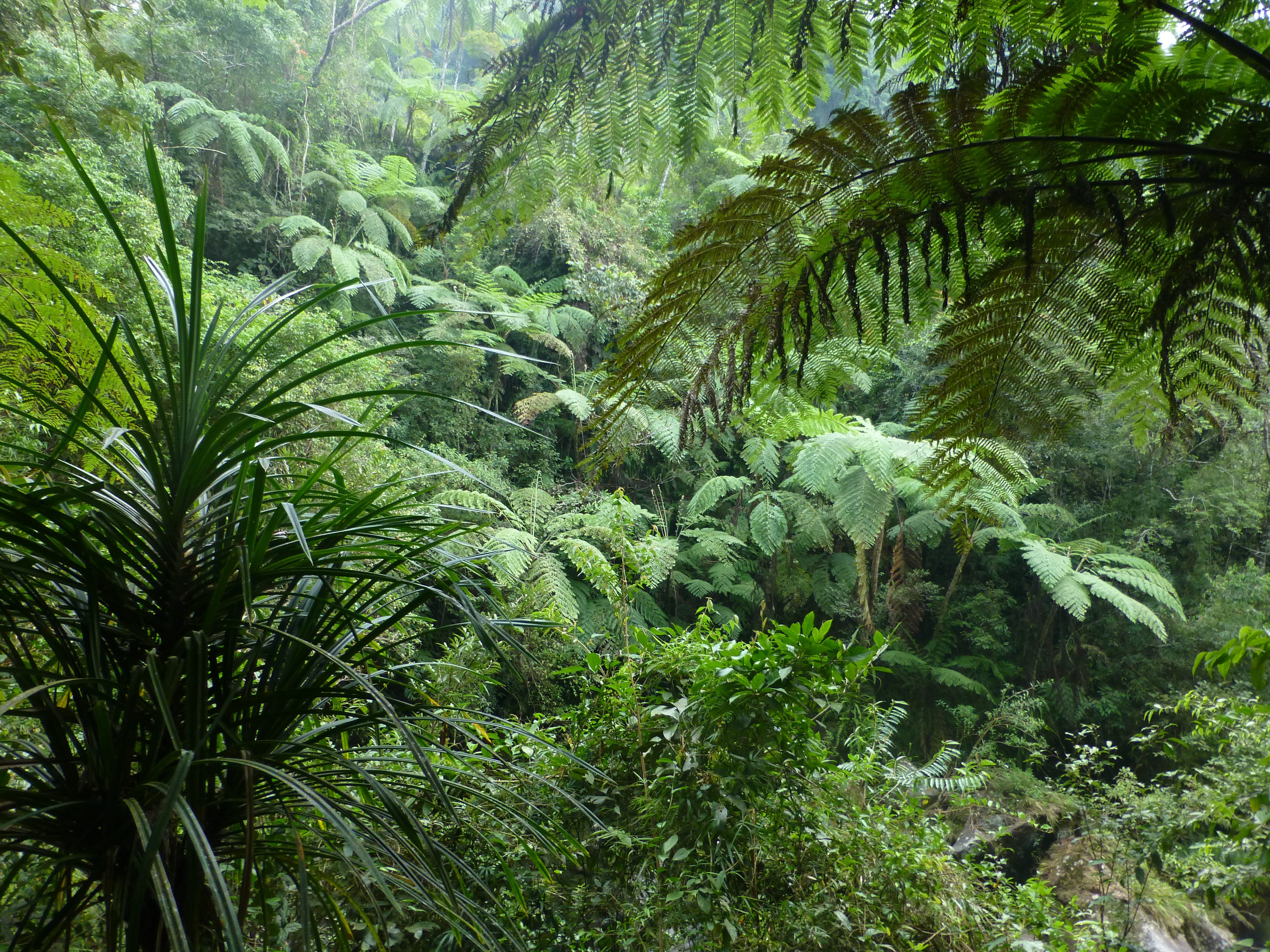
And there’s not much to see. In an hour and a quarter, we had climbed 400 meters to the first landmark on the trail, the waterfall Busay Buslugan and its small set of pools. The forest was beautiful, but so dense that you couldn’t see outward to the plains. The greenery flapped in our faces and vines grabbed our ankles. We dripped sweat in the thick humid air. The dampness on the leaves soaked us while keeping the ground muddy and slippery. We stopped occasionally to pick leeches off our clothing – before they found our skin.
You could continue to the top in another four or five hours, as a Russian foursome did that day, accompanied by no fewer than five guides/carriers. But the scenery changes little. Even at the top, clouds typically adorn the crown and bring intermittent rain, so you can’t see much of the surrounding countryside. Perhaps the crater view is worth the overnight trip.
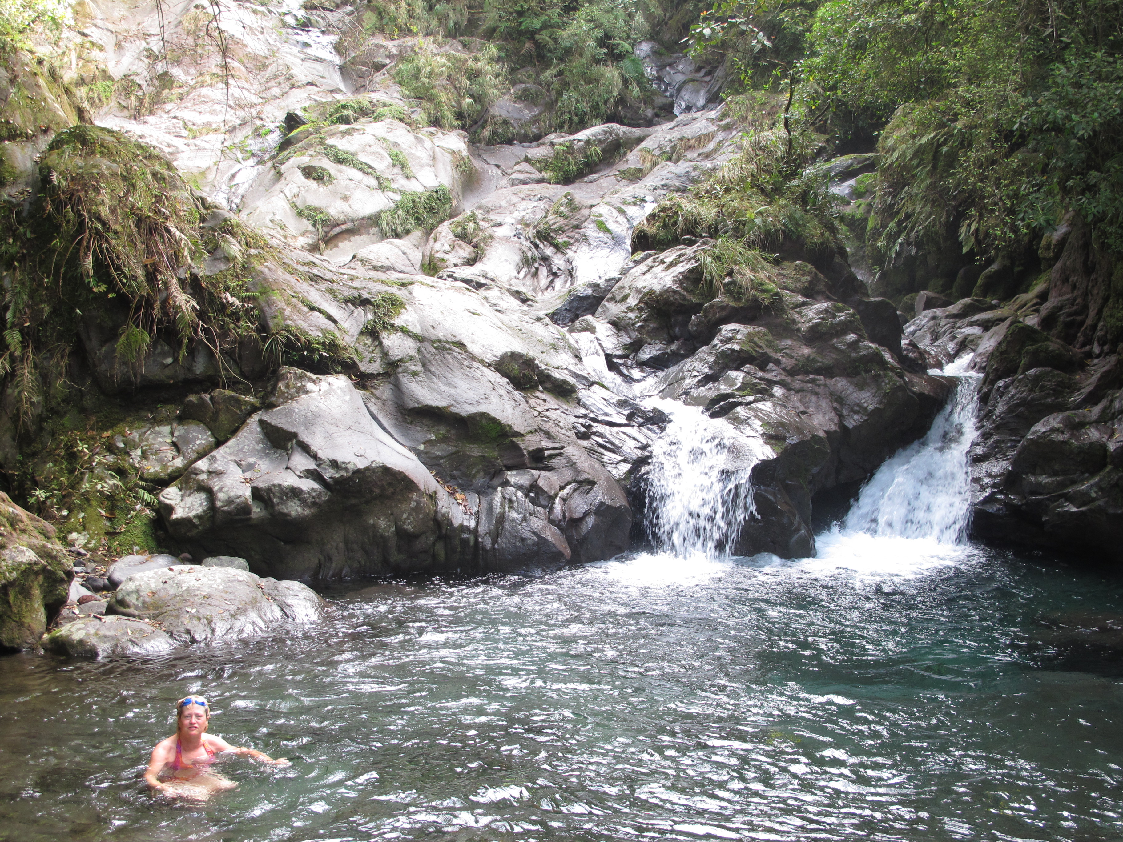
The falls of Busay Buslugan occupied a lovely natural glen, not nearly as interesting as the falls we later saw down near the village, but one where we could swim. The Russians had arrived just before us, taking up a central position along the water’s edge. One of them juggled a leech on his hand while trying to photograph it with a macro lens. None of them, nor their guides, wanted to go in the water.
Changing clothes, we soon discovered why. Yikes, was it cold! Nancy lasted in the frigid water much longer than Barry did, but we both thought the water would be a bit warmer in the hot tropical air.
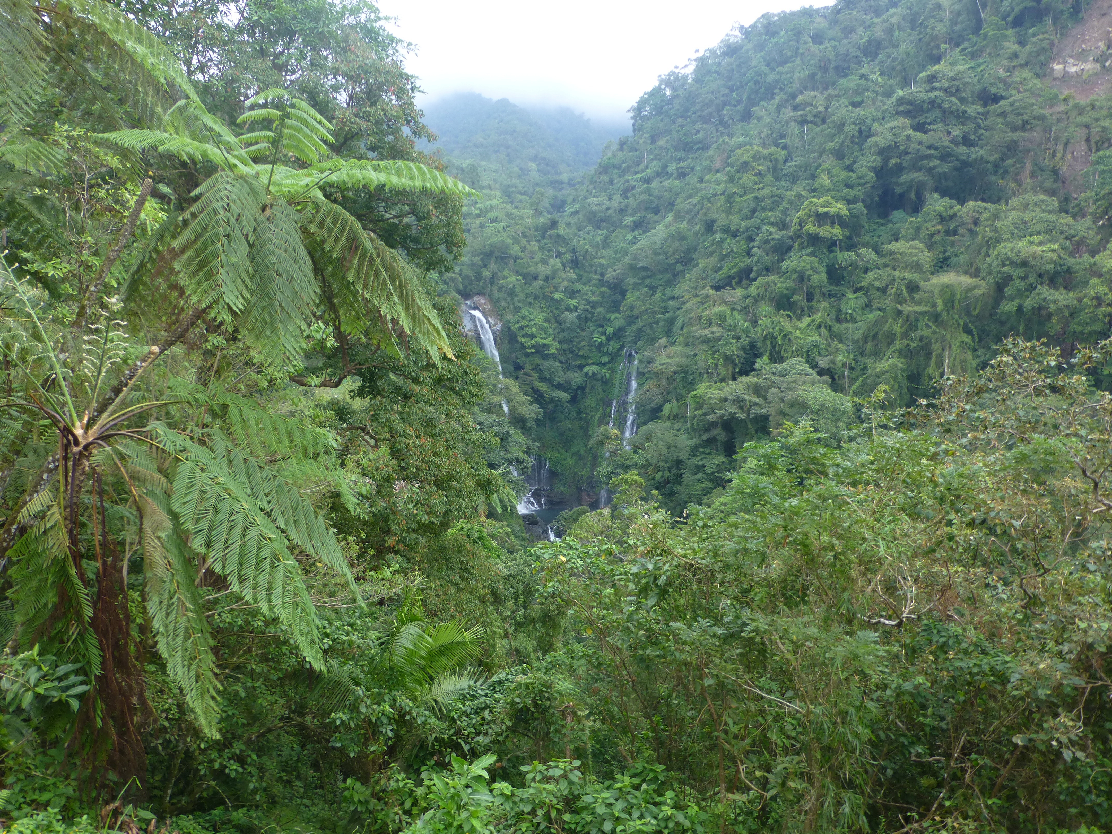
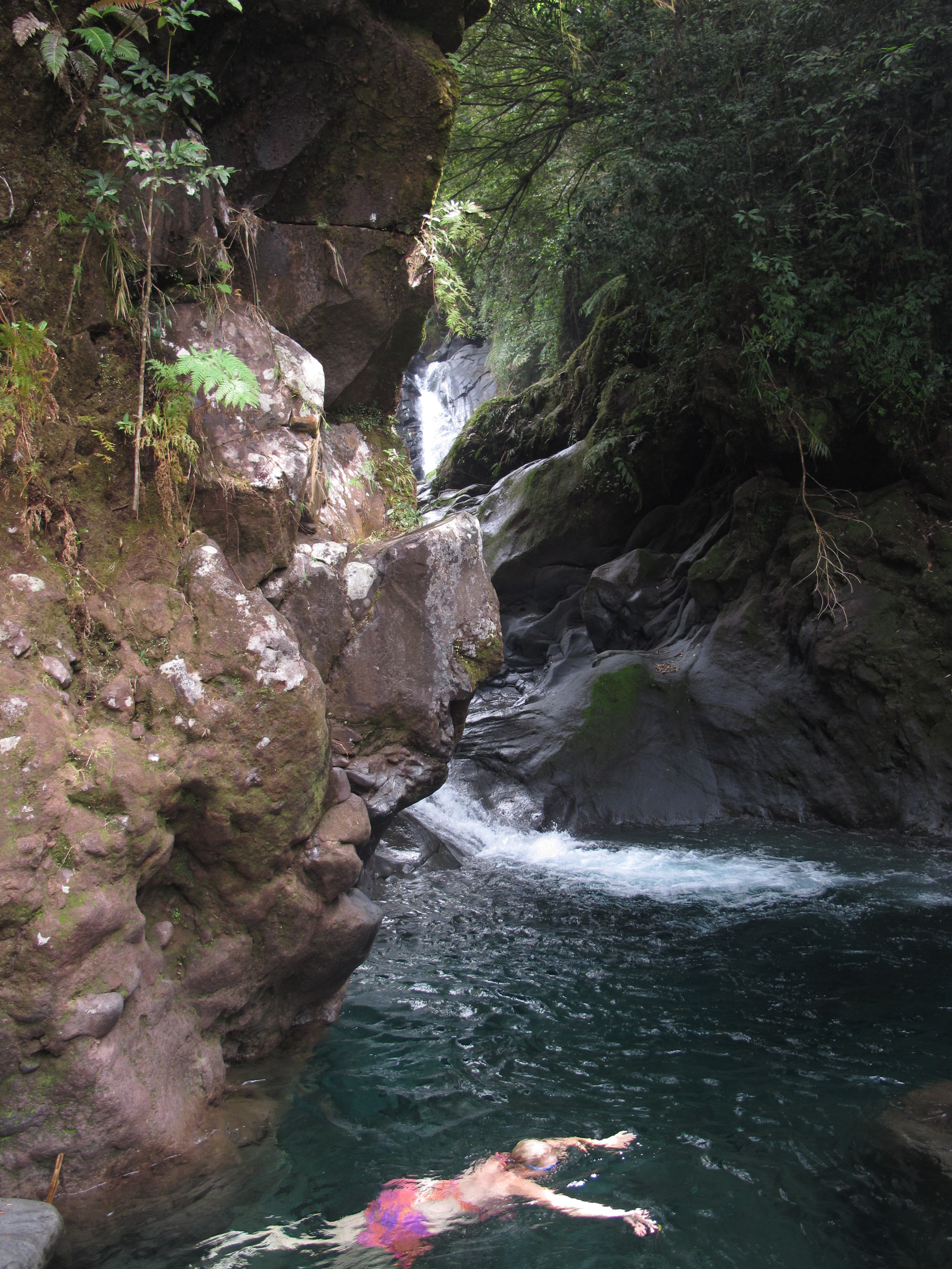
It was pleasurable enough just to be there, but we couldn’t help wonder – apart from the exercise of climbing a bit of the volcano’s side – about the value of such a short trip on such a long day. The return trip perhaps made it worthwhile. After a quick descent, we branched off through the rooster perches to the waterfalls that tumble alongside the village. The tallest of them, set amid abundant fern trees and rainforest that other visitors likened to Jurassic Park, was also the most appealing. We were even able to dip again into frigid water at the base of a lower falls, and in a picturesque tumble of rocks and pools munched appreciatively on a few sandwiches prepared for us.
Meanwhile, back at the village, our Bacolod guide – not expecting us for an hour or two yet according to his schedule – had just ordered chicken soup at a village home that offered visitors “native chicken.”
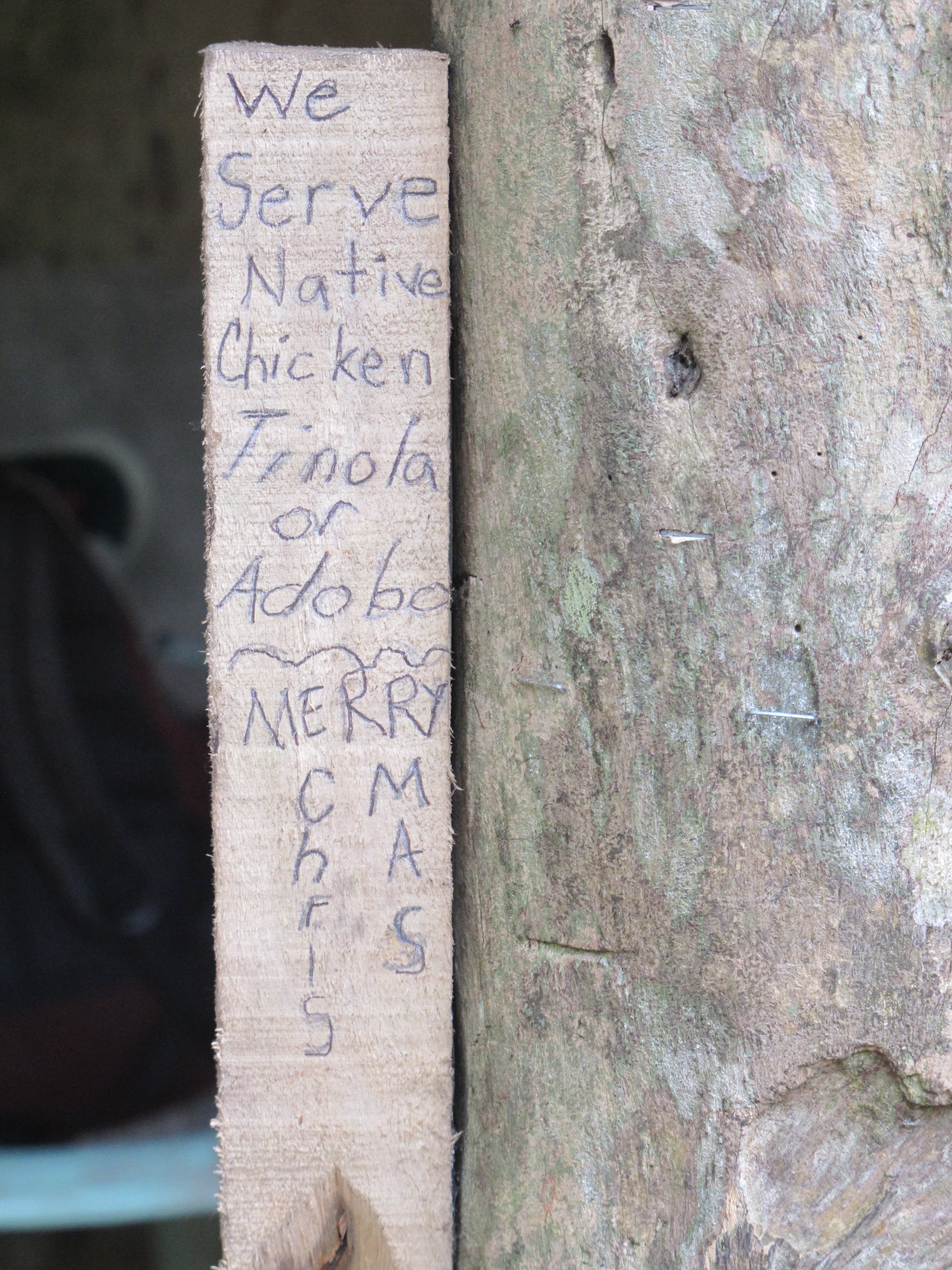
He explained that native chickens roamed free, so they were a lot tougher than caged birds. That meant it was better to soften them up in a soup like the one he had ordered. Native chicken also meant fresh: the chicken pieces we now saw afloat in the broth had indeed been parts of a whole chicken just a half hour earlier.
Cooling down and drying off from our activity, we sat with him to try the food. Though they were not quite at the level of a traditional Thanksgiving turkey, the simple soup and chicken – no longer wild, but now deliciously wet – tasted wonderful.
(Also, for more pictures from the Philippines, CLICK HERE to view the slideshow at the end of the Philippines itinerary page.)