The fourth leg of our trip took us the snow-capped mountains and glaciers of Argentina before we returned to Chile for vast Torres del Paine.
The overall journey through this gorgeous mountain landscape and desert pampas began at Puerto Montt, Chile, and ended at Ushuaia, Argentina. We spent nearly a month driving and ferrying along three thousand kilometers, from north to south.
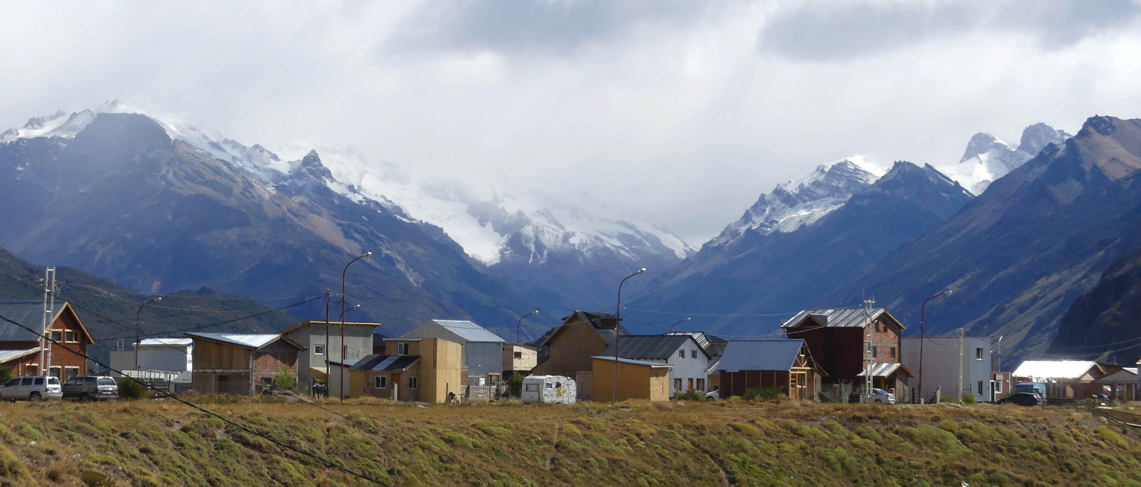
EL CHAITEN
El Chalten, Argentina, is a spectacle to visit even if you don’t hike much. The town is tucked into stunning and unusually shaped mountains, with equally splendid valleys and sprawling glacial lakes. After a long day’s drive south through the desert – including our detour to de las Manos rock art site (see post) and a horrific two hour rutted dirt stretch that nearly broke us and the car – the setting seemed like an oasis to us.
Even close to El Chalten, as striated mountains begin to appear, you’re still passing through desert.
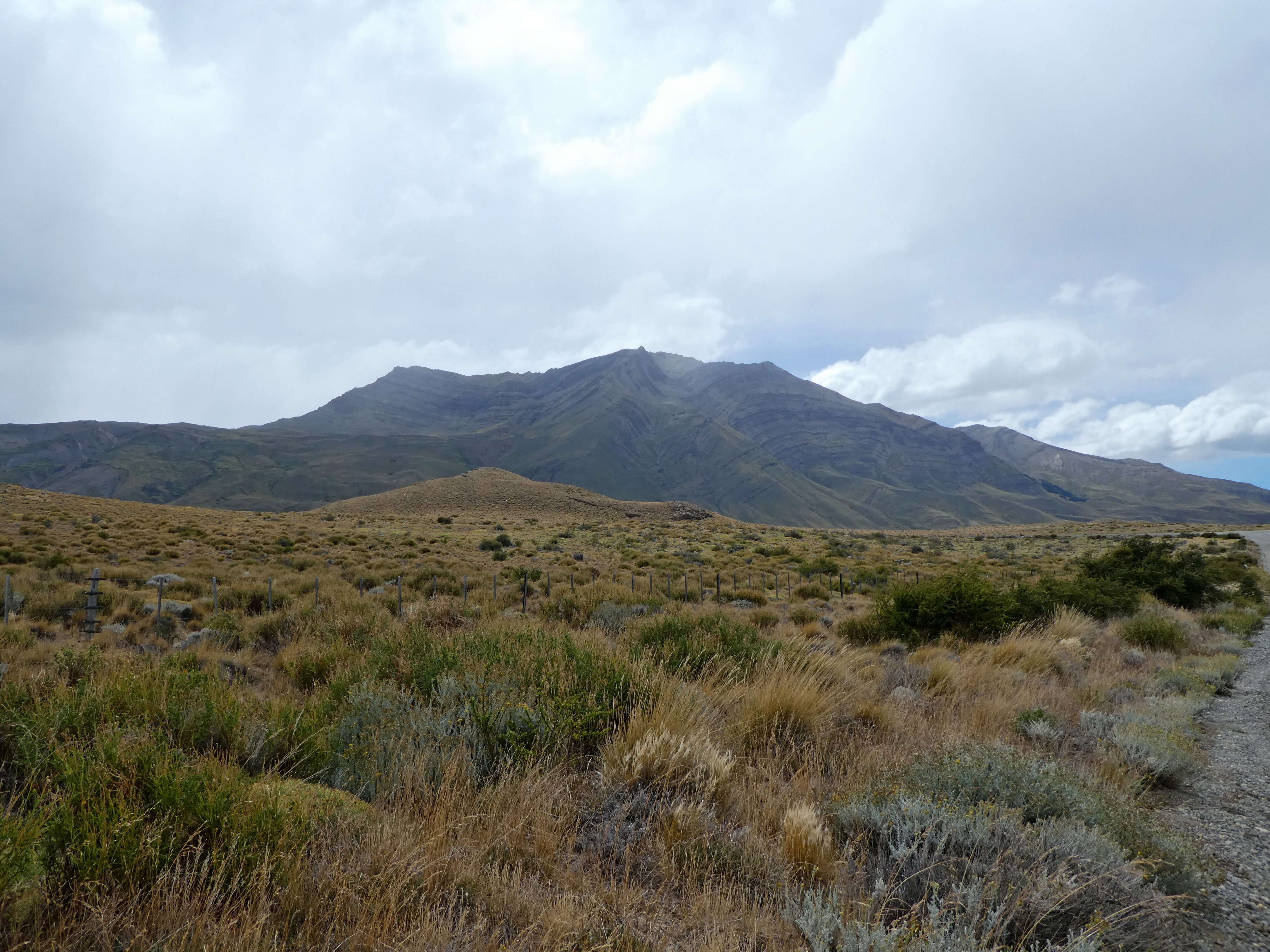
We could hardly detect our destination until about an hour before arriving.
At last, as we followed the edge of a huge glacial lake and the mountains grew large before us, a newly paved stretch of road spurred us on.
Hiking is the attraction for the many visitors, though the town tries its best to stay low-key and relatively unaffected. There is virtually no mobile service, for example. Perhaps it will change: some high end hotels and restaurants have already snuck in.
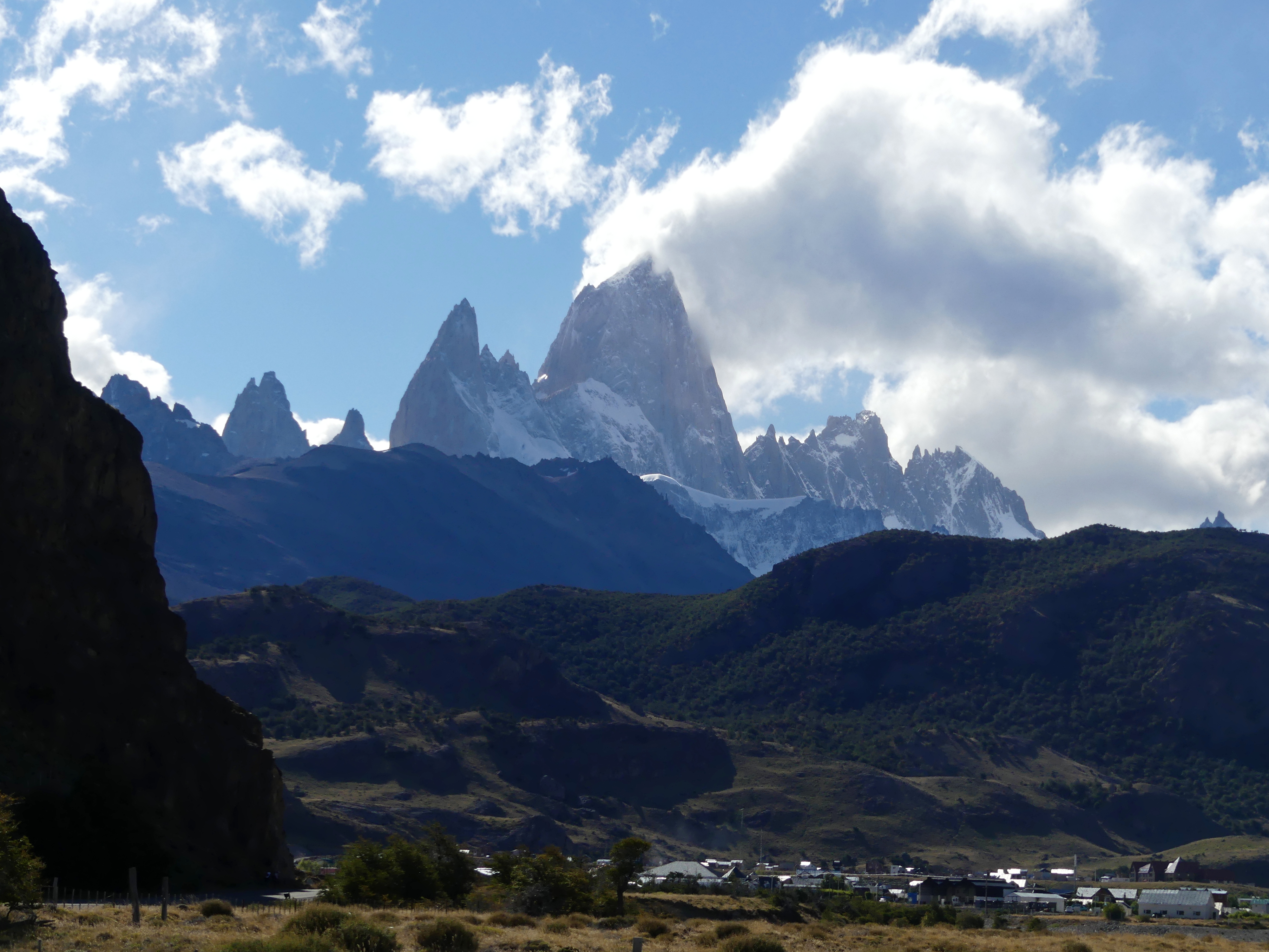
Though the torrential rain washed out one day, we took full advantage of the second on an impossibly beautiful hike to Torres glacial lake, as famous Fitzroy mountain finally emerged from the clouds.
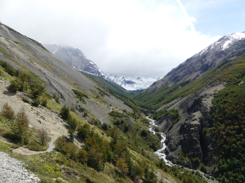
The open valley halfway to Laguna Torre, the lake named for the mountain on the right.
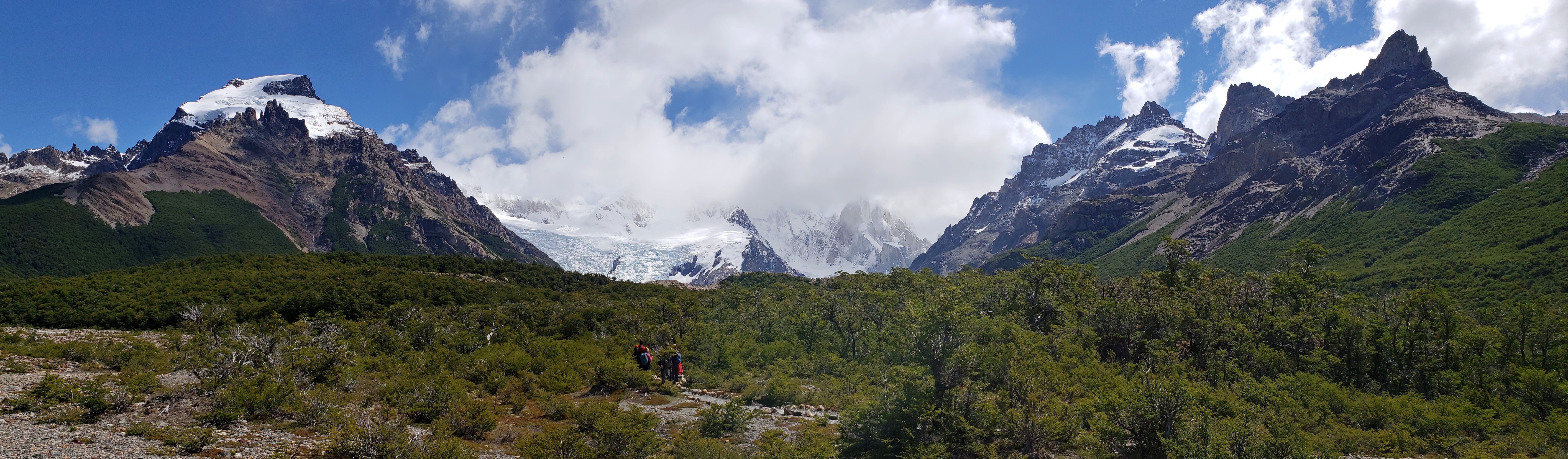
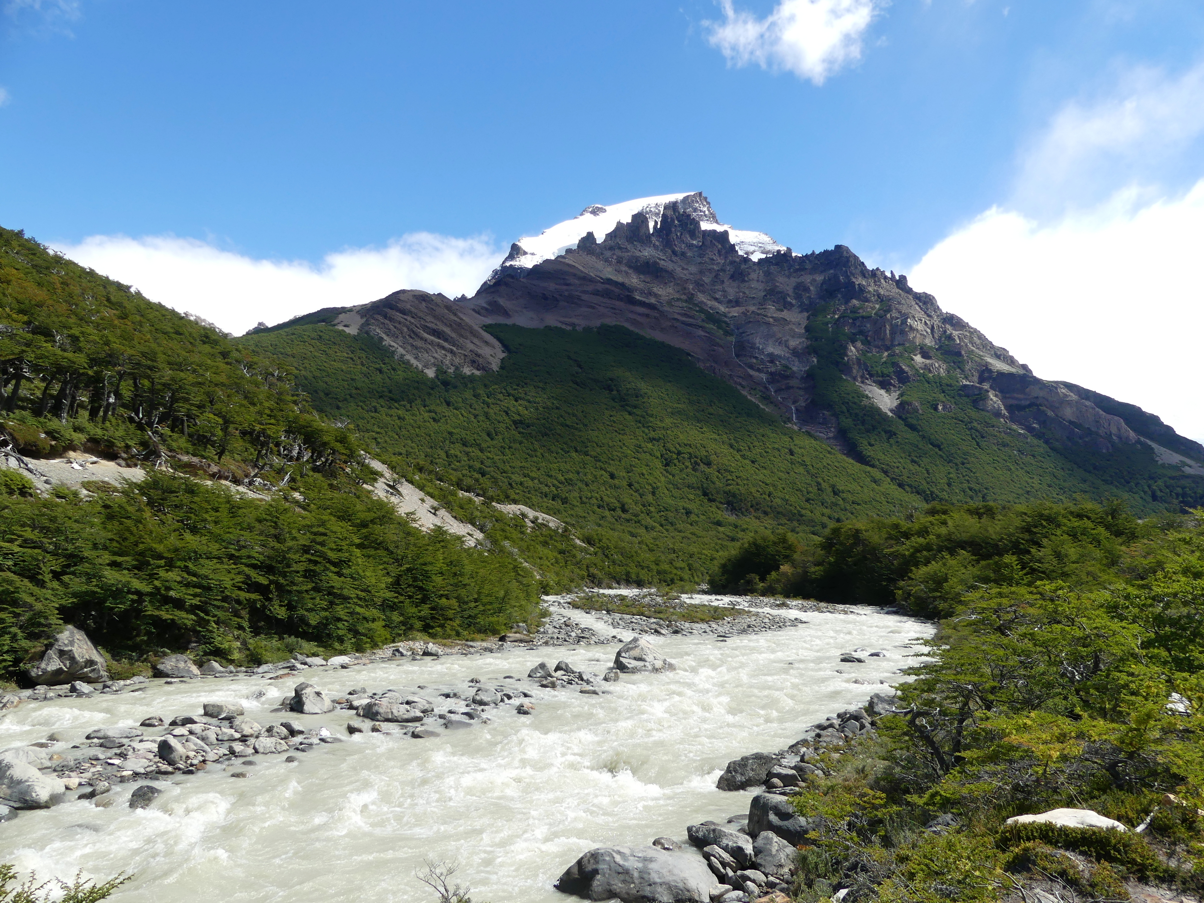
On the trail, Solo Mountain – with its odd S-curve peak – sends rushing water down valley
After 11 kilometers (about 7 miles), as the sun and clouds played along its surface, we reached the glacial lake, Laguna Torre. We had our lunch here before our return, pausing a while so we could admire the whole vista of jagged peaks above and glacial ice chunks floating below.
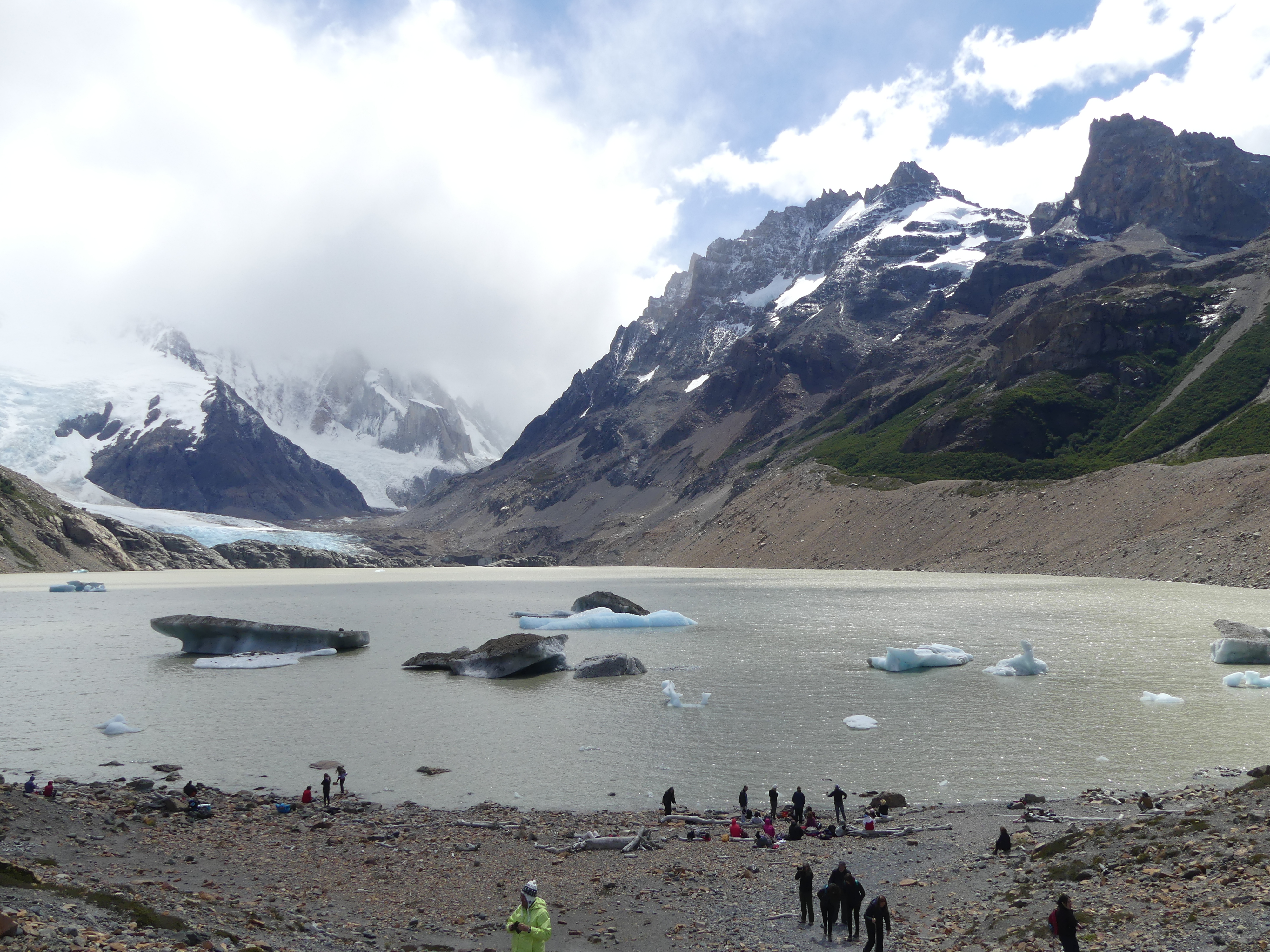
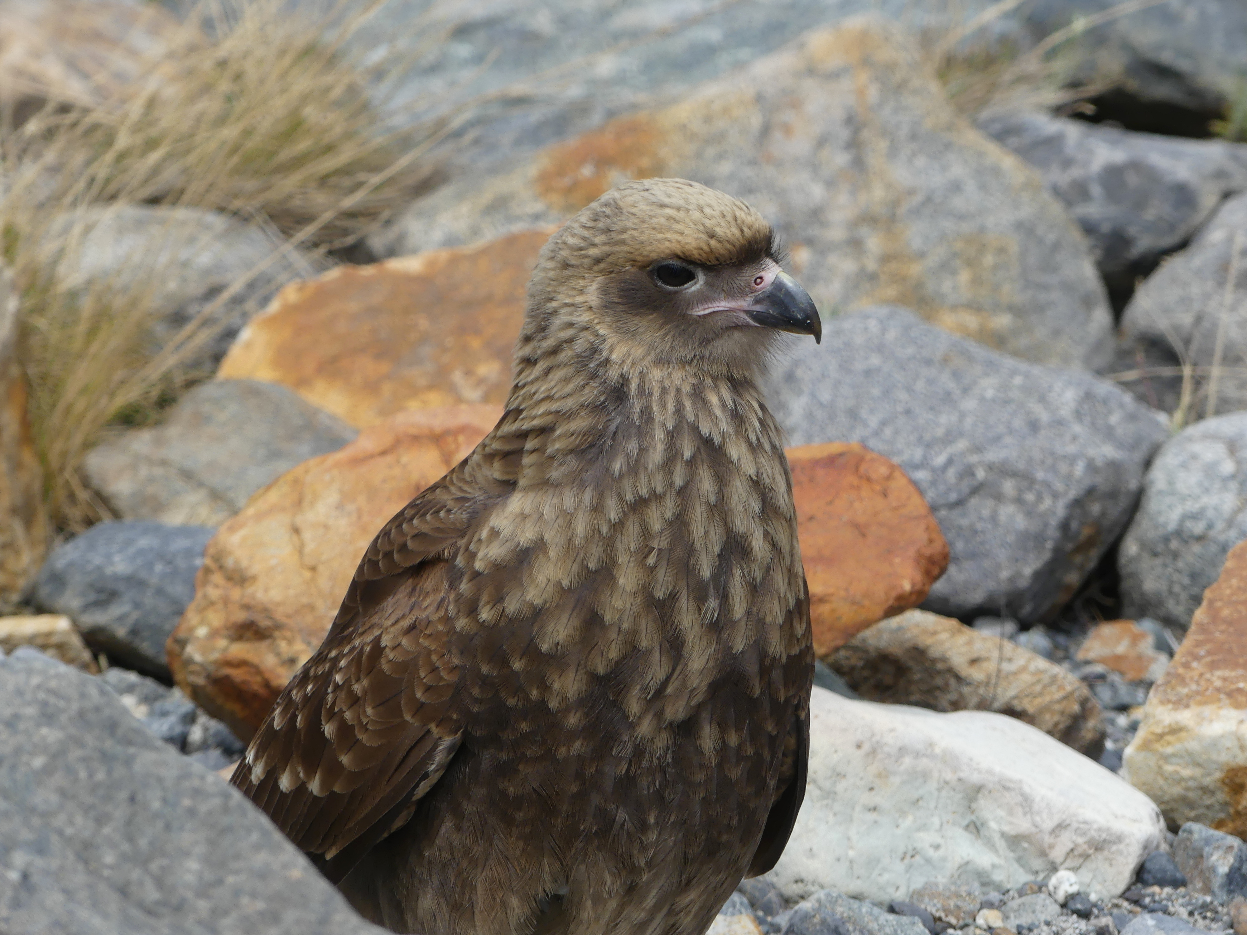
A caracara at the lake, watching for picnic treats from the hikers
When the clouds clear, Fitzroy mountain literally towers above the town. This is the most famous of the peaks nearby, for obvious reasons.
EL CALAFATE
We saw the icy column (about the height of a 20-story building) start to lean, ever so slowly widening a cleft of blue. Thread-like cracks began to appear near its base. So, during our extended visit to Perito Moreno glacier, we checked the column repeatedly. And, instead of leaving by mid-afternoon, we waited, and waited, until…well, watch the video. The wall came tumbling down.
This was our last stop in Patagonian Argentina, in the vicinity of El Calafate, a surprisingly large town on the huge Lago Argentino, with a relaxed, resort feel. At the foothills of the Andes, the town stretches across a valley hollowed out long ago by such glacial lakes. At the outskirts of town, a waterlogged wetland area offers a huge array of birds to look at.
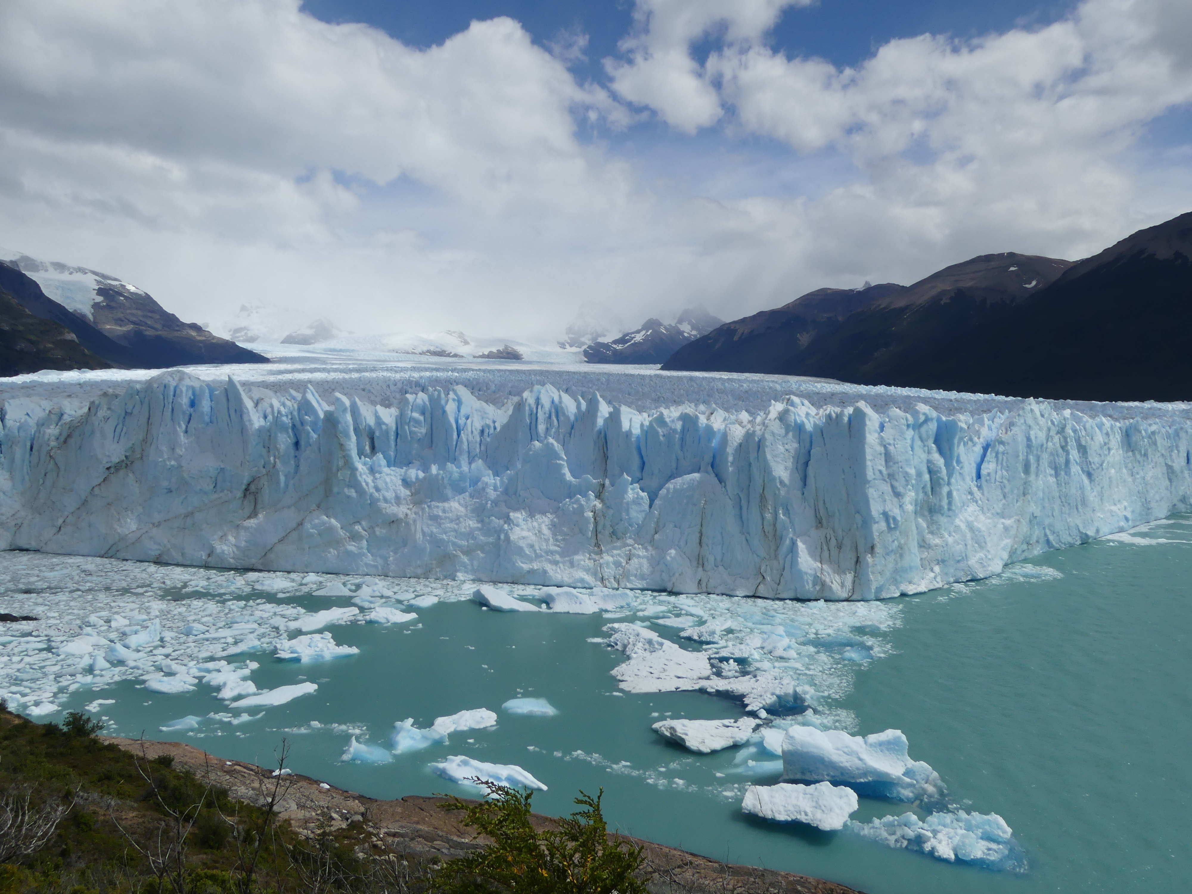
A visitor can find nearly 50 glaciers here, large and small, which constitute the Southern Patagonian Ice Field, the third largest storehouse of fresh water in the world.
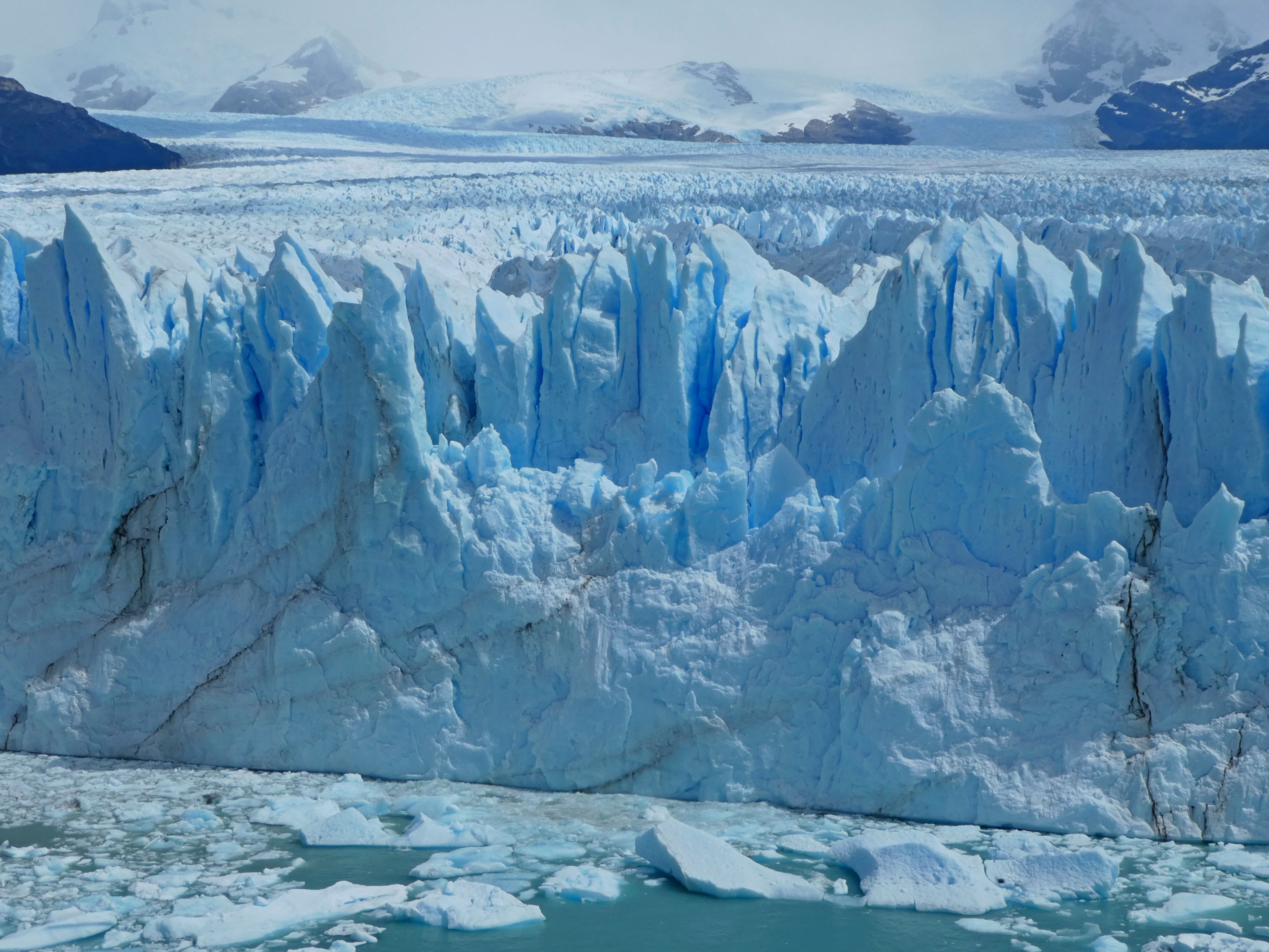
Of these, Perito Moreno presents the most spectacular wall of gleaming ice (if not the largest) because of its accessibility. Walkways and paths follow most of its 5 kilometers (3 miles) in length, so we could cozy up to its face – as much as we wanted to given how frequently chunks – like the one we witnessed – fall off it.
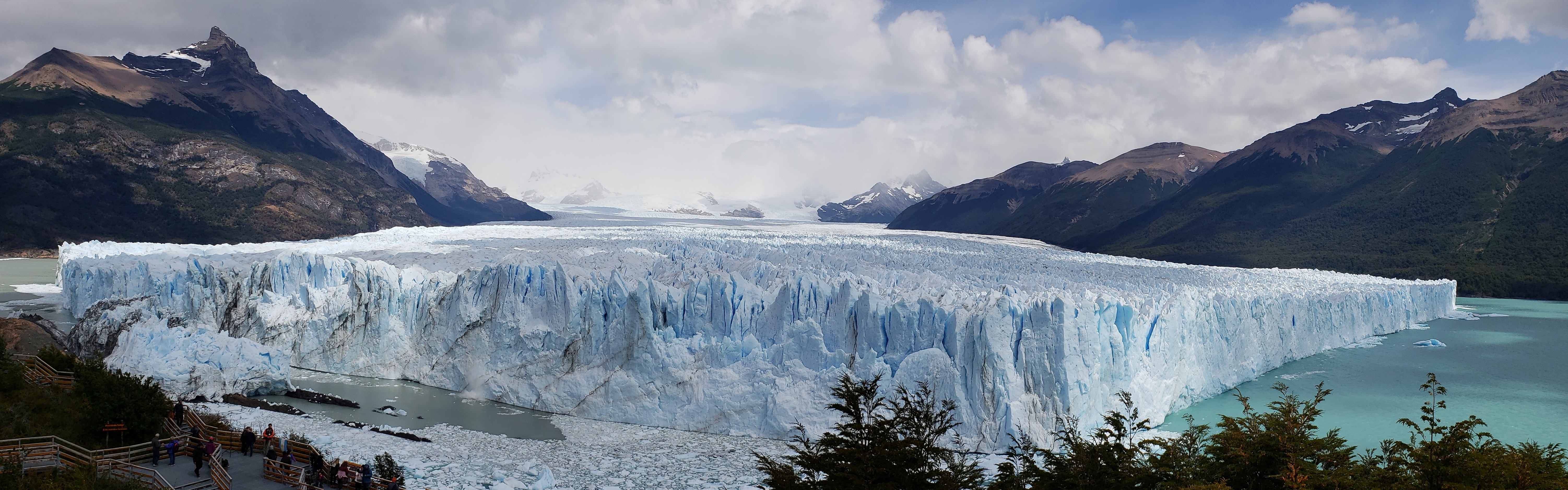
In this panorama of the glacier, you can see some of the walkways in the lower left, close but not too close to the glacial wall. The far distant origin of the glacier is 30 kilometers away (nearly 20 miles). The surface area is about 250 km2 (or nearly 100 square miles). It’s hard to imagine, but there are larger ones in the area.
A close-up of the rugged face of Perito Moreno, streaked with cracks of blue ice. Below, float some of the sheets of ice that have broken off.
Unlike most of the world’s glaciers, Perito Moreno is not receding. Every four or five years, moreover, the wedge at its forward edge forms a dam between the two sections of Lago Argentino. When the dam ruptures, a thunderous wall of water surges from one section to the other. Maybe we’ll see that another time, perhaps…
Ice chunks flow up to the shoreline, seemingly small compared to the huge glacier face. When it hits the water, a calved column like the one we filmed can propel an ice-fringed wave up to several kilometers away.
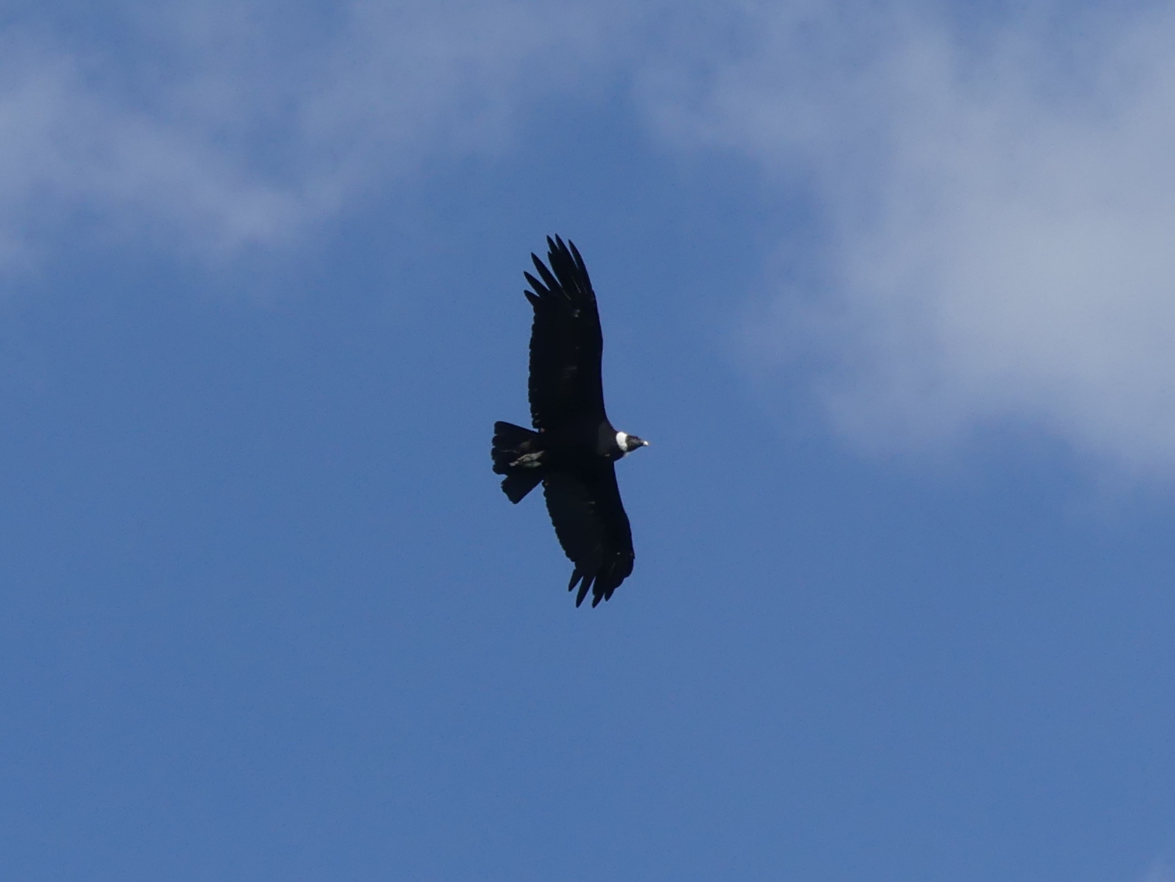
As if the glacier was not enough of an attraction, this Andean condor circled amiably above us.
TORRES DEL PAINE
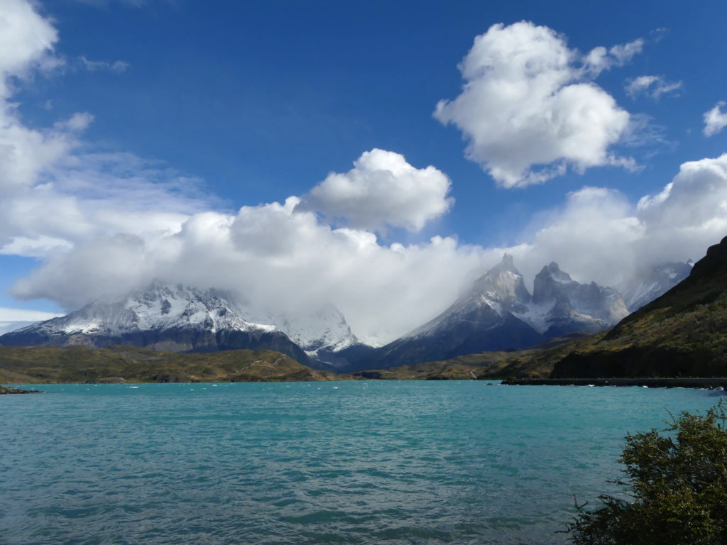
Perhaps the most famous park in Patagonia, on the Chilean side, Torres del Paine National Park features a famous hiking circuit amid its deep valleys, glacial lakes and volcanic mountains, with glampy refuges along the way. These trails buzz with foot traffic during the summer, especially the hike for which the park is named.
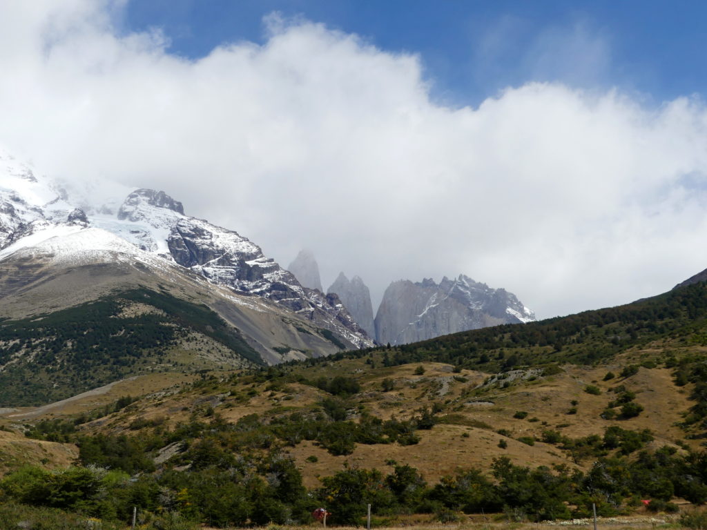
Here the triple slabs of the Torres del Paine, the namesake feature of the park, peek from their eponymous hiking trail.
Valley and river trailing down from the Torres mountains.
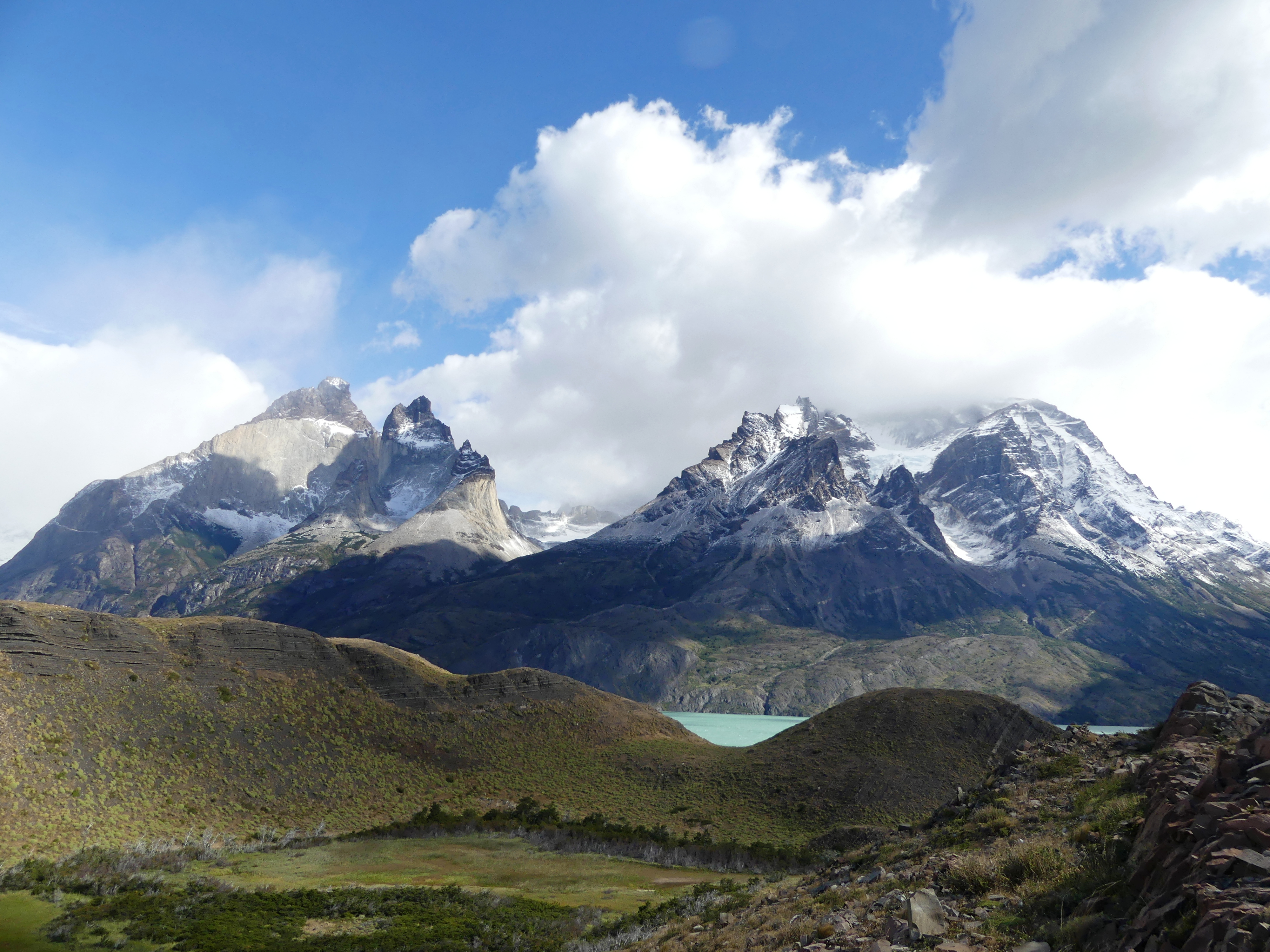
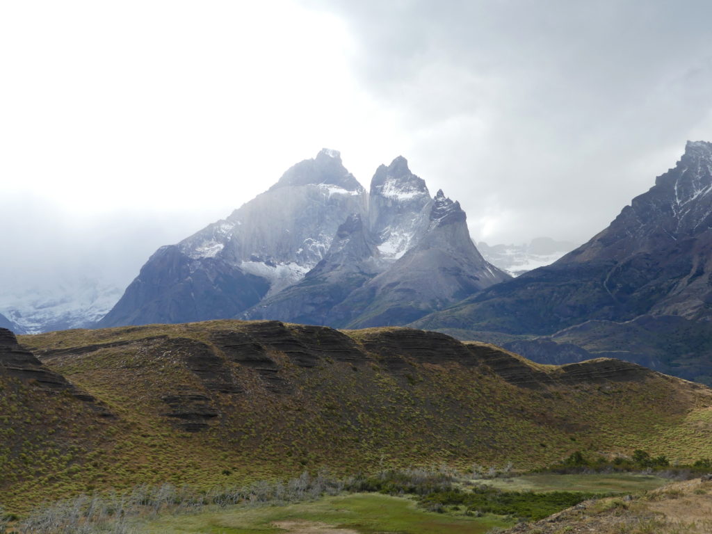
The most spectacular mountains, the Cuernos del Paine (or Horns of Paine) across from which we stayed, was even more remarkable to us – displaying its charms in any kind of weather.
From another viewpoint, the Cuernos better shows off its multi-colored peaks, alternating lighter layers of exposed granite and darker layers of sedimentary rock.
Any perspective will do to savor the charms of the layer cake of the Cuernos, like this one at Lake Nordenskjöld.

Unquestionably, even the casual visitor can delight in the park’s spectacular scenery, especially when the weather cooperates. The roads that wind through the park bring busloads to some of the best features. To our minds, however, other less known and less busy parks to the north rival the sights here.
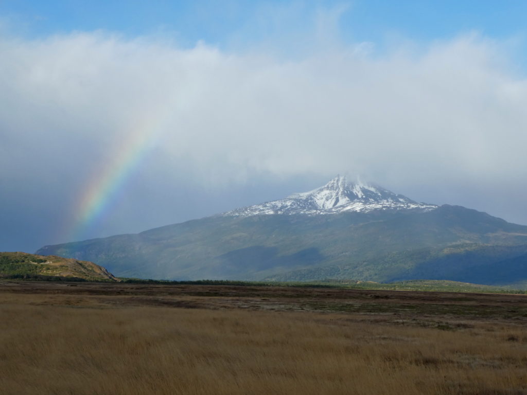
A rainbow heralds the end of some bad weather on the outskirts of Torres del Paine park.
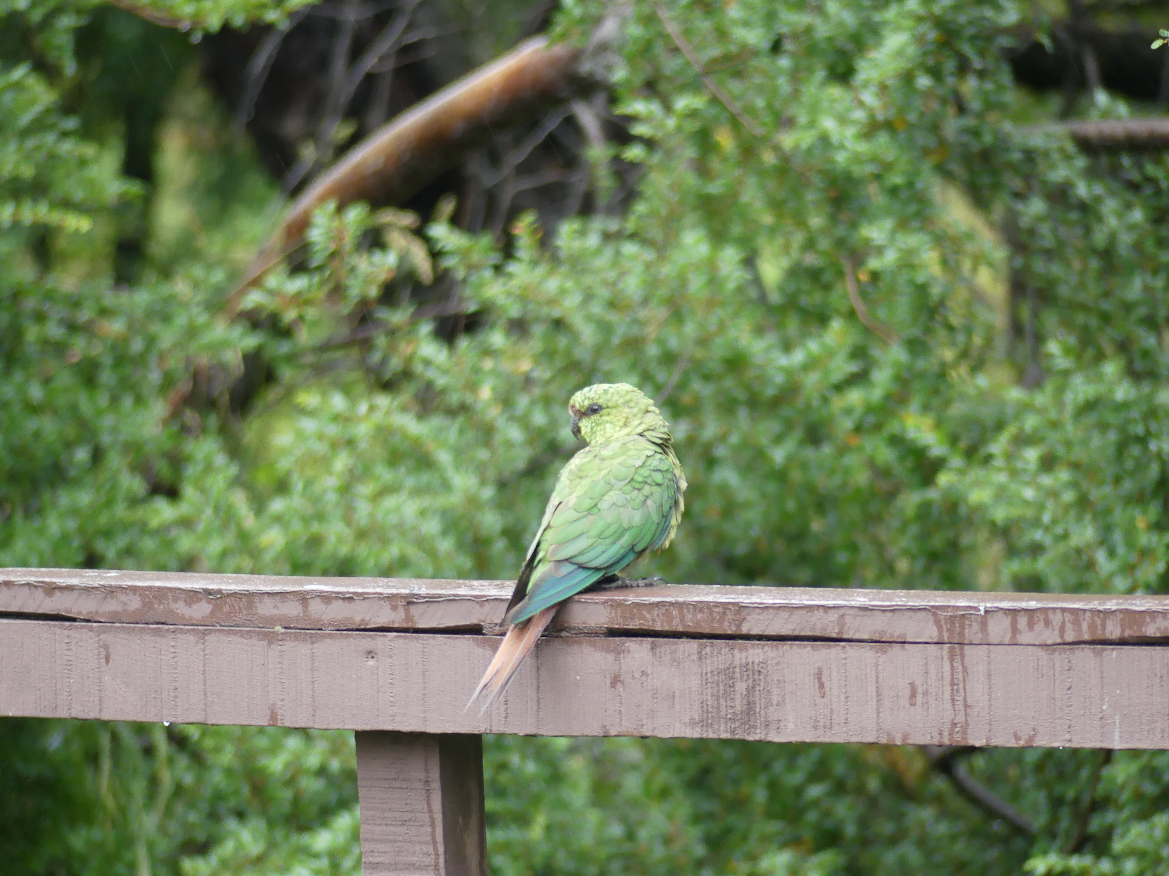
An Austral parakeet visits us at one of the small villages within the park.
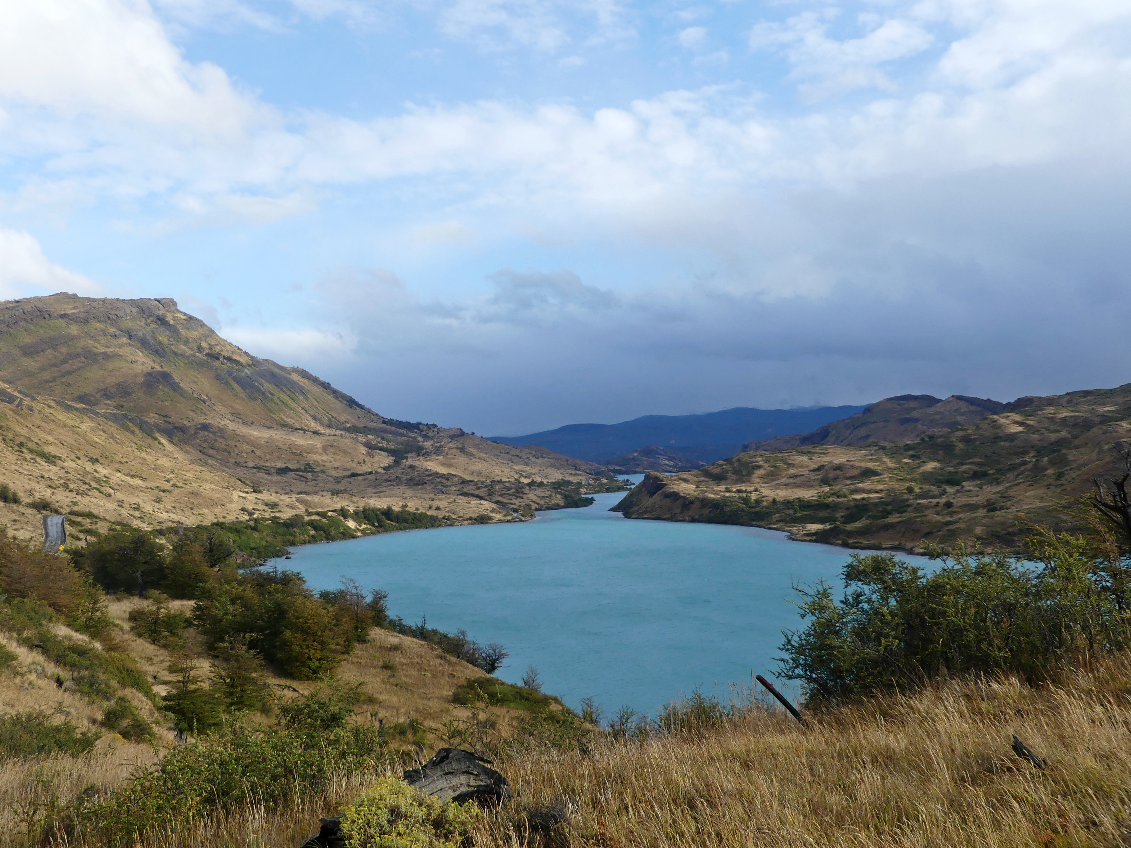
A turquoise river wiggles away from its feeder lake through desert-like grasslands in the heart of the park.
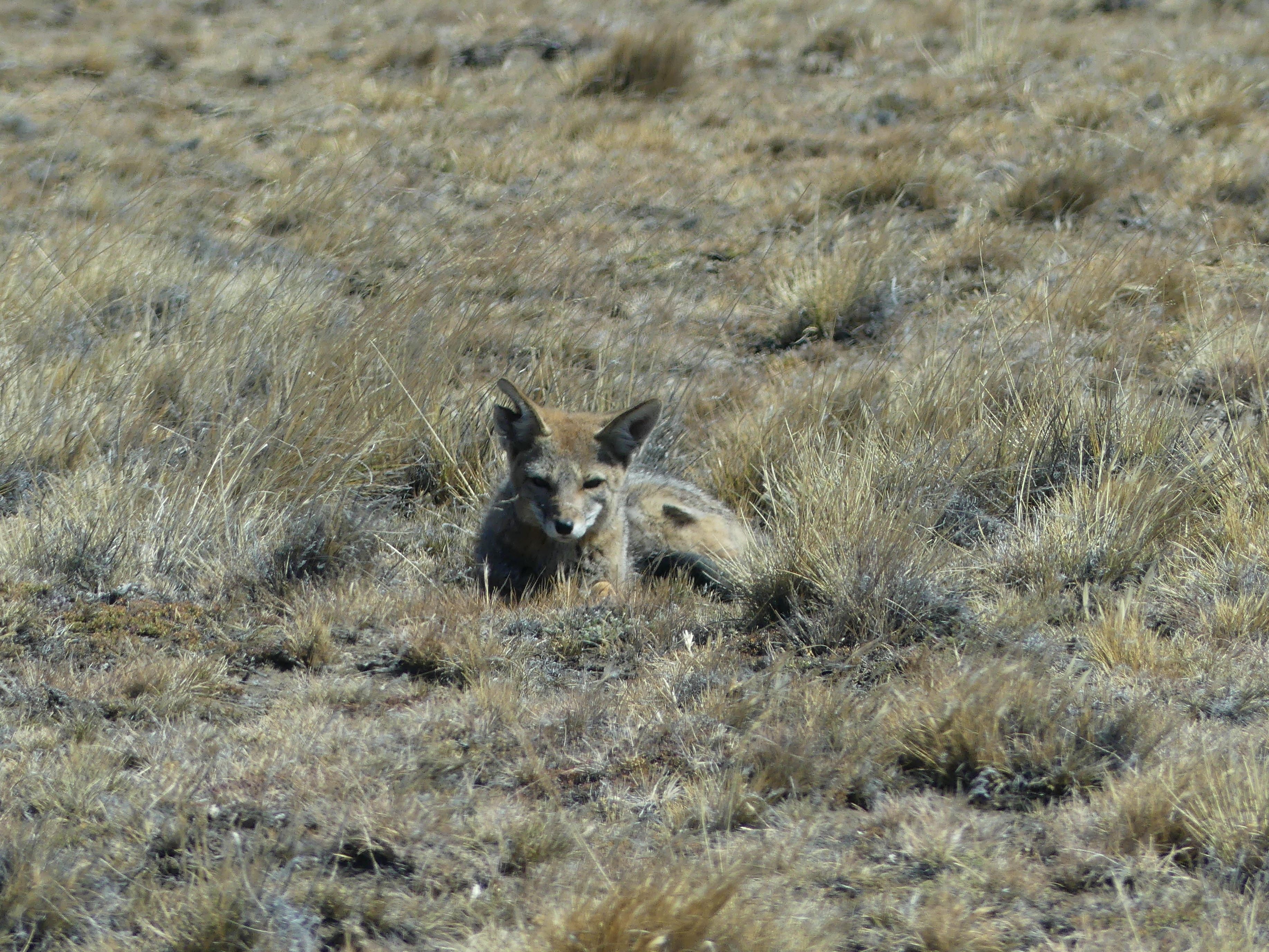
This little fox – with its split ear – watches us carefully.
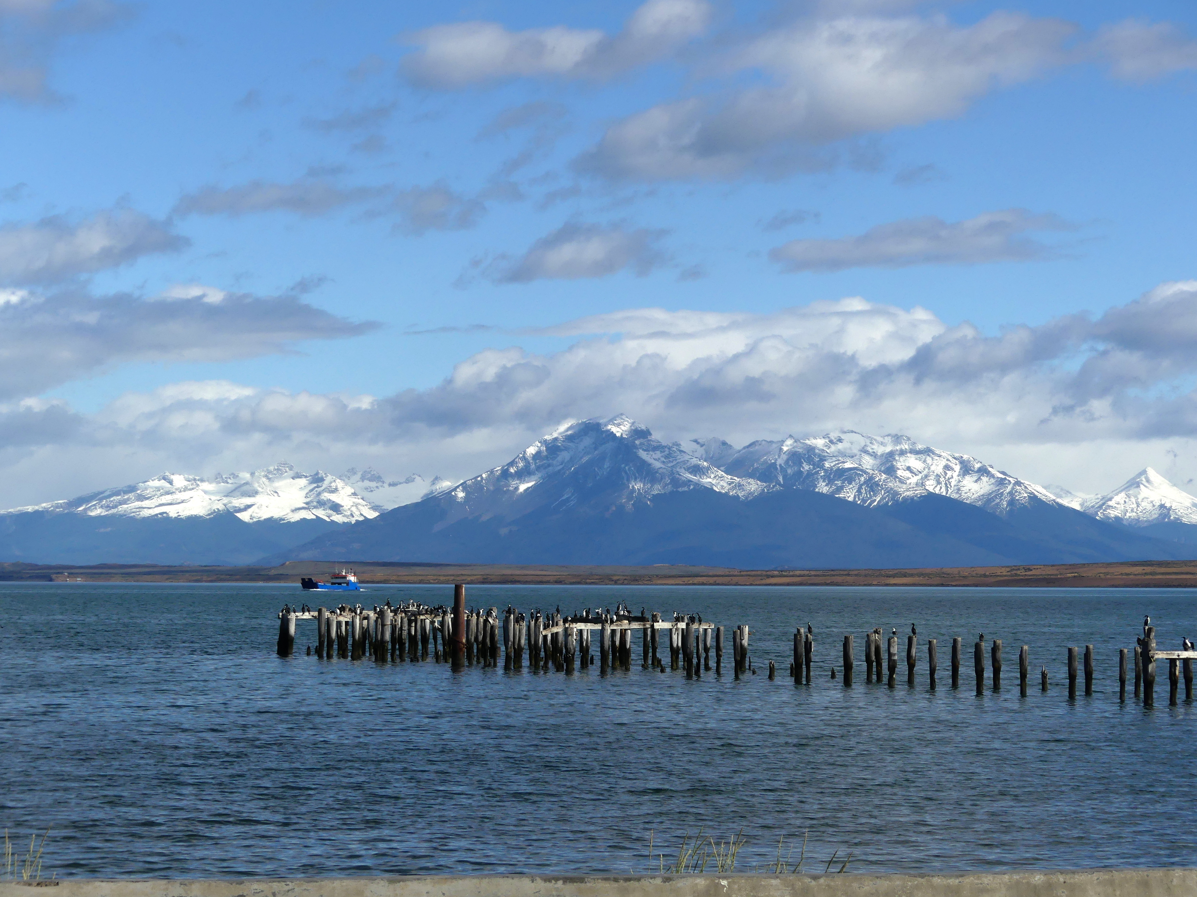
Even an hour’s drive away, in the small town of Puerto Natales, the region looks resplendent.
(To enlarge any picture above, click on it. Also, for more pictures from Argentina & Chile, CLICK HERE to view the slideshow at the end of the itinerary page.)