In brief: Connecting the Atlantic and Pacific was an engineering triumph, one you can see from a trip within the Canal. But it also split the country, a division of the well-off and poor still evident today.
The locks of the Panama Canal lift all boats from sea level up 85 feet (26 meters) to Lake Gatun along the continental divide of the Americas, and then lower them back down again to sea level. That doesn’t seem like much perhaps, unless you’re moving up or down within those locks alongside one of the big Panamax ships.
But accomplishing the task made the Canal one of the great engineering feats of the 20th century. Remarkably, the same basic equipment is still in operation after 100 years, including the steel bolted panels that hold back the water in each lock (as welding technology wasn’t yet available).
Now billions of dollars in revenue flow through the hands of Canal operators each year, tolls paid by around 14,000 thousands ships whose 10 to 12 hour passage saves them a couple of weeks of sailing around dangerous Cape Horn. Well worth it. Yet the wealth has never spread too widely.
Since the time of construction the Canal has been a tourist attraction, with the digging even featured on postcards aplenty. Tourists can still do the canal today, climbing aboard newer three deck vessels, or even a smaller, veteran tourist boat that first visited the locks early in the 20th century. Some mornings you can go north from the Pacific when all northbound ships go; afternoons, you can go south from Lake Gatun when the southbound ships take over. They alternate because some spots like the Culebra Cut just to the south of Lake Gatun are too narrow and shallow for two-way traffic. The Cut was the most difficult part of the original excavation because of the unstable soil of the adjacent hills through which the canal flows.
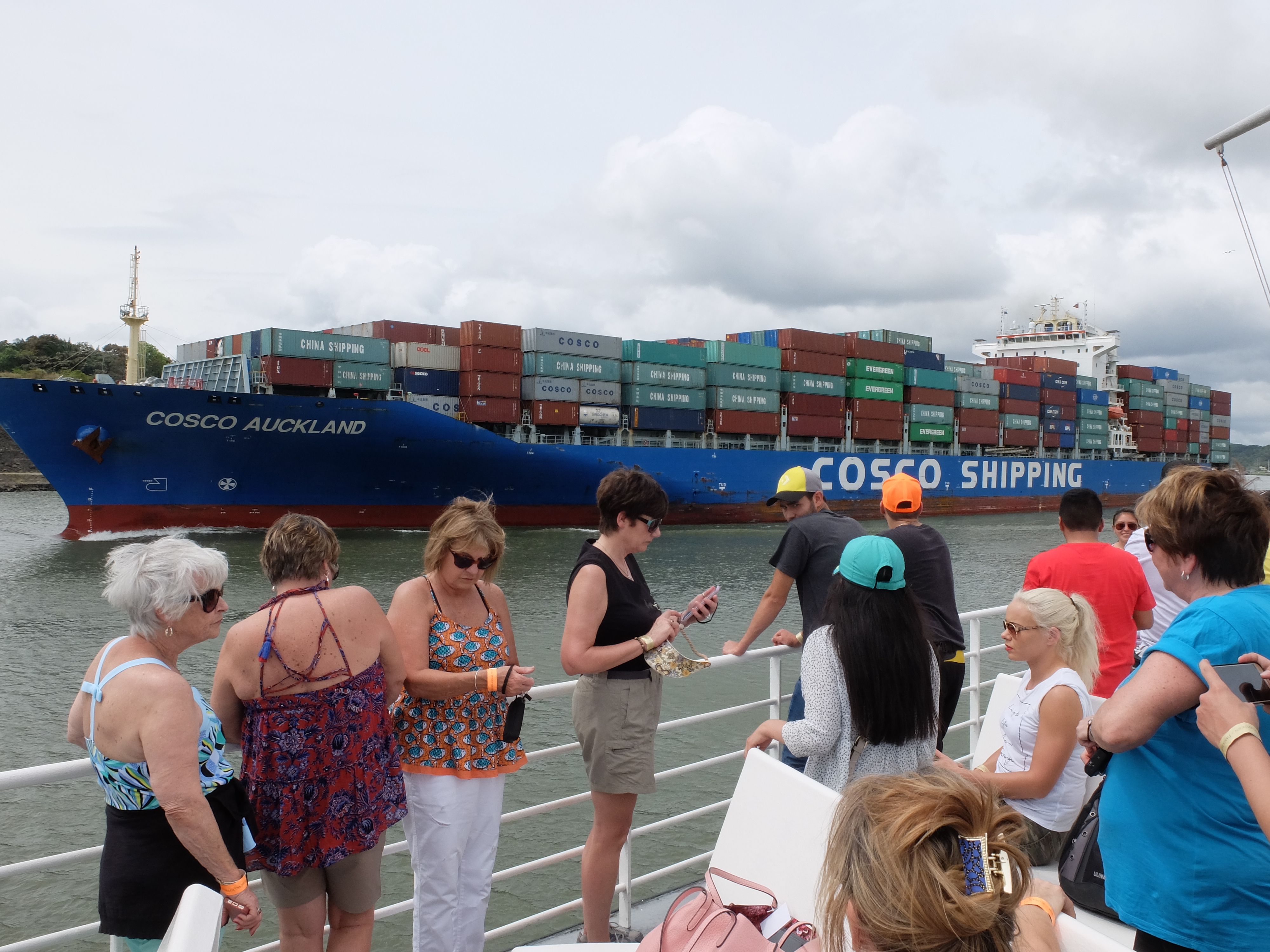
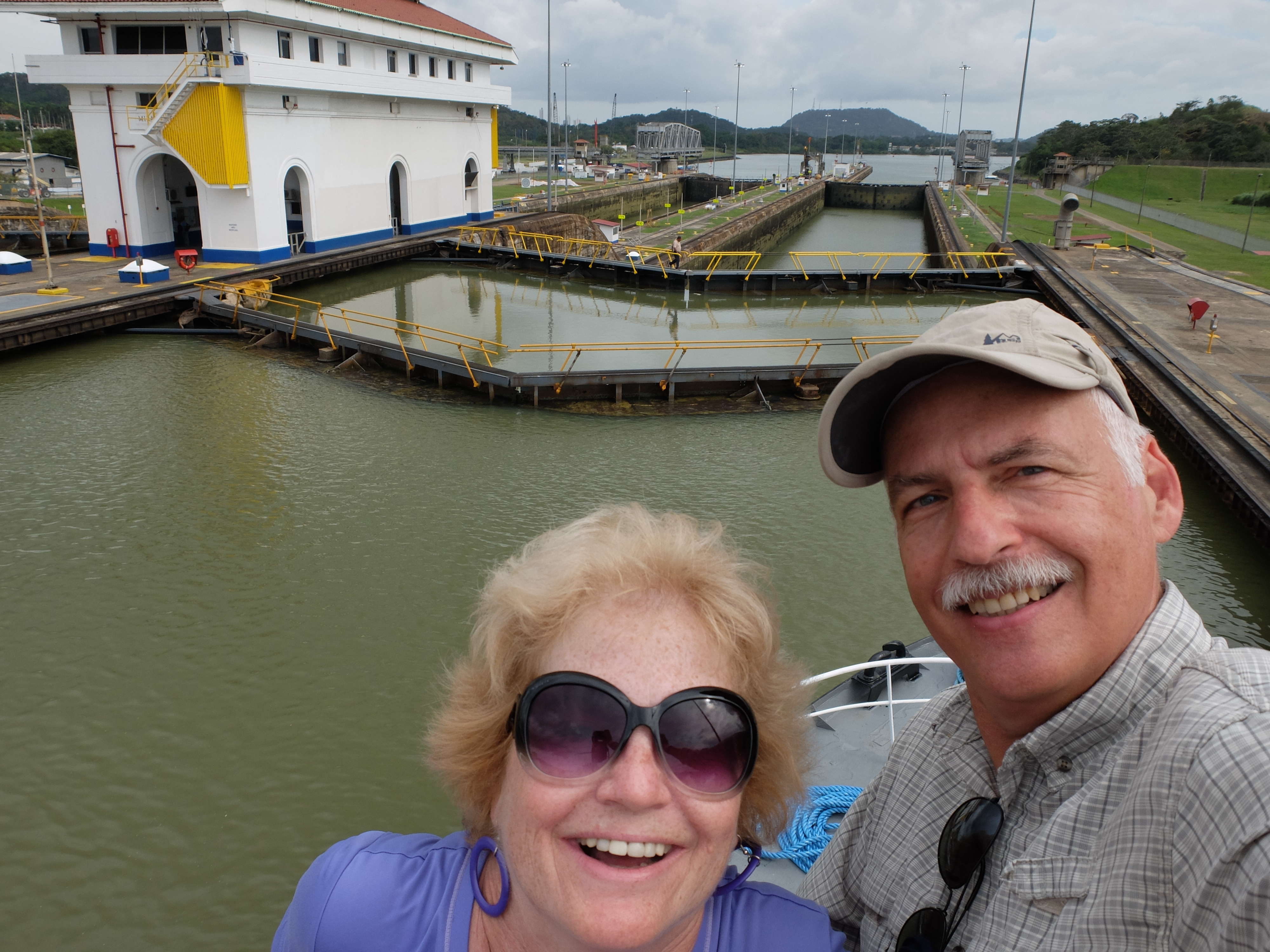
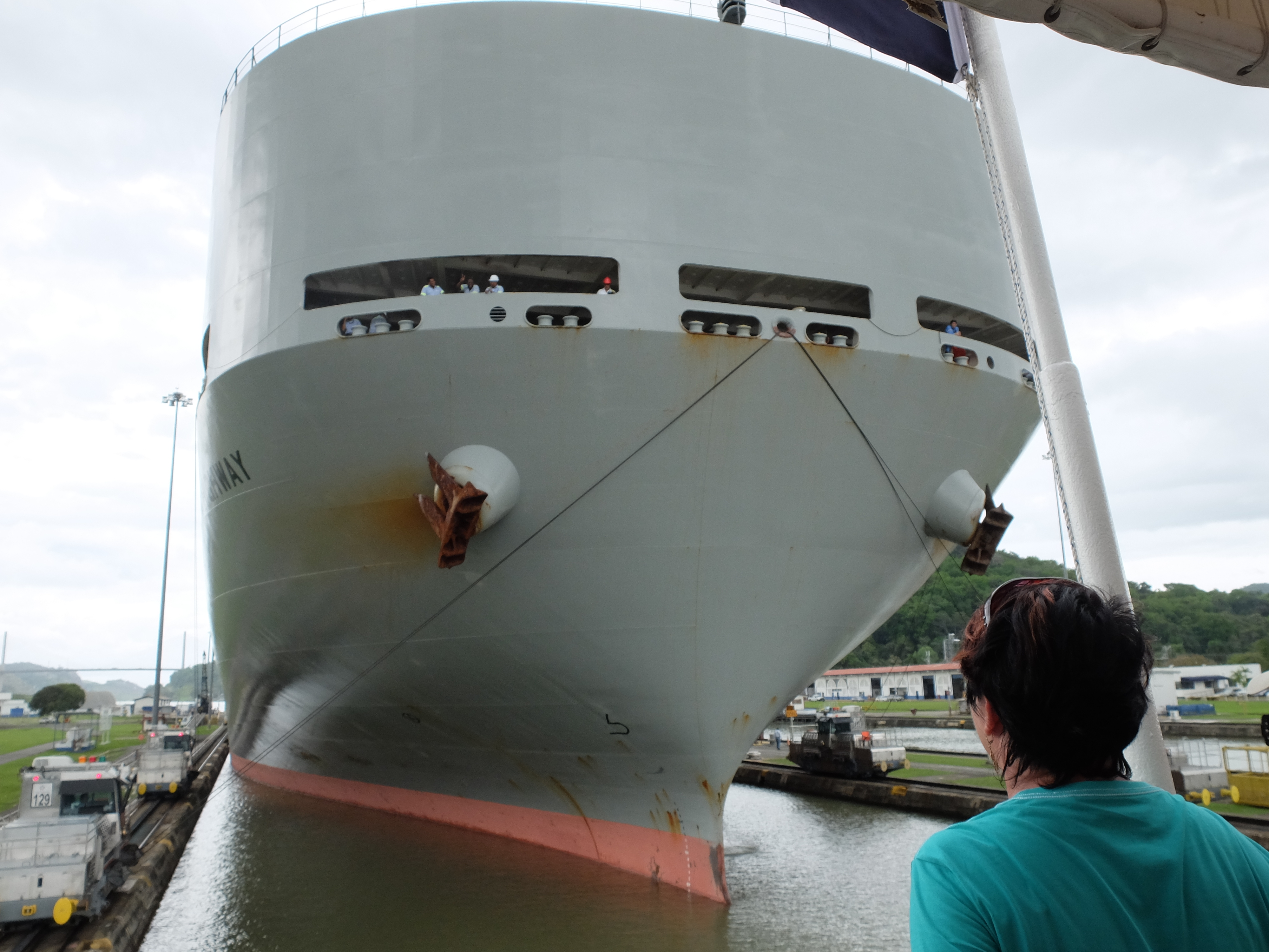
We took a bus north to Gamboa at the edge of Lake Gatun in the late morning and, for several hours in the boat, dodged a couple of massive container ships, the Panamax class, 110 feet wide (33.5 meters) and loaded with up to 4500 containers. One traveling with us boasted the name Auckland, but was piled high with containers that declared China instead. Another – perhaps 15 stories tall – loomed over us in the locks below the Cut, and again at the last locks to the Pacific called Miraflores. It was pretty impressive when it eased within a few meters of us and we waved to the crew members leaning out the front, way above us.
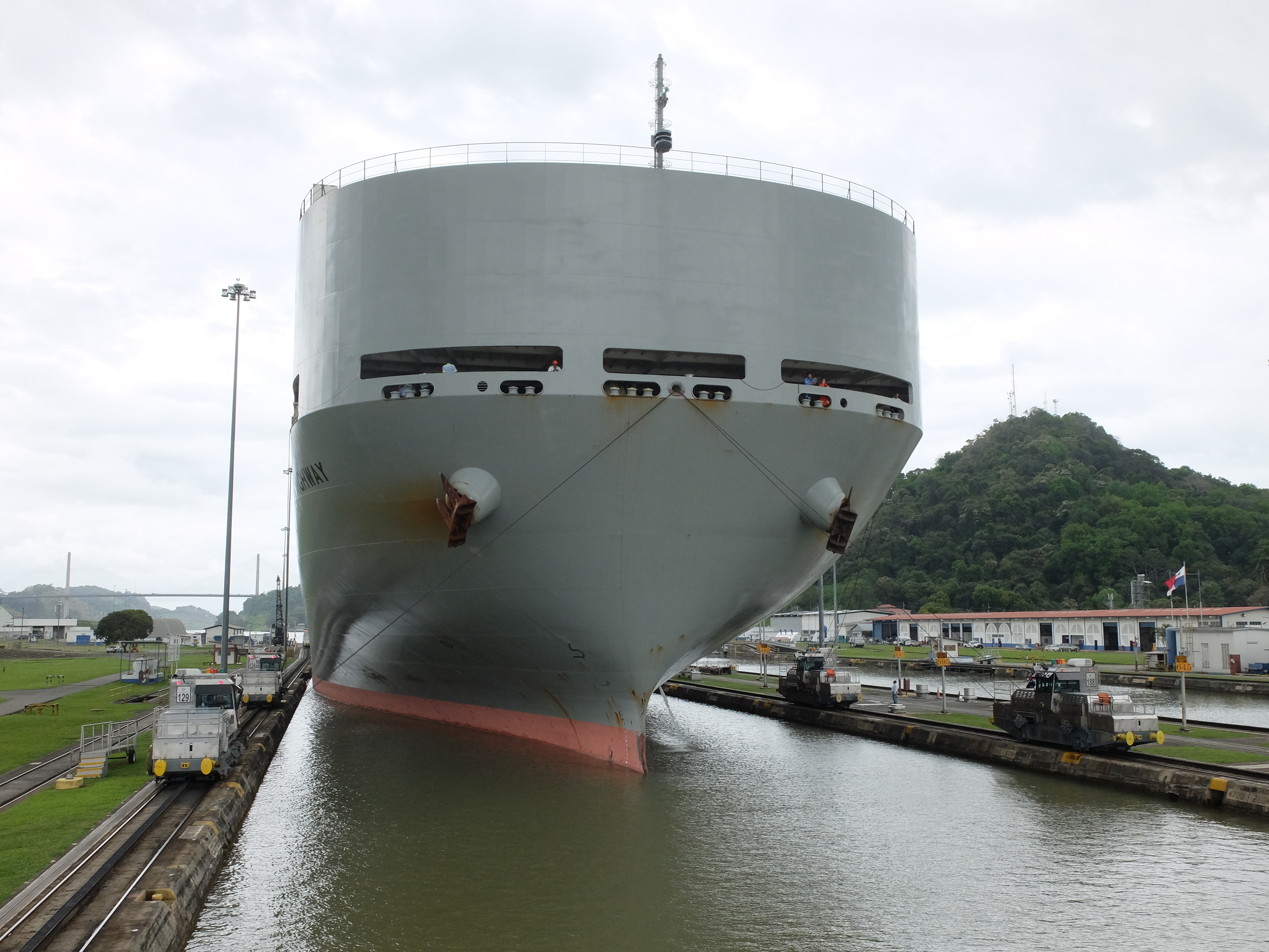
Squeezing through with at most a half meter (one foot) of clearance on either side of the ship, it had been drawn along and then kept in place by cables hooked to “mules,” electric rail cars running along the side of the locks.
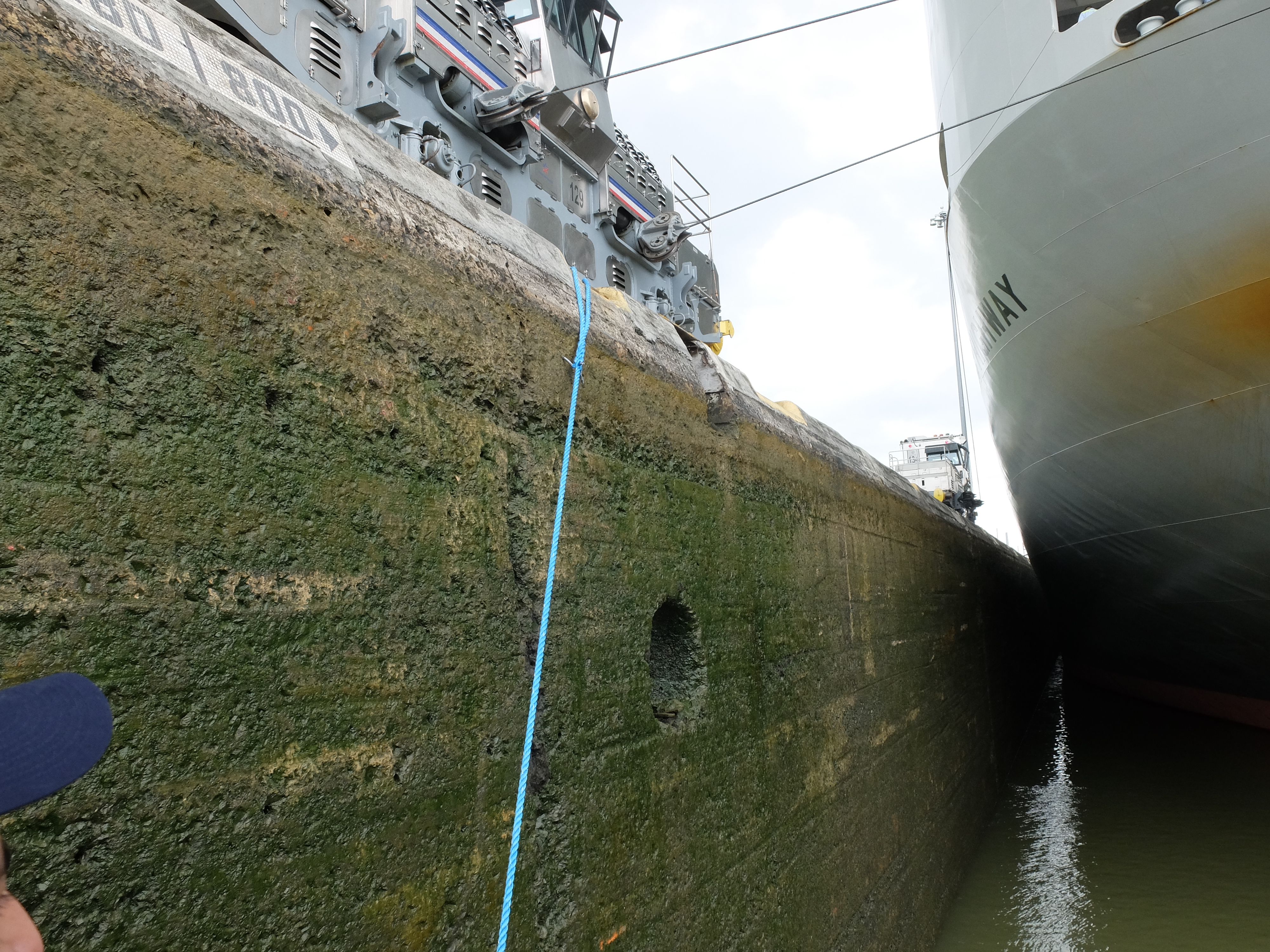
The great bolted panels closed behind us to the north. Silently and invisibly, water flowed out of the locks, recycled as much as possible for the next use. Surprisingly quickly (at about a meter per minute), we saw the mule that had been below us now way overhead – a descent masked by the immobile ship looming over us.
Once we were at the level of the next piece of water, the bolted panels to the south began to open, the same mechanism that the original engineers had installed. And we proceeded out of the locks. At Miraflores, that meant back to sea level and the Pacific Ocean. Sea birds hovered and dove around us greedily gobbling up fresh water fish stunned by the salt water in which they suddenly found themselves.
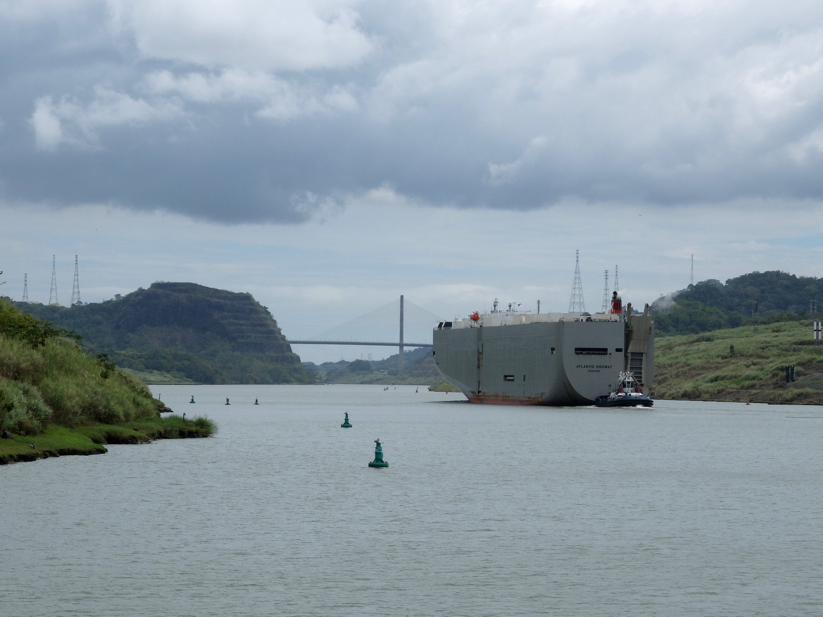
What we only glimpsed to the west of us were the additional passages and locks added in a massive new project over the last few years in the narrowest and shallowest sections. That allowed bigger and bigger boats through – redefining the Panamax vessel to titans that can carry 13000 containers instead of 4500.
Despite this enormous commercial operation, with communication towers all along the ridges and navigation markers sprinkled liberally on the shore between the locks, the Canal must be ecologically minded.
Though Panama is hemmed in by two oceans, water is a precious resource in the canal. You need it at the top more than at the bottom to keep the locks filling and provide enough water depth as well on the descent from the lake. So the Canal authorities recapture most of the water that drains from the locks. They invest in watershed protection, ensuring the health of hectares of forest so that rainwater is captured. The hills tapering off to the north and south of Gamboa are richly wooded, places where you might forget there was a billion dollar business nearby.
Beyond the thrill of traveling with the big boats, tourists are drawn to the locks by the Canal’s importance in sea-going trade and its history. Many of those on our trip had read extensively about it, and were thrilled just to be there at last.
The canal began as a complete failure. Decades before the US-sponsored construction, a French engineering company made the mistake of trying to dig a trench that would avoid locks. It lost the battle against hillsides that persistently collapsed into the digging and diseases like malaria that devastated their workers.
Learning from that, and using the works already in place including the rail line parallel to the canal, the engineer in charge, John Frank Stevens, created as much an operating system as a big dig. He dammed the main river, the Chagres, to create Lake Gatun and harness a supply of water to operate the locks. Employing over 50,000 workers during the project, he instituted health prevention and care that kept the workforce intact, as protected as possible from yellow fever and malaria. He ensured a supply chain of goods as well as materials to keep workers and development going. And brought the project in for nearly the same amount of money the canal earned in its first year alone.
But all workers were not treated equally as the prejudices of the time held true in Panama. The “whites” were paid in more usable gold, had higher quality resources available and suffered a low mortality rate. The “coloreds” – often from the West Indies – were paid in less desirable silver, had access to fewer resources and died in far greater numbers from illness and accidents. Of the more than 5000 deaths during the US construction, the preponderance were West Indian.
After about a decade of construction, and once in operation under US control from 1914 on, the Canal divided the country physically and economically. The operators established a US territory called the Canal Zone. It flanked the canal, some 16 kilometers wide (10 miles). There you could find Little America, where workers on shipping, insurance, trade and services related to the business of the canal were able to keep clear of the local Panamanian population.
In a way, this was nothing new. In the years prior to the canal building, the United States strong-armed the Colombian government to divest the isthmus that had always been a part of Colombia. With enough control, the US legislature decided to allocate funds for the project, influenced in large part by a master Panamanian manipulator. He turned the legislators away from a Nicaraguan option toward the Panamanian one, and then cut a deal that benefited himself and the US at the expense of his country.
Finally, after the US ceded the Canal to the Panama at the end of 1999, the Zone walls fell and the privileged occupants moved out.
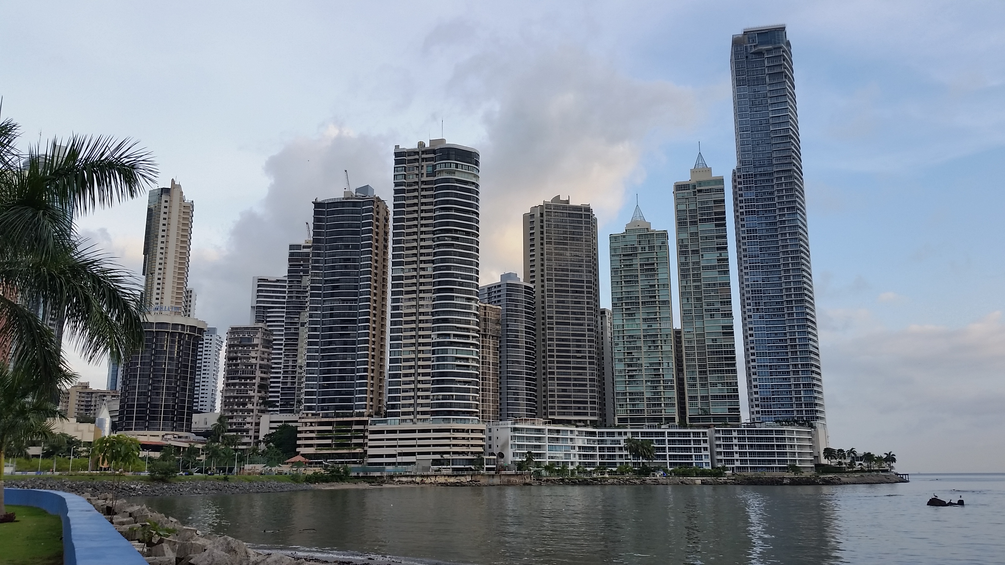
But not the other economic zones of privilege. Panama City remains divided, prosperous districts of charming bungalows or glass-wrapped skyscrapers alternate with poor barrios where much has fallen into disrepair. Despite all the money channeled through the canal, you can readily see a huge income disparity within Panama and too much poverty.
Moderate income professionals, wealthy developers, rich traders and shippers, comfortable expats, all began to create their own zones carved apart from the poorer Panamanians. Naturally they took over the land along the wide Pacific bay embracing Panama City, building those gleaming high-rises and fashionable shopping malls.
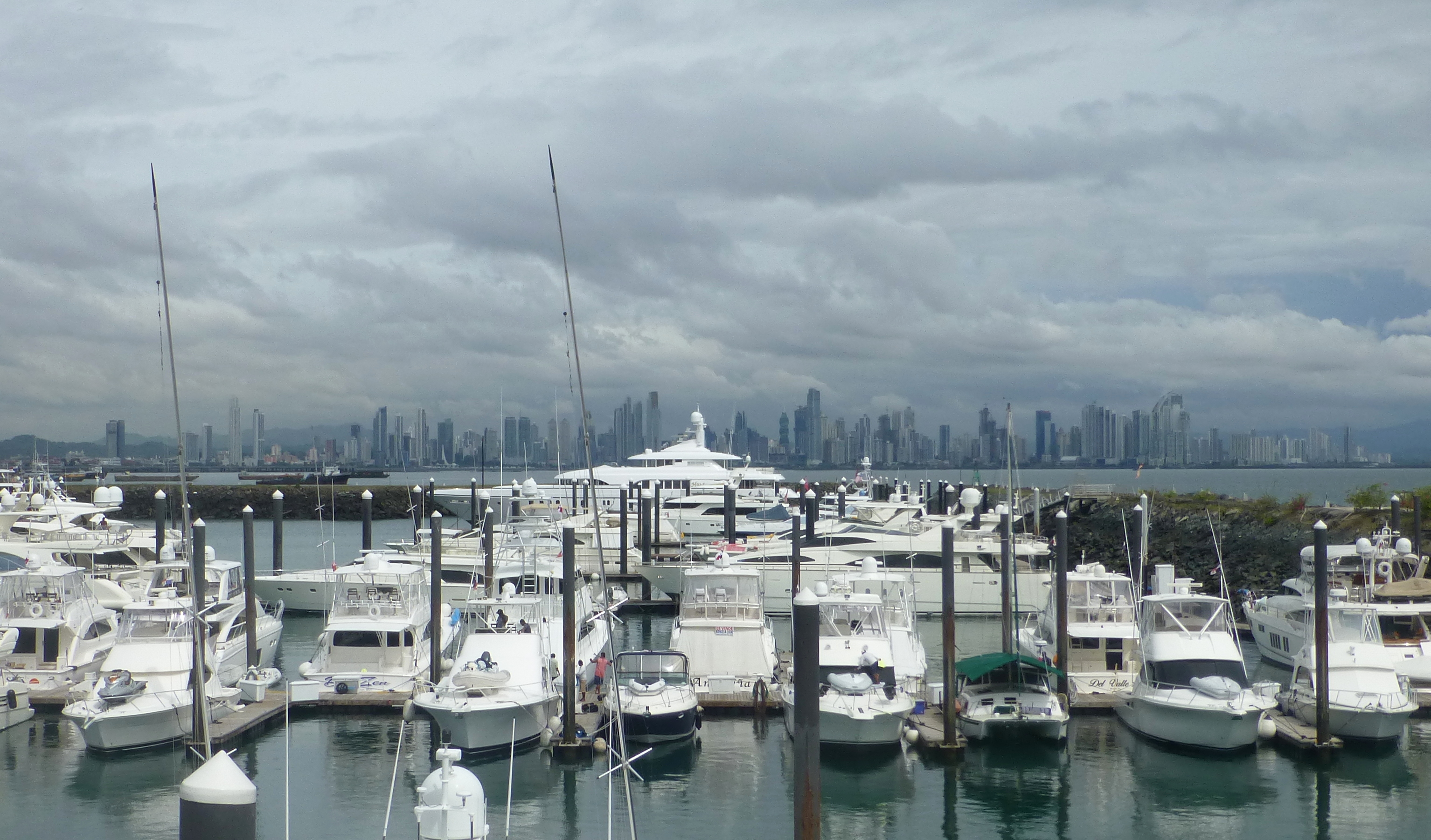
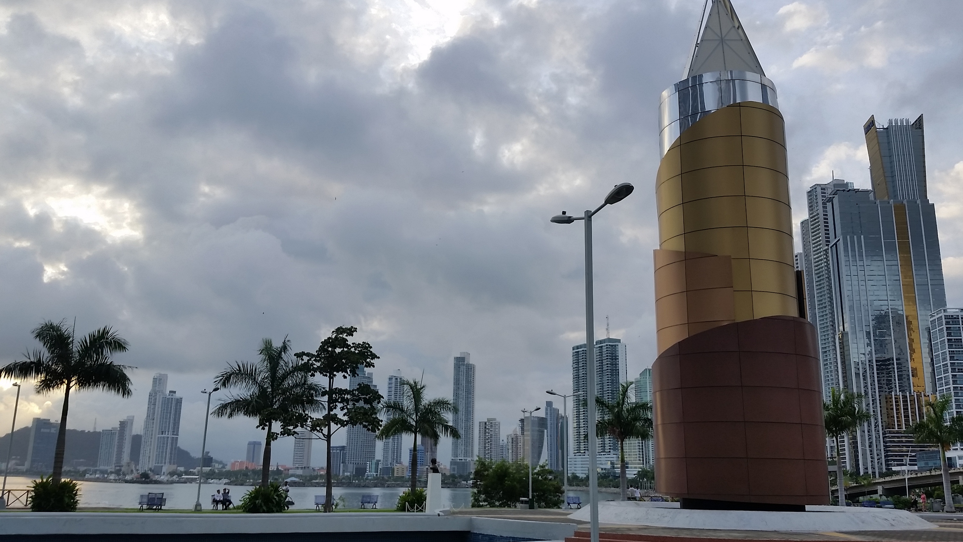
Within the last decade, development has accelerated rapidly so that a forest of apartment buildings and offices dominates the shoreline, providing stunning vistas. The new Amador Causeway, jutting deep into the bay, is a gateway to the canal and also home to posh dwellings and the yachts of the well-to-do.
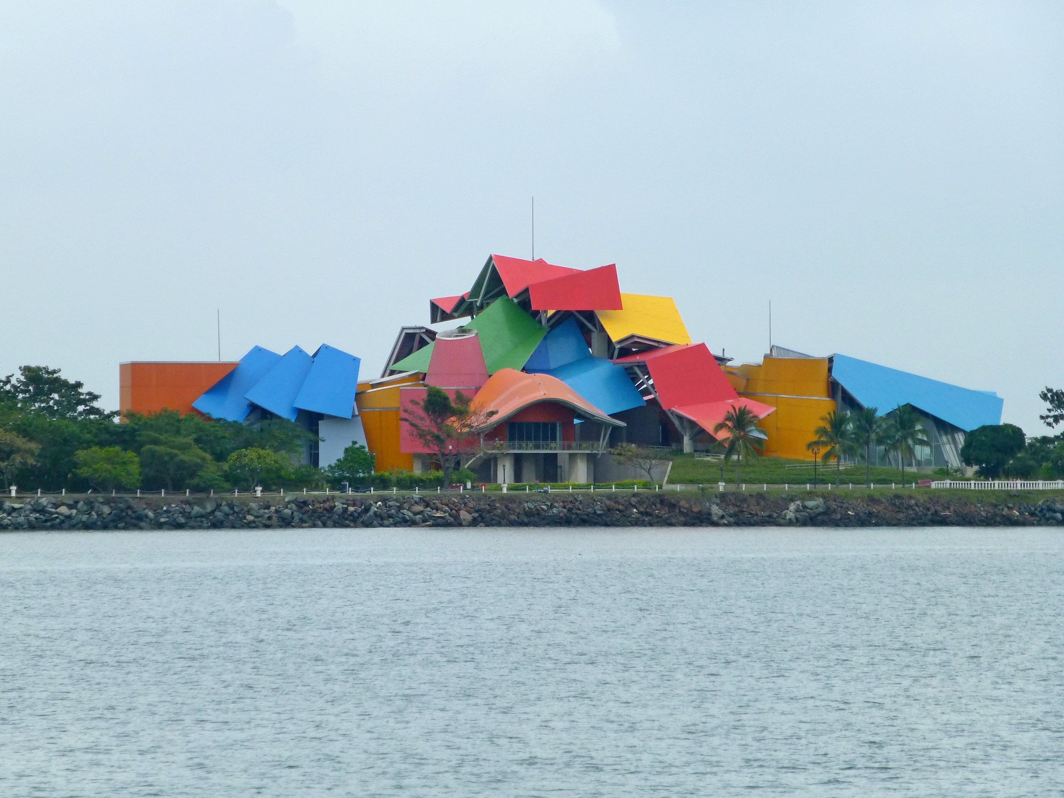
Halfway along the causeway float the tropically colored panels of Frank Gehry’s Biodiversity Museum, panels which reminded us of the less colorful intersecting angles of tin roofed barrio dwellings, hallmark of the poorest neighborhoods.
In the midst of the growth lie the skimpy ruined walls of the older city, Panama Viejo. That 16th century town proved difficult to defend from pirates and invaders, so was largely pillaged for the stones to build a more defensible newer city, a tiny square peninsula jutting into the sea a few kilometers away. Guidebooks advise visiting the archeological site, but warn about wandering too far from the ruins because of “dangerous” neighborhoods adjacent to it.
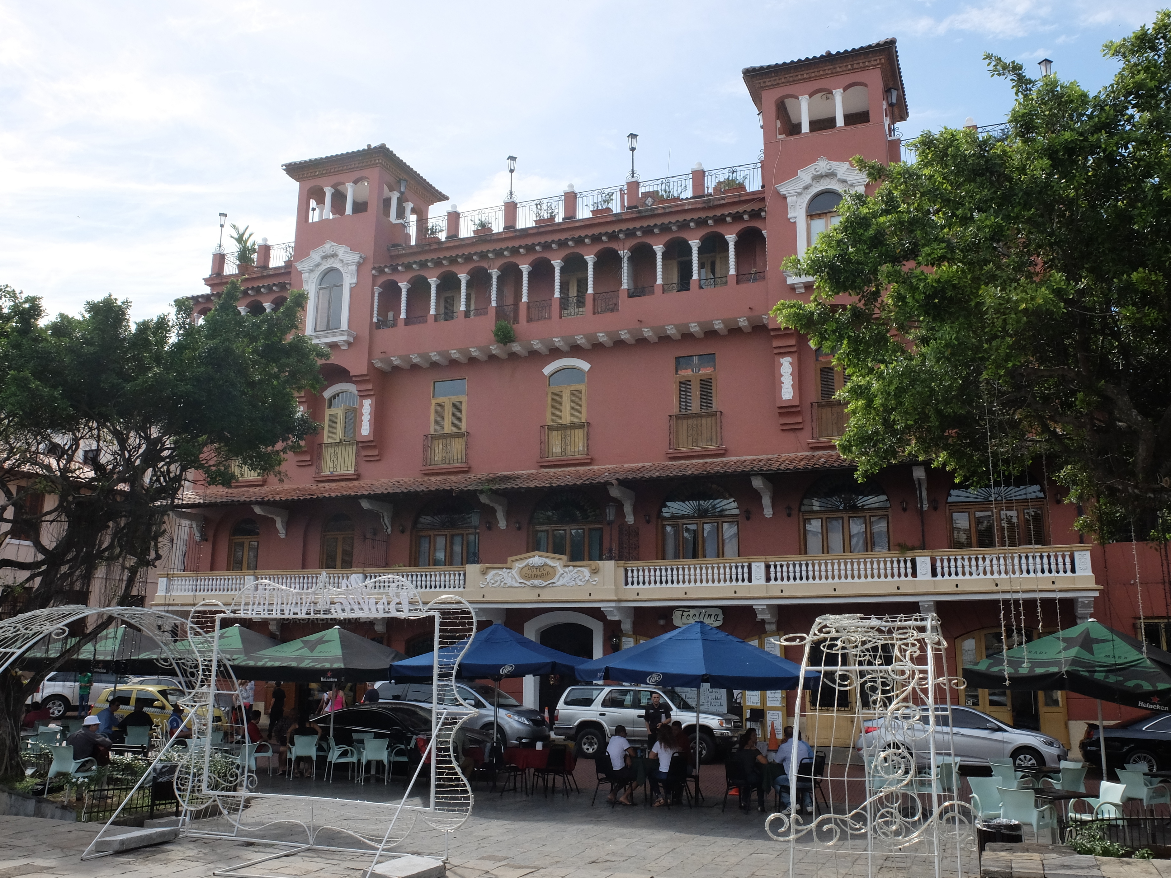
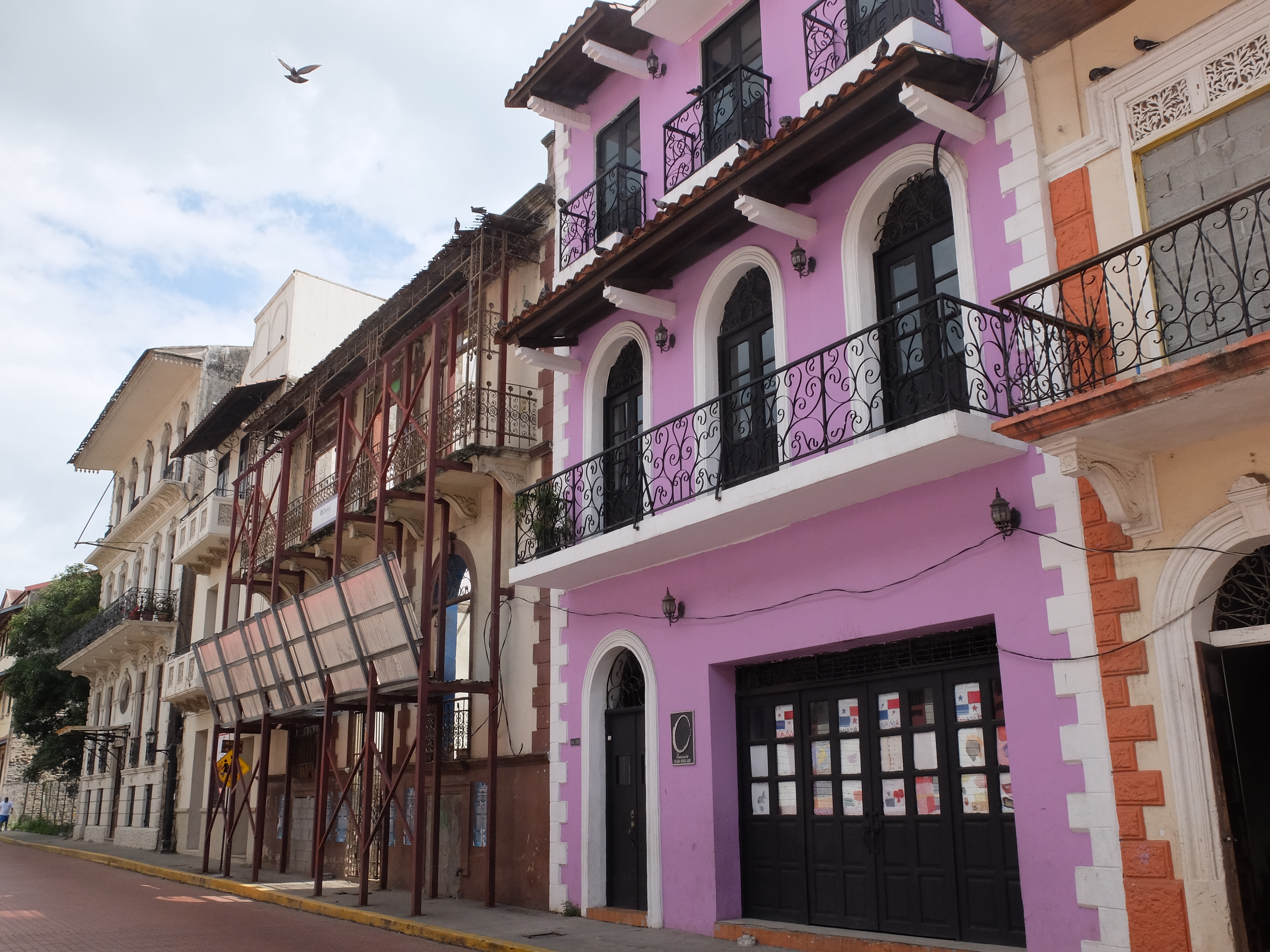
That lovely new 17th century Spanish colonial town, now called Casco Viejo, welcomes well-off tourists to elegant hotels, roof-top bars and interesting sights – most refurbished and repainted with tourist money.
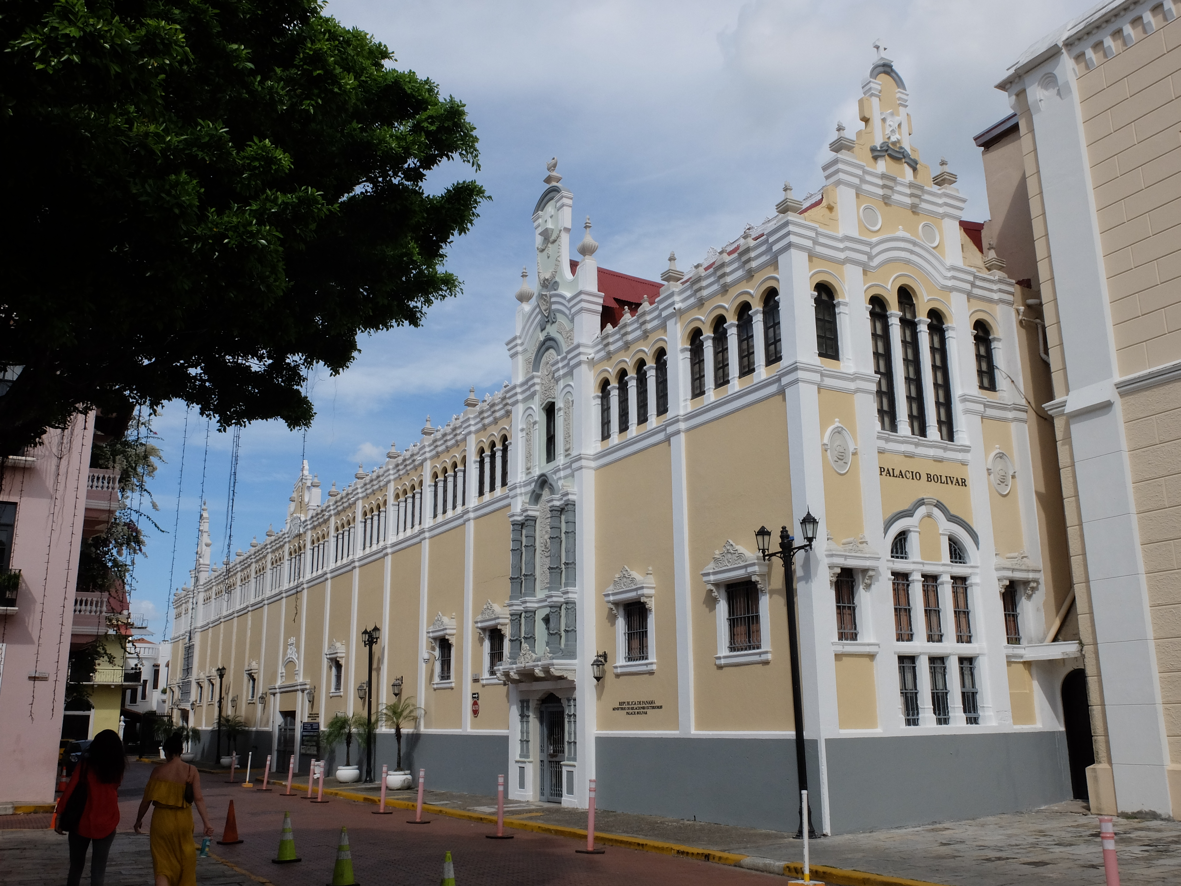
Baroque churches dot the narrow streets. Elegant turn of the last century buildings house governmental offices or refurbished hotels, including old palaces like one named for the Liberator, Simon Bolivar.
But then nearby you can walk along the once fashionable shopping streets where peeling walls and garish signs mar the drab or deteriorating buildings.
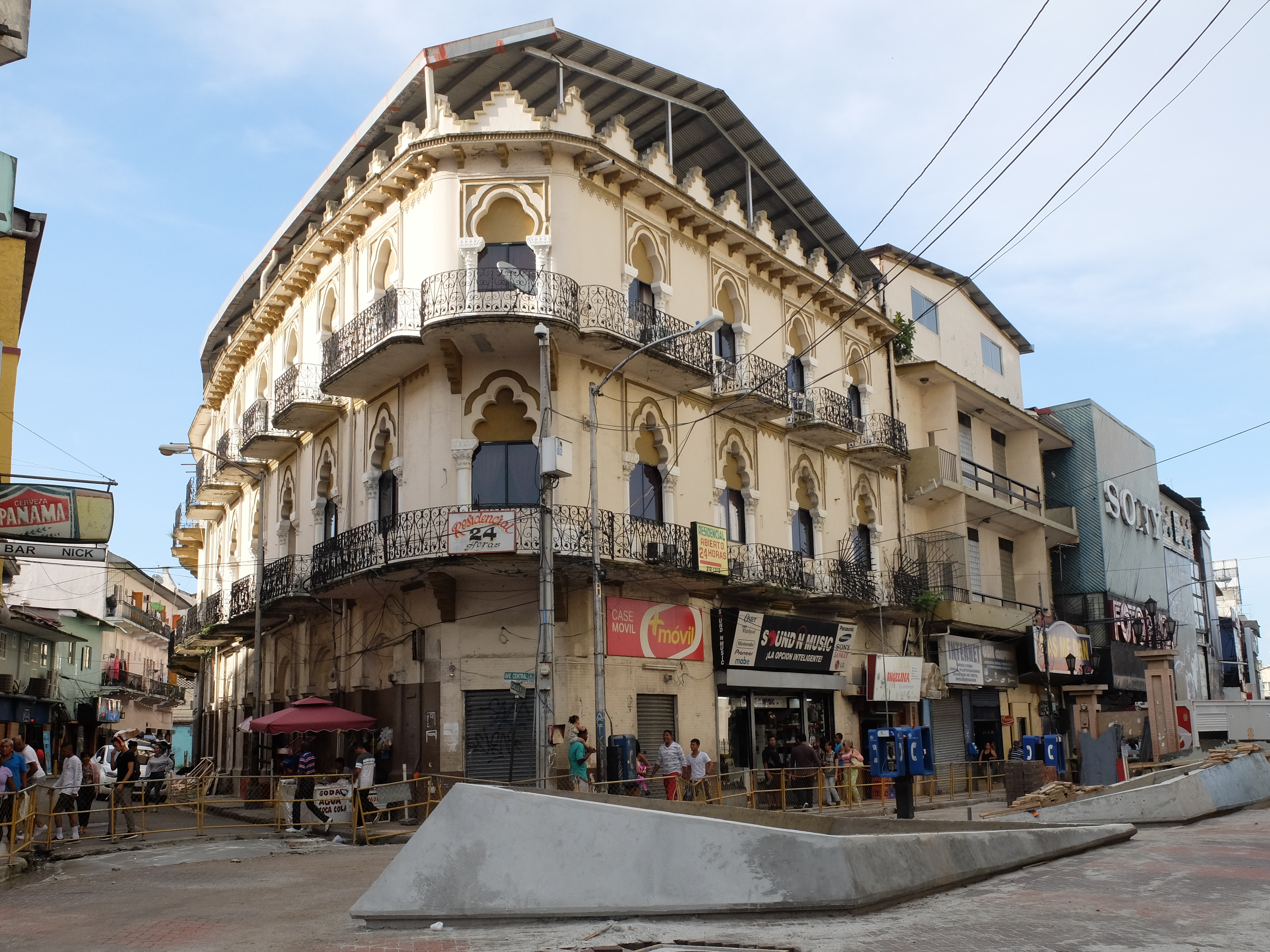
When we visited, they were all torn up to prepare for the Pope’s visit a year later. Or, near the old town, you find yourself in another district that the guidebooks flag, street after street of slum buildings housing those trapped in urban poverty.
Meanwhile, as global trade increases, the money keeps flowing through the canal and into someone’s pockets. Those locks lift all boats, large and small, but they do not lift all the people in Panama.
(Also, for more pictures from Panama, CLICK HERE to view the slideshow at the end of the itinerary page.)