To the northeast of Auckland there are nearly 50 islands scattered about Hauraki Gulf. Some are large, like the Great Barrier Island, and some are tiny. Some are like suburbs of Auckland, like Waiheke, and some are preserves, like Tiritiri-Matiangi, zealously freed of pests and under restoration to their natural state. Ferries from Auckland and towns around the bay keep a regular schedule to these islands for visitors.
We’ve visited Tiritiri and found it to be a thrilling experience, similar to a visit we made in 2009 to Kapiti Island near Wellington. Thanks to thousands of volunteer hours spent clearing non-native species and planting native greenery, wild native forests are rapidly taking over the island again.
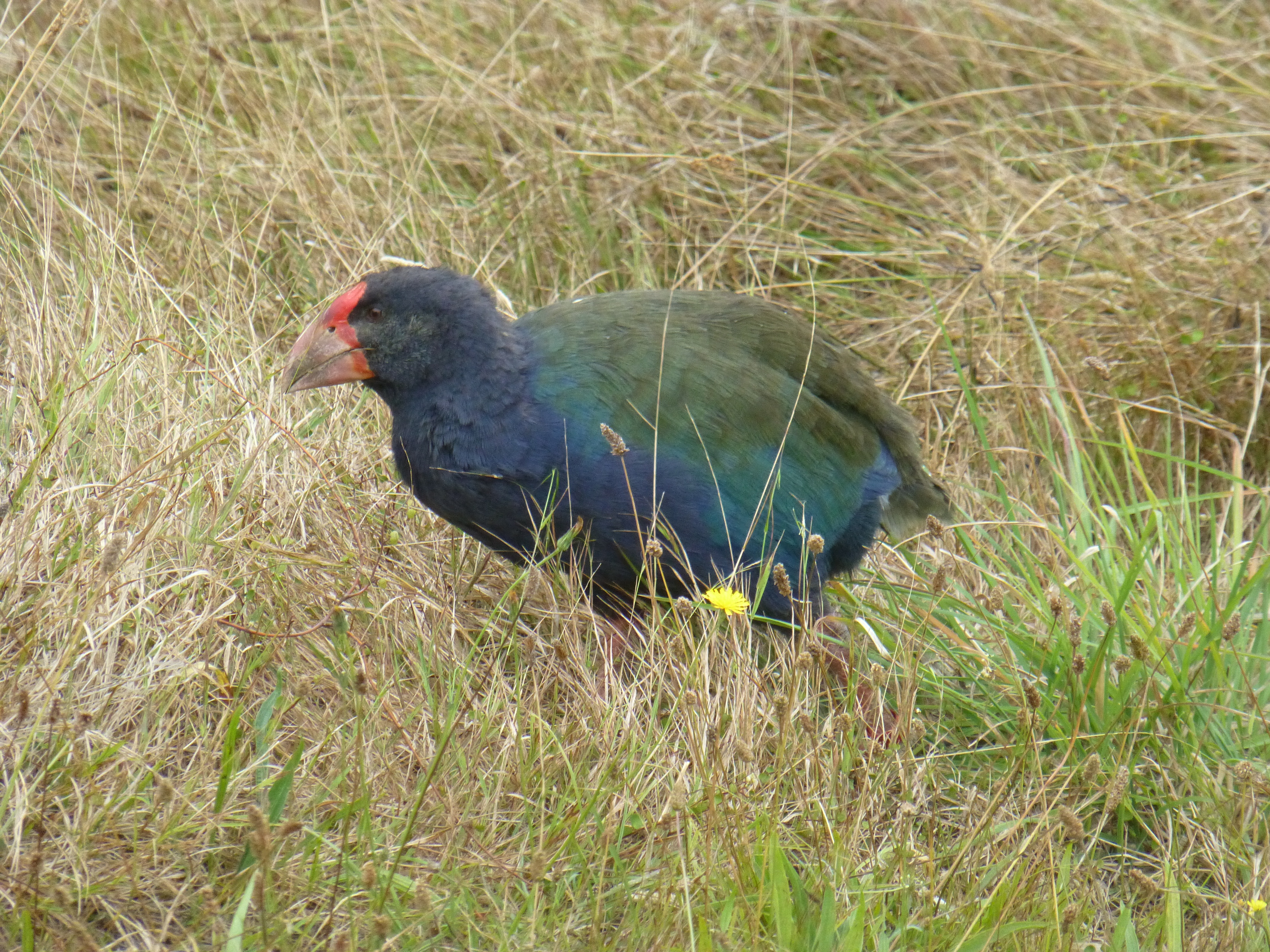
The number of native birds, free from predators, is extraordinary so that even a non-birder can enjoy their song and beauty up-close. We saw three imperturbable chicken-like Takahe on our walk all over the island, 3% of the entire global population.
It was easy to find a half dozen endemic species, though one remained elusive. An avid visitor, looking like Hemingway on safari, paced the walkways of the Wattle Trail in his vain search for the few Kokakos introduced onto the island. Another, hefting a long lens and force-marching the rest of his family, went all over the island in the same fruitless search.
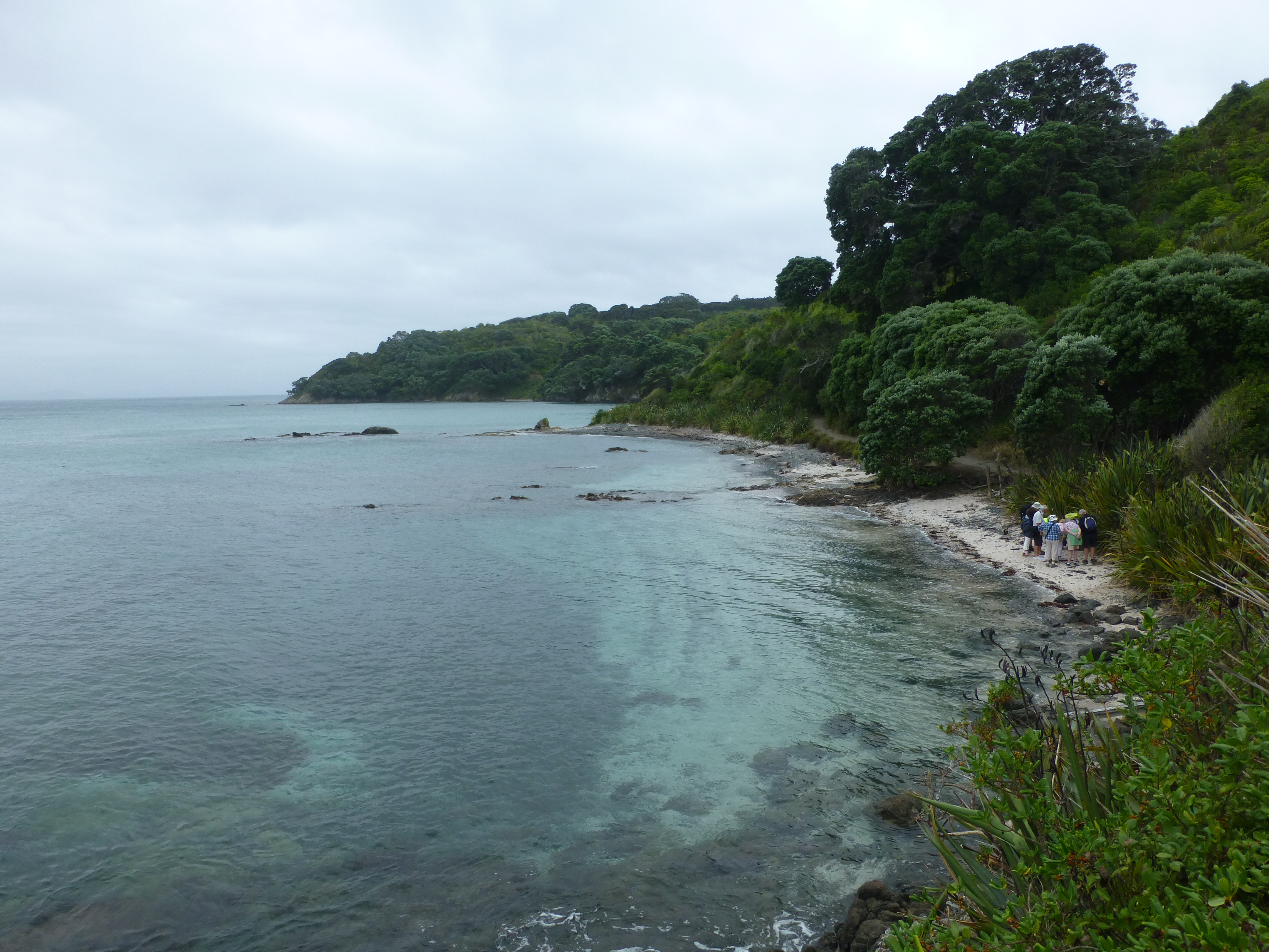
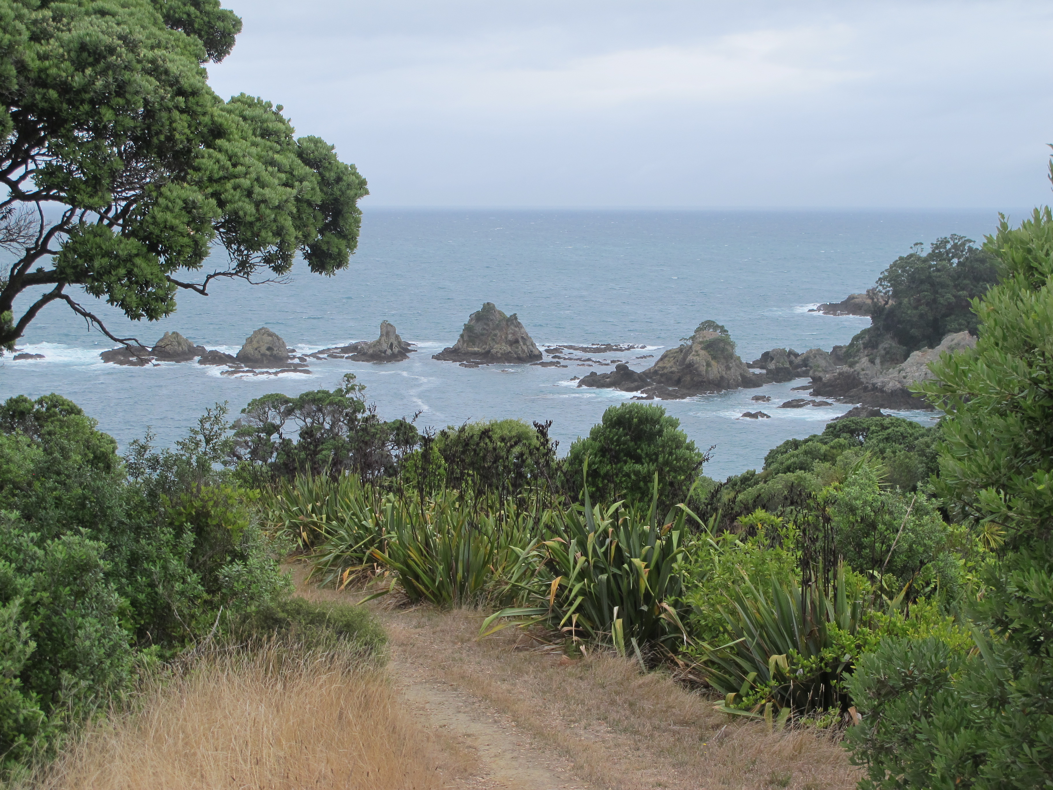
We wondered, however, whether the government agencies and conservationists in charge of the island were not restricting tourist access enough. There must have been a hundred visitors on the day we went. So it was tough to enjoy those forests of this small island in quiet. We managed to escape the throng by trekking up north on the trails, enjoying lovely coastal views despite the overcast day, but only for a brief time.
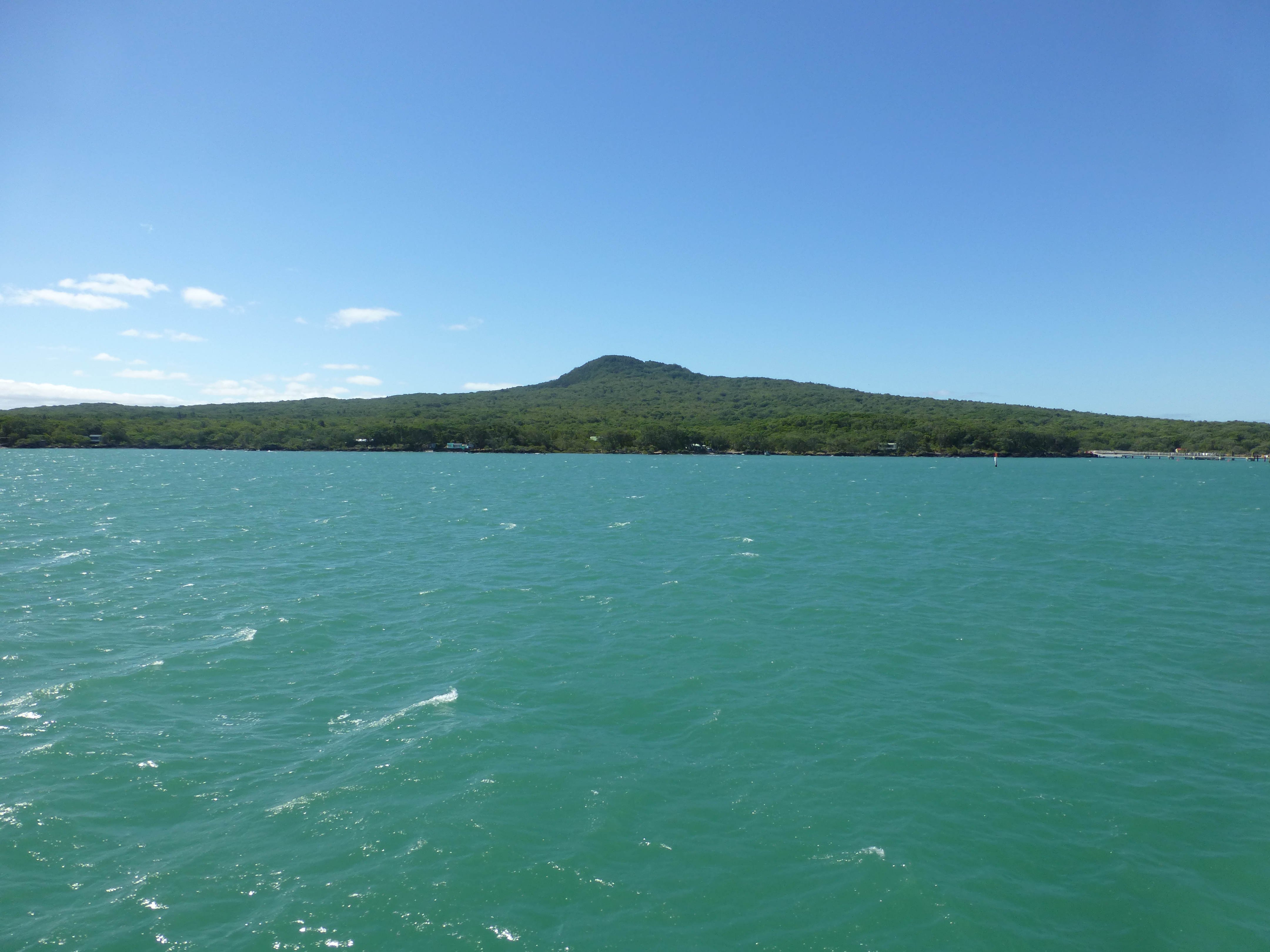
Rangitoto is a broad dumpling of a volcanic island about 260 metres high and 5 to 6 kilometers across, distinctly visible from Auckland and much of the bay north. It’s much more of a playground and recreational area than Tiritiri, though it is seeing increased efforts to restore native forests, foster endemic wildlife and remove pests (we saw wooden box traps all over the island like distance markers on a trail).
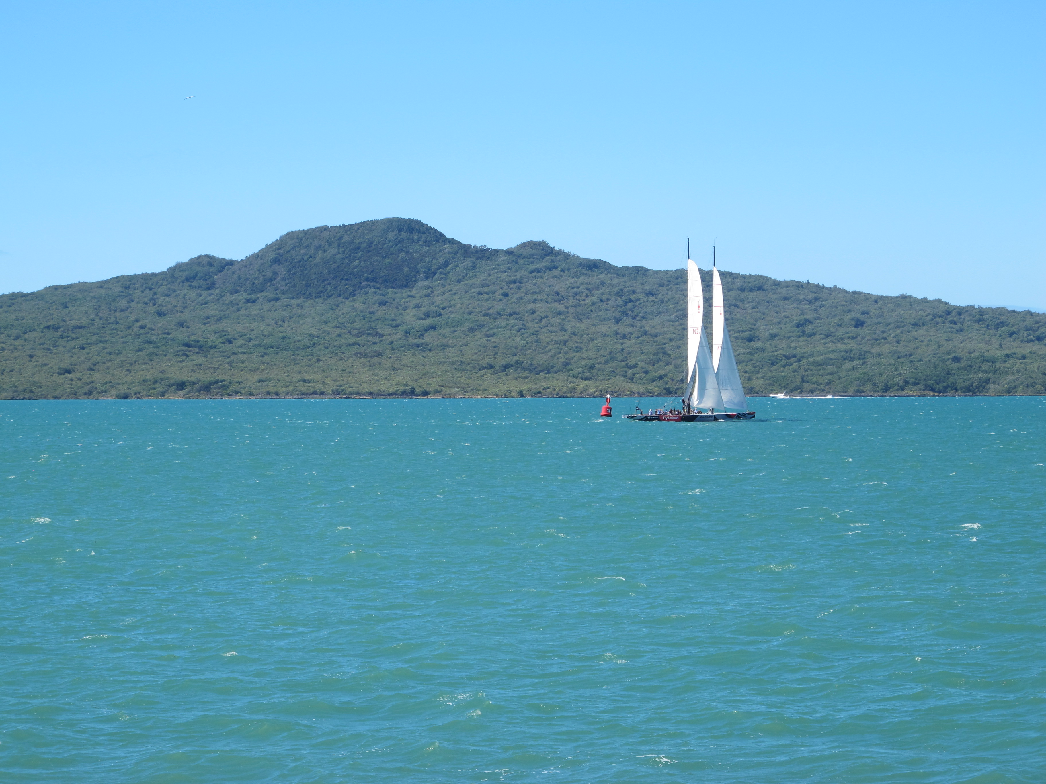
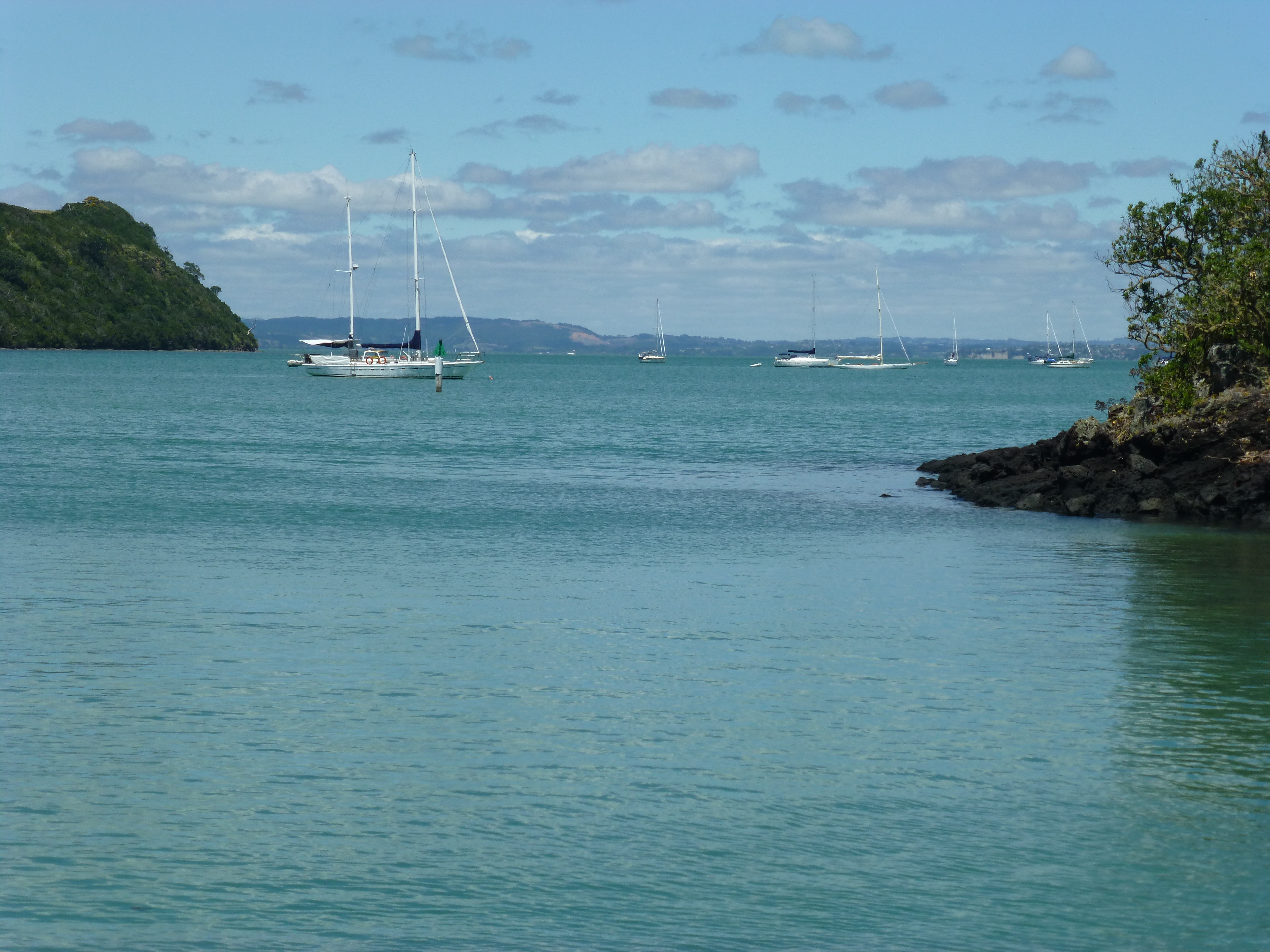
On its sister island, Motutapu, just a tiny stone bridge apart, you can even camp overnight and explore Maori archeological sites. In between the two, sailboats, motorboats, jet-skis and kayakers fill Islington Bay on a lovely day.
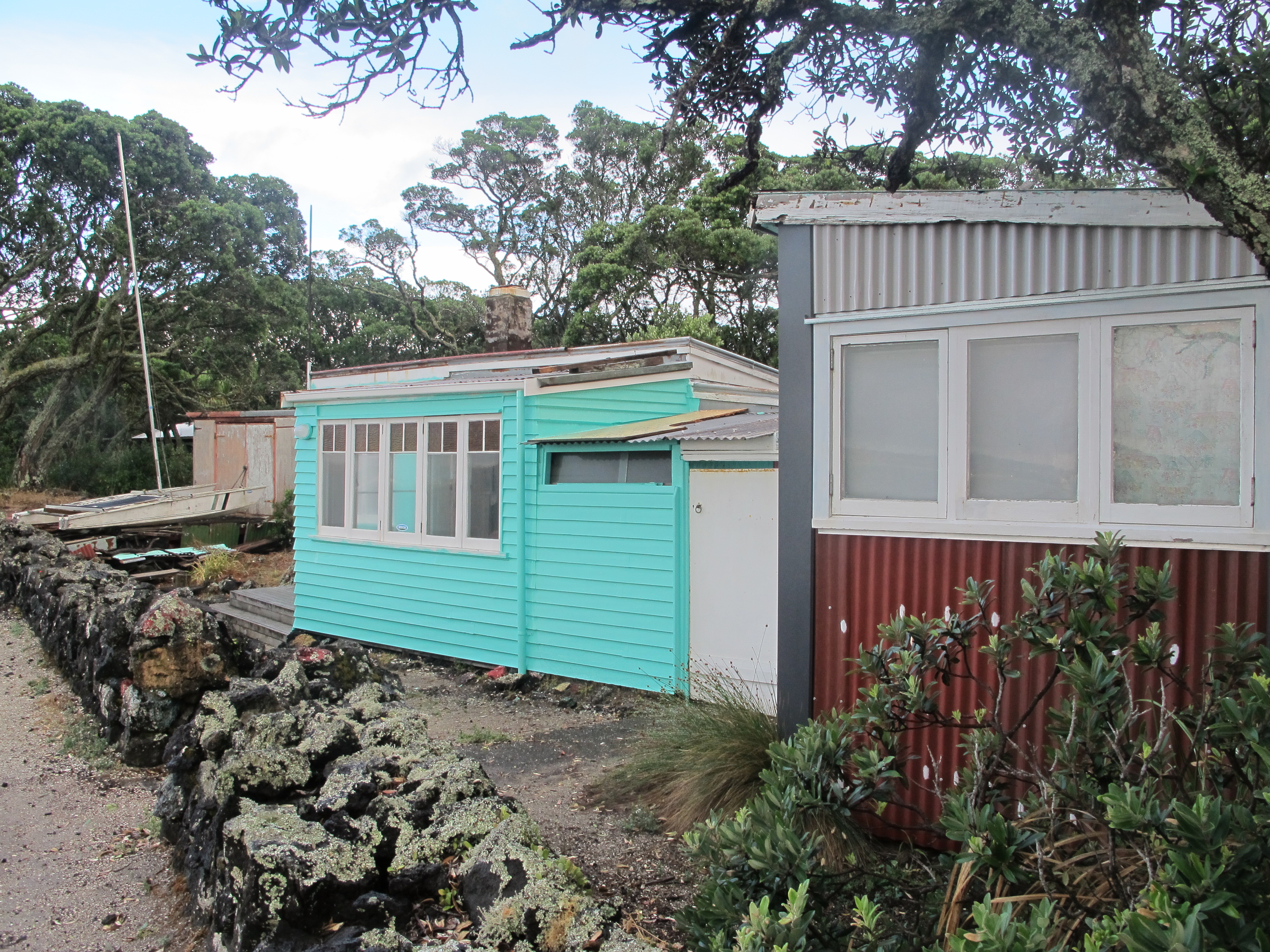
On Rangitoto itself, you’re only allowed to stay for the day, unless you own of those few “baches” along the shore. A bach is a weekend retreat (the word derived from bachelor). The ones on Rangitoto started, it seems, in the 1920s as holidaying cottages for residents of Auckland. Most have already been torn down or fallen to ruin, but many still remain along the coast near the wharf, simple small cabins mainly of whitewashed wood.
One bach has been restored as a sort of museum of bach life back when. Others are still alive. As we passed the surviving baches, we were hailed from four of them by their aging residents, perhaps in a lifetime holding arrangement with the government.
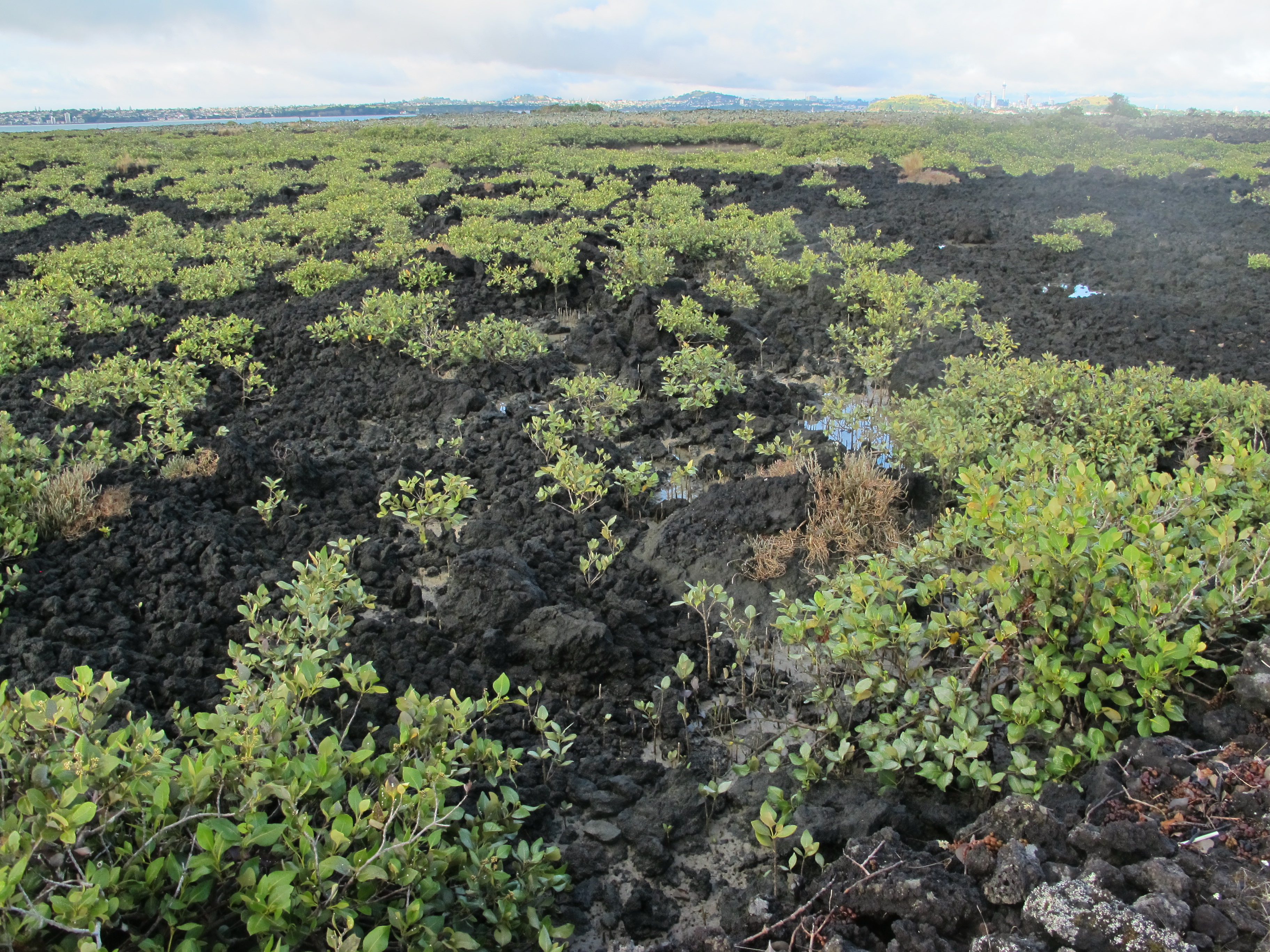
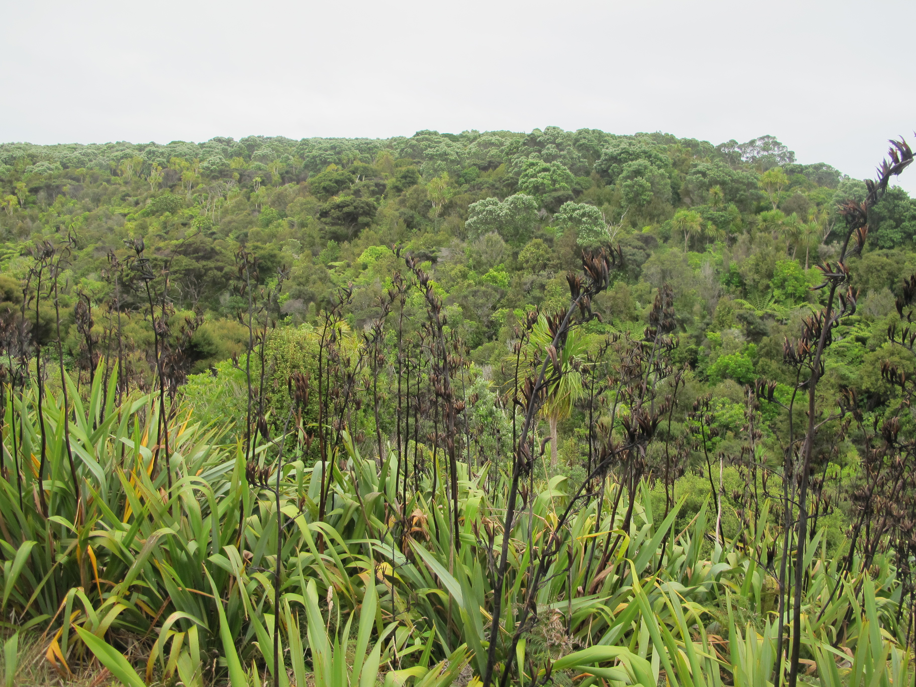
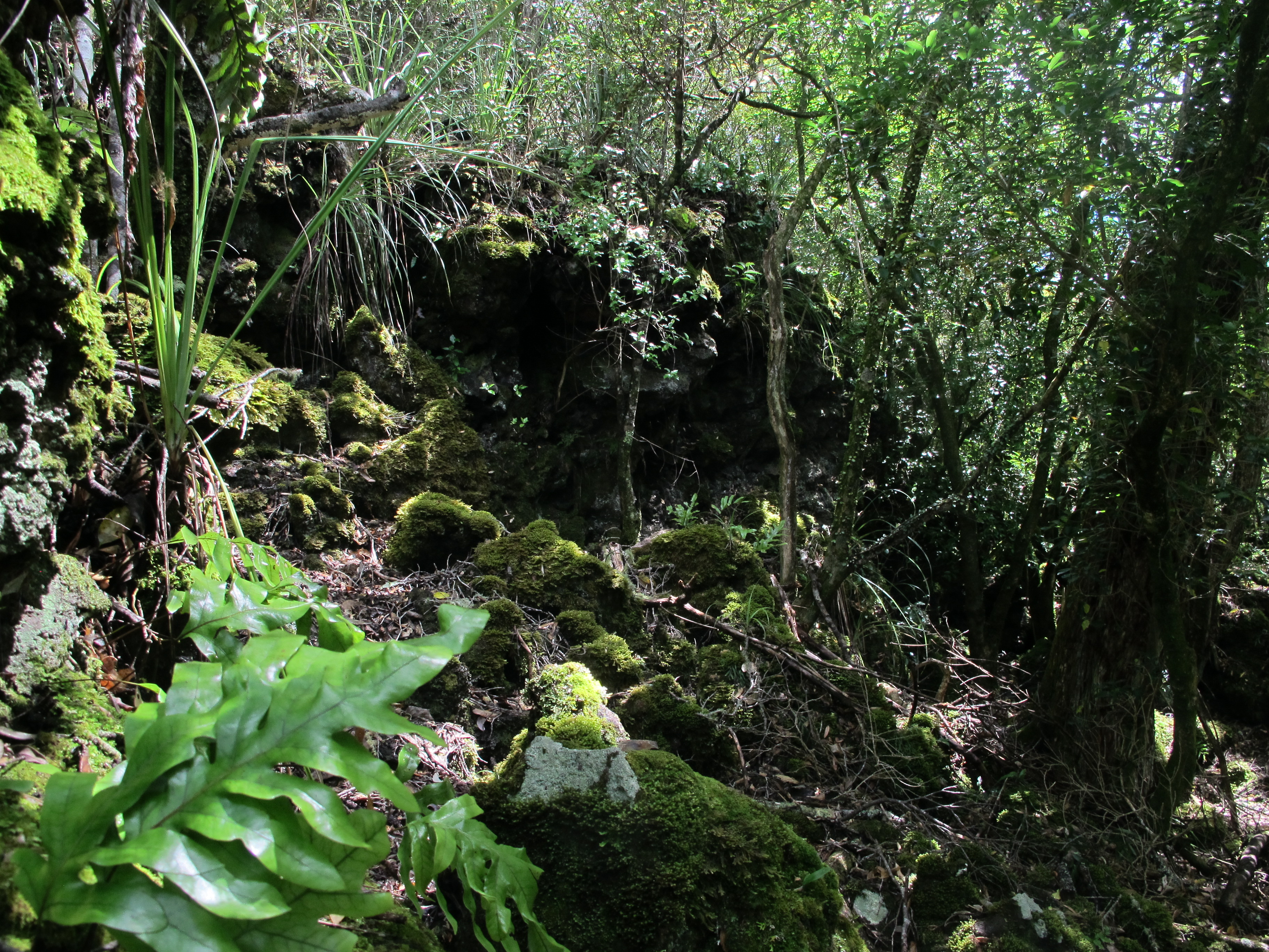
The natural landscape is just as intriguing. The last eruption of Rangitoto about 600 years ago was just yesterday geologically. Since then, a lot of the island has sprouted trees, bushes and ferns out of the fertile lava rock, transforming it into black dirt. Yet so much of it remains barren lava, frozen in place as the flowing lava cooled, in undulating and jagged formations. We took the long circuit around the island and up the elongated side of the volcano. Almost all the land was rugged lava, except the slate-grey trail itself which the DOC had formed from crushed lava.
Even here occasional thickets had formed from seeds blown along or dropped by birds; over time they would cover the remaining lava and transform it into dirt. Oddly, stray bushes sprouted from the rocks here and there, the earliest stage of reforestation. Otherwise, much of the island looks like the lava fields of Craters of the Moon, Idaho, or Hawaii’s volcanic flows or Lanzarote, Spain.
Most day visitors head straight up the side of the volcano to the top, or hop on the electric tram that buzzes most of the way up, then finish the climb on a steep and seemingly endless set of stairs. The trail they take instead of the tram, as well as the stair-stepped portion, is forested, so much of the lava has become dirt. Occasionally, however, we could see rougher patches in some gaps.
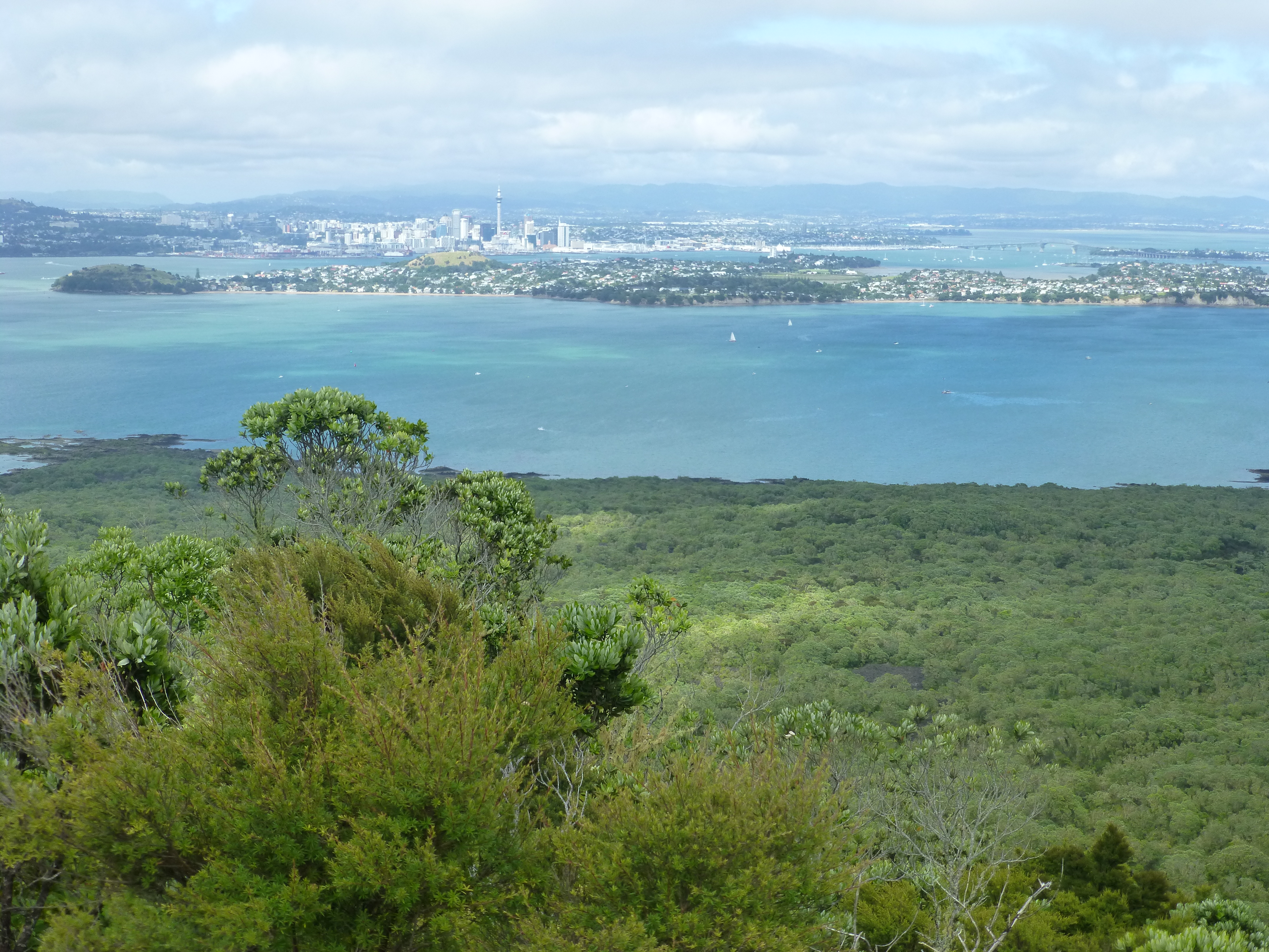
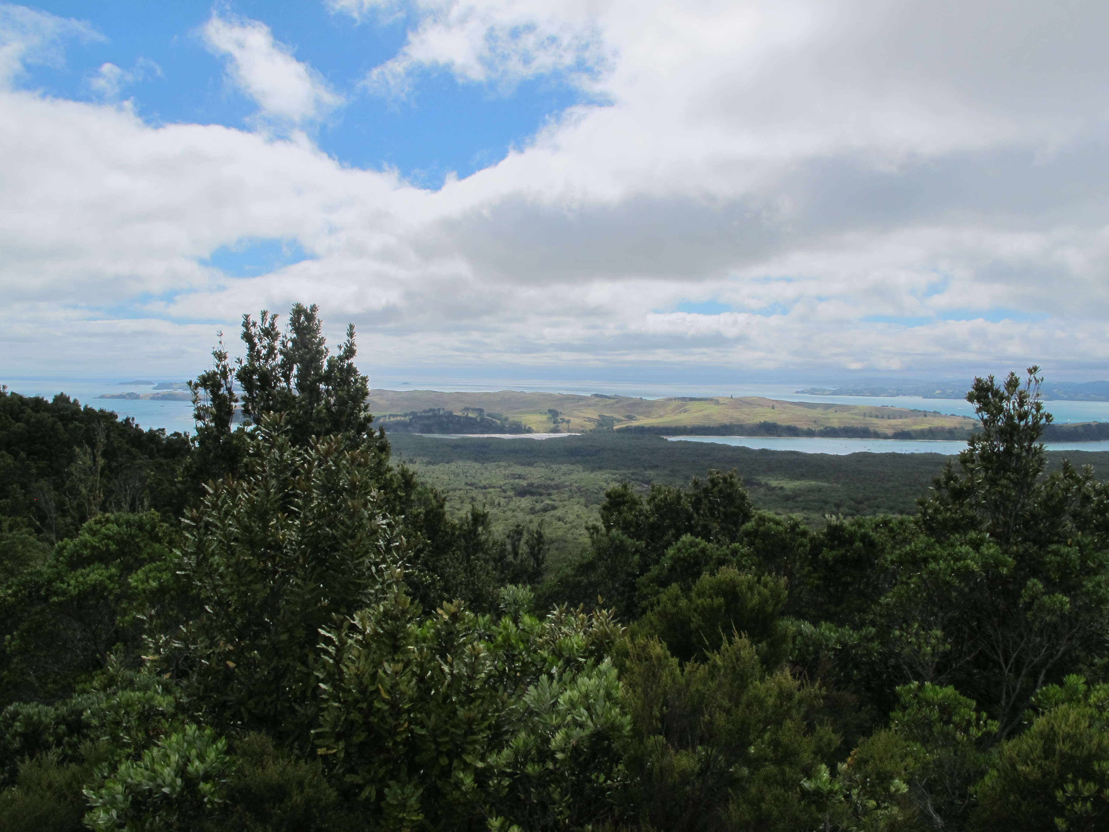
The panoramic views are at the highest point on the crater’s edge. On several broad platforms, we could see a full circle panorama of the Hauraki Gulf. To the east, Waiheke and several smaller islands rose out of the sea; to the south, the volcanic hills of Auckland and its iconic Sky Tower shimmered blue through ocean spray. The cooling breezes and bright sun dried off the sweat we had earned in our climb.
While at the top, we were joined by dozens of excited people, some of whom had done the uphill trek but most of whom had taken the tram off the most recent ferry boat. Only a few stayed more than ten minutes, except those who thought to enjoy a lunch with the view spread before them.
We spoke with two Kiwi families who were quite well travelled themselves. Each of the five in one family wore shirts or hats displaying logos from US cities. When we asked them why, they said they hadn’t realized it. Another family praised our wide travels around New Zealand, but trumped us with the story of a 10 day stay on a remote corner of Stewart Island, the third island of the country. (See the post about our stay.)
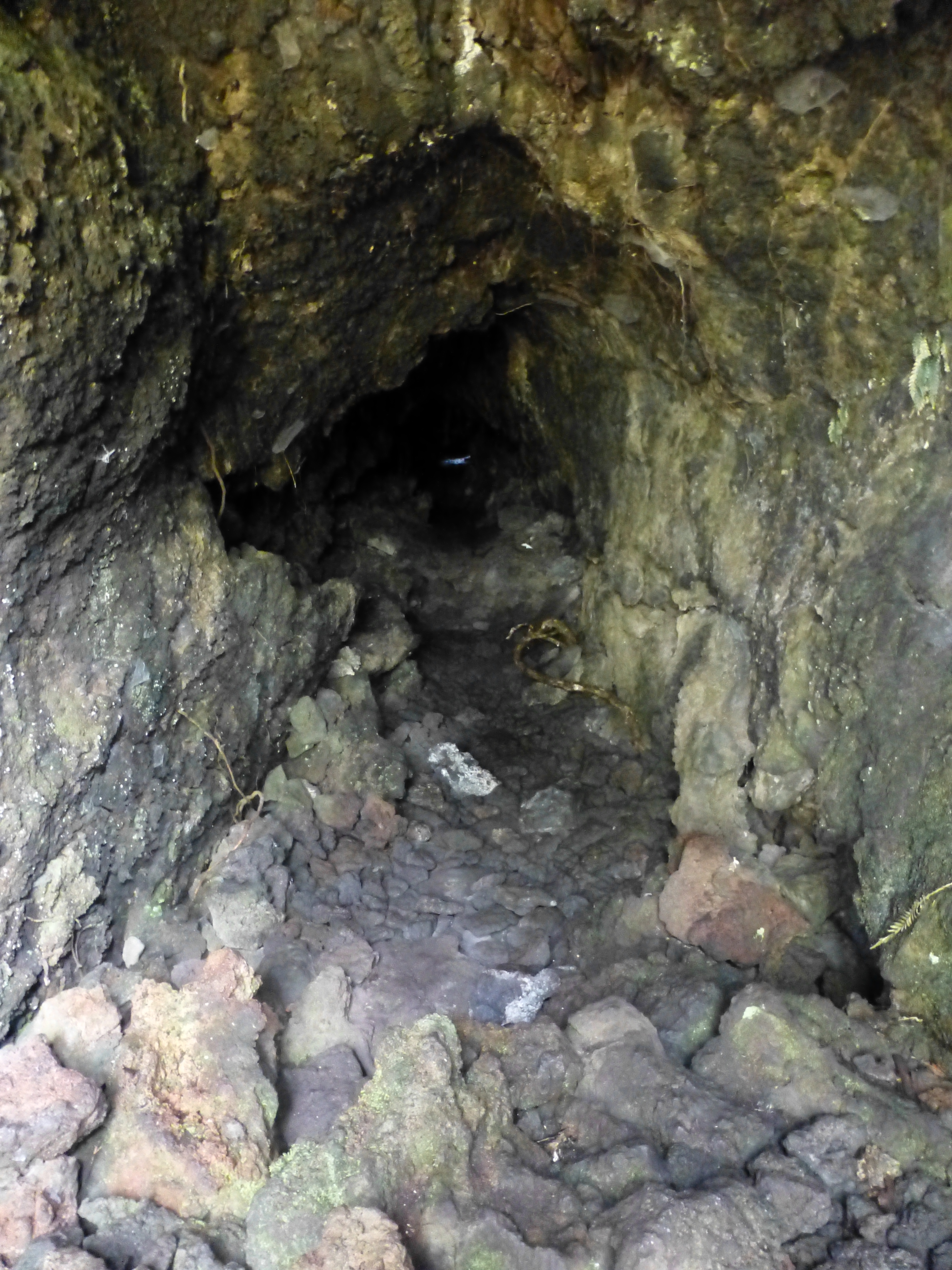
After circling the crater on another smoothed, dirt track through the woods, we diverted to caves near the top. These turned out to be lava tubes or tunnels, the result of lava flows whose surfaces cooled and hardened while the lava inside spilled out. It’s a bit tricky finding them, scrambling down to the entrances and stepping onto rugged, uneven surfaces in the semi-dark. But all those who ventured through them, like us, enjoyed the thrill of being inside the lava rock, not just walking over it.
We hiked back up through the woods to the crater’s edge, then headed down the eastern trail, which was really a wide dusty dirt road, toward Islington Bay on Rangitoto’s eastern coast.

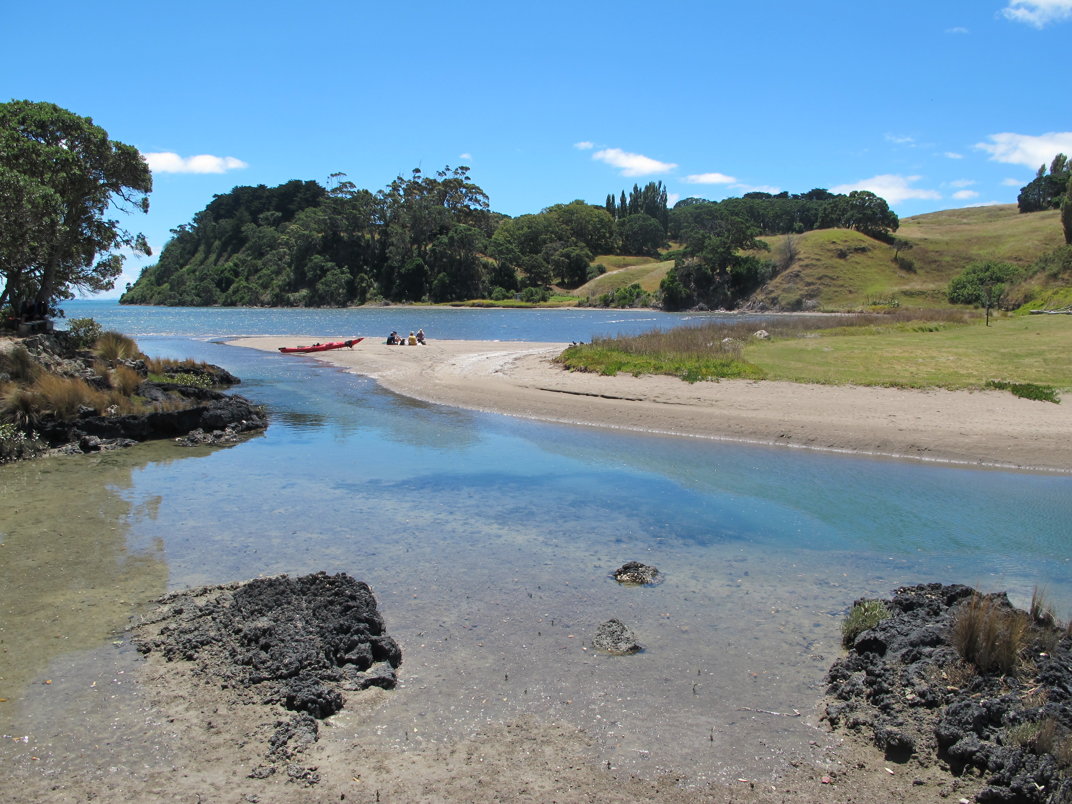
At sea level, we passed a shallow inlet north of the bridge connecting the two islands. There several kayakers lunched at a placid sandy shoal next to the bridge.
Past the bridge, in the deeper bay, we found a hundred or so pleasure craft bobbing in the sun.
But, with considerable distance left to cover, we knew we had to rush a bit to avoid missing the last ferry. So, we did our own forced-march back to the wharf, trudging somewhat wearily up and down the bumpy forested headlands of the southern coastline– a mix of rough lava sections and beaten dirt. By the time we reached the ferry with just a few minutes to spare, we had done 25 kilometers or 15 miles around and about Rangitoto.
Settling onto the ferry, we thought back to the shallow inlet near the bridge. Rounding a bend, we had found one woman next to the trail on a bench, chatting with another. The second woman was dunking herself in the inlet off a cement platform on which a man was preparing his fishing rod to catch dinner. Their wood-slat bach stood a few meters away. Just a few hours earlier, they told us, before the tide had risen, the inlet had been just sand all the way to its mouth.
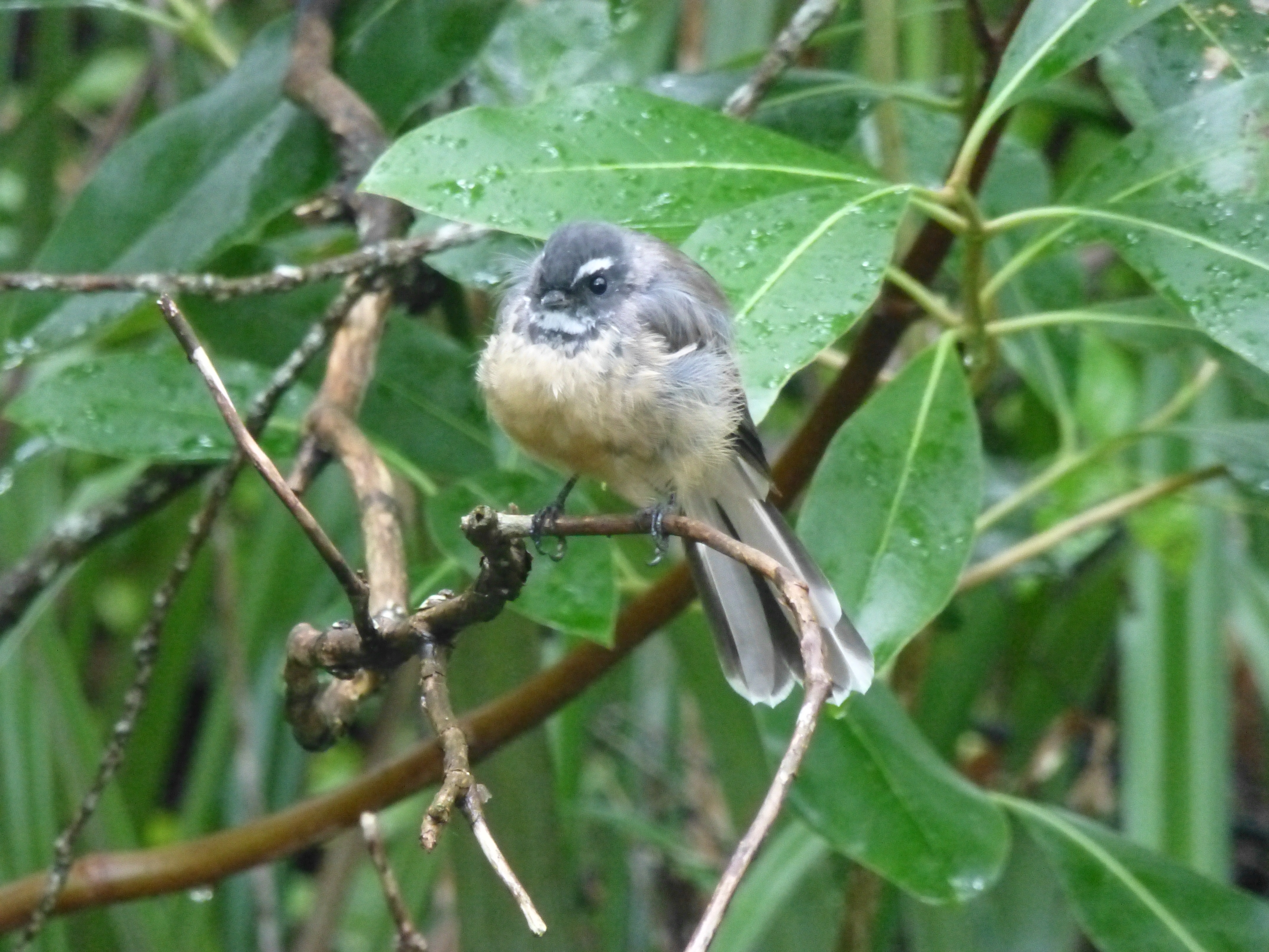
We spoke briefly about the reclamation of the island akin to the efforts on Tiritiri. Even these three had noticed the reappearance of birds after conservation groups had trapped and removed rats, wombats and feral cats from the island. Now “plovers,” which turned out to be the oystercatchers we saw near the bay, had been newly released to nest without fear on the sands. Other natives like bellbirds, fantails and even some takahe had also reappeared, they said.
Acquaintances for just ten minutes, we were invited to join them in the cooling waters of the inlet and remove a few layers of sweat from our walk. We have heaps of extra swimming “togs” they noted encouragingly. Greatly tempted, we calculated that we would hardly make the last ferry off the island if we joined them. So we grudgingly refused and hustled off. Later, we reckoned, they probably would have put us up for the night at their bach, with fresh fish for eating.
They were Kiwis, after all.
(Also, for more pictures from New Zealand, CLICK HERE to view the slideshow at the end of the New Zealand itinerary page.)