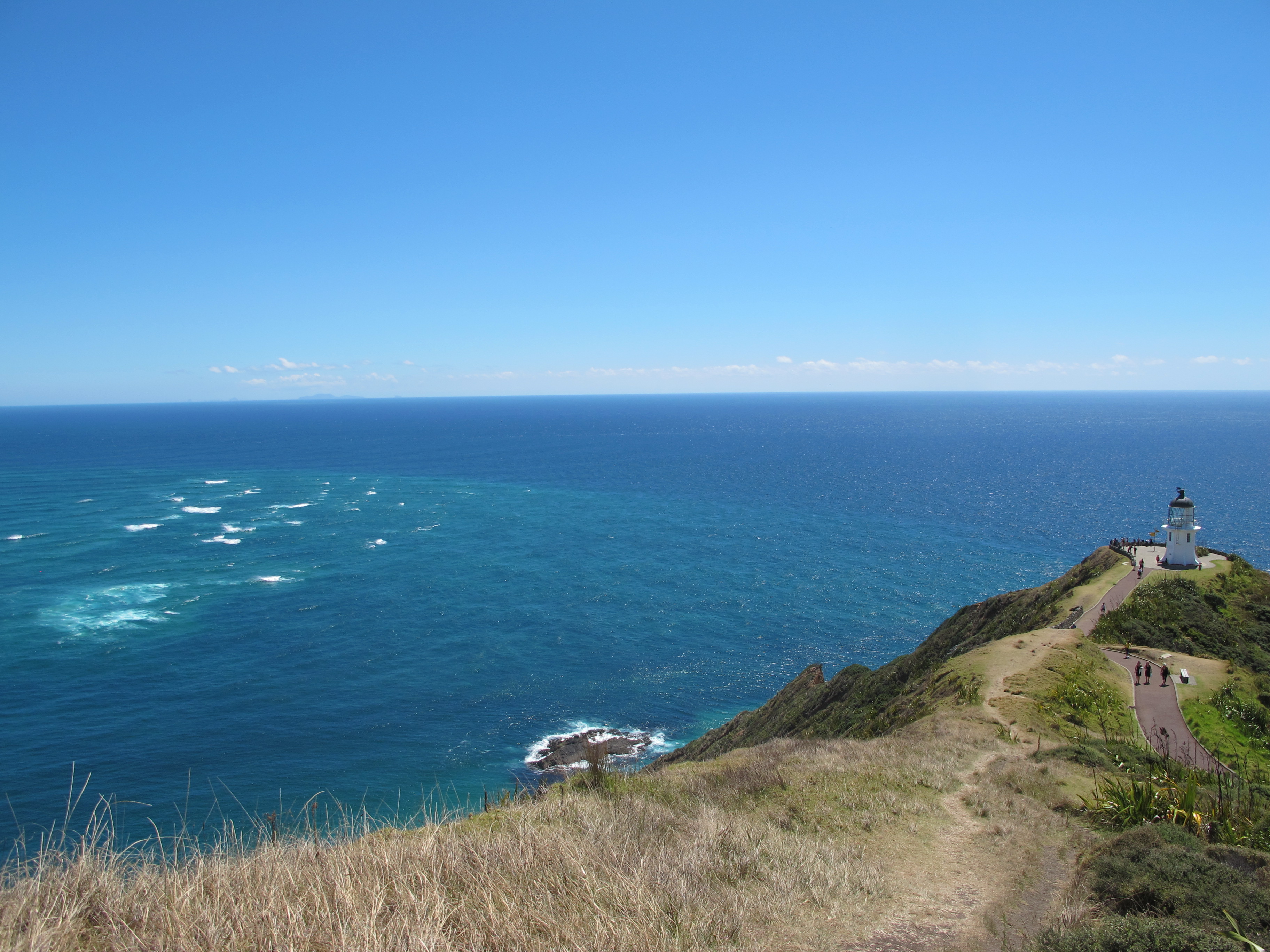
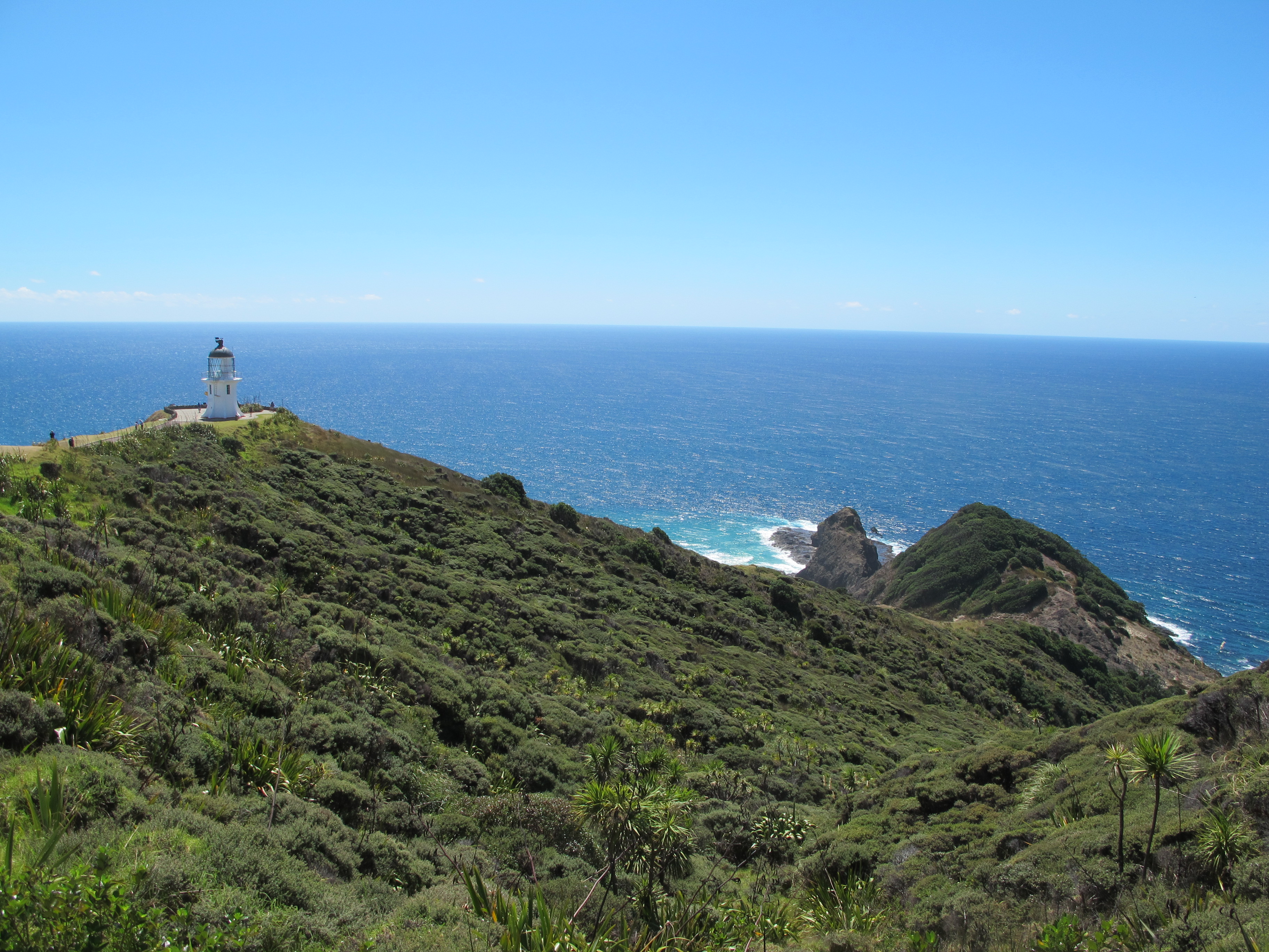
On a beautiful day Cape Reinga, the end of New Zealand, can feel so benign, if not at all peaceful. Busloads of tourists scurry about for a brief while, snapping pictures, huffing and puffing along the steep paths between the parking lots and the tip. A brilliantly white lighthouse dominates the shoreline and the tallest hill. The sky and sea show rich blues, while the landscape outshines the dry interior in green grasses.
But a closer look at the plant-life and garrigue-like landscape shows the harshness of this area at other times. The twisting road to the Cape wound through beige grazing land for sheep and cattle, but its suitability for ranching stopped within a few kilometers of the end. By then, the only plants are hardy ones that can keep hold of windswept hills and cluster for protection. The stunted, gnarled bushes spread like a forest of bonsai.
To the Maori, however, the natural forces at the Cape are not nearly as powerful as the spiritual ones.
In Maori geography, we stood at the bottom of the country, Te Rerenga Wairua. Here the spirits of the dead head on their final journey back to their spiritual home, Hawaiki, the eastern Pacific homeland of the earliest known Maori explorer Kupe.
Kupe recognized the power of the place where, in whitecaps and whirlpools, the Tasman Sea from the west (the masculine) meets the Pacific Ocean from the east (the feminine). Here, then, is a union of the two life forces, like creation itself. Even on a calm day, we could see where the currents met in swirls and foam, similar to the eddies formed in the wake of a waka (canoe) on which the spirits might depart.
The Maori spirits travel the pathway Te Ara Wainua thru the North Island, a map of which is displayed at the Cape. They then descend to a rocky outcropping named Te Reinga, where an oddly solitary pohutukawa tree (Te Arohe) seems to cling. The spirits step down to the water by way of the tree’s roots and proceed to the next world and Hawaiki.
Surprisingly, our understanding of these Maori legends and others were soon reinforced when we saw a fine New Zealand movie back in Auckland. “Pa Boys” follows a trio of Maori musicians on a road trip “down” the North Island to Cape Reinga. The main character recovers his sense of heritage as they travel together, and other characters connect more strongly with the spiritual tales and powerful rituals of their people. Nor, we learn, are the beliefs uniform across tribes. For one tribe featured in the film, spirits at death head to the top of a local mountain where the ancient canoe of their forebears awaits to carry them back to their homeland.
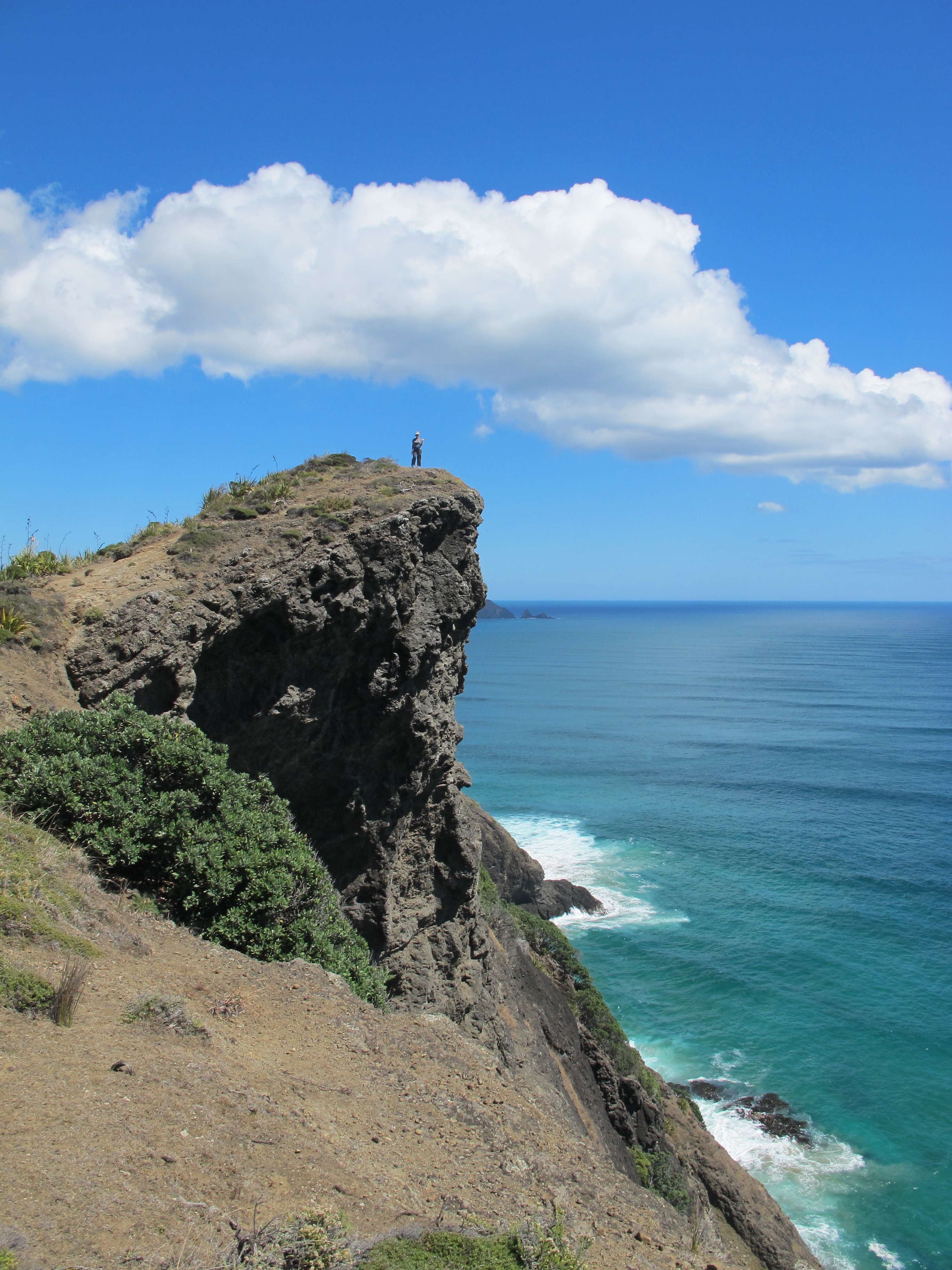
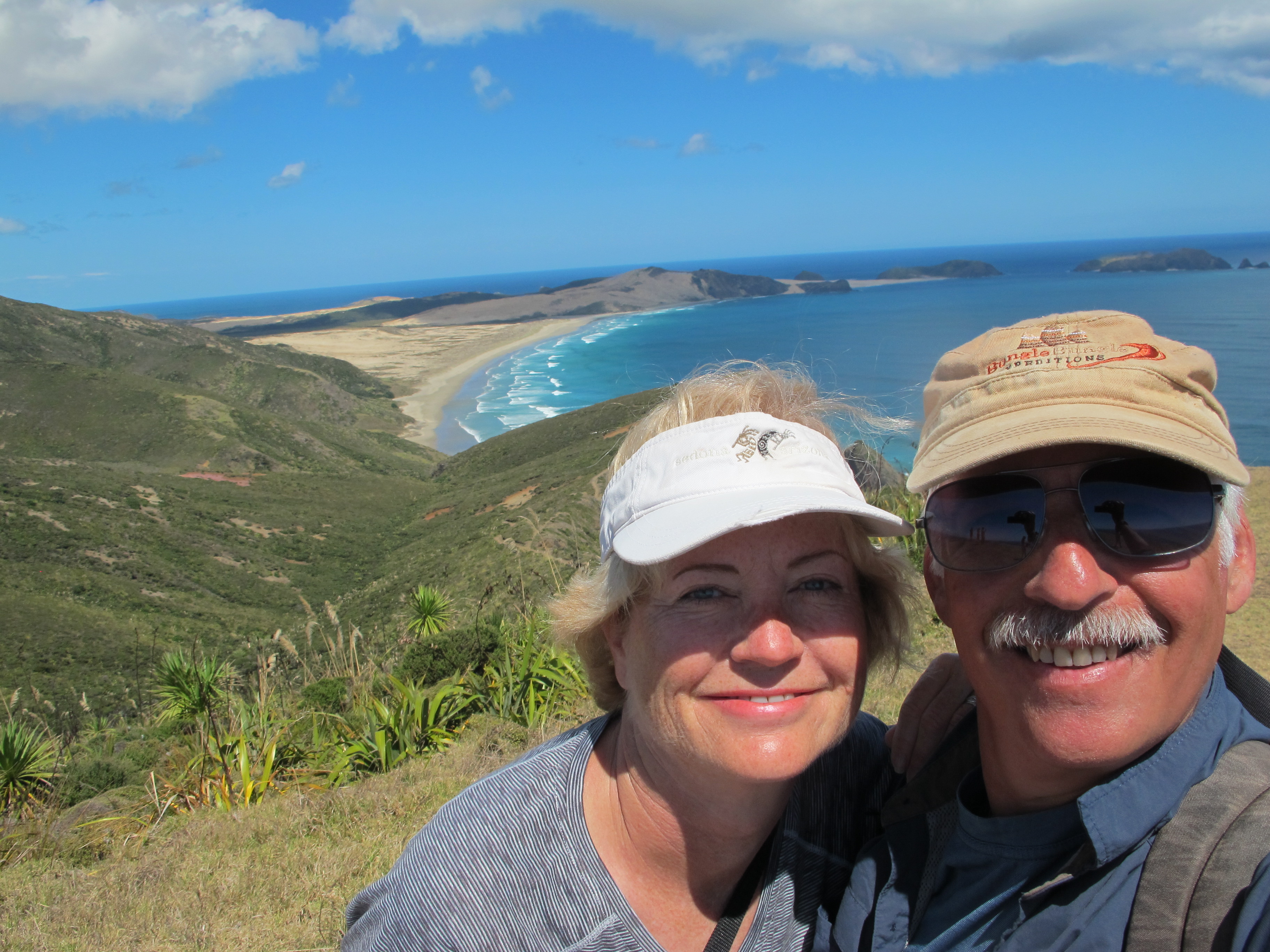
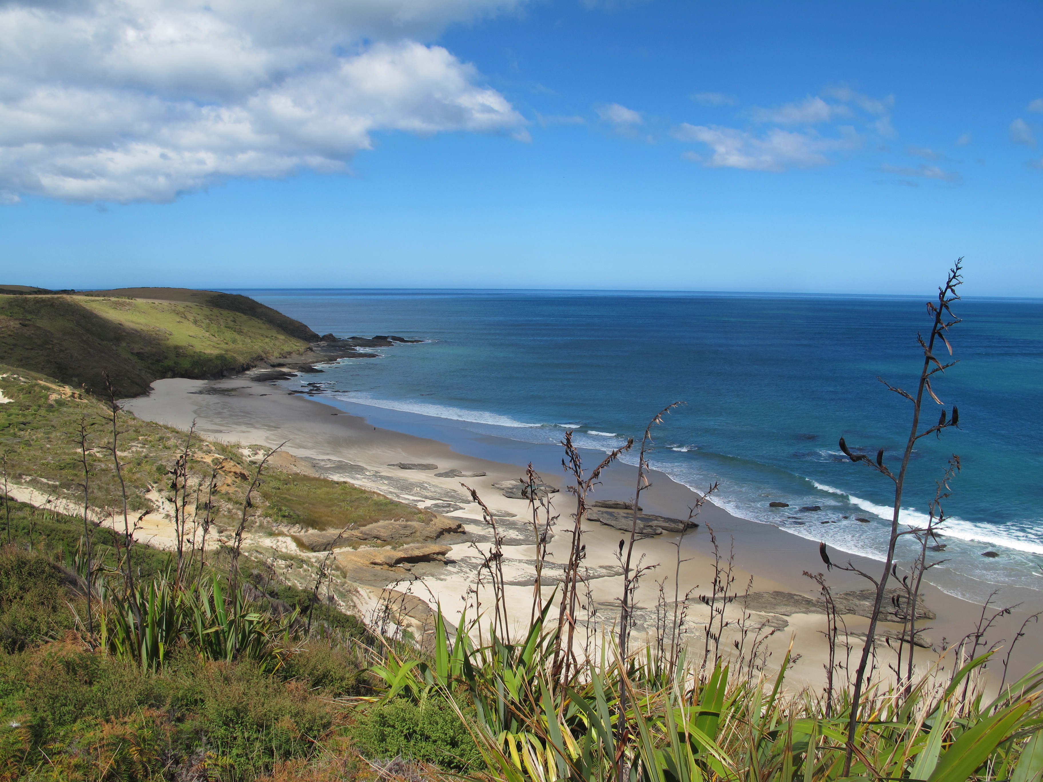
In the movie, the band members just stop at the Cape. We, however, left the crowd near the lighthouse and walked for an hour or so, tracing the steep ragged cliffs westward.
Regrettably, few others take the time to venture along here, where they could peer down at the rocky margin between sea and cliffs. The view was magical, a mix of calm and force: waves smashed violently into the base of the cliffs and the water formed strangely rippled patterns that seemed to change little.

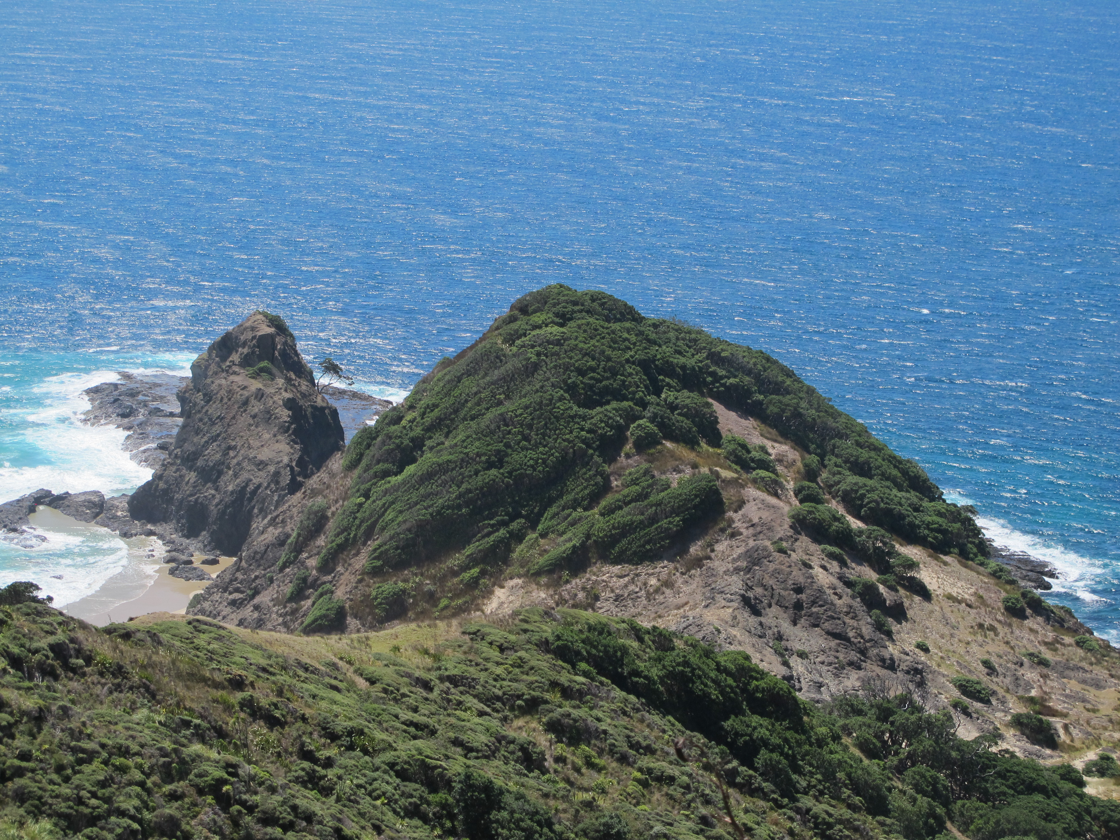
This trail is not one the spirits take to the Cape, but the view was breathtaking as we descended 230 meters to a protected cove…and the climb somewhat breathtaking on the uphill return.
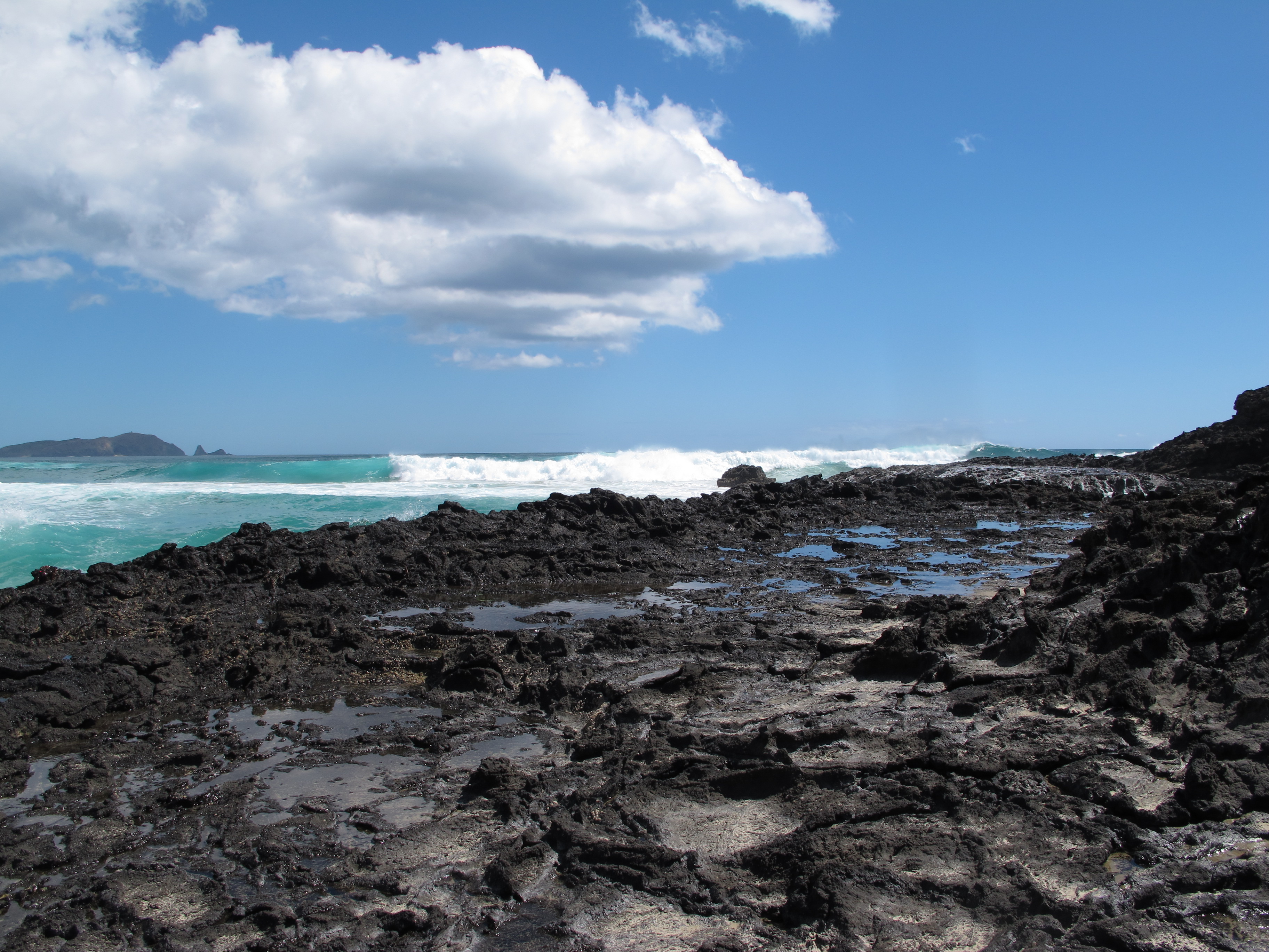
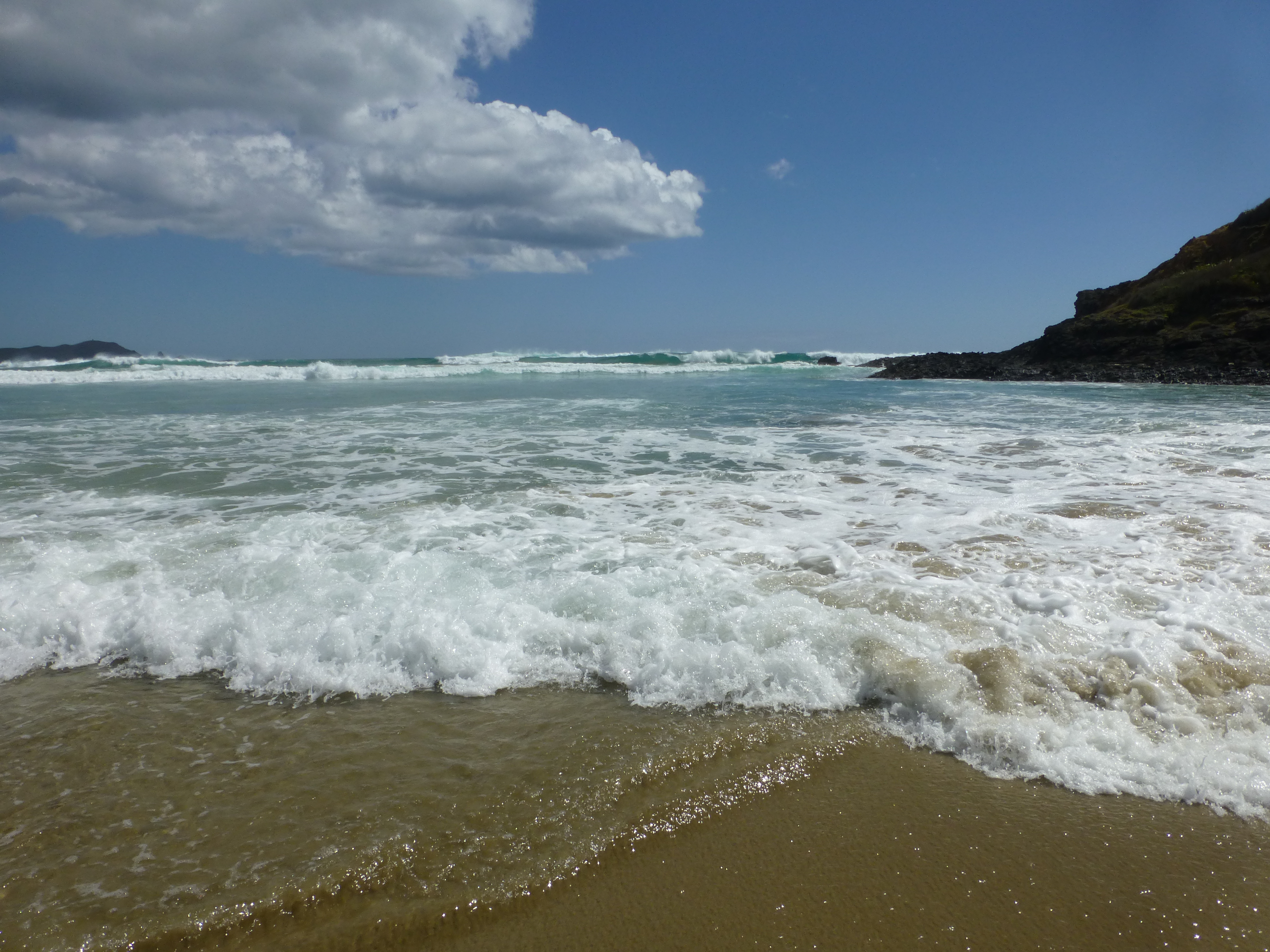
The cove itself was stunning, with rough volcanic rock along the sides where meter-high waves thrashed repeatedly. Steep hills ringed the inviting sandy beach. It was happily a place to sit and stay a while, rather than jump off to anywhere…particularly the afterlife.
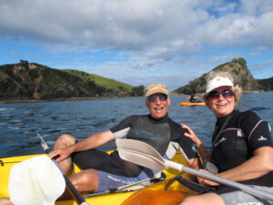
And we found ourselves never wanting to leave the entire Northland, the upper part of the North Island peninsula. We had planned to stay just long enough to roam about the Cape, but we were enticed to stay for the many pleasures it had to offer.
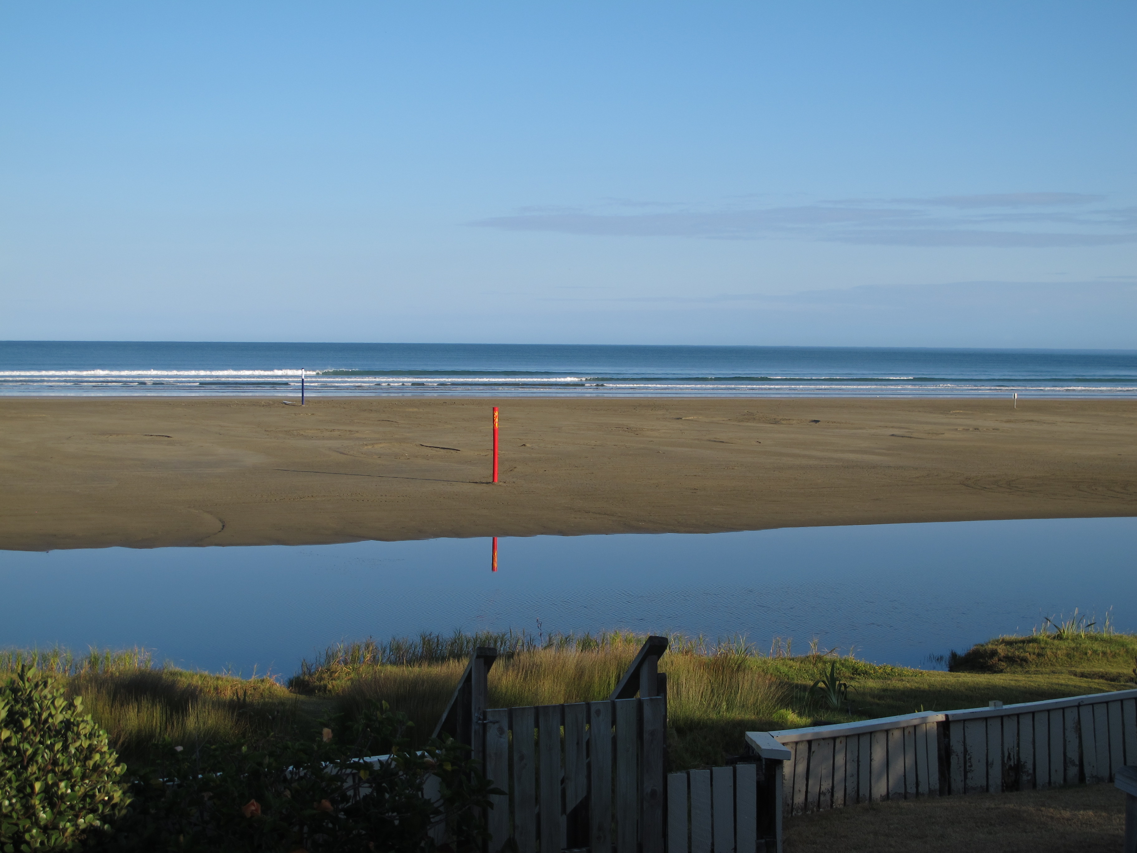
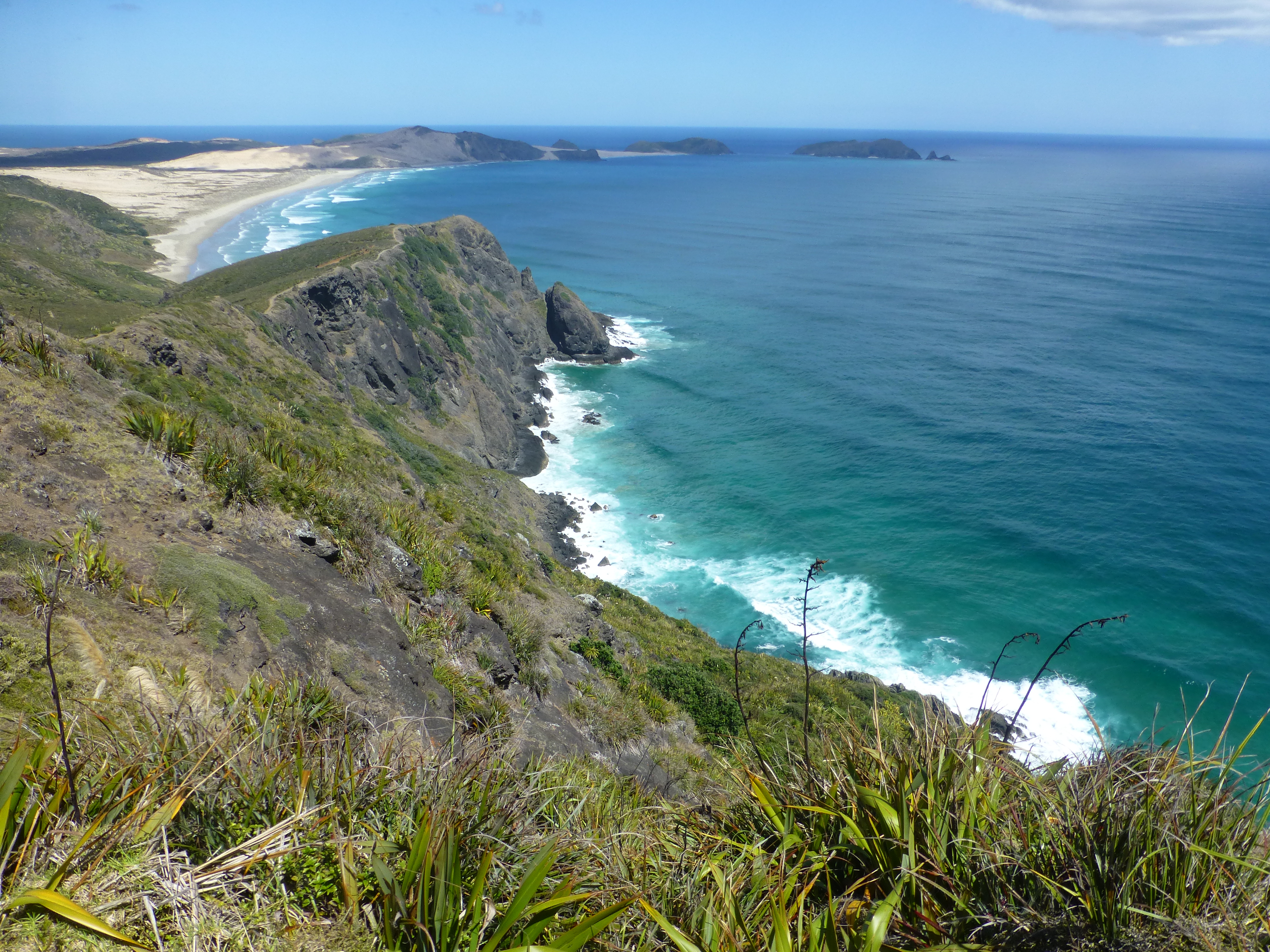
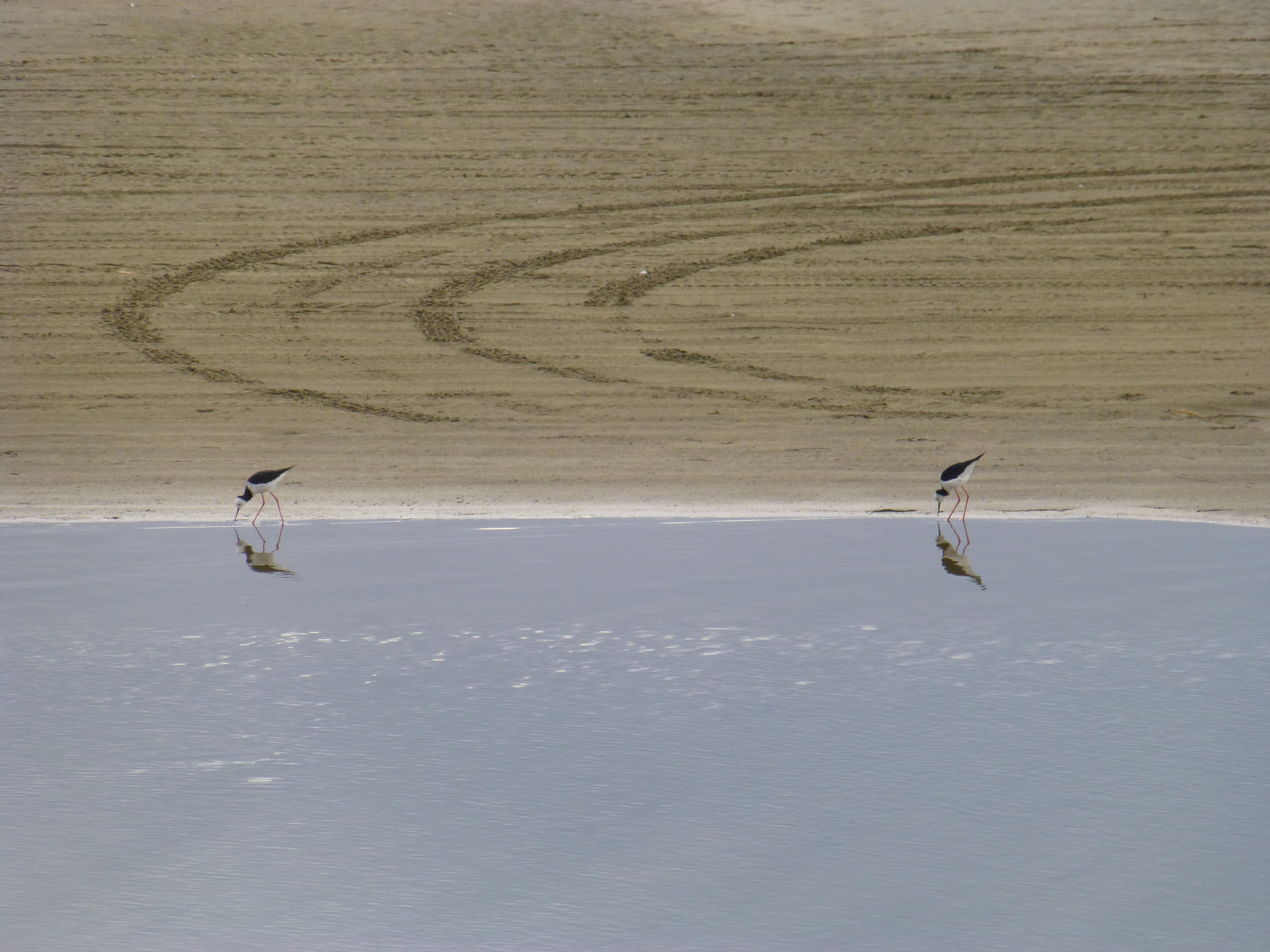
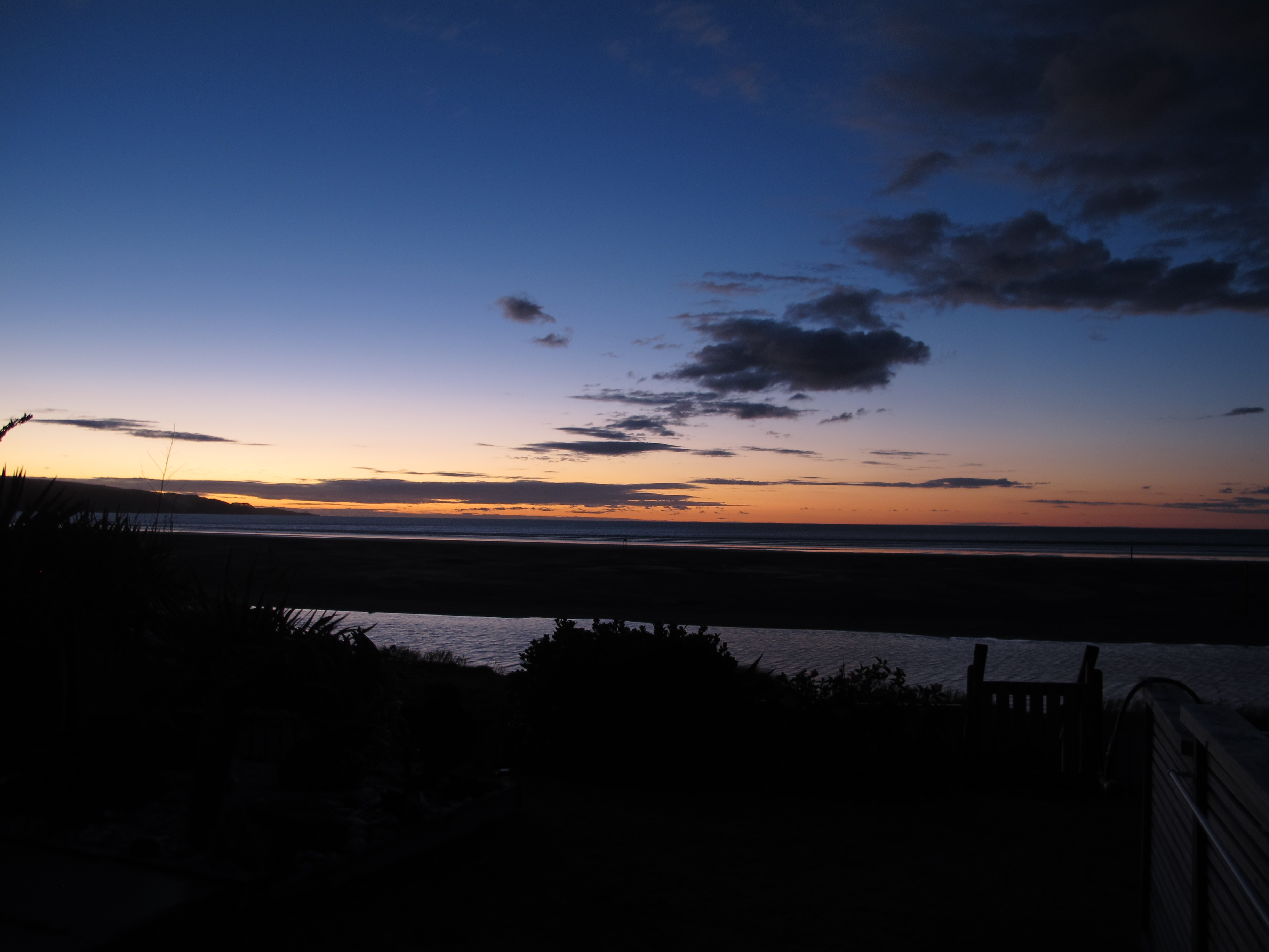
Ahipara, for example, nestles at the southern end of 90 Mile Beach, a seemingly endless sandy flat, perhaps a half kilometer wide, stretching all the way up the west coast of the Cape Reinga peninsula. We were fortunate to find a small, cozy apartment right on the beach. We could lounge on our deck in the morning or evening, gazing across a slight estuary at nesting birds like the endemic New Zealand Dotterel, as well as ungainly oystercatchers and elegant stilts. At high tide, we could enjoy the fledgling efforts of a dozen surfers, housed a few doors away from us, who were practicing on easy-going waves and gaining instruction from someone who looked like an army drill-sergeant. And, to cap off a day, we could toast the drop of the sun into the horizon each evening.
We even mastered the art of clam-digging – or rather wriggling, with a little instruction from a pair of Irishmen ocean fishing for snapper. We walked out into the surf to about mid-ankle depth and did the twist, wriggling left foot or right foot into the sea floor until we felt something like a rock. Pick up the rock and you have another clam, or tuatua, as they call them up here. Though a legal daily limit is 150 tuatuas per person, we stopped after catching a few dozen of them, cooked them on the barbie and found them succulent.
Mostly it was quiet at Ahipara, particularly in a shoulder period like March, perhaps the principal reason to dawdle. There are plenty of other reasons for tourists to come to Ahipara and the Hokianga region, the western part of Northland – whether it’s the water sports, the never-ending beach, the hilly tracks through dense rainforest, or nearby attractions like the Wairere Boulders and the ancient kauri trees (see our post on these). But the area remains relatively quiet, as most of the tourism money seems to be invested over on the east coast, at the Bay of Islands, the regional parks and other enticements there.
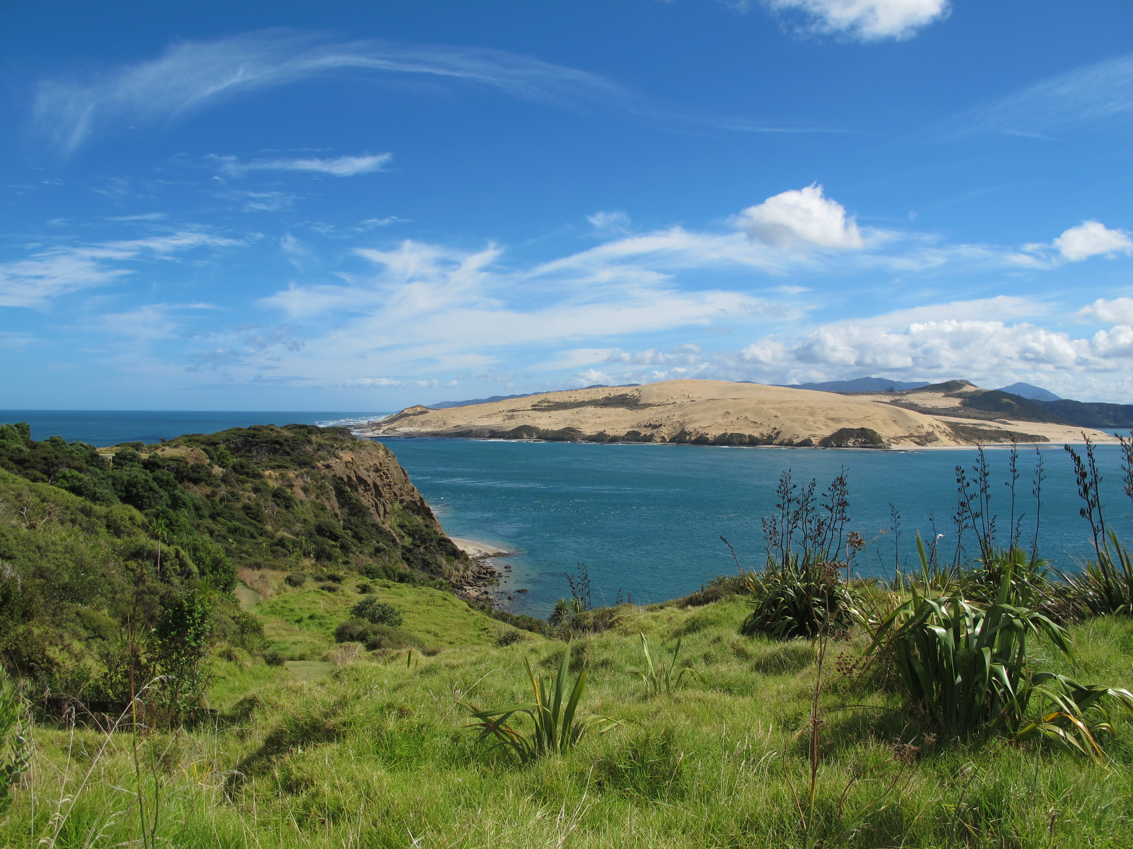
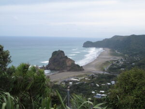
At the minuscule twin towns of Opononi and Omapere, for instance, near the sea mouth of expansive, branching Hokianga Harbour, the few visitors to the area occupied just a bit of a tiny parking lot. But the mouth itself, which a greeter at the i-Site tourist office urged us to see, was astonishingly beautiful.
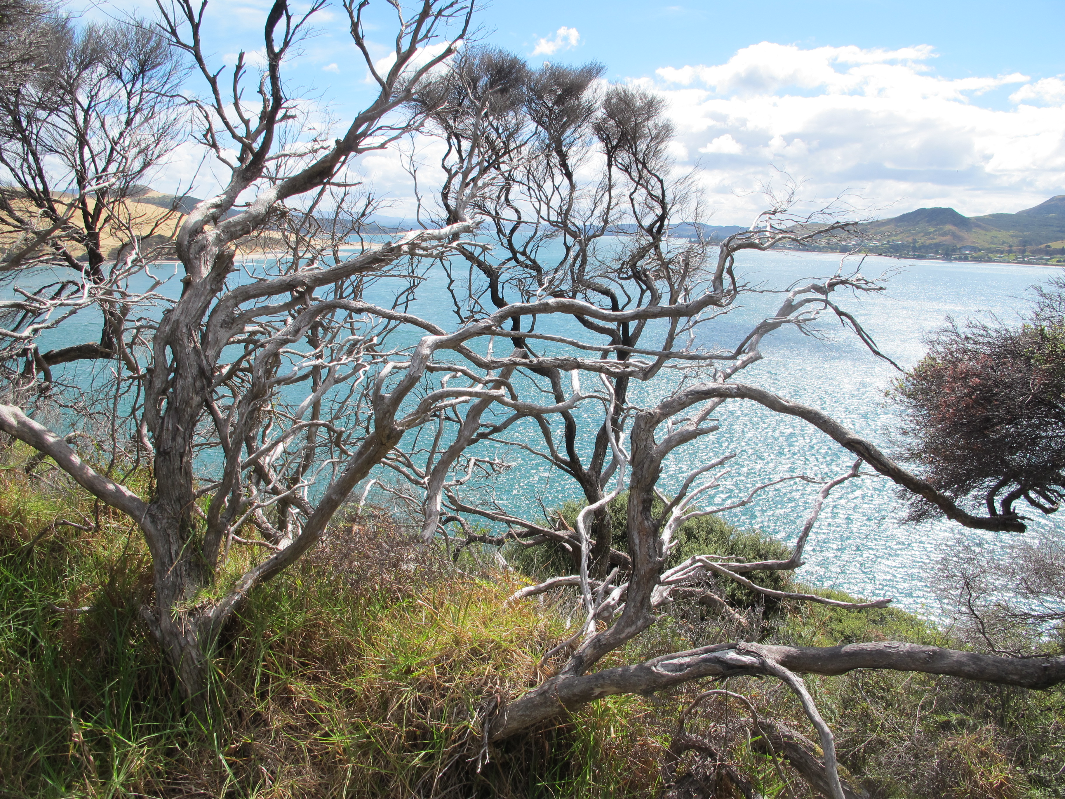
We walked one arm amid twisted, wind-stunted trees toward a weather-worn shoreline that soon gave way to an inviting scalloped beach of dark sand…with just one person on it. Bleached sandy dunes and beaches gleamed from the opposite mouth.
This west coast is reportedly quite poor relative to the rest of New Zealand, and we saw some evidence of that. Even mobile phone signal is much harder to come by. Much of the countryside seems best suited to what you see from the roads, large tracts of grazing land and widespread growing of kumara, the local sweet potato and staple of Kiwi diets. Even with fine beaches and rich marine life to offer, its coast is harder to access than the eastern shore because Hokianga Harbour and the even larger Kalpara Harbour to the south make access difficult. We took an expensive ferry just to cross the Hokianga waters. But of course developing a few more roads to the long stretches of coastline in between could change that.
When we thought about exploring the region further, we were told that there was no place to stay along the 100 to 150 kilometer run from the north of Kalpara Harbour to Helensville at its south. Though we were quite close to the non-stop tourist accommodations of the east coast at that point, as the peninsula narrows, we were still astonished at how unaccommodating the west side could be.
To us, though, the attraction of Northland’s westside came from just its laid back and untouristy feel, where you can still find enough places to stay apart from that Kalpara area and a striking wild landscape to enjoy largely on your own. There are even some foodie joints, like the hip café called Blah Blah Blah in the surprisingly bustling town of Dargaville about halfway between the Cape and Auckland. Plus the almost obligatory Thai and Indian cafes with takeaways.
The spirits of the dead may sweep down – or up – the Northland along Te Ara Wainua as they hasten back to their homeland out of Cape Reinga. The living should consider taking their time to savor the beauty and the quietude of this less traveled landscape.
(Also, for more pictures from New Zealand, CLICK HERE to view the slideshow at the end of the New Zealand itinerary page.)