

We’ve long believed in seeing the terrain a step at a time, feeling the landscape while we hike up hillsides and into valleys, or feeling the texture of a city while prowling its streets and buildings. That approach gives an elemental perspective on the beauties of the natural world or the quirks of a populated one.
But there is a special exhilaration when you survey the same scene from the rooftops, mountain peaks – or flying up above.
We had the pleasure of these dual perspectives – down below at ground level and high above around 500 meters – within two locations in northern Australia. In both, we discovered the lovely and often surprising ways that sand, shell, water and minerals have fashioned gorges, waterways and mountains.
These two locations lie in a region south and west of Darwin, a special landscape formed over millennia as the ocean receded, leaving reefs, limestone and sandstone rock high and dry – along with the remains of ancient algae (cyanobacteria) and shellfish. Once these remains emerged from the sea, twin seasons shaped them further. In the Wet season, rains inundate the area sending floodwaters raging down the soft rock and carving deep gorges. In the Dry, erosion shapes and re-shapes what the rivers no longer sweep.
(For other sights and insights we gained from this region, see our posts on Darwin, Kakadu, Mimbi, Darngku.)
Purnululu
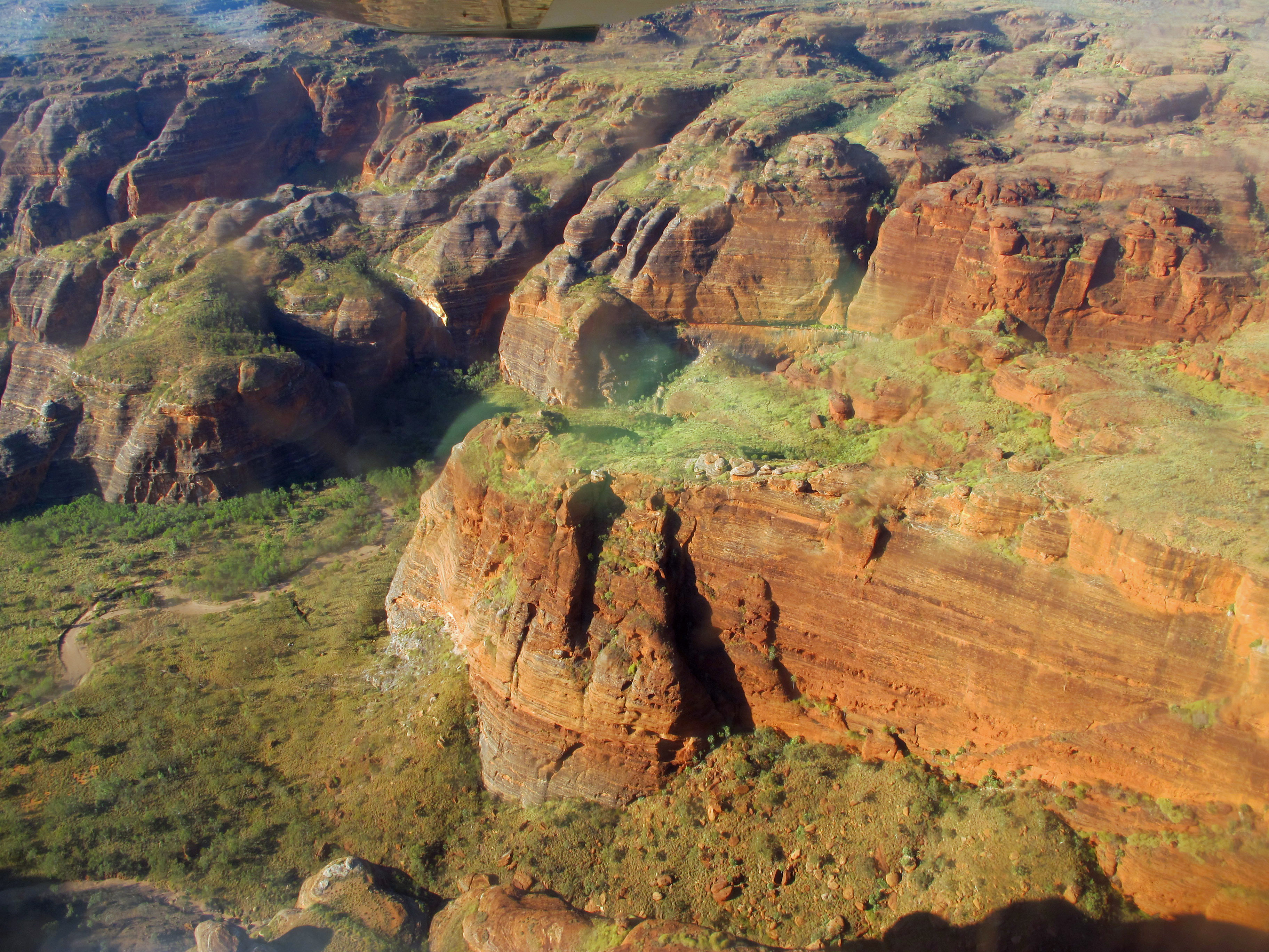
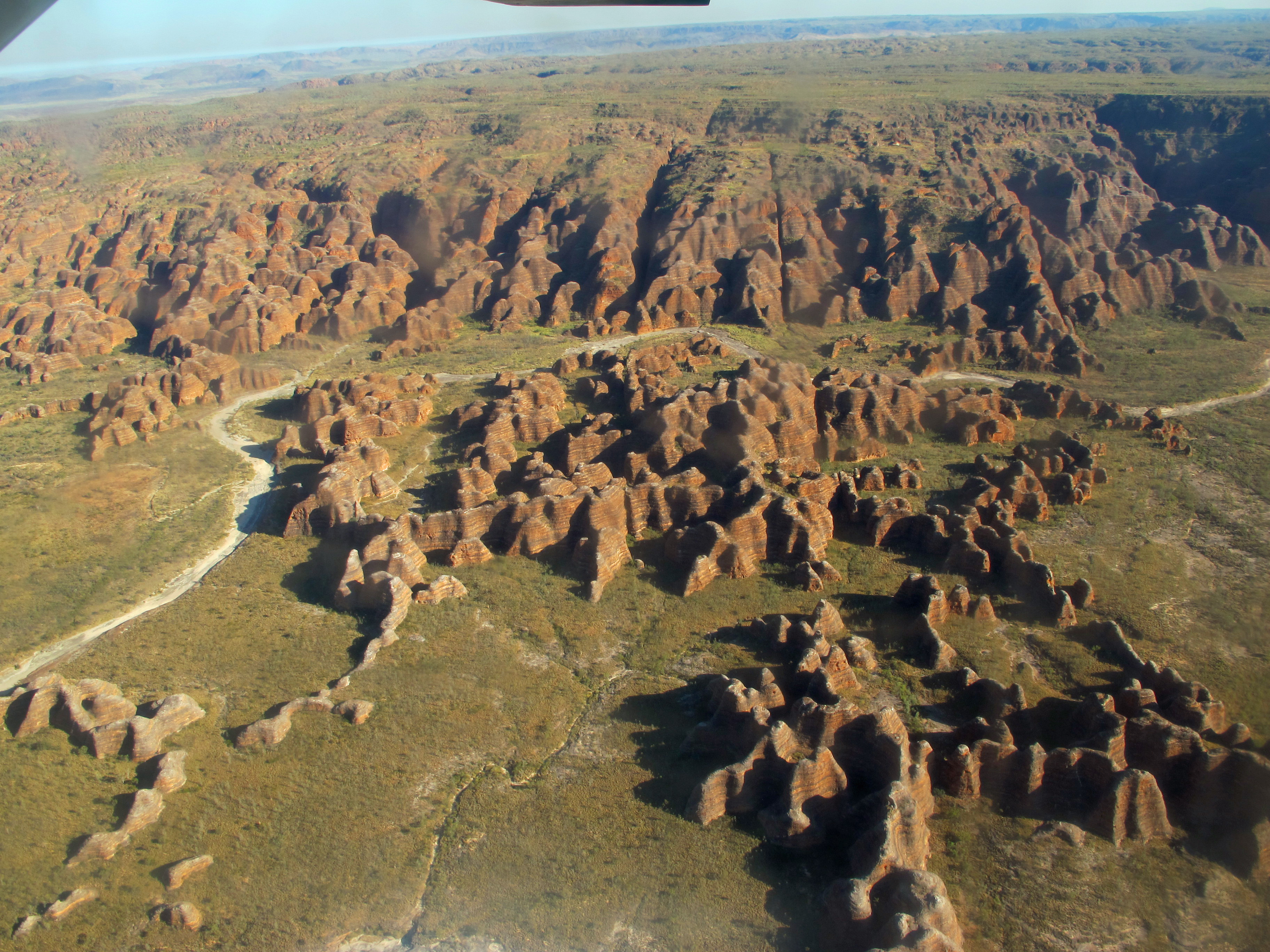
When you approach Purnululu (i.e., sandstone, in the Kija tongue) from the air, you pass slightly undulating plains interrupted more and more by sharp edged escarpments aligned from erosion by the prevailing northwesterly weather. As you near the craggy plateau of the Bungle Bungle Range, the 450 square kilometer shelf seems riven by numberless seams and cracks invisible from the ground.

At the southern end is the most unusual feature, myriad bulbous mounds of sandstone looking like huge goose bumps on the plain below. At the north end, where erosion has smoothed out the rock and blown plant-life in, the hills are clothed with vegetation much like that of the plain itself, while the rain has dug out a number of picturesque gorges. Up in the air, we could readily see how unusual it all was and understand more how the landscape evolved.
Though quite apparent from the air, the range was surprisingly not discovered by non-aboriginals until 1983. That late date makes more sense from the ground, for getting to the Bungle Bungle Range is a challenge unless you land out there. We bumped and thumped for a couple of hours over a dusty track about 50 kilometers long, with a local tour guide adeptly maneuvering the 4WD bus through several axle-threatening riverbed crossings. Bump by bump, tree by tree, you don’t even get a good sense of the landscape you’re passing through.
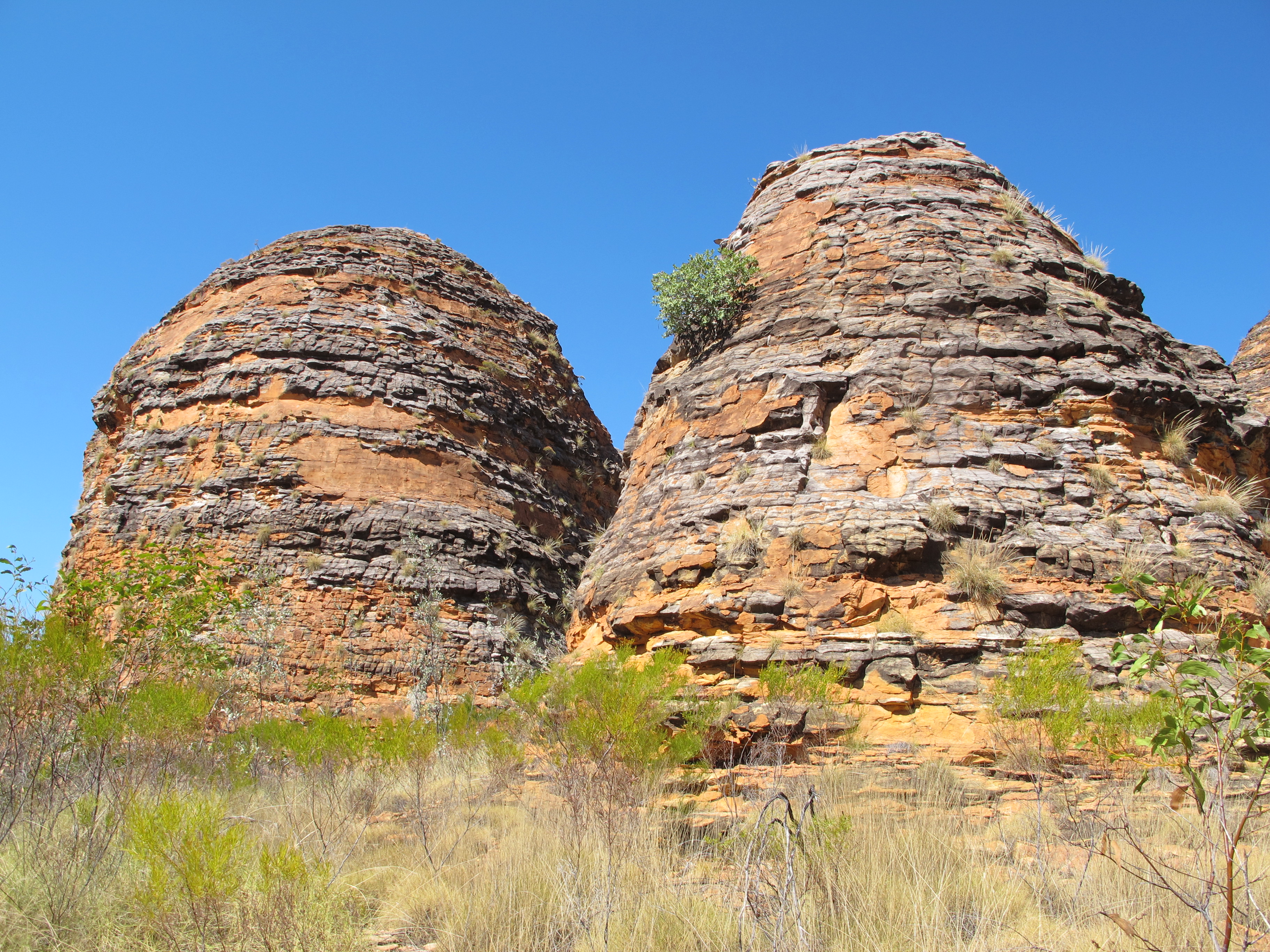
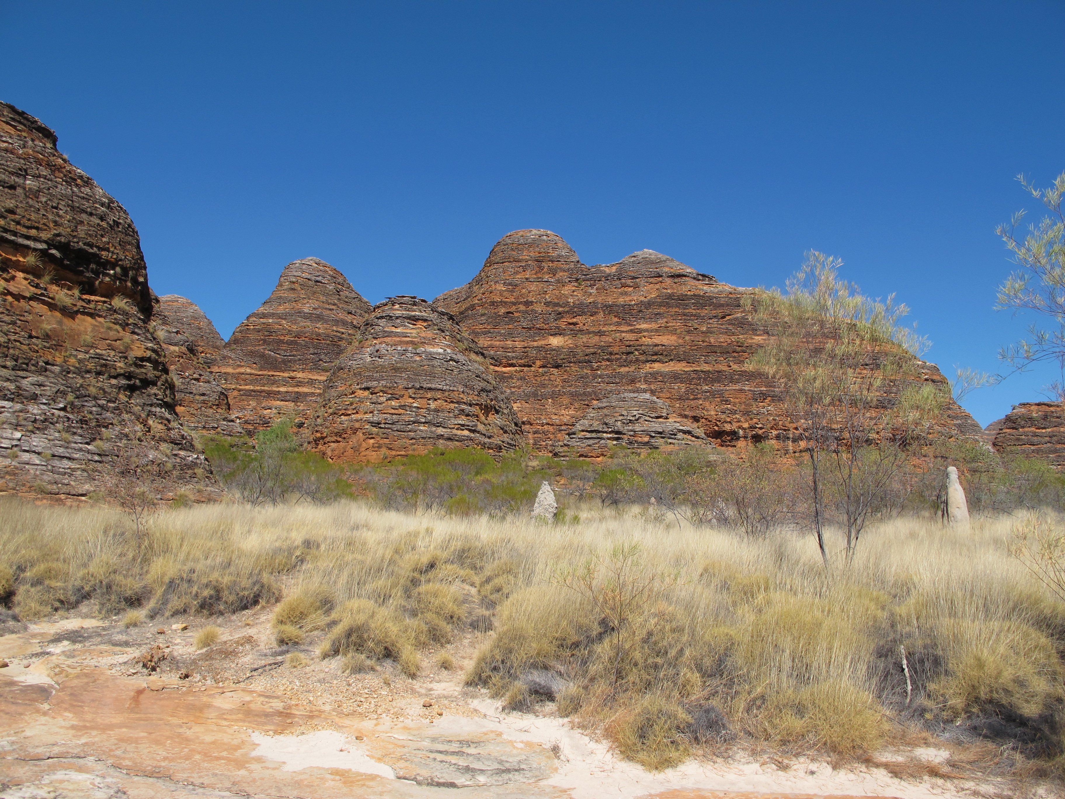
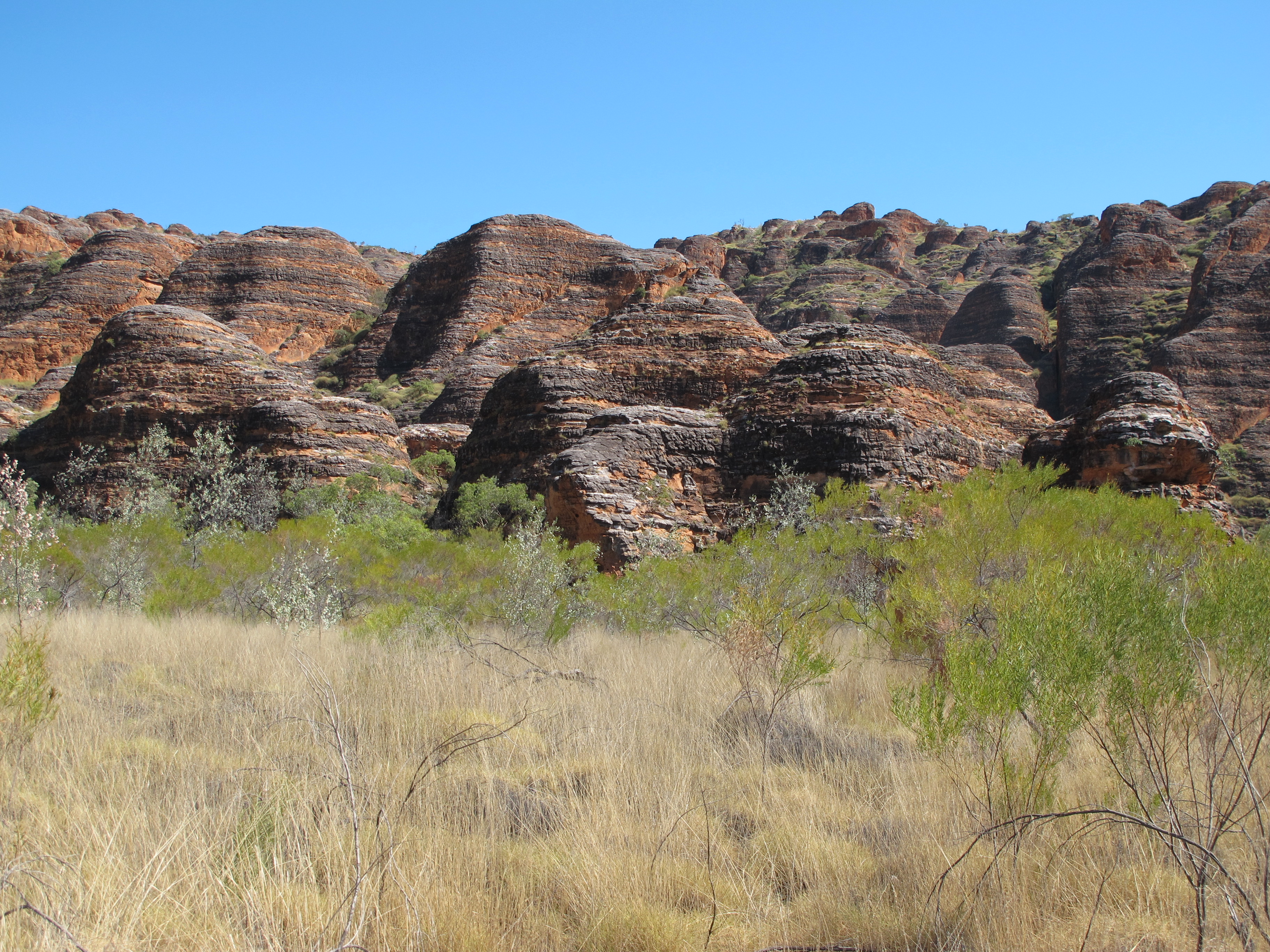
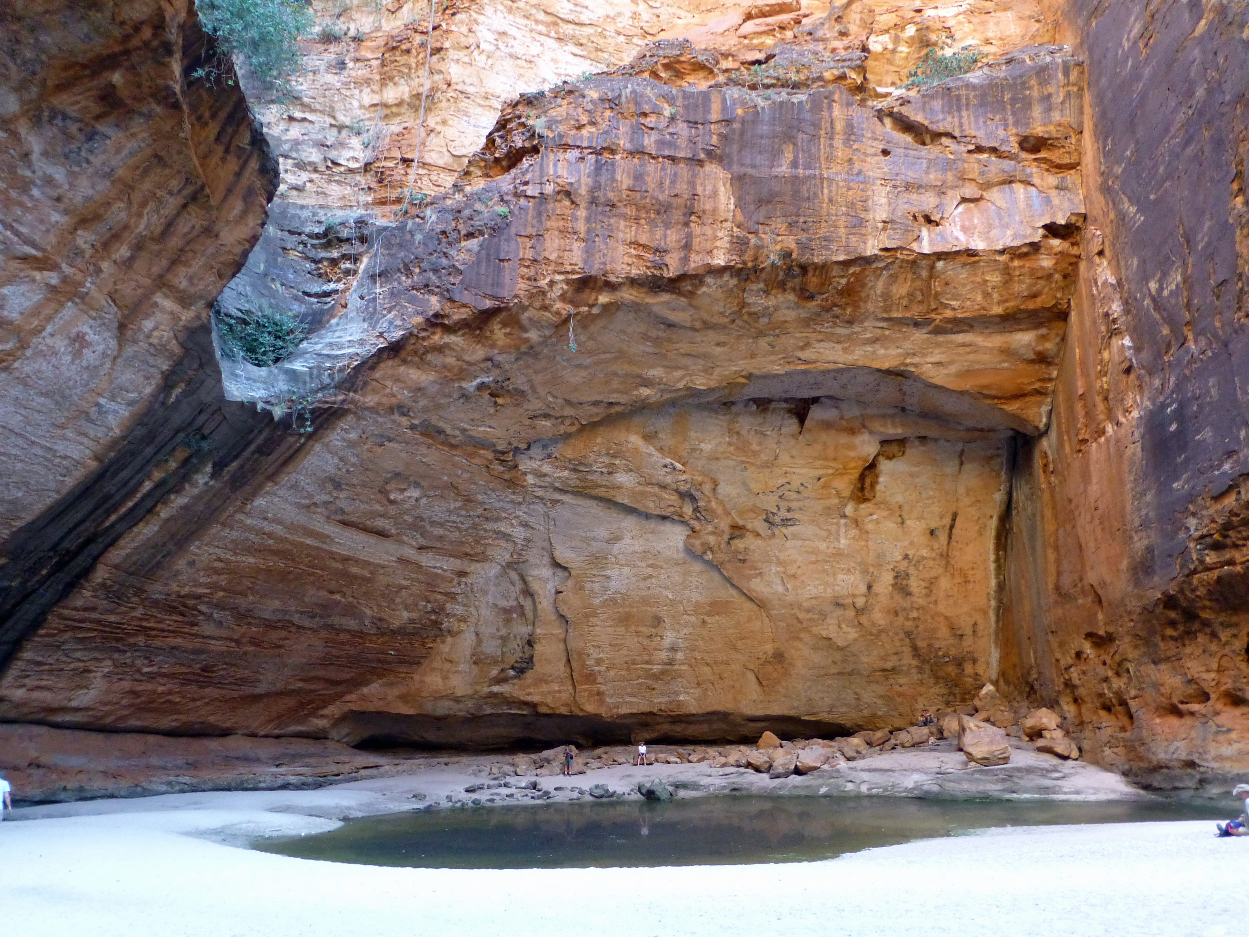
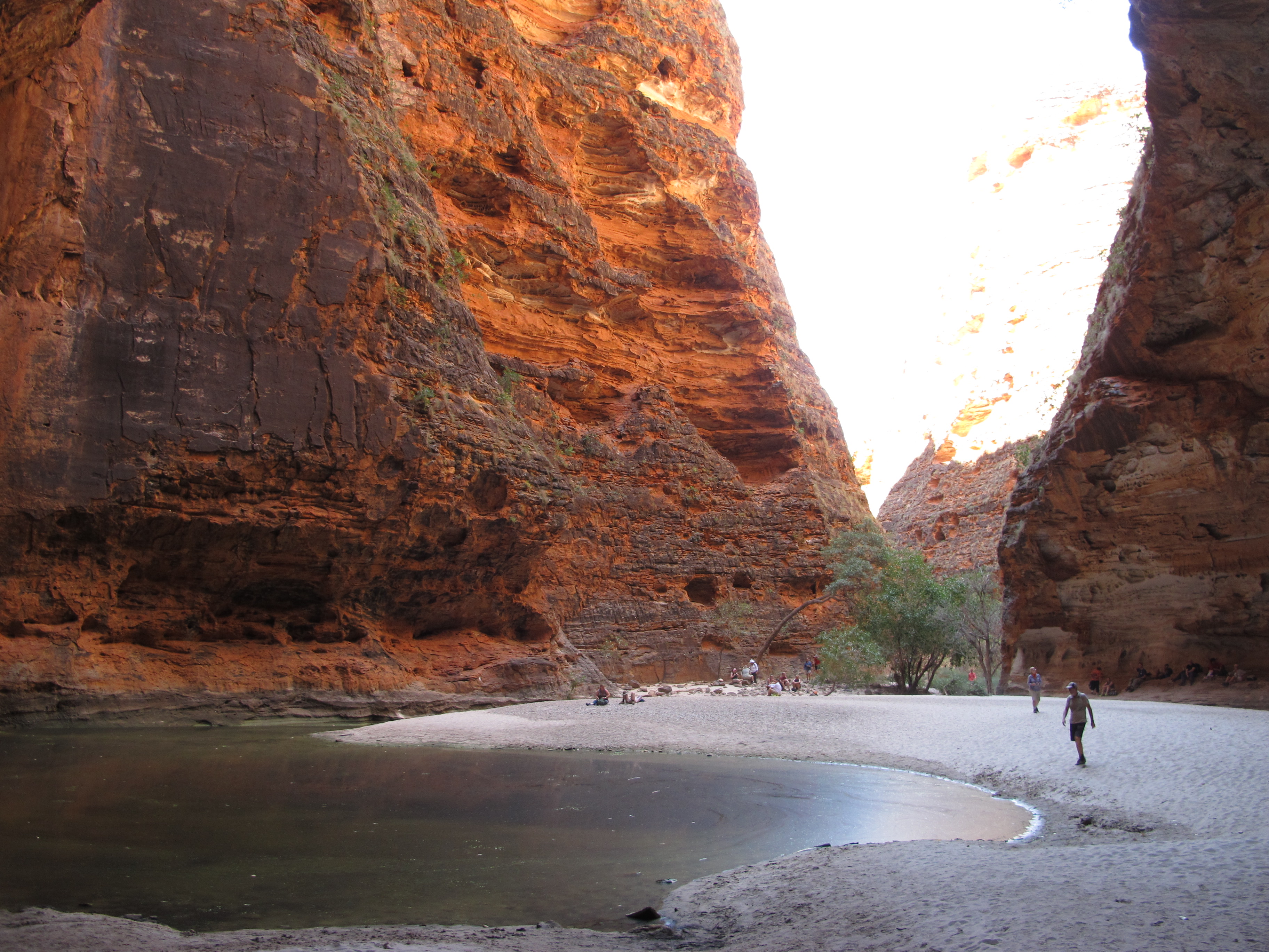
However, once we began to walk the different trails among those sandstone mounds, we could truly appreciate the special qualities of the place. As you approach them, the mounds are a remarkable site, each one striated in alternating charcoal and orange bands, like a colorfully painted beehive. Close up, though, you see the “paint” spilling over the lines. The rock surface breaks up: the gently sloped charcoal and the slightly scooped out red run into each other. A creamy color pokes through where the rock has fallen away.
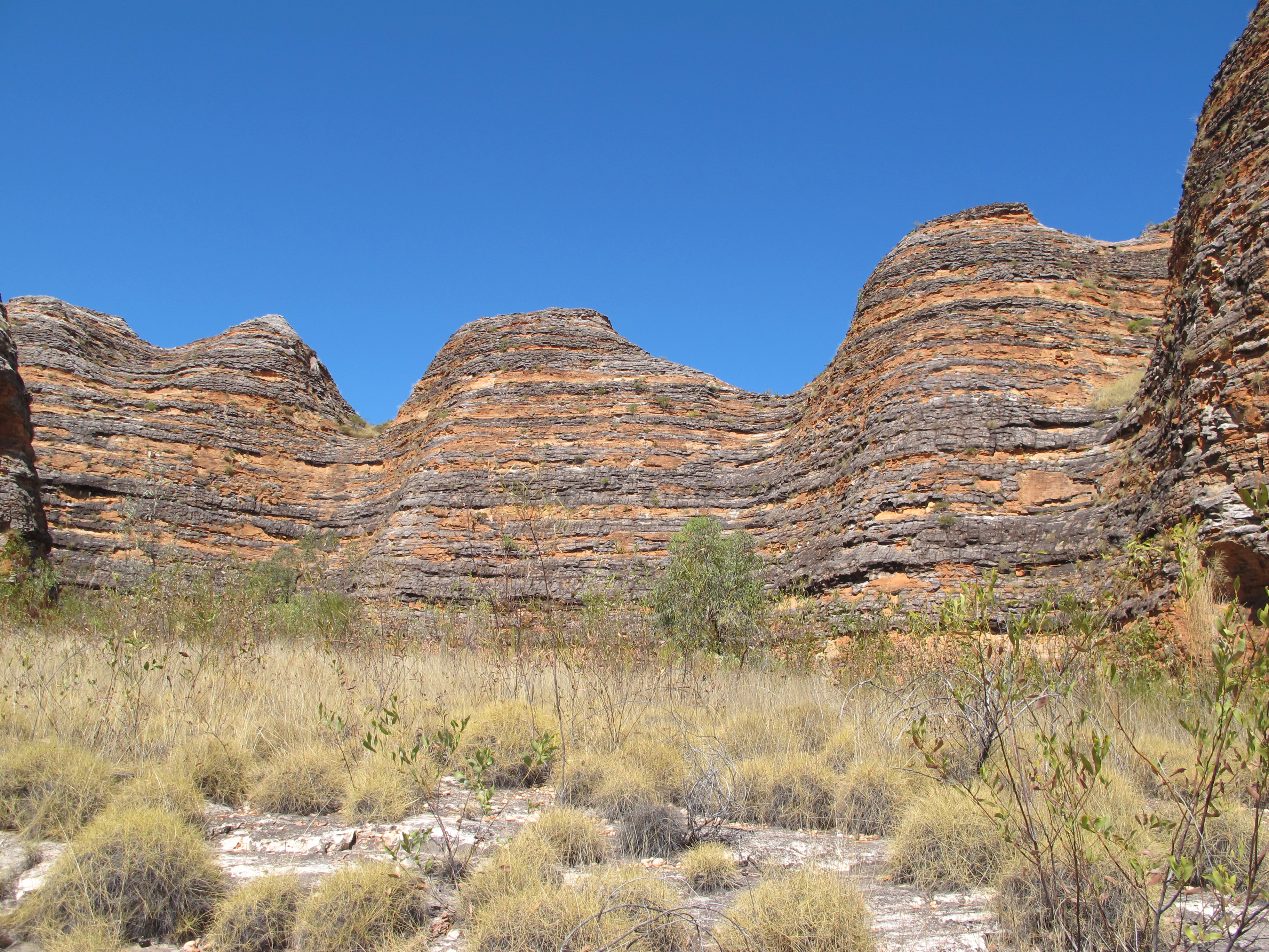
What caused all this strangeness? The sandstone hills, rich in iron, were formed naturally by erosion at the plateau’s edge, while algae gradually encased them in a blackened shell. Over time, erosion of the algae started small ledges that exposed the sandstone below the ledges and allowed the reddish iron to leach out to the surface. Beneath all of this black and red, the creamy sandstone sits, occasionally exposed when a portion of the hill cracks away.
Not surprisingly, there are few other places in the world where the combination of weather and elemental material forms beehive domes like these; the guides mention Cappadocia in Turkey as one of them.
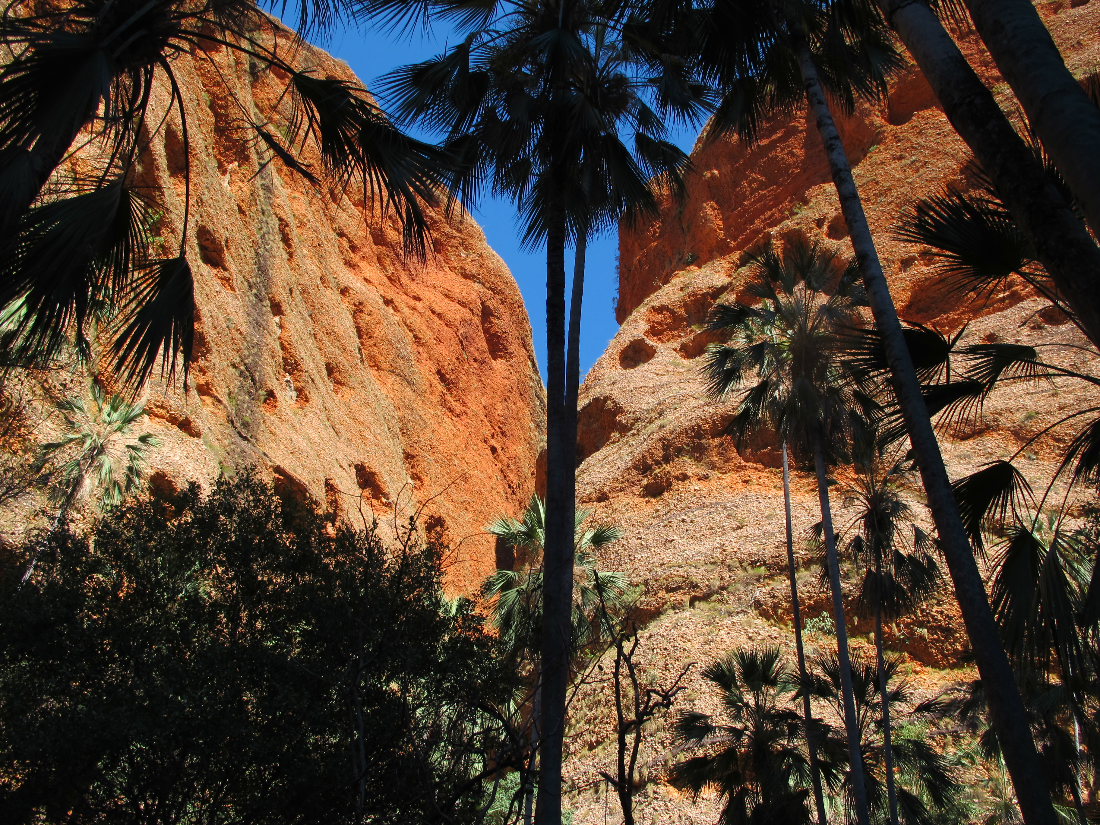
The more familiar sights we viewed from ground level at Purnululu are thrilling as well. While there, we took several short walks into canyons that delve into the plateau and whose walls are splashed with red, orange, cream and black.
In the area near the beehives, Cathedral Canyon offers a narrow passageway through the colorful 100 to 200 meter tall sandstone, culminating in the cavernous hollow that befits its name.
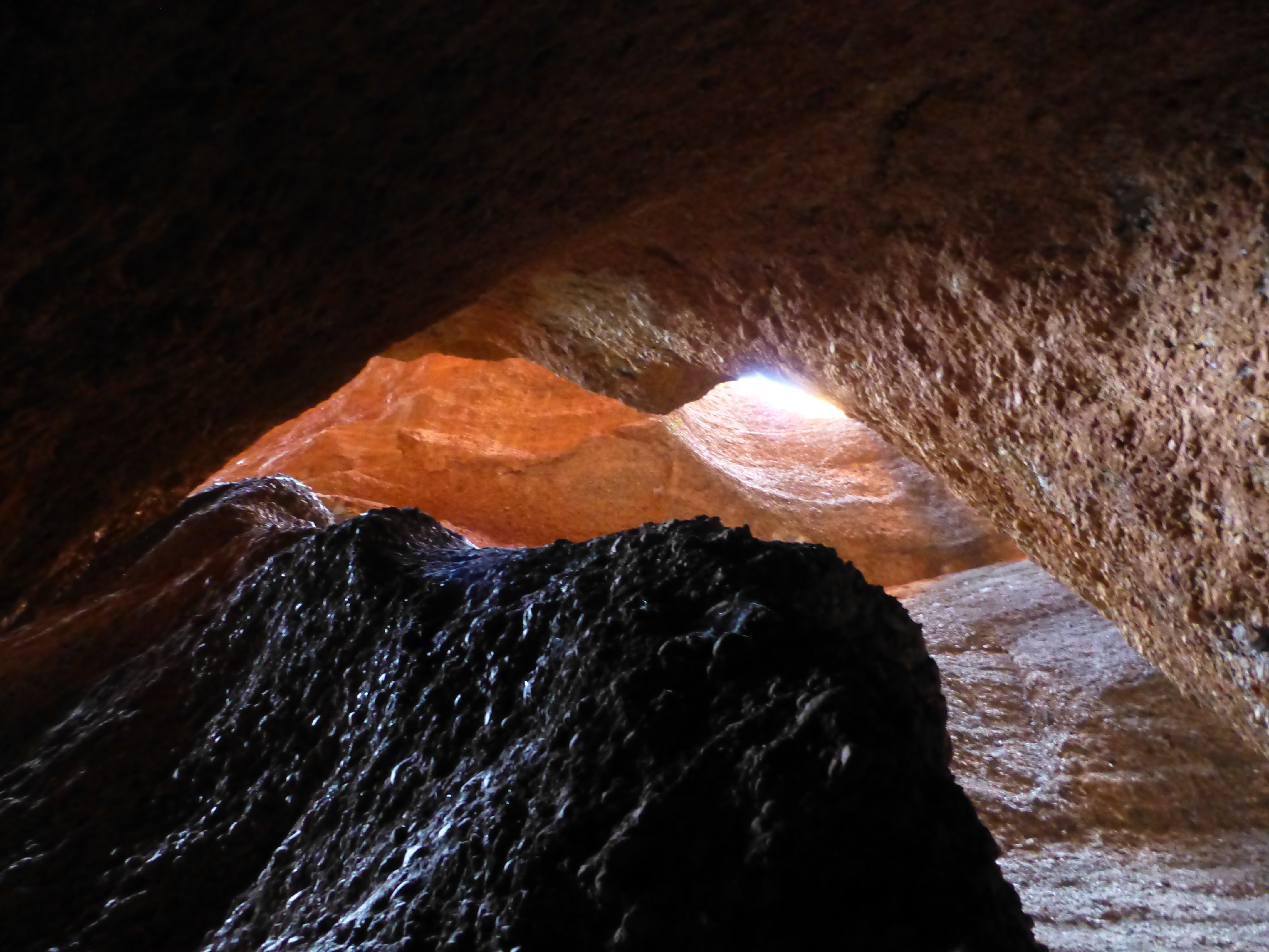
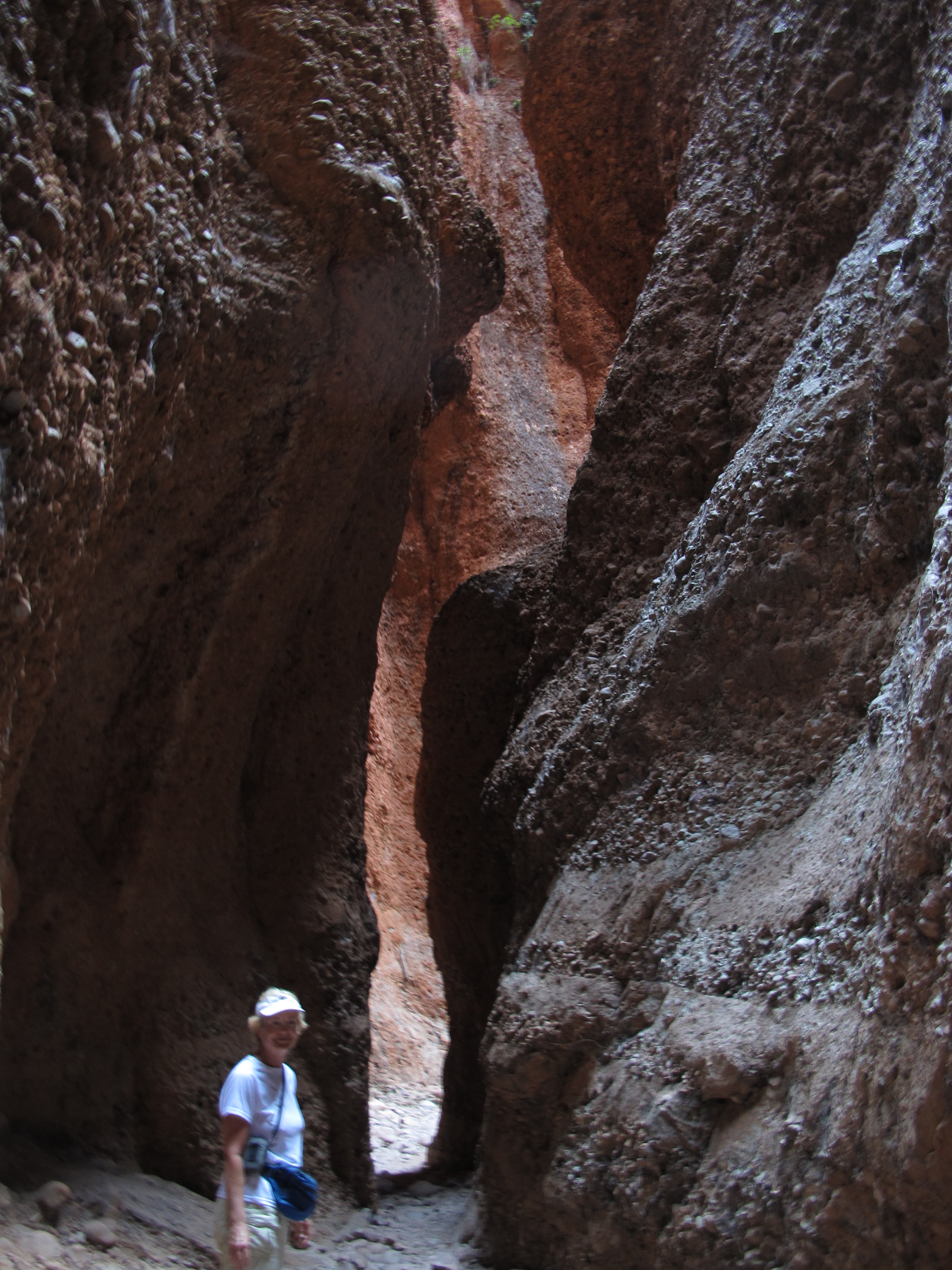
On the northern edge of the range, the charming Echidna Canyon starts narrow and just keeps skinnying down through red rock and composites of granite and sandstone. It briefly widens into a cavern, then ends abruptly justafter several narrower, rock strewn passageways.
If you can handle the heat that bakes it all, in any season, you can enjoy a wonderful few days exploring these and similar features. But the fanciful beehives are the main event; we spent three delightful hours among them.
Berkeley River and East Kimberley
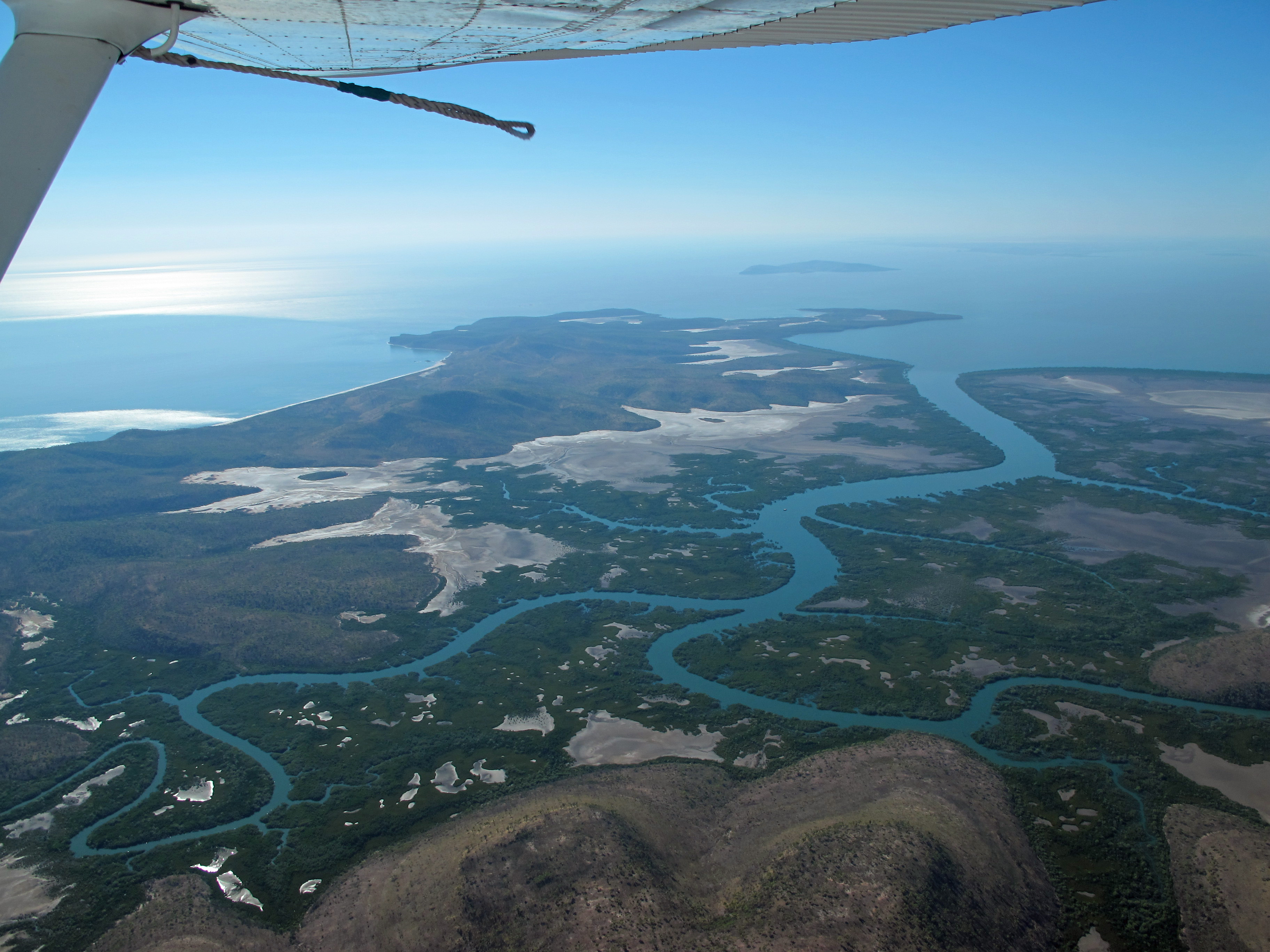
There’s little water anywhere at Purnulu during the dry season. By contrast, the Ord River delta and its sister rivers, like the Berkeley, channeling northward to the Timor Sea, create a landscape that seems all watery. That’s why the Timor shore is virtually unreachable by land. Few people come here even by boat, so this area is as unspoiled and untouched a place as you can find in the world.
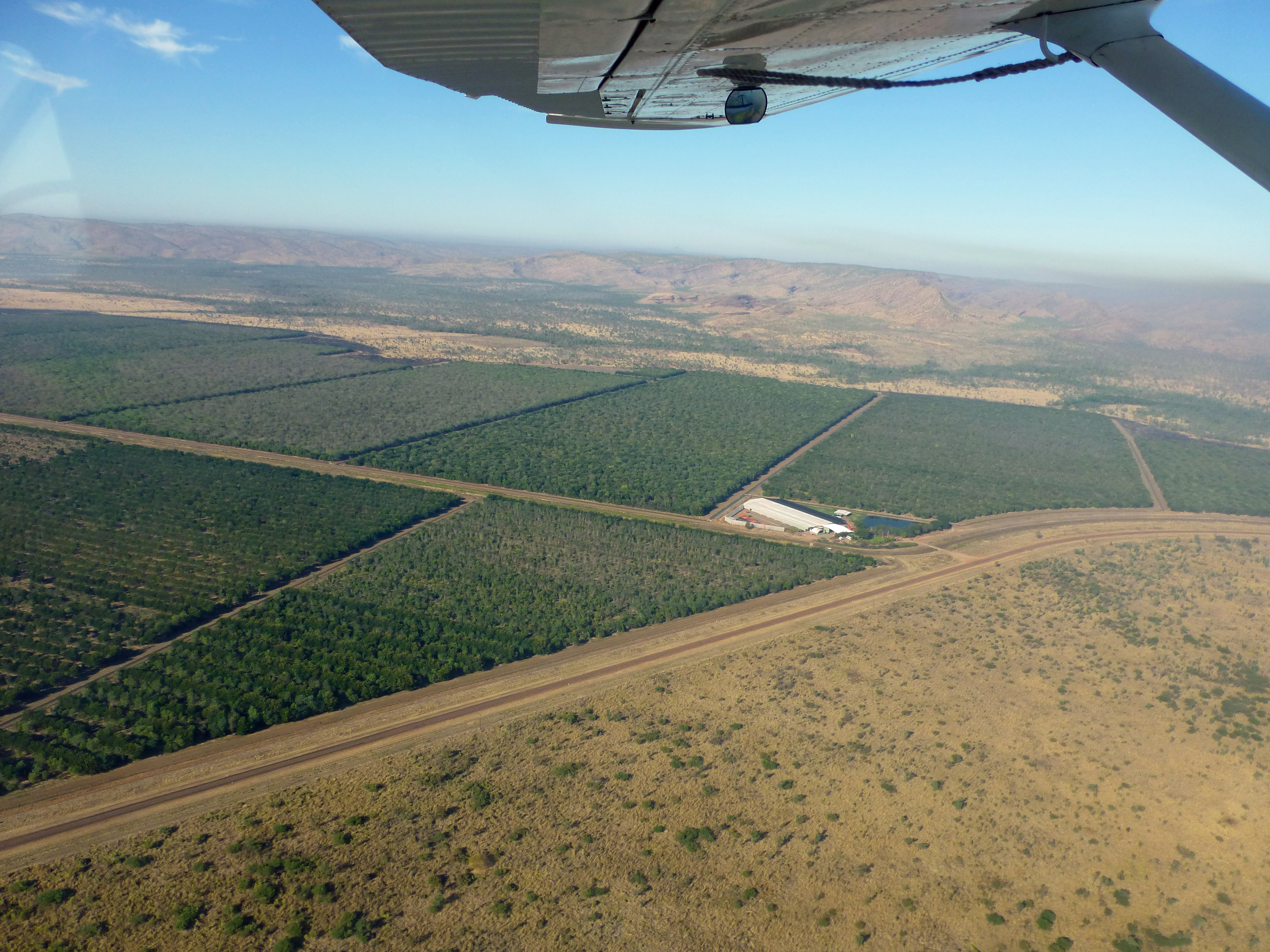
It may not stay that way. Agriculture has burgeoned because of the extensive Ord River irrigation projects. Damming contained the river’s extensive water flow during the wet season into 75 kilometer long Lake Argyle, while irrigation channels distribute the water across the plains during the year. Extensive mining and fracking of newly available gas reserves progressively alter the rivers and their landscape. We were impressed by the sprawling lake, spreading its watery tentacles far and wide among the low hills around it. We even did a very hot, but entertaining, walk along one of its arms to a lookout point. Yet, staring over the water at the tour boats scuttling people around the lake, with the knowledge of additional irrigation and extraction to come, we couldn’t help but picture how the original beauties of the East Kimberley will be defaced.
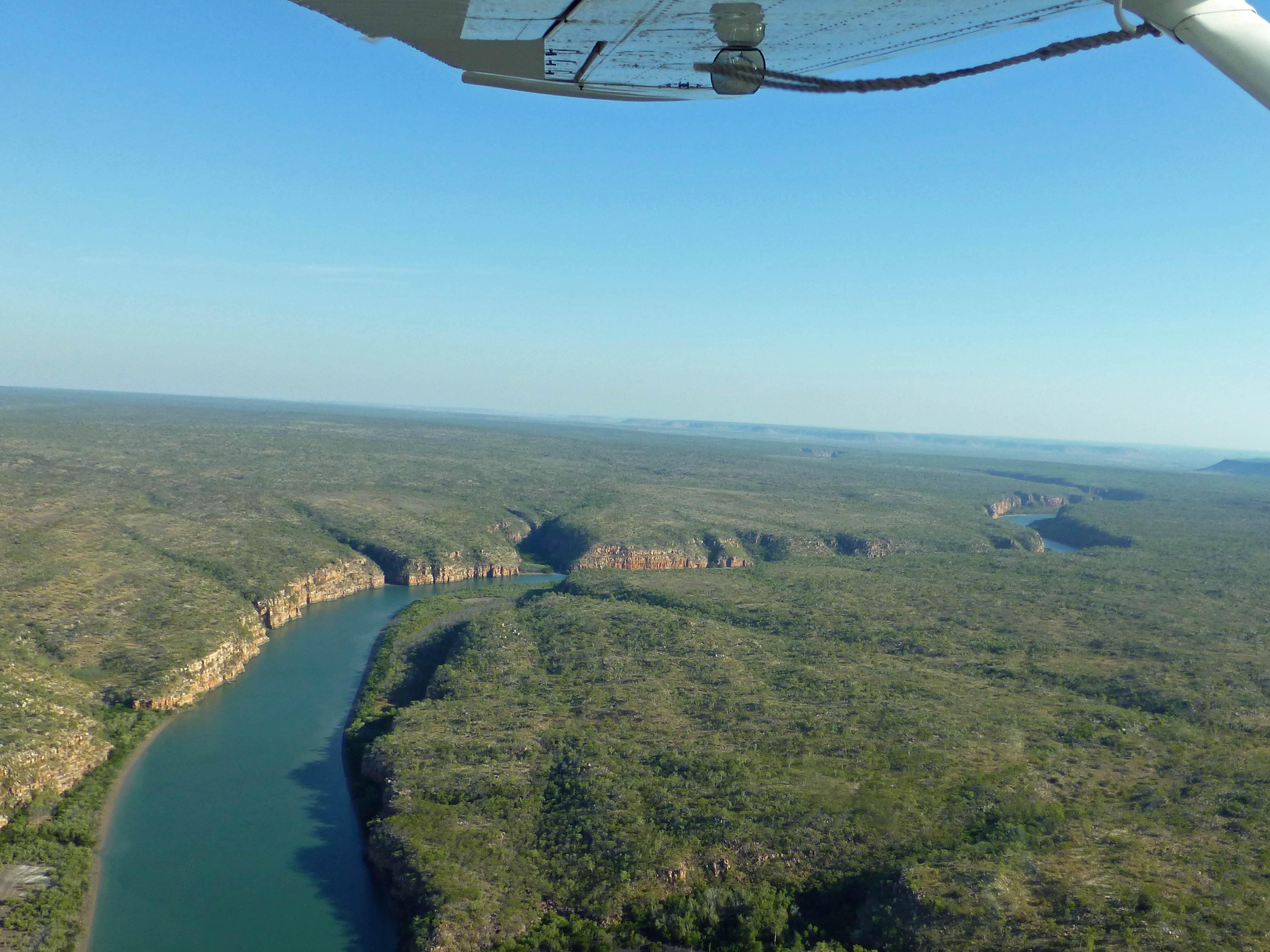
For now, anyway, like the few other visitors to the Berkeley and the Ord delta, we flew in a sea plane to the shore from fast growing Kununurra, located near the border between Western Australia and the Northern Territory.
We took off from the Ord River on a broad portion formed by another dam curving atypically backwards to take advantage of the natural hard rock beneath it. For an hour or so, we followed the Ord and other rivers as they poured into the huge Cambridge gulf, which sprawls northward from the other fast growing town of Wyndham. We then coasted along the sheer cliffs of the shoreline past other rivers and gorges before landing at the broad mouth of the Berkeley.
Surprisingly, we were not alone. Within the last few years, another change: just over the sand dunes from the Berkeley, some entrepreneur has built a small hotel consisting of plush cabins overlooking the sea…$850 per night, inclusive of pretty much everything such as our full-day boat cruise along the Berkeley. The two Aussie couples staying for a week at the cabins joined us on the boat.
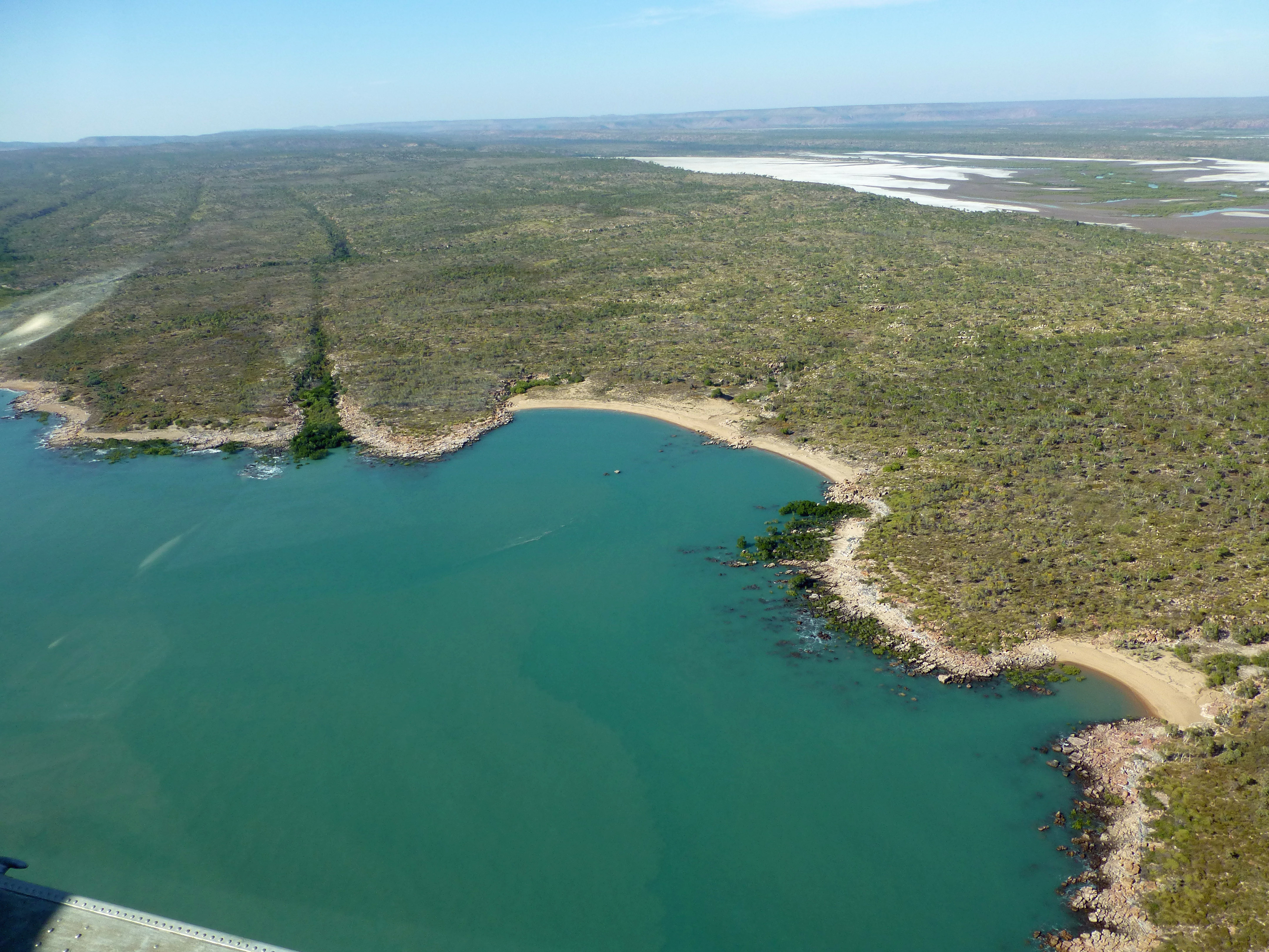
We first passed sandy banks and mangrove forests before reaching the river’s more colorful, steeper channels. With a naturalist and avid bird watcher aboard, however, we had plenty to look at along the way. Though the rocky banks only occasionally rivaled Katherine’s, the best of the gorges we’ve seen up here, we thoroughly enjoyed their vivid display of oranges and yellows, as ospreys, sea eagles and harriers peered down at us from the trees hanging onto the rock faces.
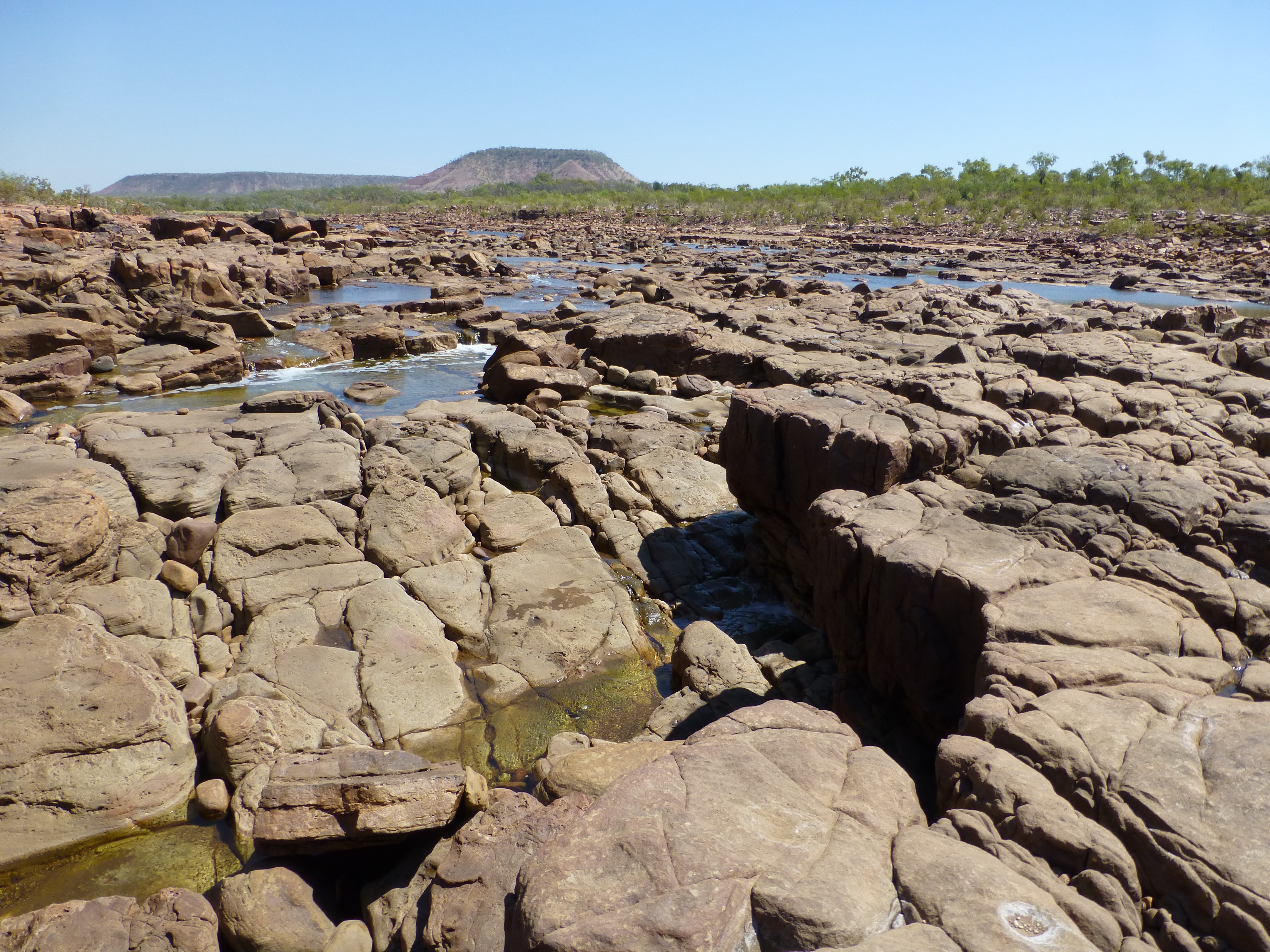
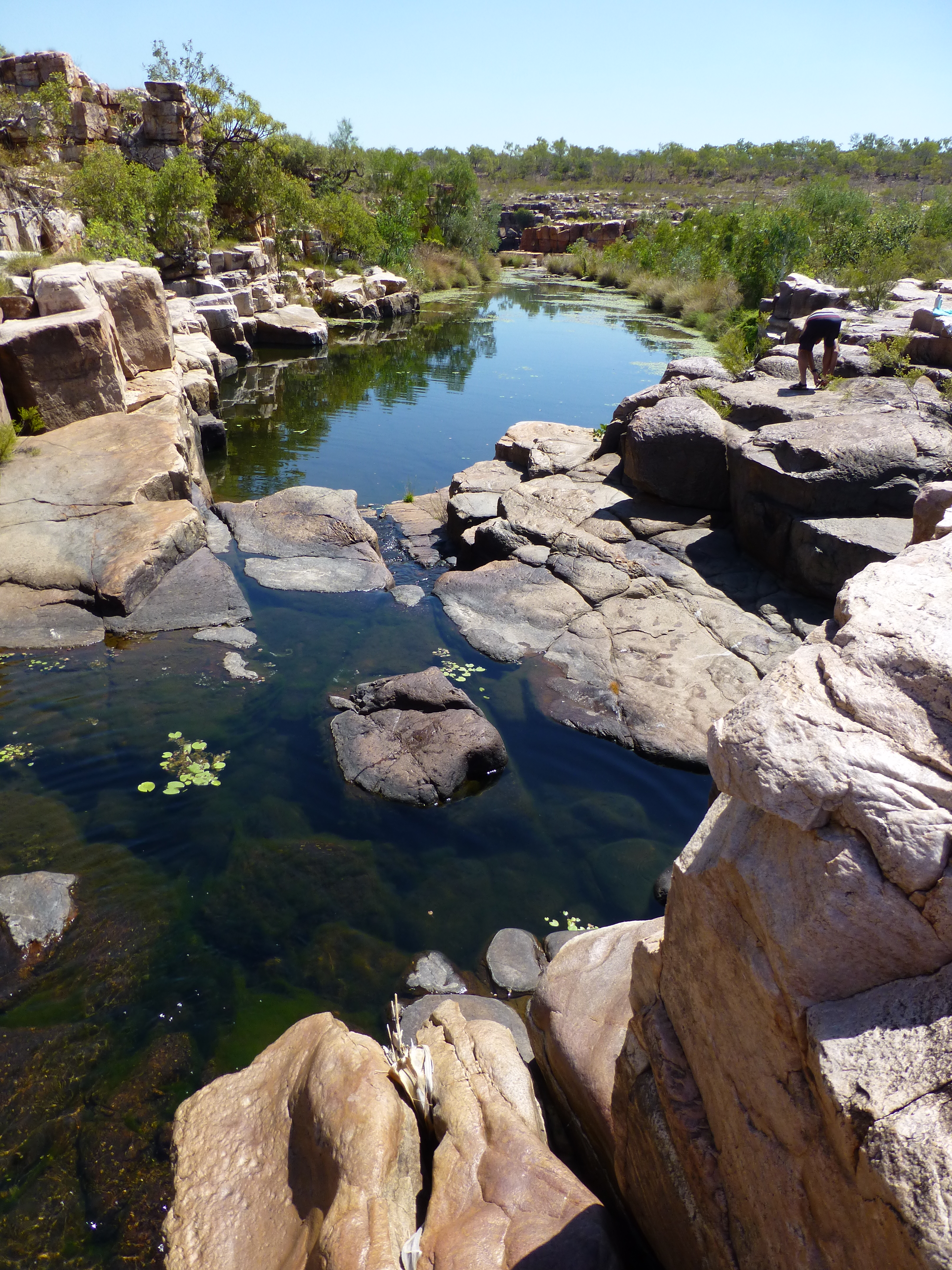
We moved upriver for hours and still were in saline water from the tidal flows inland, for the river remains navigable during the dry season only as far as the tidal sea water can reach. A set of rocky ledges marks the limit, where a shallow stream of freshwater meanders down.
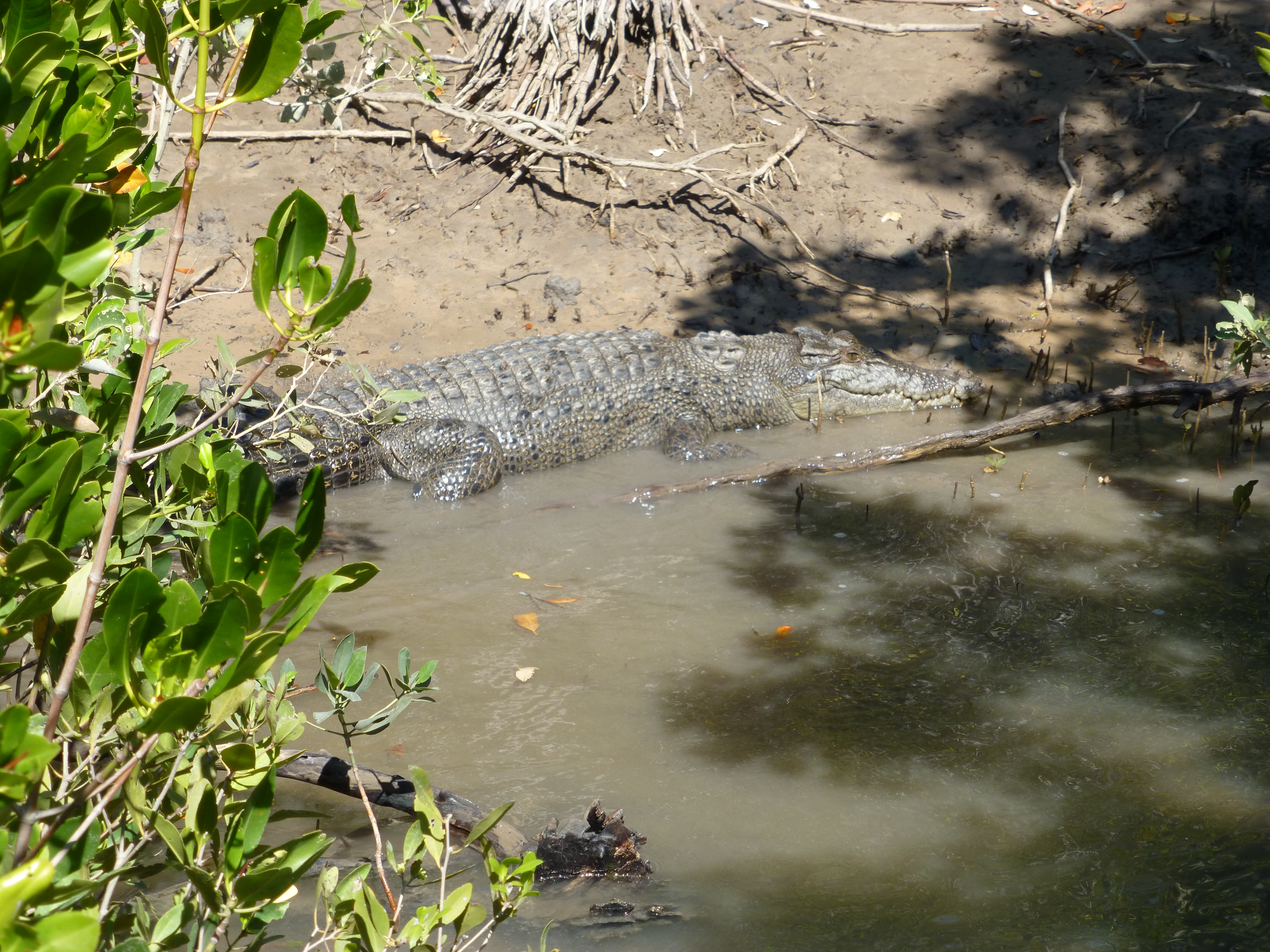
To swim, and cool off from the heat, we had to take walk a bit from the river to a few trickling freshwater pools. Salties, dangerous salt-water crocodiles, make swimming in the main channel of the river off-limits.
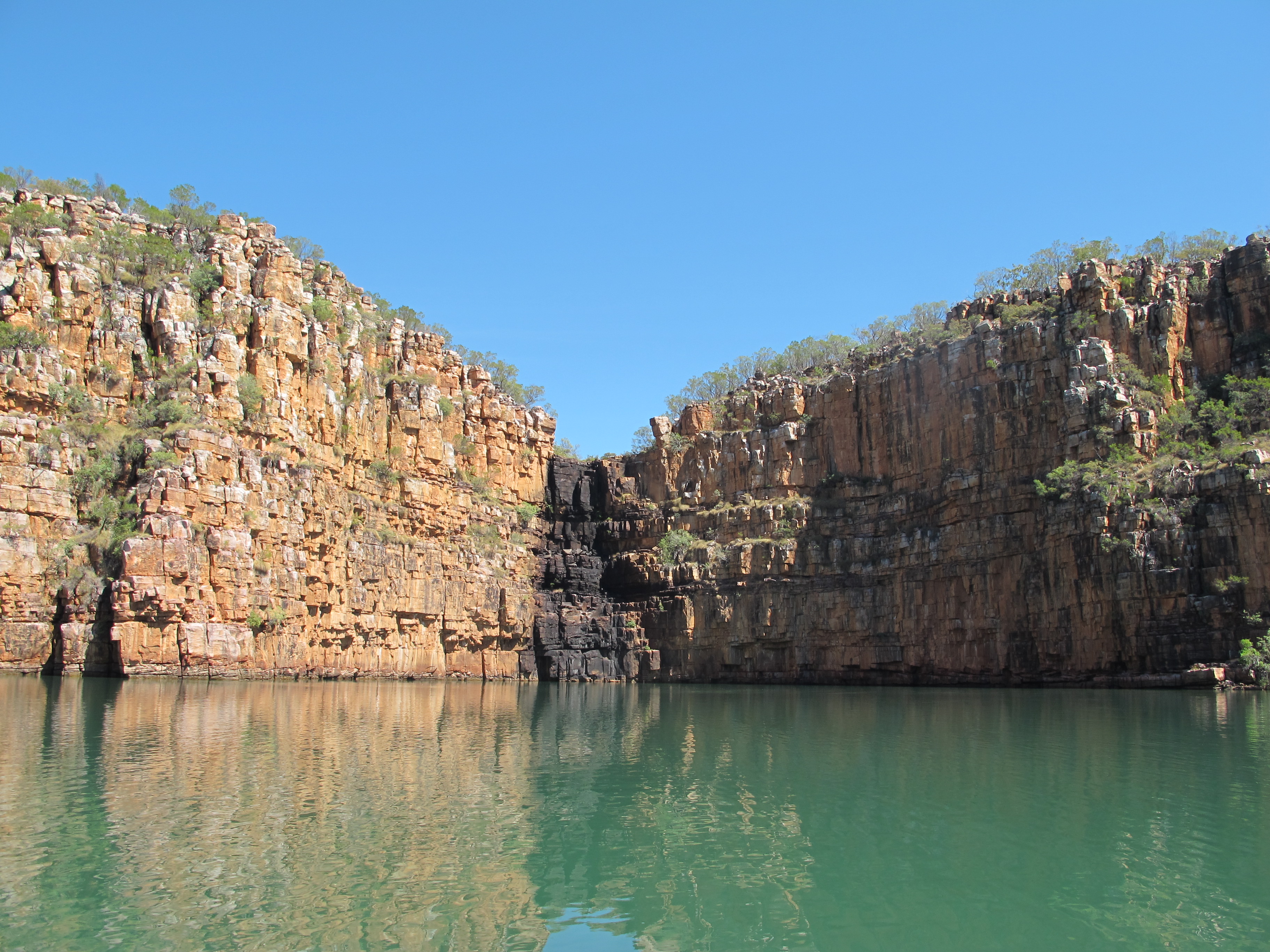
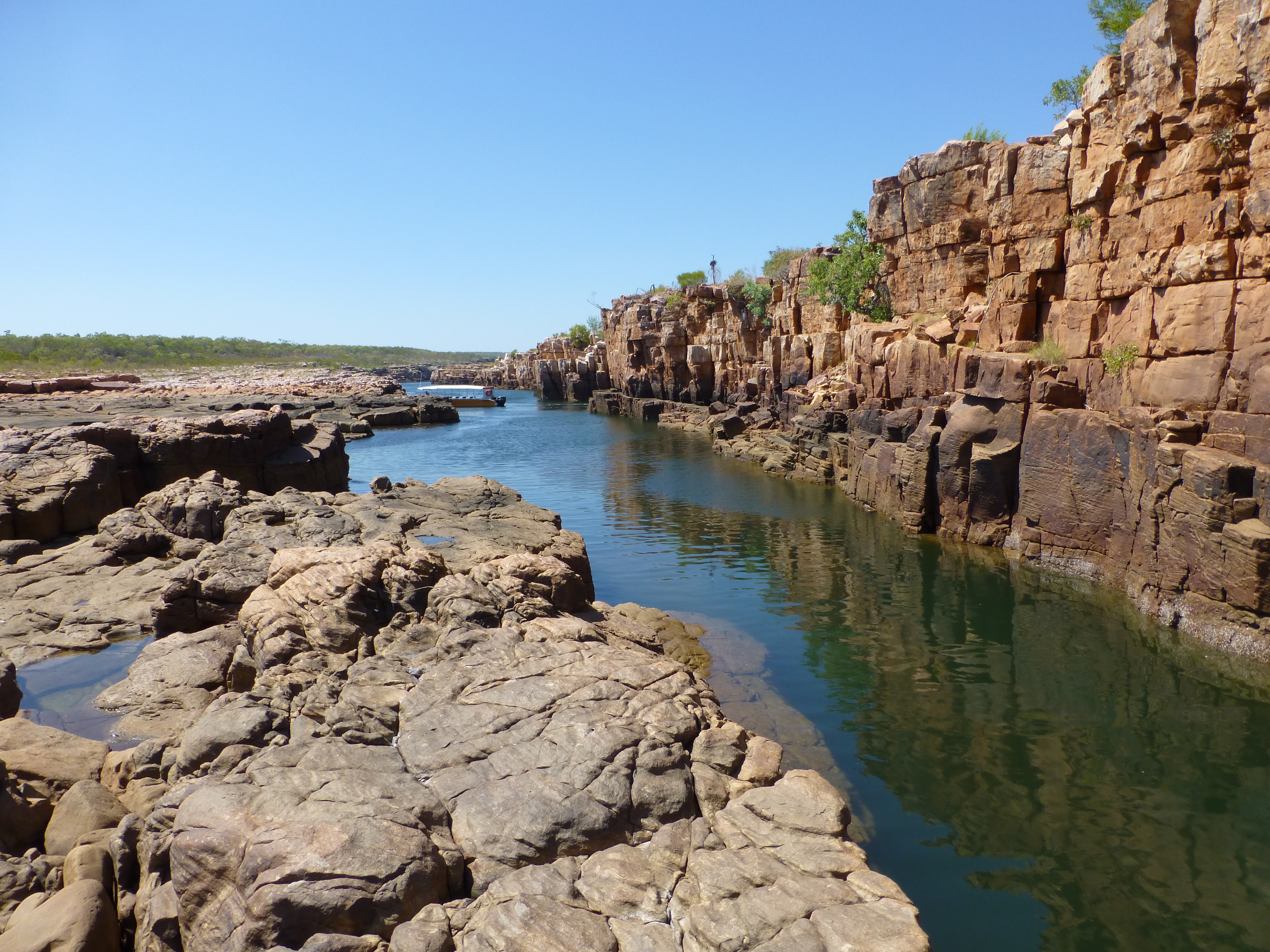
We headed back as the high tide began to ebb. Halfway back, we were nearly trapped in a deep circular recess of the river by a fast emerging sandbar. That was our lunch spot, a hollow with some of the tallest cliffs on the river. Sitting on the slate ledges at the foot of these cliffs, we felt dwarfed by them, finally realizing how high they rose, in a way we didn’t quite get while on the water.
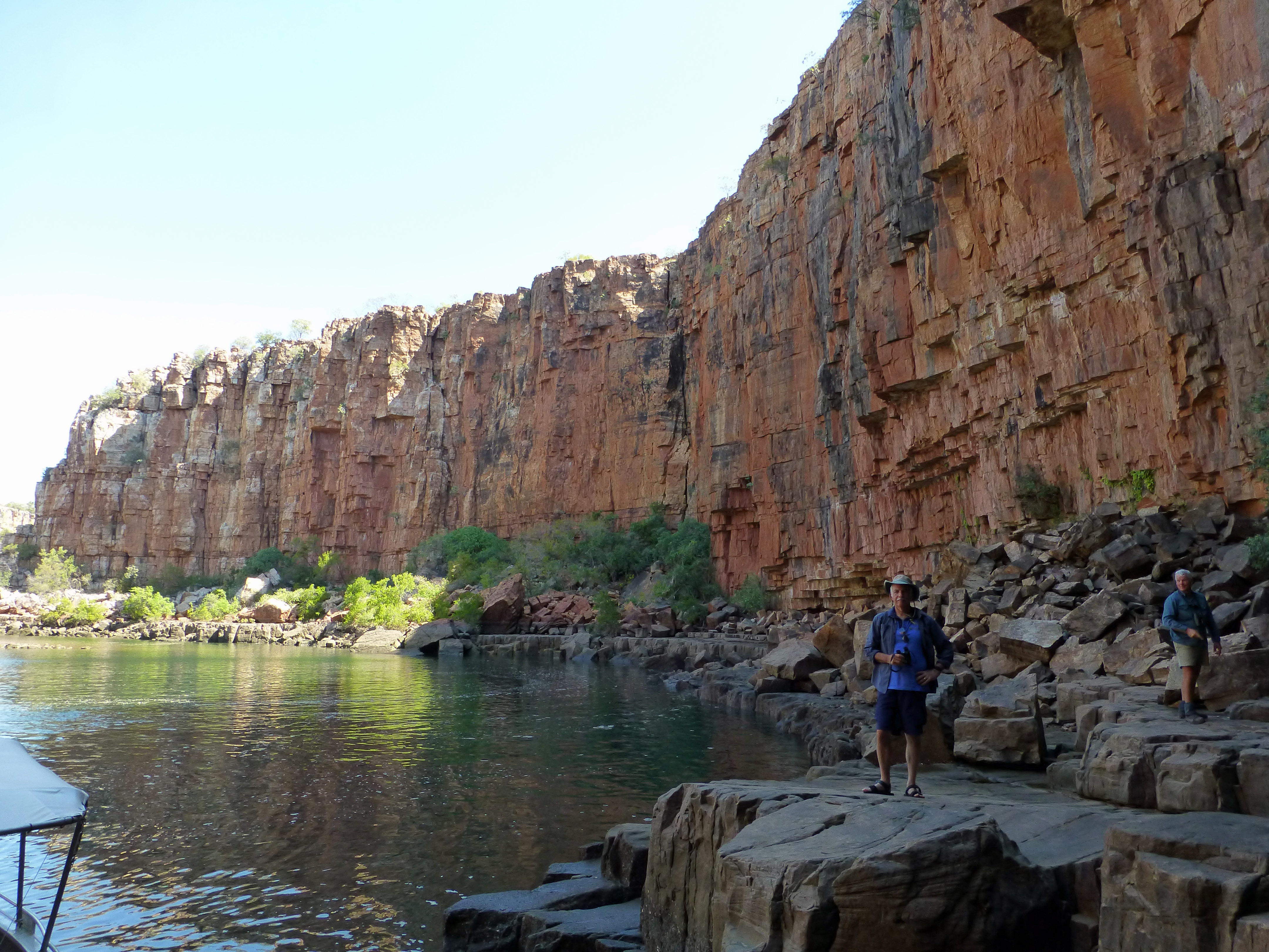
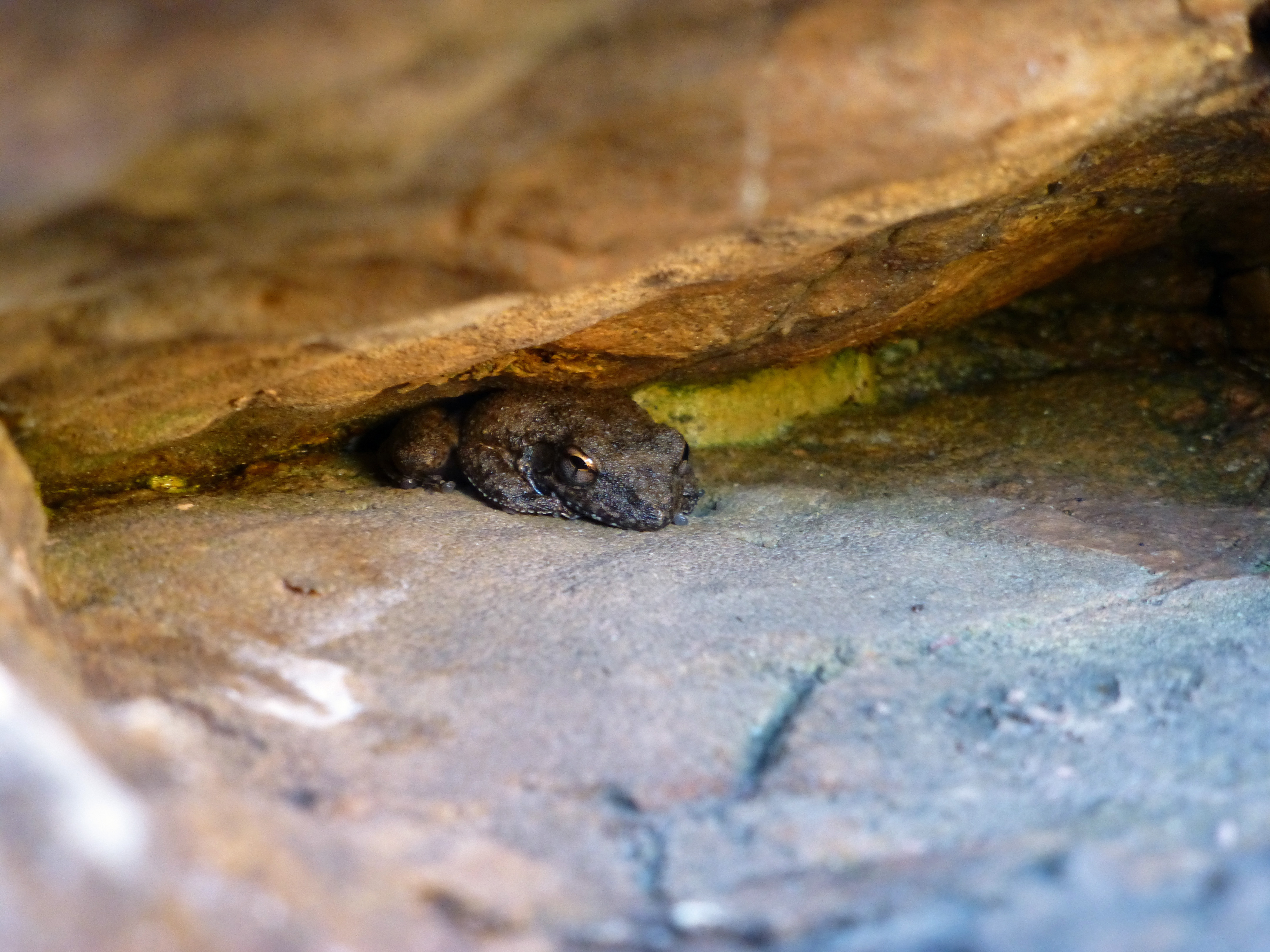
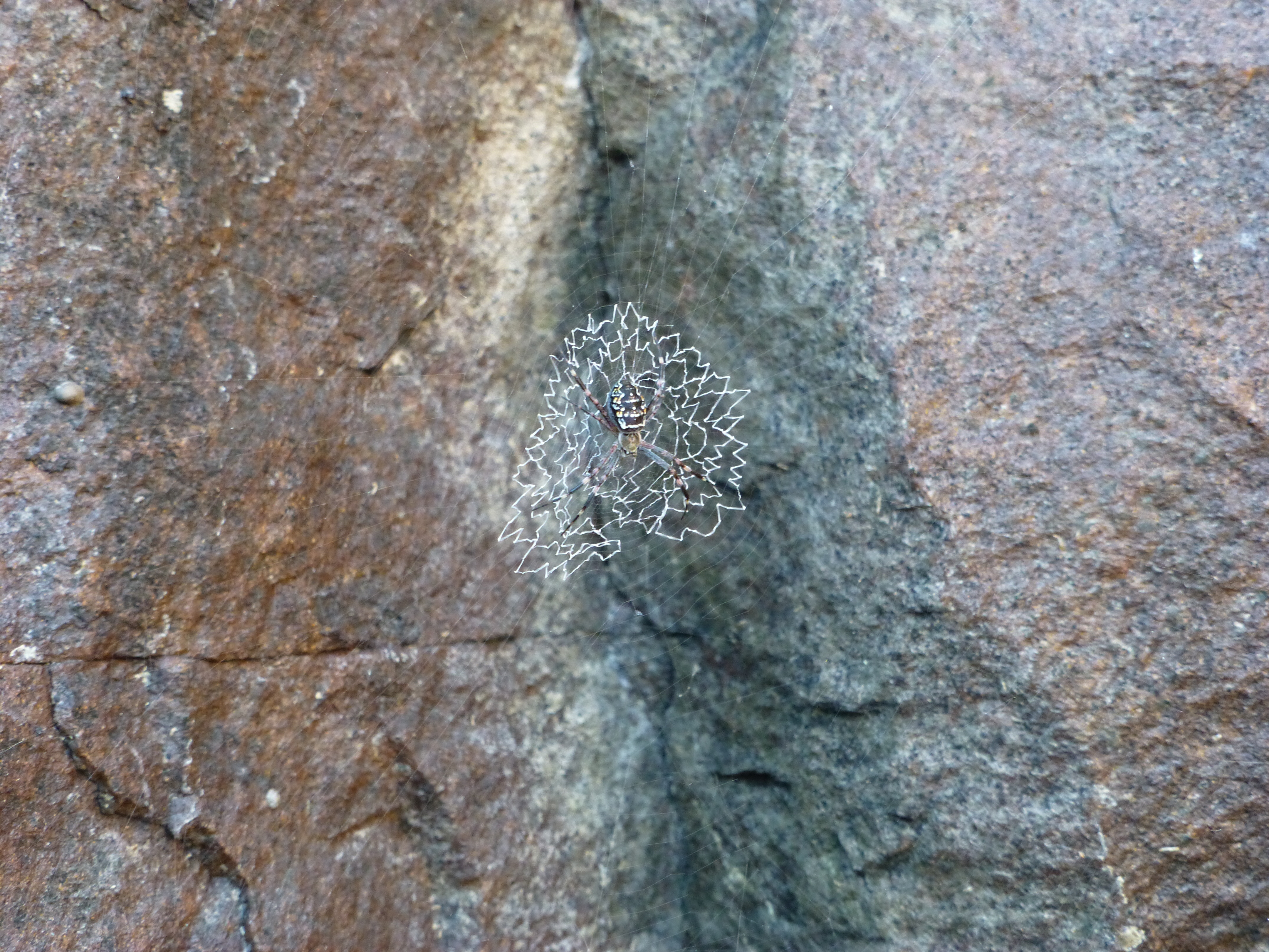
We could also savor the walls in detail: rock spiders wove intricate webs in small niches, fuzzy worms draped the wetter surfaces, a tiny frog hid in a narrow nook. The river came alive in a very different way.
The highlight, though, were the snubfin dolphins. As we neared the river mouth, one of our group spotted a fin sliding up and out of the water, and the naturalist spurred the boat driver in pursuit. We were soon treated to a display of herding by a pod of dolphins, as they thrashed along the banks to sweep fish into the shallows for easy feeding. Meanwhile, two huge sea eagles followed the action, swooping down into the frenzied fish to snatch several away for their own supper.
We beached back at the mouth, and got back on the sea plane, which wisely had been anchored far from the original shoreline to ensure it wasn’t left high and dry by the receding waters. On our return flight, we swooped up the bright blue of the Berkeley gorge, now just a wide crack with tributary crevices and diminutive walls.
In the rest of the delta, sandbars had emerged everywhere we had thought was deep water, narrowing the rivers and turning much of the Cambridge gulf to brown shallows or exposed sand. We veered lower down over several smaller rivers to spot crocodiles on the banks, and water buffalo and free-ranging cattle on the unpopulated land. Then we swooped down past the dam for a smooth landing, back down to earth at the Ord.
How grateful we were to travel amid these glories of nature – both exhilarating from above and breath-taking from up close.
(Also, for more pictures from Australia, CLICK HERE to view the slideshow at the end of the Australia itinerary page.)

Another example of a great post from the two of you. I certainly like what you’re doing and the way you are telling it. Most entertaining! Keep up the good work.