

Sand, shore, ocean, forest, farm – you could sum up the Pacific Coast Highway of New Zealand in a few words. Yet, even in a week, we couldn’t get enough of these.
The Pacific Coast Highway of California – known there as the PCH and State Highway 1 – is one of the great roads in the United States winding up the west coast past the surfers, bathers, coastal mansions, and rocky shorelines. In New Zealand, the PCH – much less consistently enumerated as a hodgepodge of different State Highway numbers – wriggles along the north and east coast of the country past, well, sand, shore, ocean, forest, farm.

What you don’t expect is how much the diverse terrain and grand natural beauty of New Zealand’s 900- kilometer PCH rivals – and perhaps outshines – the 1000 kilometer Californian one. Both are highly populated, the one with sheep and cattle, the other with town-folk. Both feature extensive development to suit these populations and wilder terrain for those who want to stray from those developments. Both share missionary styling and culture, with Spanish influence in California, and both English and French as well as Spanish heritage in New Zealand. They both pass near wine making regions: Hawke’s Bay is one of the country’s Napa Valleys here. However, the Maori presence along the coast is strong, not just historically, but in contemporary towns, culture and aesthetics; by contrast, tribal areas in California are mostly distant from the coast.
We pleasurably drove about half of this extraordinary road along the peninsula of the East Coast. So picture this area as a clock. Starting from Wairoa at 5 on the clock, we cut through a typical landscape of crumpled hills, farmland and deep gorges to connect with the PCH at 11. There the northern beaches and bays of Opotiki nestle along the Bay of Plenty. Then we rounded the peninsula clockwise to 6, ending at the art deco laden town of Napier and Hawke’s Bay to its east.
Though we took a whole week to do this, we could eagerly have spent a month en route. We have already recorded some reasons for this excitement in our posts about Wairoa and Napier (click the towns for the posts). Here are some other reasons we’d go back.

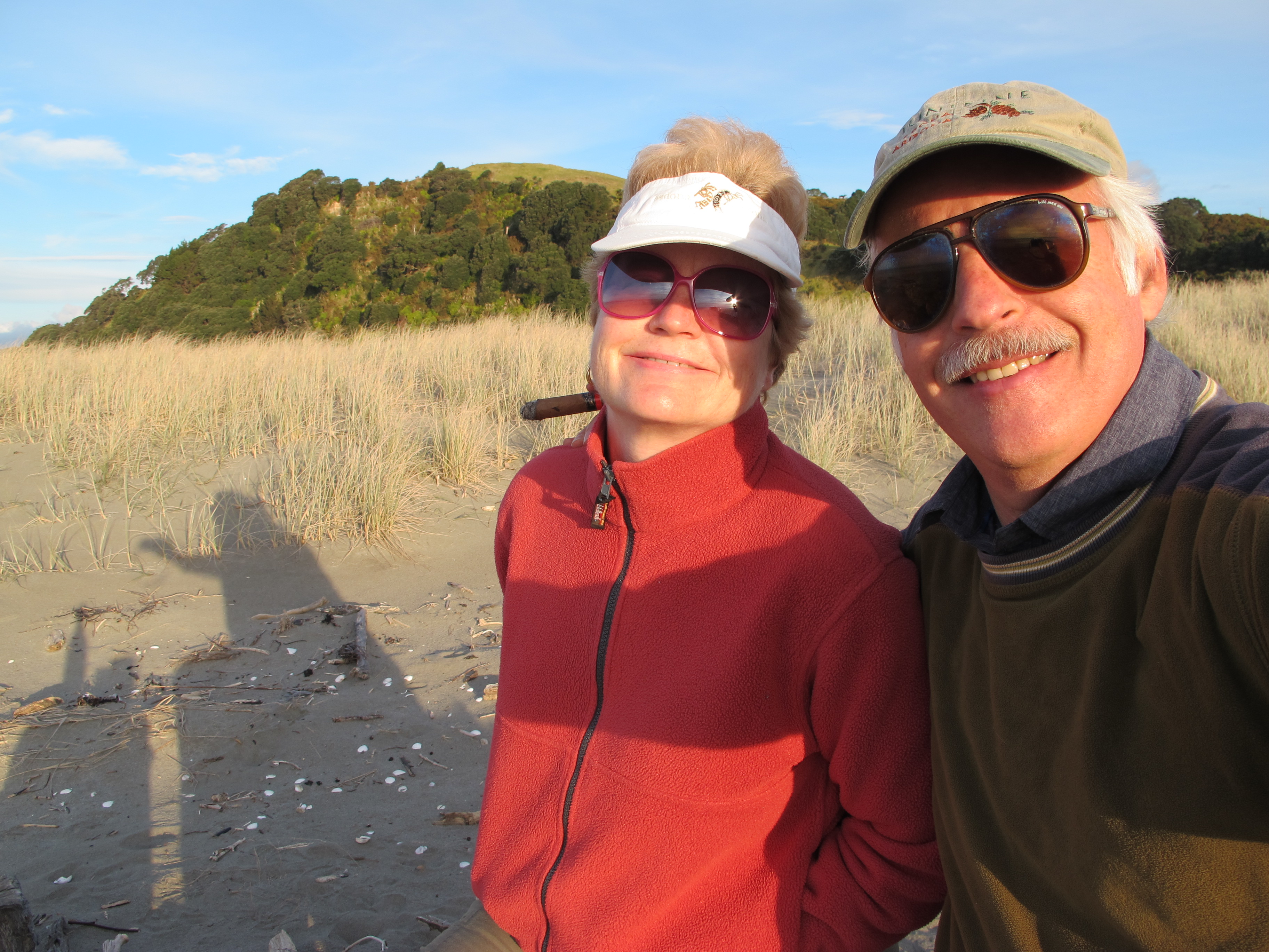
Ohiwa Beach is a spit of land that juts into the Bay of Plenty near Opotiki, one of what seem to be an endless supply of pristine beaches in the region. Ohiwa limns a small, shallow bay that appears almost to drain at low tide. We settled into a serviceable cabin in a holiday park there – a melange of campervan sites, permanently planted trailers, and modern cabins – all invisible to someone at the beach because of the natural barrier of scrub-topped dunes. We traversed the dunes to watch the sun set, picnicking on the hard packed sand with an improvised driftwood bench and table.

The warming sun dropped slowly to the horizon, losing out gradually to the chilling wind off the water. We watched soft tidal waves recede bit by bit. Yet, otherwise, time seemed to slow as we gazed at the seemingly endless margin of unspoiled sand arcing away from us and an ocean reaching past the still horizon.
You could gain a panorama of the beach by climbing a sizable hill overlooking it, but we had already experienced countless views of enormous coastal bays during our drive. The road often twisted up and over enormous headlands, which formed bookends enclosing each bay, to give us panorama after panorama. One night we slept at a hotel at the peak of one headland, with the grand Hick’s Bay sprawling beneath us.

- Sweep of the bay along the Pacific Coast Highway NZ

But, on the PCH, you never know on the ascent of headland what you will find on the descent. By the time we had circled the East Coast we found many strands just as calm as Ohiwa and sections where the tides churned up on rocky shoals, the sweep of a Hick’s Bay or a cozy cove. The variety itself was an enticement to linger for a while.
And, beyond lingering, to hike some of the headlands for other vistas and a bit of exercise. Forests have returned to these coastal hills, as preserves, though many were once cleared for farmland, and countless trails are available for walkers or bikers. With too short a time and inclement weather, however, we did not hike as much as we expected.
We decided to do one track, however, to which we were directed by the Ohiwa holiday park host. It was one of the best, she said, a somewhat secret trek to a fine waterfall. Start at the bridge over a stream at Whanarua Bay, she directed, but park at the nut house for safety (from marauding locals apparently).
We found the bridge and what really was a Nut House just beyond it, offering local macadamias to tourists, and parked there even though it was closed for some indeterminate period. After some debate, because the sky threatened rain and we had already seen plenty of rainfall, we walked ten minutes or so back to the bridge. We found no obvious trail except down toward the sea, not the direction we expected. Sloshing across a stream several times for fifteen minutes, we did in fact end at the sea, one of those rocky bays with crashing waves.

Nice, but not what we were looking for. So we tried going up from this trail, gained the road again a few yards from our start, and finally found an entry point in the lush rainforest that promised an upward hike. What we found instead was soggy, muddy and soon impassable – with fallen trees blocking what might have been the trail, and slippery rubble-strewn passages otherwise. We turned around after a lot of effort and not much distance, arriving at the car just before it started pouring rain again. The hike remains a big secret.

As we rounded 1 on the PCH clock, we found a different kind of coastline with beach-less stony cliffs abutting the ocean. There, the East Cape Lighthouse still lights the night for boats approaching the shore, though now automated and unmanned. It seemed like a little pimple on the bluff as we neared it, maneuvering along the slow gravel road that divided farmland from the sea. Even at the base of the bluff away from the sea, it looked tiny. Apparently, the shifting borders between water and land even threatened the lighthouse some years ago, so it too has moved around these hills to keep itself, as well seagoers, safe. It’s a fixed attraction for tourists now. We hiked up the 800 stairs that make the steep ascent passable, found the lighthouse not so tiny and enjoyed the reward, a full circle view over cliffs, farmland and distant hills.

We suspect this kind of coastline predominates on the East Coast peninsula from 2 to 4 on the clock, for here the PCH steers away from the coast to pass through the familiar hillside terrain of farms and small villages. Few side roads offer access points to go to the shore from the highway, though with more time they looked tempting to explore. And then there were all the articulated trucks. These tore down the road carrying massive pine logs sheared off now denuded hillsides for delivery to Napier and the rest of Asia. When you weren’t trying to pass them, you were trying to avoid the axle-threatening ruts they have dug in the road.

But, continuing around to 4 on the clock, we found the much smaller peninsula at Mahia, where the sweeping beaches return. We passed black sand beaches strewn with driftwood as If some child of a giant had willfully scattered tree trunks and limbs about. And we passed miles of beach covered with fine white sand, dazzling in the sun.

So we want to return some time to the Kiwi PCH, a road that caresses an extraordinary coast – particularly as the weather warms for bathing, for cycling bike trails that track old native paths, for hikes undone and waterfalls unseen, for kayaking the protected bays, and for savoring more seafood like paua and crayfish(lobster) or the locally farmed lamb and beef. And we want to learn more of the rich history of Maori tribes in this area, full of the legends they wove and their conflicts with the Europeans.
Maybe we need two months, come to think of it. And, we suspect, that even if every Kiwi hit these beaches during the hotter days of summer, we would still find many shorelines here on which time would slow down while we sat by ourselves toasting the leisurely sunset and ebbing waves.
(And for more pictures from New Zealand, CLICK HERE to view the slideshow at the end of the New Zealand itinerary page.)

I so so love reading your travel log posts and admiring the scenery. It drops my blood pressure and makes me think of how grateful I am for this vast amazing world that we live in. Happy Travels! Love, Tricia
Thanks for that! It’s nice to know that Barry’s writings are received so well. Hope you are well.
Nancy