Here are some of the things we enjoyed around this spectacular country…in three geographical regions. First, the west.
We drove the complete ring road of Iceland, a roughly 1400 kilometer trip according to Iceland, but we added side trips and sections off the main road, eventually finishing over 3000 kilometers instead.
TOP TIP FOR ICELAND: If you only have a short time (a few days or week), or you’re short of funds in this expensive country, do less by selecting a single region. No matter where you go, you will see wonderful things – and not just find you’re pushing yourself along the road. So relax, pick any of the sections we posted about. Plus, choose your tours wisely as the price can mount quickly too.
Reykjavik
Legend says that an early medieval settler sailed to Iceland from his Norway homeland carrying the sentimental foundations of his ancestral home. On sighting land, he tossed these two logs into the sea to show him where to locate his new home. The logs washed onto shore in a bay (vik) apparently shrouded in smoke (reykja), which was really fog. Despite the misnomer, so began Reykjavik, which would become Iceland’s governmental seat (under Danish rule) from the late 18th century on. Since independence in 1944, the capital has sprawled far from its original harbor to accommodate 2/3 of all 350,000 Icelanders. But that still makes this a small, small city – even though tourists now number about 200,000 per month in peak season, a level which has grown rapidly. For us, it was about time to see what the fuss was all about. We found that old culture and new ways live comfortably together, with enough building cranes to indicate that much more new is coming.
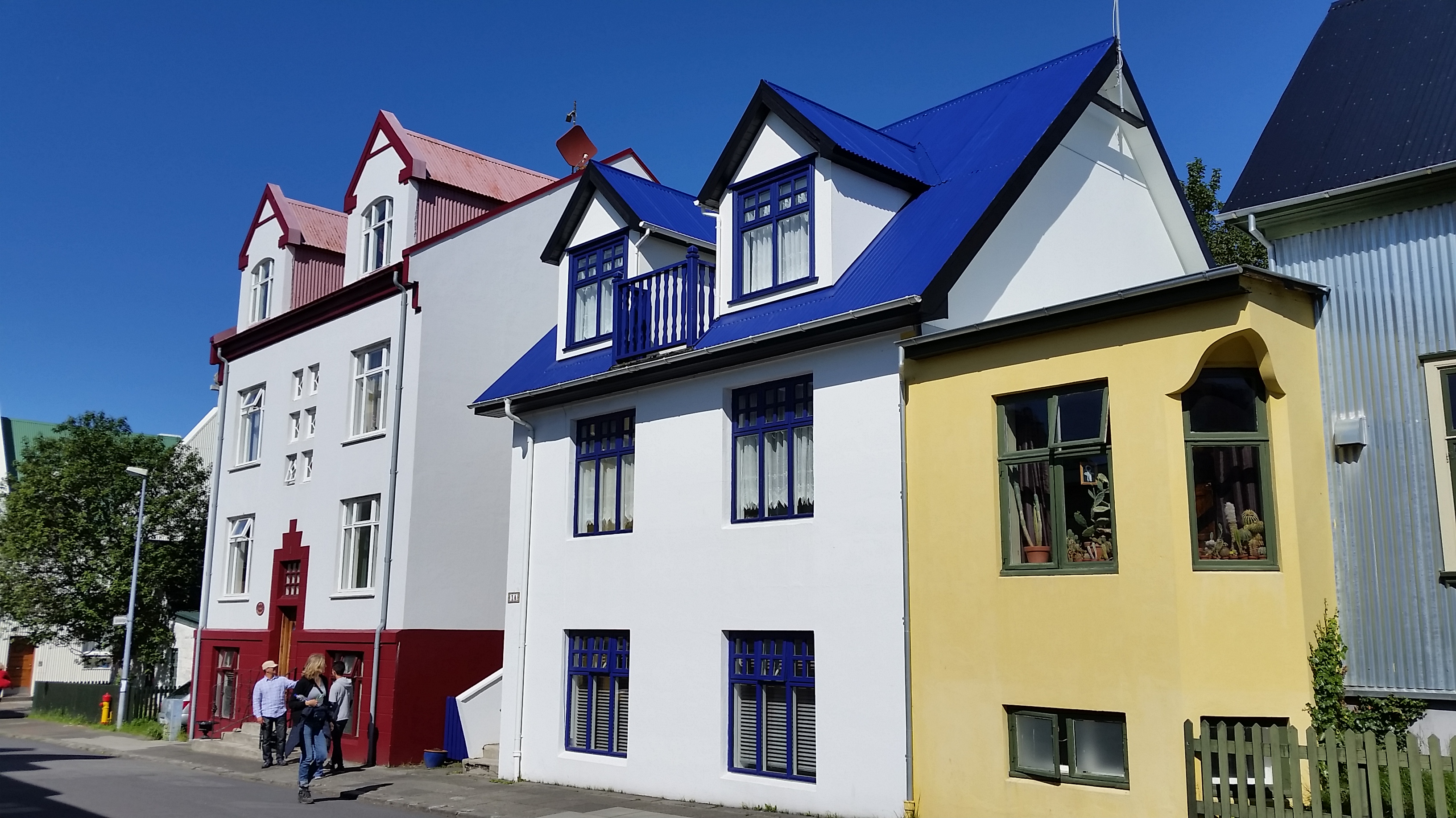
The older homes in Reykjavik, from the late 19th or early 20th c, are wood structures later clad in corrugated iron for weather protection, though below freezing temperatures are not frequent here. It’s become a custom to paint them in vivid colors since the long dark nights can feel rather blah. Amidst these sit numerous plastered houses with gabled charm and bright colors.
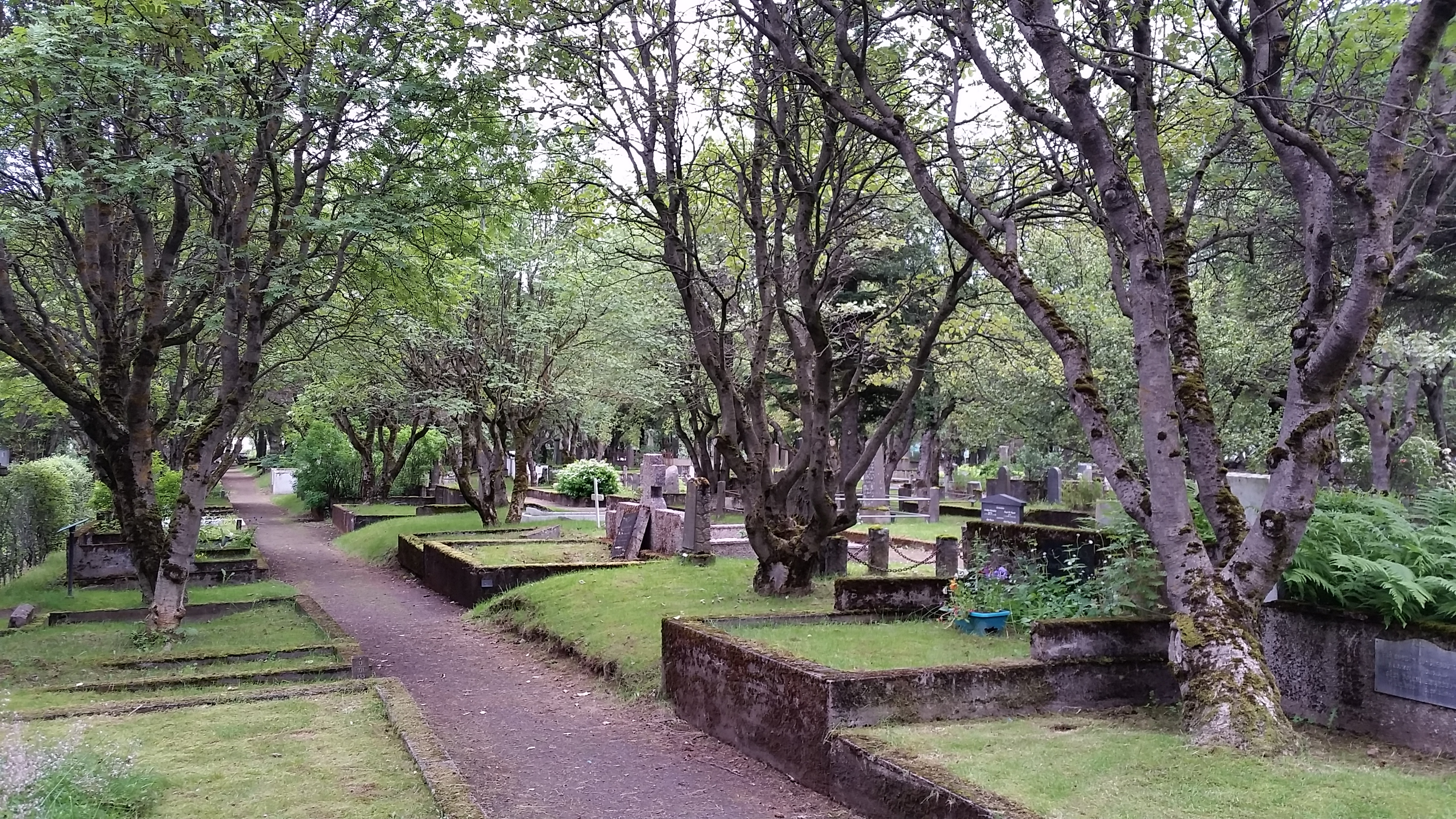
The old cemetery in the heart of town, with graves dating back to the mid-1800s. This is one of the few wooded sections around here.
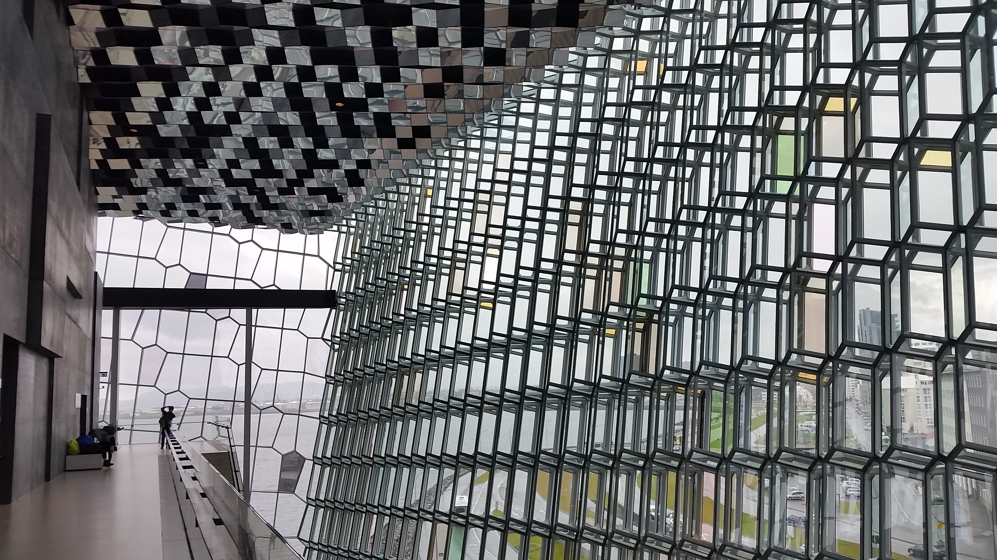
The interior of Harpa Concert Hall is a prismatic dream with one of the city’s waterfronts behind. From the outside endless reflect surfaces and colors that capture the sky, sea and crystalline basalt formations of volcanic Iceland’s coast.
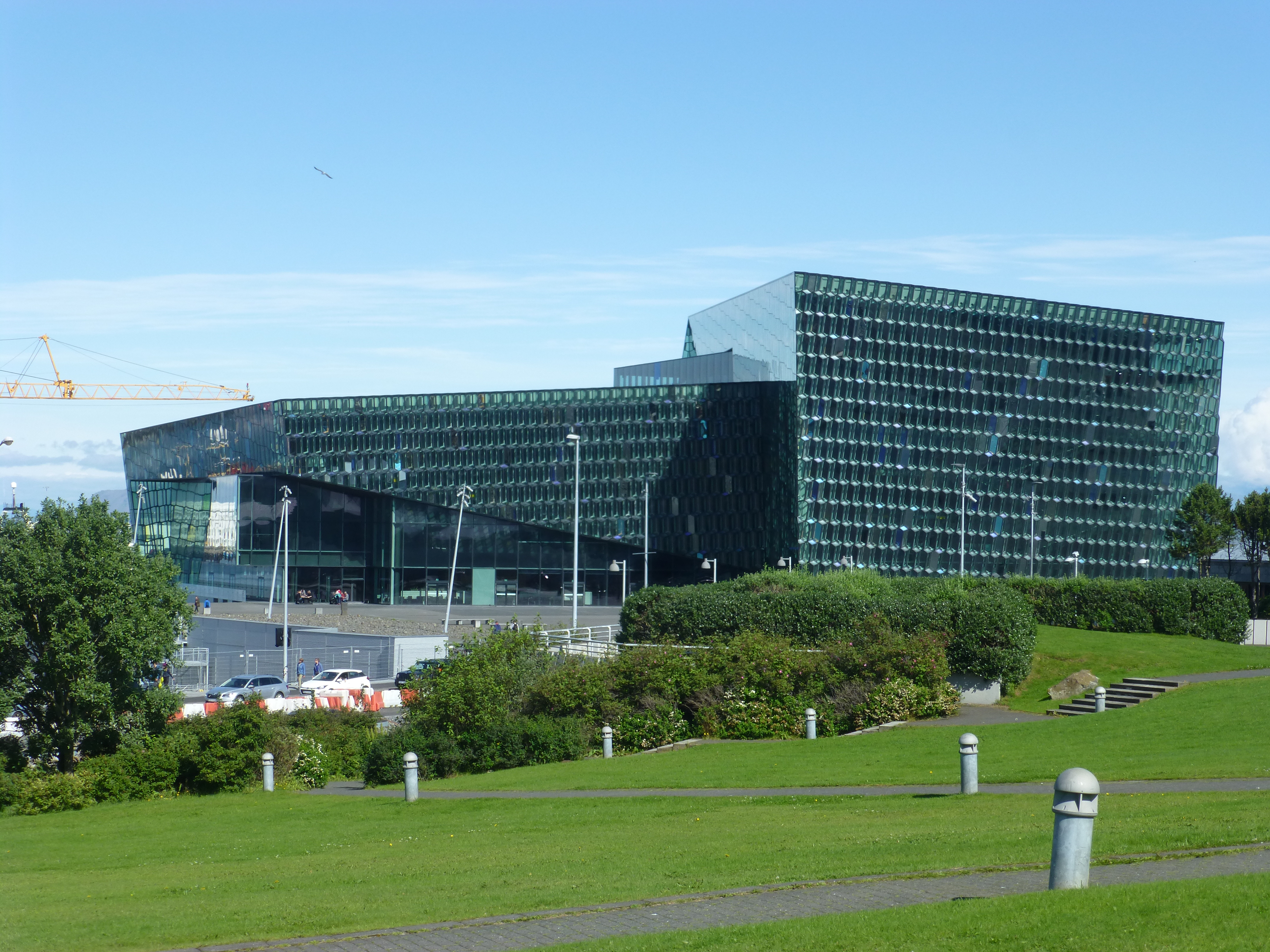
Because of the 2008 recession, Harpa’s construction was nearly abandoned until it was rescued through a scramble of funding. The massive multi-use project that was originally intended to accompany Harpa did not begin until recently, now that economic prosperity has returned along with the tourists. The crane to the left is working on the project now, but it is just one of many cranes laboring to renovate or add city structures.
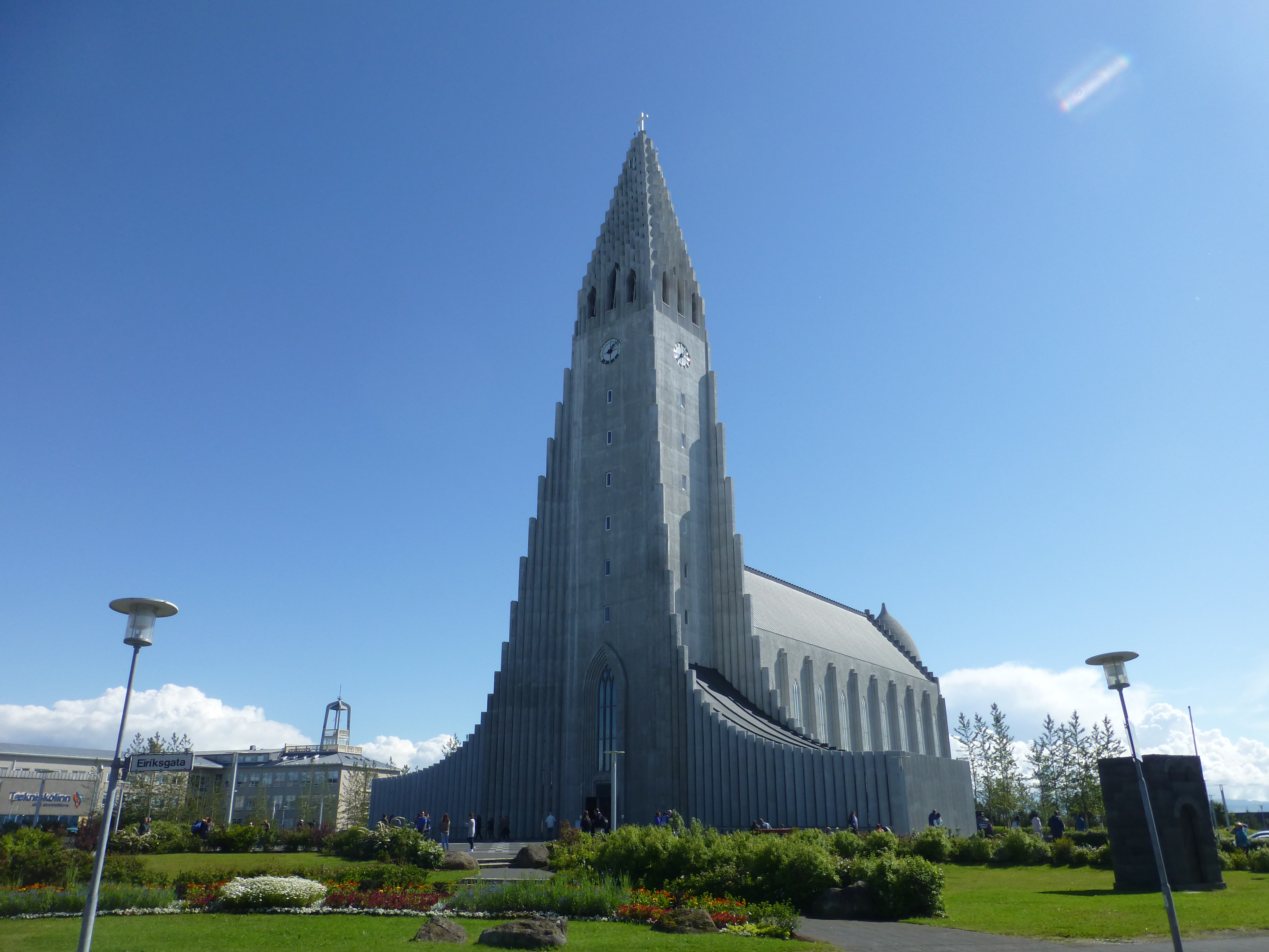
Hallgrímskirkja Lutheran church was begun in 1945 but was 41 years in the making. You can climb up the tower for the view over Rejkjavik…
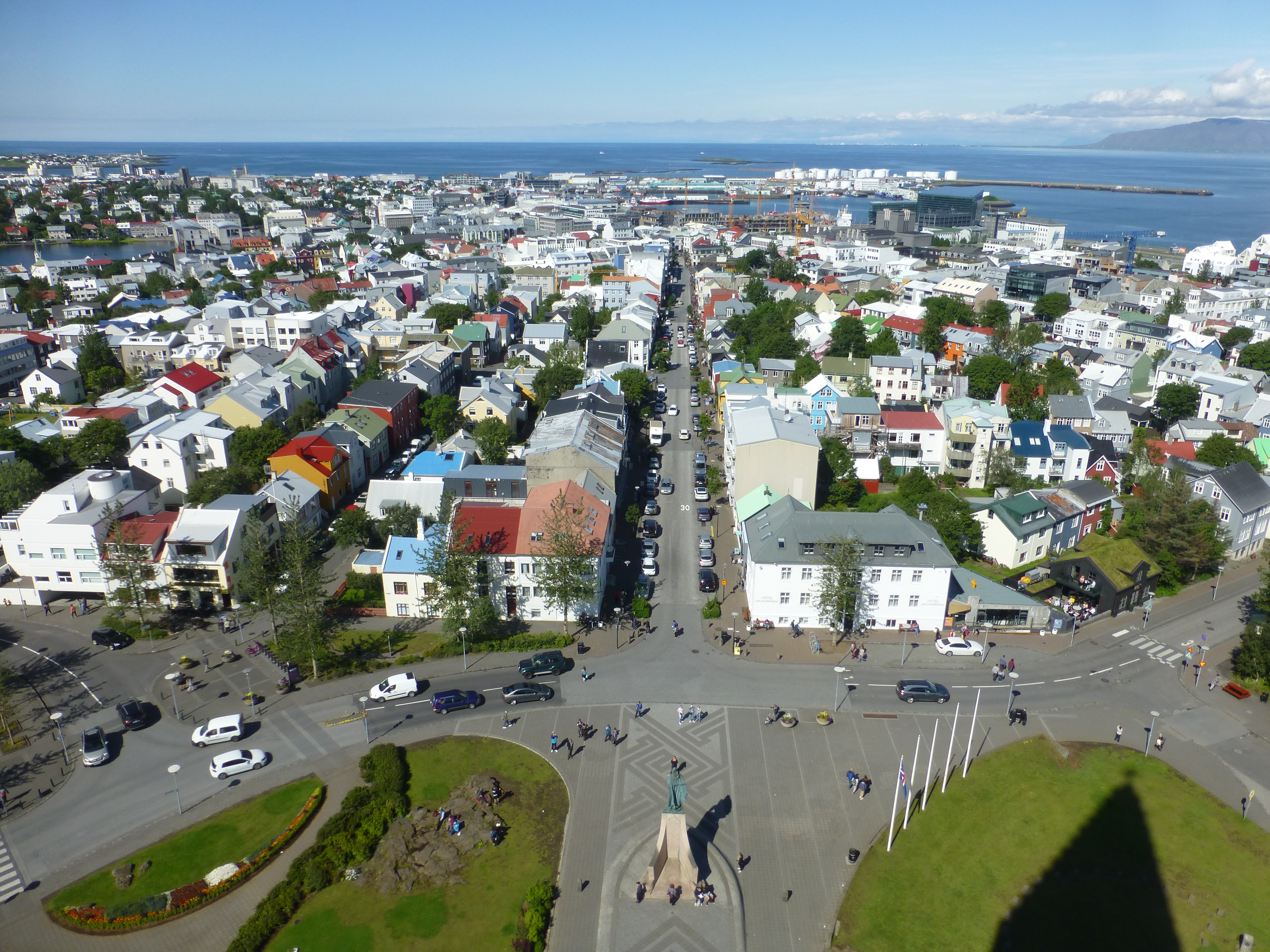
Reykjavik, as viewed from the tower of the church. Way down the central street of the new town you reach the old harbor.
To the upper left is the pond at the center of town.
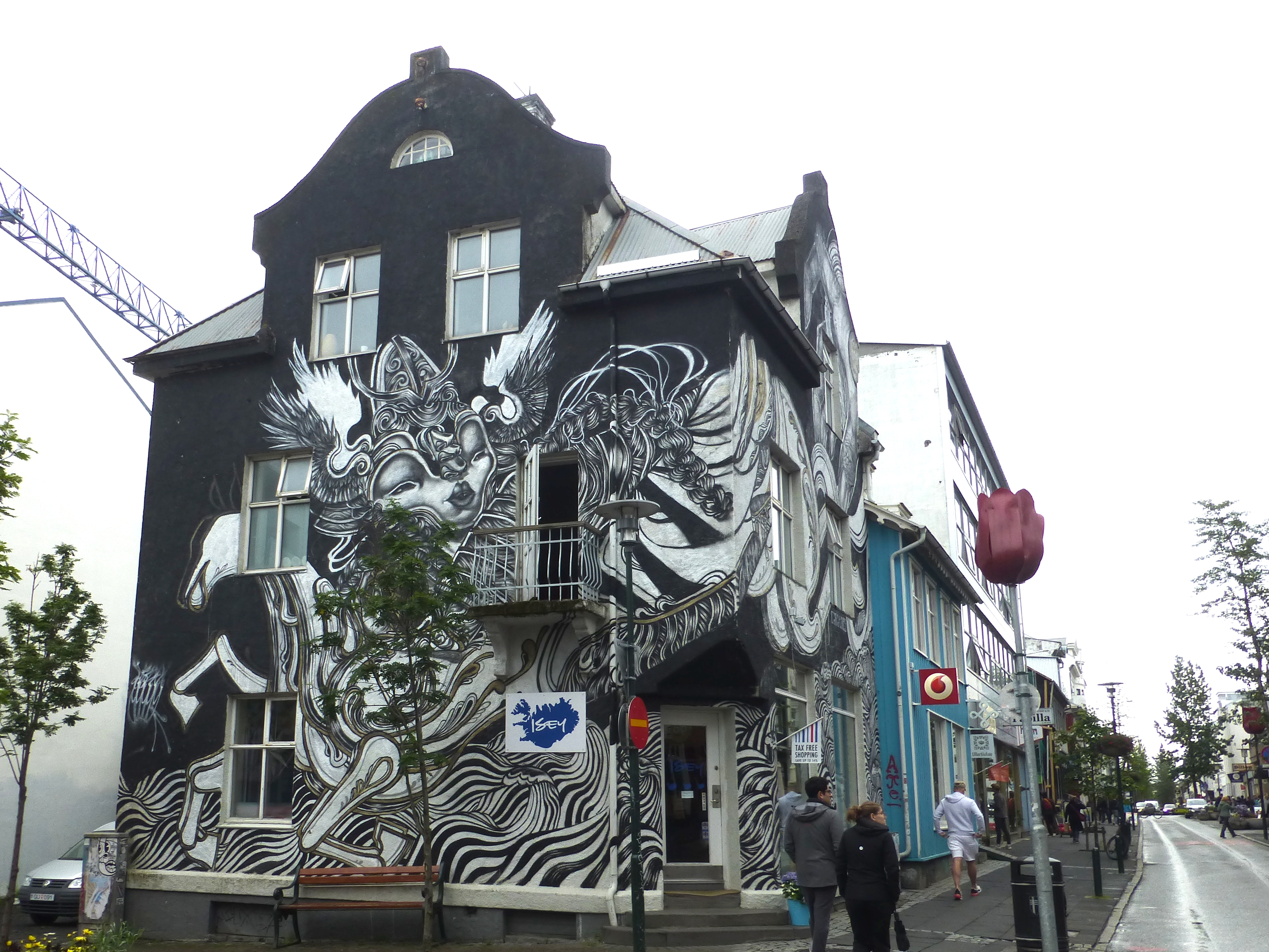
A female Norse god thunders off the side of this building.
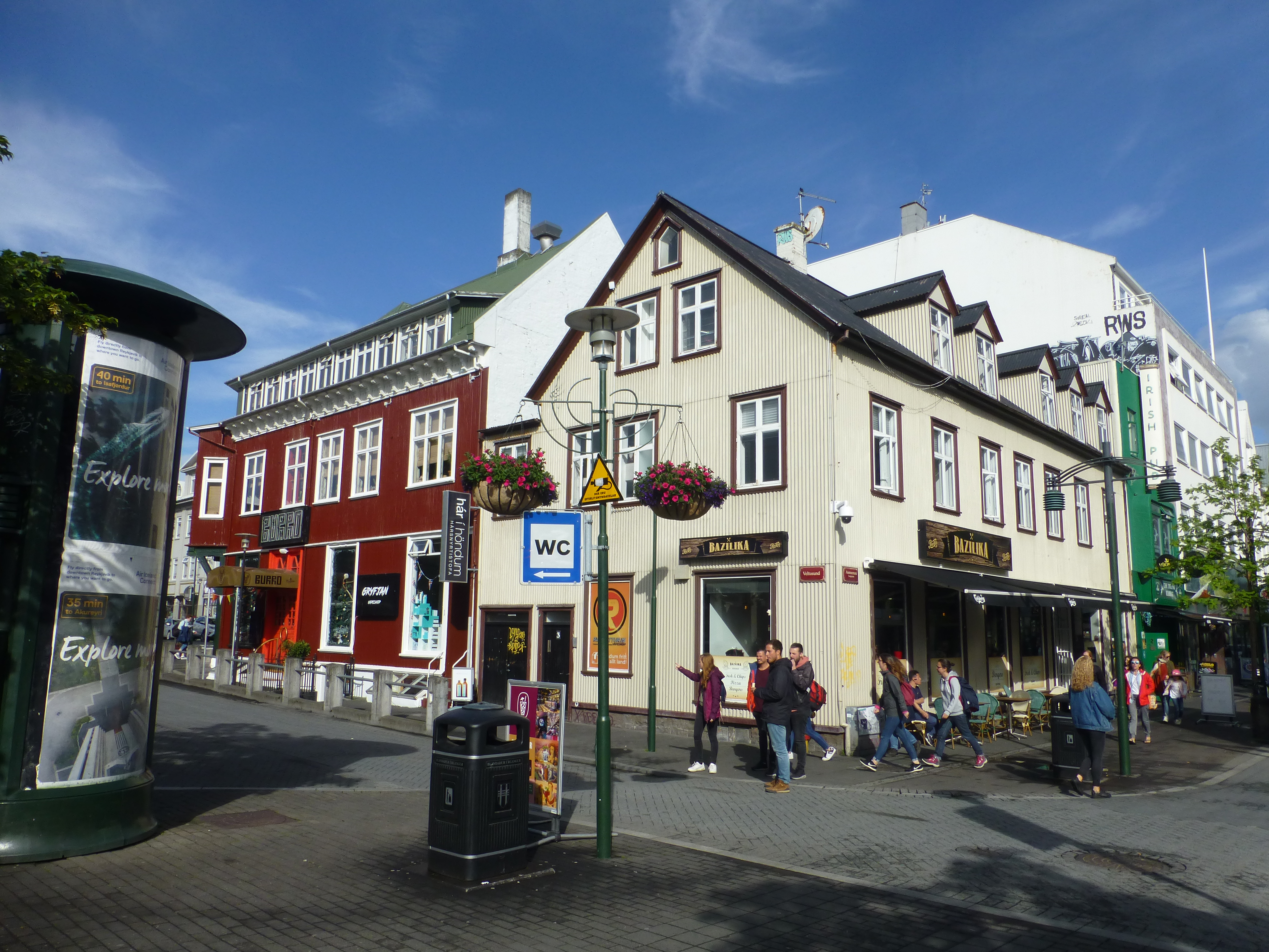
One of downtown Reykjavik’s main intersections, a pedestrian street. However, Reykjavik’s main streets for traffic are difficult to distinguish from pedestrian streets.
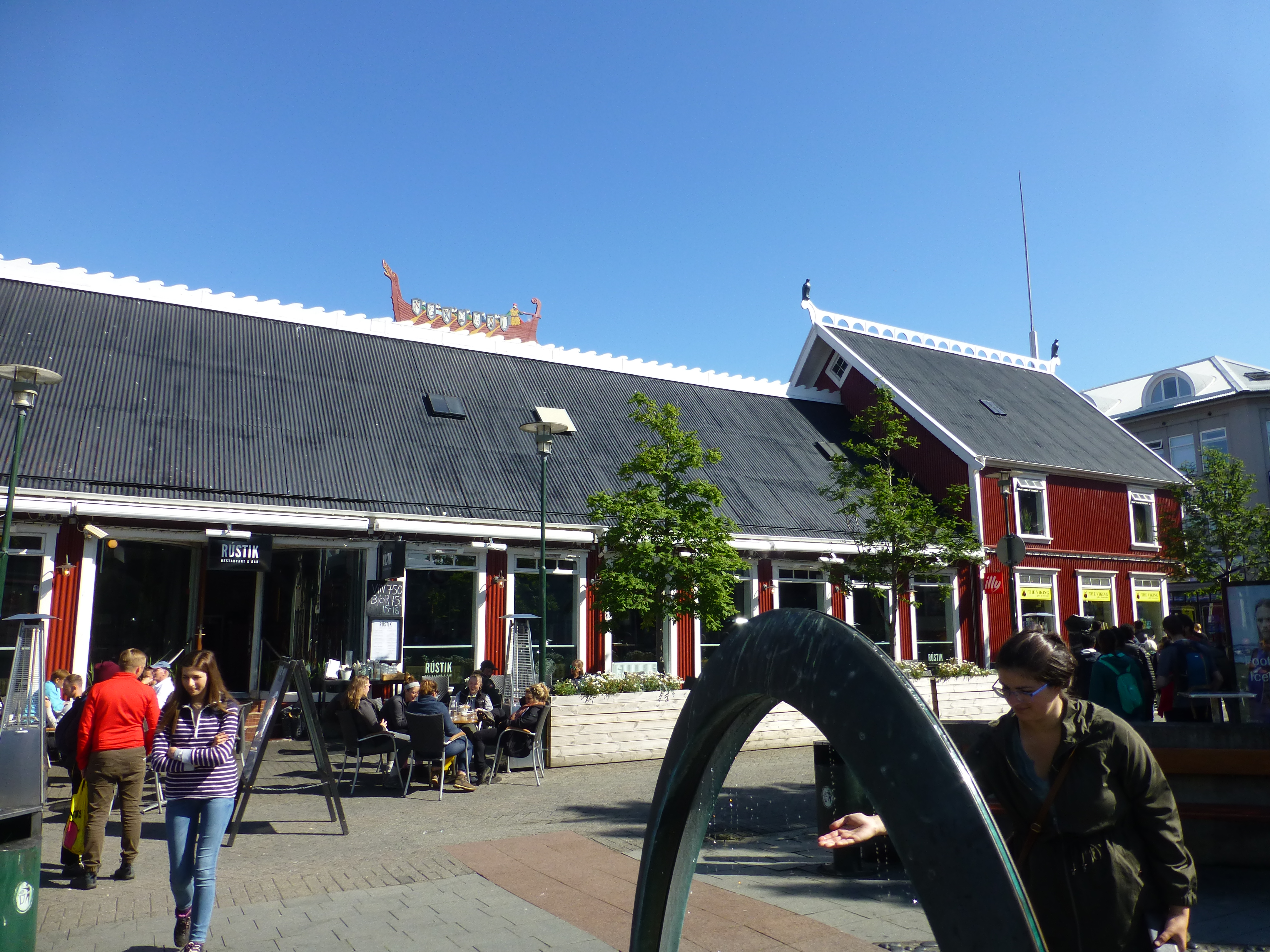
The main square in town, with a restaurant complex topped by a Viking ship in the background and an odd fountain in the foreground. Despite the invasion of tourists, the town can still feel oh so quiet most of the time, perhaps because during the day visitors are touring the sights in the area.
The Golden Circle
For those with little time to spend in Iceland (or little money, as this is one very expensive island), a day or two just outside Reykjavik might be their whole experience. We are not sure why that area is called the Golden Circle. Perhaps because the three main sights on the circuit – Gullfoss waterfall, Geysir hot springs and Thingvellir tectonic rift – are naturally dazzling in themselves, as well as historically interesting. Or perhaps because there’s much gold that locals can mine from squiring the many tourists around. For us, despite the crowds, the Golden Circle proved to be a valuable start to our route around the entire Icelandic coast.
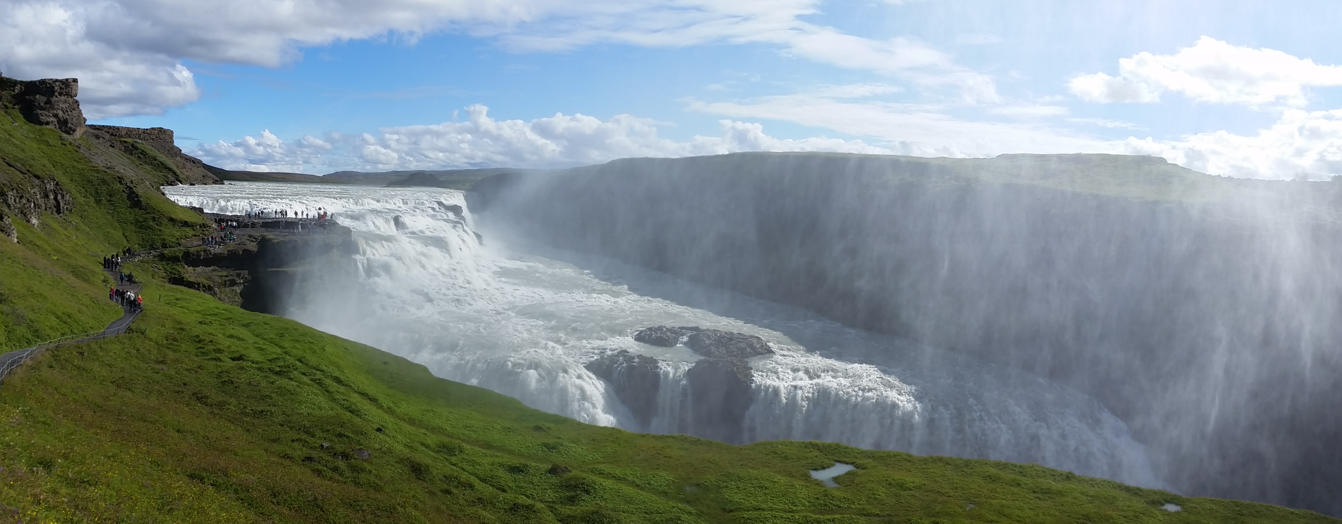
The upper drop of Gullfoss waterfall. The noise of the surging water is truly thunderous. If you click on the photo, you can notice tiny, tiny people at the upper edge.
At the lower drop of Gullfoss waterfall. Since ‘foss’ means waterfall, most signs feature redundancy.

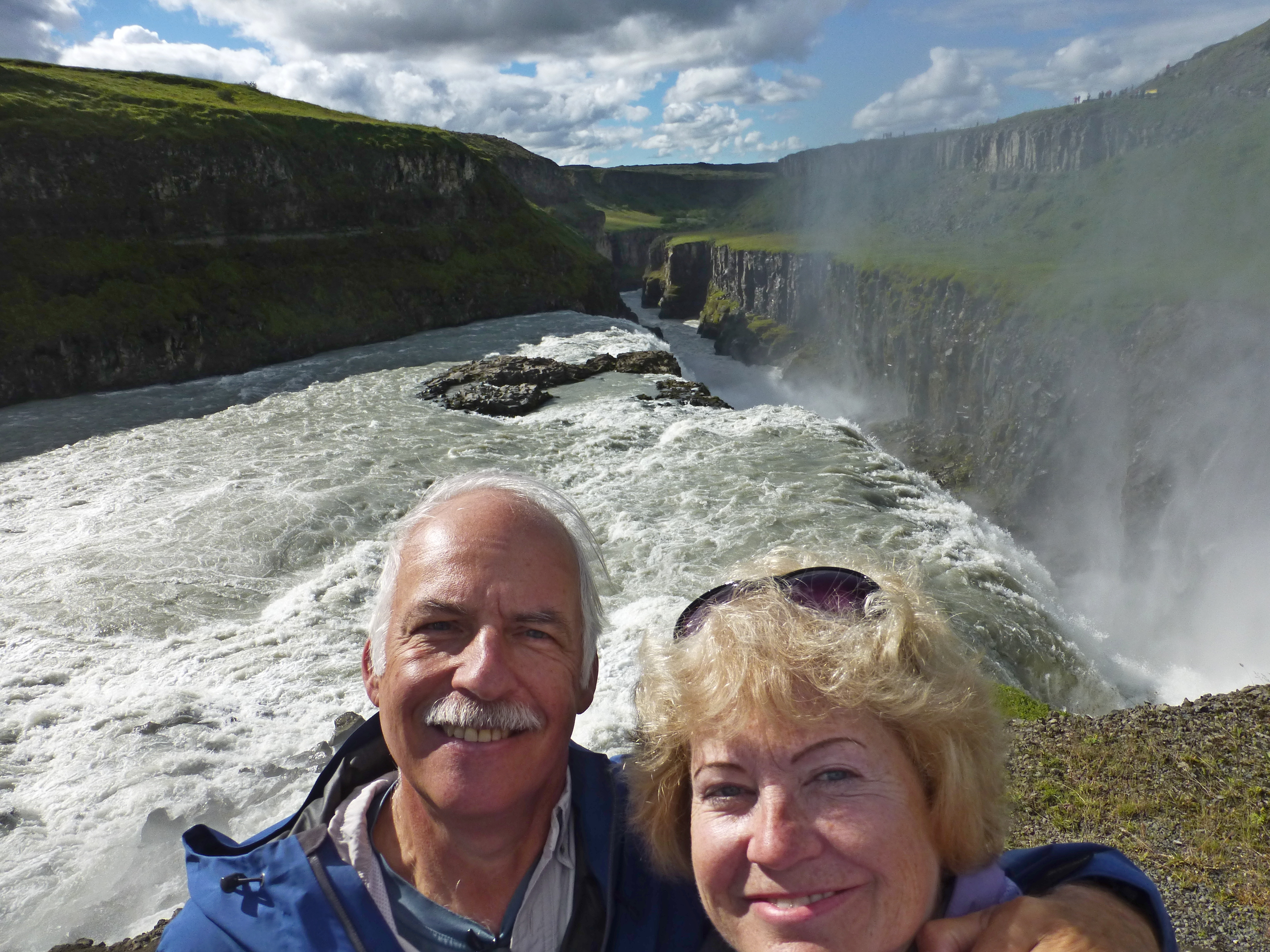
Soaking wet and giddy after the Geysir geyser sends spray all over Nancy. Fortunately, the sun warmed and dried her up despite the cool temperatures.
The Geysir geyser erupts on average every 7 minutes, though it is notoriously inconsistent in timing and in the direction of the spray.
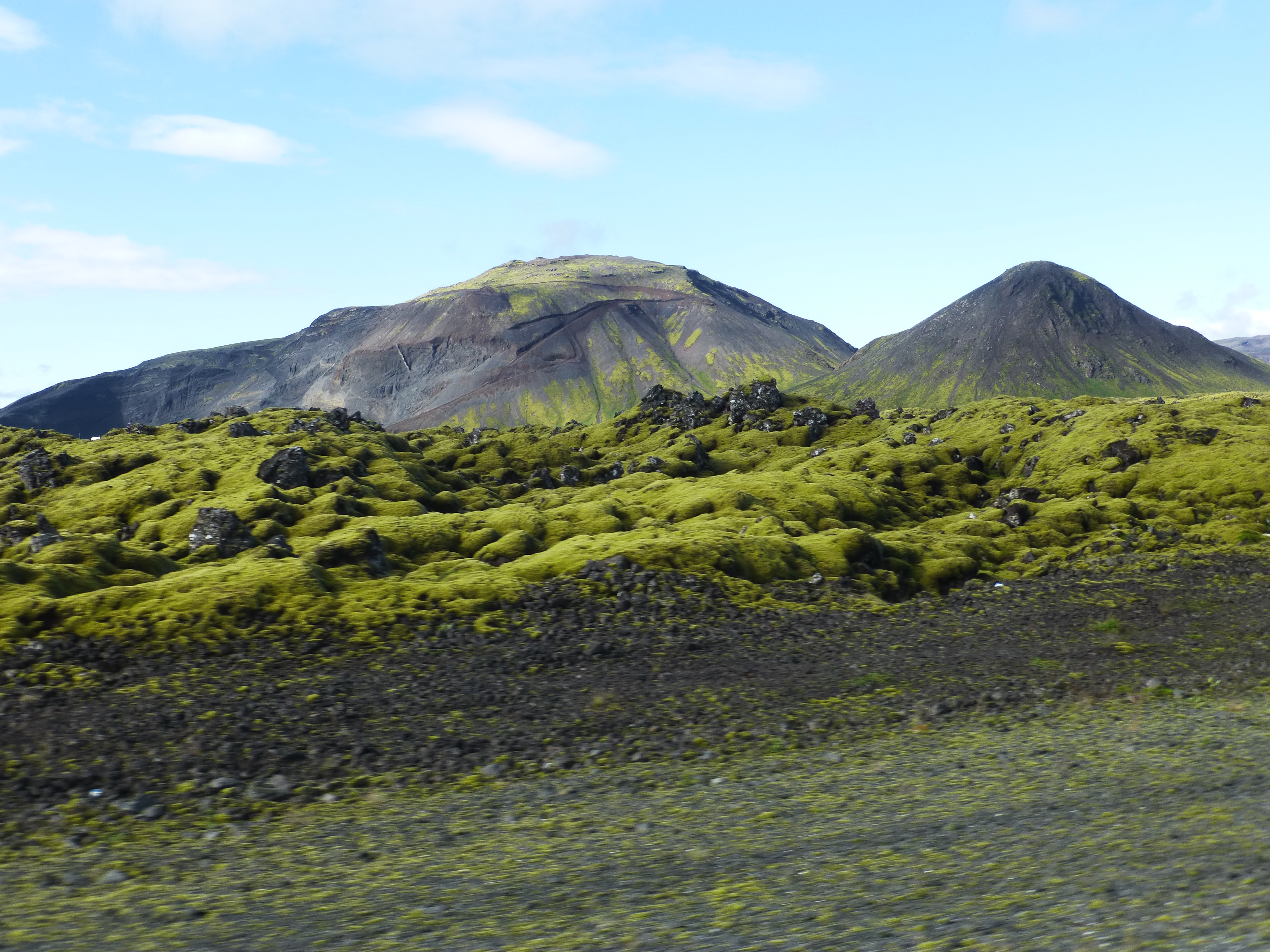
A typical Icelandic lava field with a volcanic mountain in the background, along the Golden Circle route
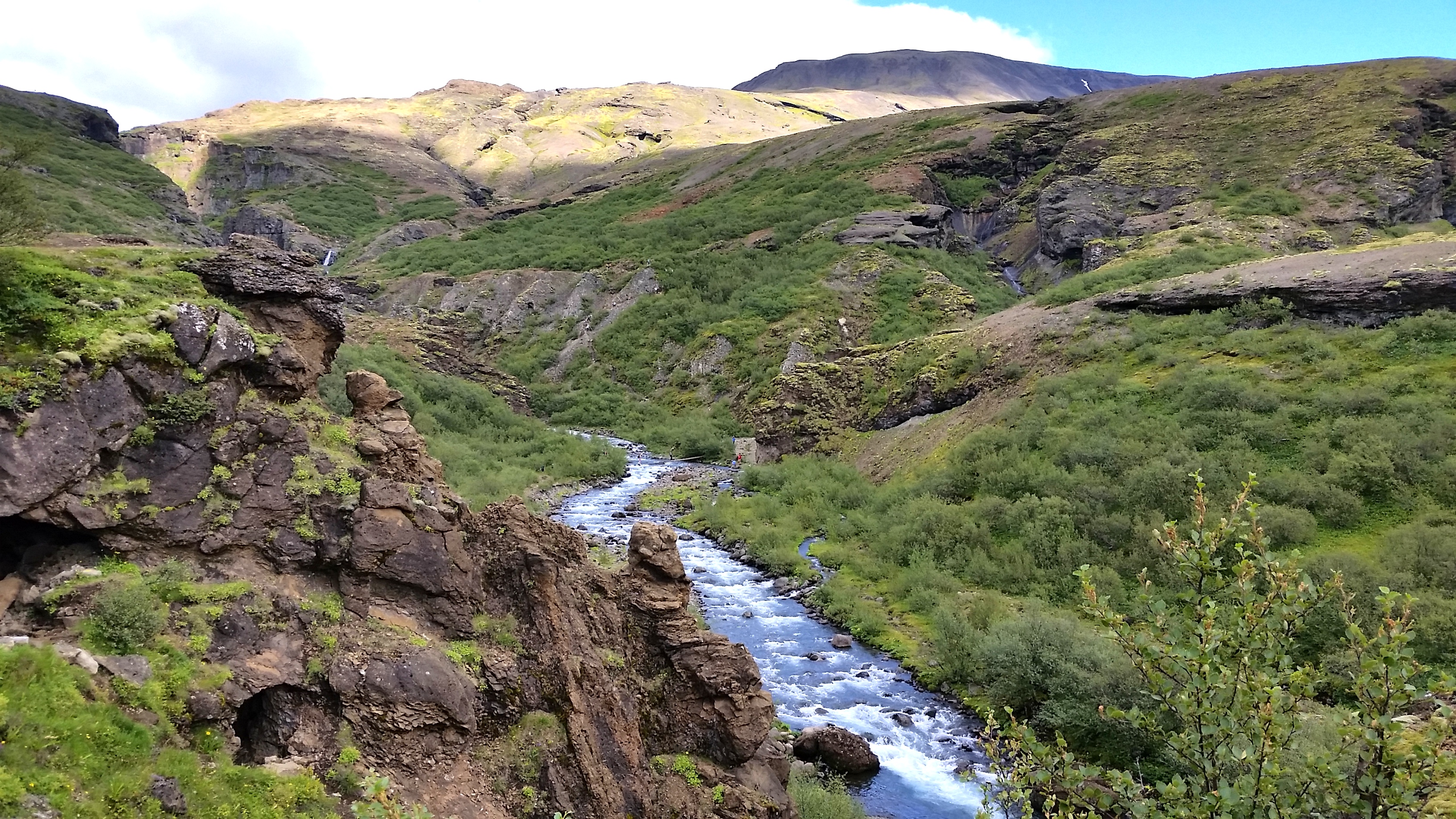
Another example of the landscape in the southwest part of Iceland, just off the Golden Circle, which includes scenic beauties like this river and its guiding hills.
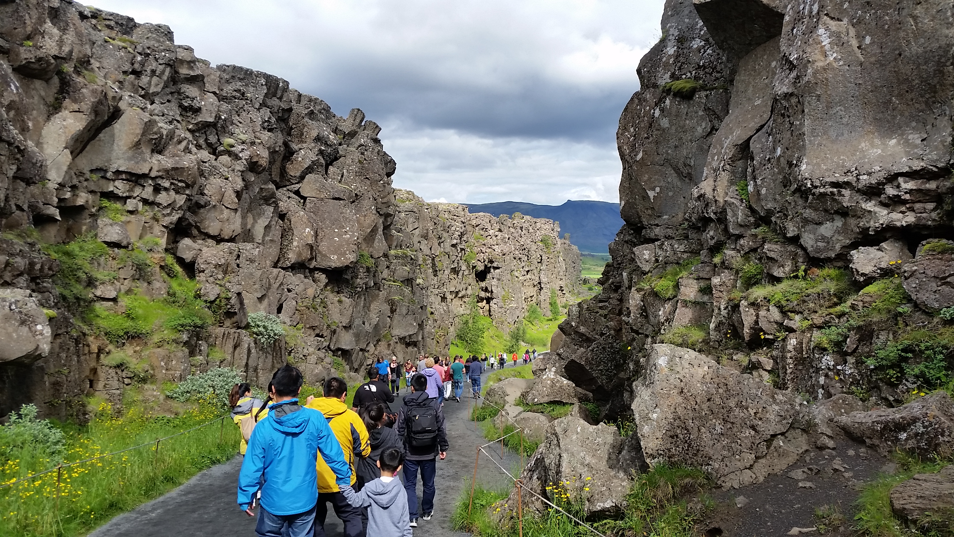
The Atlantic rift at the site called Thingvellir has given visitors a wide thoroughfare to use back to the first settlers in 930 AD. For ten centuries, this impressive location was the site of the Althingi, the annual parliamentary meeting of Icelandic chieftains to settle disputes, enact laws and trade. This same form of representative democracy still meets, but now in Reykjavik. Throughout the centuries, market booths with beer and other goods filled the gap too, most notably that of Snorri Thorgrímsson, who was featured in several of the famous sagas, tales of the early settlers.
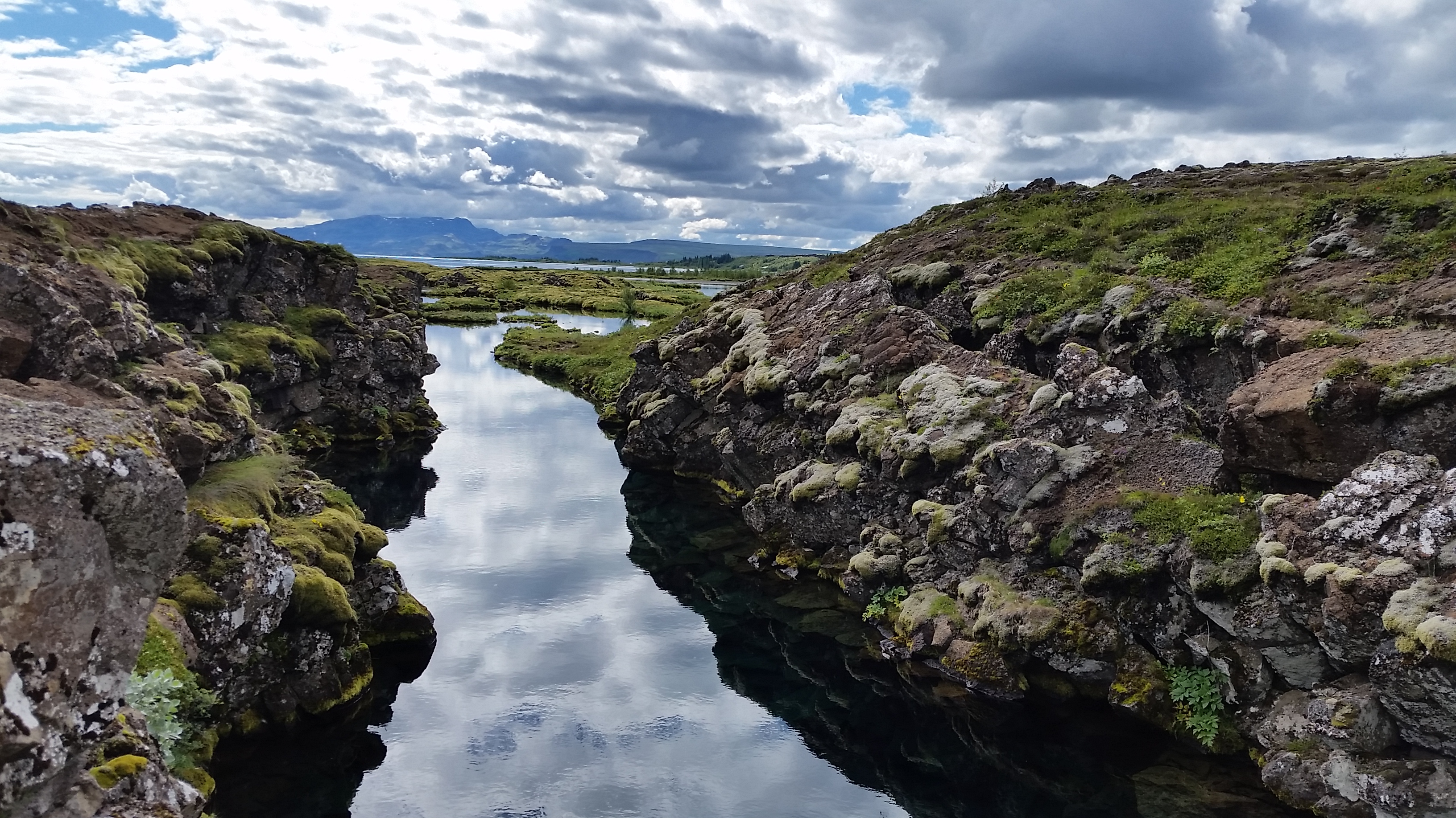
A gap at the Atlantic rift – the ever widening split (2.5 cm or 1 inch per year) between two tectonic plates. Gaps fill with both water from underground springs and clouds by reflection.
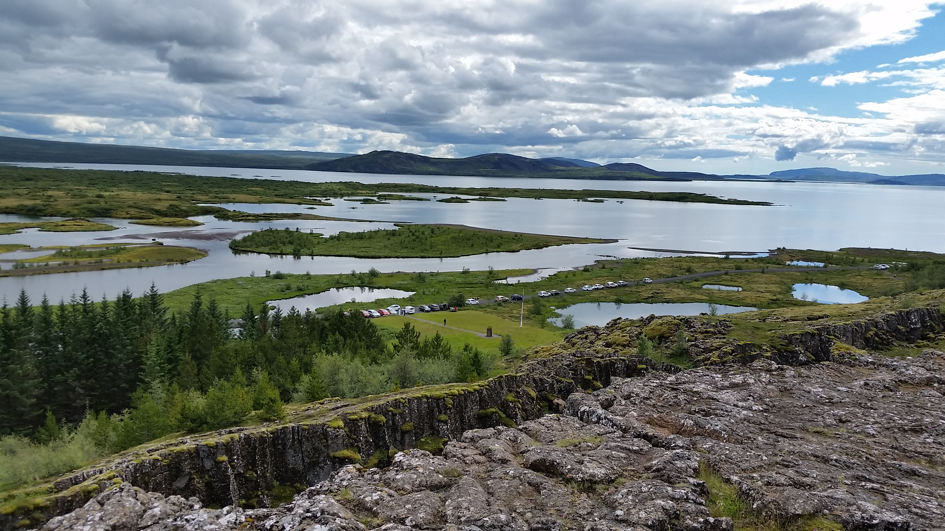
The huge lake named Thingvallavatn at the lower end of the rift area is a recreational dream of beautiful coves encircled by volcanic mountains. The water is so clear that you can see rock formations down 100 meters (or yards) at the deepest part. So snorkelers and divers in dry suits troop in and out of the lake just for the sight of these.
Snaefellsness Peninsula
The peninsula has been dubbed Iceland in miniature. Here you can find a rugged coastline with contorted formations of lava rock. Abutting these are sheer cliffs of various sizes, worn and etched by eons of erosion as they slope to the sea. Inland, gnarled lava fields sprawl over the flatland, partly rock chunks and partly turf grown over the rocks. The peninsula’s sizable glacier was draped in clouds even on a clear day, but nicely fed the many waterfalls spilling down the cliffs. Every so often you come upon tiny fishing villages set like jewels in the splendid landscape and dating back to the first settlers.
The lakes make magic on a sunny day.
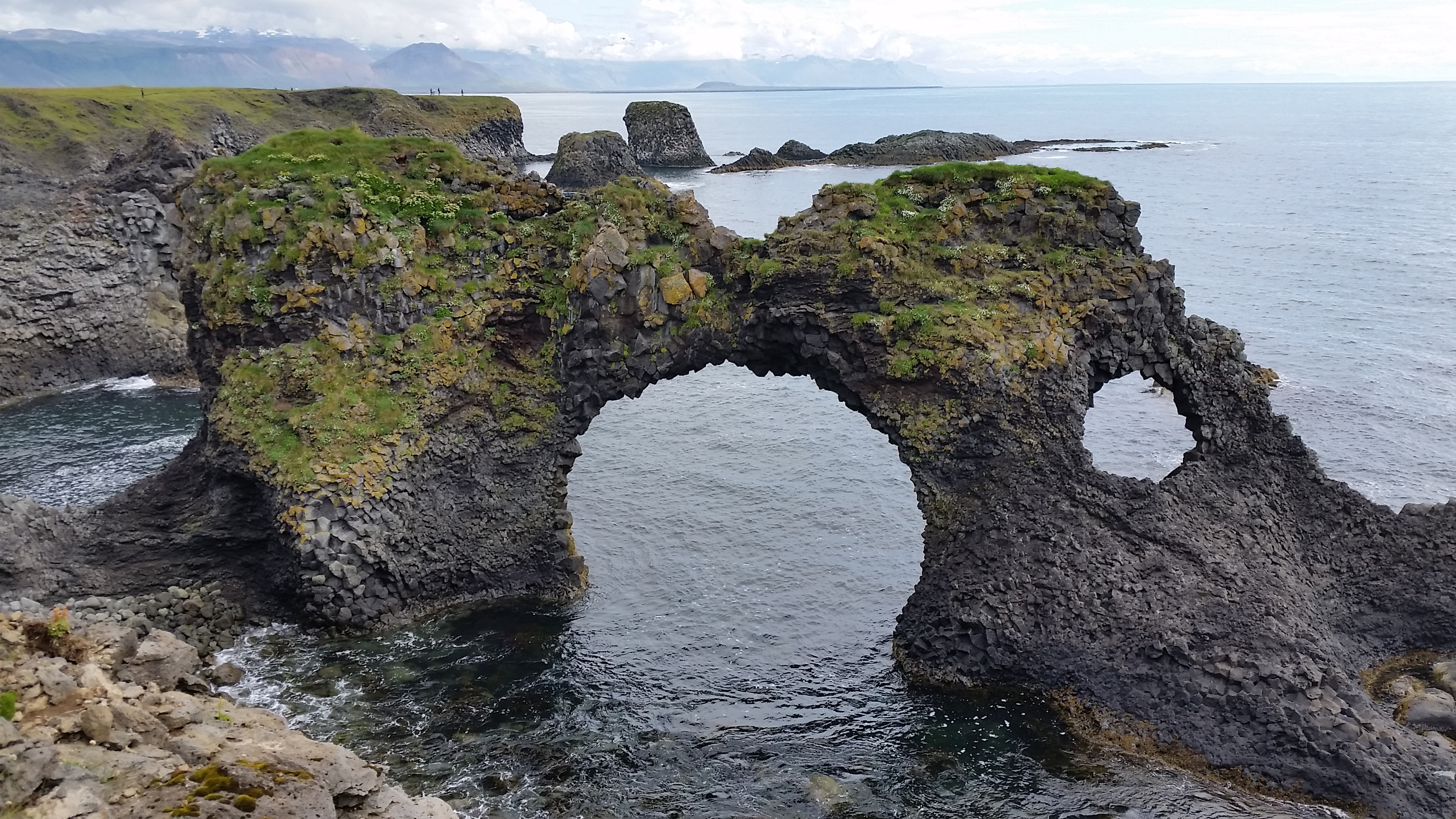
Some of the coastal formations form shapes like this. Other arches, now broken by waves and wind, were nearby. You’d never want to leave the coastline except that the interior is so interesting too.
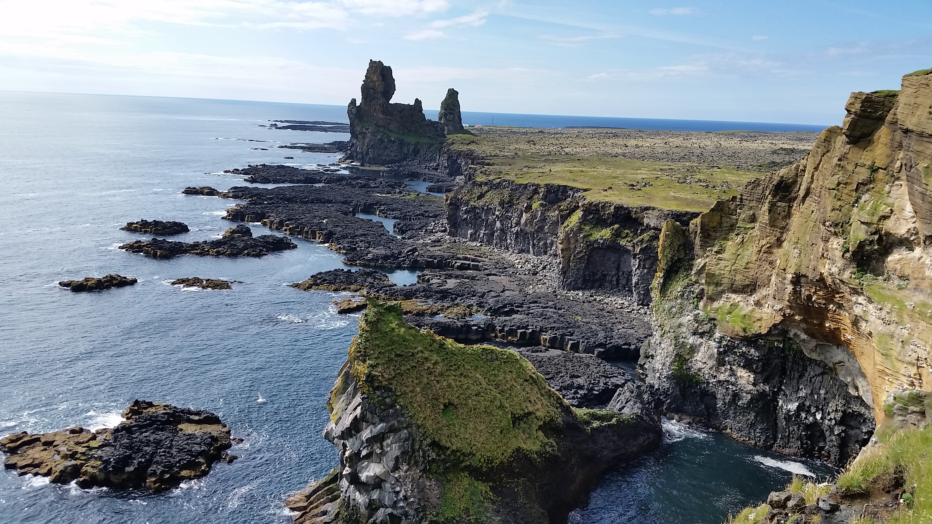
Sheer cliffs lead to the remains of a coastal crater.
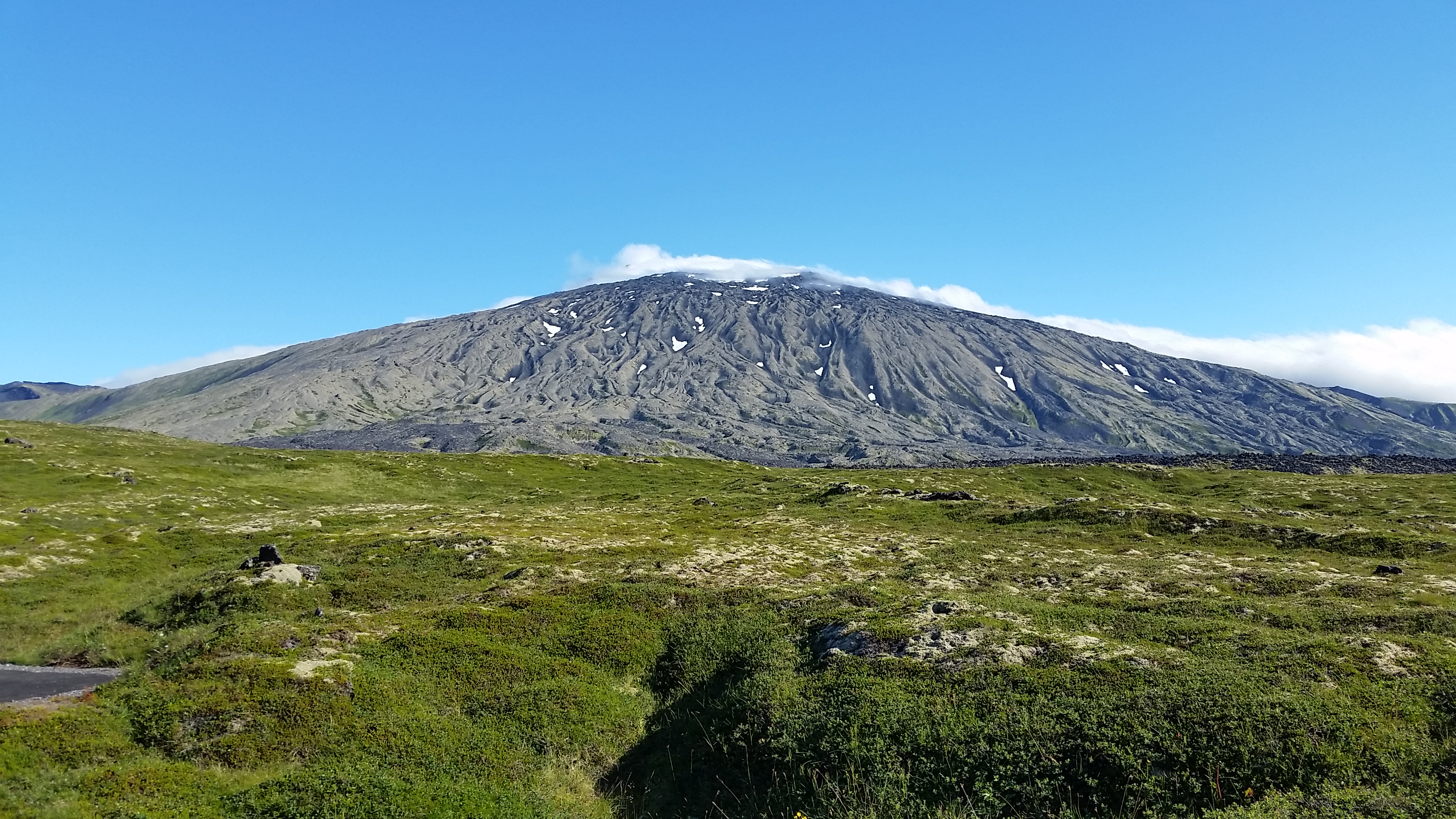
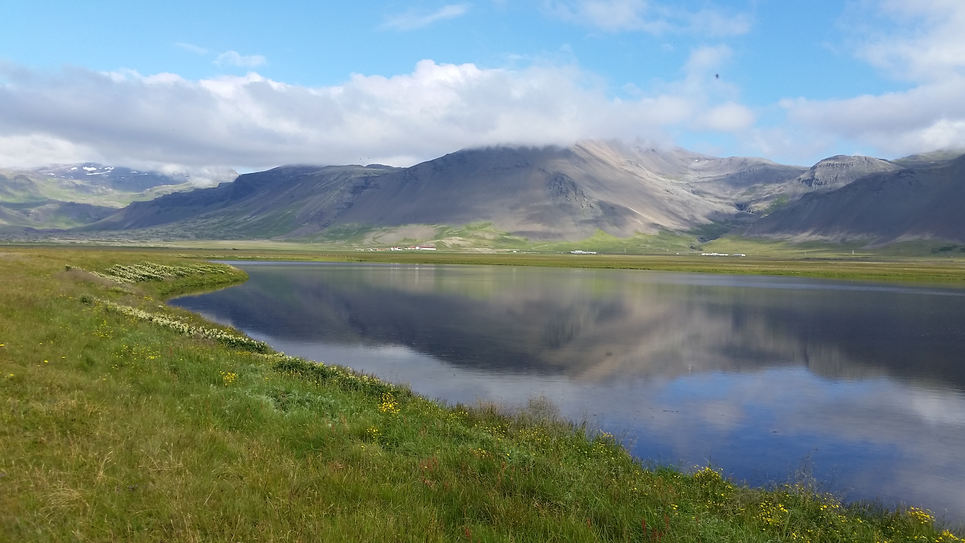
A cloud topping makes this grizzled volcano still seem active. There were days when we could see no part of this volcano, hidden in the clouds.
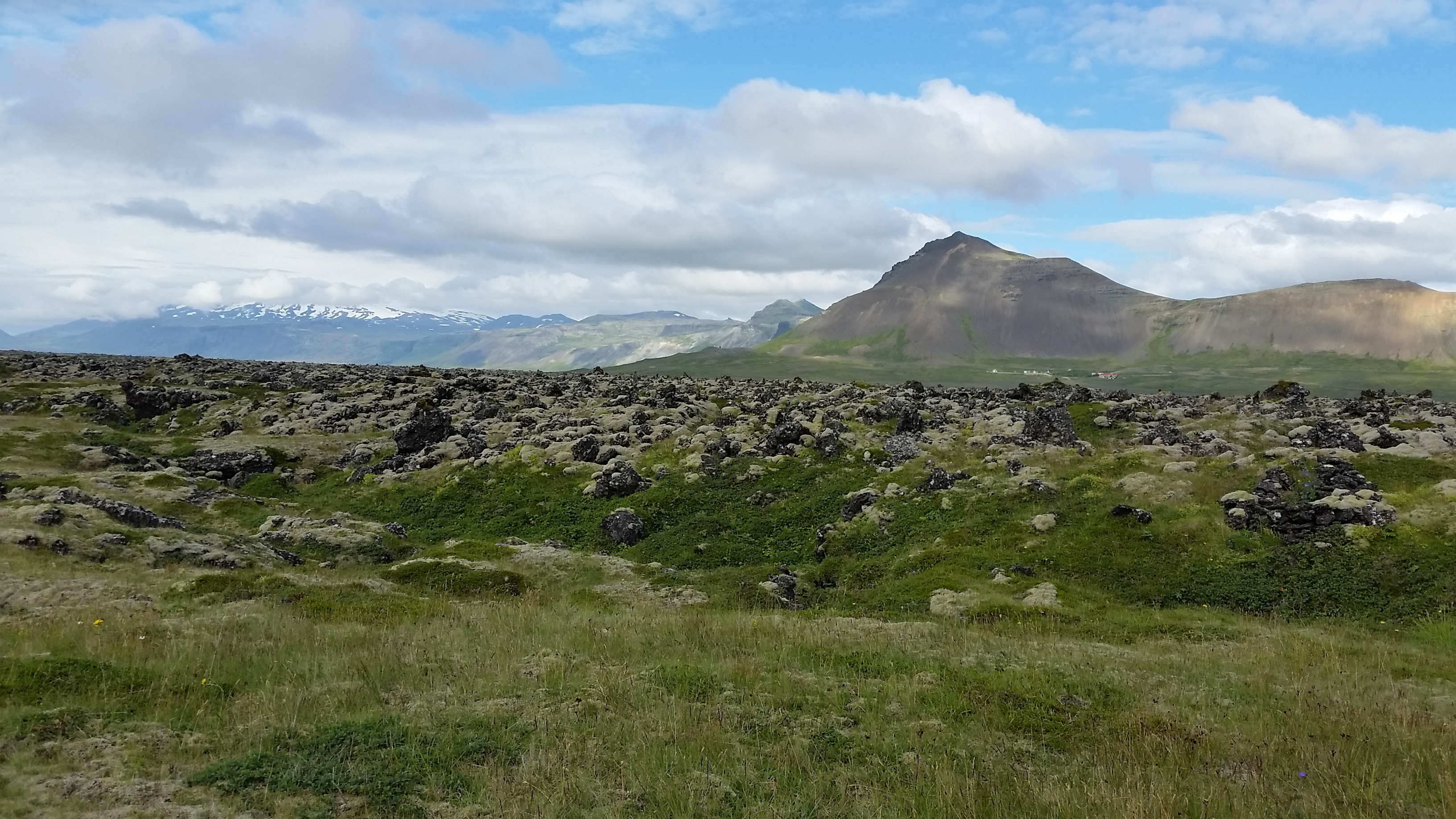
Lava fields in the foreground with their old sources behind.
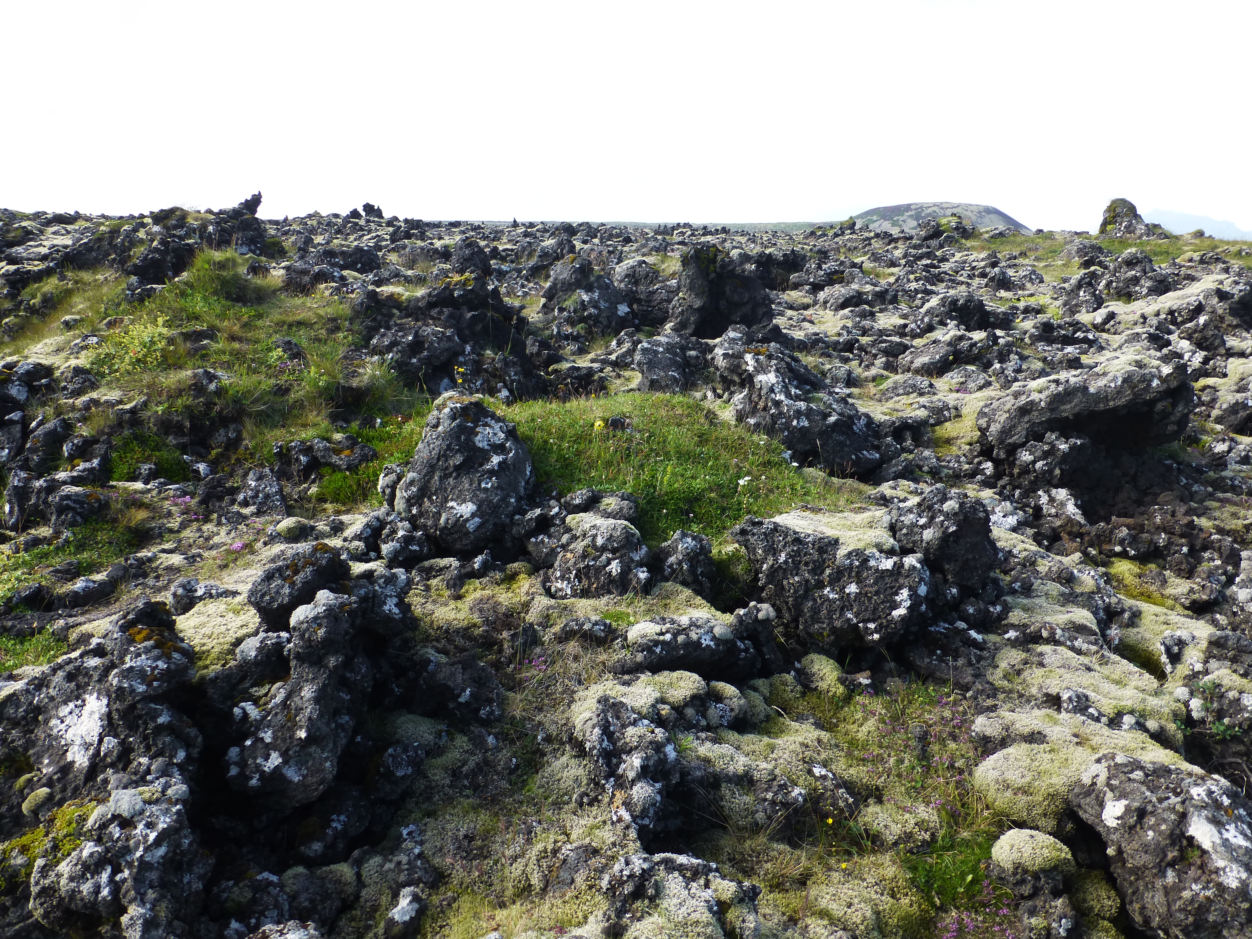
Typical lava fields in Snaefellsnes are quite rough and rugged on the surface, broken up with plants and grass. People still use old pathways to carefully wind past crevices, caved-in lava tubes and other perils.
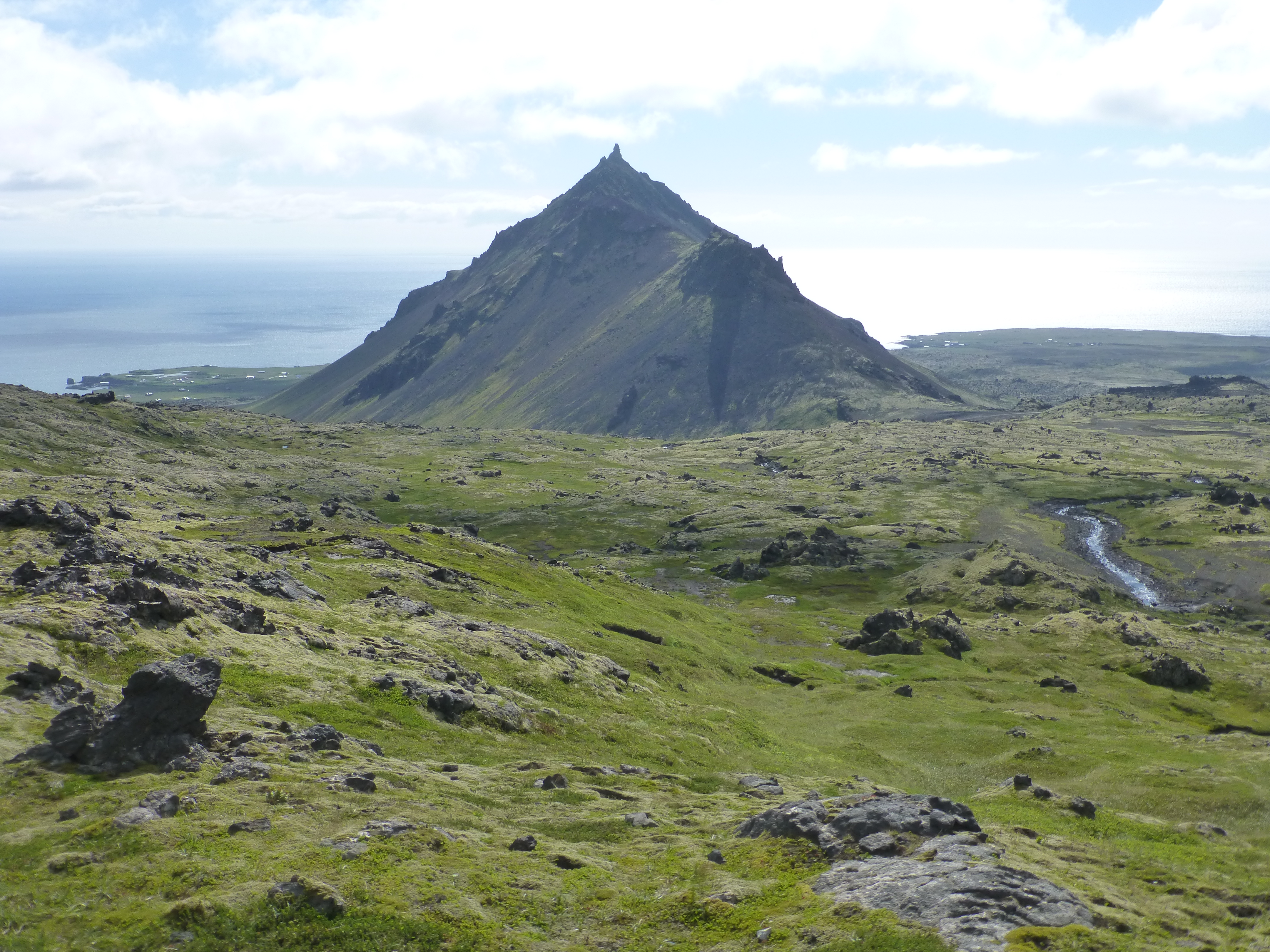
Pyramidal Kirkjufell mountain from high above the sea. It’s one of the best known features of the peninsula.

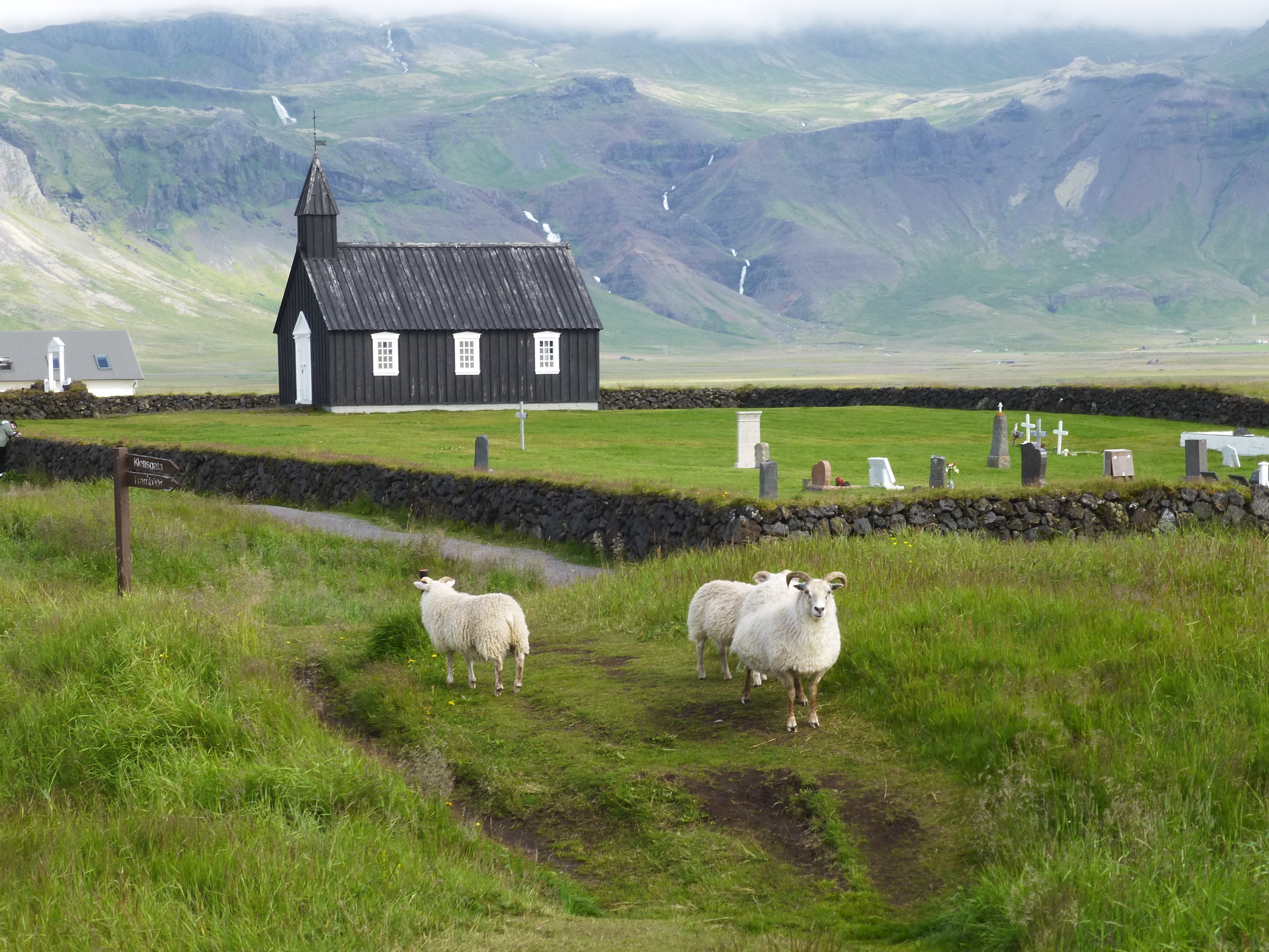
19th century church with wary sheep amid lava fields near Kirkjufell Mountain, the iconic pyramid at the tip of Snaefellsness.
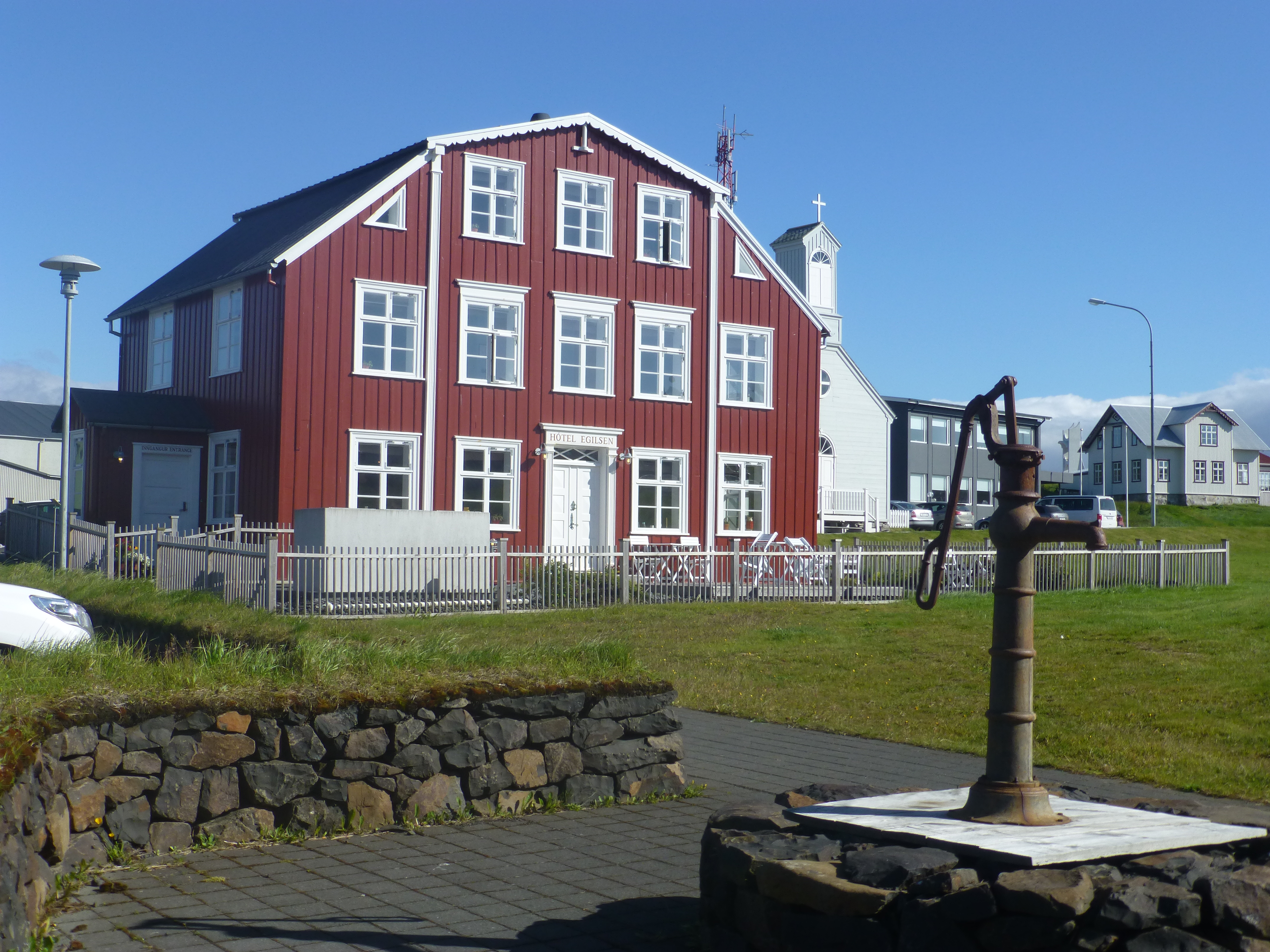
Turn of the 19th century house and church at the old fishing village of Stykkisholmur. Nearby, we stayed in a very new, cozy little bi-level cabin. It’s only defect was that the sloped ceiling for the upstairs bedroom reached only about 4 feet (1.2 meters) in height. To use it, we needed to crawl around the floor.
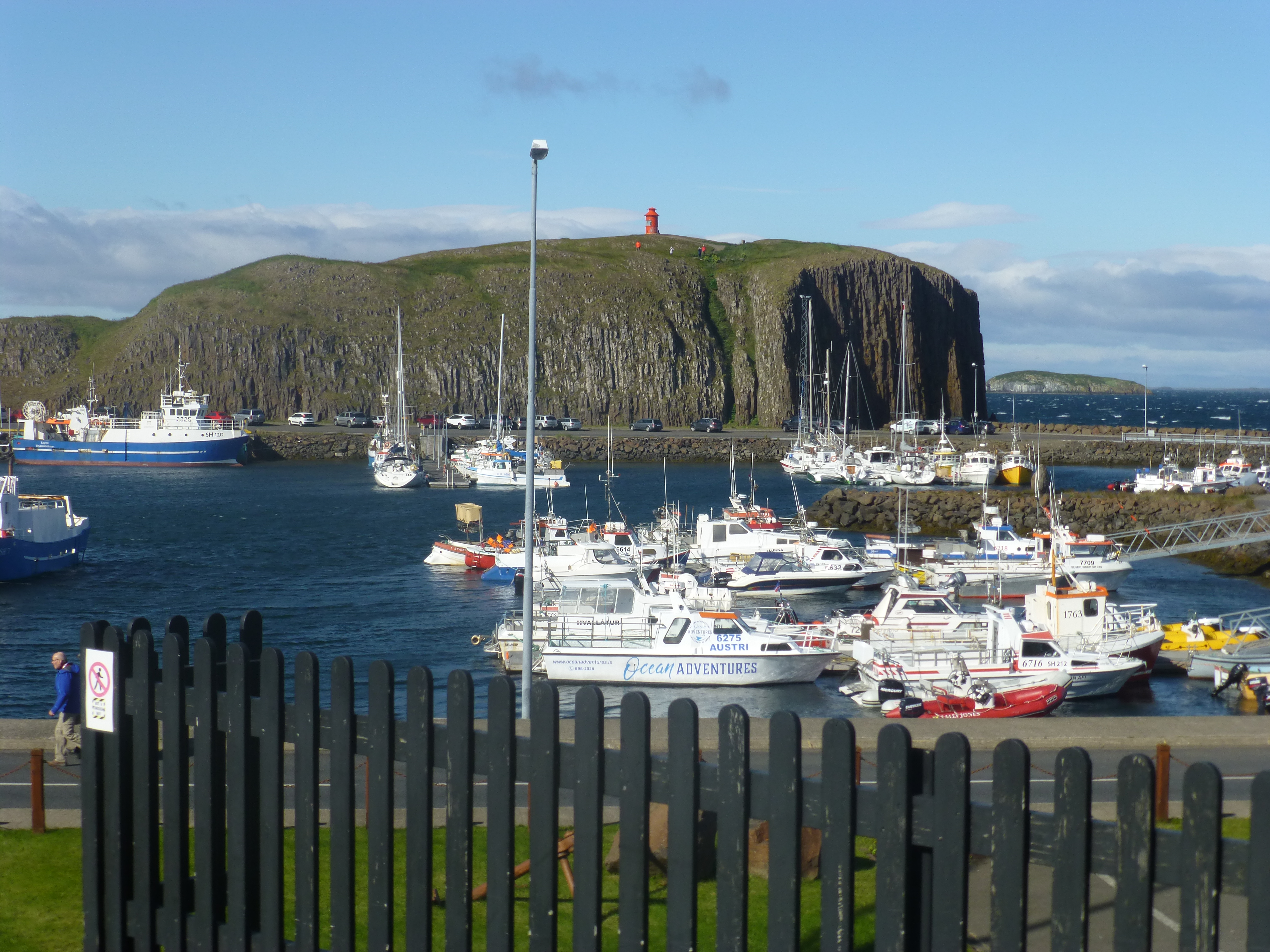
Sheer striated cliffs and harbor, Stykkisholmur, where we caught the ferry to the Westfjords.
Westfjords
Westfjords, the large northwestern section of Iceland, is in some ways a local secret. Here’s where you can go to escape the throngs of tourists, where you can go to enjoy relaxing and expansive country side. Little here is dramatic – unless you consider 20 kilometer long fjords with low lying hills dramatic. Roads go lazily down one shoreline past beaches of multi-colored sands, and then back up the other. Or they climb high up and over on a bypass, affording at times breathtaking overlooks. We passed charming fishing villages whose 100 or so residents still occupy old wood-frame buildings. And animals love the region: we roamed rough cut cliffs that puffin and kittiwakes love, rocky shoals that seals favor, and the best whale watching in the country.
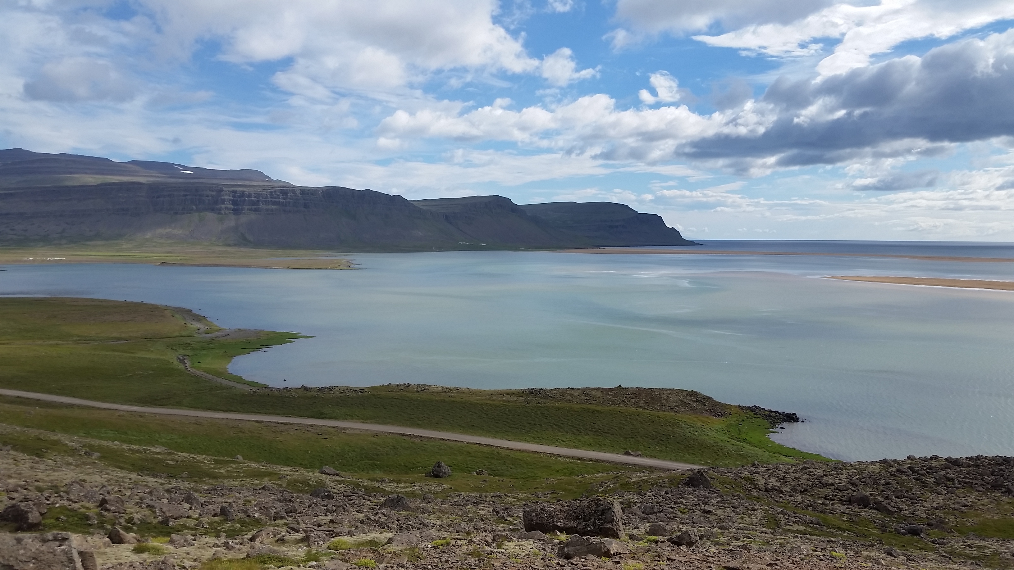
A seven kilometer pink sand beach starts at the mouth of this bay.
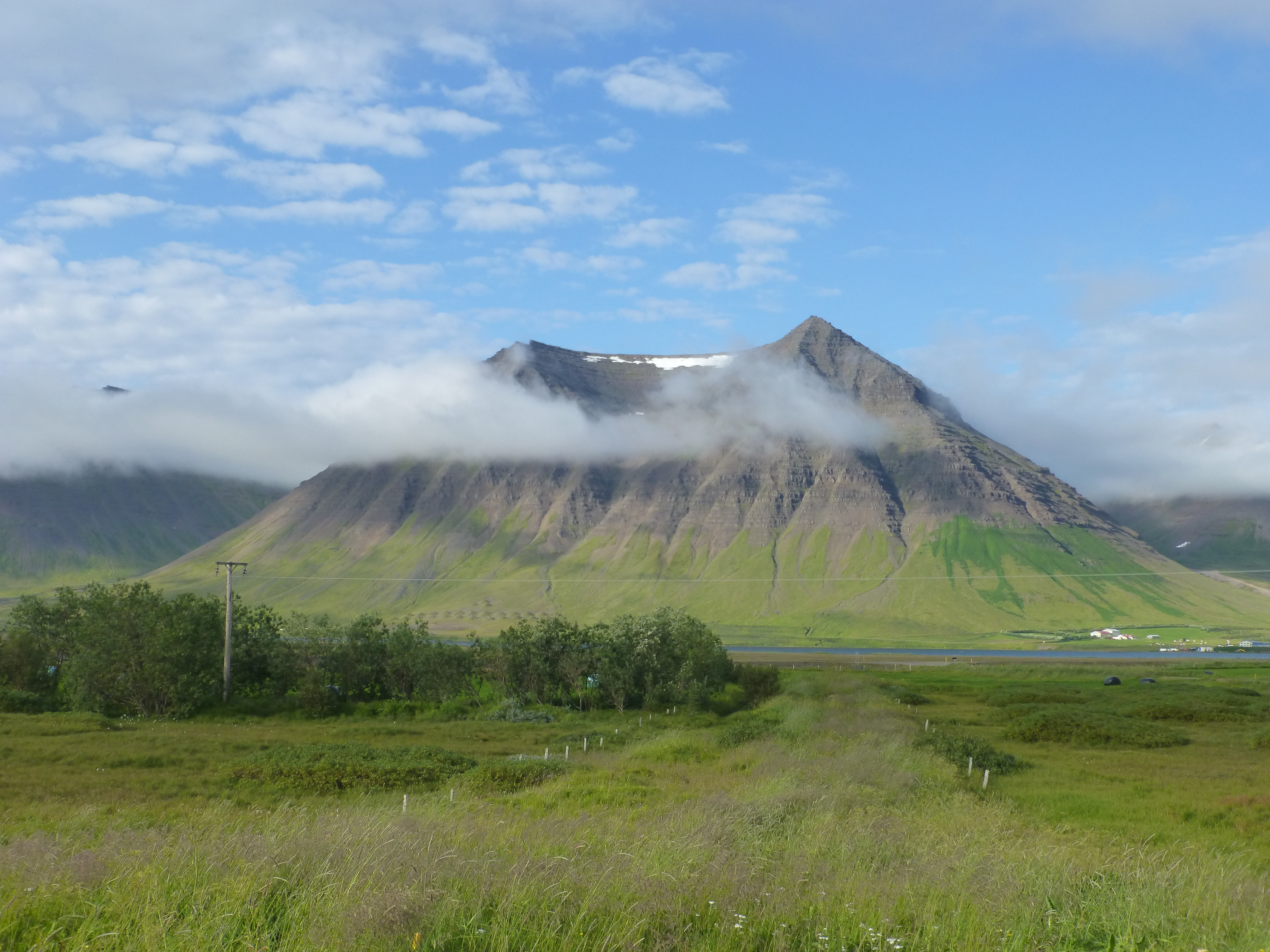
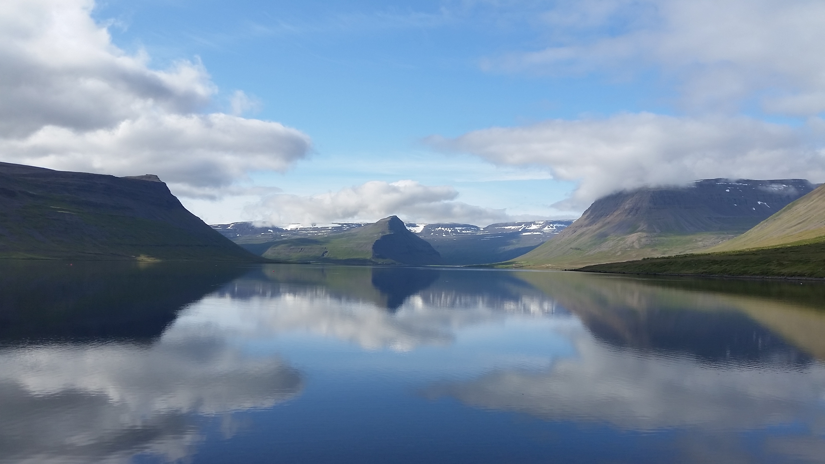
A typical Westfjords view is full of water, or the cloud-topped peak of a volcano – or, of course, both of these together. You’re never far from either of them.
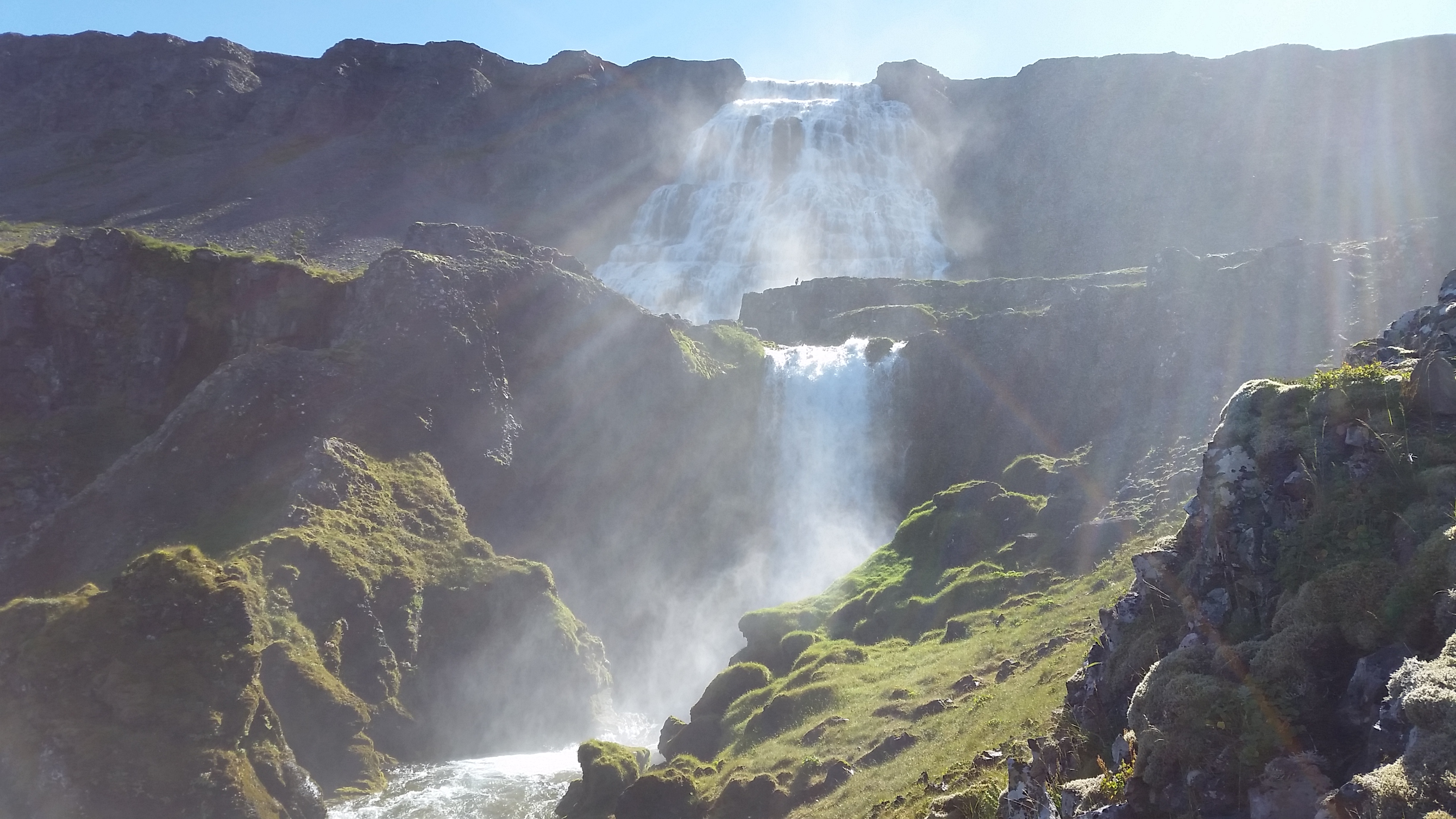
At least six different levels of falls comprise Dynjandi, with an impressive rush of water at its uppermost sections. We were able to climb up to the top level. We could not decide which one of them was more enjoyable to look at.
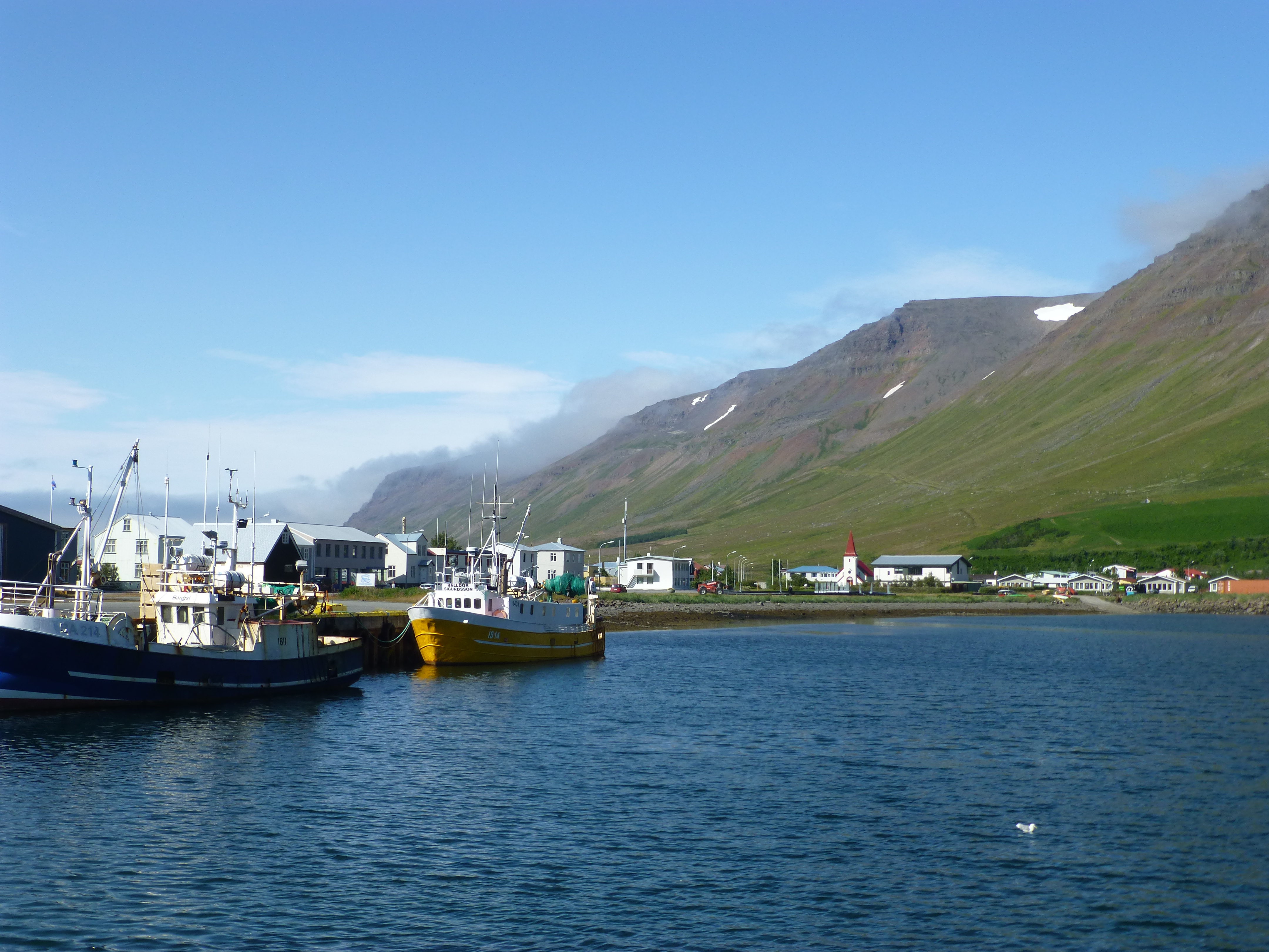
Fishing village of Flateyri. Fishing boats still work the fjords for fresh catch. However, we stayed nearby in an old schoolhouse which had long been closed due to lack of youngsters to teach. It’s the big city of Reykjavik that is growing.
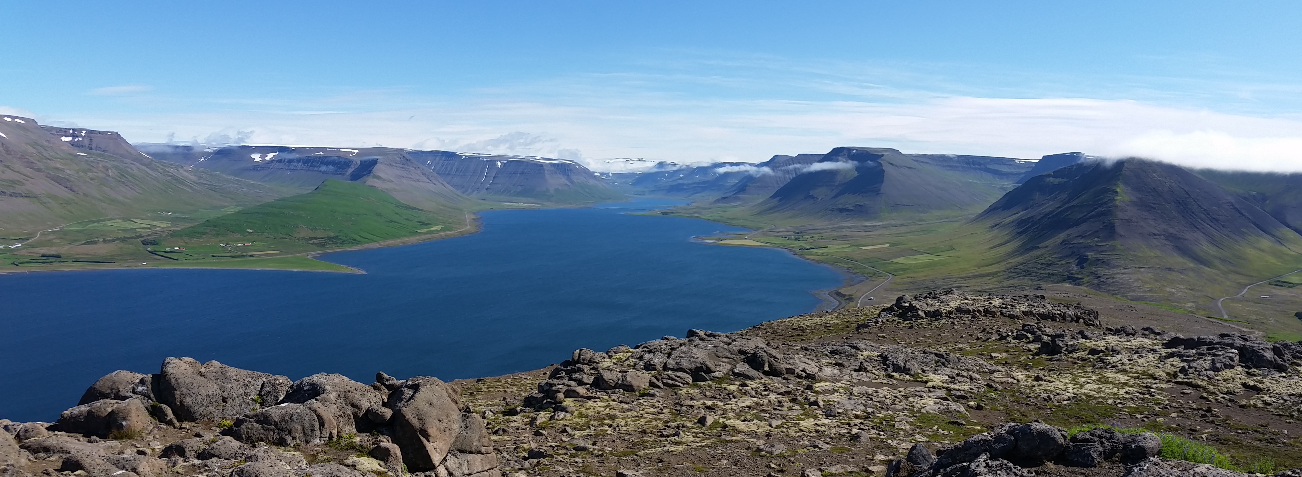
Overlooking a valley between the fjords.
Looking back at another fjord. When the sunlight, clouds and water interact with such clarity here, the effects are sublime
The oldest store in Iceland is a bookstore dating from 1906 that still prices used books by weight and is run by a descendant of the original merchants.
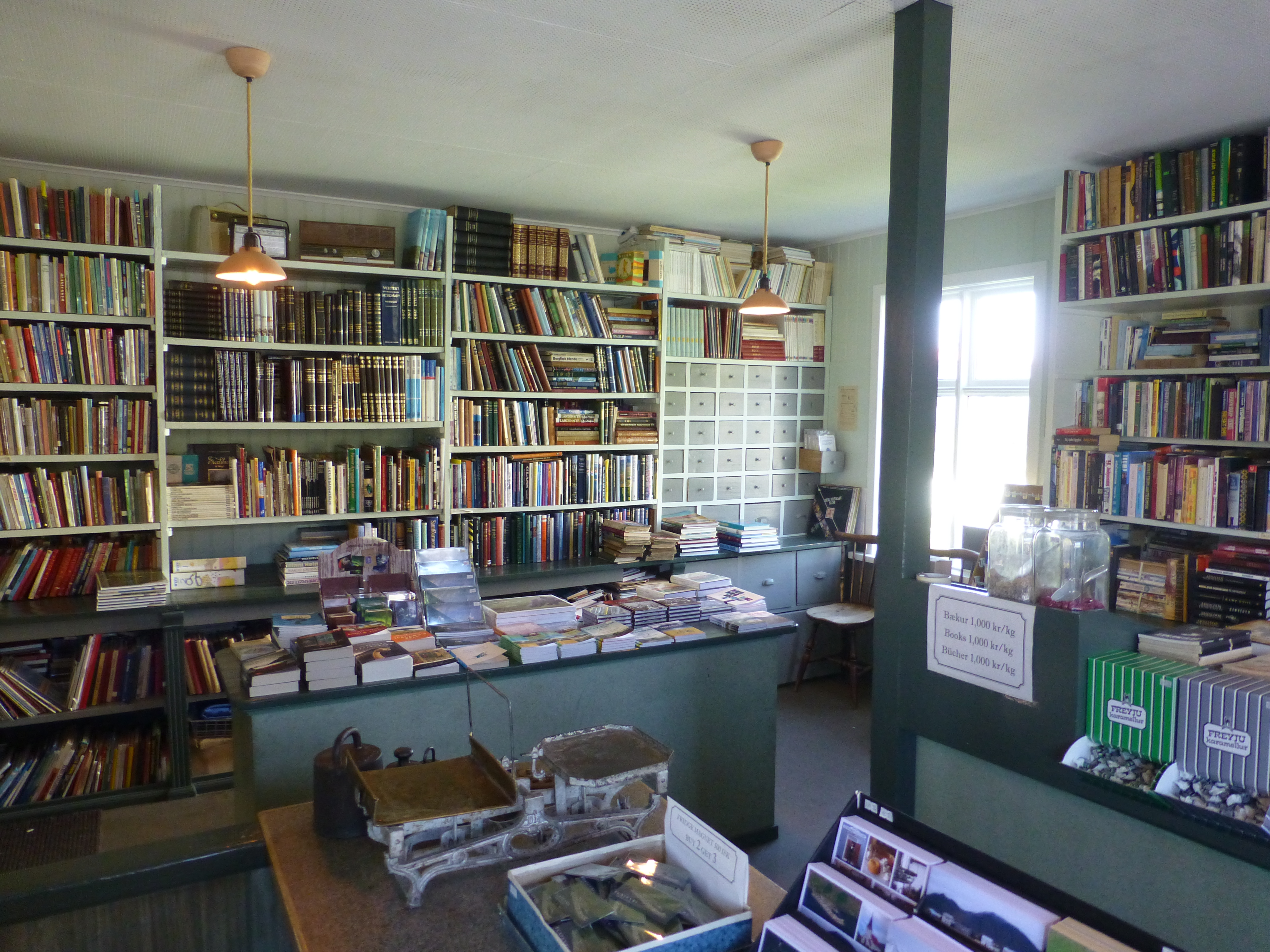
The house preserves the living space of his grandparents as it was 70 years earlier.
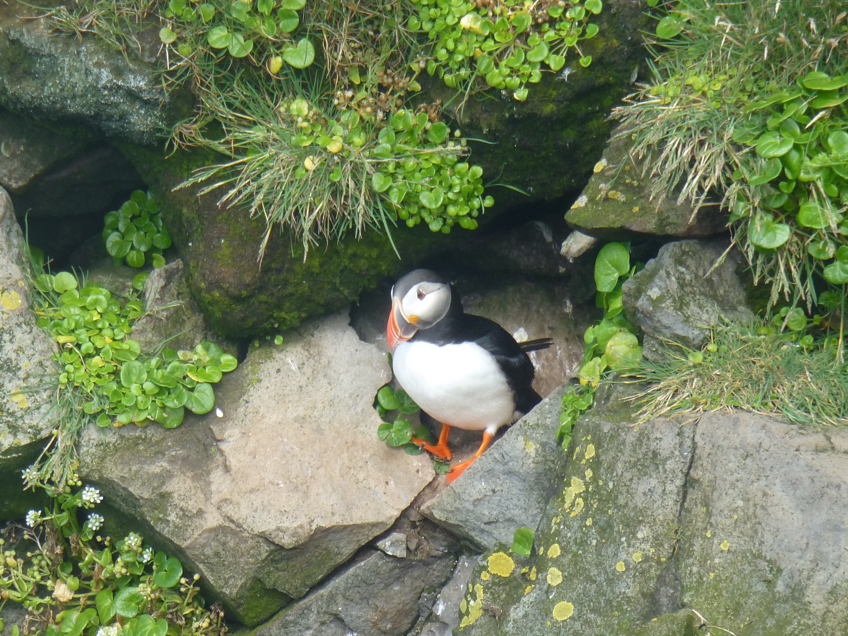
A puffin emerges from its burrow on the steep cliffs at the westernmost point of Iceland…and Europe.
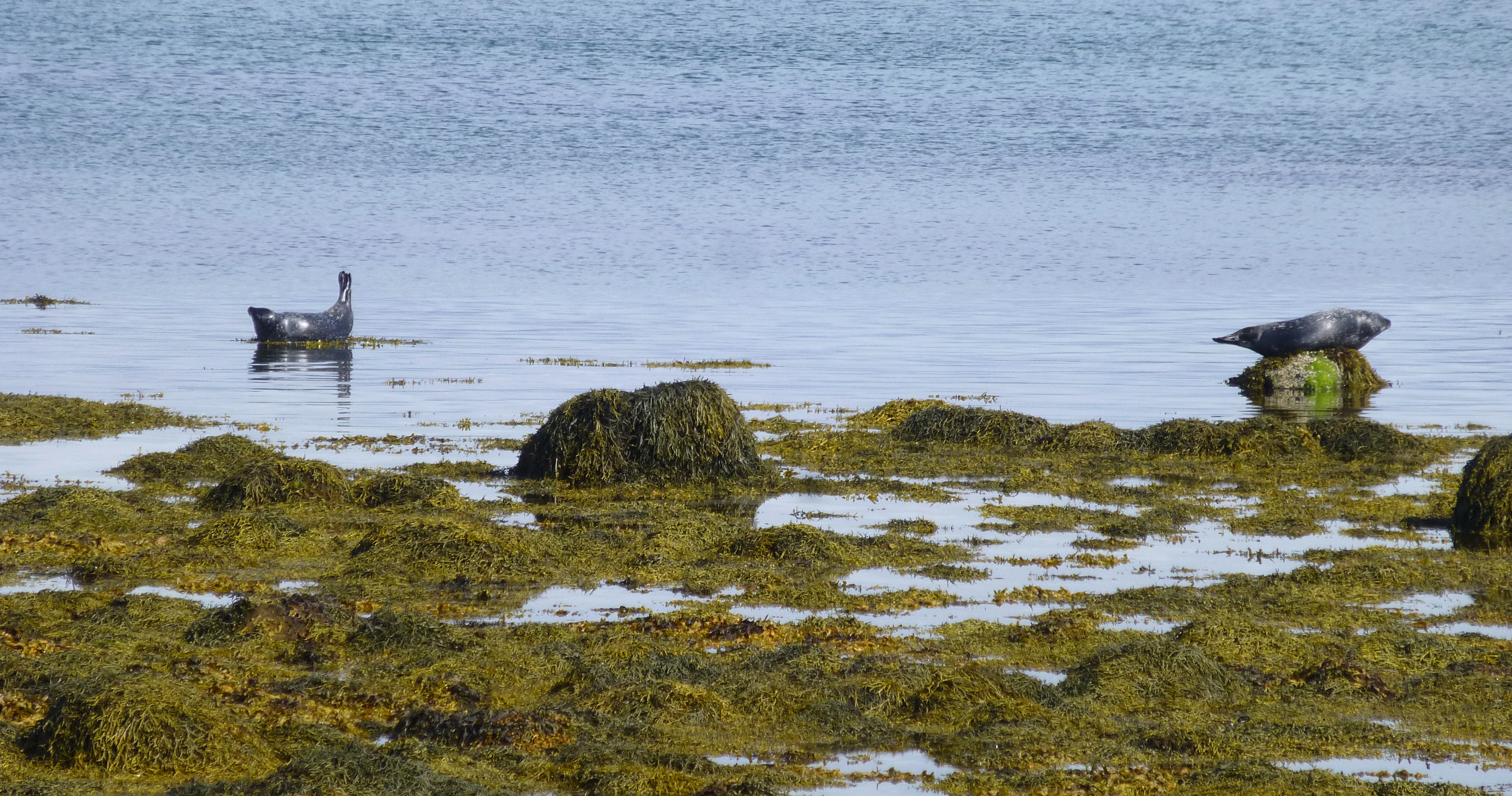
Seals stretch and sun on the shoals at various headlands along the Westfjords.
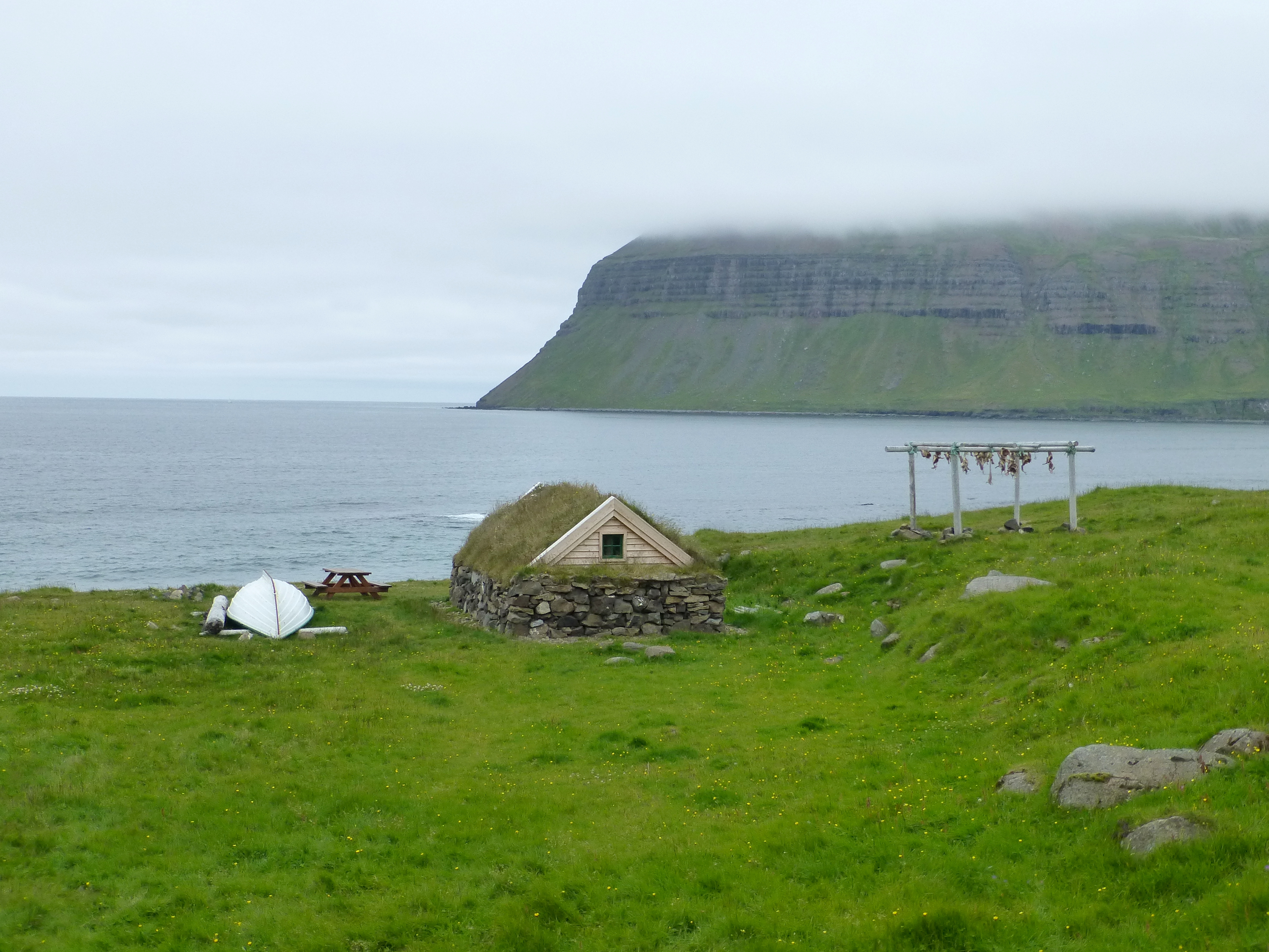
Drying fish heads hang beside a fisherman’s house, whose rough stone base and grass-covered roof date at least from the 18th century.
Down the embankment, a black sand beach gives access to the sea.
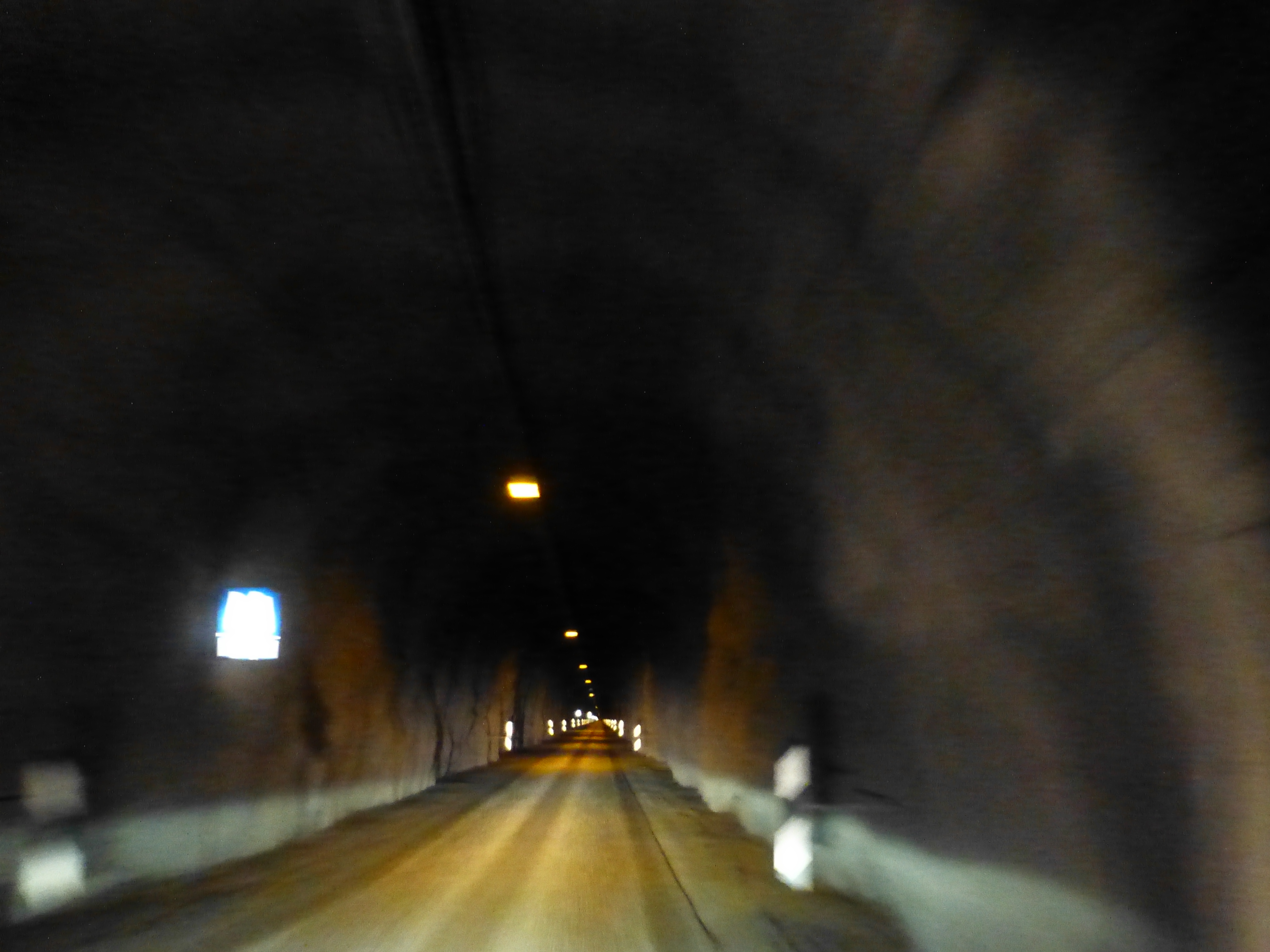
Quiz question: how would you design a 5 kilometer (3 mile) tunnel open to two-way traffic, but with just one lane? Answer: you give one direction priority to continue through; every 100 meters or so, you build a pull-over space for those going in the other direction to move themselves out of the way of the oncoming headlights.
(Also, for more pictures from Iceland, CLICK HERE to view the slideshow at the end of the itinerary page.)