Rounding Iceland at say 2 to 4 on its clock face, after enjoying so much along the way, we started to think, yeah, OK, I’ve seen all the the country has to offer. Not quite. Here are the some of the things in that third region which engaged us.
We drove the complete ring road of Iceland, a roughly 1400 kilometer trip according to Iceland, but we added side trips and sections off the main road, eventually finishing over 3000 kilometers instead.
TOP TIP FOR ICELAND: If you only have a short time (a few days or week), or you’re short of funds in this expensive country, do less by selecting a single region. No matter where you go, you will see wonderful things – and not just find you’re pushing yourself along the road. So relax, pick any of the sections we posted about. Plus, choose your tours wisely as the price can mount quickly too.
The Eastern fjords
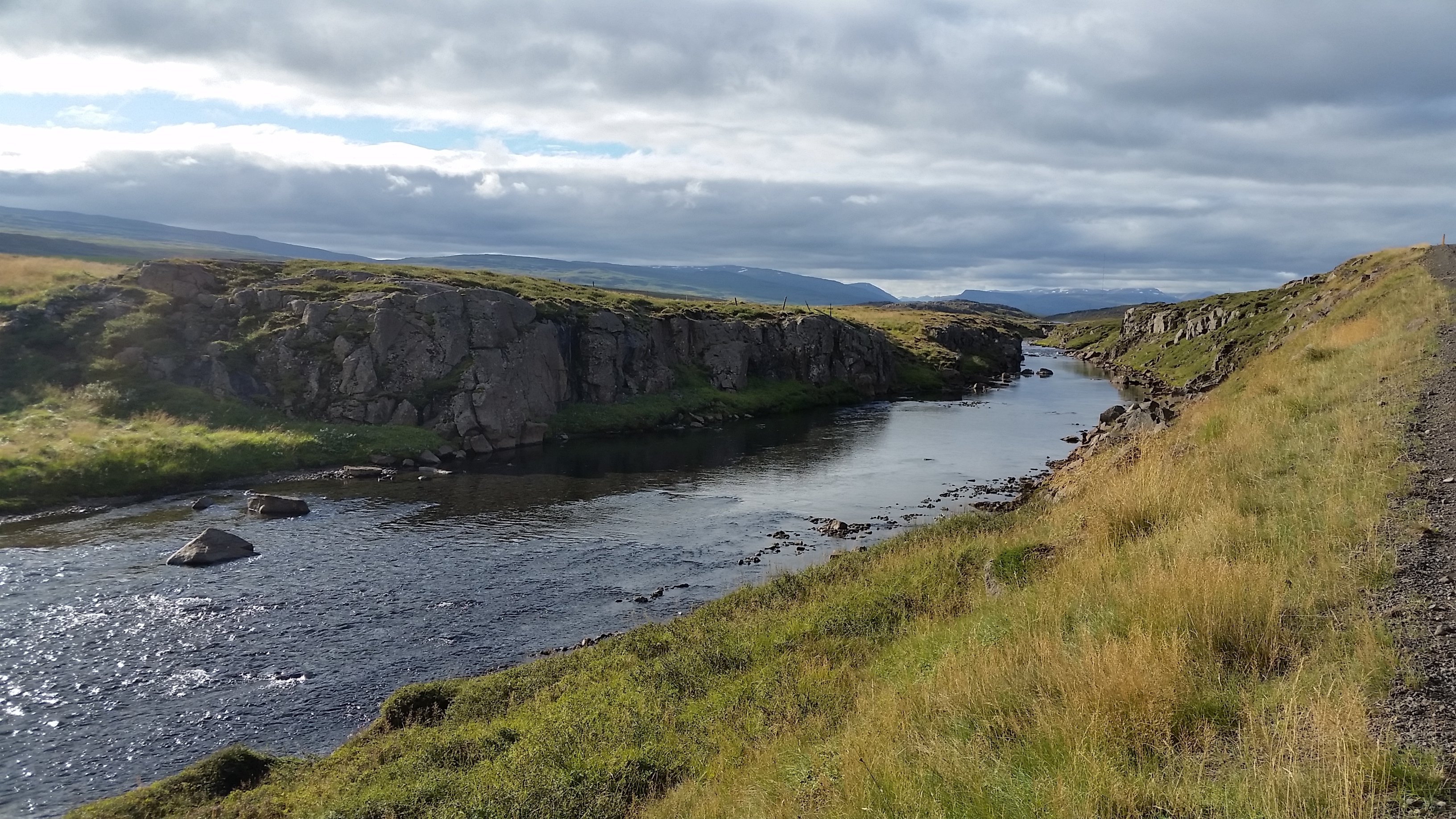
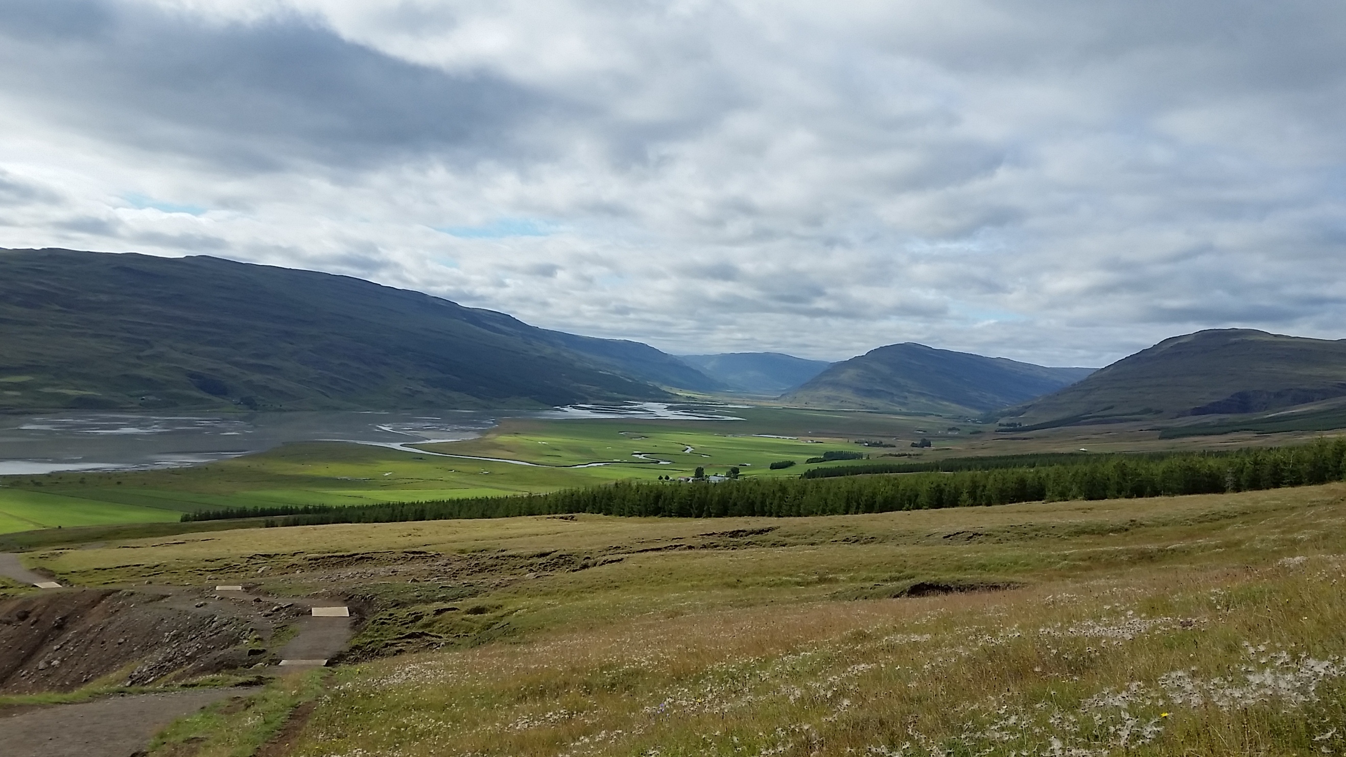
The east is another land of fjords, but these are narrower, at times with precipitous cliffs spilling directly onto the shoreline, at times with broad valleys once hollowed out by the sea. At the tips of the fjords, we found some of the most picturesque of Iceland’s fishing villages. Up above them, several of the largest mountains in the country reached back into the highland areas. After 4 on the clock face, we began to skirt the expansive Atlantic Ocean itself where roughly eroded ridges swoop down to black sand beaches…and started to ponder the upcoming Vatnasjokull Glacier that lurks to the south.
A bit of Lagarfljot north of the East’s largest town, Egilsstadir. At times seemingly a fjord, a river and an inlet, this narrow waterway is fed by waterfalls from the snowy eastern mountains as well as the vast southern glacier of Vatnajokull.
Lagarfljot again, though south of Egilsstadir, near famous Hengifoss waterfall. At the waterway’s southern edge, we found more hot springs, but not the natural pools we had been trying to discover. The ones here were quiet, but still just a few man made hot tubs.
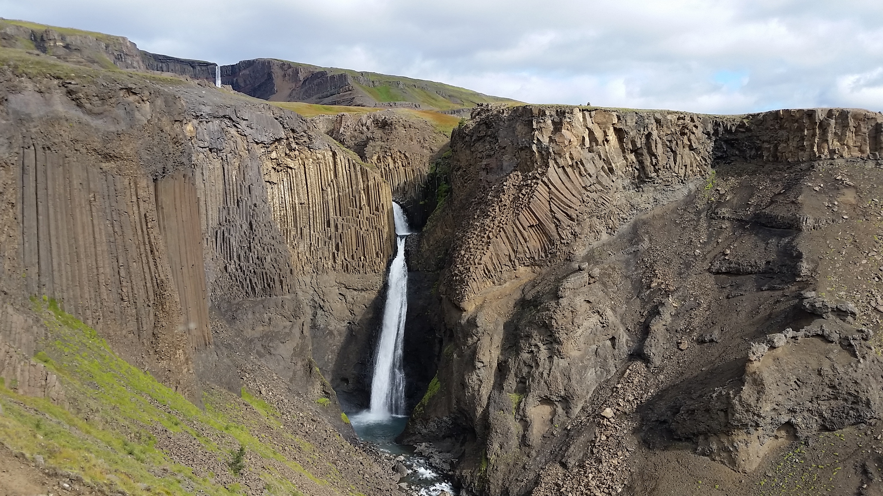
A lower section of the famous waterfall Hengifoss, with the top part peeking out in the distant background, a challenging hike away. The unusual rock formations are the best cluster we saw of Iceland’s famous basalt columns. We studied the display that explained how these were formed and still could not quite visualize the process. They somehow emerged as hexagonal columns perpendicular to the flow of lava. Perhaps, we felt, the origin of such a stunning display was best left a mystery.
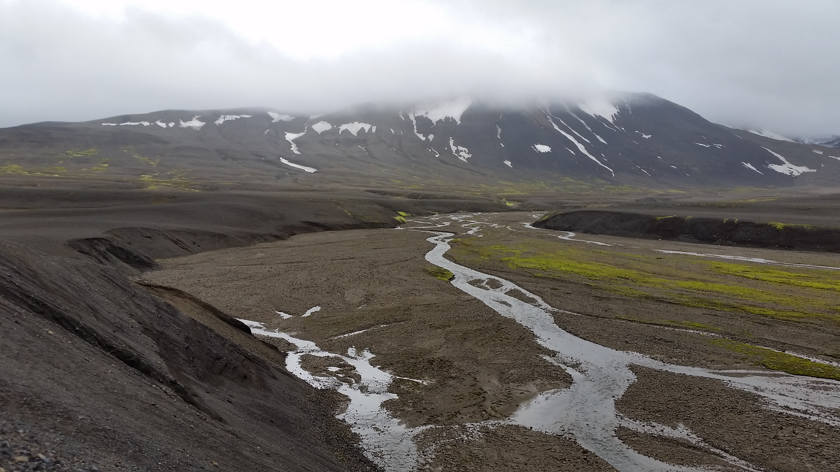
Far up in the highlands among the volcanic mountains. If you have a capable four wheel drive vehicle, you can rumble along Iceland’s many F-roads, an array of gravel trails and river-fording into the interior regions of the country, roads that can require a beast of a vehicle at times. Here we had climbed aside one of the most popular of mountains to hike, Snaefell (or “snowy”) at the northern edge of Vatnajokull Glacier – a wee bit cloudy on this day. Even in our 4WD, we appreciated the somewhat prepared road, as the lava fields around us were surprisingly muddy and unsupportive. As is typical, the grey volcanic soil is riven by wandering streams like this one spilling down from the mountains along with ribbons of green moss whose iridescence creates such a contrast to the ashen soil.
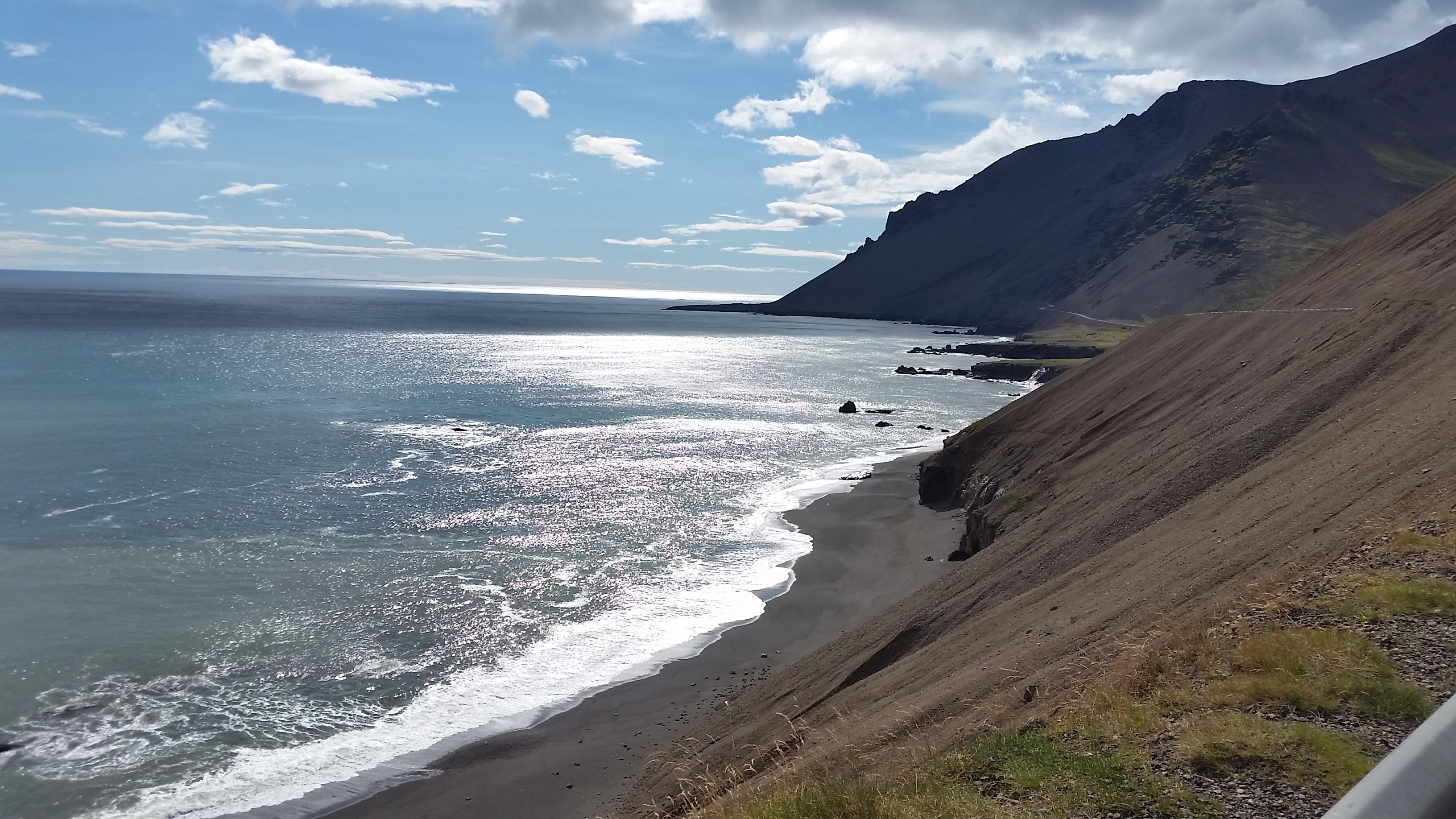
Black beach along the Norwegian Sea and Atlantic Ocean
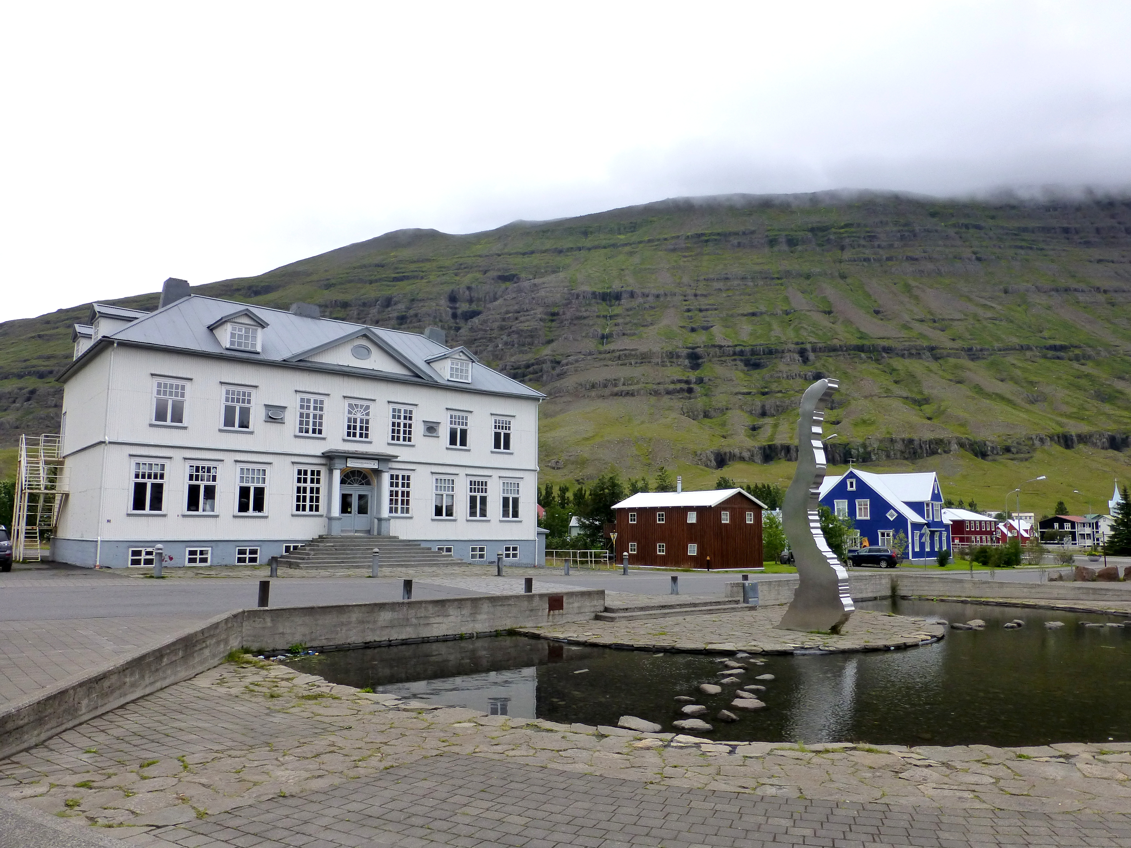
To reach the town of Seydisfjordur, part of which you see here, we climbed over the top of a mountain range along the fjord and wound steeply down past dozens of waterfalls fed by the eastern mountains that form a scoop toward the town. This is undeniably one of the most picturesque of all the fishing villages we visited and perhaps what might have been a movie set for picturesque Iceland villages. And, yes, a camera crew was working on its streets.
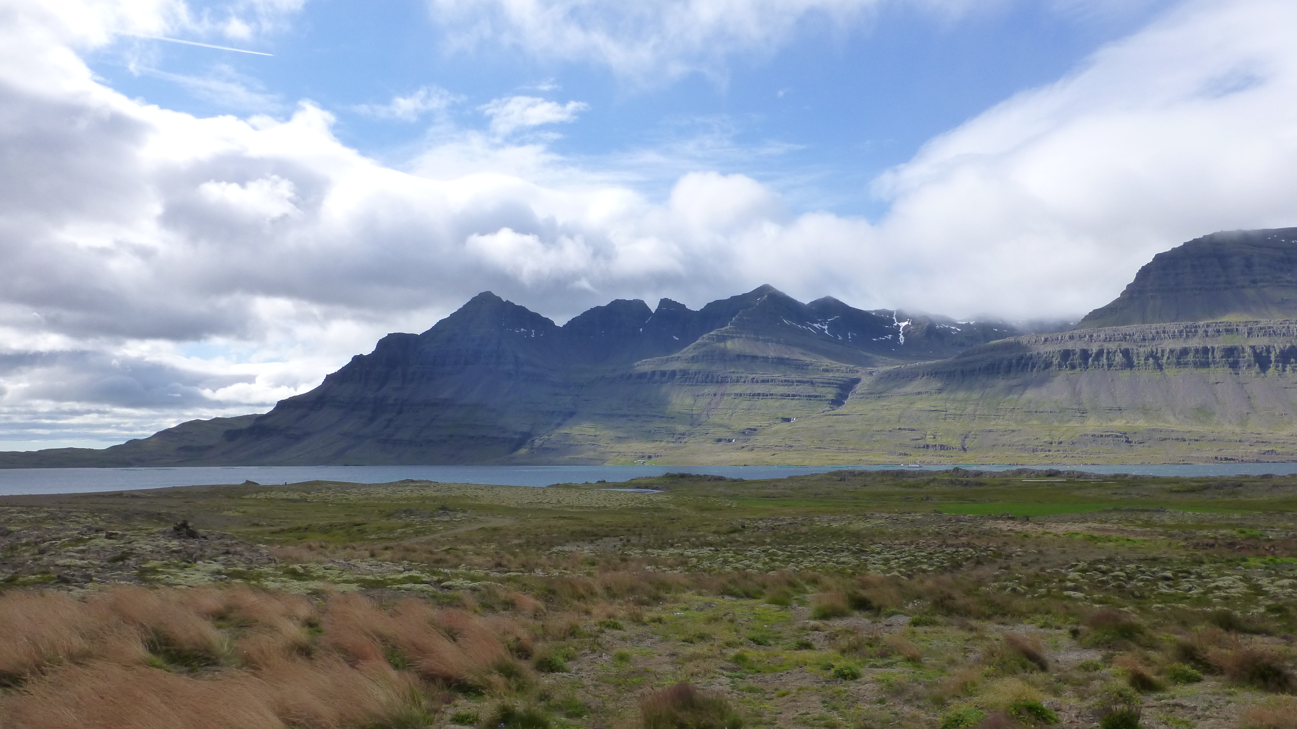
One of dozens of “oh, wow” moments where jagged ridgelines, sweeping hills and fjords come together in the east.
The South: Vatnajokull glacier and lagoon
By boat
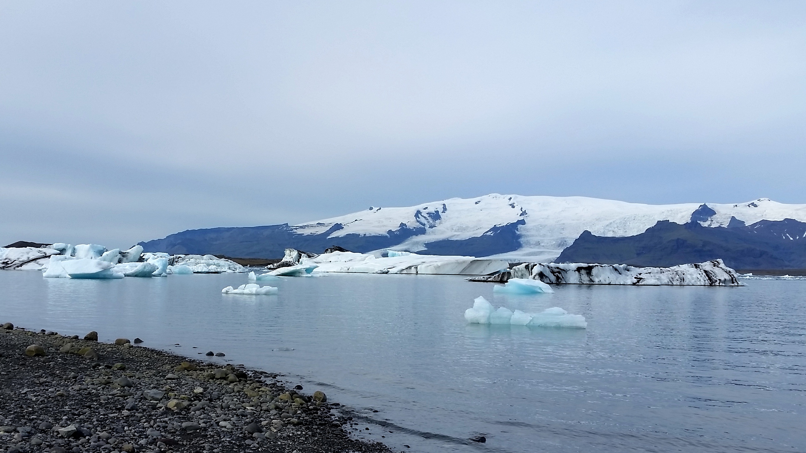
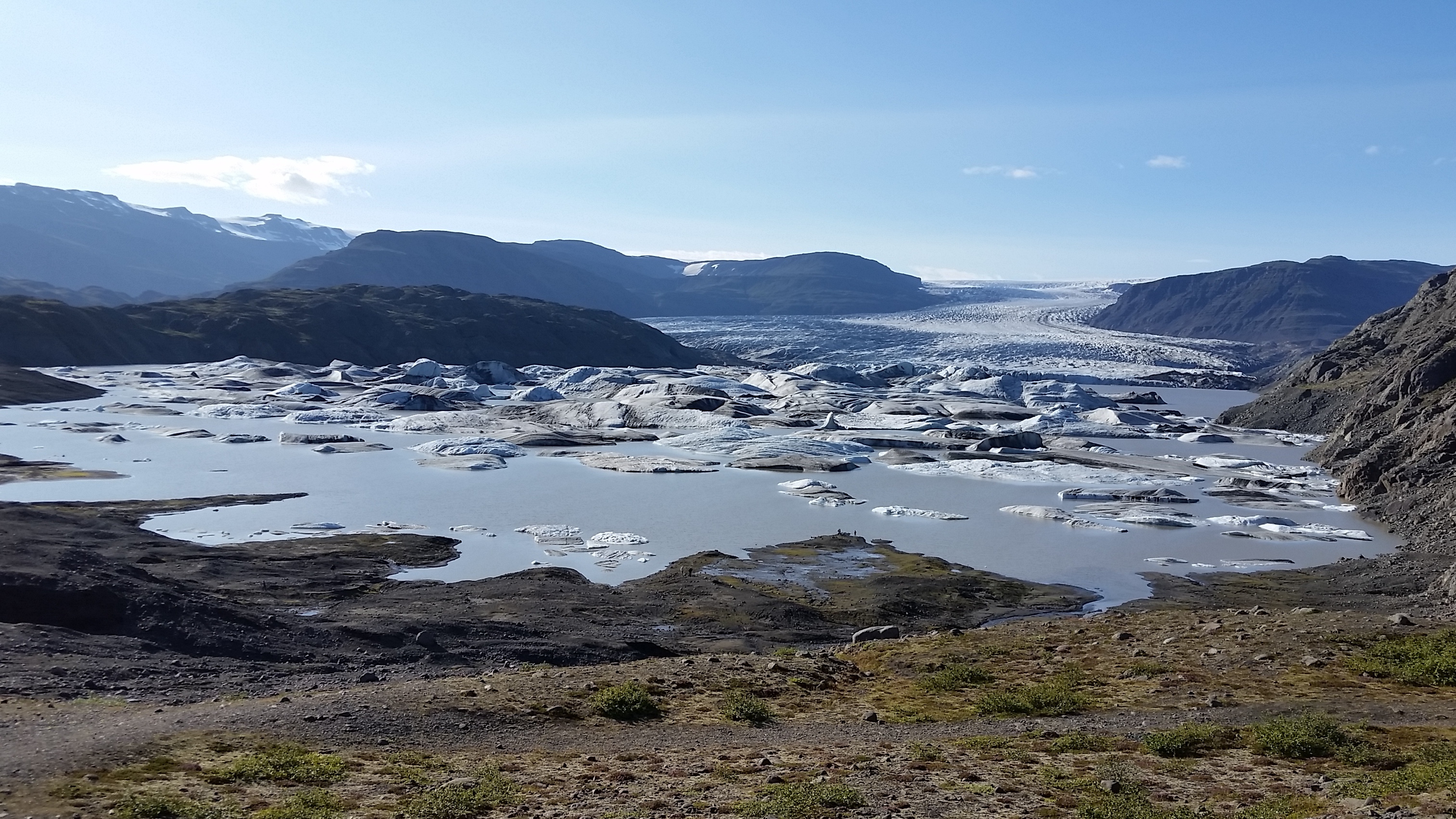
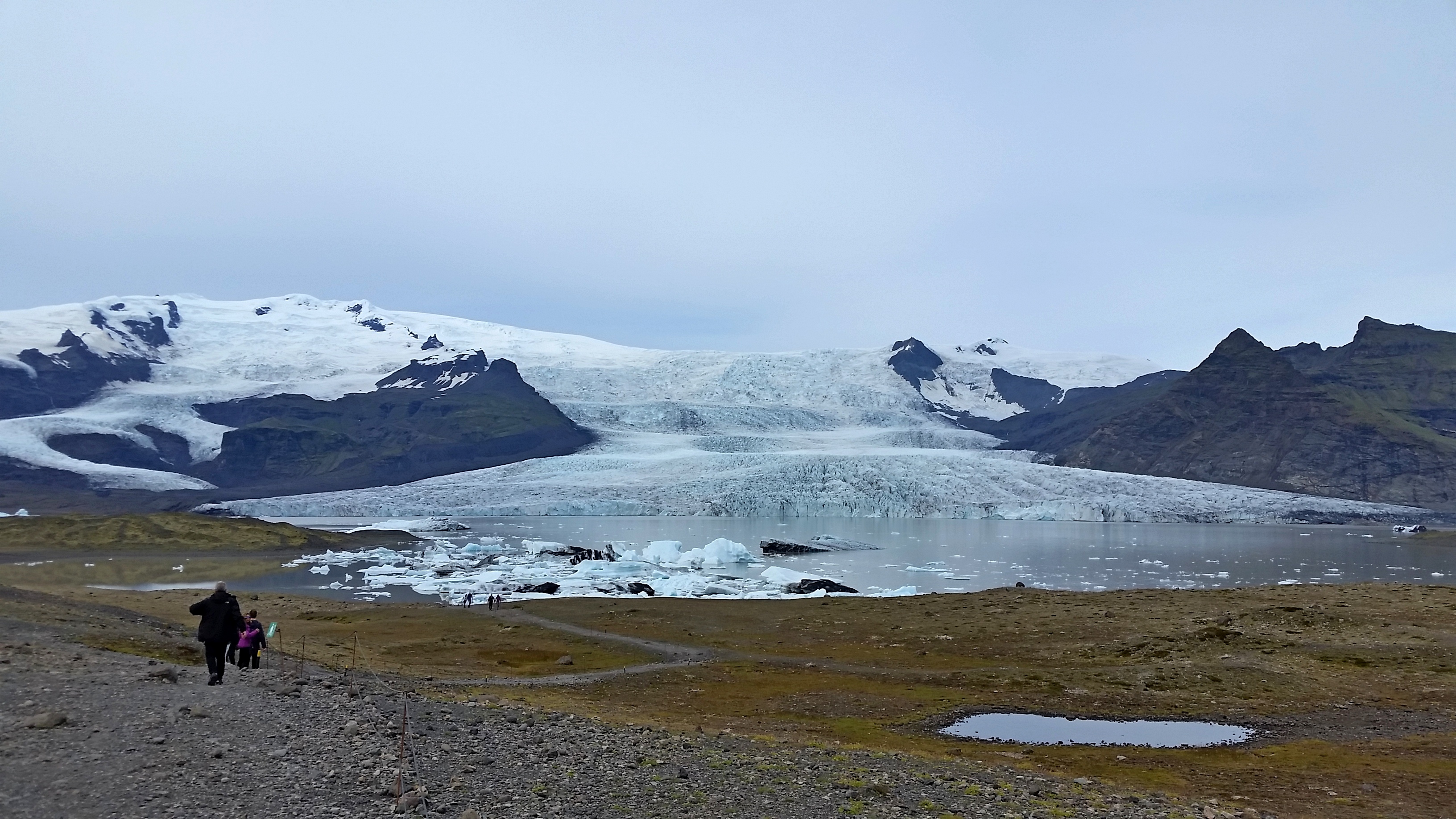
It was one of our most delightful days in Iceland, our day exploring massive Vatnajokull glacier. At over 8000 square kilometers (3000 square miles), nearly a tenth of the country in area and up to a kilometer thick, this ice cap dominates the southeastern region. Our eyes were easily tricked into underestimating how large it is from afar or even up close at any of a dozen places where its icy fingers had crept toward the sea along channels sheared in past millennia. Each of those fingers ends at a lagoon formed by melting ice. We gleefully toured the largest of them by boat.
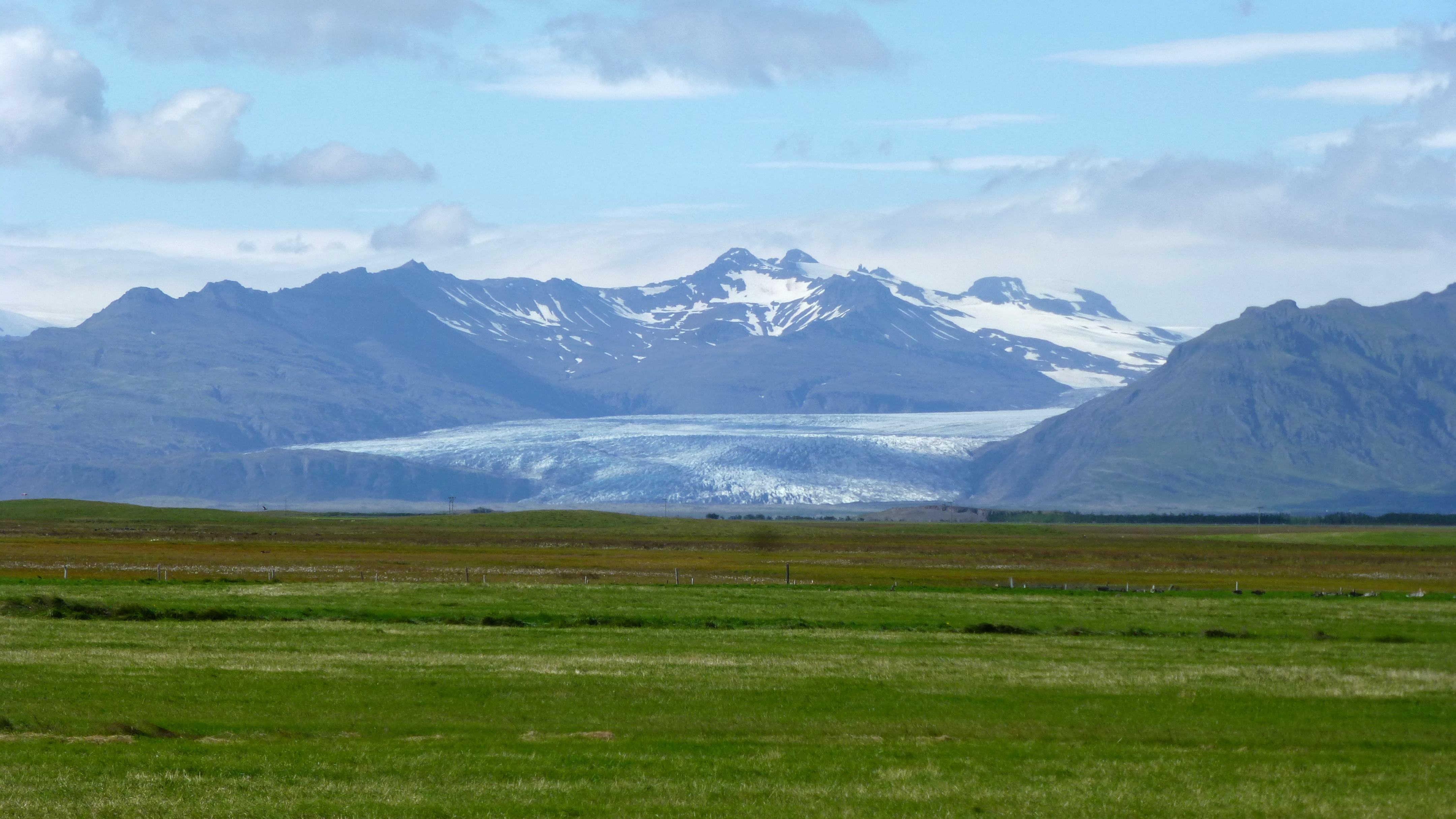
Driving the southern portion of Iceland’s ring road, we could admire the splendor of Vatnajokull and views like this for about a hundred kilometers.
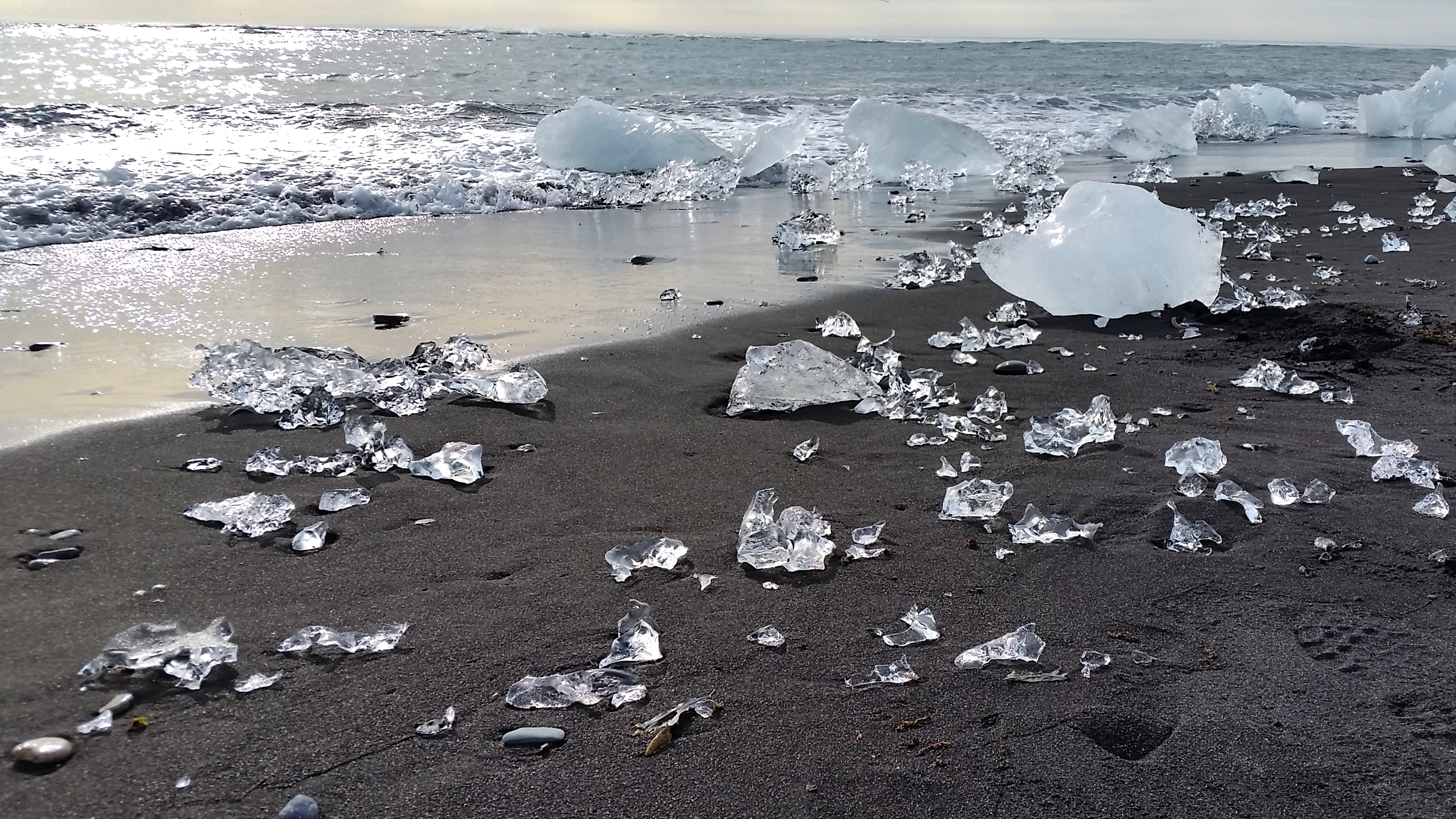
Diamond Beach, at the outlet from the Jokulsarlon, a large glacial lagoon. Huge chunks split from the glacier’s edge and drift slowly toward the sea, melting and breaking apart. These small bits of transparent ice collect on the shore, like uncut diamonds adorning the intensely black lava beach.
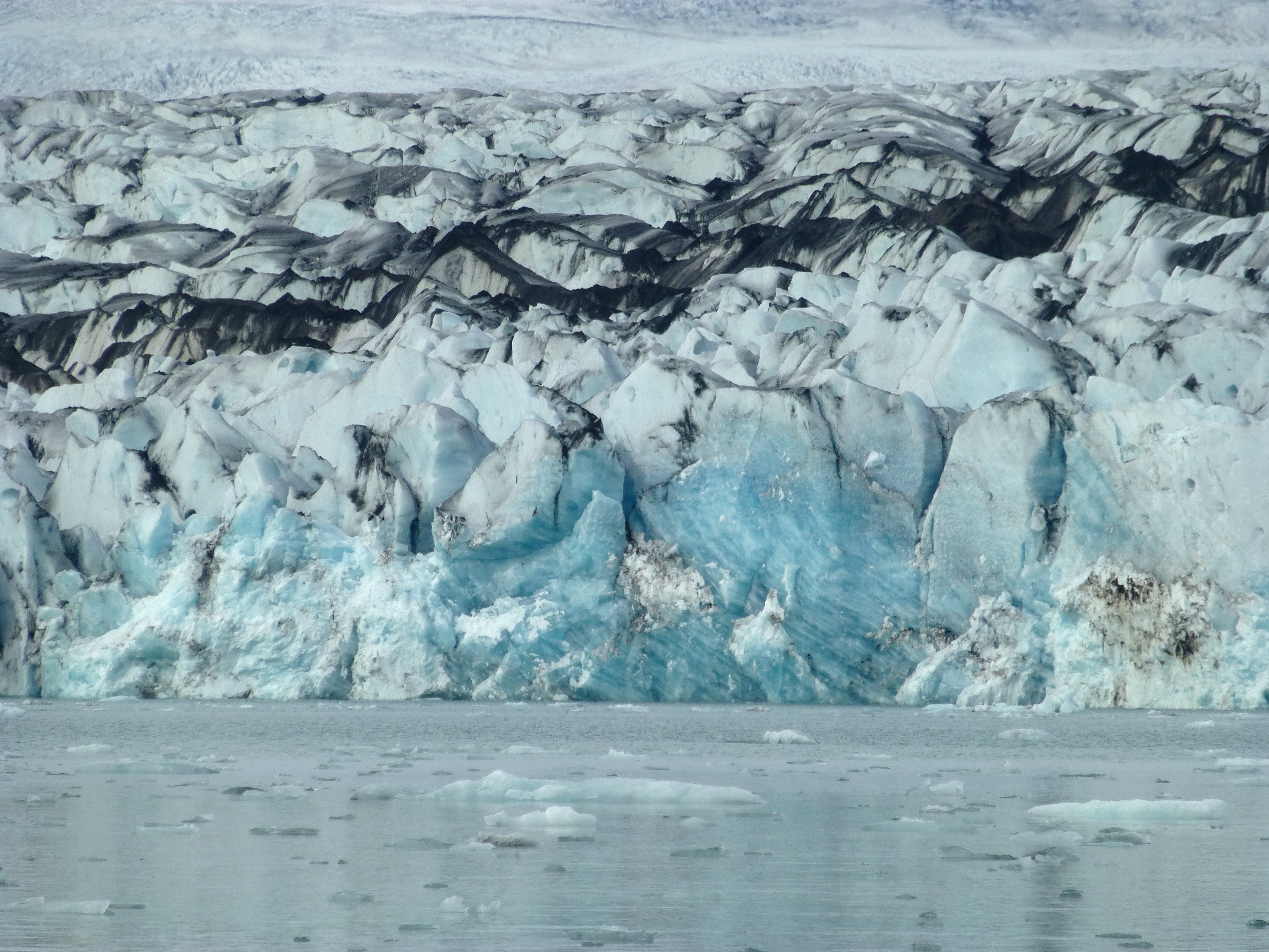
Several fingers of the glacier reach toward the Jokulsarlon lagoon where icy blocks streaked with volcanic ash have split off and headed toward the ocean. All of Vatnajokull glacier will disappear within 100 years, partly due to a natural evolution and party due to climate change.
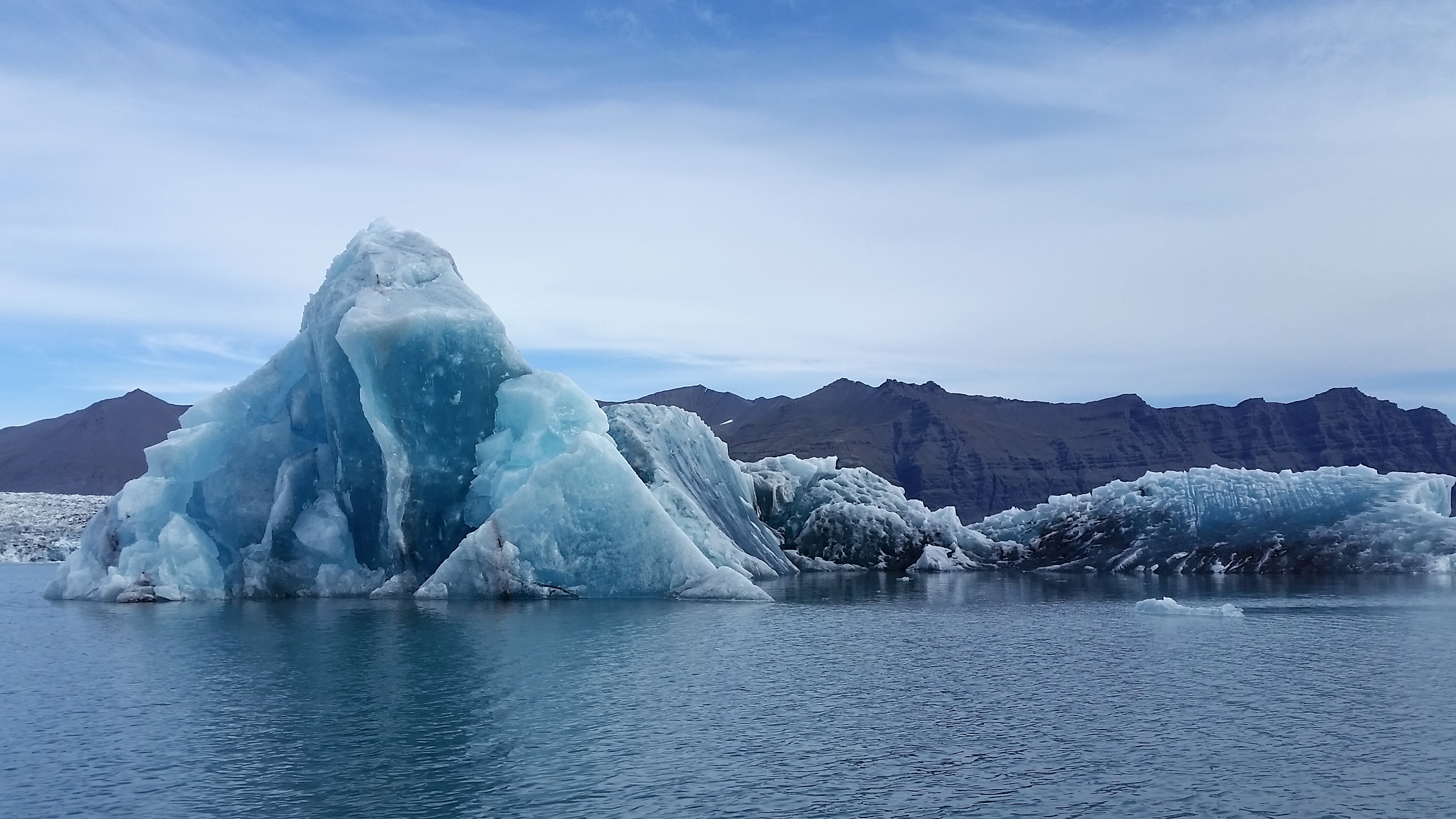
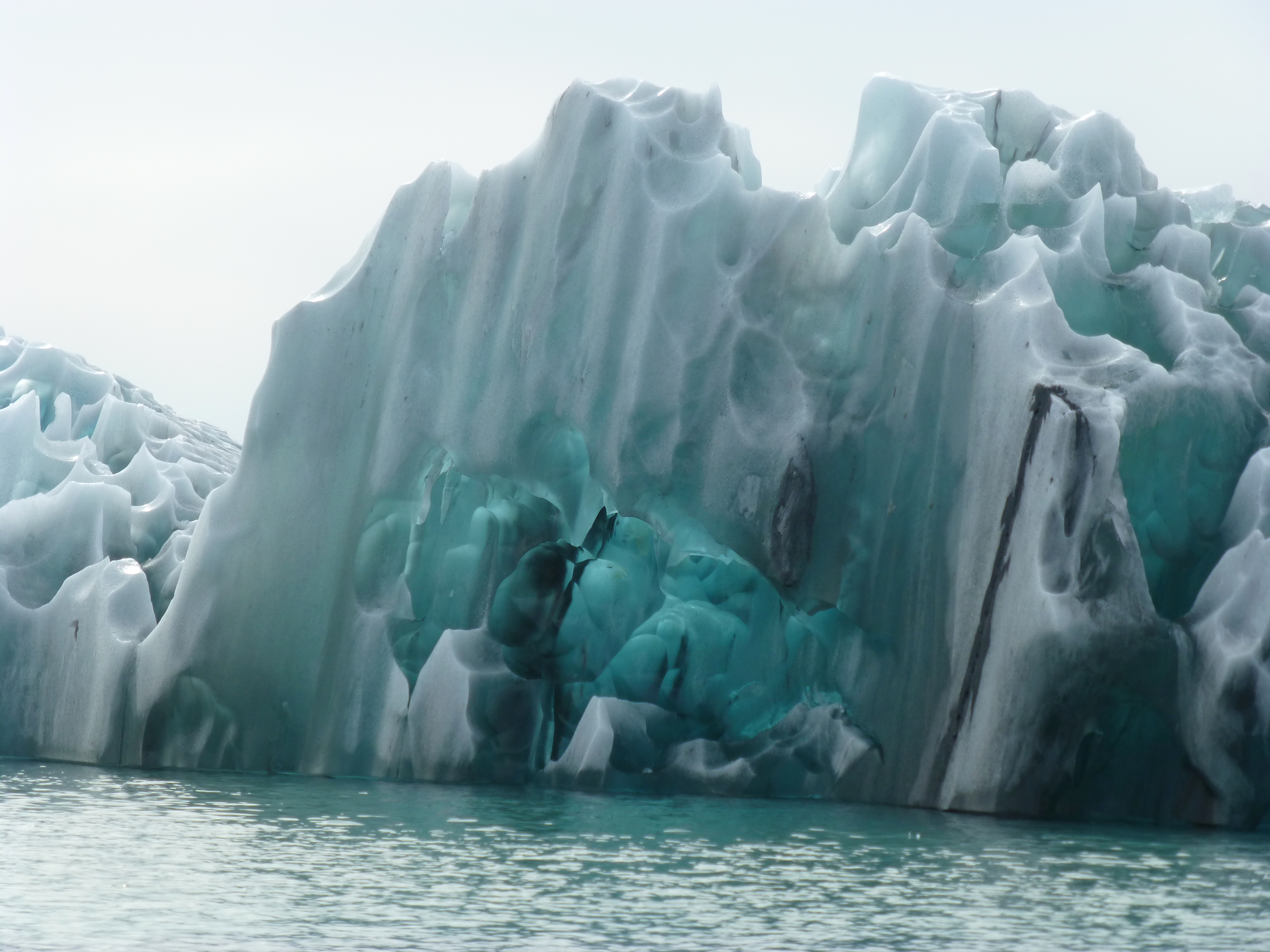
The ice blocks – after fracturing off the glacier, melting and rolling over – form shapes of endless variety and complexity. Intense blue, a reflection of the lowest wavelength light, is the color of ice that has only recently been exposed to air and light, usually after the iceberg rolls over in the water. In less than a day, this one will be all white. Every day in the lagoon, the shapes and colors differ.
The glacial wall of Vatnajokull from about a kilometer away in the lagoon doesn’t look to be about 300 meters (yards) high.
Striated iceberg with meringue top in the lagoon.
On foot
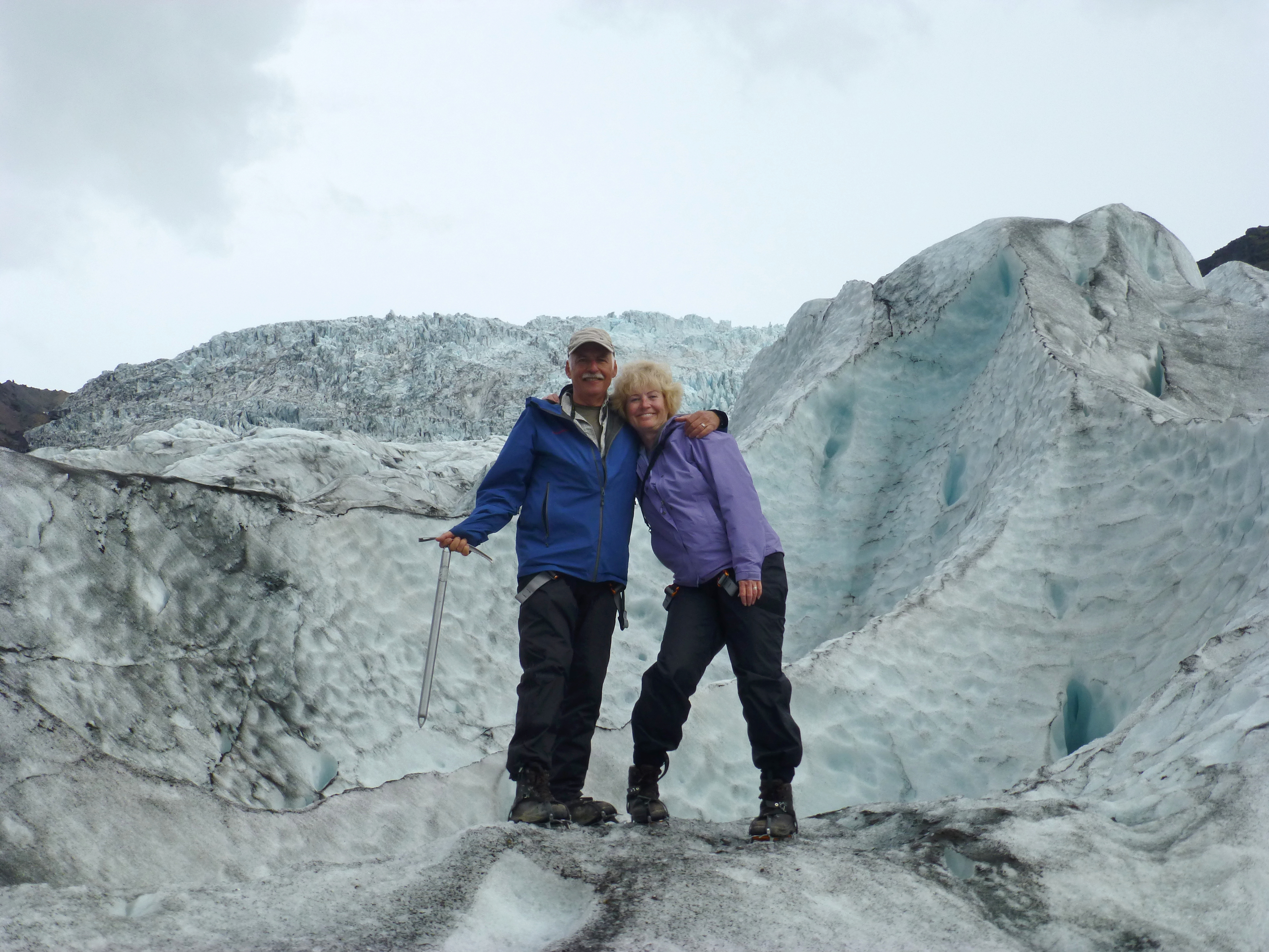
“The greatest danger is tripping yourself with your own crampons,” Snorri asserted, as our small group started climbing Falljokull, a rugged finger of the huge Vatnajokull glacier. One woman soon flopped forward to demonstrate the point. Traipsing along the rugged, ever-shifting surface, though, we had a very different impression – as we skirted holes plunging 20 meters (yards) or more, icy rifts with narrow ridges to cross, steep drop-offs to mount or descend, and lurking caves. We were glad we were sharing Snorri’s 8 year experience, but not some of his dives into the much deeper holes he told about. In turn, he was astonished that our little group dared do so much. So we ended up higher than most and, with some ice-chopping by Snorri, steeper than most…or so he said. It was a thrilling experience, far different from our previous walk at a kind of landing strip on a New Zealand glacier, which was flat and not at all threatening. Toward the end, Snorri added one concern we had not known – the very real threat that the ice wall here could collapse, releasing a virtual tsunami of melted water and ice beneath us, destroying the town below. A crampon trip-up seemed way more preferable.
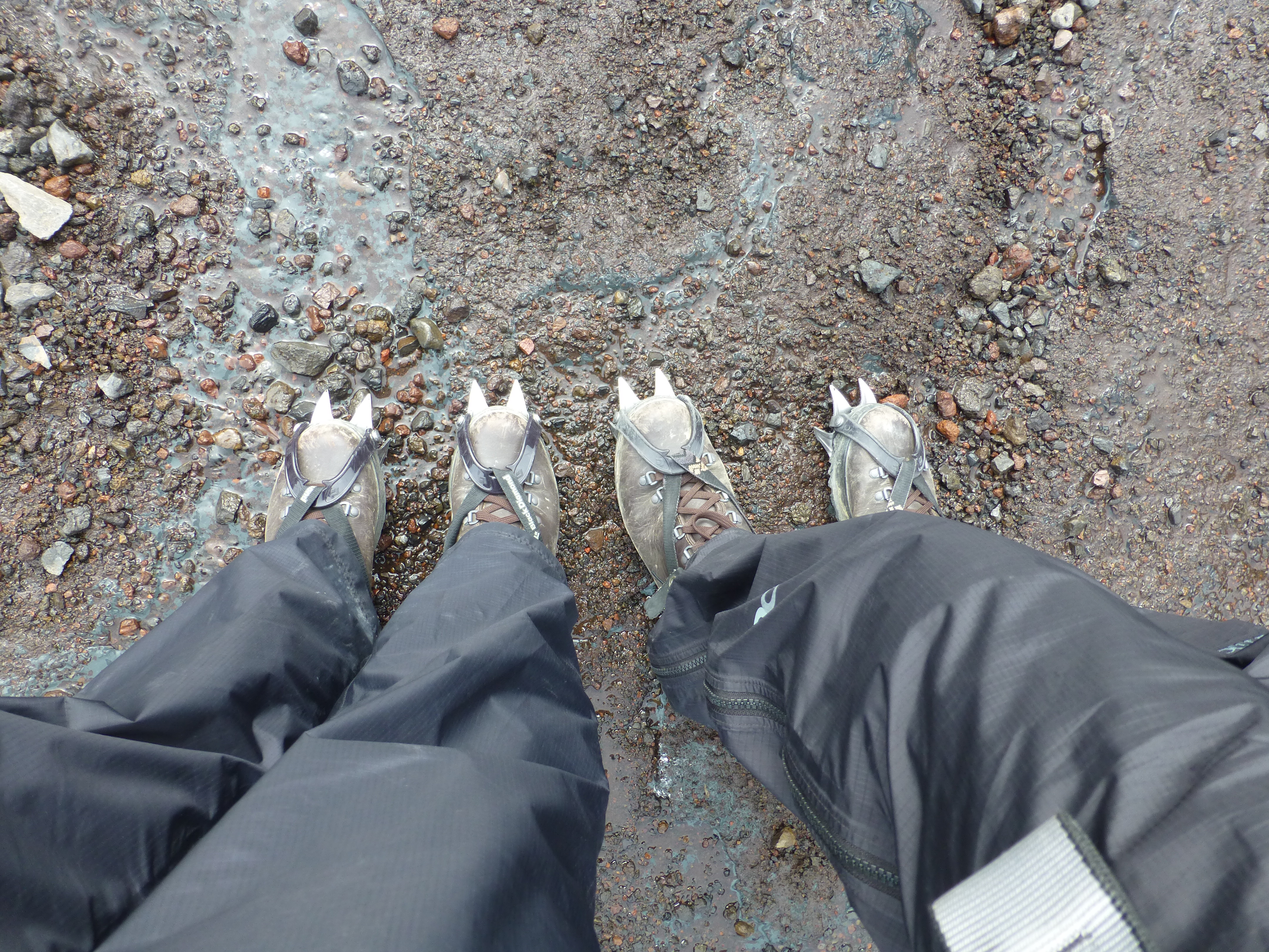
Crampons mounted…and forewarned about tripping ourselves up.
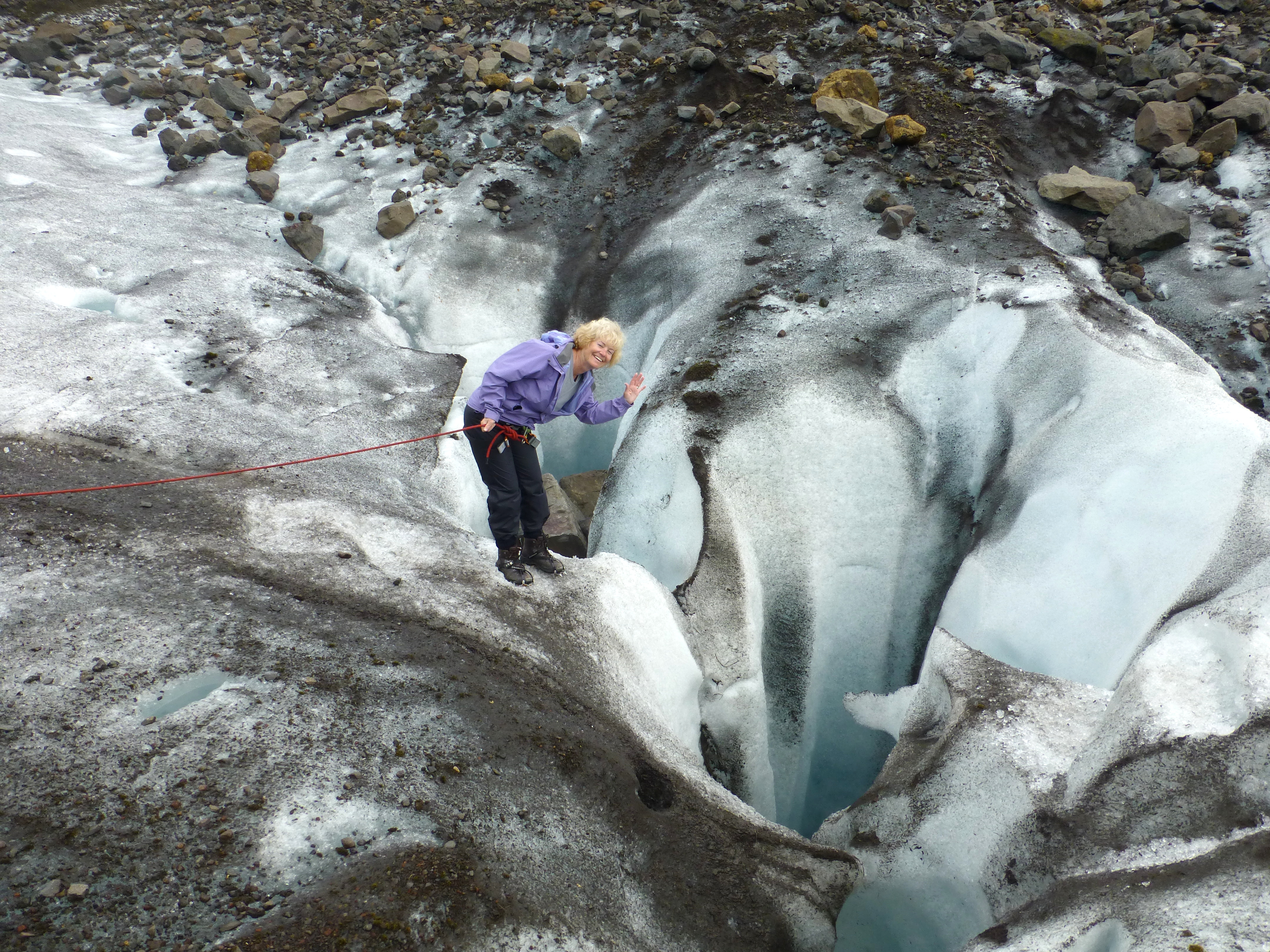
Nancy accepts a lifeline in order to inspect one deep blue hole. In others we could see water within the glacier.
It takes some good experience to know your way along the rugged surface, such as this patch ahead of us, at Falljokull.
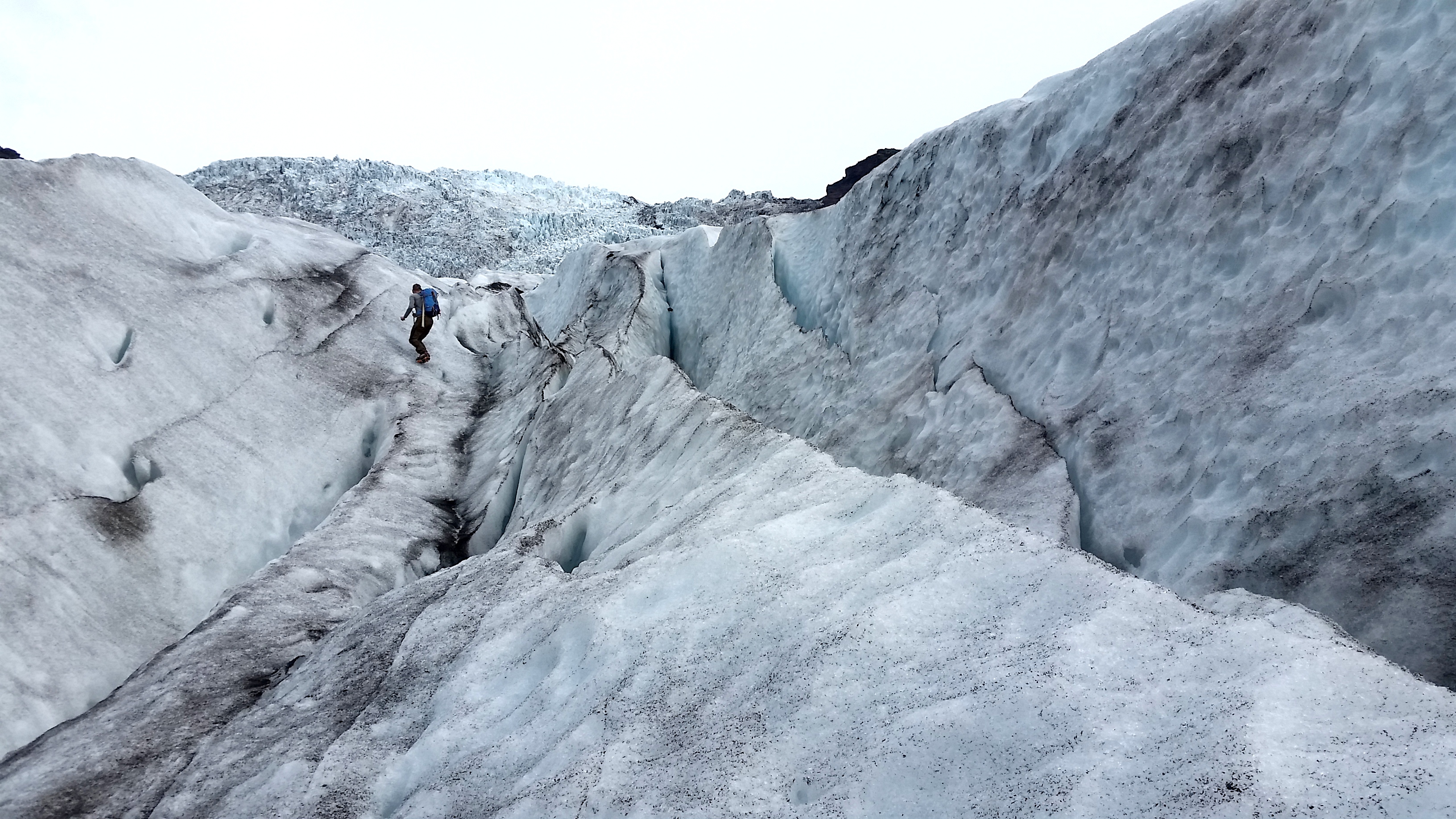
A steep rise to the right, a gaping rift to the left and a climb to the next ridge – Snorri goes first, and we all follow. The surface is flecked with lava ash, not dirt.
The Fingers of the Glacier
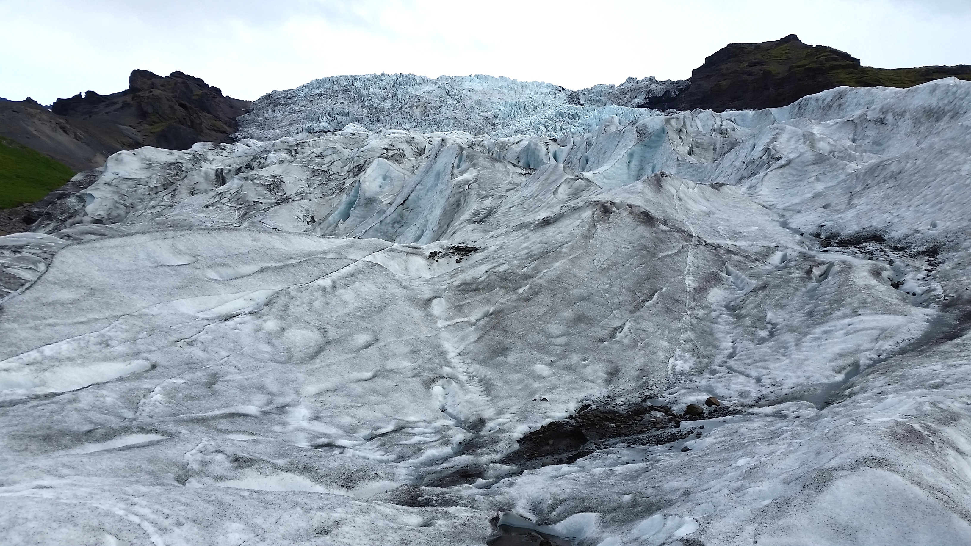
The feeling of grandeur on the previous day, at another glacial finger called Hoffellsjokull, was beyond words.
Yet another lagoon spreads from a glacial finger. Distances are very deceiving…the water’s edge is several miles/kilometers from the glacier wall.
Southwest and Reykjanes Peninsula
After more than three weeks in Iceland, we ended up where we started our circuit – at Reykjavik’s airport. Even after the wonder of the big glacier in the southeast, and within just a few hours of the capital, we still found much to admire and enjoy in the southwest – charming hikes up waterfalls, canyons and headlands; stunning coastlines; moss-laden lava fields; picturesque old fishing villages; and a surprising concentration of puffins at the steep cliffs of Dyrholaey. It was, we also thought, so appropriate that our last stop before flying to the US was walking from Europe to North America via a short bridge that spanned the tectonic plates underlying the continents.
Nowhere else had we seen such a field of, well, breasts.
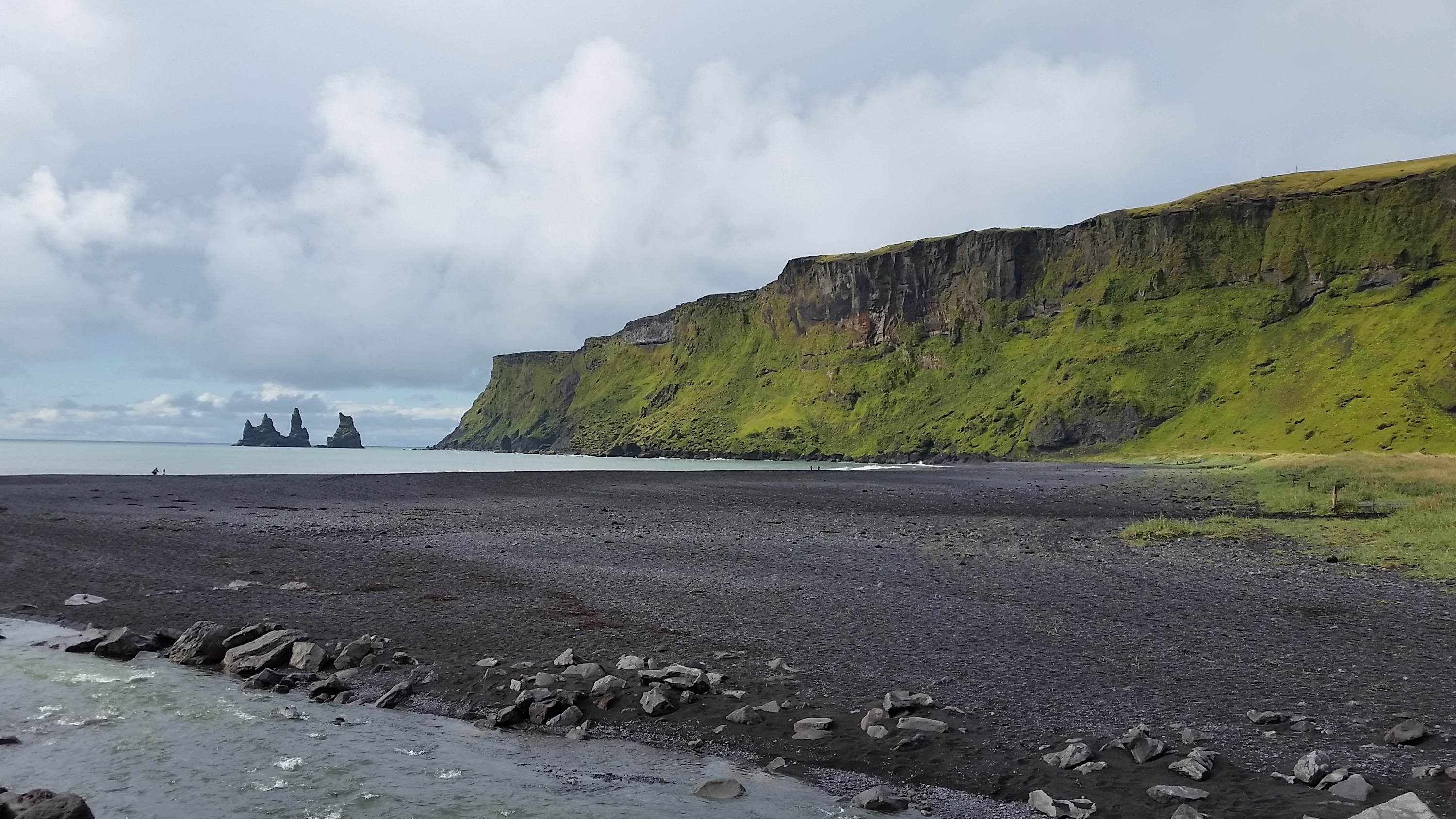
Headland and black beach, Vik. This was another town where we felt we could stay and enjoy the beauty of the vistas for a long time.
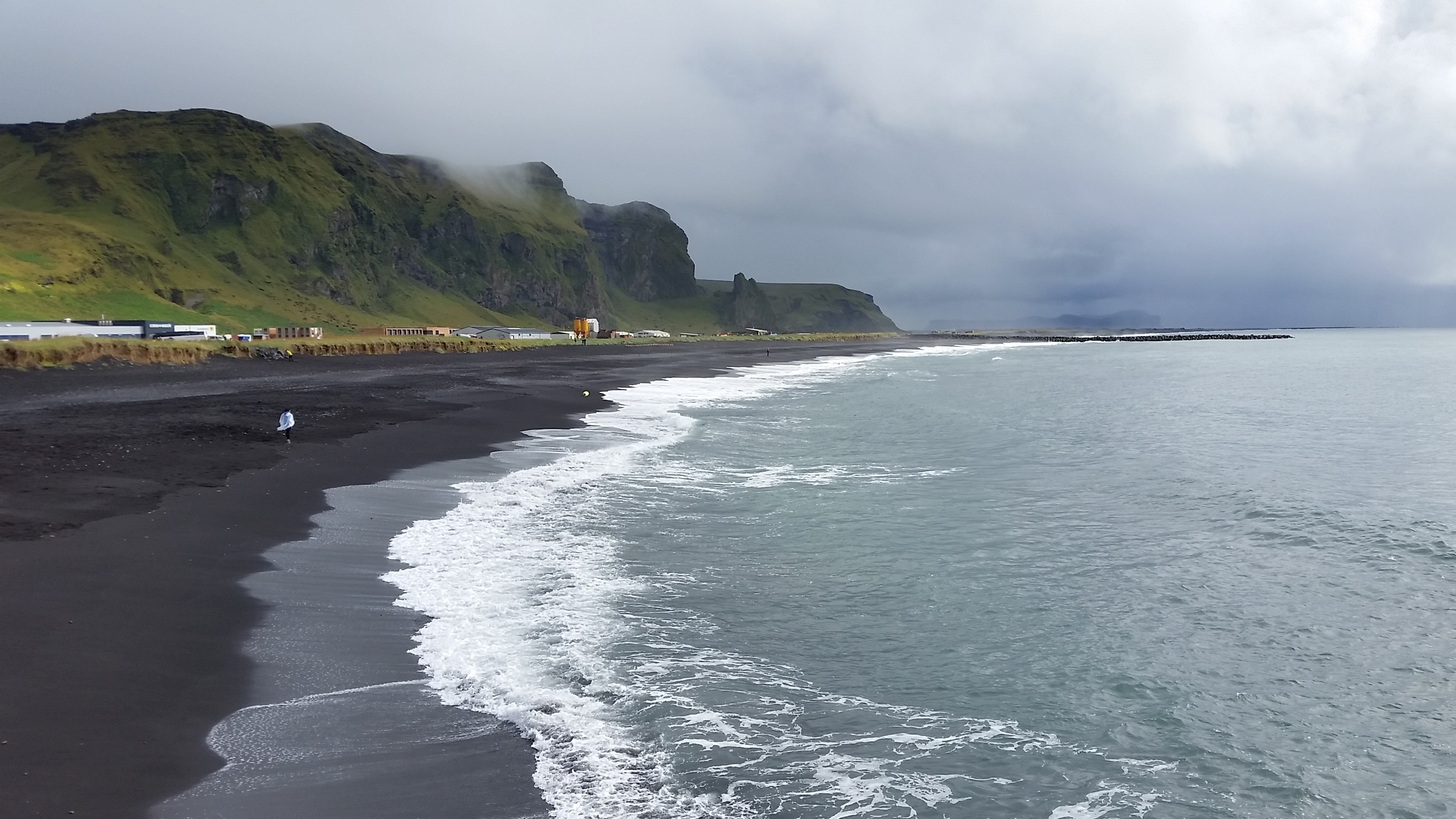
Vik coastline looking to the west of town.
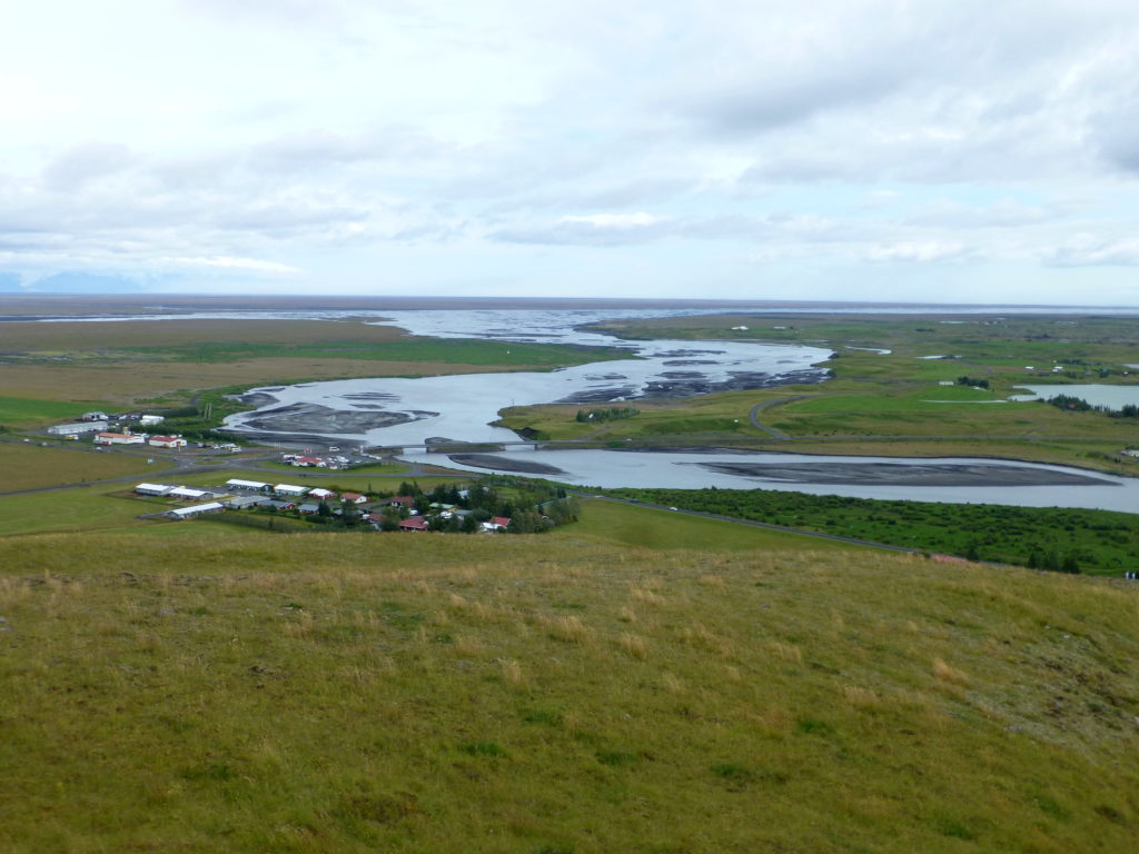
Hiking up on a coastal headland overlooking tiny Kirkjubaejarklaustur, we gazed out at this river to the sea.
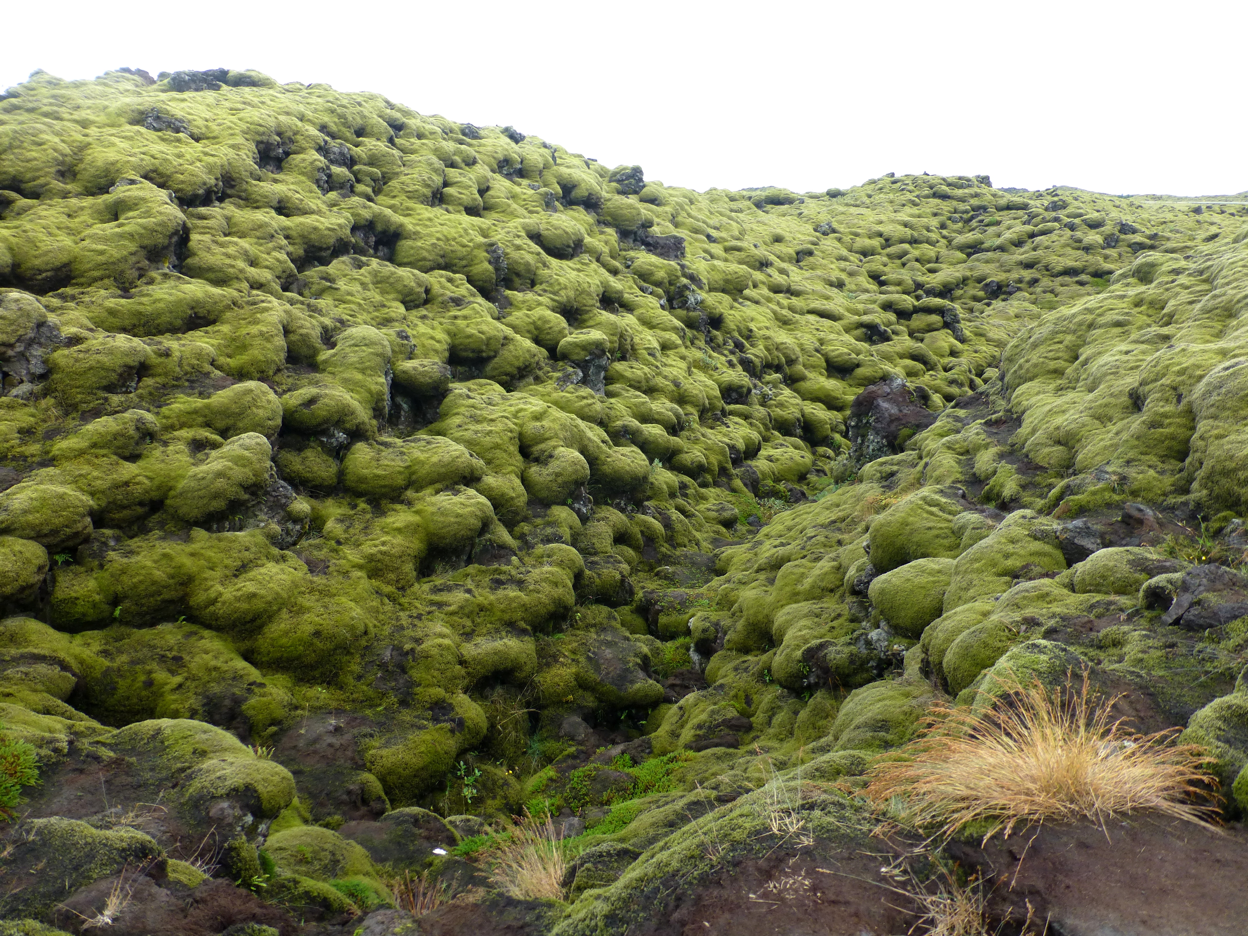
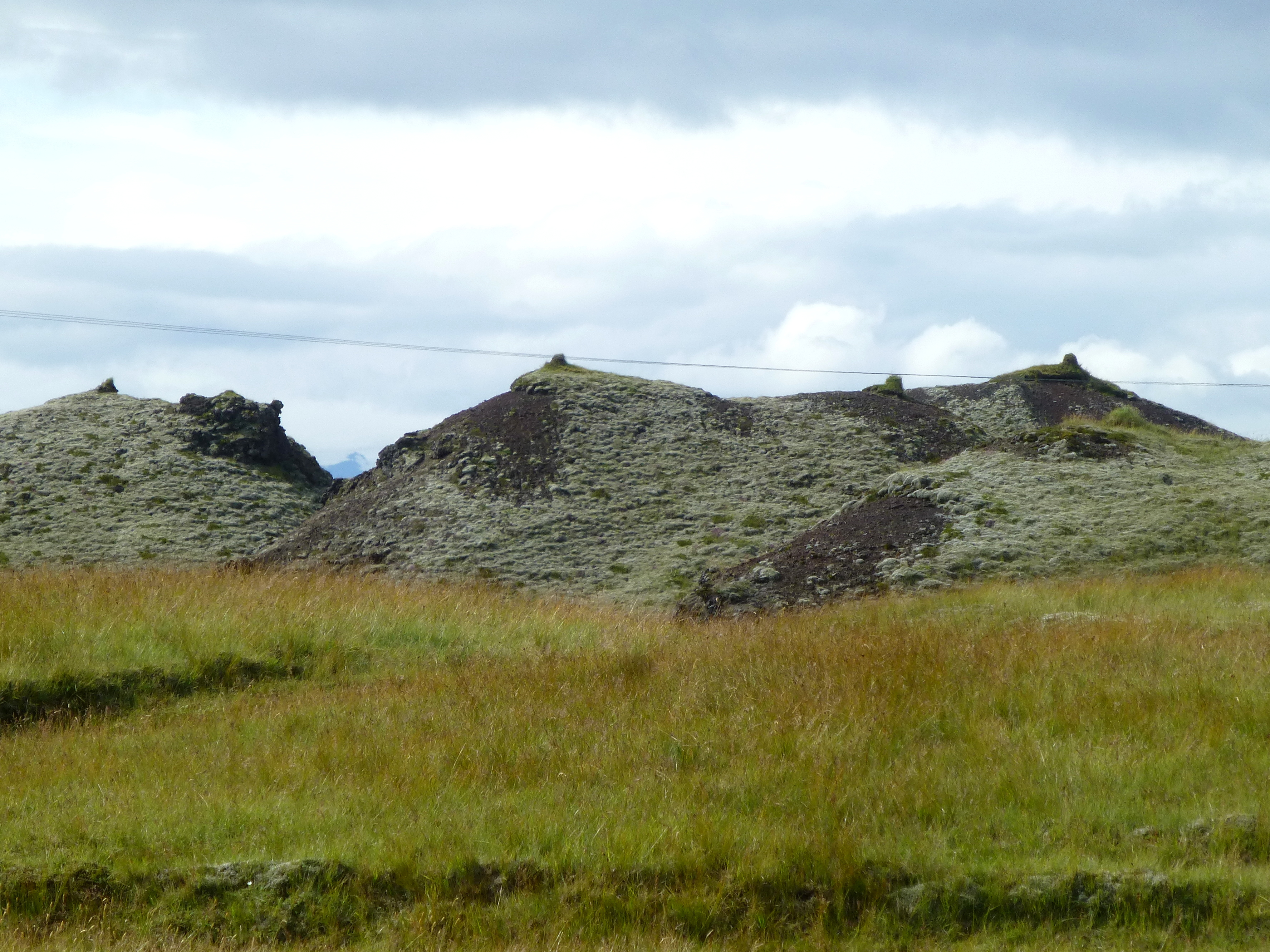
The mossiest of lava fields spread all around us for hours.
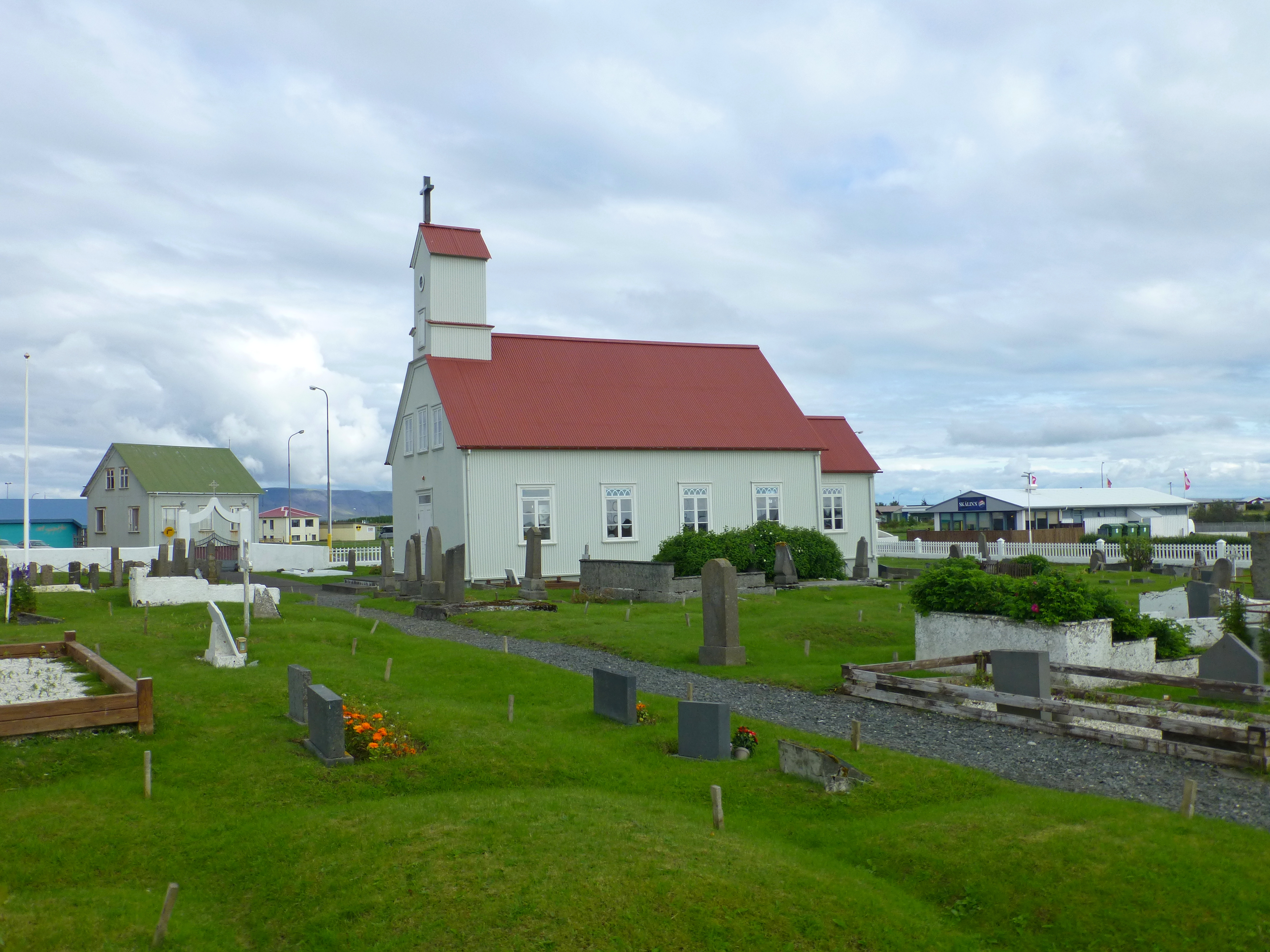
Church and graveyard at Stokkseyri, one of several peaceful fishing villages at the edge of Reykjanes peninsula, Iceland’s southwestern corner
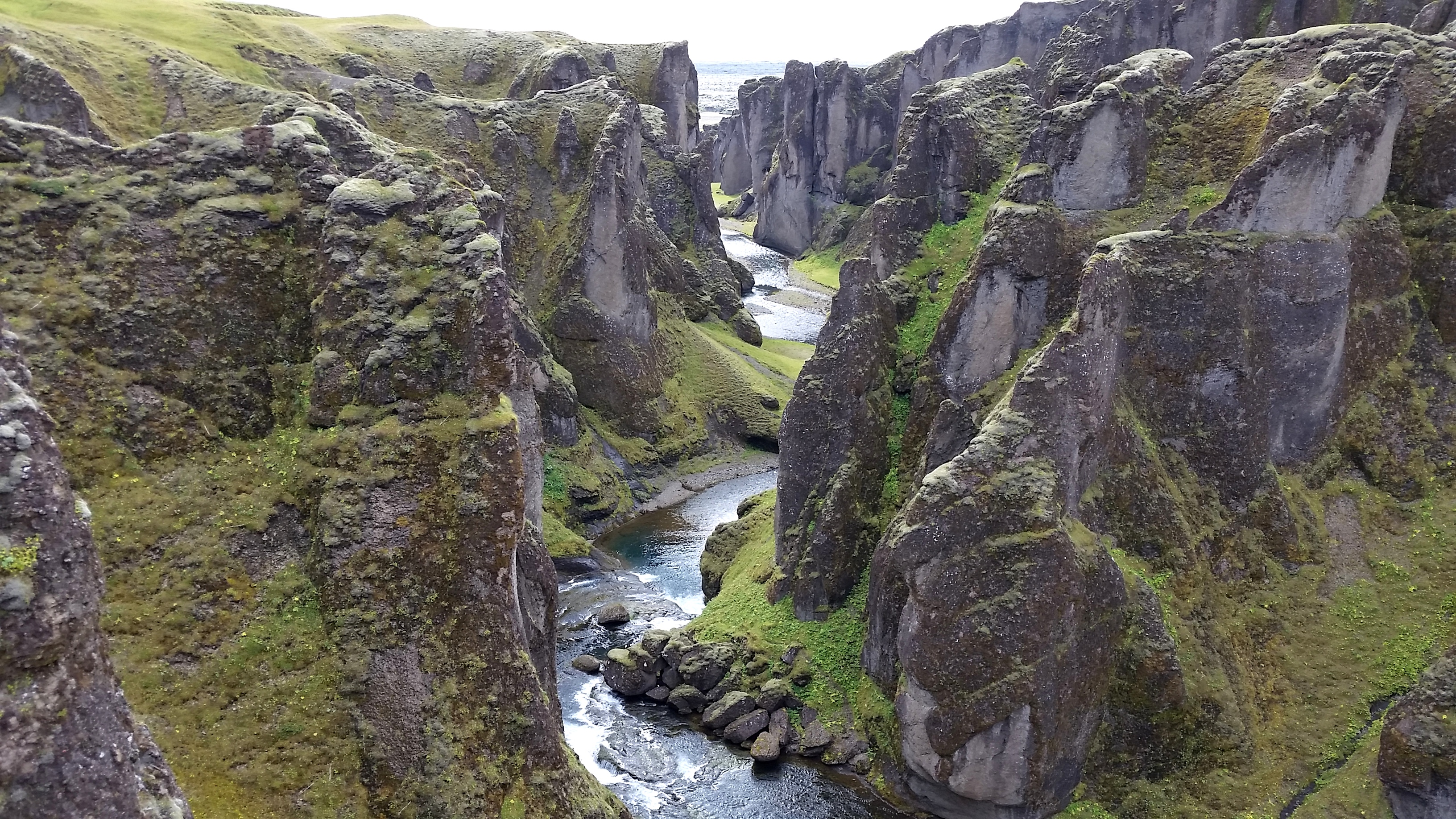
A hike along dizzying Fjadrargljufur canyon was short, but long on spectacular canyon views.
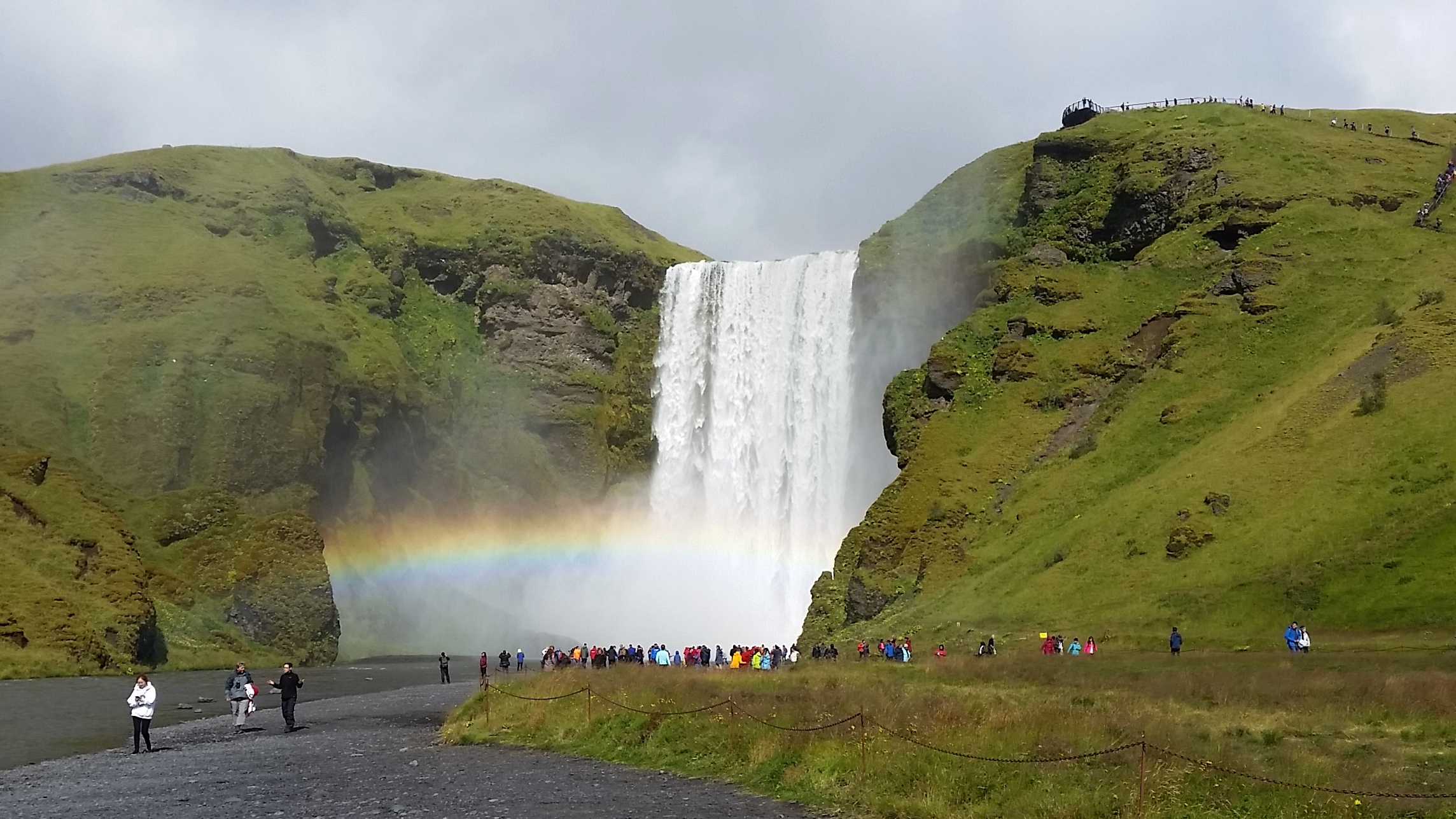
Our last and most colorful waterfall, Skogafoss. We arrived when it was a bit cloudy, and then enough sunlight cut through to help create this glorious rainbow from the falls’ waters.
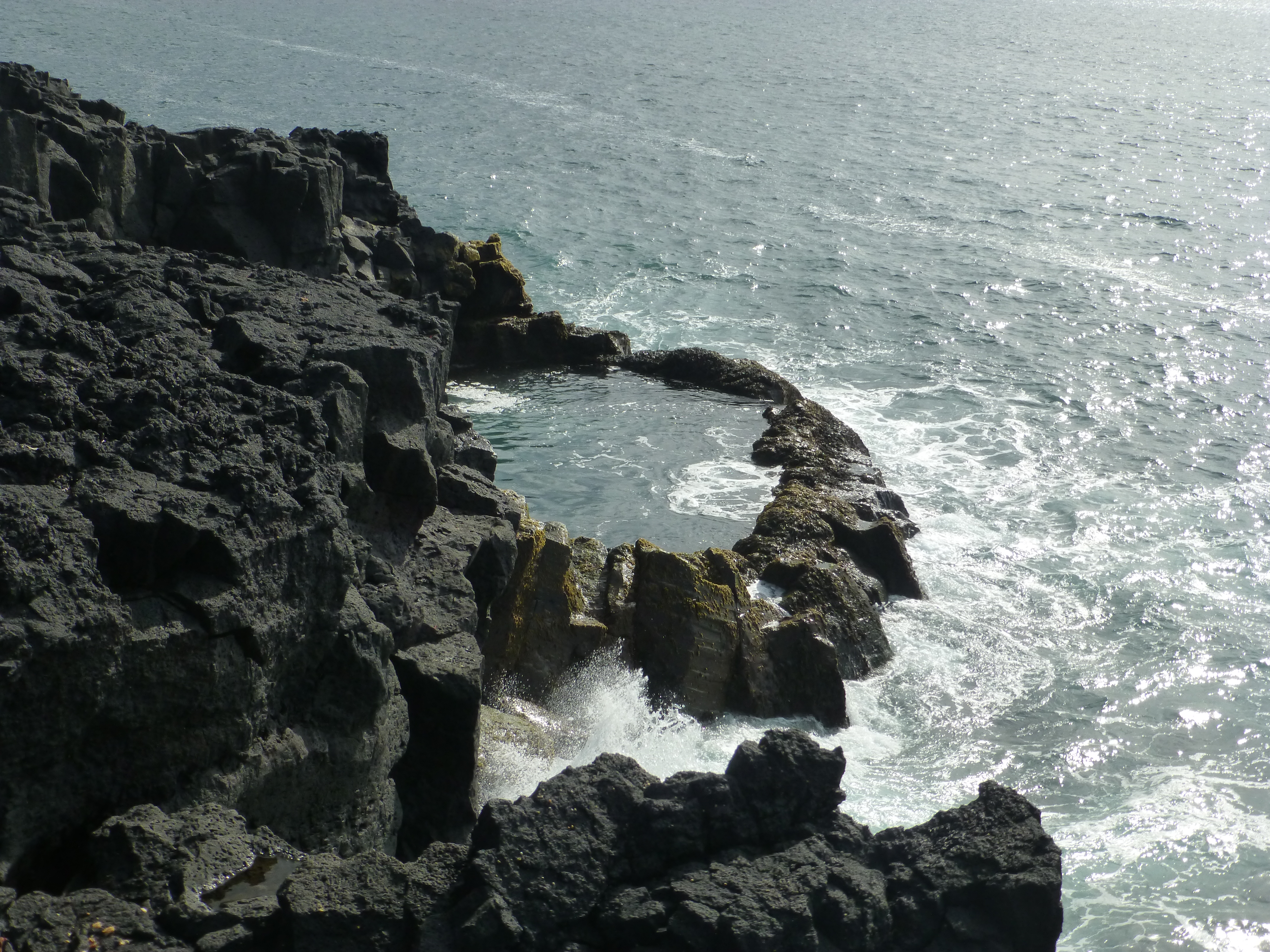
Oddny’s pool, Reykjanes Peninsula, one of the many naturally formed circles in the lava shoreline. Legends say that Oddny dawdled in this pool too long and was turned into one of the nearby rock formations.
Bridge between the continents, Reykjanes Peninsula, where Europe and America meet, tectonically at least.
(Also, for more pictures from Iceland, CLICK HERE to view the slideshow at the end of the itinerary page.)