We just finished our extended stay on the island of Santo Antão, the most northwestern of the 10 islands of Cabo Verde. To us, this is the most magnificent of the islands. The towns are just large enough to obtain what you need, but remain tranquil. The villages define picturesque, boasting the friendliest people and boldly painted facades alongside the coal-black lava cliffs. Black sand beaches are quiet and seductive, even when the surf’s up. And, to top it all off, we could drive and hike the most spectacular mountainous landscape.
Along the Sea
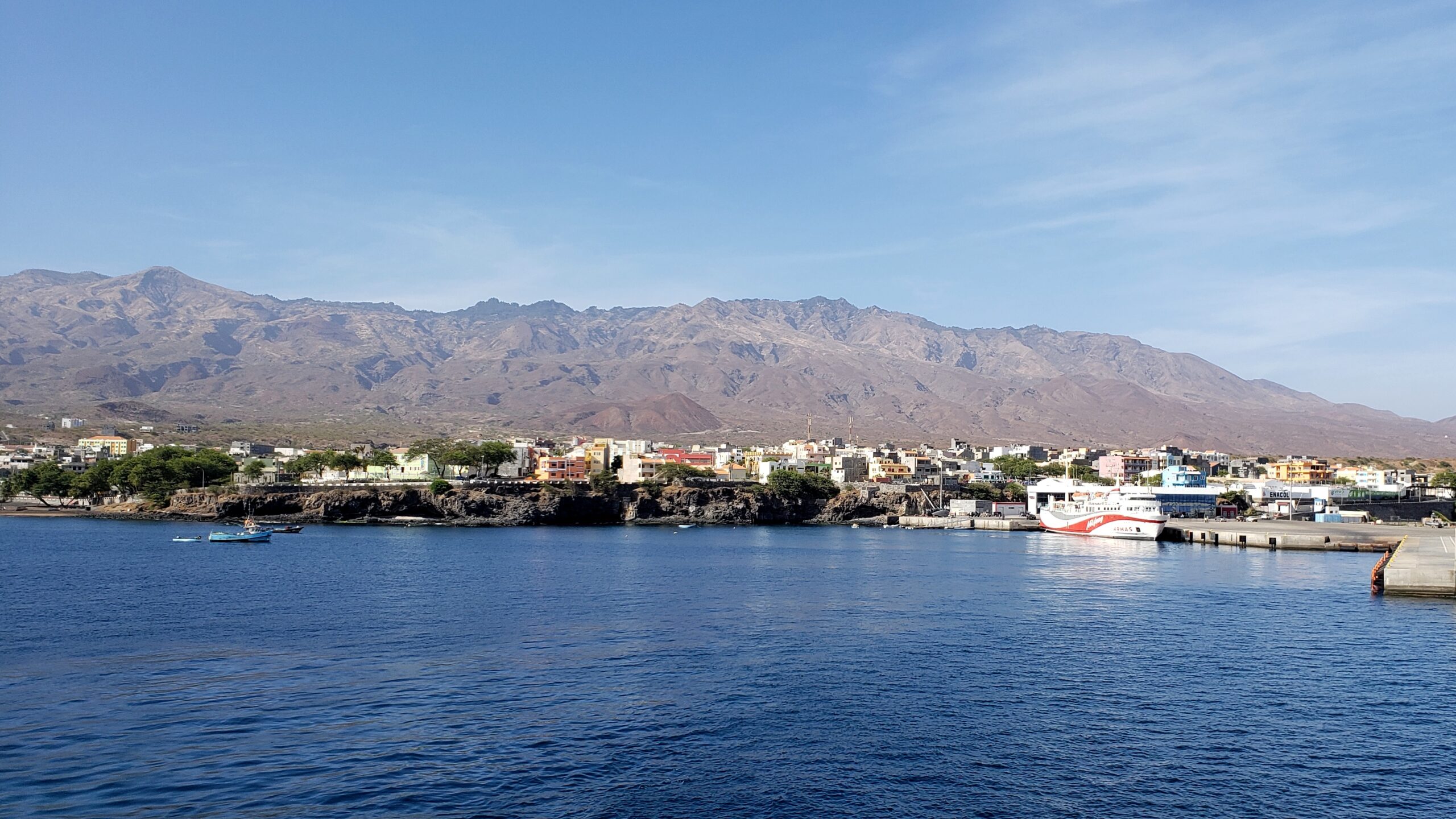
Porto Novo, as seen from our ferry to the neighboring island of São Vicente, is the largest town on the island – yet relaxed and quiet too. The mountain backdrop looks lovely, but gives no hint of the unique pleasure of its canyon terrain.
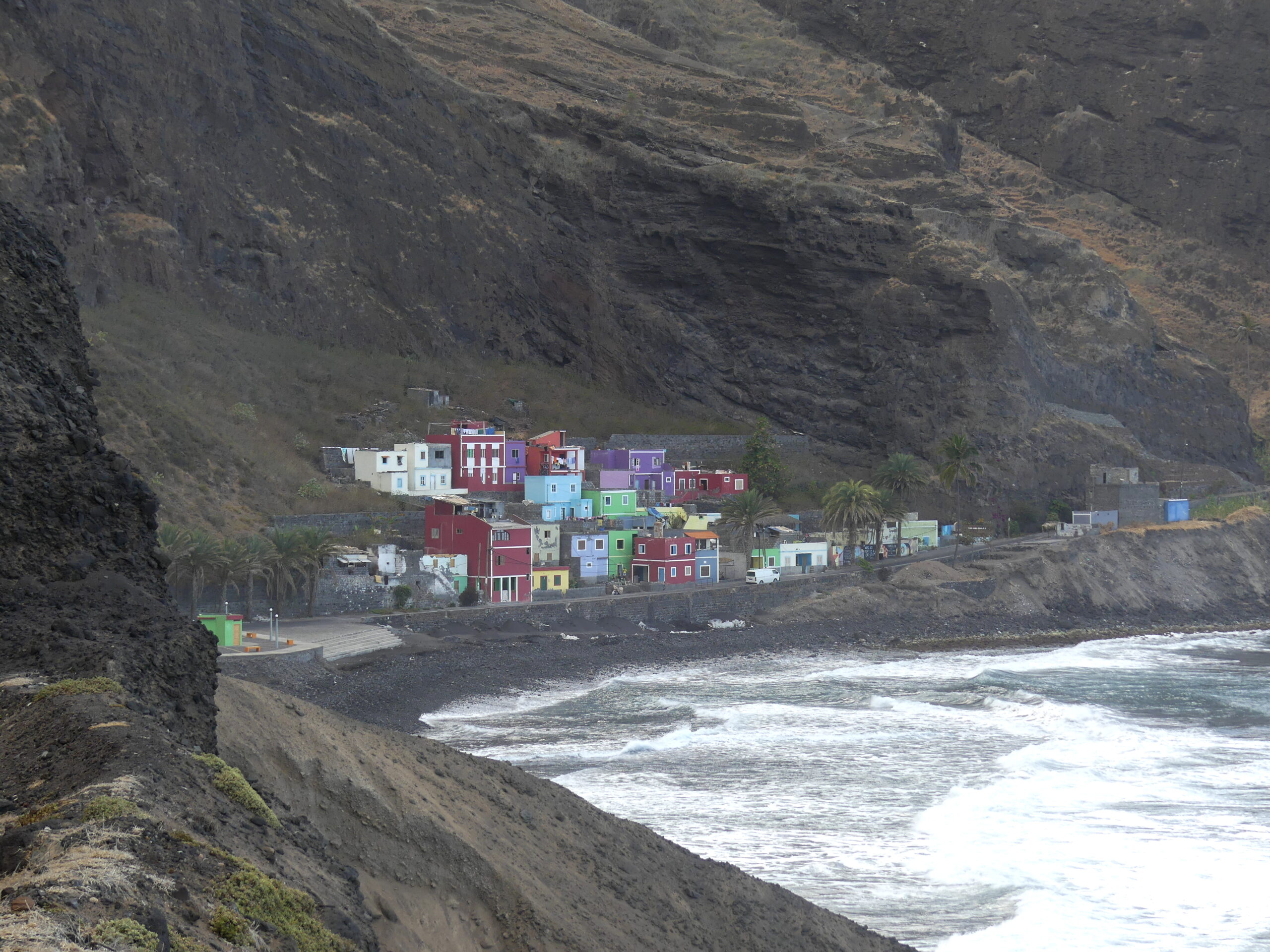
As one heads from the ferry at Porto Novo along the eastern coast of Santo Antão, the drive winds up and down the steep cliff-sides, with luscious views over the sea and, surprise, the most colorful towns ready to greet you around the bends. These are the splashy colors of Janela, which means window in Portuguese.
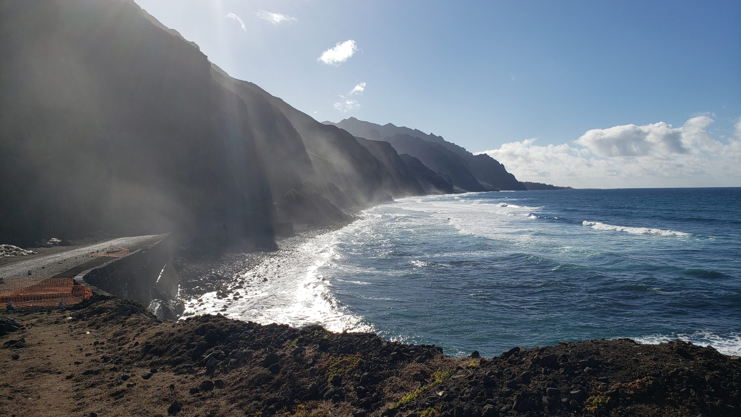
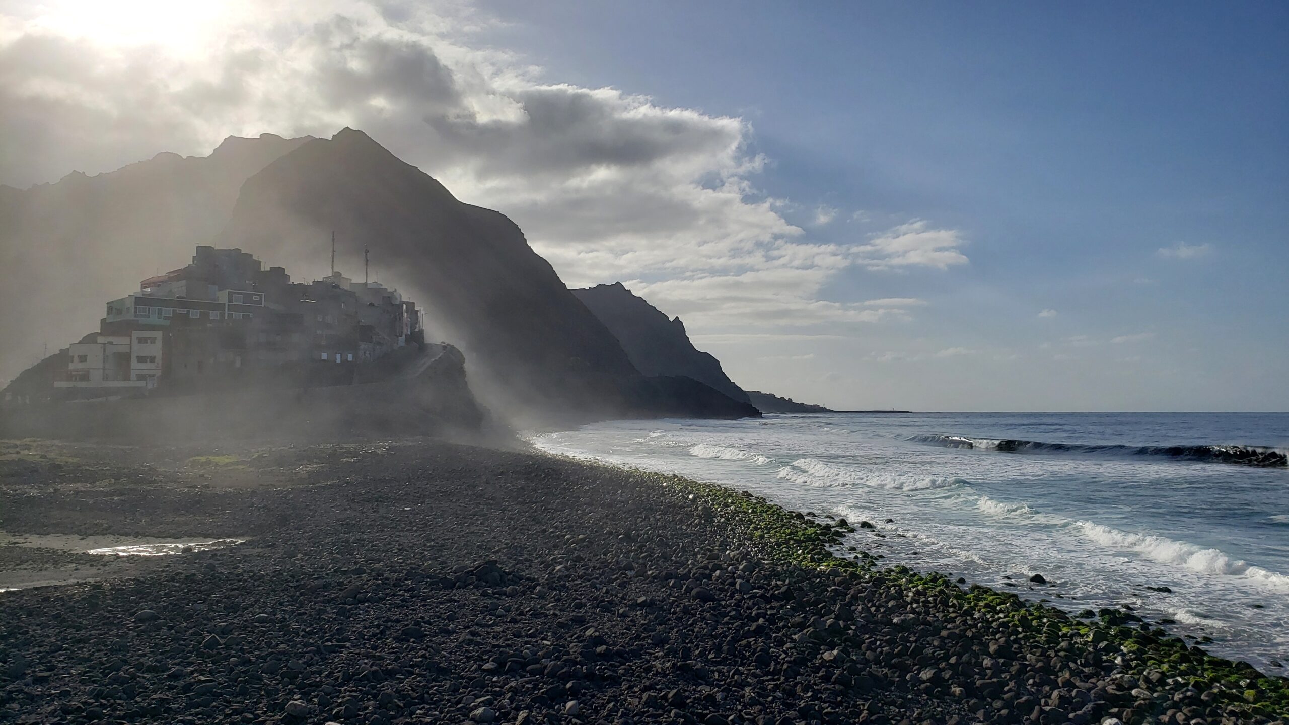
Often wind-whipped, waves beat against the basalt cliffs sweeping mist up the ridges.
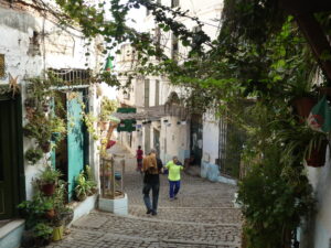
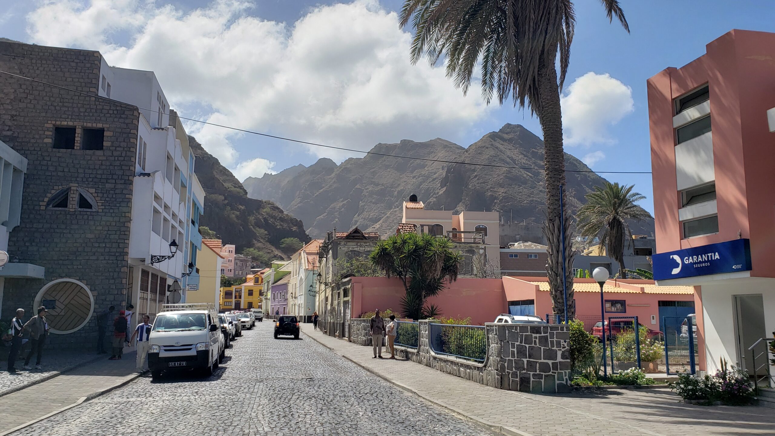
Ribeira Grande nestles gently on the northern shore of the island, our gateway to numerous hikes and drives up the mountains, plus a most pleasant place to stay and relax.
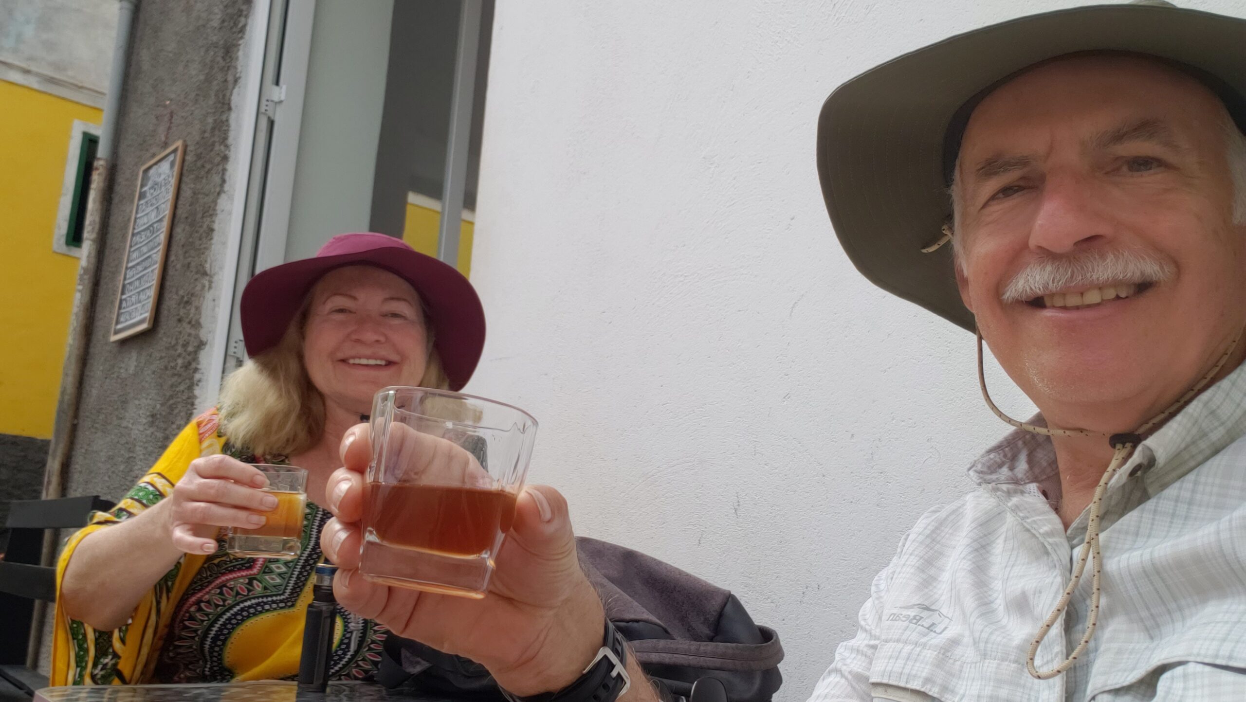
At an outdoor café in Ribeira Grande, we discussed with some residents the merits of the two local alcohols made from sugar cane: the vodka-like grogue and rum-like pontche. We didn’t mind trying a few.
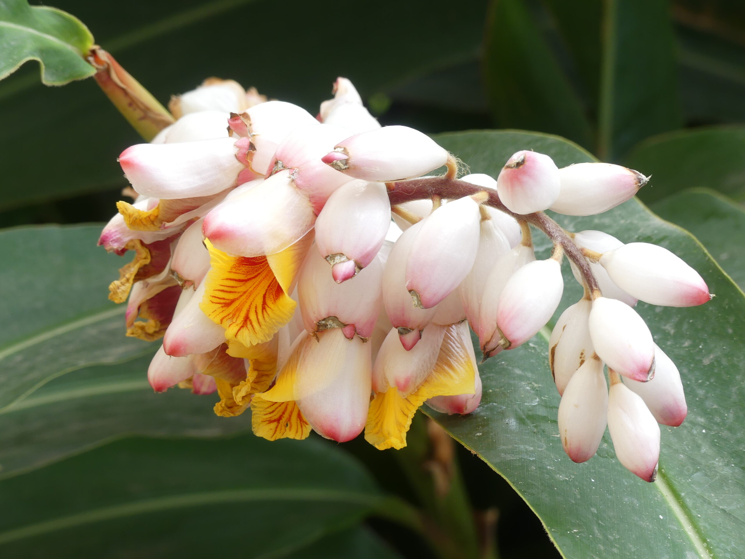
Our apartment sat within a cane field and garden, from which we enjoyed delicious just-picked papayas and bananas – as well as gorgeous flowers like these.
Late afternoon along the shore of Ribeira Grande, our village on Santo Antão island. That’s a part of the town perched up on the conical hill. The road leads to the last accessible town on the northeastern coast, nearby Ponta do Sol, which is famous for its sunsets, mainly because it looks westerly.
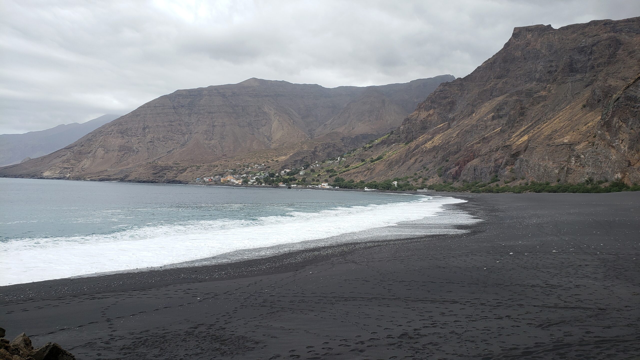
This was our destination after a long drive through the surprisingly diverse landscape of the mountain peaks and canyons. Once we crossed the firmest part of this striking black beach, the small fishing village of Tarrafal offered a welcoming café.
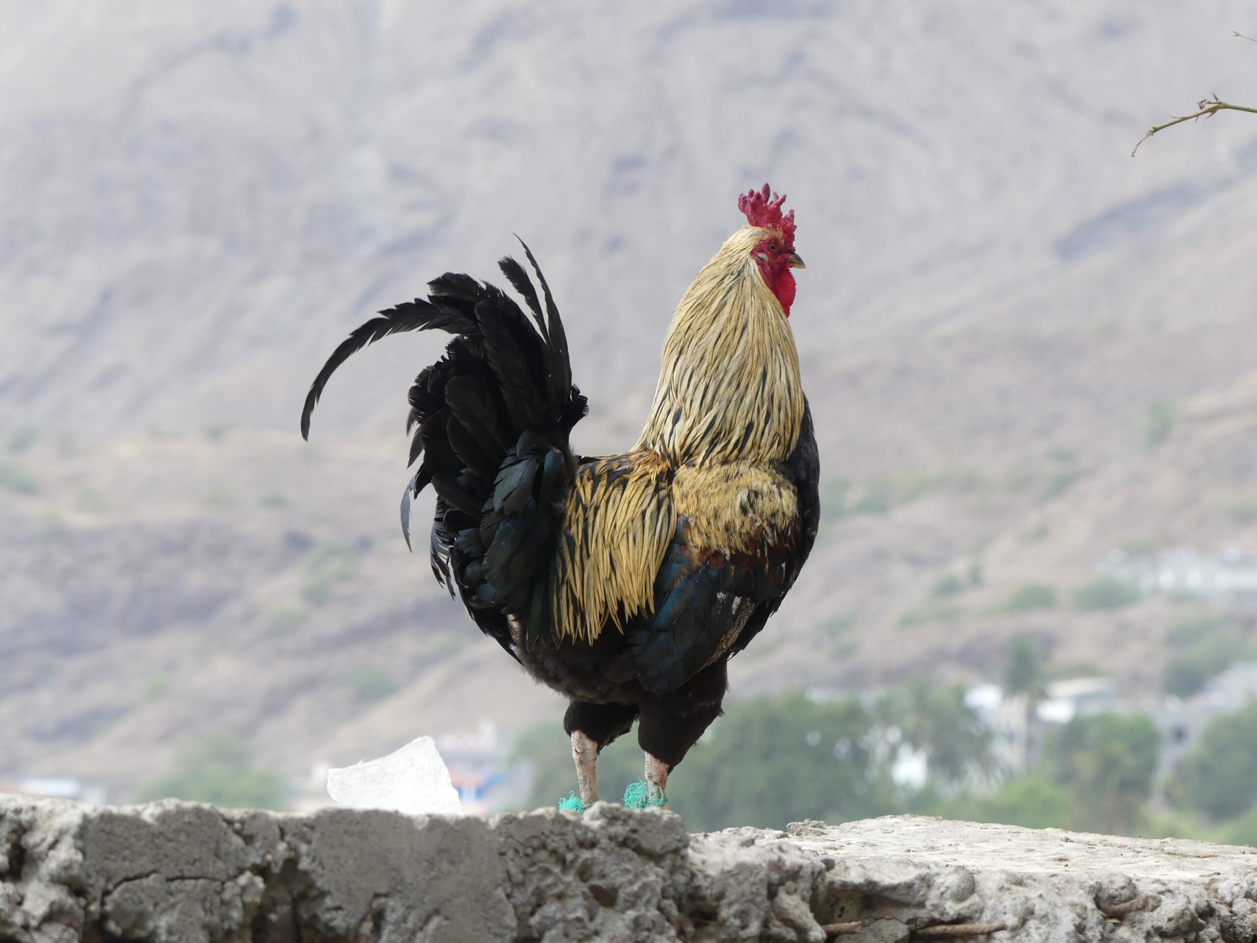
We saw some lovely wild birds during our stay, but this rooster greeting us at Tarrafal still got out attention. Or were we thinking of the symbol of Portugal, the cockerel? Roosters here generally make their presence known throughout the villages. The residents primarily fish as a livelihood, but many grow their own vegetables and fruits – and eggs.
At the tops
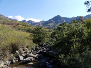
The shoreline was splendid, but the true grandeur of the island is revealed higher up in its incomparable mountain landscape. Or really three landscapes: deep ravines dividing high volcanic peaks, high plains, and nearly mile-high evergreen woods.
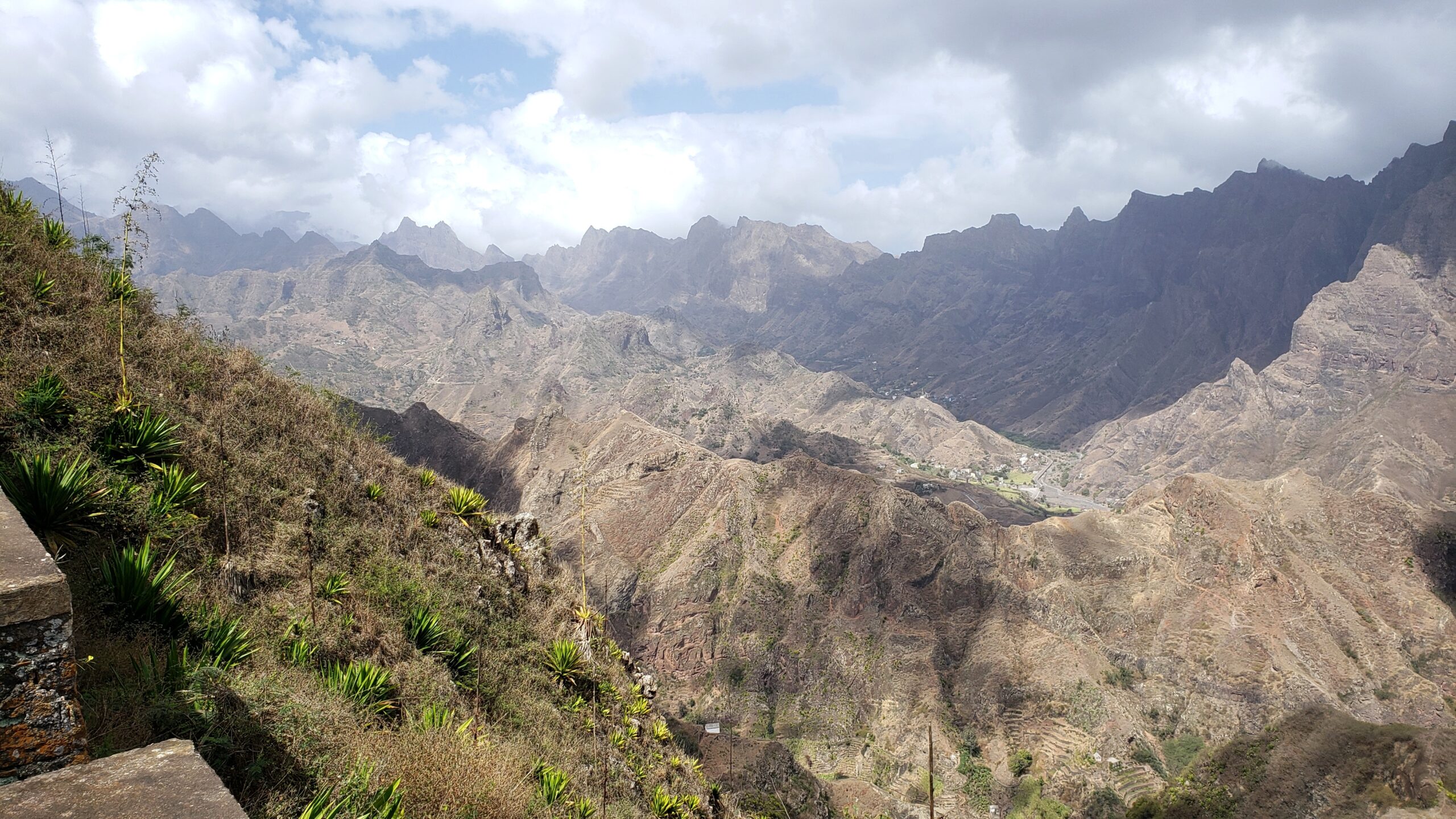
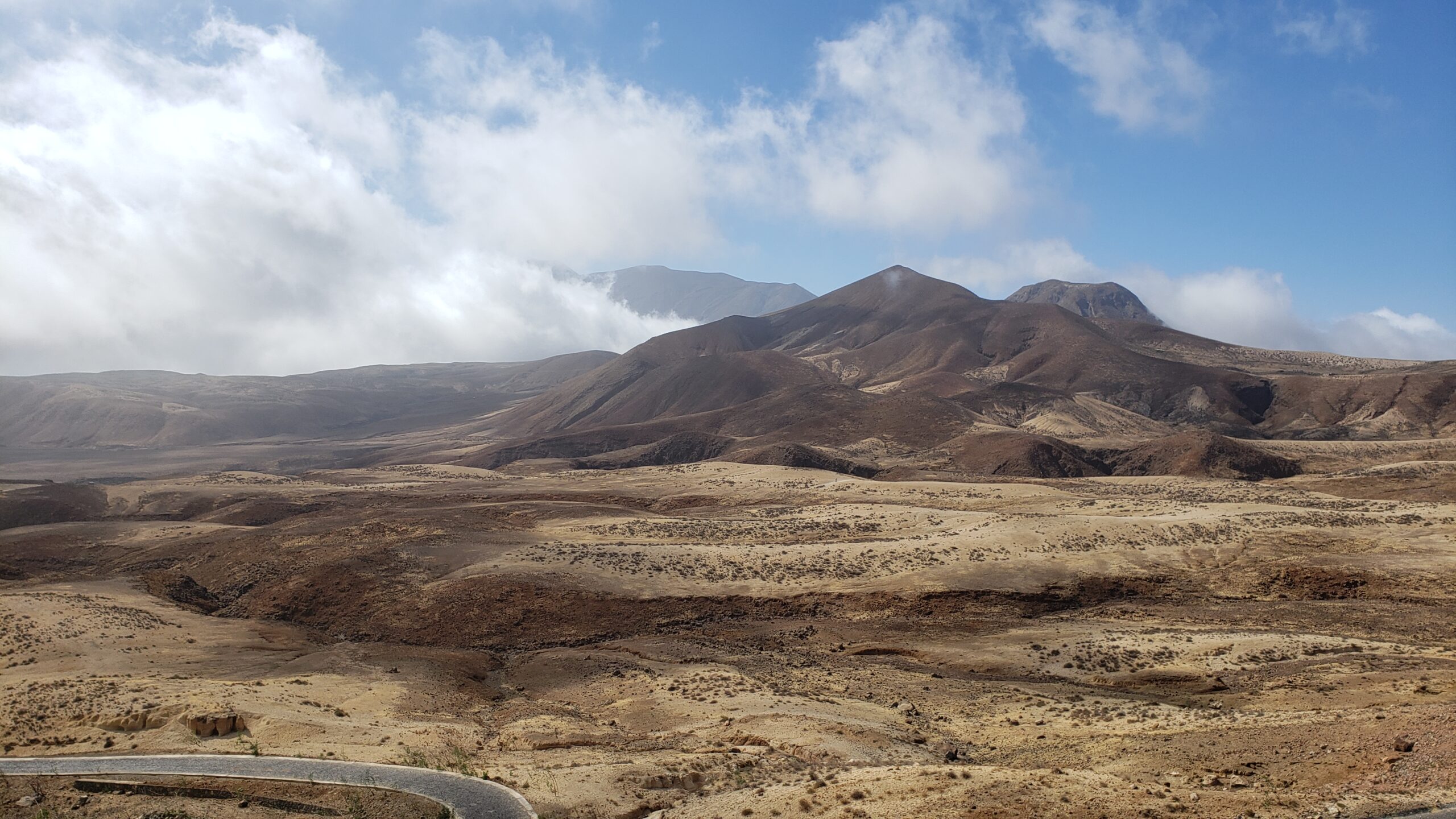
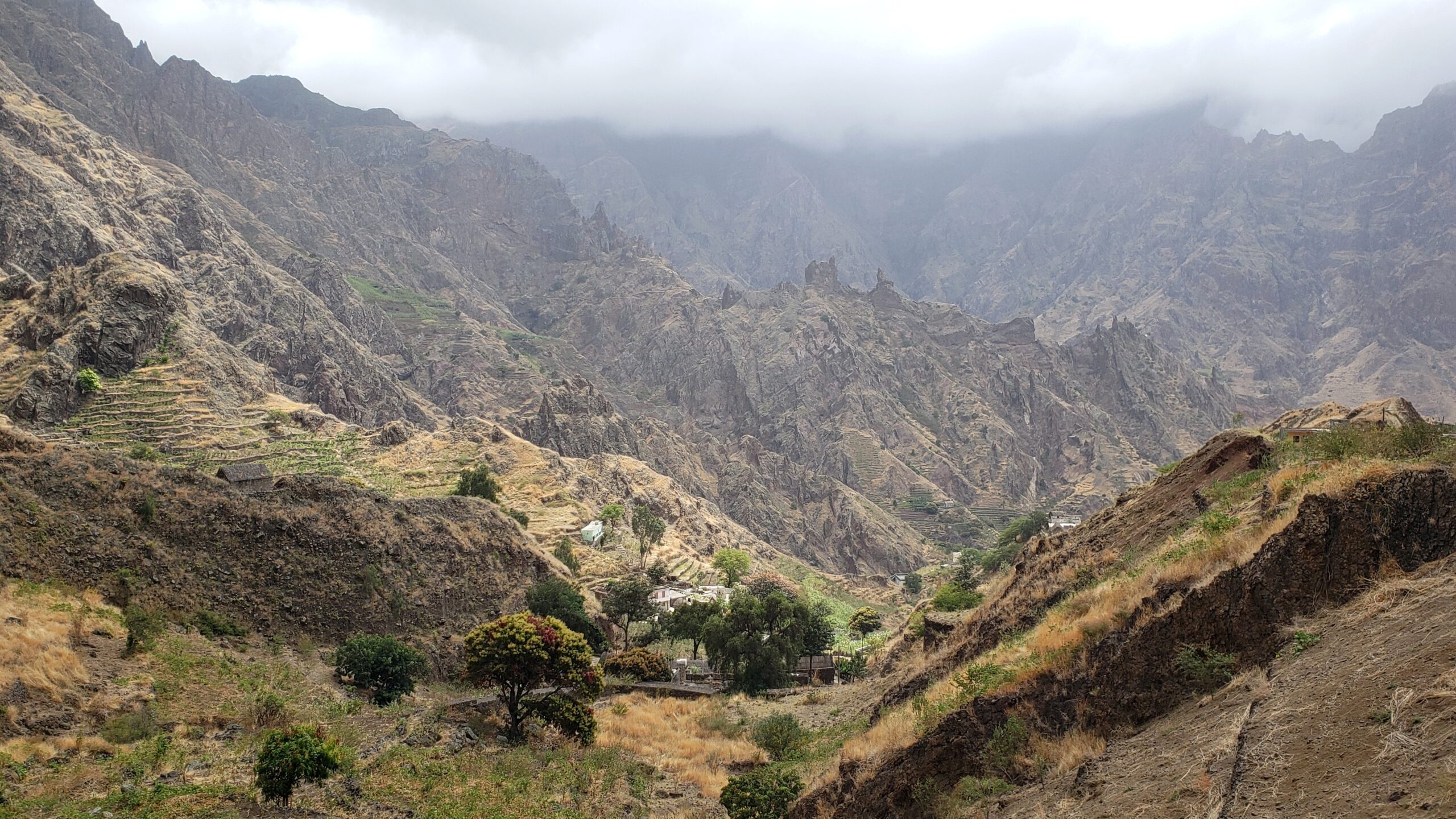
The highest peaks reach about 1600 meters (a mile high). The ragged ridge lines are often separated by dizzyingly steep canyons. At least five ridges are evident at this viewpoint. Whole towns and isolated farmhouses perch on what flat land there is.
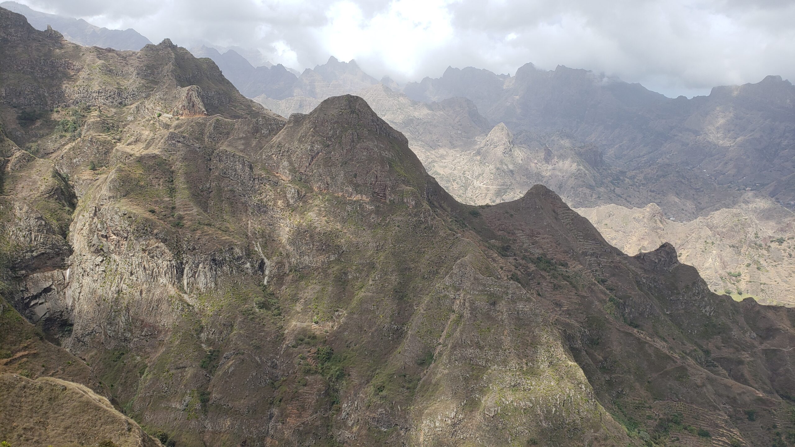
More ridgelines and ravines near the top of the island.
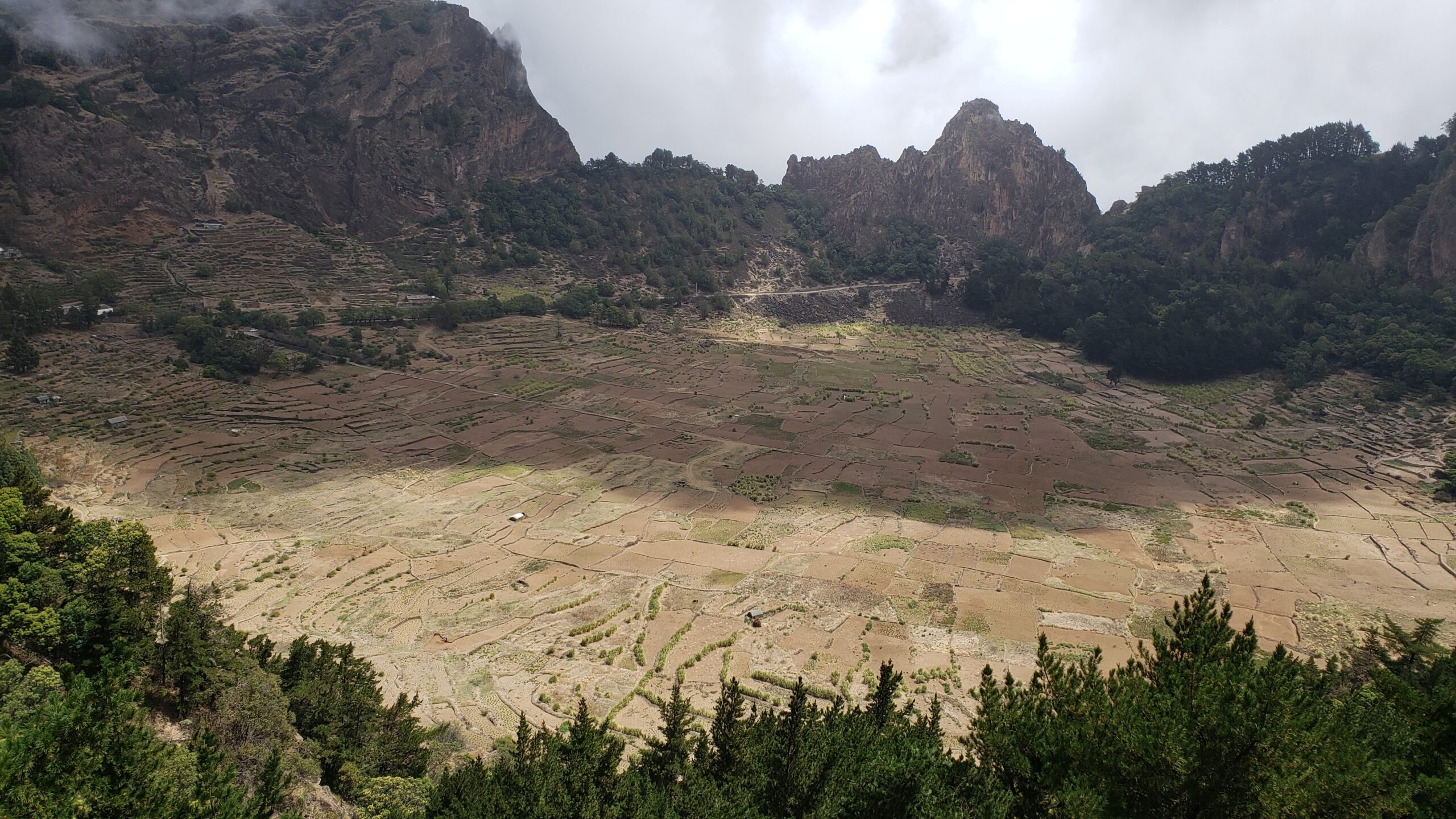
One of the most popular hikes is down from Cova, the volcanic crater in the midst of the island. This viewpoint at 4200 feet above sea level (1300 meters) looks over the fertile farmland of the crater hundreds of meters below.
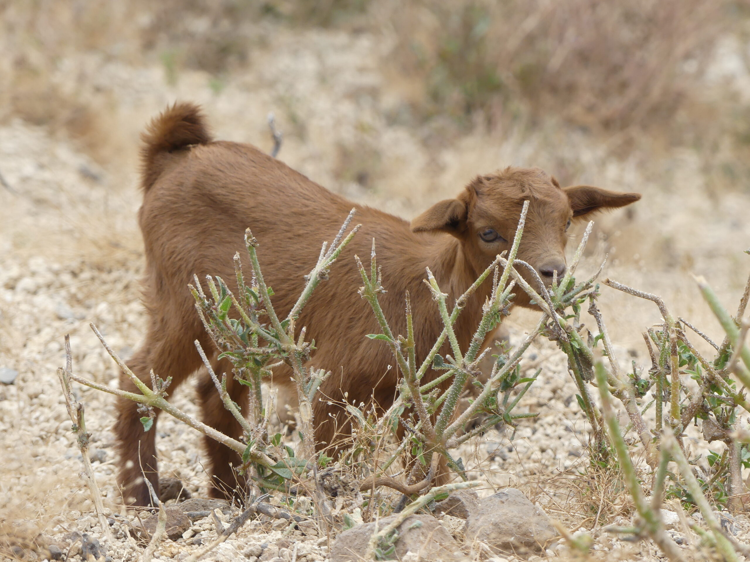
We were astonished to discover a broad altoplano, high plains grassland set against volcanic cones, sprawling before us after we descended a bit from the peak of the island.
This little fellow was grazing near the road over those high grassy plains. In the distance, its elders eyed us suspiciously for stopping near him.
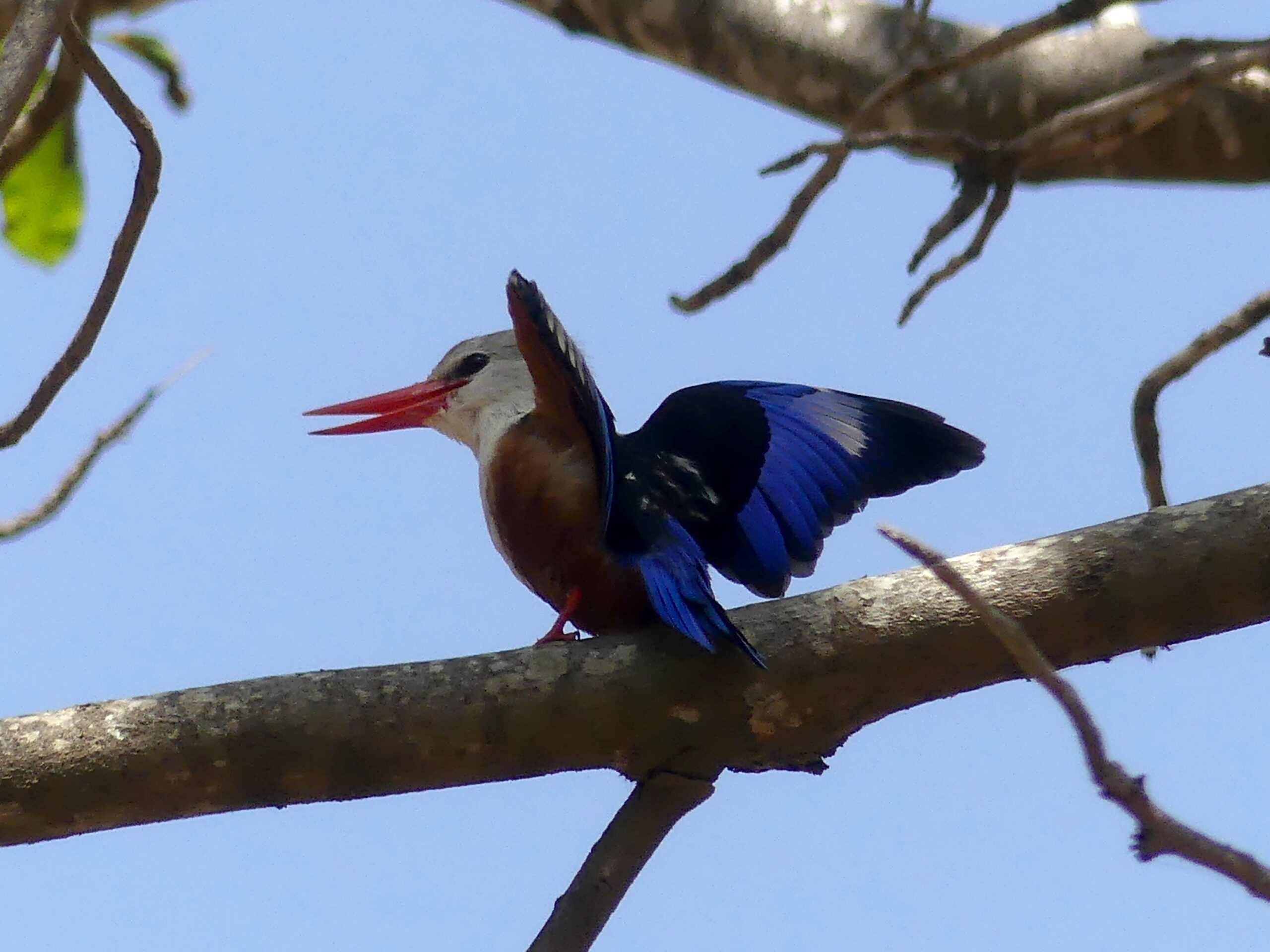
This lover of woodlands, the grey-headed kingfisher, does not rely on fish to eat…and finds Santo Antão’s mountains as appealing as we did.
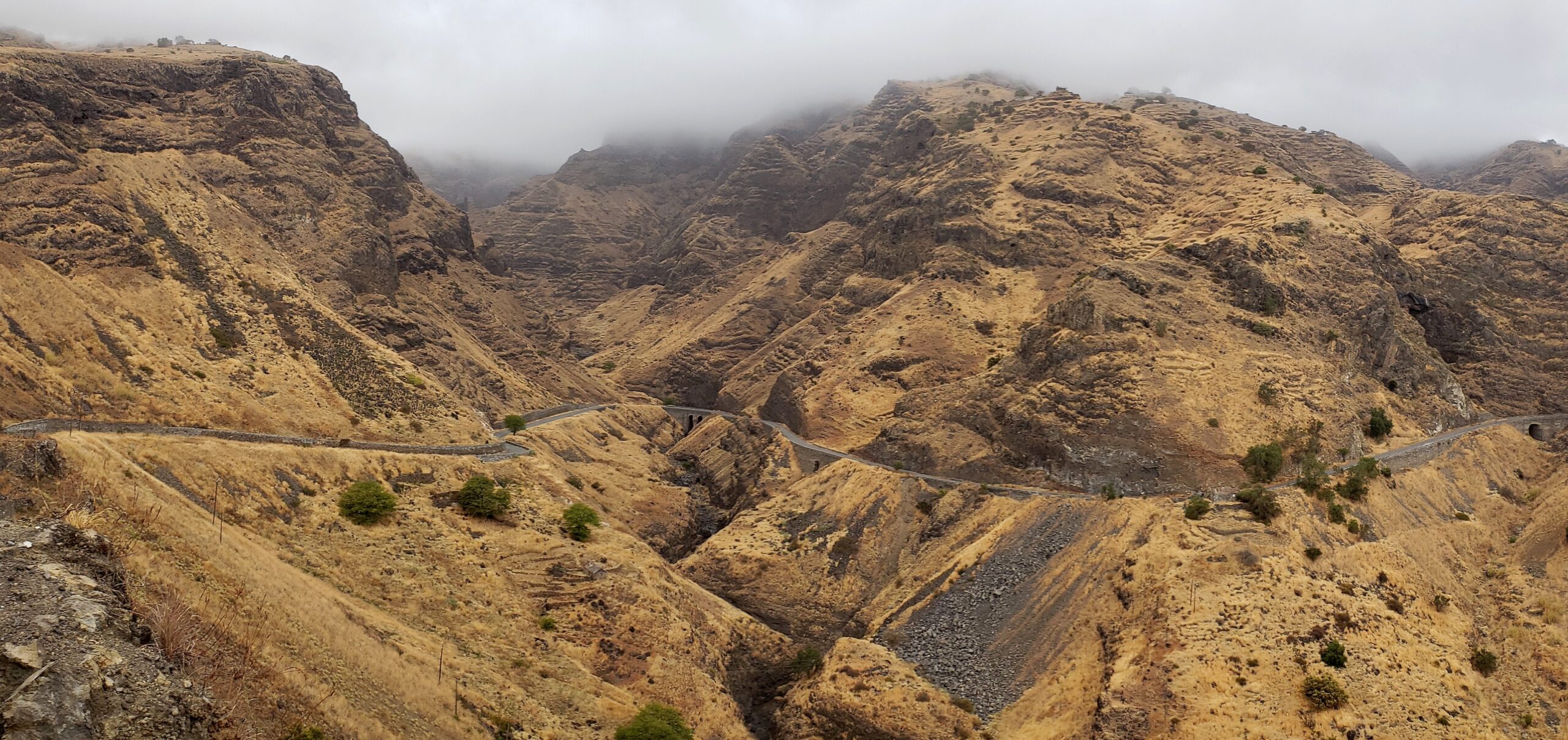
The clouds had gathered around the island as we returned from our drive up and over the island’s heights. As we turned through a pass, this vast green ravine opened up before us – and caught our breath. For a sense of scale, notice the tiny road going across.
The way to Cha da Igreja, a small coastal town with an 18th century church at its center. The road twists down from a high point of the island through terraced farms to the sea.
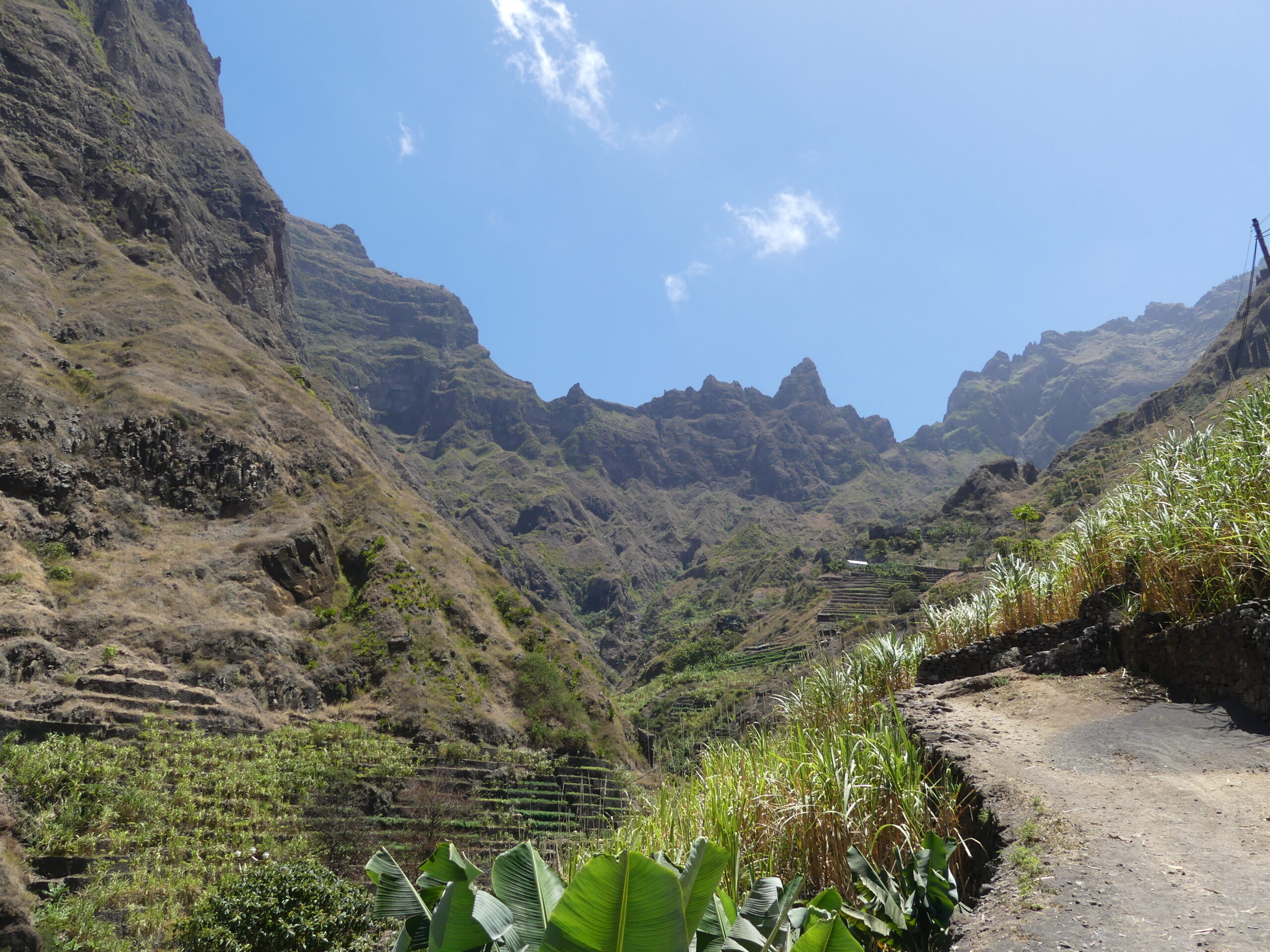
A view up the valley along our hike to Xoxo, a small village above our town of Ribeira Grande.
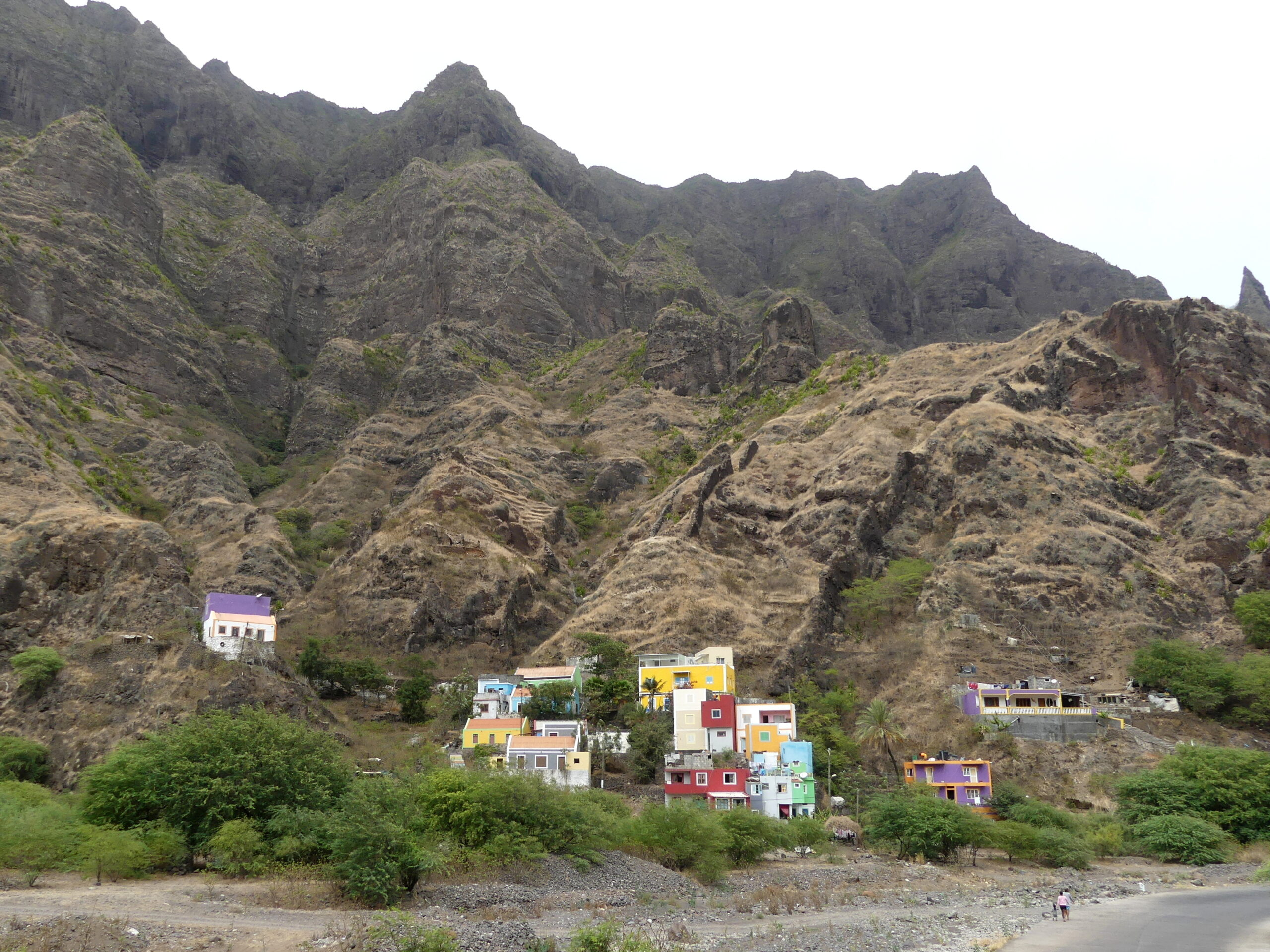
A colorful set of buildings up-valley from our town of Ribeira Grande stands boldly beneath those high peaks.
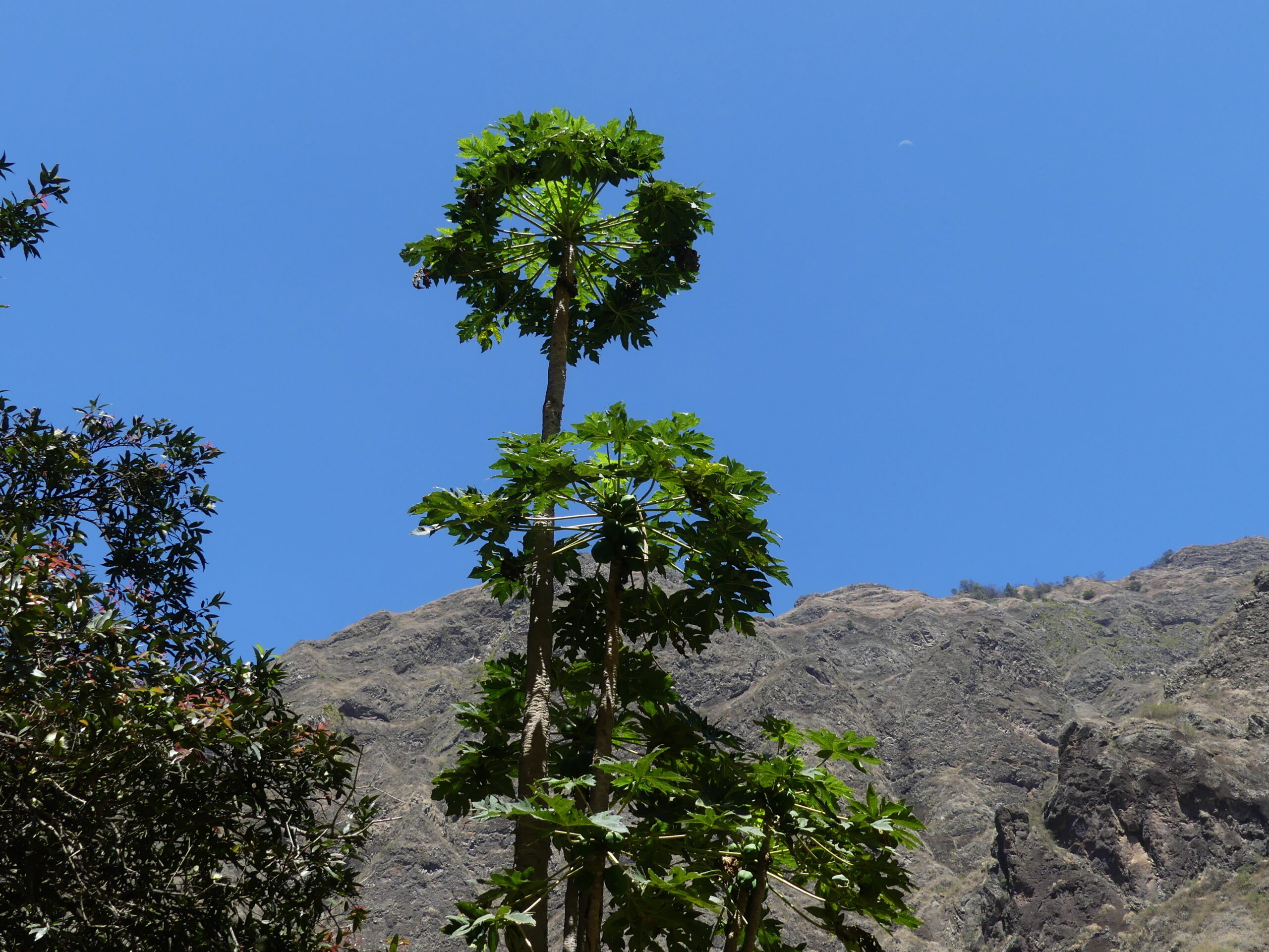
The famous landmark of Xoxo, where we hiked, is a lone vertical column of rock rising from within the small village. Near it, though, was this curiously geometric papaya plant reaching upwards as well, with a faintly visible moon to its upper right.
(To enlarge any picture above, click on it. Also, for more pictures from Cape Verde, CLICK HERE to view the slideshow at the end of the itinerary page.)