In brief: A look at three of the places within the mountain range of South Africa that curls 1100 kilometers from the north of the country to the southwest.
They’re called the Dragon Mountains – or Drakensberg Plateau – a high range of steep cliffs, cascading canyons and rocky ridge-lines strangely shaped by erosion from sandstone, limestone and volcanic basalt. The ridges, to us, seemed particularly draconic/dragon-like in character.
The mountain range curls 1100 kilometers all the way from the north of the country to the southwest. We followed a lot of it, but here are some of the highlights we enjoyed along the Drakensberg Escarpment.
Golden Gate
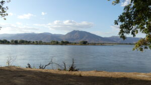
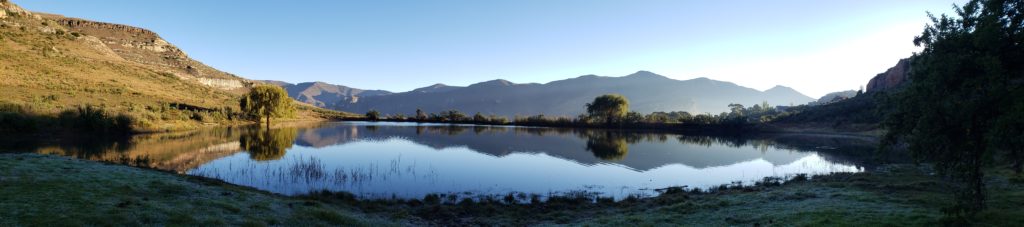
After our overnight flight to Johannesburg, we drove southward to the Free State province of South Africa. There in the Eastern Highlands we camped at the edge of Golden Gate National Park, where, in the crisp morning air, we emerged from our tent to delight in this panorama of lake and mountain.

We had not really decided on whether to do a lot of camping on the trip. But we figured we would just take the plunge and try it from the outset. The nights were cold for camping (only a few degrees C, about 40 F), but the days splendid and comfortable for enjoying the terrain (around 20 plus C, or 70 F). So we learned right away how to manage this good-sized tent as our home for most of the four months to follow.
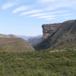
Golden Gate presents a thrilling landscape of sandstone cliffs, awash in yellows, ochres and reds. Most notable is the jutting golden gate cliff of Golden Gate park, at the edge of the valley leading to it. In the evening light, it is dazzlingly golden.
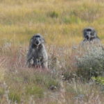
Herds of wildebeest and hartebeest, zebra and hairy Chakma baboons grazed on the grassy hills fronting the cliff formations. We noticed that their fur was much coarser, thicker than lowland baboons, as befits the colder conditions.
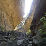
At Golden Gate we chose to climb to Echo Canyon, a vigorous climb up a ravine in the park.
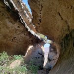
There within that natural wonder, with the light and color a spectacle in themselves, our voices bounced back to us repeatedly.
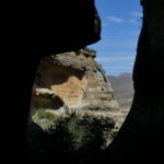
The Canyon gave us a keyhole view of Golden Gate park’s valley. And an arch in the sandstone rock face greeted us on our descent.

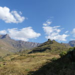
One other well-known and impressive feature of the park is Mushroom Rock, accessible by a ridge walk from the canyon, with layers of yellow and red topped by a decorative cap.
The Amphitheatre, Drakensberg North
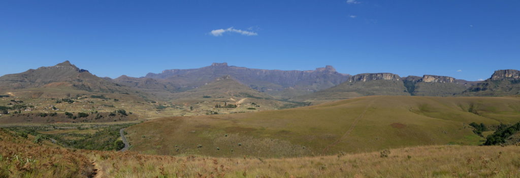
After Golden Gate, we continued south along the Drakensberg to the bowl called the Amphitheatre.
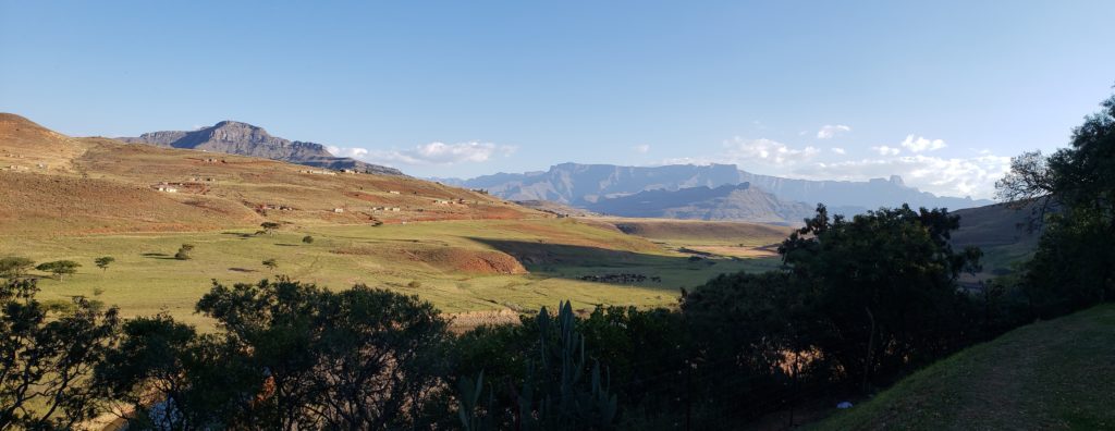
Across the farmed valley, we could view the Amphitheatre wall from our campsite.
Within the bowl, the whole amphitheatre stretched before us. The local village at the left was preparing a long day’s wedding celebration, with feasting and corn beer for all. We were told that the normal dowry from the male to the female’s family is 11 cows, with more for an especially beautiful or intelligent woman and less for one previously married (!).
The grasslands at the foothills of the Amphitheatre
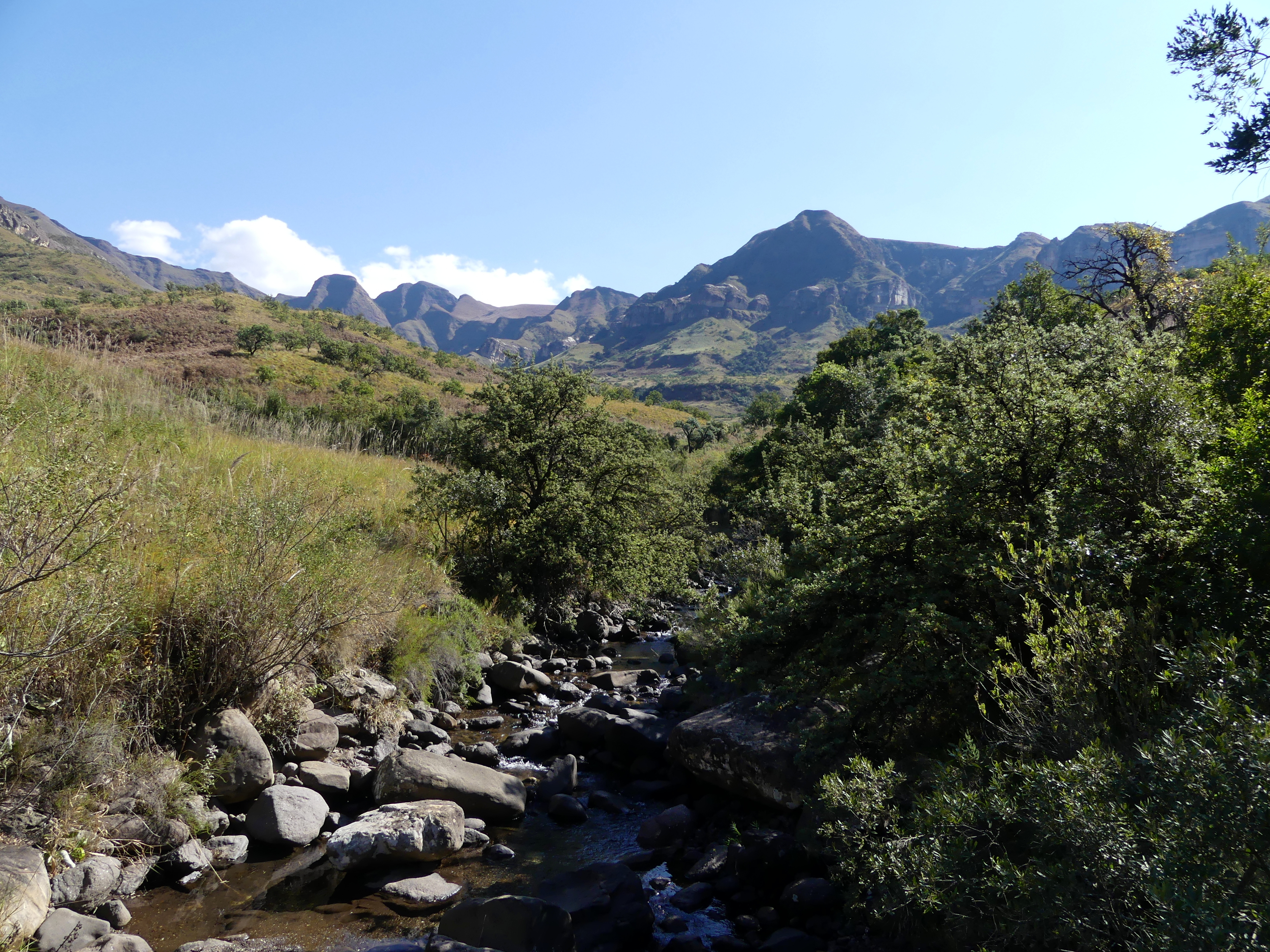
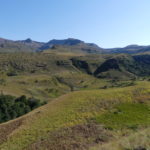
The amphitheatre from along the hike. In the rainy season, five major waterfalls drop from the highland area on top, though innumerable canyons drop off the plateau. At the top is the highland nation of Lesotho which continues for about 200 kilometers at altitudes around 3000 meters (10,000 feet).
Along our hike up one canyon of the amphitheatre
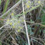
Star-burst flowers along the trail of our hike
Hidden among these hills lies an extensive artistic record by the nomadic San people, who used to be known popularly as bushmen, covers cave walls here – with paints made from rock, blood, egg and other materials.
Though these antelopes painted by the San are only about 800 years old, their people roamed this area for over 20,000 years. In the southern region of Africa, rock art by their ancestors dates back 70,000 years, the oldest yet found in the world.
Deeper thoughts at Blyde River
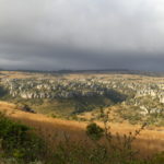
Our final stop on the long Drakensberg Escarpment of South Africa was Blyde River Canyon Nature Reserve far to the north. Here two rivers – Blyde the happy and Treuer the sad – come together.

The river names come from a tale of the voertrekkers, the early Dutch settlers who moved here from the Capetown area. Once settled here for the waters, the men disappeared across one river searching for their cattle and did not return. That was called the sad river, Treuer. When they finally returned, they crossed the other river. They noted the happy occasion by naming the second river Blyde (or happy in Afrikaans, as in the English word blithe).
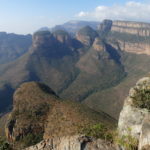
The rivers have carved out of the red sandstone a natural wonder, one of the largest canyons, perhaps the largest green canyon, in the world – some 30 kilometers long and 750 meters deep on average (2500 feet). High above the canyon and down into it, we did a giddy three hour hike with incomparable vistas of river bends, lake and colorful cliffs.
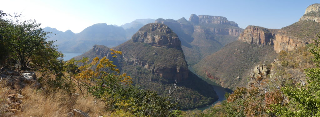
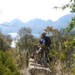
Our view on the Blyde River canyon from the hike, where the river bends around to reach the lake and the Three Rondavels peek out from the back.
The Three Rondavels crown the deepest part of the canyon. These are naturally formed round mountains with conical tops, named for the indigenous’ huts they resemble. This viewpoint is ideal for photographing the rondavels, especially in a selfie, but it is overrun with tourists, so hardly the place for relishing the natural wonder. Our hike across the river, all to ourselves with a slightly more distant perspective on the three, gave us much more pleasure.
Barry soaks up the rays while savoring the lake and blue hills of the canyon.
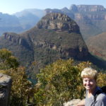
Nancy perches above the sandstone mountain that defines a looping river bend. It was a challenge to avoid taking more photos and selfies, what with the vistas alongside of us.
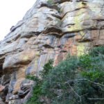
The cliffs around us were a rainbow of yellows and oranges and the greens of algae. Here plants and waterflow added more color to the mix.
To the east of the main canyon, the cliff rock seems chopped into blocks and then lined up for drying on ridge tops – gorgeous in the evening light, even with a storm threatening beyond.
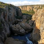
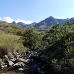
Near the main canyon we visited Bourke’s Potholes, an unfortunate name for an engaging array of pools and rippling dropoffs leading to a falls at the confluence of the Blyde and the Treuer.
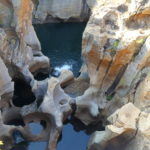
There the water has shaped 20 meter deep crevasses, adorned with beautifully scalloped funnels.
(Also, for more pictures from South Africa, CLICK HERE to view the slideshow at the end of the itinerary page.)