


We know it; we’re suckers for a room with a view. Especially in Tasmania, we mean not just any view, but a view overlooking the ocean, or a crescent bay, or a tide-washed beach. And not just out the window, but sitting on a deck munching on cheese, fruit, veggies, dip, and sipping red and white grape products.
We can be notoriously parsimonious when we spend only a little time in an overnight hotel, but give us a few days so that we can spend some quality hours and we’ll scrape up the extra pennies from the floor of the car for that deck facing the bay.

So it was at Eaglehawk Neck, where we could sit on our deck and gaze at arcing Pirate Cove and the scrawny land bridge that connects the Tasman Peninsula to the mainland of Tasmania.

And again at Swansea, where the horizon was filled with the white sandy band of Nine Mile Beach, across the white-capped turquoise waters of Great Oyster Bay and topped by the hills of Freycinet Peninsula.

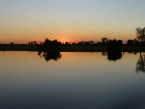
Or at Stanley, a cozy little town on the northwestern Tasmanian coast nestled against a volcanic mound called the “Nut” at the end of its own peninsula, where the sun set before us over the frothy, wind-whipped bay.
It’s not like we didn’t see plenty of coastline when touring around.
When not lounging at Eaglehawk Neck, we could admire the rugged sandstone and dolerite cliffs and hollows, all formed from wind and wave action, each of which seemed to be named for maximum enticement.

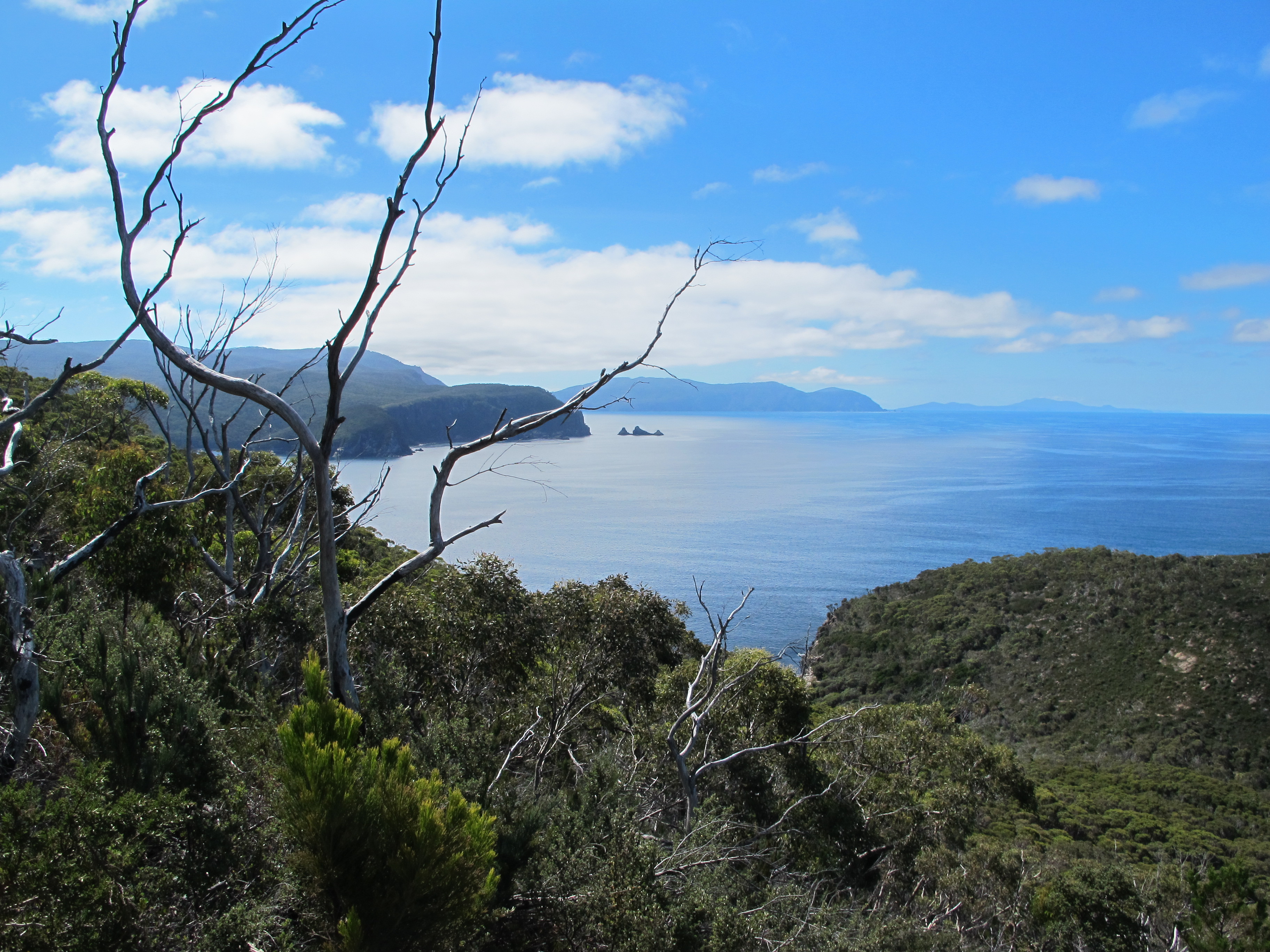
Just south, on the Tasman Peninsula, we could see the splintered multi-colored cliff faces of Tasman National Park, with relatively placid waves still frothing at their base as if awaiting their chance to swallow another piece of rock.

Or make a new arch, like one nearby, for the triumphal waters to enter. A short way off the sea pushed into a deep cleft colorfully named Devil’s Kitchen and we heard the booming of waves squeezed through a gap in the coastal rock and slapped against a welcoming wall, while a daunty, bobbing cormorant feasted on the fish drawn into it as well.

Close to our hotel overlook, a naturally formed rock formation called the tesselated pavement seemed, in one section, as if a giant had scored a grid pattern into the flat surface of the rock.

In another section, they appeared to be formed bricks, remnants of foundations of ancient ruins.
These features were right off the road, but it took more work to see other grand coastal sights. We hiked for three hours beside elongated Fortescue Bay out to the tip of Cape Hauy peninsula.

The somewhat unhelpful trail map failed to indicate that an hour of the trip in each direction passed through dry, repetitive bush far from the coast.

The only challenge on the typically manicured trails crafted by the forest service were the 1000 steps of sandstone and shale they fashioned for the hillside climbs. But the spectacle at the end was worth it, as the peninsula ended with huge canted chunks of land that overlooked formerly connected rocky islets and misty rugged headlands to the north.
From Swansea, midway up the east coast, we could take the choppy ferry at Triabunna to the magnificent Maria Island Sanctuary, home to all 11 endemic birds of Tasmania and former home to hundred of prisoners sent for reform and productive labor.

Their penitentiary is now a no-frills backpacker hotel.
You could spend a pleasant week exploring the island’s beaches, bush forests and coastal features, either in the penitentiary or camping. A day trip lets you do a little bit of all, after an easy, though bumpy, one hour ferry ride across the channel from the mainland. We hired mountain bikes and went two-thirds of the way along the dirt track that traverses the length of the island.

Along the way, we admired the Painted Rocks, sandstone shelves hollowed out by tides, ablaze with hues of yellows, oranges and creams in diverse, surprising patterns. Everywhere we looked, colors and lines, seams and hollows shifted to delight the eye.

Moving on, we passed coves with gleaming white sand beaches where impossibly blue marshy streams eased in to meet the insistent waves.

And, best of all, we halted for hours at a seemingly endless curve of quiescent beach, staring at birds dozing on the sandbars and dousing ourselves occasionally in the cool, clear ocean waters. A slice of paradise.
Lastly, Stanley and its volcanic Nut were the mid-point for a two-day ride along the northwestern coast of Tasmania, through the wilderness of the Tarkine.

We saw the coastline at its fiercest from the lighthouse station on Table Cape at Wynyard, where the shattered rocks below and the fierce winds howled again of the tremendous forces that shape things here. And, once more, we saw, in the dune-crested coves and bays, the soothing side of ocean life.

At the town of Arthur River, we crested the sand dunes and peered over rocky shoals toward the blank ocean horizon. We were at the end of this world, we read, the last point of land in Tasmania. Next stop, as you head west in this Roaring Forties latitude, South America.
We made the turn south to leave the sea and all the pleasures it had given us – by car, by foot and resting on our patios. We were soon to pass in the shadow of the treeless granite mountains of the Norfolk Range along the gravel-covered Western Explorer, or the Road to Nowhere. We would climb mountain heights in other forests. But we were reluctant to go.
Just below the town of Arthur River, we turned down a side road through the dunes and paused at a tiny shoreline assemblage of homes known as Sarah Anne’s Rocks. A half-dozen houses, old and new, hung onto the dunes.
We thought hard about walking up to those who rested on their decks, staring at the horizon’s curve and an ocean unstopped until South America. And asking, “Can we sit on your porch for a while?”
(Also, for more pictures from Australia, CLICK HERE to view the slideshow at the end of the Australia itinerary page.)
Would be great if they came home and you were just sitting on their deck, drinking their wine. Great shots as always, these are highlights
Wish we had thought of that…and had the wine with us. It probably would have taken a long time for any police to arrive and kick us off! But perhaps that’s too much pressure, when we just want to lay back and relax out there.